
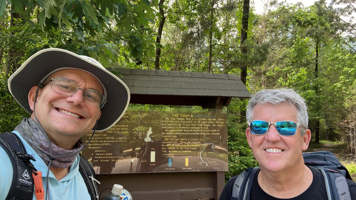
My research in preparation for hiking this trail led to apparently contradictory data. Official websites mentioned broken bridges and an impassable section, while a recent YouTuber thru-hiked with what looked like no difficulties. I hiked the length of the trail over two days in April 2026 and had a fantastic time! Below, I share what I learned in the form of a guide and add context to the apparent contradiction.
I hope this post might inspire others to experience this fine trail.
What is the Four C Trail? | Trail Overview | How Passable Is the Trail? | Maps | Camping | Logistics | Drinking Water | Precautions | Trail Access Points | Other Resources | Acknowledgements
What is the Four C Trail?
From the National Forest website:
The Four C National Recreation Trail leads hikers through part of the Davy Crockett National Forest. This 20-mile-long trail begins at Ratcliff Lake Recreation Area and ends at the Neches Bluff Overlook.
Named for the Central Coal and Coke Company, which logged virgin timber in the area, the Four C Trail follows some abandoned tramways built by that company. The area around the trail is a forest that grew after the company completed its logging operation in the early 1920s. The sawmill was located at Ratcliff Lake, which served as a log pond.
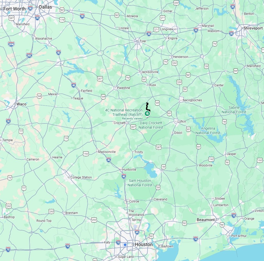
The trail is located in East Texas in the middle of a triangle between Houston, Dallas, and Shreveport, about two hours from each. Locally, it is between Crockett, Lufkin, and Nacogdoches, on the west side of the Neches River.
Google Map links:
Ratcliff Trailhead.
Neches Bluff Trailhead.
https://www.fs.usda.gov/r08/texas/recreation/trails/four-c-national-recreation-trail
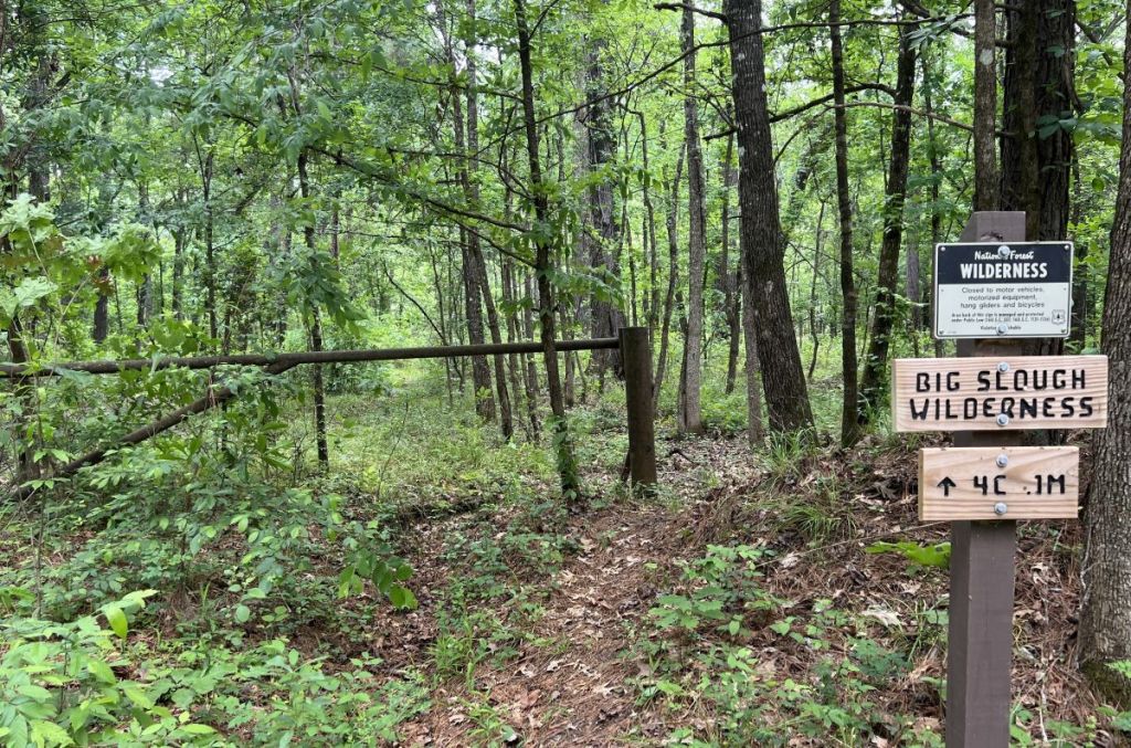
Of special note is the Big Slough (pronounced slew) Wilderness, a 3,455-acre area, protected by the National Wilderness Preservation System in 1984. This system strictly prohibits motorized equipment (including chainsaws), mechanical transport (including anything with wheels or drones), roads, and commercial enterprises to maintain a natural, untainted environment. Even though it is the smallest wilderness in Texas, it is the least accessible due to flooding and its dense, swampy, bottomland hardwood nature.
Four congressmen who had contributed significantly to protecting the East Texas wilderness areas were honored by having champion trees named after them. The state’s largest loblolly pine at that time was located in the Big Slough Wilderness, had a 14-ft circumference, and was named after Congressman Charlie Wilson, as in the movie, Charlie Wilson’s War. That tree had to be felled after a lightning strike and was determined to be over 130 years old.
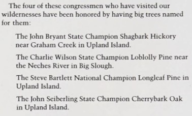
The current state champion is also in the Big Slough Wilderness, where Dave Wade found it in April 2026. The tree has a circumference of 15 ft 8 in and a height of 142 ft.
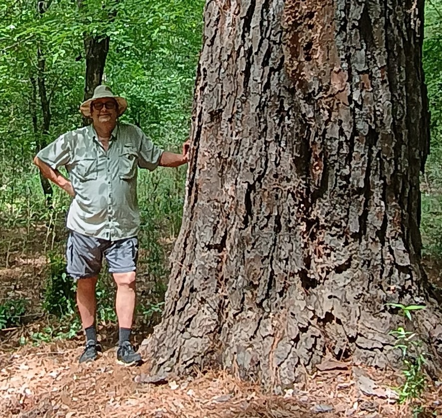
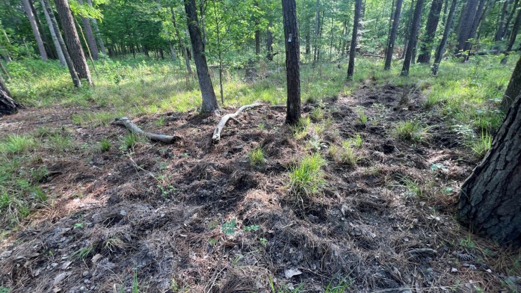
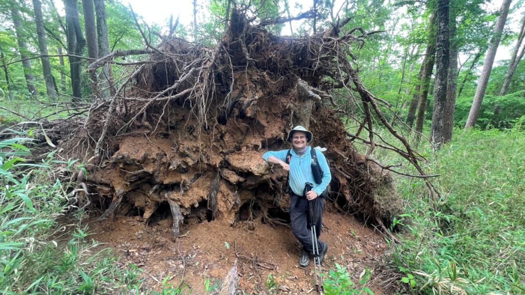
There are multiple loblolly pines with circumferences over 15 ft and heights over 140 ft. The trail traverses the wilderness’s western edge, and it passes by one tree that was over 100 years old when it fell. It was hand-sawn by a crosscut crew in April 2026 to clear the trail.
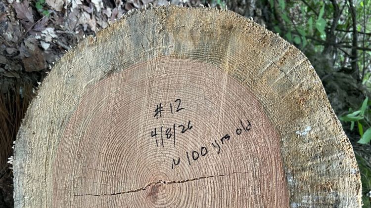
In contrast to the natural wilderness is the legacy of the Central Coal and Coke Company (Four C). Its sawmill operated near Ratcliff from 1902 to 1918. The nearly 500-ft-long sawmill, with over 1,000 employees, was the largest sawmill west of the Mississippi and could cut 300,000 ft of lumber per day. Its mill pond, now Ratcliff Lake, could float six million feet of logs at a time. It closed in 1918 simply because it had run out of lumber, having deforested all of the surrounding woodland. The area was later reforested by the Civilian Conservation Corps (CCC) in the 1930s, becoming the Davy Crockett National Forest. You can find remains of the sawmill in the southeast corner of the park, which are fun to check out as part of a two-mile walk around Lake Ratcliff.
From https://easttexashistory.org/items/show/124.
Source of photo: The History Center at Diboll.
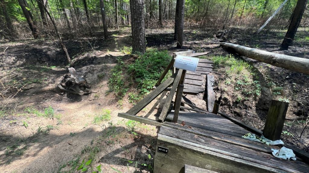
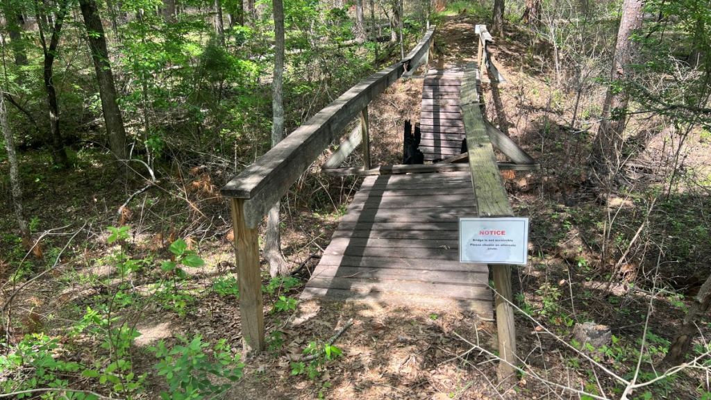
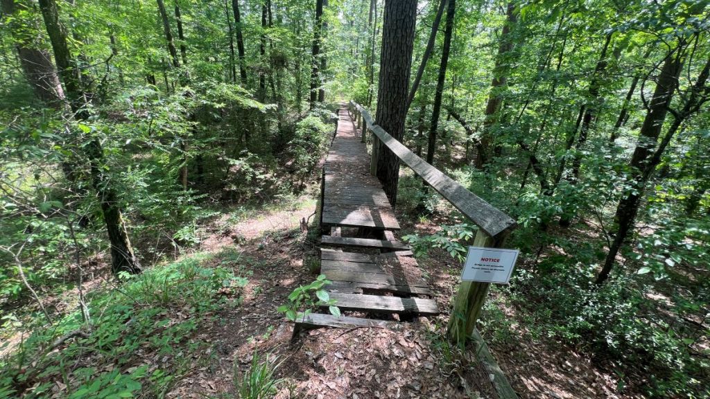
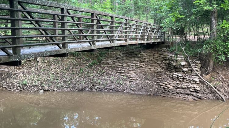
Part of the company’s legacy is the remaining railroad grades. Temporary railroads were built in the forests for lumber transport, though in these parts, longer-term needs led to more robust construction involving elevated railroad grades (embankments) and bridges. The Four C trail follows the former tramways in several places, most notably in the Big Slough Wilderness, where it sits on top of a 25-ft tall embankment. The elevation provides a great perspective of the forest with no hint of the historical industry (as shown in the video at 8:00 mins). No evidence of the railroad bridges remains, and storms continue to disrupt modern bridges for hikers.
The elevation provides a great perspective of the forest with no hint of the historical industry. No evidence of the railroad bridges remains, and storms continue to disrupt modern bridges for hikers.
The Four C Hiking Trail Group on Facebook is an excellent resource. You can find reports about recent activities and ask specific questions. You do not need a Facebook account to browse. The Group’s previous posts offer a fascinating perspective on the trail’s recent history. The trail was devastated by a 206 mph tornado in 2019. The FB group’s post document how volunteers started repairing bridges and removing fallen trees in 2023, in conjunction with the Forest Service who replaced major trees. Such efforts are ongoing.
Trail Overview
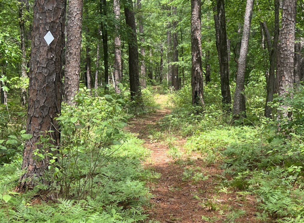
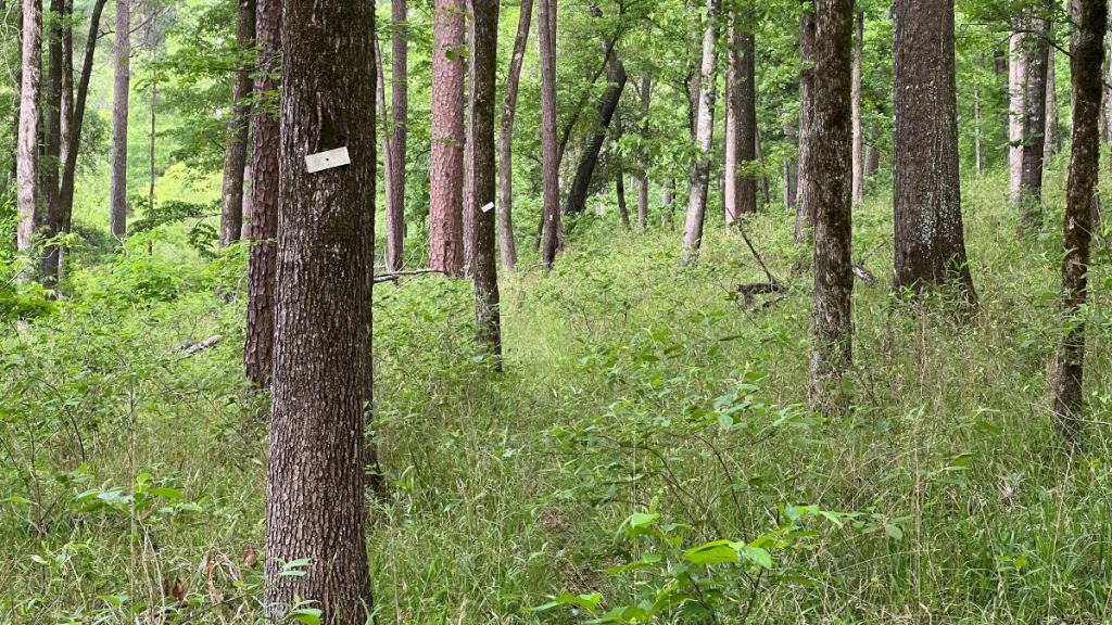
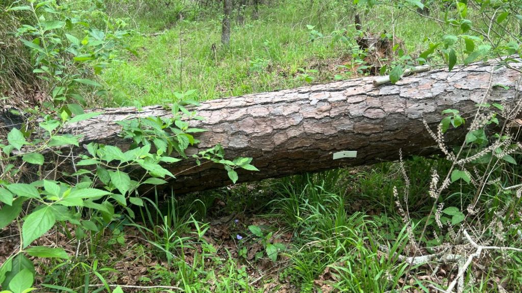
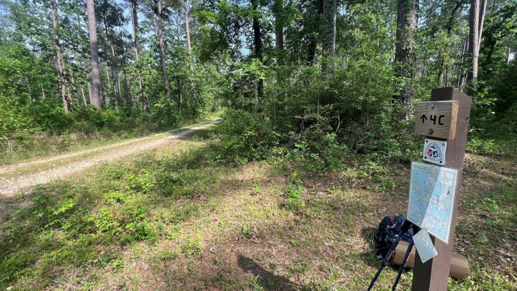
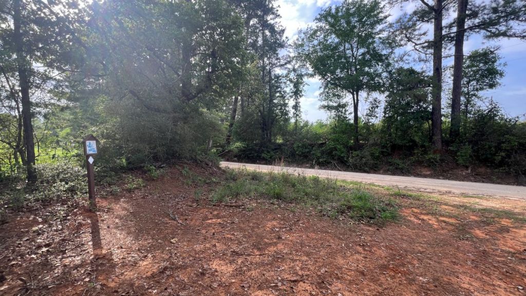
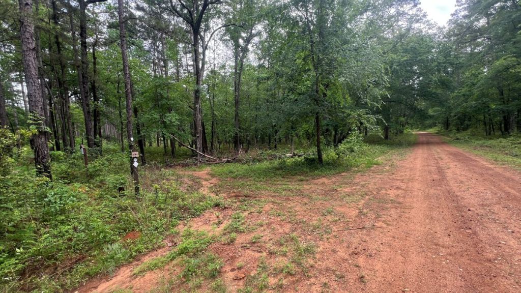
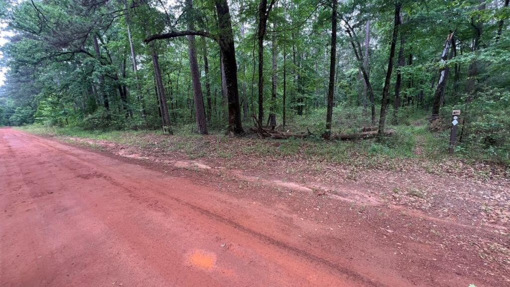
The trail is marked by white tags on trees. Either rectangular- or diamond-shaped ones are used. In many cases, the tag points to the trail’s direction forward. Unfortunately, some are held in with just one nail, so they can rotate. For most of the trail, you can see the next tag from the previous one. Sometimes, a tree holding a tag has been blown down, or undergrowth may hide a tag. A worn path is usually visible on the ground, though hog rooting can obscure it. In the Big Slough Wilderness, tags and the path have been washed away, so one has to define a route.
Reports suggest the first five miles from each end of the trail are well marked and easy to navigate, especially the southern end.
AllTrails suggests the trail has ~ 1,000 ft of elevation gain. The only hills I noticed were the climb up to Neches Bluff at the end, and the railroad embankments in the Big Slough. The AllTrails profile suggests other hills, but we did not notice them when hiking.

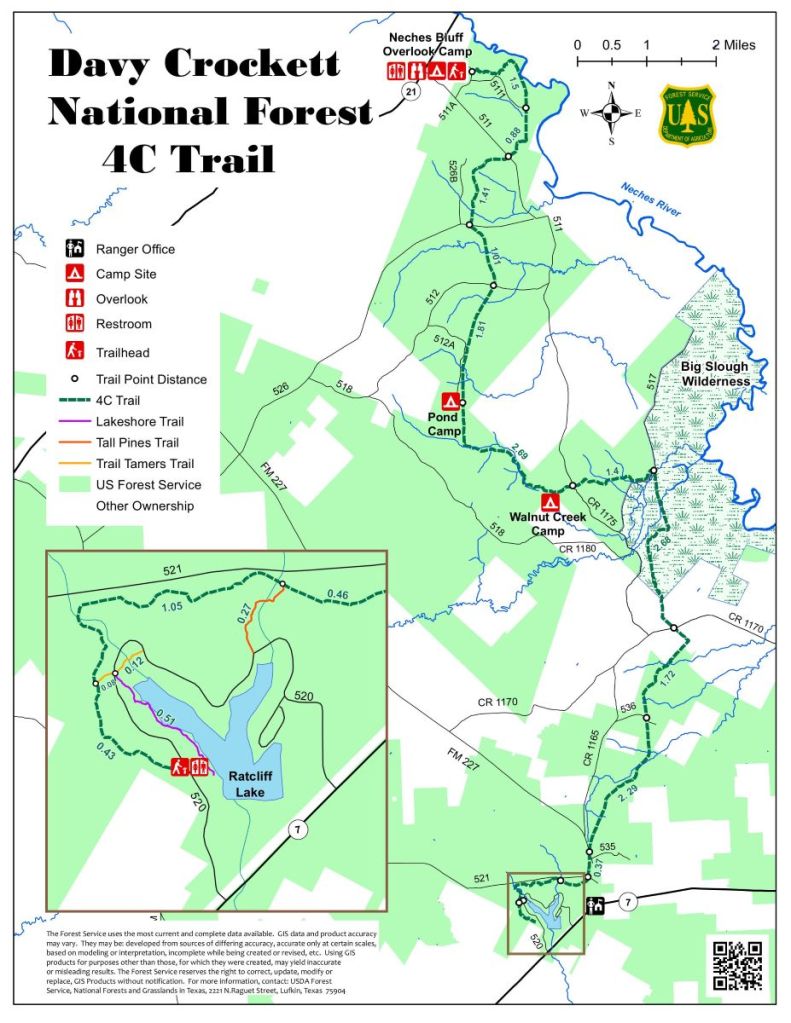
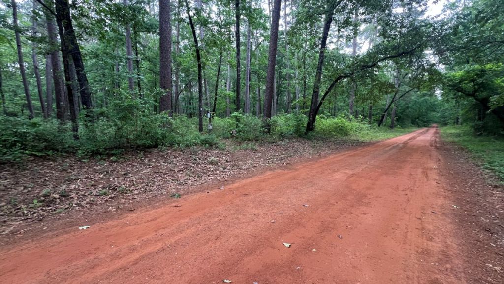
I’ve created the table below using roads and the wilderness as section boundaries. The forest varies between different sections. While there is active logging in the area, this has not directly touched the trail, and the path remains within National Forest woodland except for the short section on private land.
| Sections | Terrain | Notes |
|---|---|---|
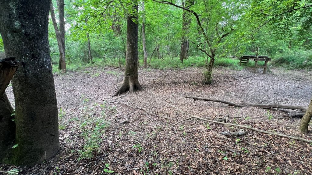
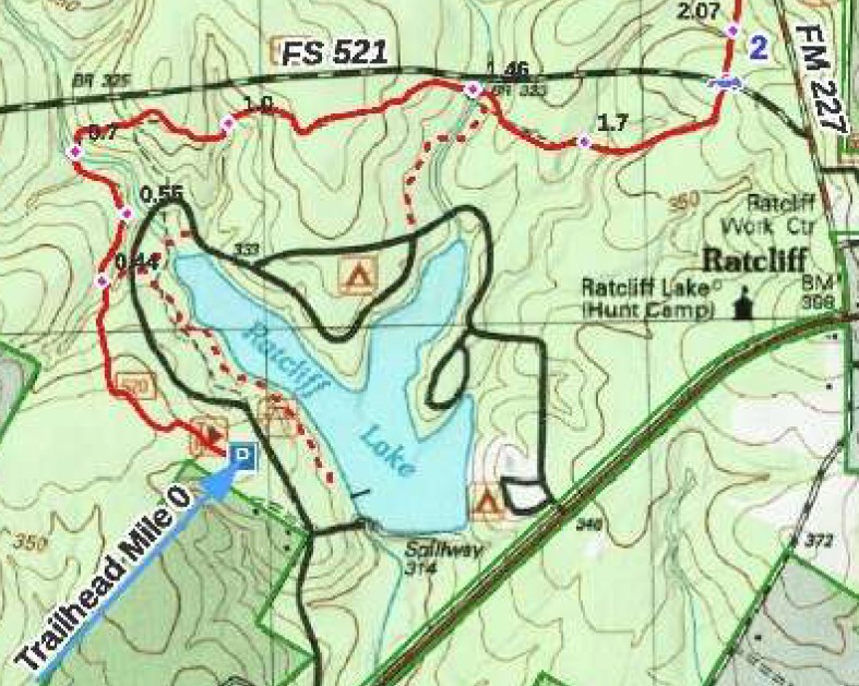
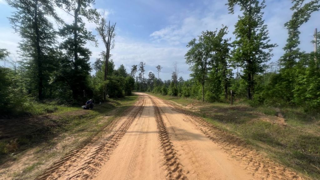
| 0.0-2.0 | Flat, well-groomed trail. | Well-used trail close to Ratcliff Recreation Area. Much of the route is shared with other trails. Easy to walk around the broken bridge at 1.7. Restrooms and water in Ratcliff Recreation Area, which has a day-use fee and has highly-rated camping. |
| 2.0-6.4 | Generally flat. | 4.0 to 5.0 is a straight section following an old tramway. Trail crosses FS 521 at 2.0, FM 227 at 2.4, FS 536 at 4.5, and CR 1170 at 6.4. This section has 14 bridges, four of which are damaged. |
| 6.4 to 6.95 | Flat. Potentially overgrown. | This short section is on open private land. The lack of canopy causes the undergrowth to grow tall. |
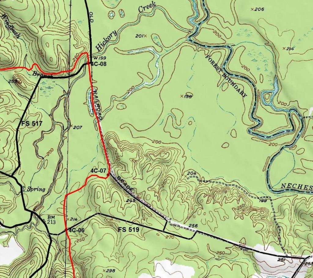
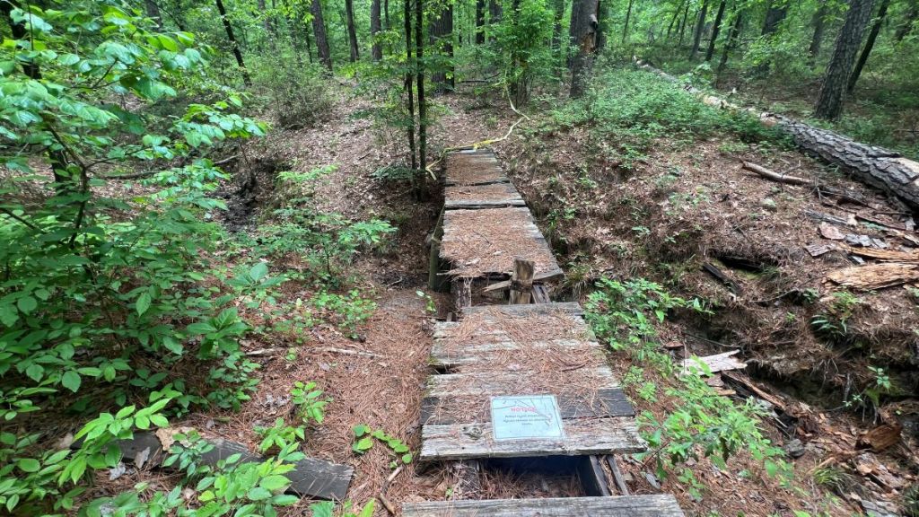
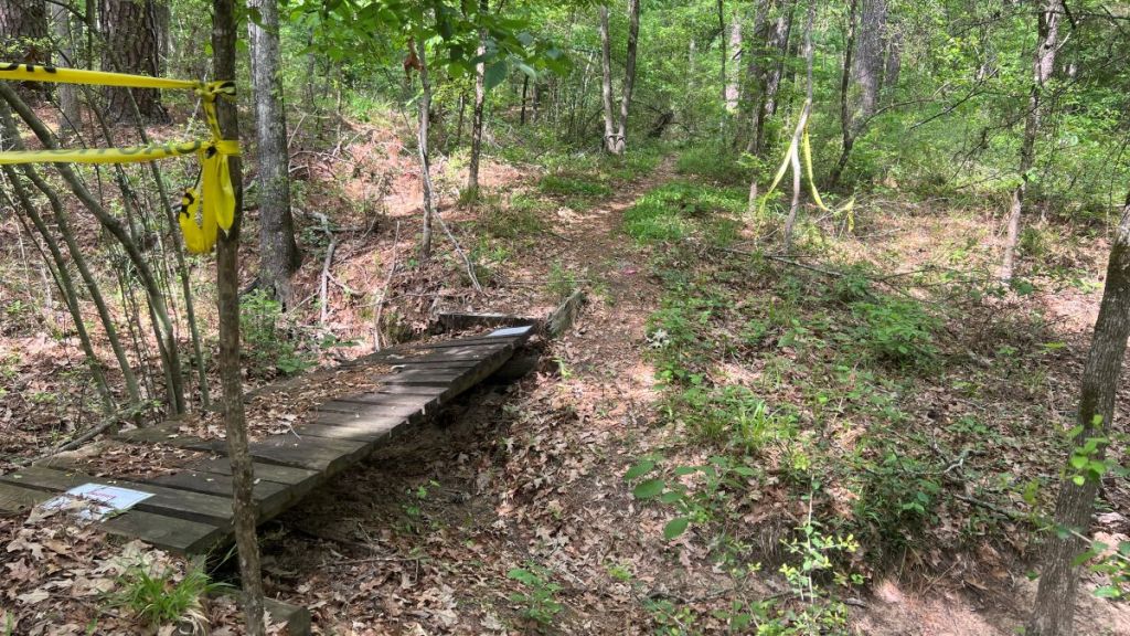
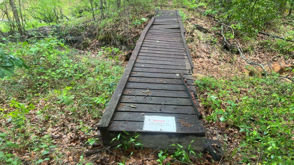
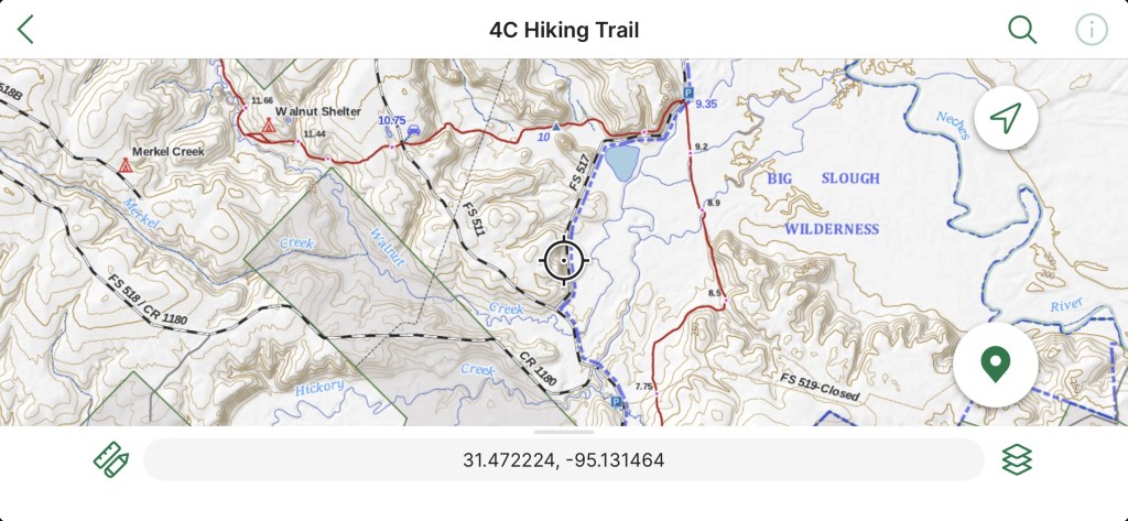
| 6.95 to 9.35 | Big Slough Wilderness. Wilder. More difficult to navigate. | One can access this section via a connector from parking at 7.75 on CR 1175. Elevated tramway from 8.5 to 8.85 and 8.95 to 9.35. Missing bridge at 8.9; need to cross the South Slough River on fallen trees. Wading might be possible. Missing bridge at 9.2. The North Slough River might be dry or shallow. Missing and damaged boardwalks on either side of the North and South Slough rivers. Impressive iron bridge at 9.3. |
| 9.35 to 15.3 | The least-used middle section of the trail. Fairly flat. | Crosses FS 511 at 10.75. 16 bridges with one broken at 15.0. Some impressive new bridges over Walnut Creek at 11.97 and 12.8. Walnut Shelter at 11.55. Pond Camp at 13.5. The trail follows an old tramway from 13 to 15.3. |
| 15.3 to 17.4 | Gently undulating, clearly defined trail. | 9 bridges, including an impressive new bridge over Camp Creek at 15.73. |
| 17.4 to 19.9 | Flat until final 1/2 mile. | 2 bridges. Follows utility easement from 18.0 to 19.4. Can see Neches River at 19.1. Road access possible at 18.5. Observation Deck at Neches Bluff. Vault toilet and camping at Neches Bluff. |
There are plenty of birds in the forest. The Merlin app can help identify their song, or the rangers can provide more details.
Also, there is a Geocaching power trail of 64 caches on the southern half of the trail. Some you might spot without even looking, but please leave any where you found it. Find more information on the Geocaching website.
How Passable Is the Trail?
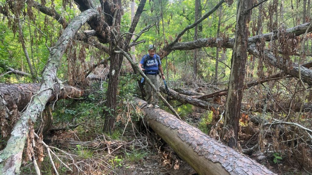
In short, “it depends.” I had no problems hiking the whole trail in April 2026, similar to Cameron Hall’s experience in his fantastic 28-minute video from February 2026. Most of the trail’s route is obvious, indicated by a worn path or blazes on trees, though a map is required for the Big Slough and encouraged throughout the trail. Older reports on YouTube, Facebook, or AllTrails might not represent the trail’s current condition. Blowdowns across the trail will discourage some, and the volunteer trail maintainers constantly try to remove them. (Update on June 26, 2026: volunteers have just completed clearing every blowdown on the trail, having surveyed its complete length in April and clearing on multiple workdays with a crosscut and multiple chainsaw crews). The condition of the bottomlands in the Big Slough Wilderness depends on recent rainfall, and a river must be crossed using fallen trees, the difficulty of which will depend on water levels.
With the area prone to storms and flooding, the trail’s condition varies. In February 2025, a year before Cameron’s video, Texas Game Wardens had to rescue hog hunters who became stranded and hypothermic in the Big Slough during floods.
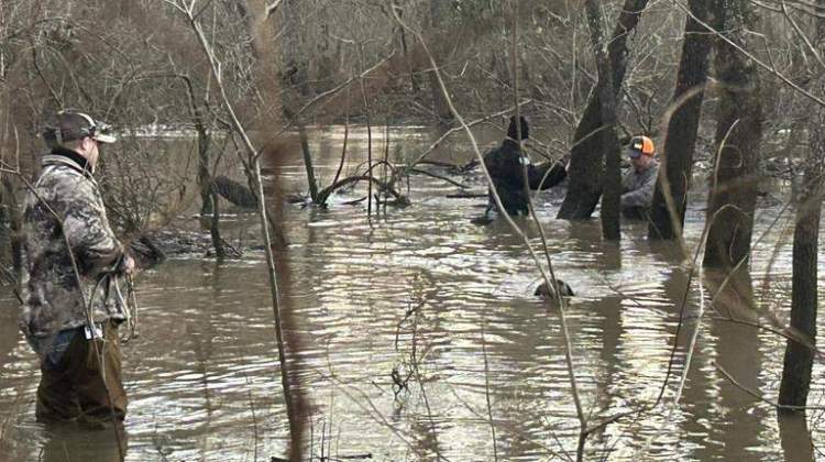
Photo by Texas Game Wardens from this article.
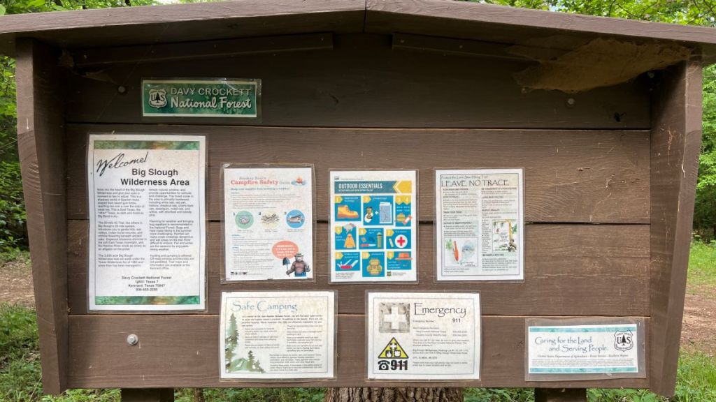
After the tornadoes in April 2019, there was an official USFS “Emergency Provision” closing most of the trail because of tornado damage. As of April 2026, there is the following alert for the Davy Crockett National Forest:
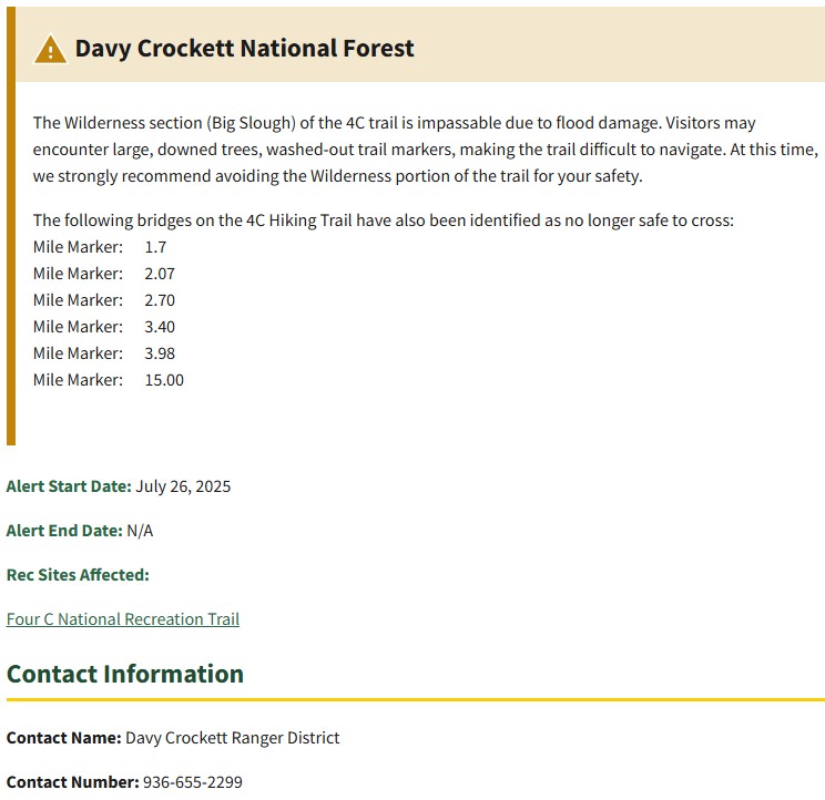
The description of the Big Slough as “impassable” is accurate for inexperienced hikers. Sections where boardwalks and bridges have been washed away have no blazes or evidence of a trail. Cell phone signal is spotty at best in this wilderness. However, such an environment is attractive for others!
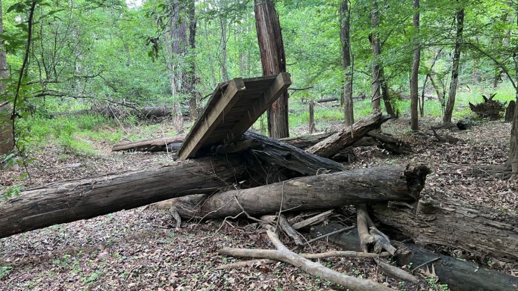
However, there aren’t major obstacles and it is cool to hike amongst the former boardwalk.
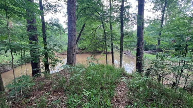
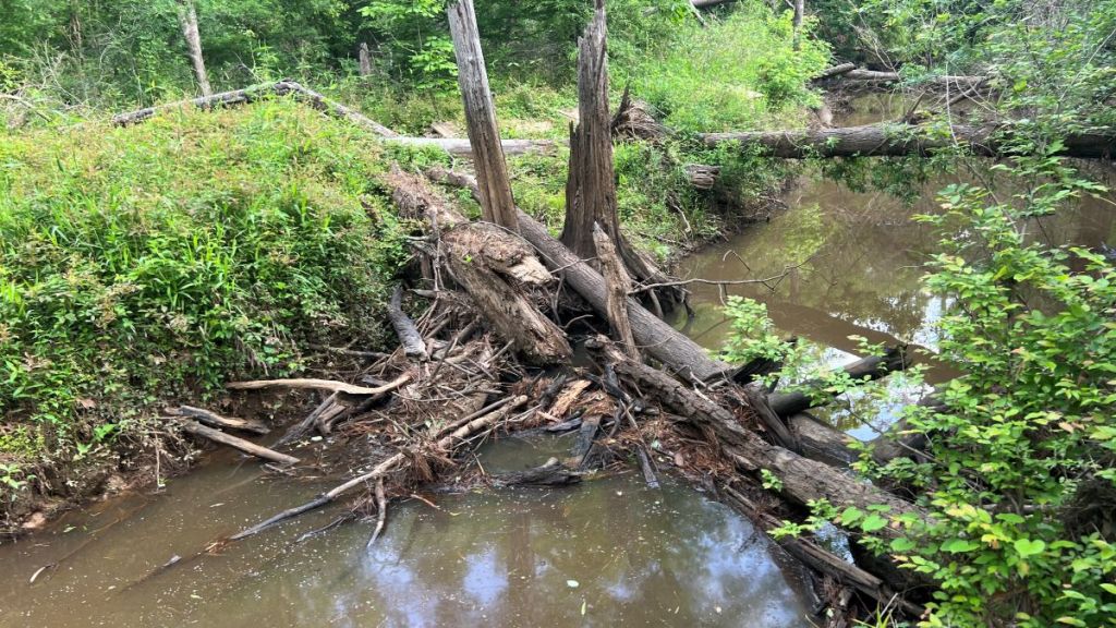
We hiked during a dry spell, and there was only one wet river that we needed to cross. The South Slough River at mile 8.9 was low, exposing logs to cross on, and a fallen tree resting on the banks. The water was barely flowing.
I took this photo when the USGS Neches River gauge at Alto was showing 8 ft.
These YouTube videos show Vance balancing on the log and me taking the low route.
I expect that the USGS Neches River height gauge near Alto is a useful indication of water levels in the Big Slough. We hiked when this gauge showed a level of about 8 ft. In June 2025, the river was in flood and 13 ft deeper at 21ft. I expect that this would result in the South Slough River being approximately 13 ft deeper too, completely flooding this area of the Big Slough and making it impassable to even very experienced hikers.

The blue curve is the previous year, and the brown curve it the year before that.
The yellow, red, and purple bands indicate progressive flood stages.
Maps show another river at mile 9.2, known as the North Slough. This bridge is also washed away, but the river was dry when we crossed. It is wider than the South Slough and could be wadable if filled with water.
The National Forest alert mentions unsafe bridges at miles 1.7, 2.07, 2.70, 3.40, 3.98, and 15.00. These are all small bridges, and the associated creeks were dry when we hiked the trail. Similar creeks on the Lone Star Hiking Trail or the Trail Between the Lakes do not have bridges. Walking around these bridges was straightforward. In total, the Four C trail has 51 bridges!
While damaged bridges are mentioned, there are several new bridges across the more significant rivers on the trail, such as Camp Creek at 15.73 and over Walnut Creek at atbout 12.8 and 11.97.
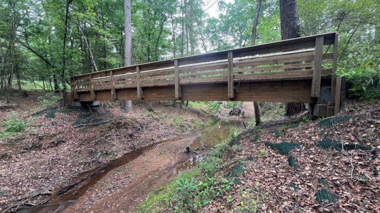
The robust iron bridge over Hickory Creek at 9.35 was refurbished by volunteers in 2023 (see this FB post). This bridge was originally purchased from Continental Bridge by the National Forest in 1998. That company was acquired by Contech 2000. The bridge’s specification was It is a 70’ x 4’ Pedestrian bridge utilizing self-weathering steel with nominal 2×8 IPE decking. The bridge is designed for an 85psf live loading and a 4,000 lb vehicle load.
As with any National Forest trail in southeast Texas, you will likely encounter a fallen tree on the trail. While volunteers collaborating with the Forest Service strive to clear them as soon as possible, negotiating such obstacles is part of the adventure. (Note – the trail was completely cleared of blowdowns in June 2026).
For current conditions, it is best to check the trail’s National Forest website or call the ranger (936-655-2299) during regular office hours, in addition to checking the Neches River gauge. The Four C Hiking Trail Facebook Group is a useful source of information. Trail reports help, and some are linked at the bottom of this post, and others can be found on the trail’s page on AllTrails.
The trail is maintained by volunteers associated with the Lone Star Hiking Trail. This page gives you an idea of what volunteering is like and you can review past projects on the Four C Hiking Trail Facebook Group page. If you are interested in volunteering, please reach out via the Lone Star Hiking Trail Club or the Four C Hiking Trail Facebook Group. It is great if every hiker helps out by picking up trash or clearing smaller branches off the trail when possible.
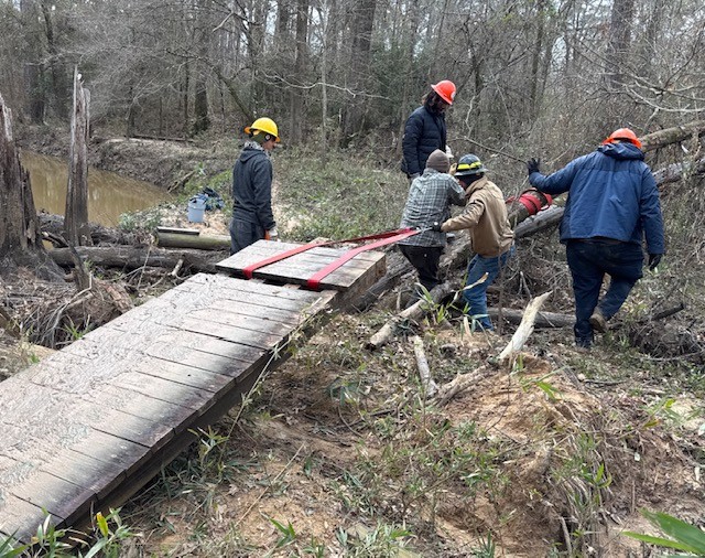
The Forest Service continues to repair and replace bridges along the trail, but the process is challenging, especially in the wilderness area. This Facebook report shows a TxCC team working on the boardwalk in January 2025.
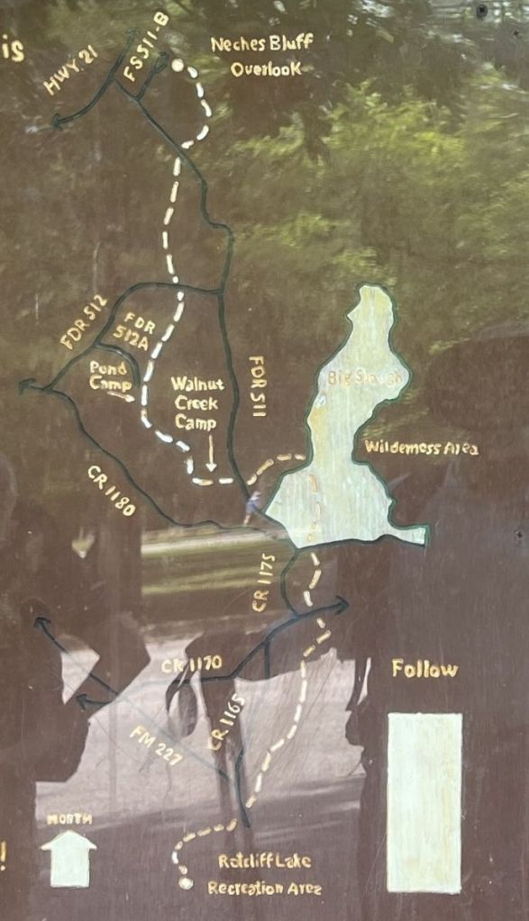
Maps
I recommend using the GPS-enabled Avenza Maps application on your smartphone and the free “4C Hiking Trail” map by the Lone Star Hiking Trail Club. It is a detailed topographic map that works offline and shows your location. It includes mileage markers, identifies road crossings that can be used for water caches, and established campsites.
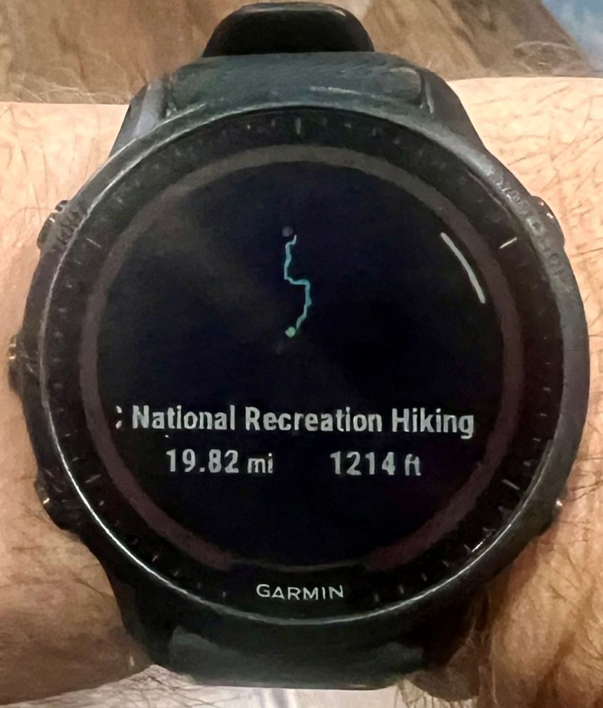
AllTrails is an alternative GPS-enabled map, with this trail as “4-C National Recreation Hiking Trail.” I used its GPX route on my Garmin watch, which worked very well. Caltopo is another viable option.
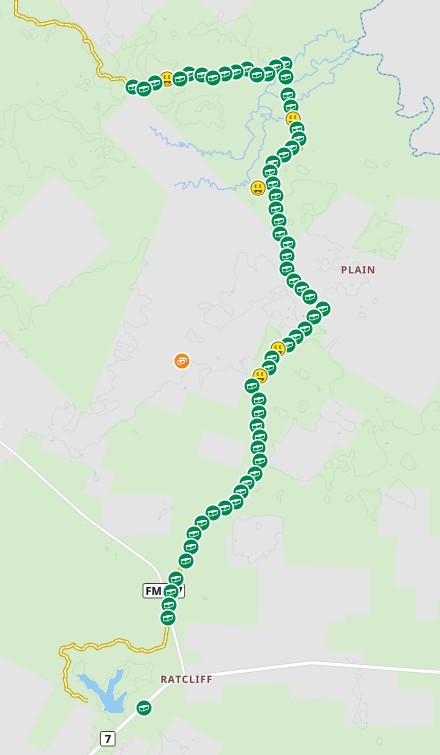
I created this custom Google Map showing the trail and features. I don’t recommend it for on-trail navigation, but it might be useful for planning.

For printing, the same base map used in Avenza is available as a PDF on the Lone Star Hiking Trail website.
The diamond symbols on the route on this map, and the one below, typically represent a bridge.

This topo map is similar to the one used in Avenza. It uses a different basemap, which some prefer, and is formatted for easy printing on two sheets of letter paper. Older topo maps are also available at ouachitamaps.
At trailheads along the trail, an FS map is posted with a “you are here” arrow. It only shows roads on National Forest land.

This map is from Realms of Beauty: Wilderness Areas of East Texas, published in 1986. Note how is shows FR 519 as the southern edge of the Big Slough Wilderness. Land south of the road was subsequently added.
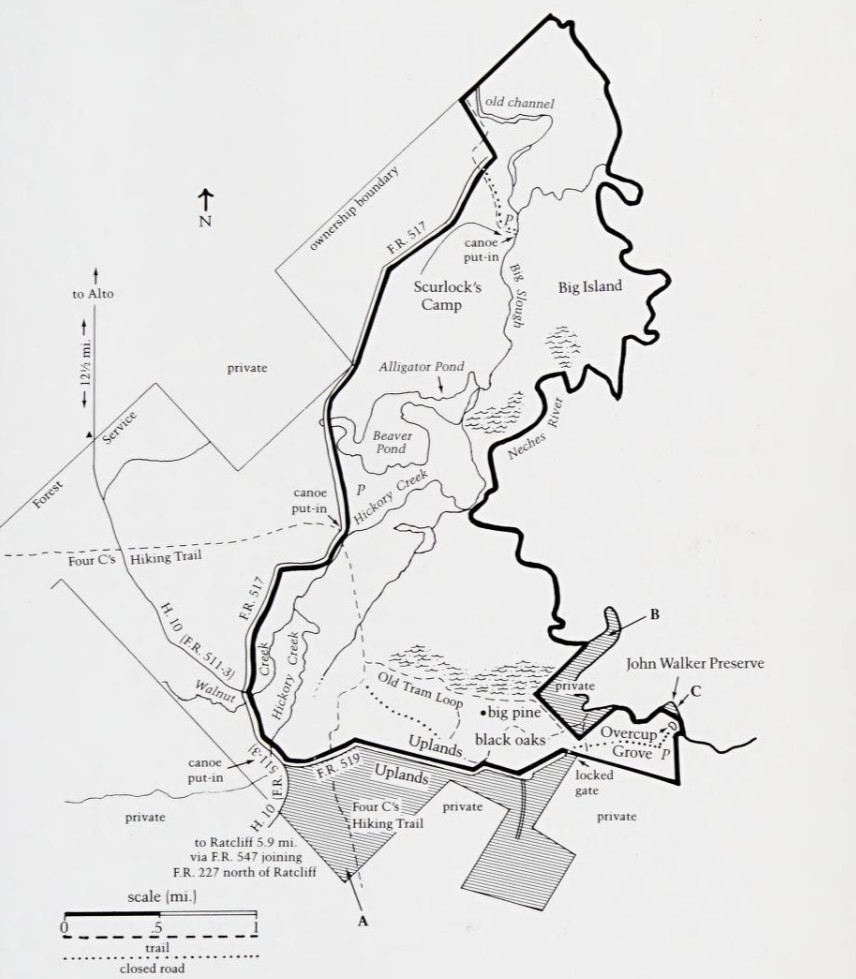
The map at the Ratcliff trailhead shows the Wilderness area’s southern boundary as the FR519. It must have been created before the wilderness area was extended.
Camping
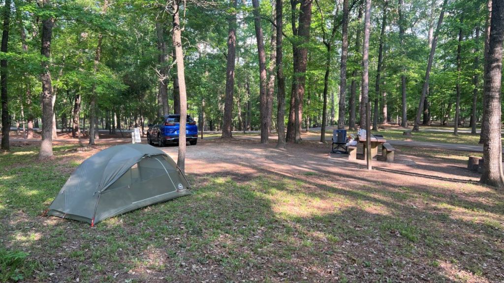
There are developed campgrounds at each end of the trail. Ratcliff Lake Recreation Area has developed sites for tents and RVs and offers restrooms, showers, and potable water. Sites are reserved and paid for at recreation.gov. The site often fills up at weekends, though some sites are first come, first served.
The Neches Bluff Campground has primitive sites with a vault toilet but no water.

It had toilet paper when I checked it out.
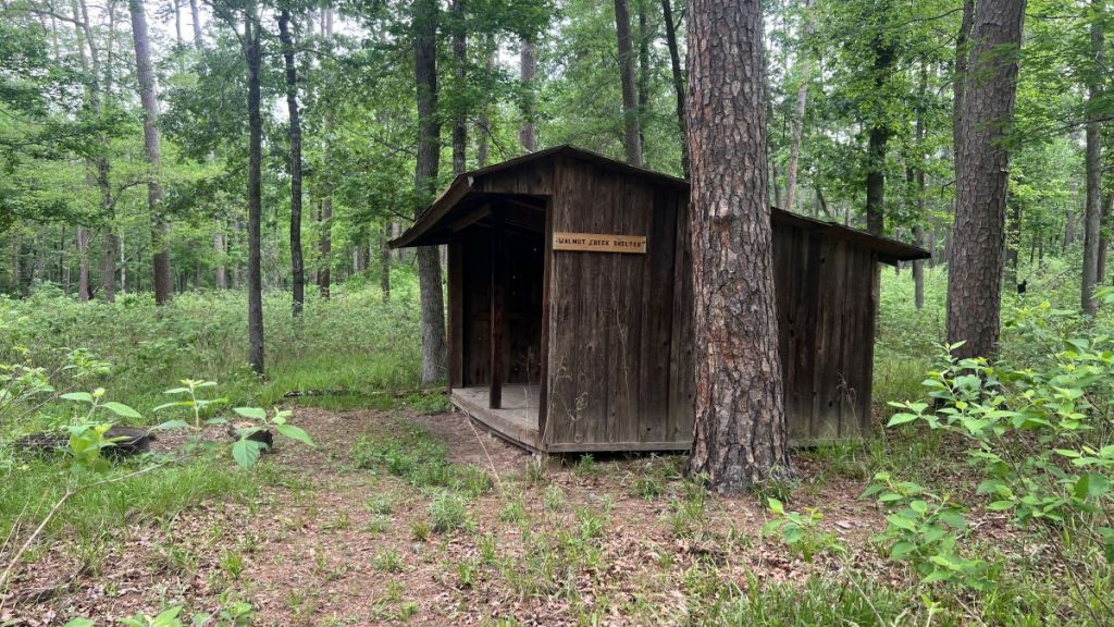
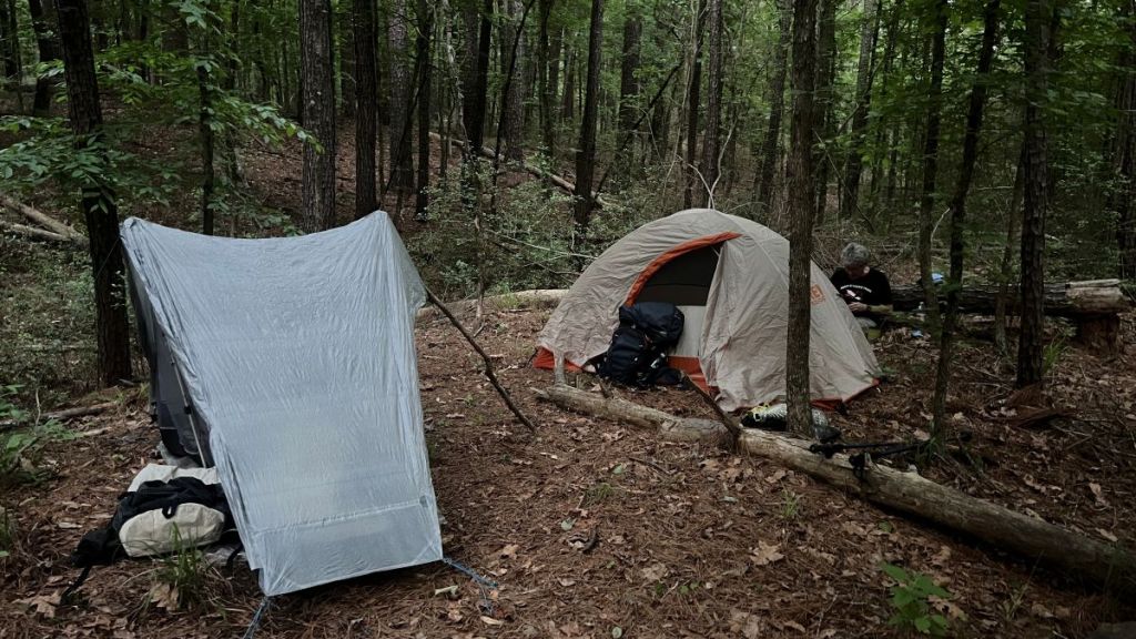
The Walnut Shelter is on the trail around mile 11.5. There is protection from the weather, a fire ring, and room for tents.
Pond Camp around mile 13.5 is a primitive site. The road to it might be impassable, depending on vehicle and weather.
The above sites can be used at any time of the year as they are designated campgrounds for hunting season. If hiking in hunting season, wear orange! Outside of hunting season, primitive camping is permitted anywhere along the trail, including in the Big Slough Wilderness Area. Follow these National Forest camping rules. Avoid camping in low-lying areas that might flood.
Logistics
As this is an end-to-end trail, you have to work out how to get back to where you started. There are a few options:
- Use two cars, which is what we did.
- Do a yo-yo, hiking back along the trail to where you started. A variant to this is to hike back along forest roads, which is what Cameron Hall did. The more direct route is about sixteen miles.
- You might be able to find someone to shuttle you in the Four C Hiking Trail Facebook Group.
- You might be able to hitch, as the trail ends are near busy roads. A taxi might be possible from a nearby town, but it should be verified beforehand.
Drinking Water
There are no potable water sources along the trail, except in Ratcliff Recreation Area. The Forest Service advises against collecting water from ponds and streams for drinking, even after filtering, because of possible heavy-metal contamination from historical industrial activities. This is a similar situation to other areas in East Texas, and reports indicate that hikers have filtered such water and used it for drinking and cooking without issues. If you have questions about this, peruse Facebook groups or ask other hikers or the USFS rangers.
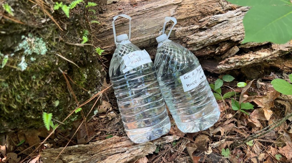
There are plenty of places where water can be cached along the trail. The Avenza map shows where the trail crosses roads with a car symbol and mileage marker. These dirt roads are generally accessible to regular cars, though care should be taken after rain. County Roads (CR) are generally in better condition than Forest Roads (FR). I cached water at 7.75, walking in a short distance from CR 1175. 9.35 and 10.75 are close to the center of the trail. 2.4, 4.5, 15.3, 16.2, 17.5, 18.5, and 19.9 are also good choices. I would be cautious about caching at 6.4 as it is surrounded by private land. Access to 13.5 and might be iffy.
Label the water container with your name and expected pickup date. Hide it so that other people don’t find it. Don’t leave food as animals will find it. DO NOT leave the container behind, either empty or full, as other hikers will not use it or carry it out for you. If you have to leave the cache behind in an emergency, please inform the Four C Hiking Trail Facebook Group or the park ranger.
Precautions
The risks along the Four C trail are similar to elsewhere in East Texas forests.
- It is advised against hiking in the summer months when it is dangerously hot and humid. Even in April, daytime highs were in the 80s, and we needed more than a gallon of water per person per day. Even though a lot of the trail is under tree canopies, sun protection remains critical. I always hike in a hat, long sleeves, and long pants.
- Take precautions against mosquitoes and ticks. I prefer to treat my clothes with permethrin. Deet is effective. Picaridin is an effective alternative to DEET.
- There is plenty of wildlife in the woods. We saw a hog mother and cub, and plenty of hog damage. We saw deer, armadillos, a non-venomous snake, and squirrels. We heard coyotes. Black bears have recently been seen in East Texas, though they are rare. Overnight, I kept our food in an odor-proof Opspak bag in my tent.
- Cellphone reception is spotty, working in some places on the trail but not others. We had Verizon and T-Mobile phones. The Cell Coverage map on CalTopo might help.
- Be aware of and follow any fire restrictions. Check https://tfsweb.tamu.edu/wildfire-and-other-disasters/burn-bans-and-information/ for burn bans. Ensure any fire is completely out and cold before leaving it or going to sleep. Follow Smokey Bear’s Campfire Safety Guide.
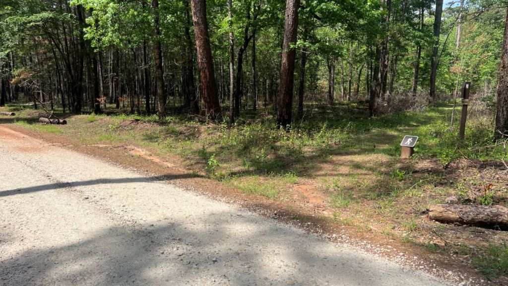
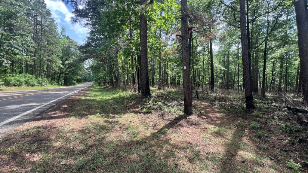
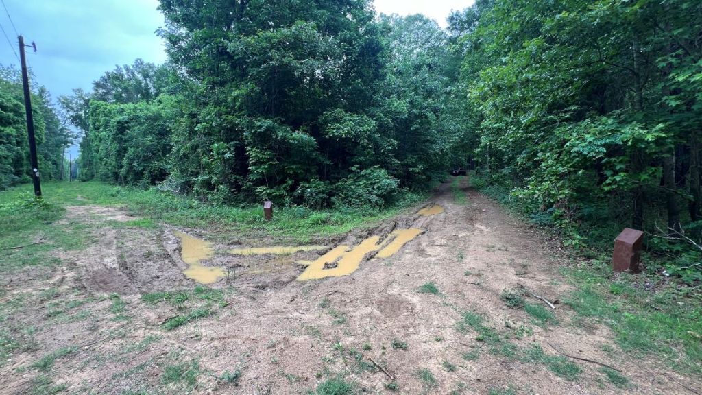
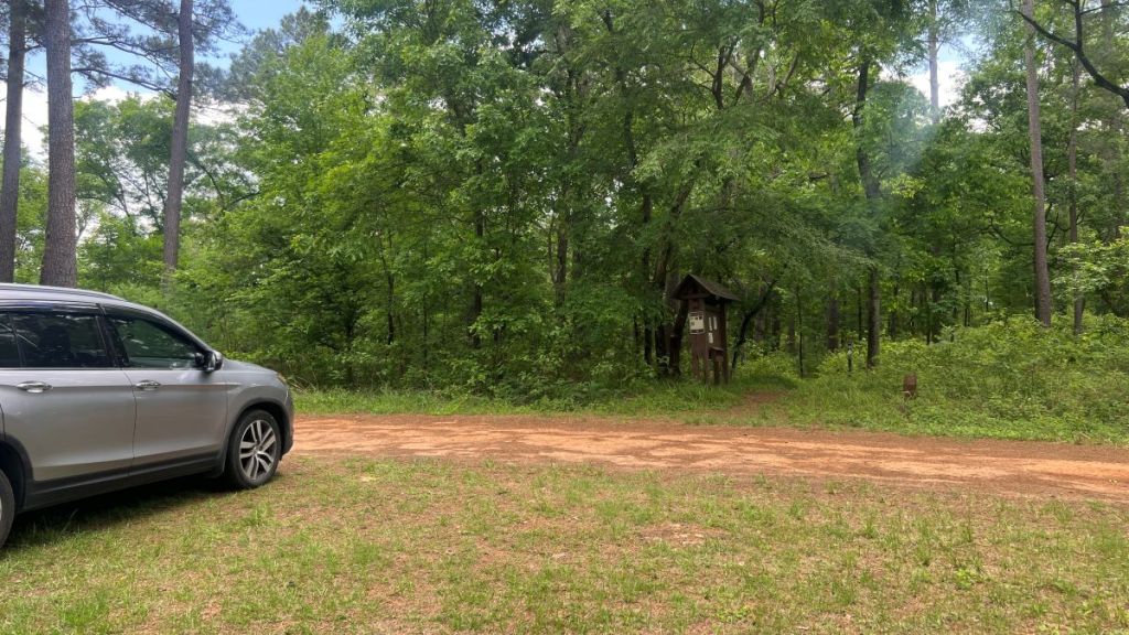
Trail Access Points
Below are photos of where the trail crosses roads. There is only truly off-road parking at each end of the trail, at 7.75 and at 9.35. Care should be taken when parking on forest roads, as they might be used by large trucks in logging operations. Also, “dead-end” roads, such as FS536 at 4.5, FS517 at 9.35, or FS5111 at 18.5, might be blocked by a fallen tree.

Other Resources
A blog post about my 2-day, 1-night trip, camping near mile 8.5, and caching water at 7.75.
Cameron Hall’s YouTube video of his yo-yo-ish thru hike. He hiked along the trail northwards and returned on forest roads, spending one night on the trail near mile 15 and caching water at Neches Bluff.
The official National Forest website for the Four C National Recreation Trail.
The Four C National Recreation Trail page on the Lone Star Hiking Trail Club website.
A guide to the Four C Trail at Ouachitamaps.
Realms of Beauty: The Wilderness Areas of East Texas by Edward C. Fritz. Paperback available from Amazon, or a digital copy at archive.org. Or be nice to Dave, and he might show you his copy! Published in 1986, it describes the Big Slough Wilderness Area, one of five Wilderness Areas in East Texas.
Central Coal and Coke Company (4-C) Sawmill website at https://easttexashistory.org/items/show/124.
Acknowledgements
Thanks to Cameron Hall’s video, which inspired me to hike the trail. Thanks to my hiking buddy Vance for putting up with my quirks, encouraging me, and sharing interesting history. Thanks to the Forest Service personnel for looking after these forests. Thanks to the LSHT Maintenance Team that maintains the trail, and to Dave for sharing his book, Realms of Beauty: Wilderness Areas of East Texas, and for educating me about champion Texas trees.
