

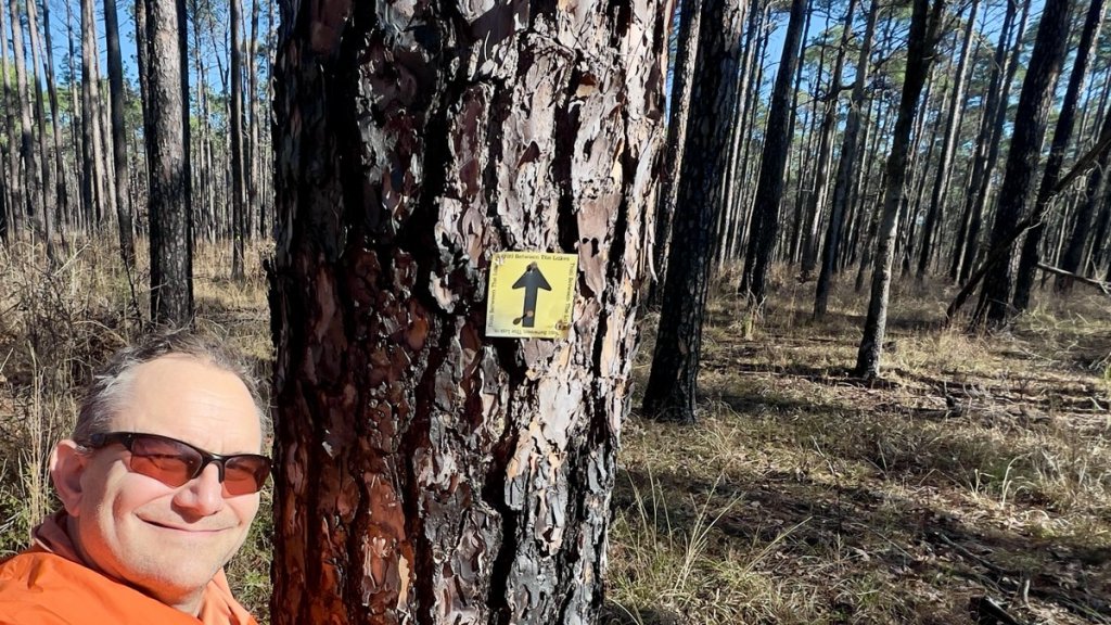
(Check out the trail’s guide here.)
Multi-day backpacking adventures are not normally associated with East Texas. The 96-mile Lone Star Hiking Trail (LSHT), north of Houston by Huntsville, might come to mind. But there is an often passed-over trail close to the Louisiana border that takes the explorer deep into wild pine forests. I was guilty of passing it over, heading to the 31-mile Grand Loop off the LSHT in the Sam Houston National Forest or the 27-mile Eagle Rock Loop (ERL) in the Ouachita National Forest. The 28-mile Trail Between the Lakes (TBTL) passes through the Sabine National Forest between Sam Rayburn Reservoir and Toledo Bend Reservoir. I finally got around to completing the trail over a weekend in January 2025 and I can’t wait to get back.

The TBTL might be viewed as the LSHT’s little brother, but as any parent knows, siblings have very different characters and you love all of them. While the flora, fauna, and environments of the two trails are similar, the TBTL has a very different vibe. Its wild central section contrasts with its well-groomed ends, providing convenience for the less adventurous day-hiker and stimulating variety for the thru-hiker. It reveals to the adventurer how untamed forests are. Much of it is not a simple “walk in the park,” but that’s why we have National and State Parks. It’s completable over a weekend yet it has a lot less traffic than others. The subscribers to Facebook interest groups hint at this, with the TBTL’s group having 1.7k members compared to the LSHT’s 20k and the ERL’s 4k. These features make the TBTL special.
I describe the available online resources about the TBTL in this post. Before this trip, I had researched as much as I could, with great advice from Bryan, who administers the FB group. Eric and Vicki had generously offered me a shuttle ride from one end of the trail to the other as well as providing an insightful video on YouTube (OH LOOK! Outdoors). Bryan, Eric, and Vicki are part of the Golden Triangle Sierra Club which helps oversee and maintain the trail with the Forest Service.
What Was I Thinking?
After a wet week prior to my target weekend, two inches of rain fell the night before I was due to start with the temperature forecast into the 20’s. I knew there were several steep sided creeks that filled up with rain though Bryan assured me I’d be able to find a fallen tree to help me across, albeit that it was likely to be “interesting.” Interesting? I couldn’t get out of my head the thought of falling off such a tree into icy cold water. By myself. And probably at nightfall, allowing me to properly freeze over night. I’d read reviews that suggested extensive logging operations, oil and gas activity that made the water undrinkable, many blown-down trees that made the trail barely passable, and insufficient trail markers that almost guaranteed you’d get lost. (This was all greatly exaggerated as I later found out). I seriously considered cancelling. Writing out the goals for my trip excited me, and I reminded myself that any night in the woods is better than none!
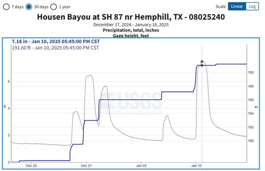
Five inches of rain fell between December 24th and January 5th, and two more inches immediately before I started my hike. The vertical dotted line shows that Housen Bayou crested over 8 feet higher than “normal” at sunset (5:45pm) on January 10th, which was about one hour after I crossed Little Creek.
While I expect the rain gauge was representative of the rainfall on the TBTL, I learned that the TBTL’s rivers do not behave like Housen Bayou. As outlined below, I discovered that Little Creek, probably the largest creek on the trail, increased in depth by about ten feet after the two inches of rain, but rapidly fell back to a “normal” level which was knee-deep and easily wadable.
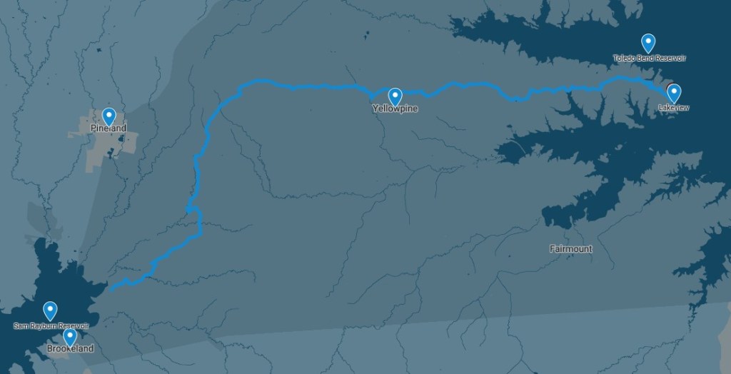
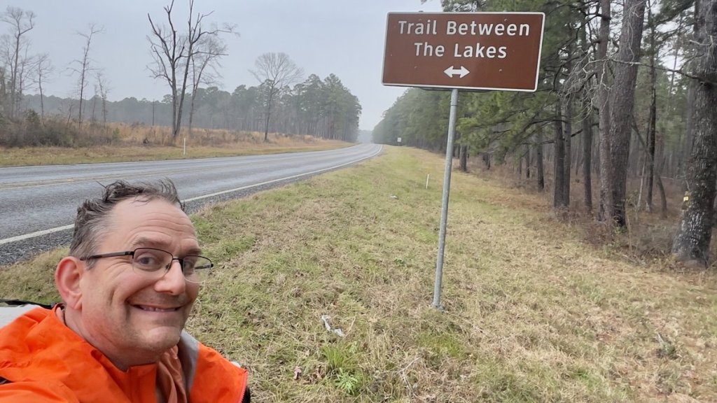
With trepidation, I left Houston on Friday morning for my three hour drive. Location names of Brookeland, Pineland, Yellowpine, and Lakeview described my destination. The swollen rivers that I passed over after leaving the Interstate in Livingston revitalized my concerns but I was all in! After hiding a couple of water caches near trail heads, I met Eric and Vicki at the eastern end and enjoyed our brief time together as they drove me to the west end. They graciously offered emergency help if I needed it. One attraction of backpacking is exposing yourself to potential emergencies while striving for complete self-sufficiency.
Day 1
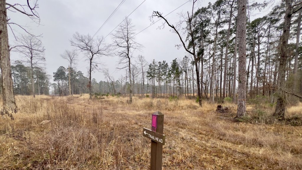
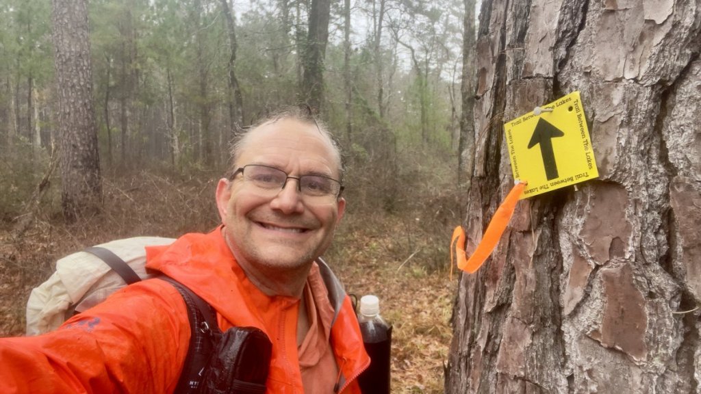
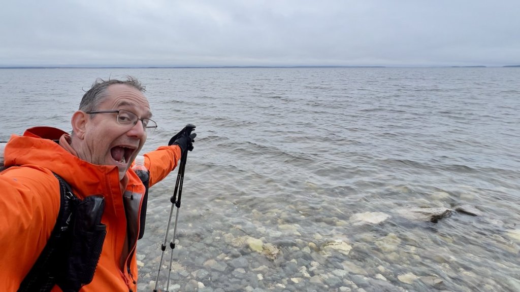
My farewell wave to Eric and Vicki was my last interaction with other humans for the next 50 hours. They left me by the kiosk in the small car park, but first I had to cross the road and scramble down an embankment to touch Sam Rayburn Reservoir. After all, this was the trail BETWEEN the lakes, not almost between. Perhaps I’m influenced by Alfred Wainwright’s tradition of dipping one’s boots in the Irish Sea as you start England’s Coast to Coast trek and repeating the ritual 192 miles later in the North Sea.

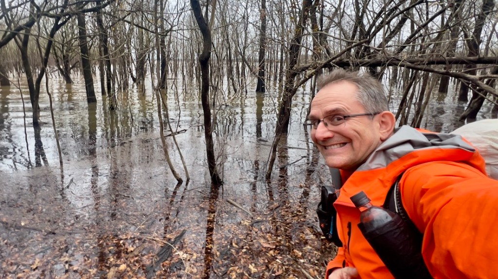
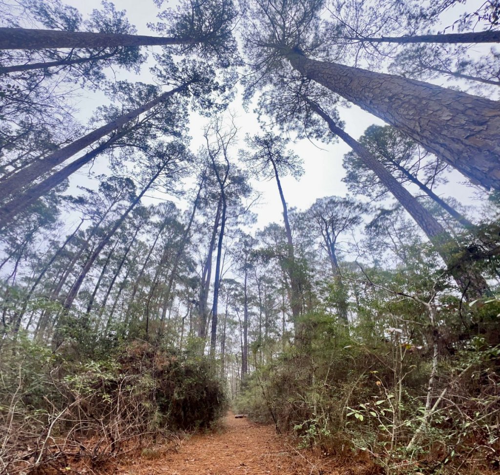
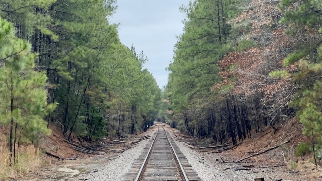
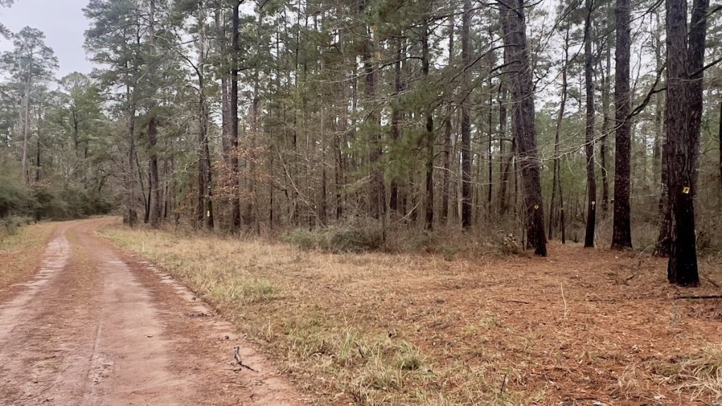
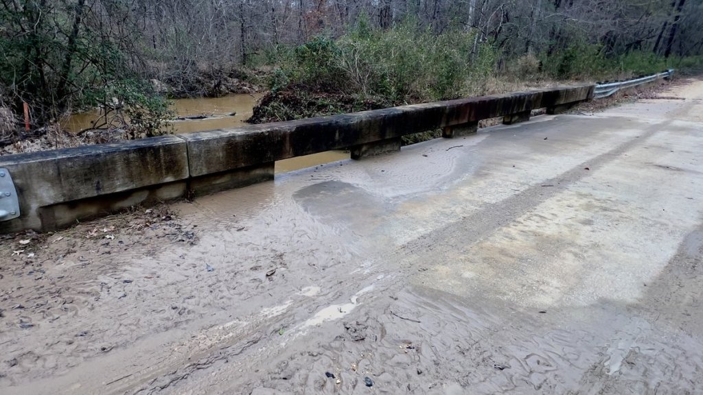
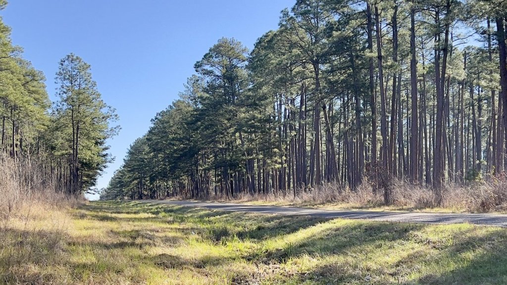
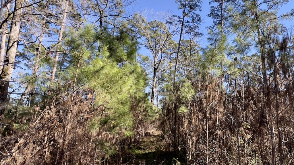
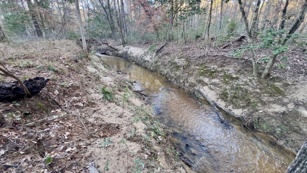
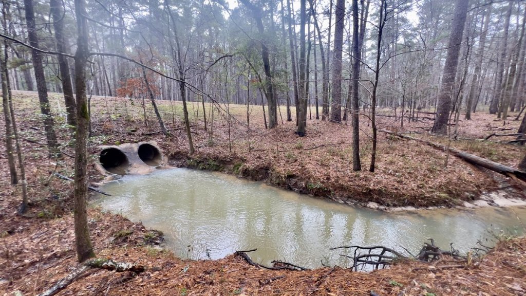
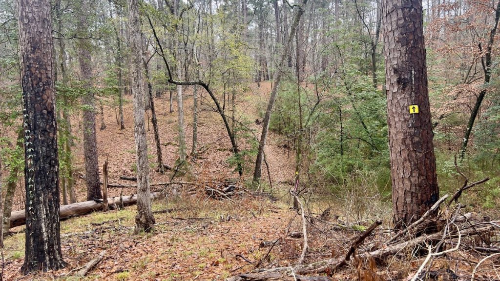
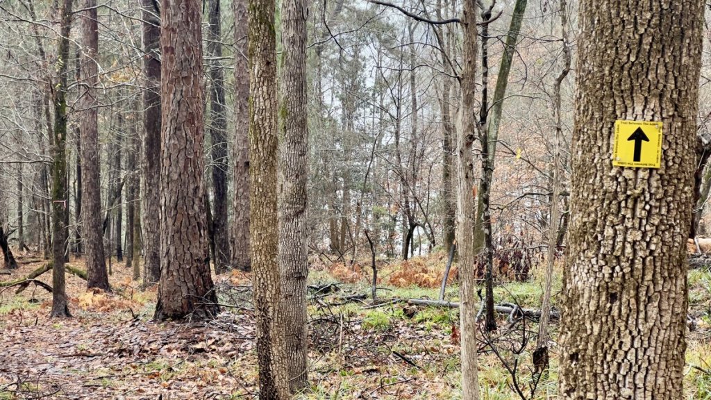
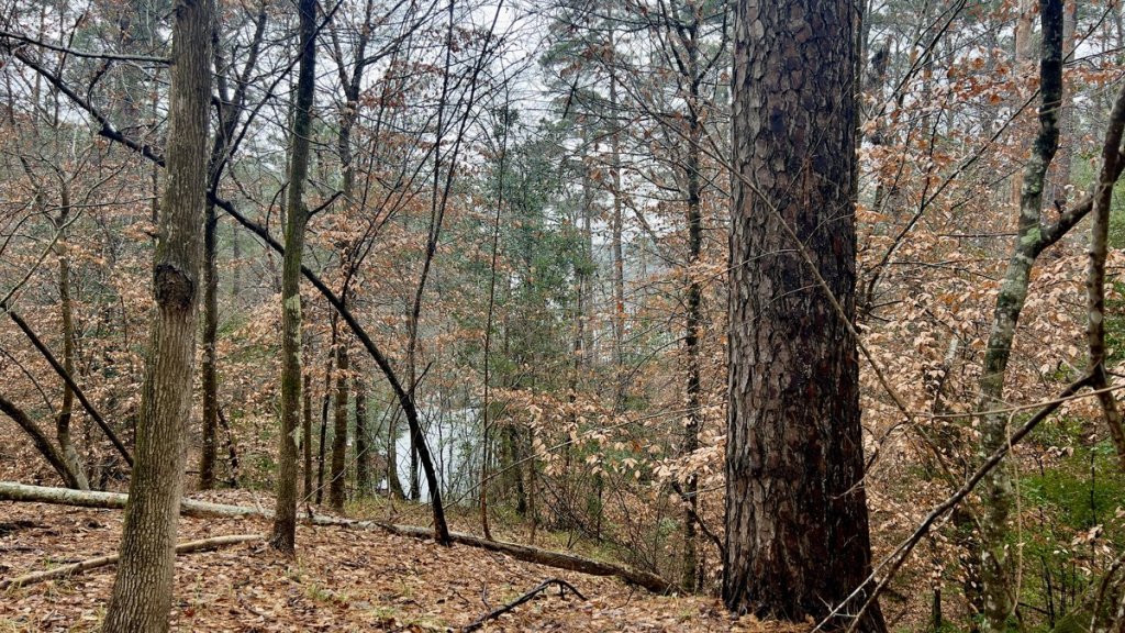
After completing my prelude, I headed into the forest, and any concerns and worries rapidly dissolved. Everything I needed for the next three days and two nights was in the 25-pound pack in my back. Almost immediately I passed the first mile marker indicating I had 28 miles to go. I prefer hiking such that the mile markers count down to my finish. A well-groomed path of pine needles led me between majestic pine tree towers. The cool temperatures were perfect for hiking and the traffic noise gradually attenuated below wind noise. The first 4.5 miles alternated between trail and forest road, crossing over a railway, and a couple of small streams that I was able to traverse with dry feet. A road bridge crossed a very swollen Devil’s Ford river, with evidence that the river had recently been flowing over the bridge! It had stopped raining less than twelve hours previously. This was going to be “interesting”!


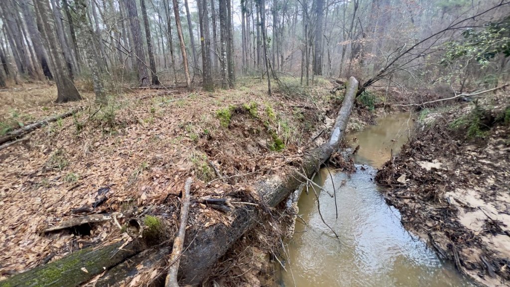
Its name did not put me at ease, but I held onto the hope that “Little Creek” might indeed be little!
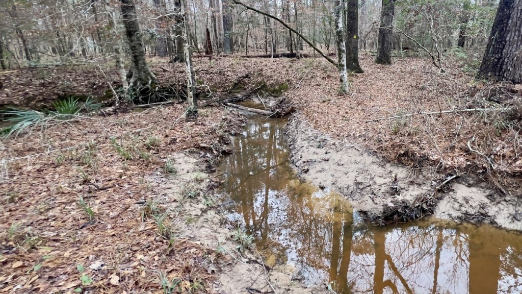
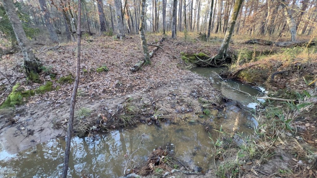
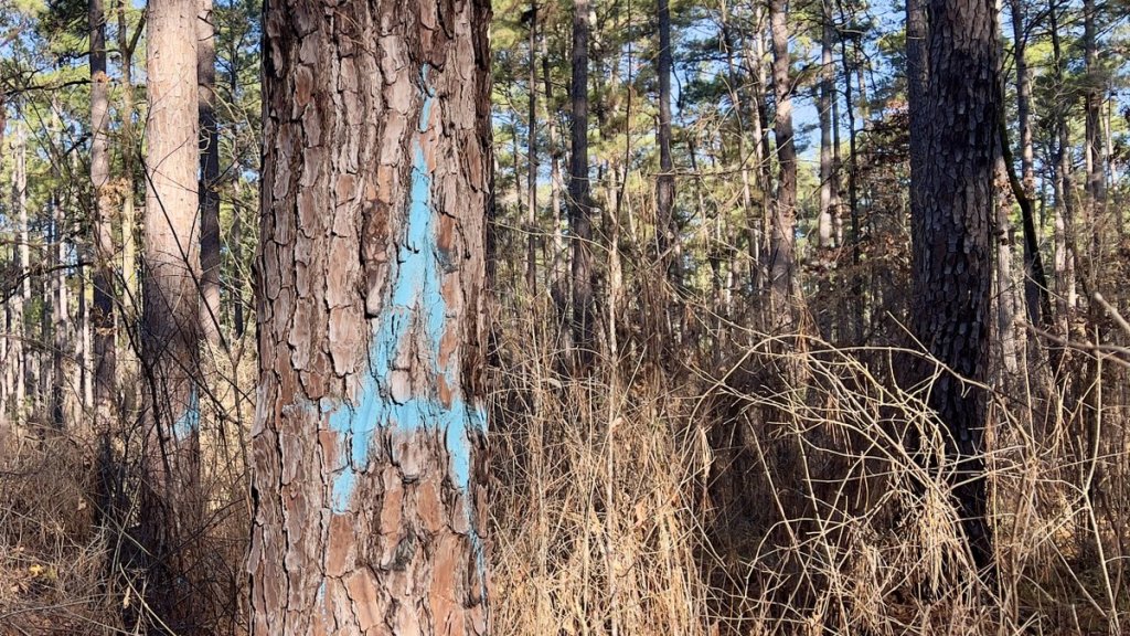
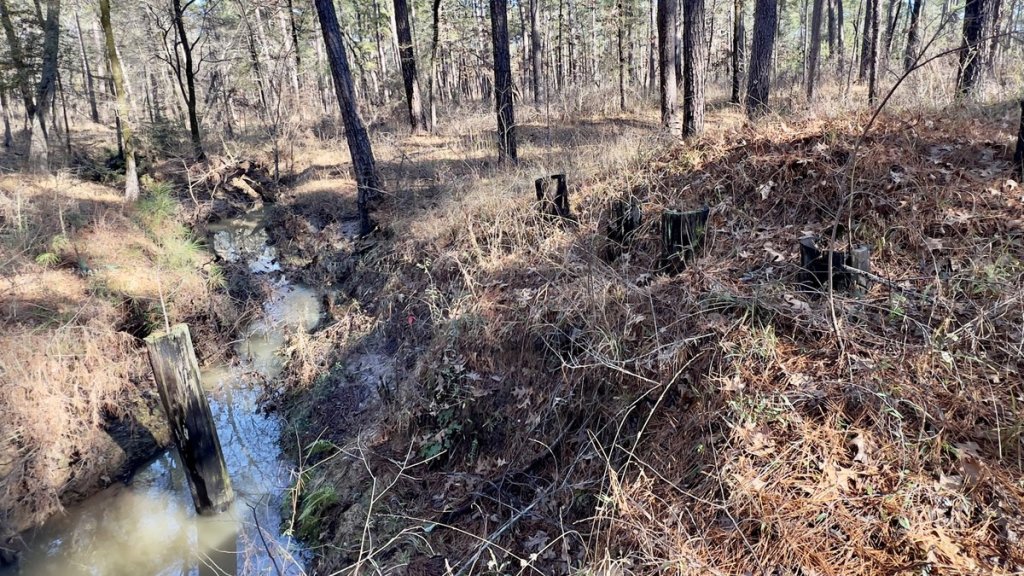
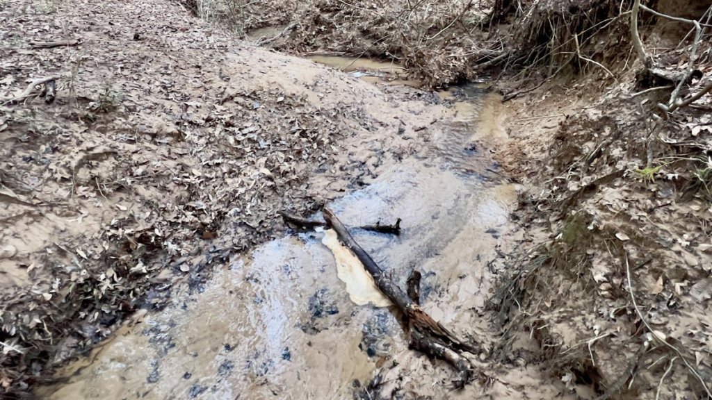
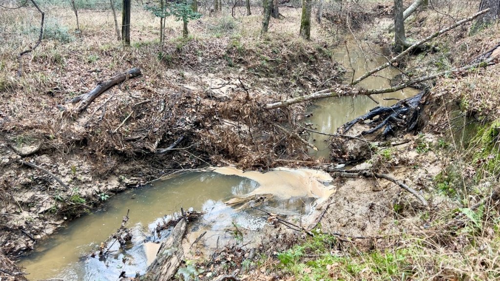
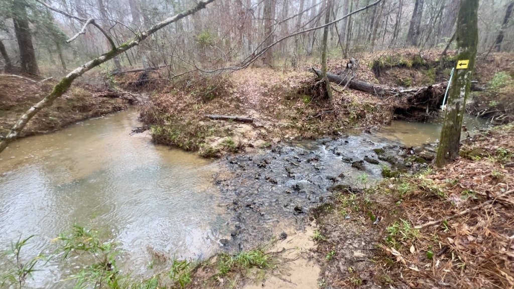
I was most worried about crossing “Little Creek” after 4.5 miles. I feared the name included sarcasm, and I had plotted an alternate route on forest roads if she proved not-so-little. I was so thankful when I discovered the creek only covered the bottom of a ten-foot ravine. Mud on the top of the banks showed the creek had overfilled the ravine during the downpour twelve hours earlier. The crossing-point as per the trail markers was by steep banks and water of unknown depth. A short reconnoiter revealed a convenient crossing a little downstream, marked with blue paint and tape, where I could cross in knee-deep water. Yay! No swimming today 😁. I could handle cold feet.
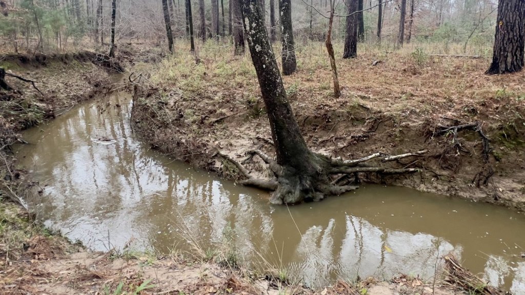


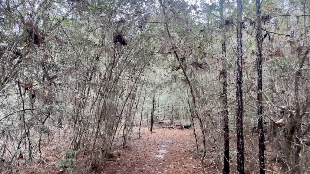
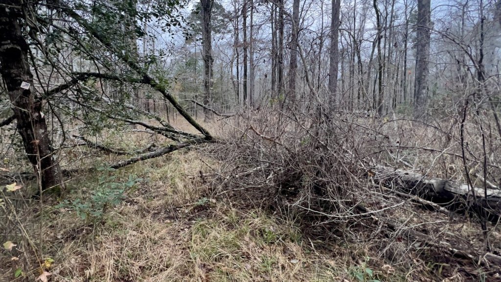
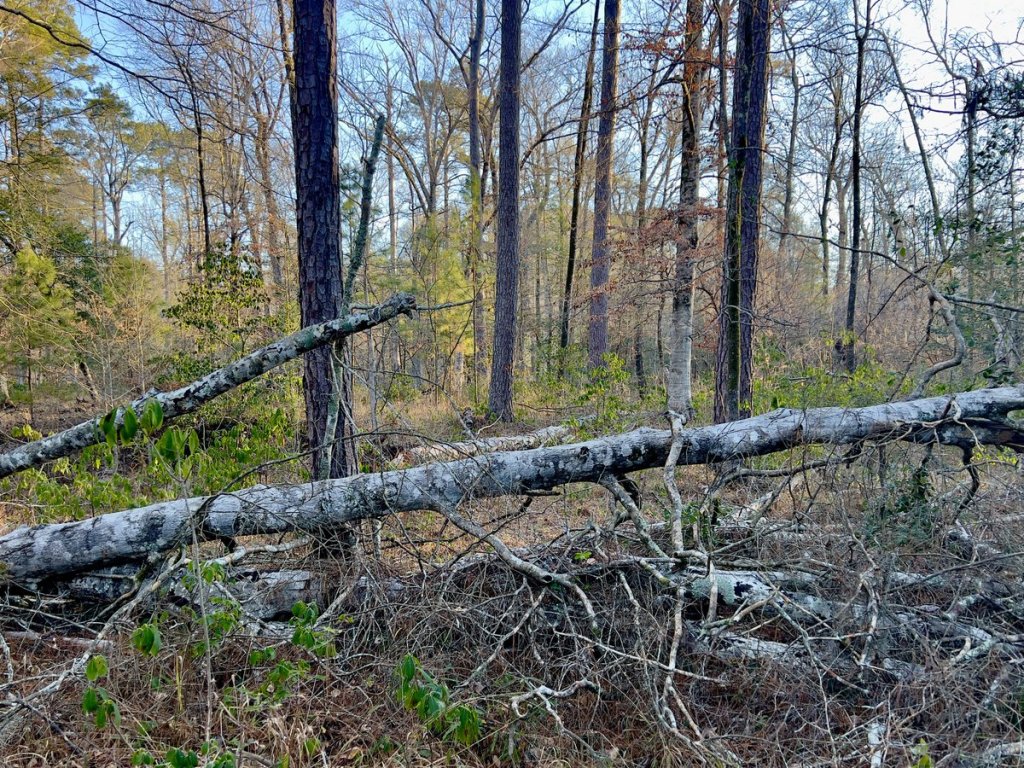
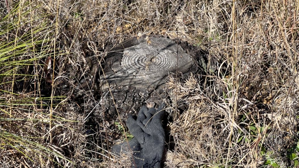
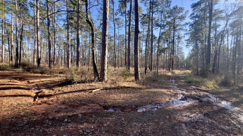
The river crossing signaled a change in trail condition. While there was more tree-debris on the trail, the reduced foot-traffic reduced the trail’s clarity and it became intermittently marshy as it followed Curry Creek. This forest was wilder and less tamed. Some large scat on the trail showed I wouldn’t be spending the night alone.


I’m unsure of what animal was in the woods with me, and guess it was either deer or hog. I did not see any other sign of deer on the whole trip, but I saw plenty of hog rooting and heard hogs squealing at night, but I never saw any.
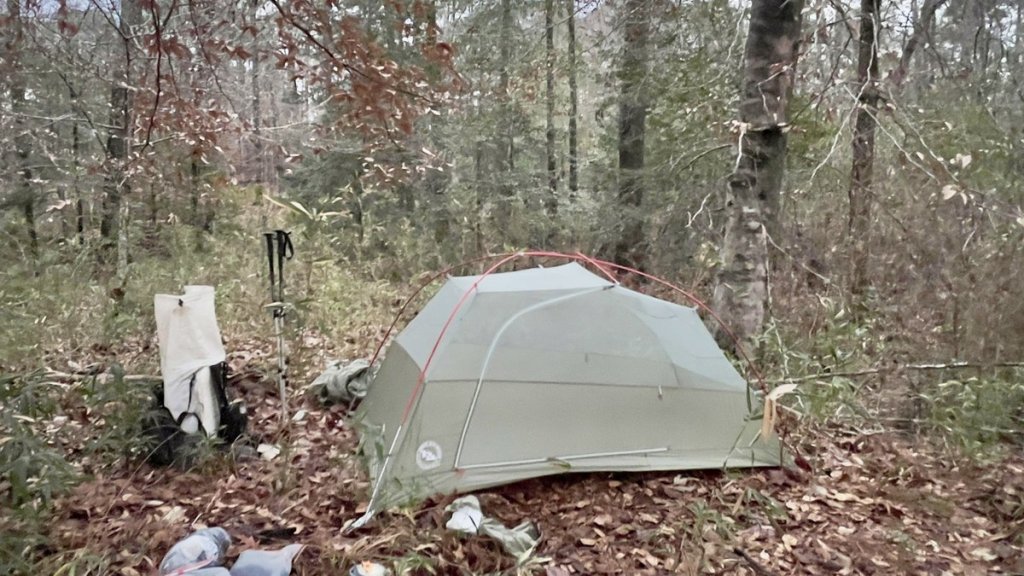
I wanted to keep hiking but sunset approached and I had to set up my new tent for the first time. So I found a suitable site, pitched my tent and enjoyed a fine dinner as the setting sun handed off to the rising moon. With plenty of warm gear in a spacious tent, I contentedly lay in bed after dinner, reflecting on the blessings of the day as my feet warmed up. I’d checked in with Janet with my InReach which assured me she wouldn’t be worrying. Night brought a drop in the wind, reducing its sound in the trees. A hog squealed nearby, some birds said goodnight, and a passing train blew its horn. I could hear the faint rumbling of the Georgia Pacific saw mill in Pineland. I’d chosen “All Quiet on the Western Front” as this trip’s movie, and watching the first half made me appreciate my luxurious tent and friendly woodland neighbors.
Goodnight!
Day 2
The coyotes started barking to each other about 30 minutes before sunrise, telling me to get up. Twittering birds joined the dawn chorus as I enjoyed my breakfast, followed by a few distant gunshots. The ice on my tent’s rainfly confirmed the effectiveness of my sleep system, but putting on frozen socks and shoes numbed my feet and encouraged me to get moving immediately. Fortunately, brisk walking got the blood flowing and their feeling returned within the hour.
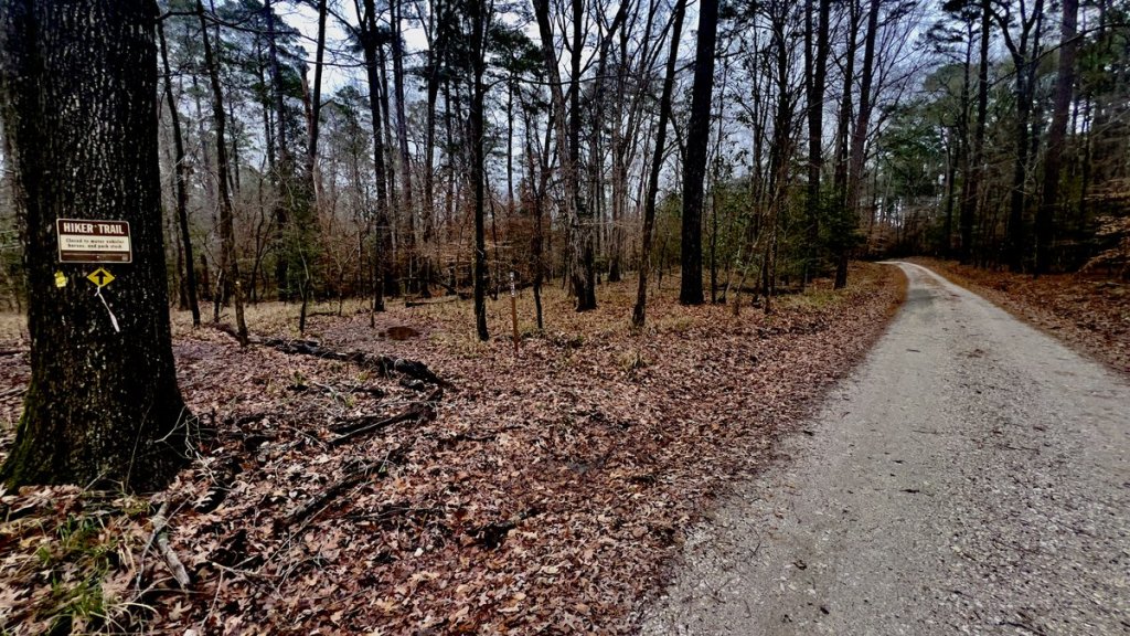
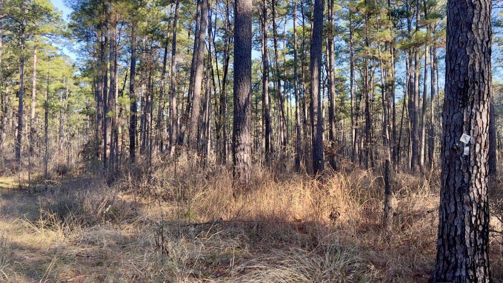
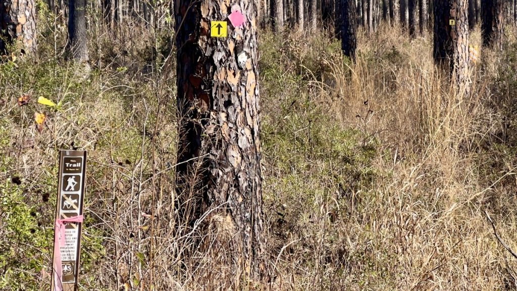
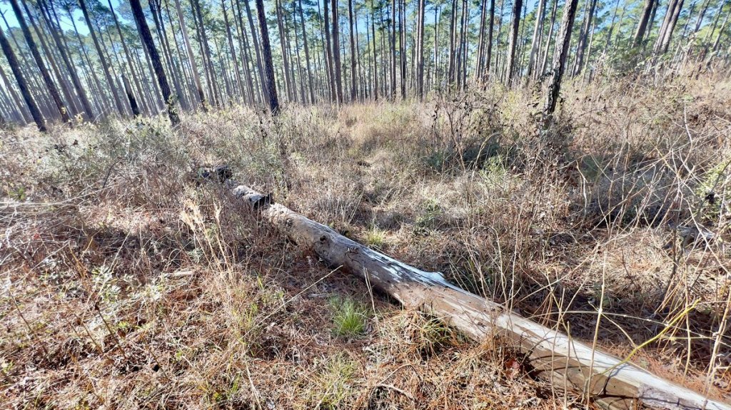
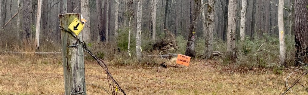
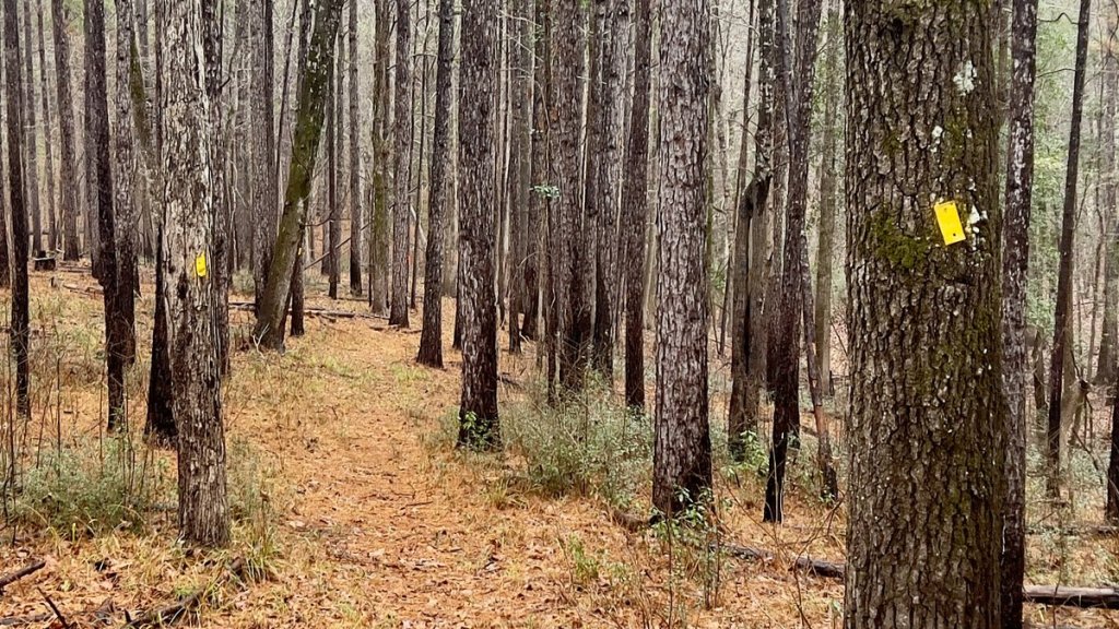
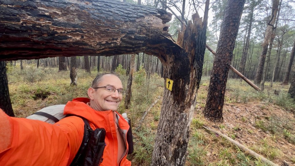
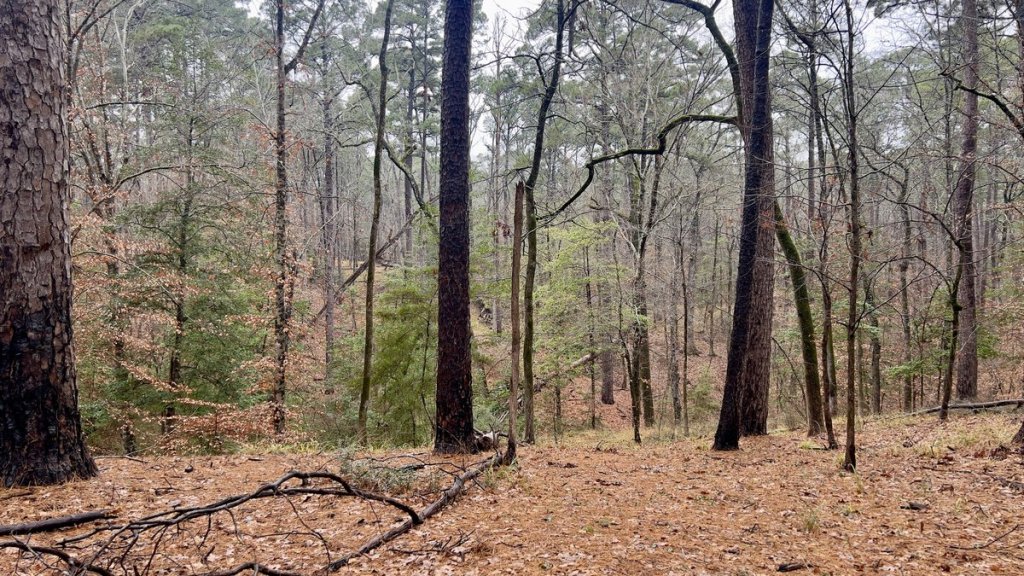
I set off with nine hours of daylight remaining. While I wanted to walk as far as I could, I quickly found the opportunity of clearing the smaller fallen branches off the trail. It was fun leaving the trail in better shape and also kept me warm. There were a few bigger logs for which I hope to return and remove (update: with much work of volunteers, the trail has since been cleared of all obstacles and mowed). Coupled with the debris and the less-worn trail was the challenge of navigating the trail. This was not like a National Park trail, which is akin to a highway. While the path was often obvious, there were times when it was quite a puzzle. I’d stand at a trail marker, searching the forest ahead for the next trail marker. The morning light made spotting them quite difficult. Can I see any hints of a worn trail. Is there a sawn log which indicates the trail? Is a marker hiding behind a fallen tree? Does the trail follow or cross the river? It was amazing how this stretch of trail from Little Creek (M23.5) to FM 2426 (M19.4) differed from the initial section to Little Creek, though hunting-related signage was throughout both sections. The trail crossed an abandoned road and passed by the remnants of a bridge over Curry Creek. A few small creeks, including Oz Branch (mile 21.6), created additional challenges of keeping feet dry, complementing the marshy areas where keeping them dry was very difficult. I retrieved my cached gallon of water just before FM 2426, crossing into the forest beyond without even seeing a car.


The trail mostly followed alongside Curry Creek which meant we had to cross a few tributaries, but I was able to get over them without getting wet. There was some residual water from the rains on the trail.
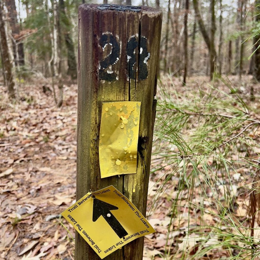
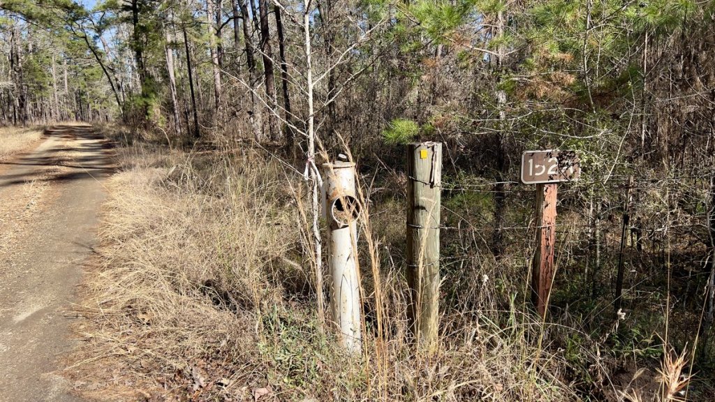
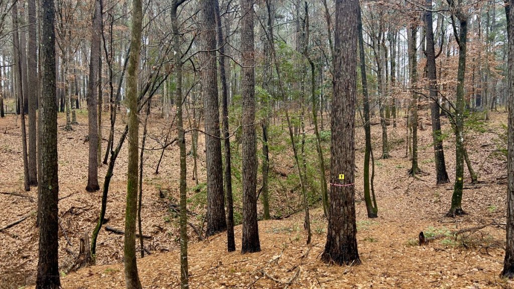
“Trail sense” is useful on this trail. Some markers are not very visible, especially in the morning light. Looking for clues as to where the trail goes helps, like gaps cut in logs. The trail crosses old forest roads, and you need to watch out you don’t inadvertently start walking along the old road rather than the trail.

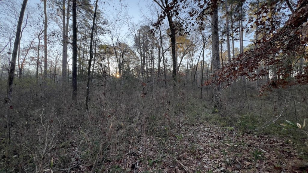
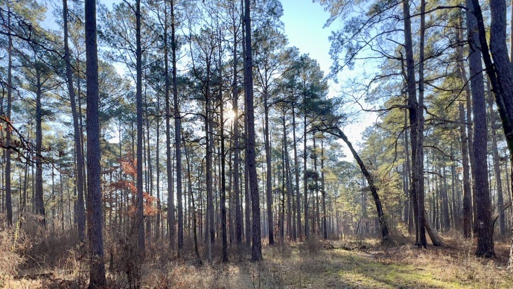
The sun was just right for my silhouette photo!
The terrain changed after crossing the road. This is where I had overly-optimistically planned to camp on my first night with my water cache. It was wet with barely any viable camping spots, but mile marker 19 was a good location to decant my water cache and eat lunch.


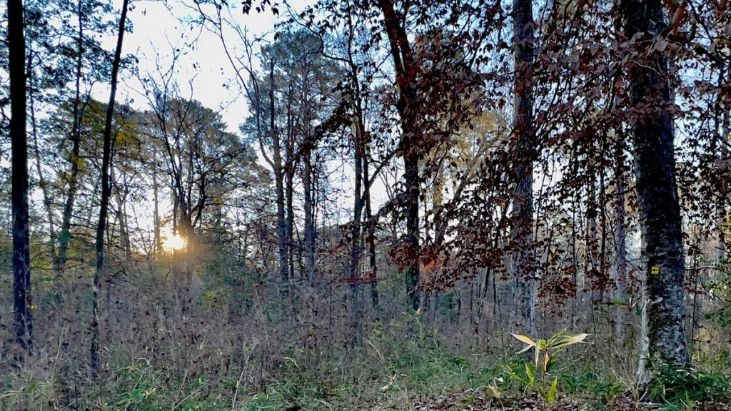
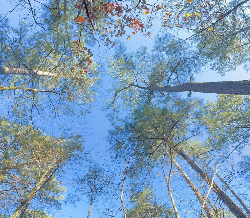
The sun was getting higher so it was time for the shades!
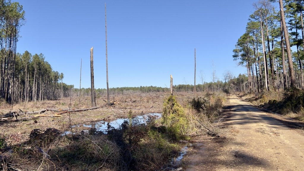
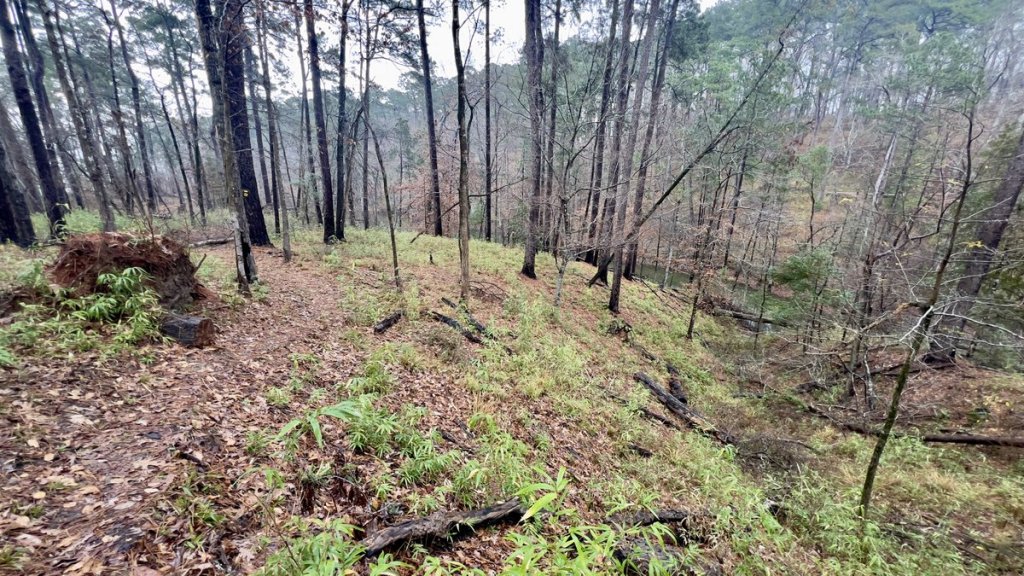
After less than a mile, I crossed Sixmile Creek (mile 18.5) and touched the southern tip of a logging zone. This was the only point on the whole walk with any hint of active operations, and even here, there was no sign of machinery. The trail skirted the edge of the cleared area for about 50 yards, and gradually turned from a northerly to an easterly direction. It led me through sections of forest representing all of the different life stages of the pine trees: saplings, young trees, older trees, and clearings. At mile 16.8, I climbed to the high point on the trail, nearly missing a right-turn down the other side (I’ve since returned and added a marker).


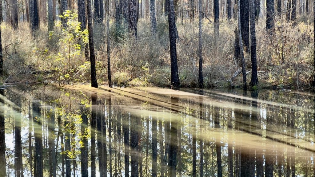
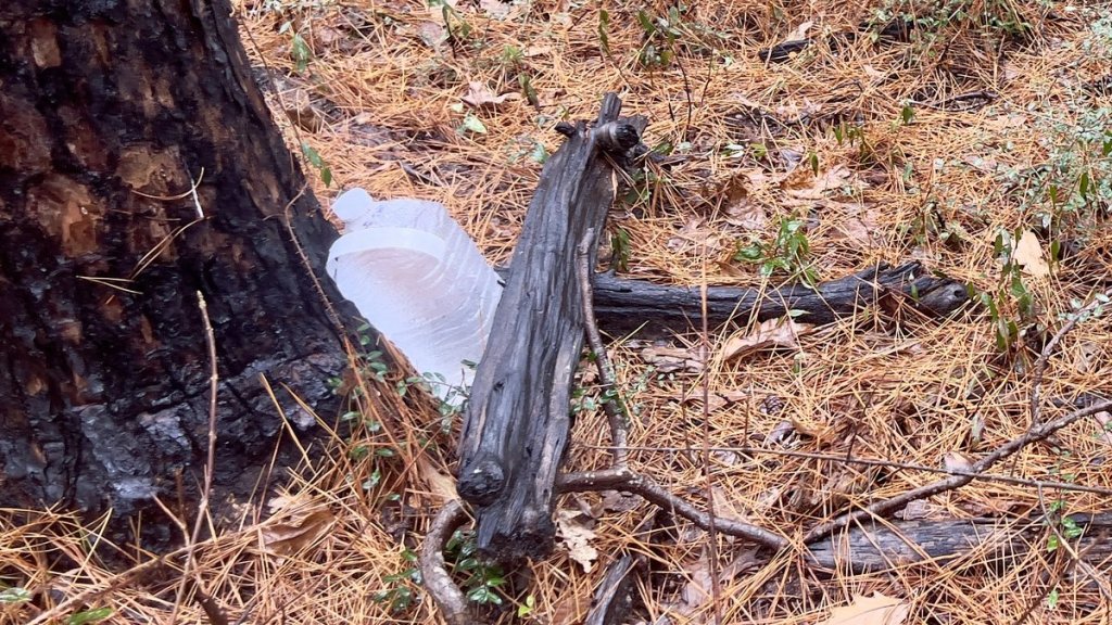
The trail’s high point signaled a theme change from pine-tree-lifecycle to old forest roads. I found an abandoned water cache at a road crossing soon after the high point. The only other trash I had seen so far was several different Mylar balloons. Happy birthday someone! The trail wove on and off forest roads, through dense young forest, past another bridge remnant over Fish Creek (mile 15.8), and took me to the fenced-in Jones Cemetery (mile 15). I continued to walk along barely used forest roads, providing pleasant variety from woodland paths, and skirted a beautiful pond reflecting the forest and the afternoon sun (mile 14).
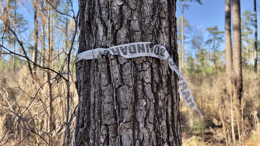
There was some very old “Harvest Boundary” tape. It looked like it had been a VERY long time since a harvest!

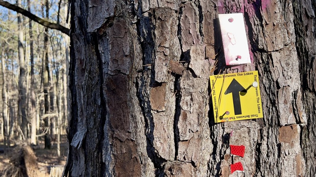
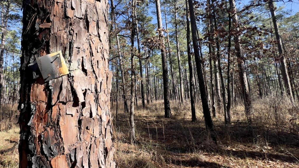
Over a short section, I spotted some reflective trail markers. Most of the trail would be difficult to navigate at night, but I expect that hunters had placed these to help them navigate this section of the woods.


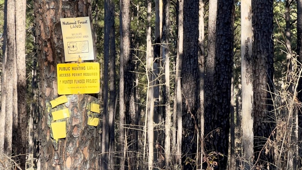
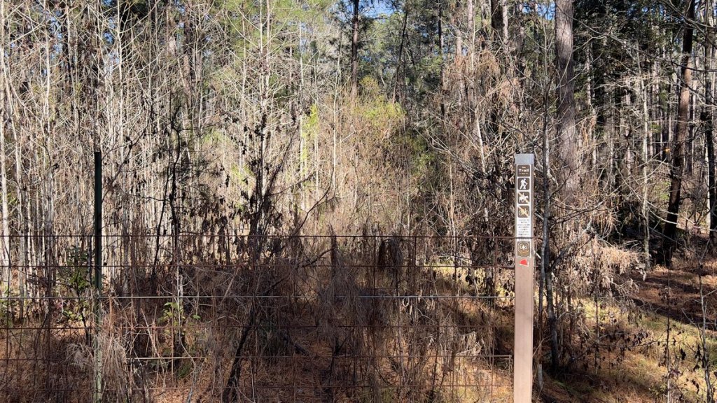
There had been hunting-related signage along the side of the trail for most of it so far, but I don’t remember seeing any after crossing Walnut Creek. I heard gunshots in the mornings and evenings but I did not meet any hunters or see any evidence of their activity, though I was hiking after the close of the main season.


At about an hour before sunset, I came to Walnut Creek (mile 13.4). The sides looked steep and the water looked wet and wide. While it looked shallower than Little Creek, I didn’t fancy soaking my feet in icy water at the end of the day so I looked for a campsite. Close inspection of a perfect flat spot revealed an animal burrow, so I opted for a slightly sloping area with the bonus of a large log to serve as my dining chair and table.


It had been a good day. I had cleared a lot of small debris from the trail and taken notes of the bigger debris I was unable to move. It had been very satisfying with tremendous variety. While the forest lacks the big vistas, there is a kind of peace that you can only find in the trees. The abandoned roads and bridges suggest this is not where humans should live, with the cemetery suggesting it’s OK if you are dead! I followed a fine dinner with finishing the movie “All Quiet on the Western Front” which reminded me of my blessings. I realized I was barely past halfway after two days so tomorrow was going to be a long one. I set my alarm, in case the coyotes didn’t wake me, and enjoyed peaceful slumber.
Day 3
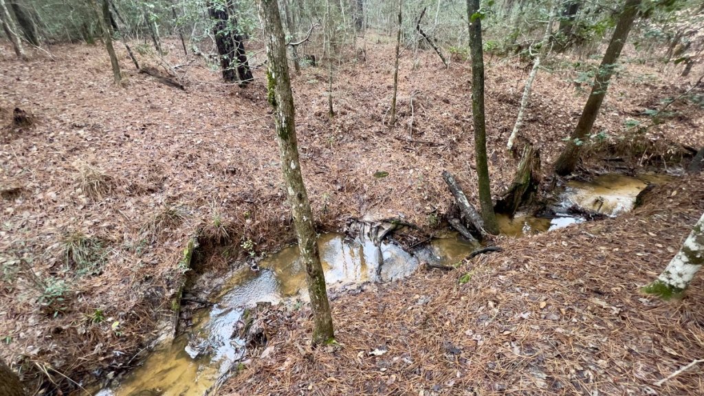
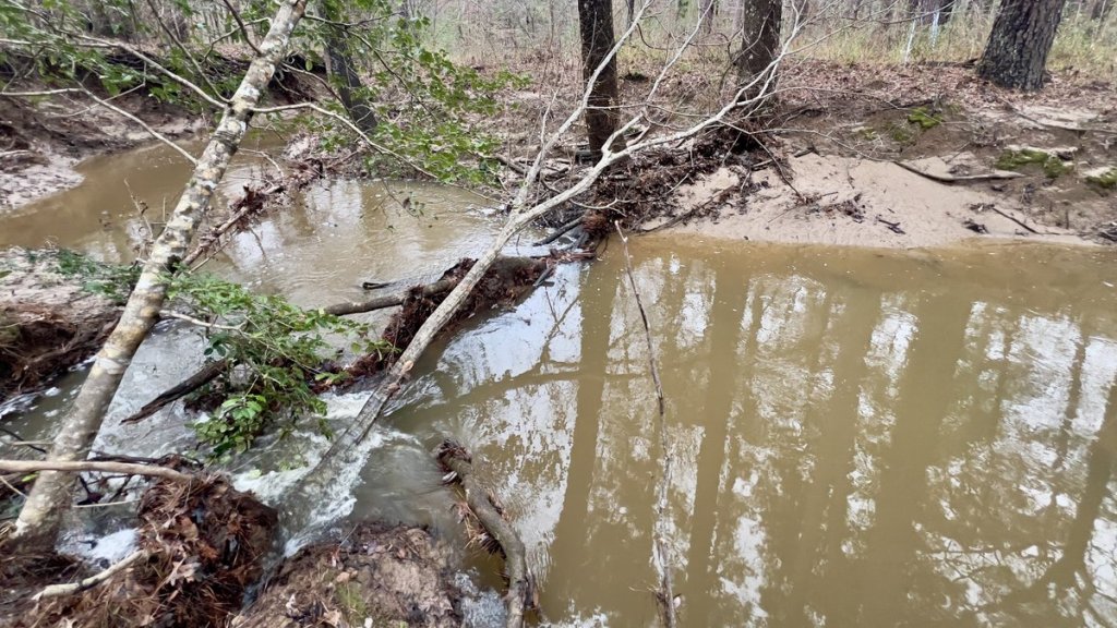
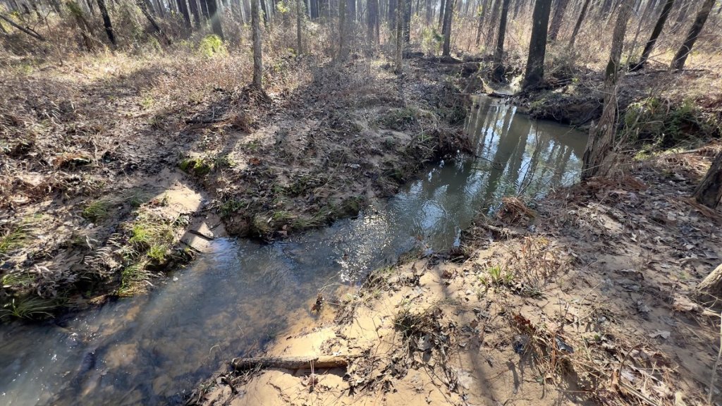
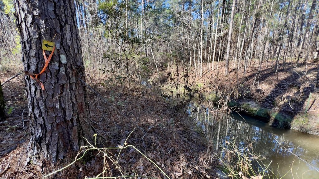
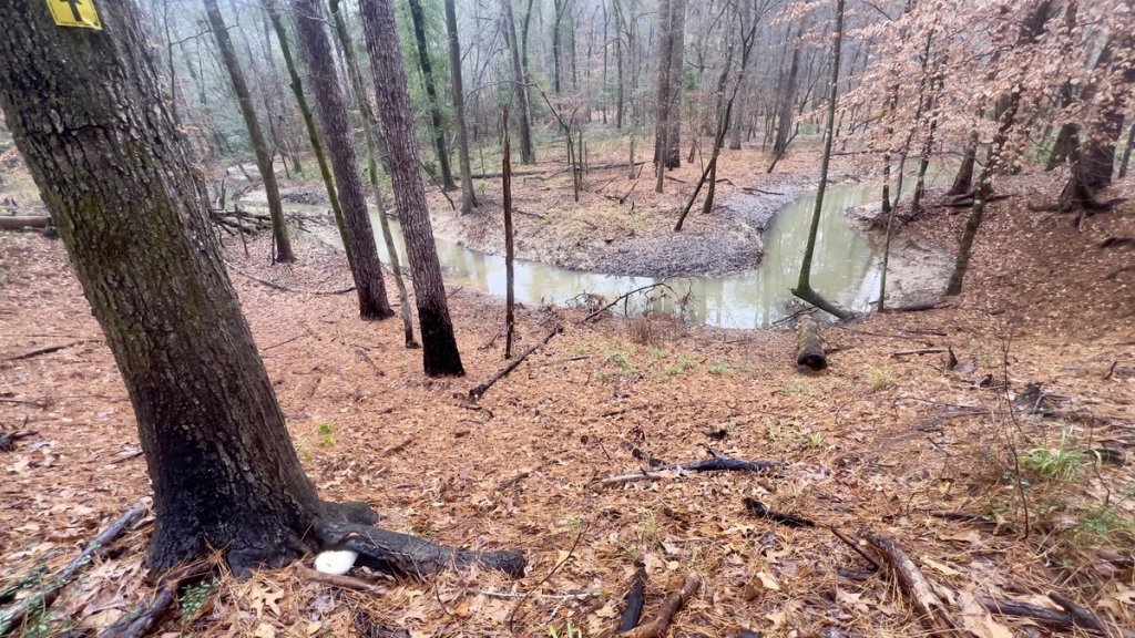
Part of the final day’s mission was to eat all the remaining food, so breakfast was fun! I treated myself to dry socks, and searched for a good crossing point over Walnut Creek. After bushwhacking upstream a bit, I found a spot with less steep banks where I could cross the water with only one foot getting slightly wet.

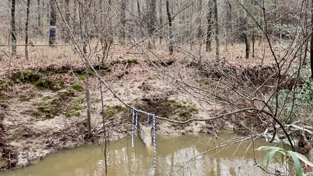
The leaf line suggests how much this ravine fills up after heavy rain, though it likely drains quickly like Little Creek.

The short 1.4 mile section from Walnut Creek (mile 13.4) to the Yellowpine trailhead (mile 12) had the greatest density of debris and blowdowns (update: these have been cleared). I had seen clusters of debris earlier, and wondered if they were due to localized tornadoes. I soon realized that I no longer had time to clear any debris though I was able to find a geocache hidden in 2006!


My passing through told me I had (only) twelve miles left!
As I crossed TX 87 (mile 12), there was a little rain. I had not seen any in the forecast, so incorrectly assumed it would be just a little, and did not put on my waterproof pants until it was too late. I think I’d optimistically misread the forecast! However, the main issues with the rain were my glasses and phone. I had been taking notes every mile (to help me write this) but it was so much more difficult to write or take photos in the rain. So, the section from TX 87 to about mile 7 is a bit of a blur. I did not even notice mile markers 10 and 9. I look forward to returning and walking this section again!

The only natural rocks in the trail were at this crossing over Lick Branch at mile 9.5.
From about mile marker 7, I felt a change in the trail. It was about here that the peninsula started. The terrain became hillier, undulating between wet streams and open pine forest. I picked up my second water cache from the road junction at 6.7 miles (known as Five Points), but I barely needed it. While the trail was generally pine needles, the hogs had carved it up in several places. I started to hear boats on the water and the trail was well defined. I felt I was on my victory lap, but there were still a few miles to go.

I picked up my water cache, though needed little of it and dumped most of the water.

I was happy to “leave no trace” with this one.
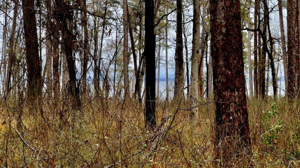
I celebrated spotting the lake, then Louisiana, and finally my truck at the trailhead kiosk. I kept going past the kiosk to touch the water, so that I truly had walked between the lakes! I was checking out the cool campsites at Lakeview when a man and his beautiful Golden Doodle drove up in his golf cart and asked whether I’d been hiking for three days. He came to walk his dog every day and had seen my truck since Friday, which gave me peace of mind about security. He’d only seen one other car during that time. He reminisced how he used to ride his motorbike in the 70s on what is now the TBTL.

The End!
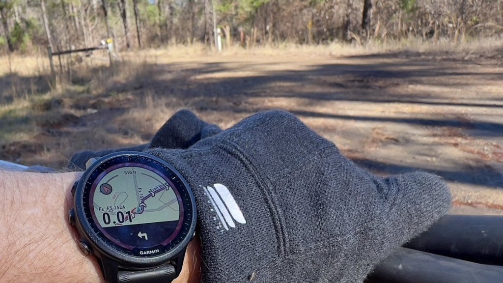
I’d finished 50 hours after I’d started. I’d competed the whole hike; I’d cleared a bunch of debris and captured details of bigger falls; I’d checked out my new tent and a new head torch and loved both; I’d tried navigating with a GPX route on my Garmin watch and it was fantastic; I confirmed that I had dialed in my cold(ish) weather kit list; I was alone for two days and OK with it; I spent time reflecting, praying, and being thankful for my blessings. And I had discovered a trail that I fell in love with. It’s tough to compare it to the other thirty-milers that I’ve done (LSHT, ERL, and OML) but the TBTL was special. And I will be back. And I hope this might inspire others to give it a closer look. This was a great time of year for the trail as I saw no mosquitoes, chiggers, or snakes.

| Start | Distance | Ascent | Stop | Hiking Time | |
|---|---|---|---|---|---|
| Day 1 | 1:55pm @ MM28.2 | 6.95 mi | 387 ft | 5:20pm @ MM23 | 3hr23min |
| Day 2 | 8:05am @ MM23 | 12.1 mi | 650 ft | 4:45pm @ MM13.4 | 7hr53min |
| Day 3 | 7:40am @ MM13.4 | 16.2 mi | 1,296 ft | 4:21pm @ MM0 | 8hr44min |
Note that I spent signifiicant time on day 2 clearing the trail.
My total starting packweight was about 27 lbs (437 oz) – see details here. This included 5 lbs of extra clothes for warmth, 2 liters of water (70 oz), and 59 oz of food. For two complete days, I brought 6800 calories of food averaging 132 calories/oz (see details here), and it was the perfect amount, consuming my final snack in the last mile of the trail, and enjoying the treats that I had left in my truck.
Please follow us on this journey by subscribing below, and we would love to hear your encouraging feedback.

What an adventure, by yourself! Might have to check out a section next time I come to Houston to see my brother. Maybe get a chance to see you and Janet, too!
LikeLike