
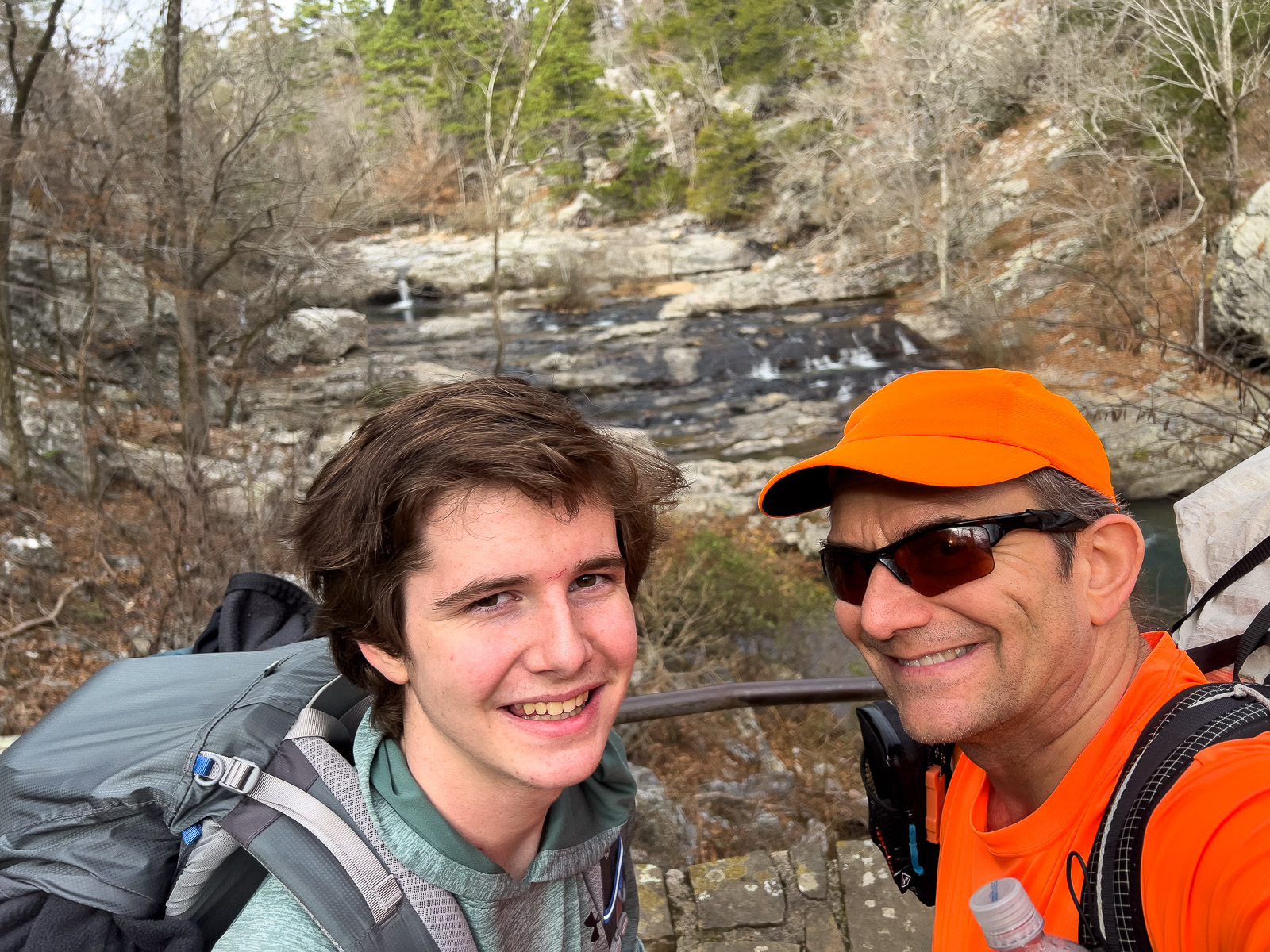
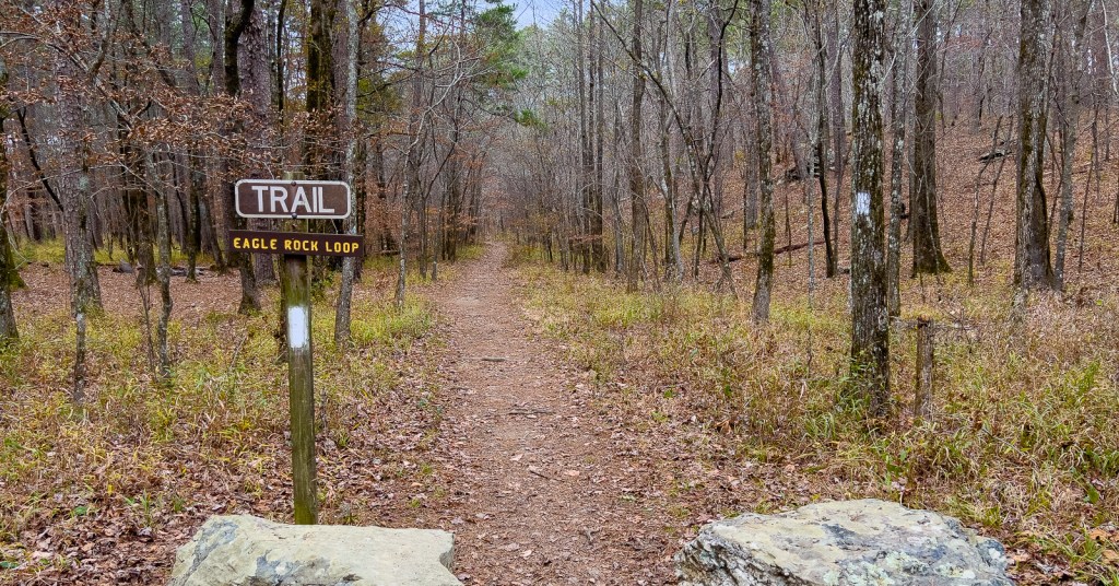
The 27-mile Eagle Rock Loop (ERL) in the Ouachita National Forest in southwest Arkansas has been on my “list” for several years. At nearly 400 miles from Houston, it is our closest multi-day trail in hills. I was thrilled in early November when I suggested to Samuel that we do it over the Thanksgiving break (Sunday Nov 20 to Wednesday Nov 23) and I received the most positive response possible from a teenager: “yeah, sure.” Neither of us had much time for preparation, but this loop was ideal for little preparation given our level of experience. (Read about return to the ERL in Nov 2024 here, where we took an alternate route to avoid high water.)
Summary
| Day | Activity | Mileage Hiked |
|---|---|---|
| Sunday Nov 20th | Drive Houston to Texarkana hotel | 0 miles |
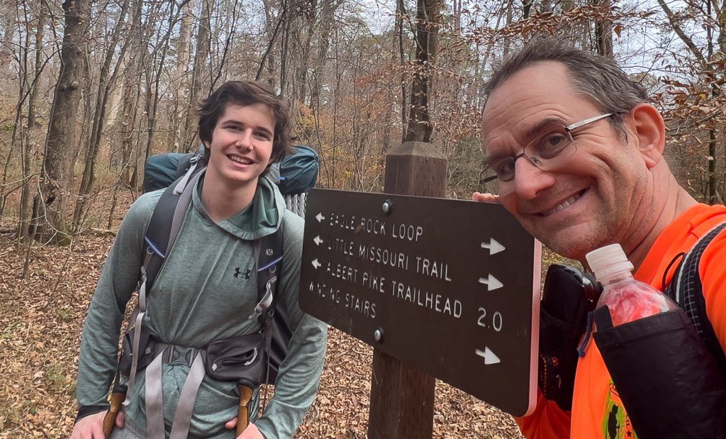
| Monday Nov 21st | Drive to Winding Stairs Trailhead (NFW106). Hike CCW, via Window Rock, to last campsite before Athens/Big Fork trail. | 13 miles |
| Tuesday Nov 22nd | Hike CCW via Spirit Mountain and Brush Heap to Eagle Rock Vista | 8 miles |
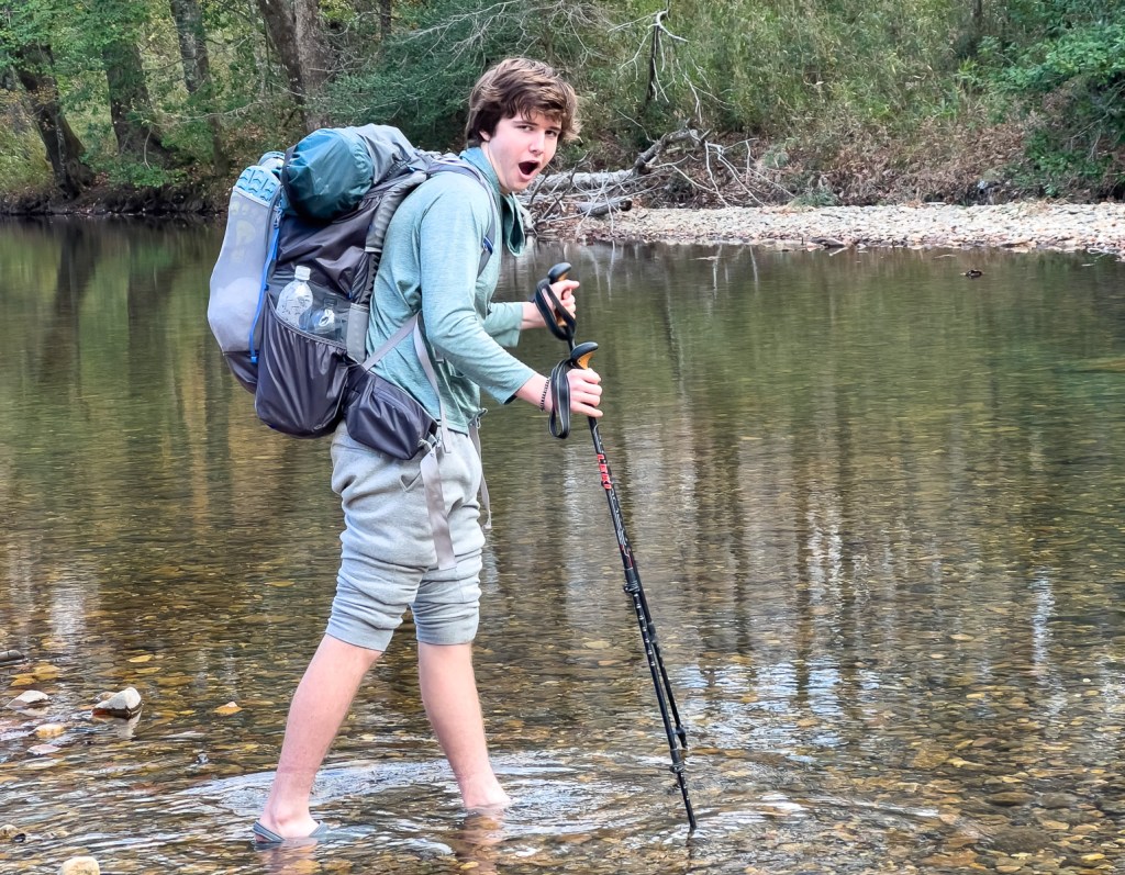
| Wednesday Nov 23rd | Hike out to trailhead, wading across the river twice. Drive to Louisiana | 8 miles |
It was a fantastic trip with great weather, warming campfires, a chorus of coyotes, just the right amount of food, and only two wet (yet painfully cold) crossings. Read on for more!
Planning and Preparation
My primary planning resources were Charlie Williams’s website, the Eagle Rock Loop Trail Reports Facebook Group, the Forest Service’s Guide, the AllTrails map, and the FarOut Guide. I discovered this video that was extremely well made and provided entertainment and some useful background. I hope this blog can fill a gap while complementing the other resources!
January 2026 update: when investigating why the link to the Forest Service map no longer worked, I found that there is now a free ERL map on Avenza. I have found Avenza maps to be excellent on the Lonestar Hiking Trail and Trail Between The Lakes, so this one is certainly worth checking out.

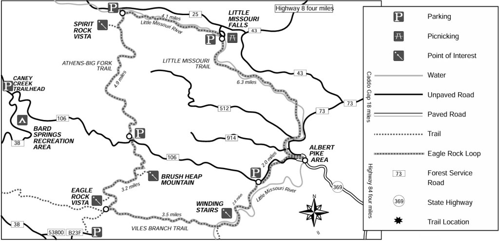
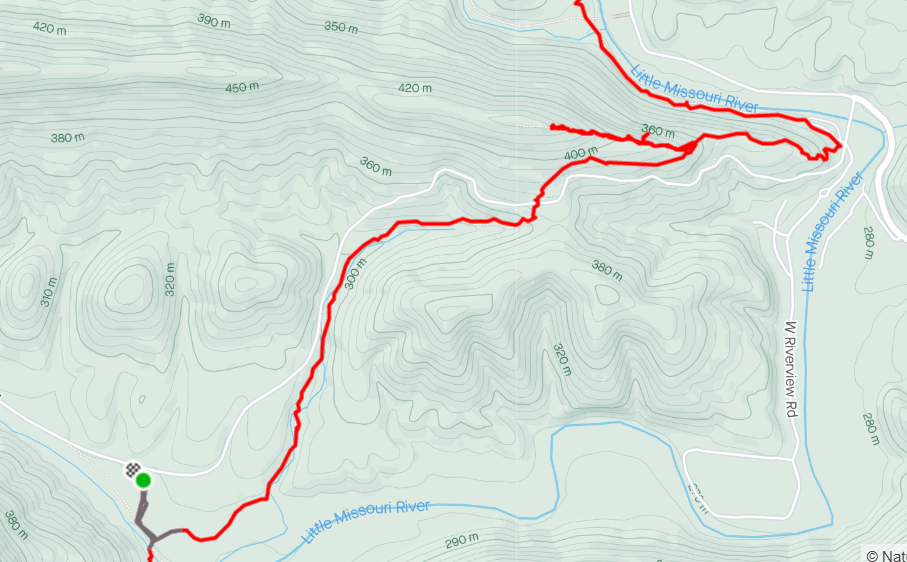
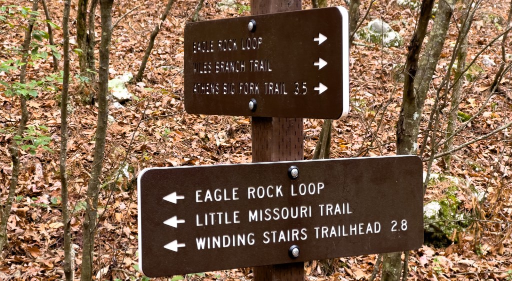
My first decision was a start point and a direction. Things to consider include when to do the hills, getting feet wet, and where you can park. We chose to start at Winding Stair trailhead (the green and black circle above) near Albert, labelled NFW106 SW Parking in Google Maps, and hike counterclockwise. Alternative start points include Little Missouri Falls trailhead on the northeast side, the Little Missouri/Athens-Big Fork trailhead at the northwest corner, the Blaylock Creek West Trailhead on the west side in the hills, and the Athens-Big Fork South Trailhead at the southwest corner. Overnight parking and camping are forbidden at Albert Pike Recreation Area after a catastrophic flash flood in 2010 when 4.3 inches of rain in 3 hours led to twenty deaths. (see Official USGS report and photos).
Coupled with the start point decision is how long to take. At 27-miles, some can do the whole loop in a day (it’s only a marathon!) We wanted a relaxed and enjoyable hike so aimed for 2 nights. This plan allowed a 12-mile, relatively flat first day along the very scenic Little Missouri, with our first campsite by the river just before the northwest corner. The second day would cover most of the hills, camping at Eagle Rock Vista after 8 miles at the top of the sixth and last ridge. This left a short six-mile final day with two wet crossings of the Little Missouri. We would not change the plan one bit as this worked perfectly for us. This starting point was also most convenient for arriving from Houston and heading to Louisiana afterwards for Thanksgiving. We had considered camping at a trailhead the first night as we were arriving late but chose to stay in Texarkana and drive the 1.75 hours at dawn the following morning.
The next decision was gear. Our most recent backpacking trip had been the Grand Canyon in May which was hot and arduous, so we had gone as light as possible, even ditching the stove. However, we had memories of being cold in Colorado in July 2021, and some ERL weather reports for Langley or Mena showed temperatures dropping to the low 20’s the week before our trip. The forecasts during our week did not go much below freezing, but this still convinced us to pack on the warm side. This meant we each brought a puffy and a fleece, sweatpants and thermals, and I brought 2 thermorests (one is the very light Uberlite which is comfortable but not warm). We also brought the stove for hot food and drinks, and I brought a Nalgene for a hot water bottle (which I ended up not needing). Our provisional equipment list is here, but we ended up leaving a few things behind resulting in starting dry weights of about 18 lbs which included some luxuries.
The next decision was food. The main lesson from Colorado had been to avoid monotony, and we needed something warming. The lower temperatures meant perishable items such as cheese and chocolate would survive. Our dinners were based around a cheese-and-cracker appetizer followed by one Mountain House and one Raman Noodle, and a side of either Velveeta Mac and Cheese or Idahoan mashed potato, with chocolate (both bars and hot to drink) to finish it off. Breakfast centered on oatmeal, Trader Joe’s coffee and hot chocolate, and more chocolate! We had a variety of snacks throughout the day, including a couple of sandwiches. For previous trips, I have planned food around calories, aiming at about 2500 calories each per day. With less preparation this time, I had thrown in too much, and fortunately we left quite a lot behind when we repacked at the hotel, the night before.
The final decision was about technology. While I am tempted to head out with ZERO technology, I like what I bring. I use an Iphone 13 Pro as my primary camera (shooting raw), and having downloaded AllTrails, FarOut, and GoogleMaps. I track our hike using my Garmin Instinct, though this time I also tracked using AllTrails which worked well. I brought my Garmin InReach Mini which we used the first night to check in with my wife, but we got some cellphone reception on several of the high points. I use an Ankar PowerCore 10,000 to recharge these as required. I also brought my DJI Mini 2 drone plus controller and 3 batteries which added nearly 2 lbs, but I wanted to bring it on a trip and this one seemed appropriate.
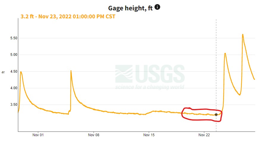
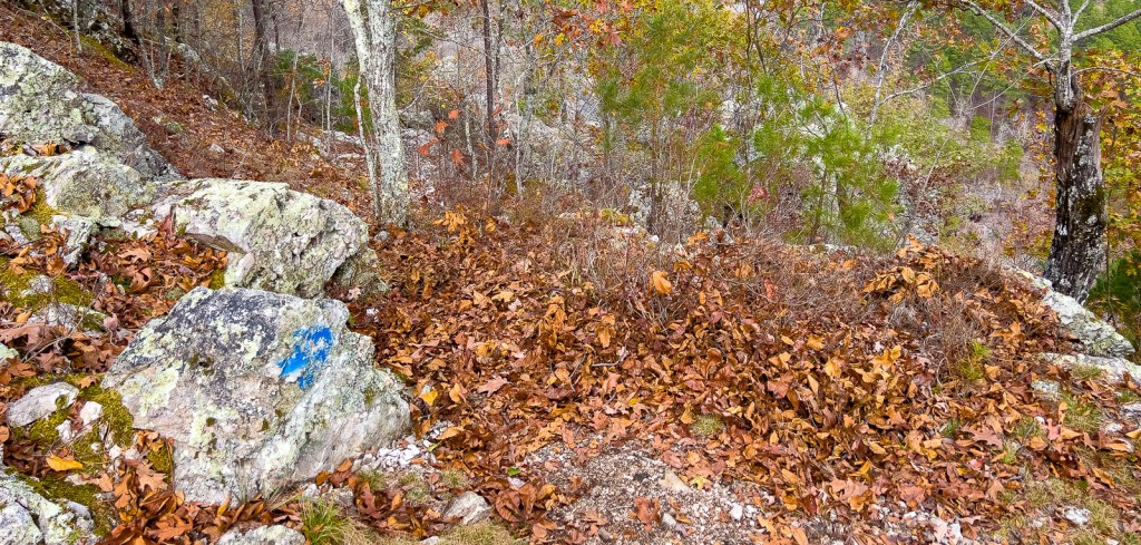
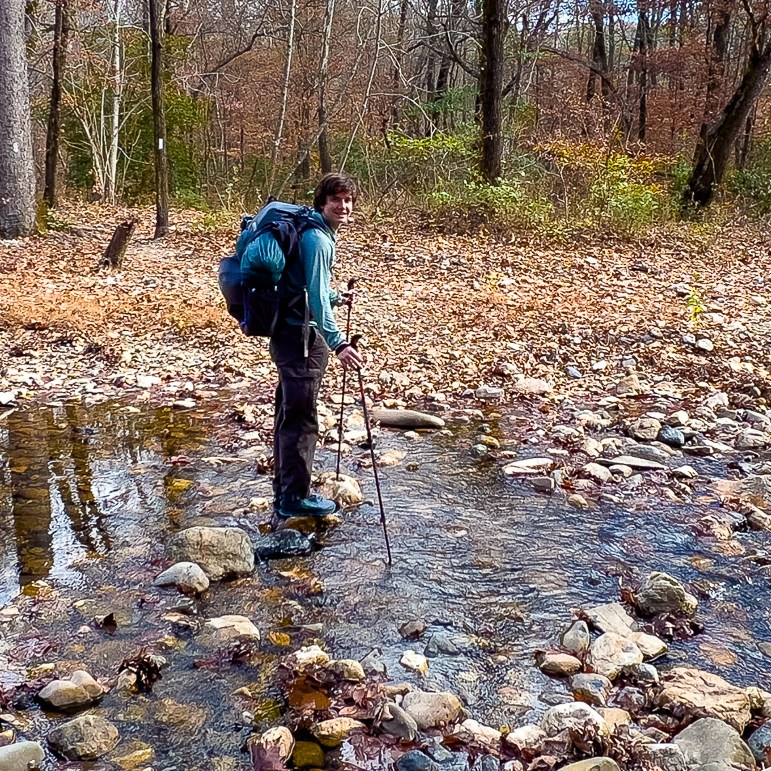
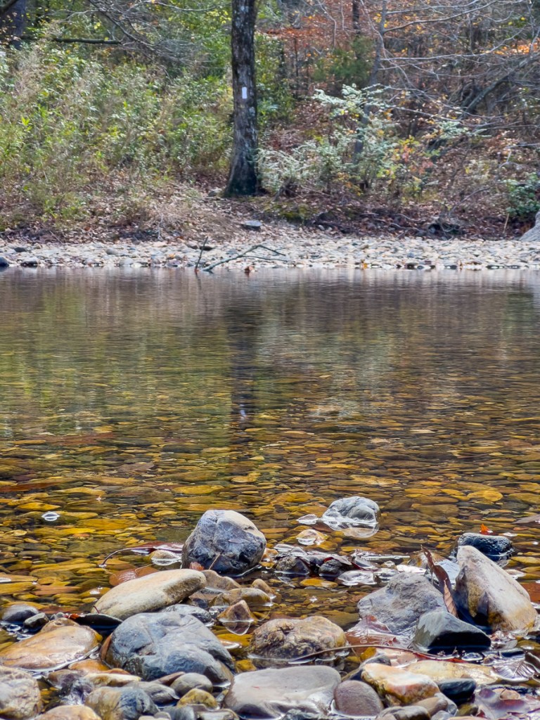
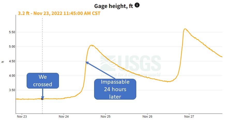
Before departing, it is essential to check the weather for rain and the level of the Little Missouri using this gauge near Langley. If the gauge is below 4ft, the deepest crossing on the loop in the southeast corner, just above where Viles Branch joins the Little Missouri, will be calf-to-knee deep. The crossing by Winding Staircase had a similar depth. If the gauge is 4-4.5 ft, sites advise that it is possible but dangerous, and they advise not to cross if it is over 4.5 ft. There was not an obvious trail to avoid these crossings and the route looks steep on maps. While there were several scenic campsites between these two crossings, we would think twice in case the river rose overnight. With the gauge at 3.2 ft, we were able to keep our trailrunners dry at all crossings other than these two.

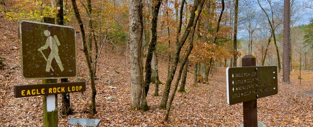
Day 1: Winding Stair Trailhead to the Northwest Corner
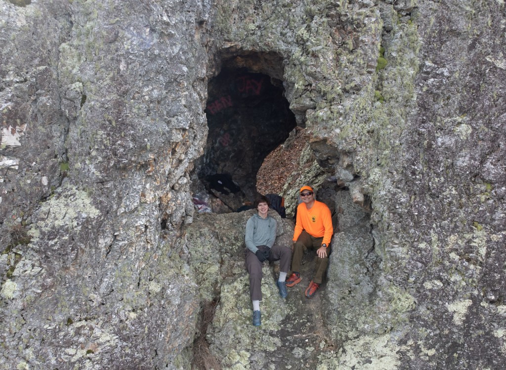
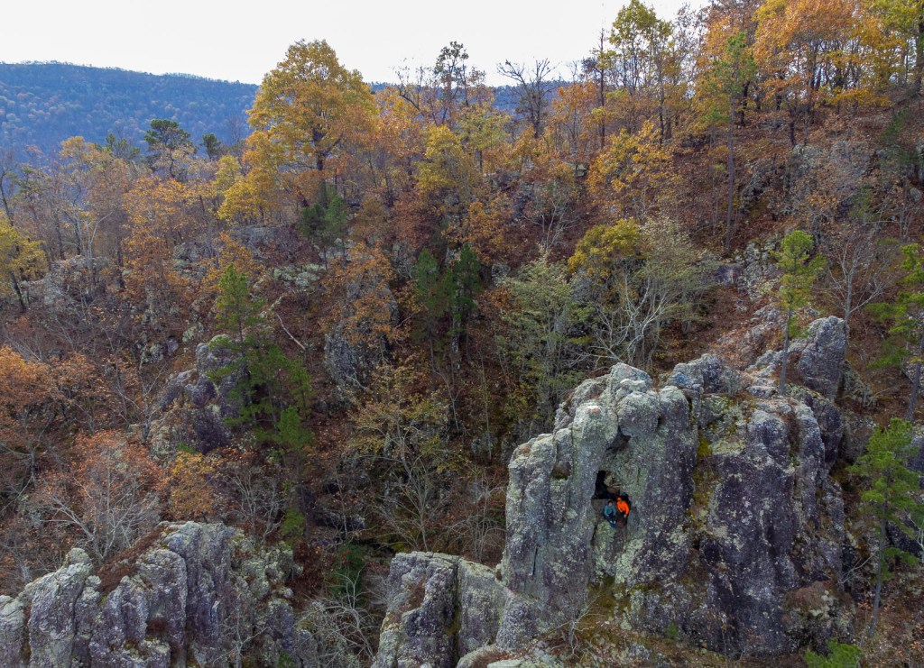
In summary, we started hiking at 8:30am (sunrise at 7am) and finished at 3:45pm (sunset at 5pm) after 13 miles which included a side hike to the must-see “window rock.” Our feet stayed dry and we met only a couple of other hiking groups and saw no other tents except at the trailheads.

We arrived at the trailhead at about 8am. The parking lot had about 15 cars in it, with the majority from Texas. I don’t know where they all were as we did not see many people on the hike. We had been uncertain about bringing the extra clothes, but the temperature as we stepped of the car convinced us we’d need them. The trailhead pit toilet (with TP!) was a bonus.


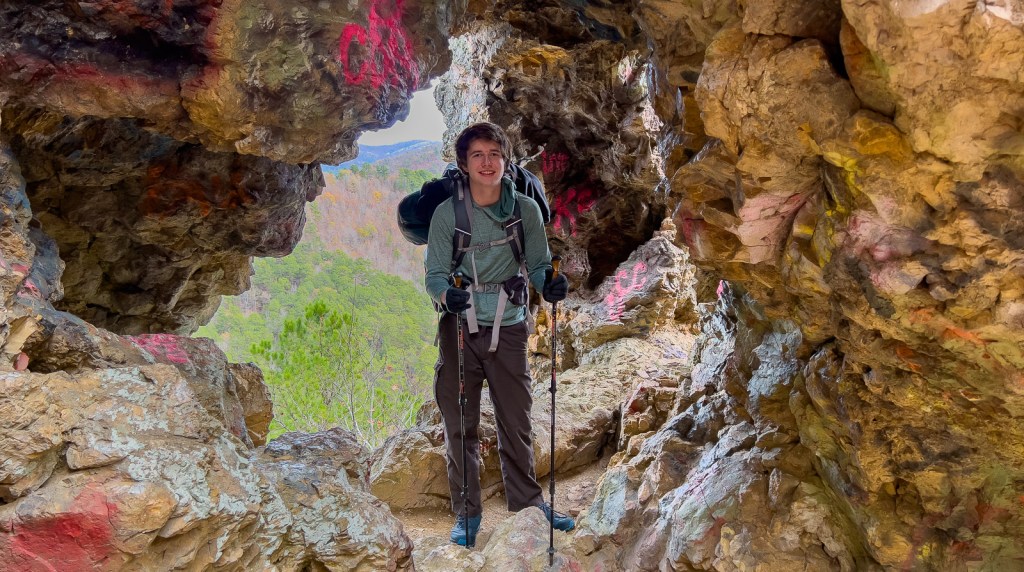

On the way down from the window, we met a grandfather and his grandson climbing up. The grandfather hadn’t visited in over twenty years. Having rejoined the main trail, we met a group of two guys and two girls, with the guys carrying large daypacks, but only one of the guys looked happy! Onward to Albert Pike.

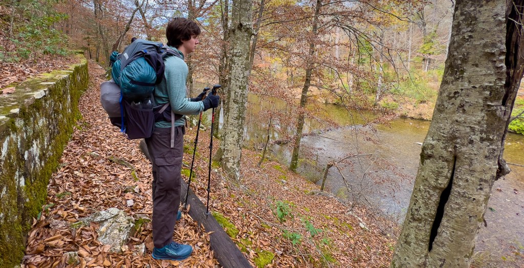


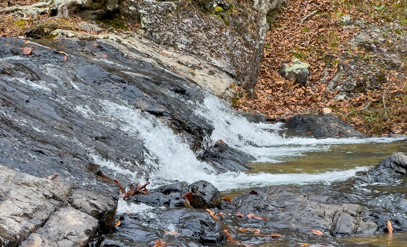
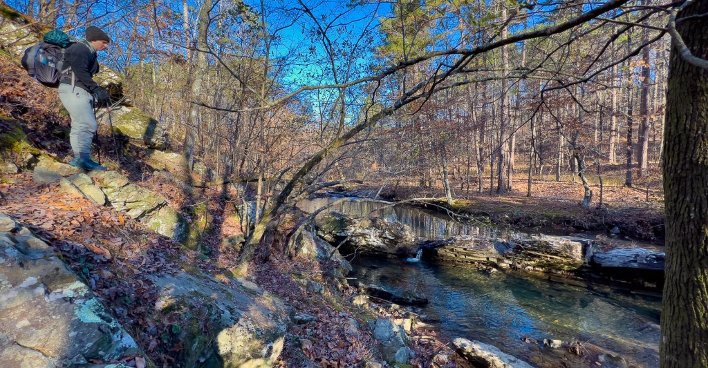
A multitude of tributaries flowing into the Little Missouri provided lots of rock-hopping challenges, but we managed to keep our feet dry.


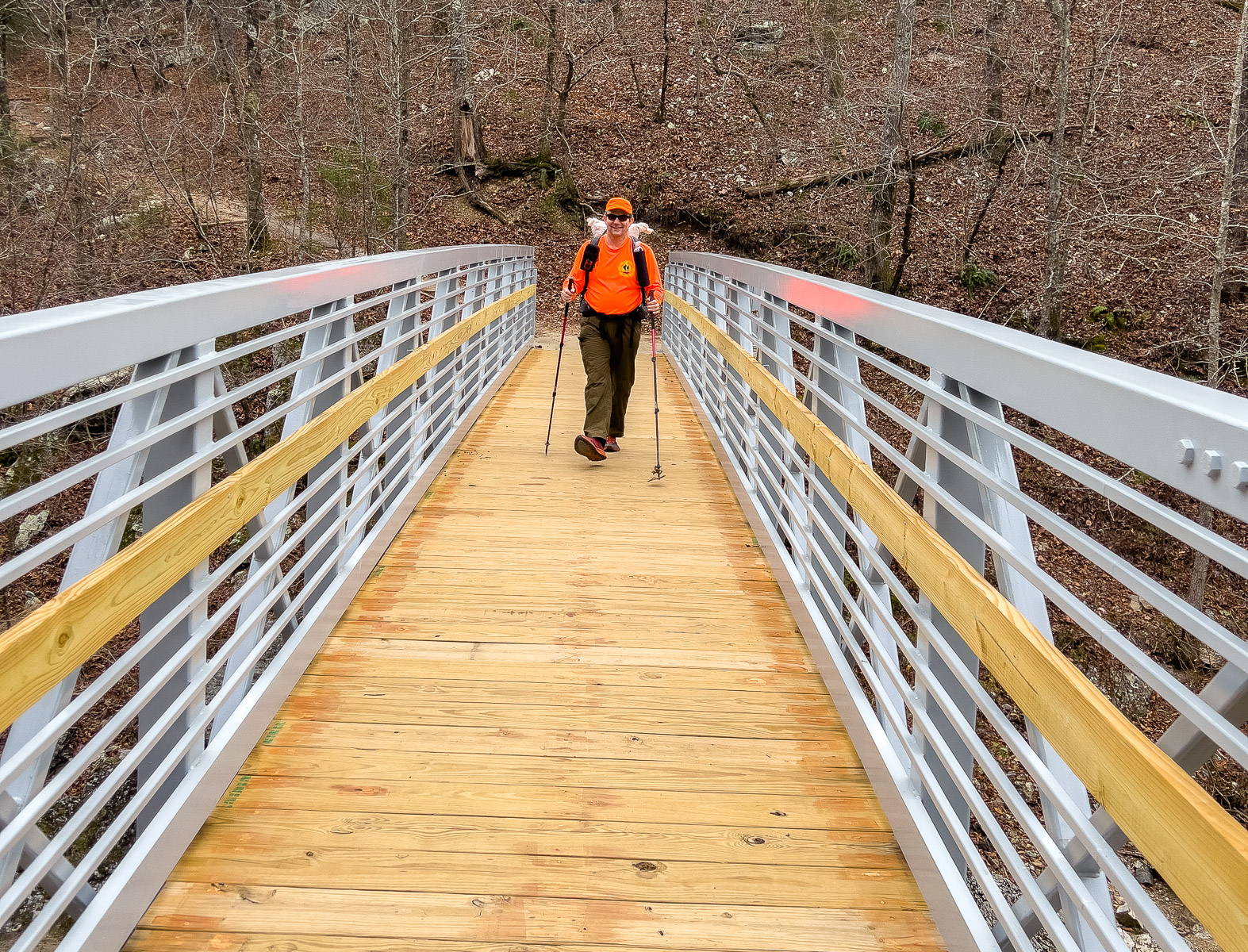
It was about 3 miles from the start to Albert Pike, and then about 6 miles to Little Missouri Falls, which was a perfect stopping point for a longer snack before crossing a fine bridge to the trailhead carpark. We saw a couple of families visiting the falls.


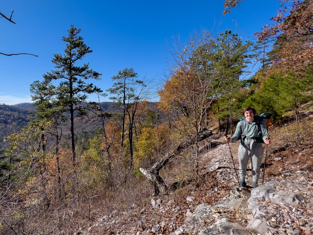
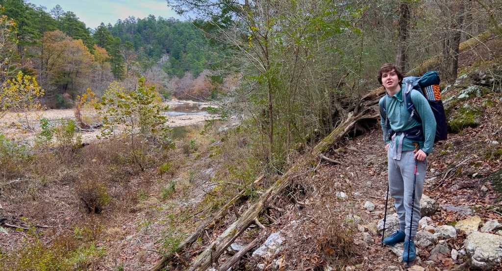
Day 2: Little Missouri to Eagle Rock Vista
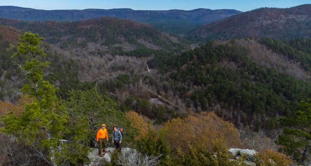
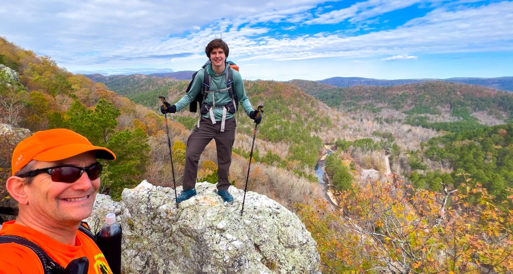
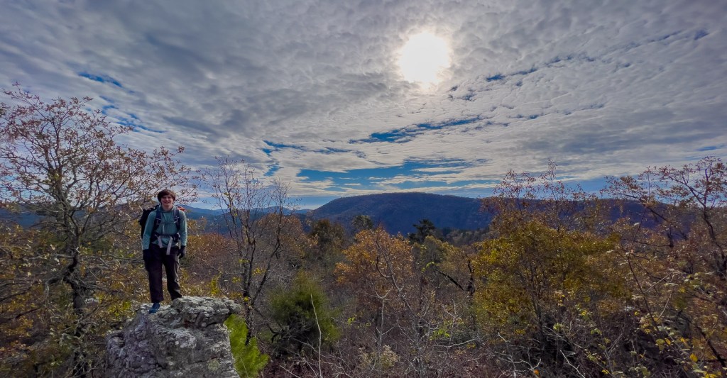
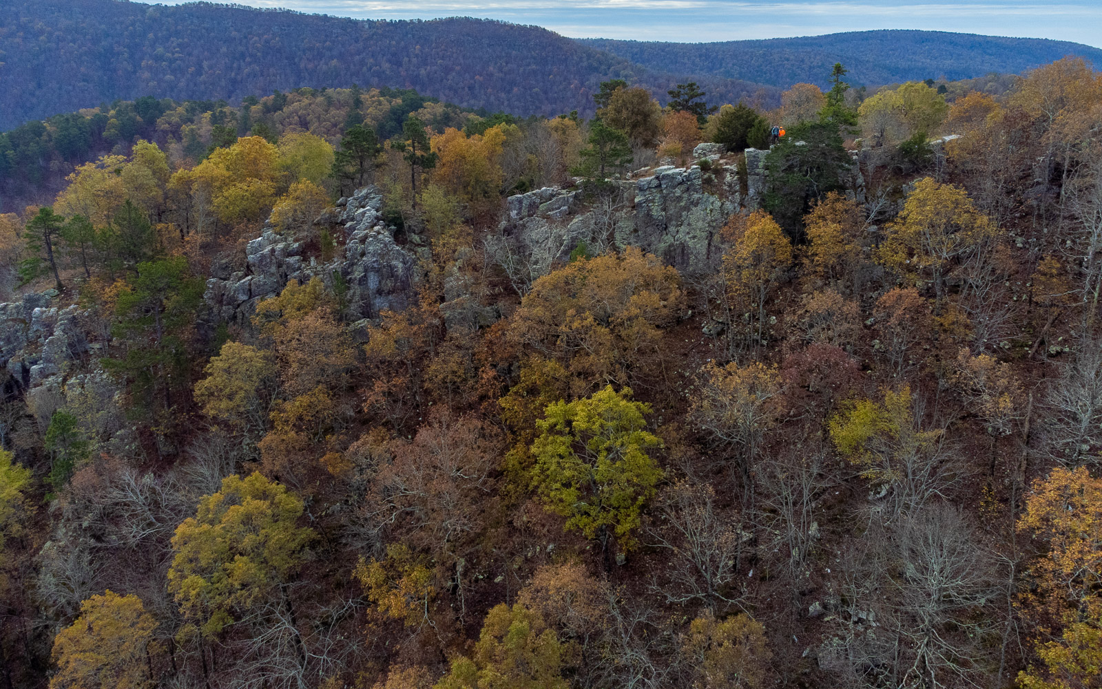
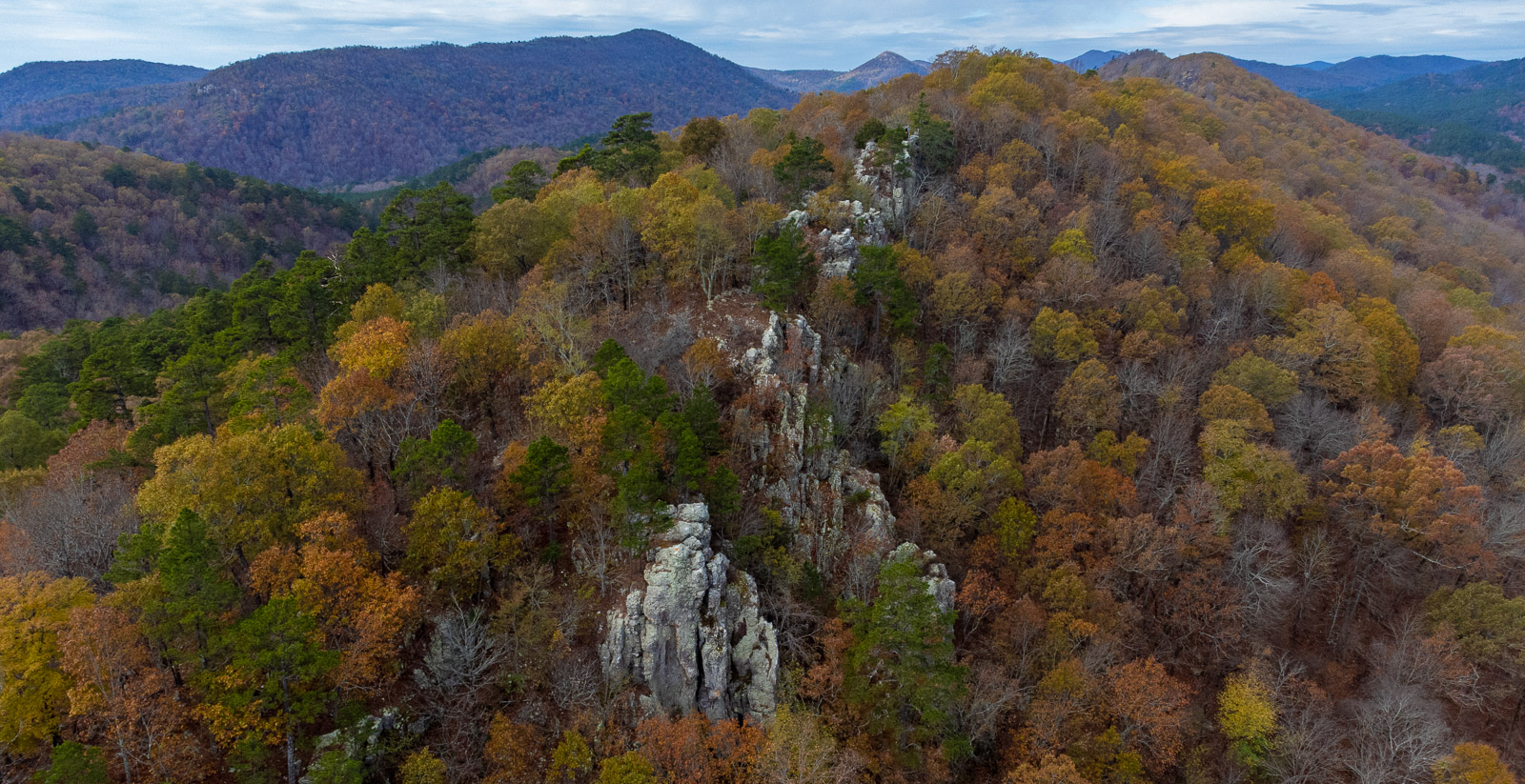
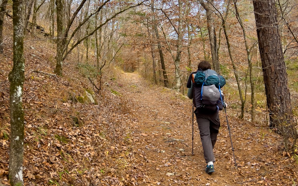
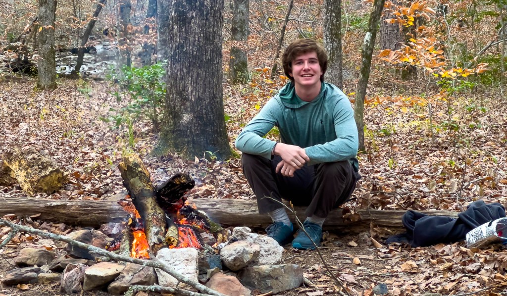
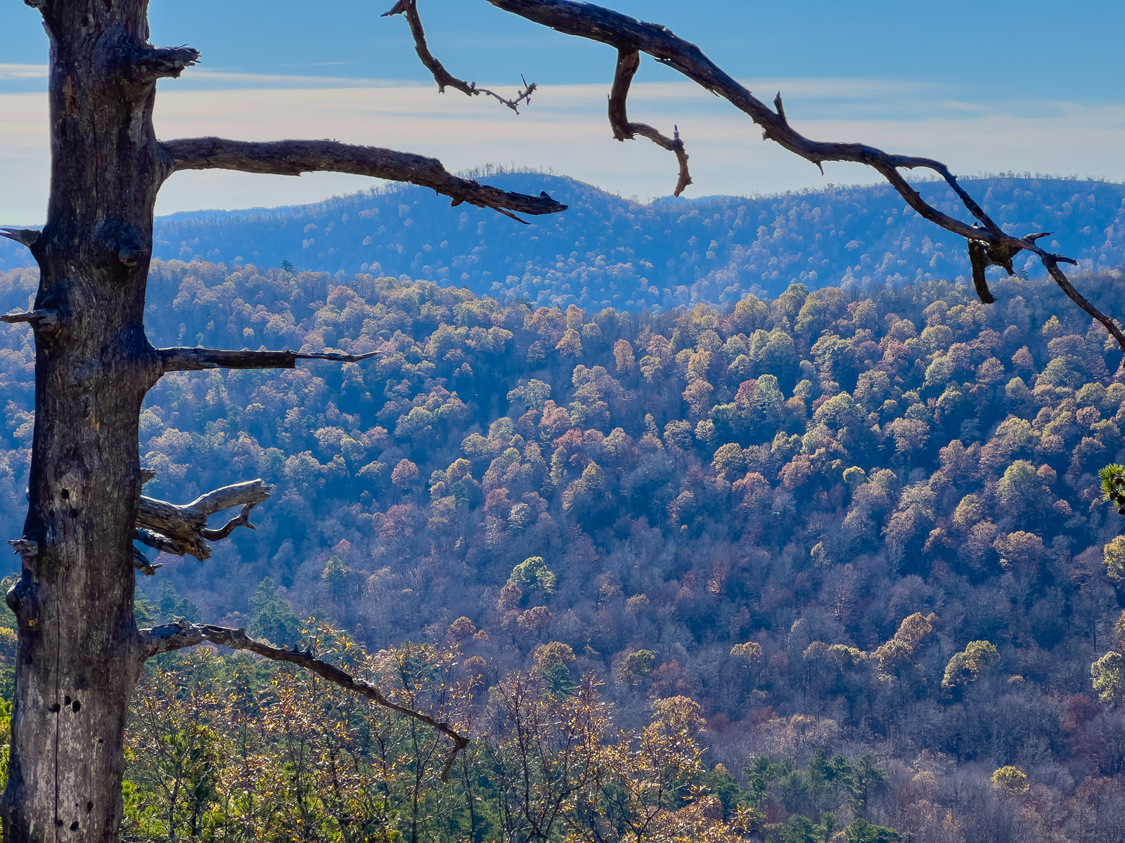
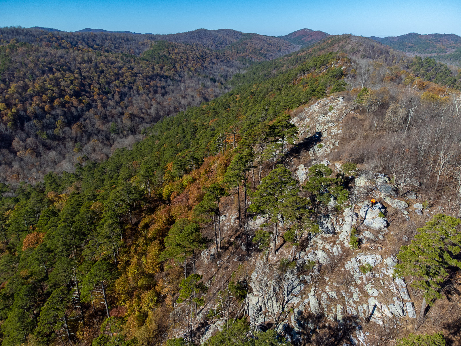
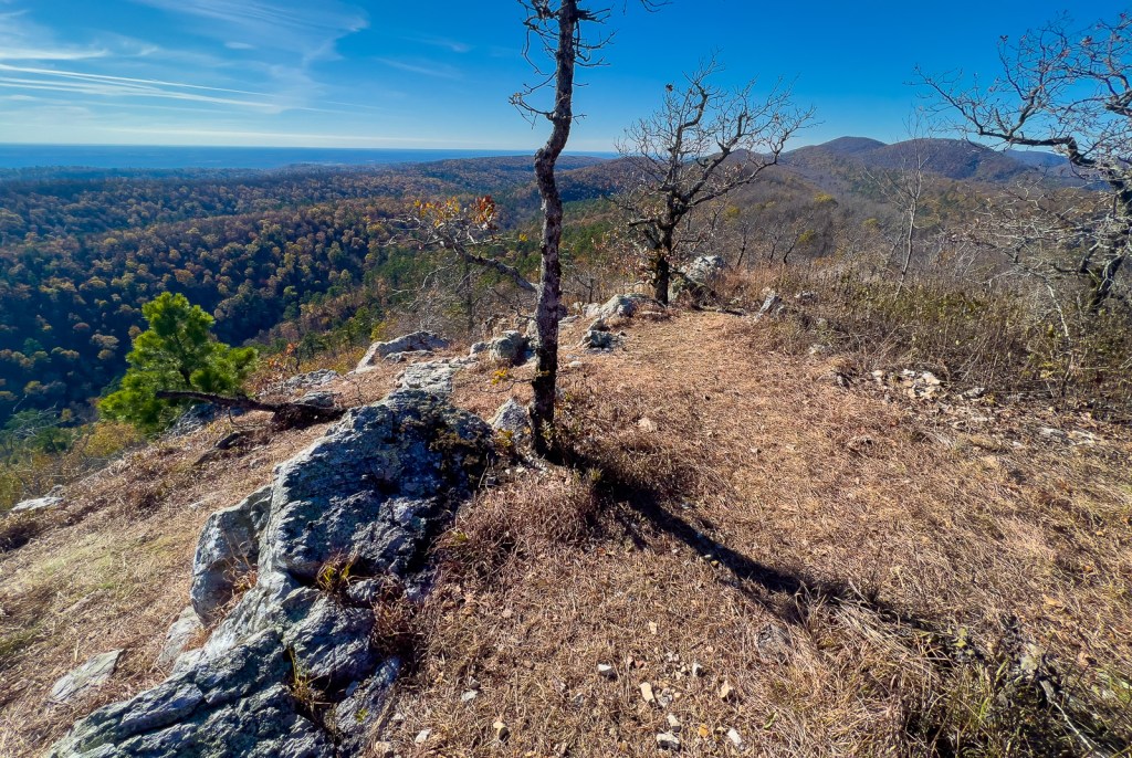
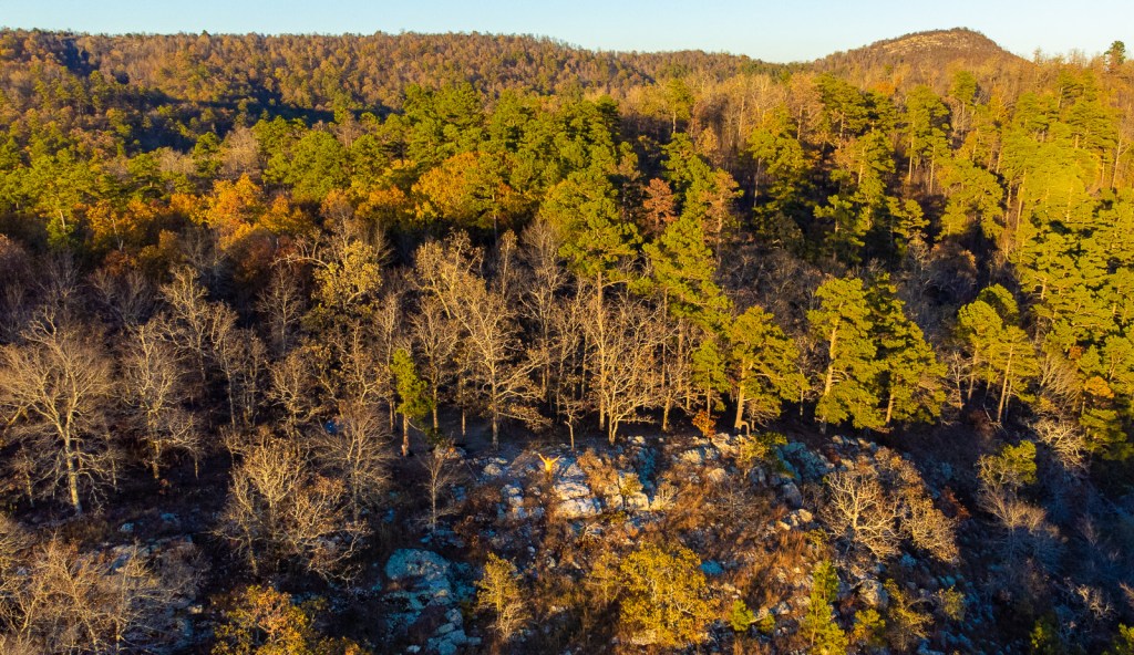
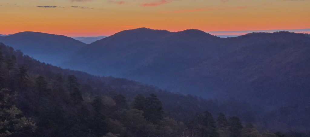
There was some ice on our tent in the morning, so it had dropped below freezing, but we had stayed warm. We’d watched Men In Black until we fell asleep. On waking up, hot drinks and breakfast were most welcomed and the puffy jackets appreciated! This day was a little over 8 miles with 3 side hikes, and the most climbing of the loop but without many river crossings. While the scenery was continuously great, the day treated us to two fantastic vistas.


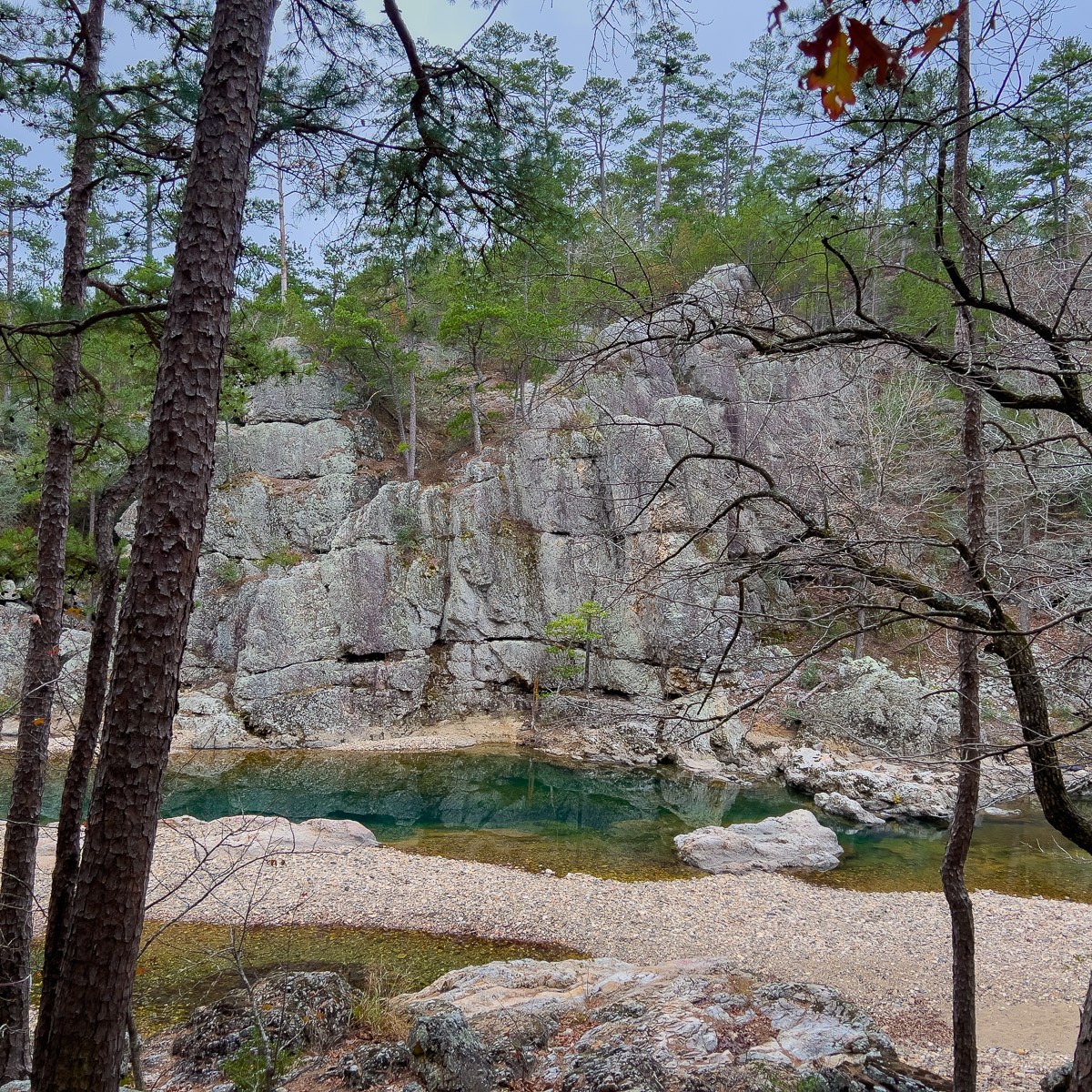
At the top of the first ridge, there was an obvious path to the right. The path splits and rejoins at the viewpoint Spirit Rock. It was the perfect place to catch the view, fly the drone, and dry off any overnight condensation on the tent’s fly.

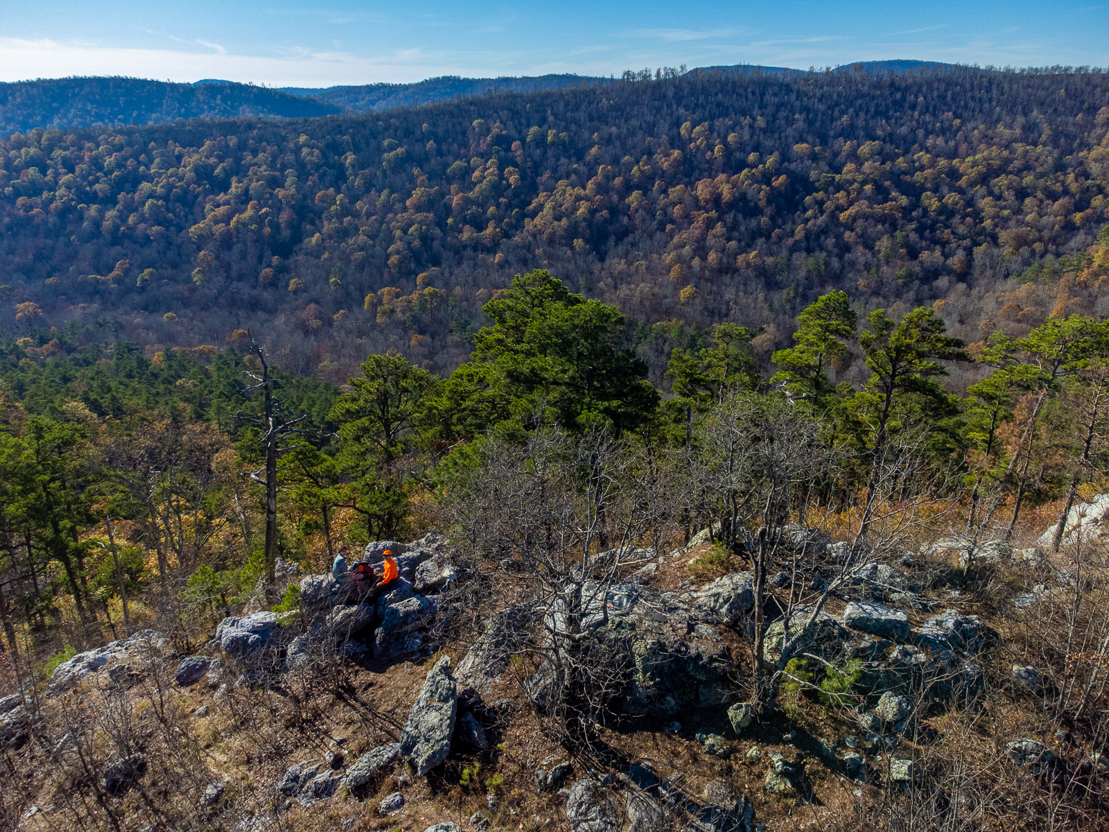


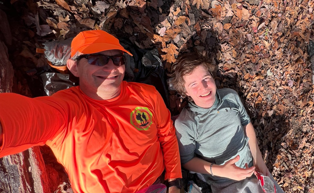


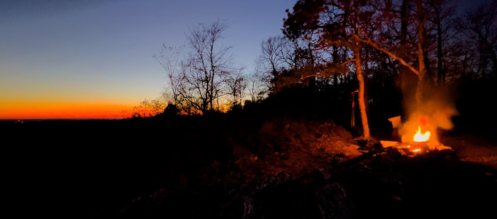

As we were settling into the campsite after the sun had set, I thought about how I hadn’t heard any gunshots. The only evidence of hunting had been an old sign about turkeys at the bottom of the second hill. Most other hikers were not wearing orange, so I was thinking that I had been making an unnecessarily loud fashion statement, as my photos have shown! However, I then heard some rustling in the woods and this man walked out with his hunting rifle over his shoulder and said hello as he walked through our camp. We also heard two gunshots the following morning after sunrise from across the valley.

Day 3: Eagle Rock Vista to Winding Stair Trailhead
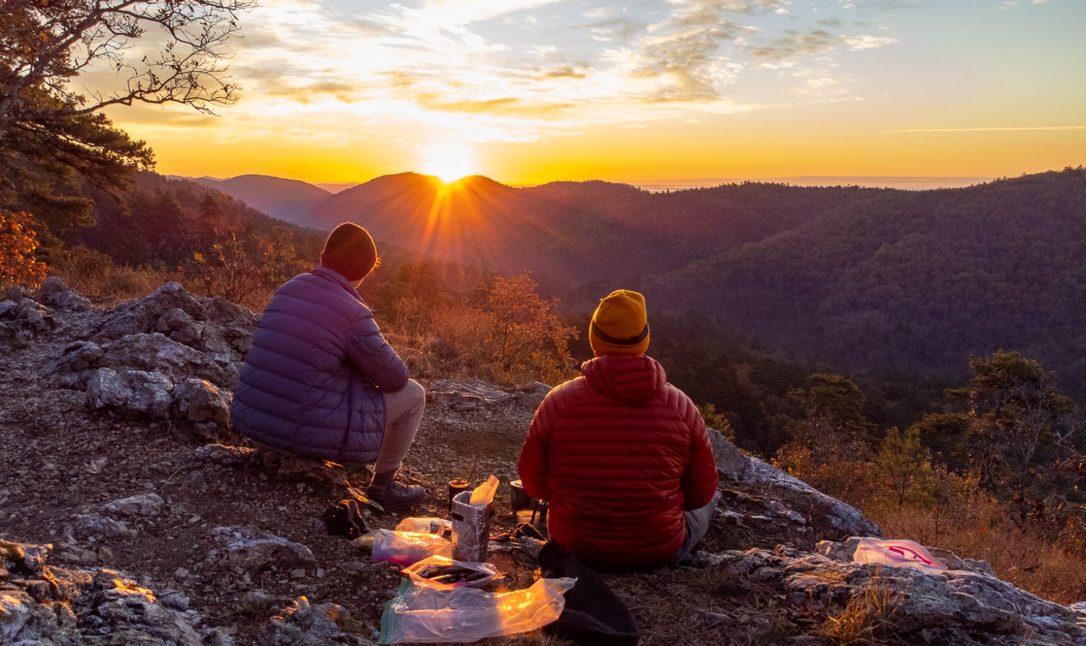
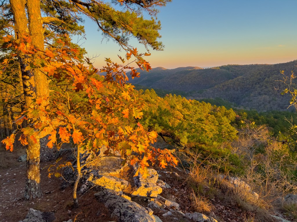
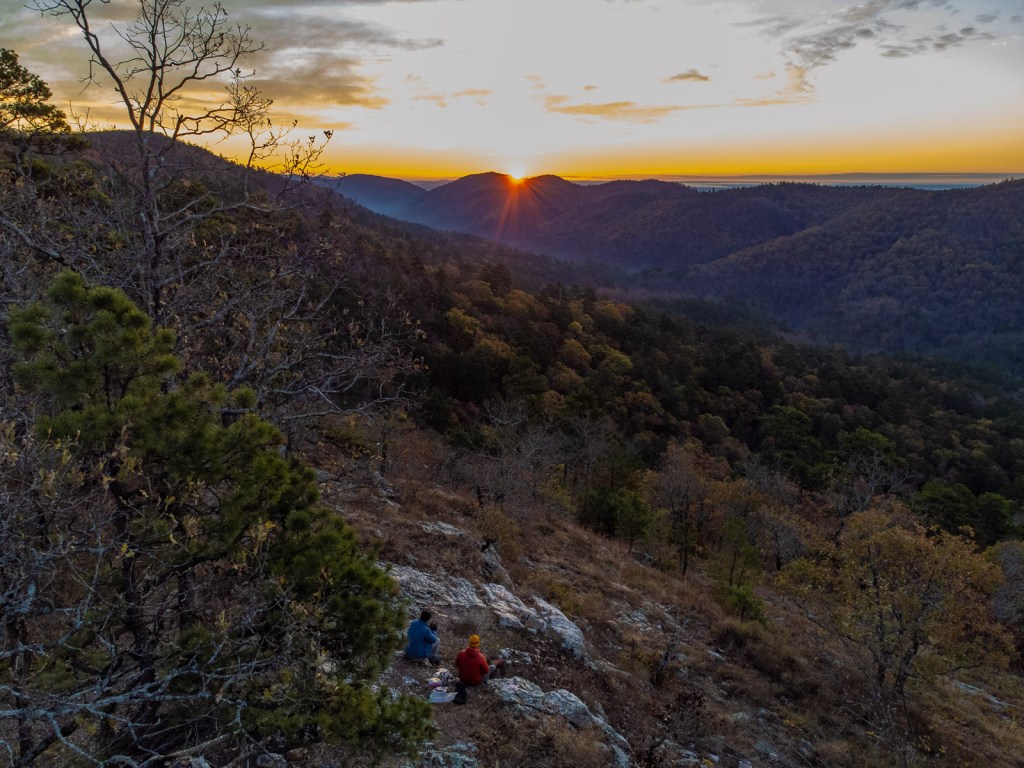
Normally on the final day of a trip, we just want to hike out. But we knew we were likely to be given an outstanding sunrise at 7am. So I woke up at 6 and I was not disappointed.


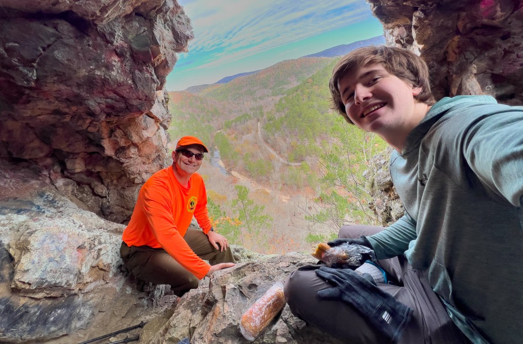
On this east side of the river, there were plenty of great campsites and some interesting caves. We would hesitate to camp in case the river rose, though it is possible to hike out via a different route.


I hope you have found this information either interesting or useful, and ideally both. Please check out our other backpacking adventures at https://cajunlimeys.com/backpacking/.

Beautiful pictures! Enjoyed reading about your adventures.
LikeLike