

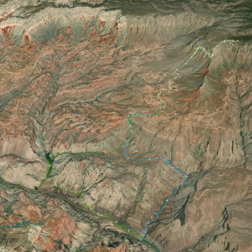
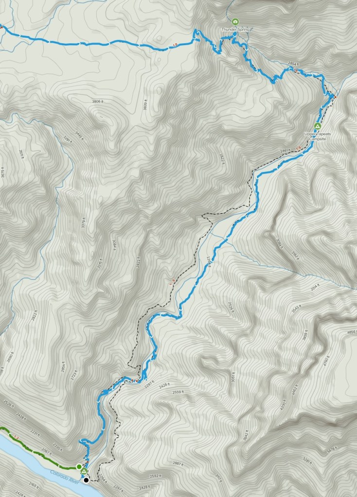
Hiking from the North Rim to the river in a remote corner of the Grand Canyon National Park was a daunting prospect. We were packed with the lightest and least equipment that we could, and a new approach to food that I hoped would work. I found the best overview of the route at AllTrails.com, and the screenshot of their 3-d map below gives you an idea, showing our own GPS route. While I found others recommending 4-5 days to do this hike, we planned 3 days / 2 nights. Our permit reflected this, with the ranger commenting “aggressive schedule requested” on our permit.
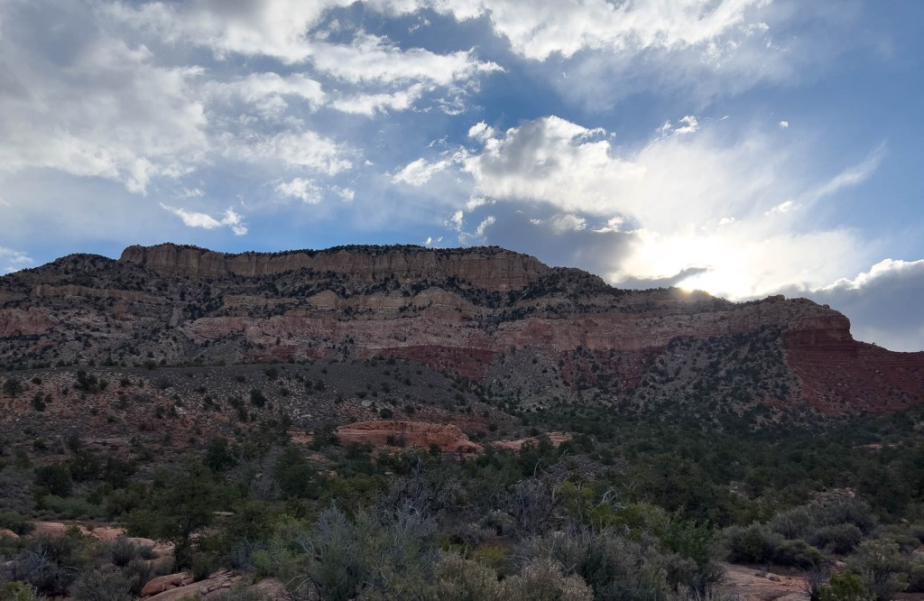
Our first day was from the trailhead at the top of the graphic, to the Colorado River at the bottom right, via Thunder River and Tapeats Creek. You can see the two “very steep” sections near the beginning and the middle. The first of these drops you from The Rim onto The Esplanade, and the second into Surprise valley. I logged it as a 12-mile day, close to the 11.4 miles as per the National Park, with a drop from 7200ft to 2000ft.
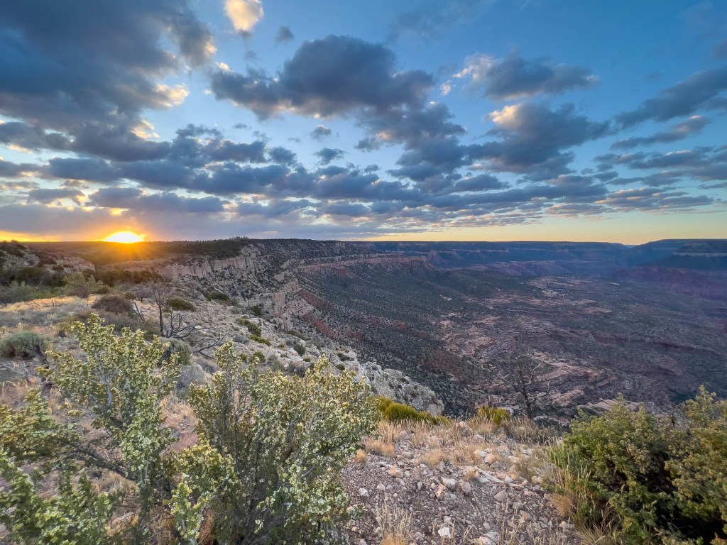
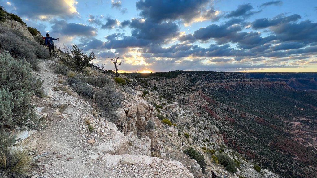
The desire to see the sun rise over the rim, as well as concerns about the heat, meant a 6am start at the trailhead. We used the Holiday Inn Express in Kanab as our base which Google accurately identified as a 2-hour drive, as the last few miles are rough off-road which our rented Ford Escape handled without issue. We even managed to avoid the rabbits, mice, and deer that ran across the road in the morning twilight. Six parked cars greeted us in the trailhead parking lot which was a good sign of isolation. The chilly mid-30s degF did not feel that cold, and much of the first mile is actually uphill; the temperature was perfect! The sun rise did not disappoint, and we made good steady progress down the 50 switchbacks of Bill Hall trail and across the Esplanade.


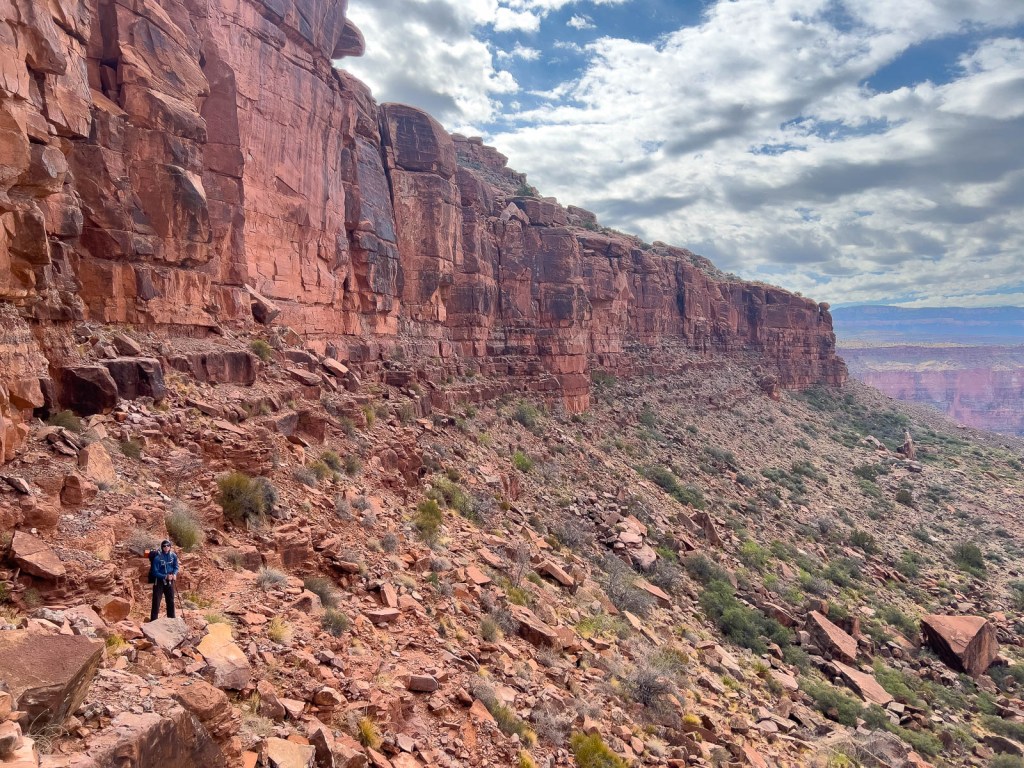
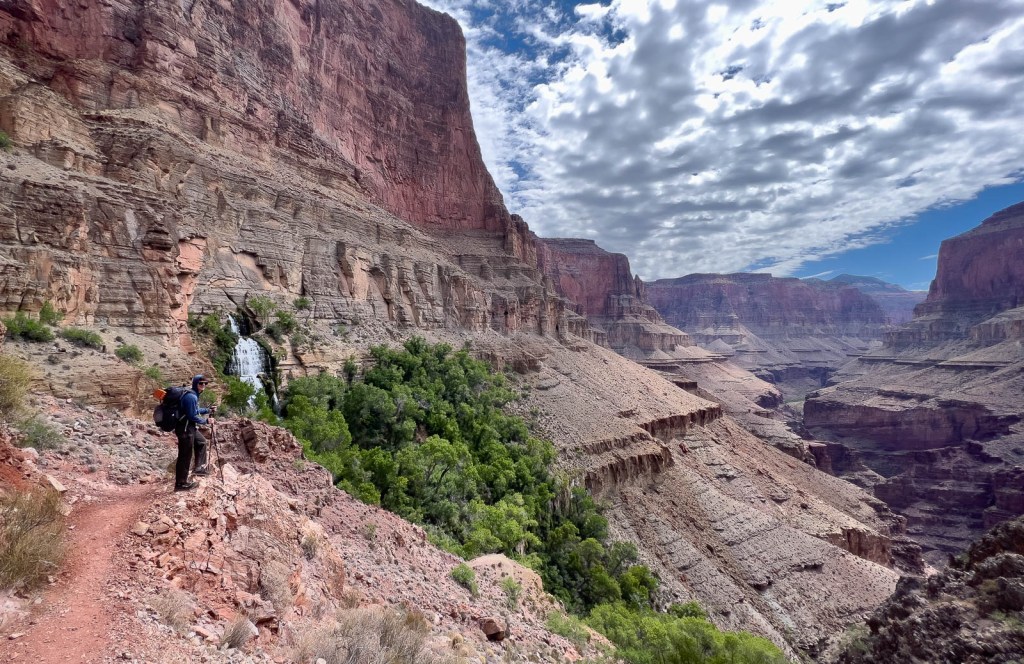
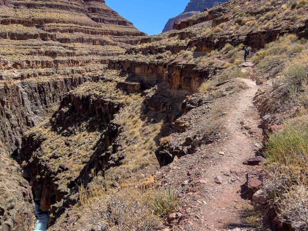
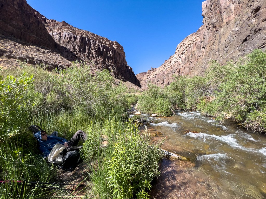
We exited shade as we crossed the Esplanade and found a suitable location to cache our gallon of water before the next major descent. A group of 10 hikers, led by an REI guide, were heading out of the canyon having camped the previous night at the edge of the Esplanade. This explained the majority of the cars at the trailhead. They were on a 4–5-day trip and commented how our intent to get to the Colorado was ambitious, which got me a bit worried! Soon we were descending the next big incline into Surprise Valley, and the legs were getting wobbly. The traverse across Surprise Valley was straightforward before the amazing sight of a water gushing out of the rockface at Thunder Falls.
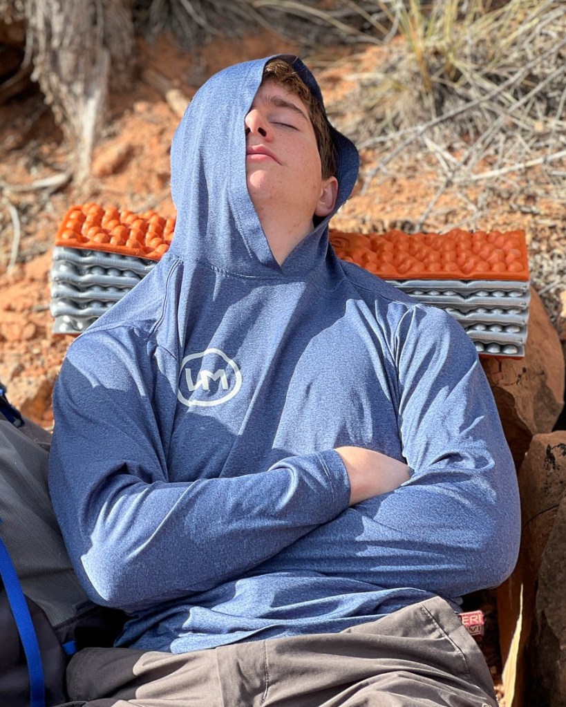


While Samuel took his nap, the lizards prowled!


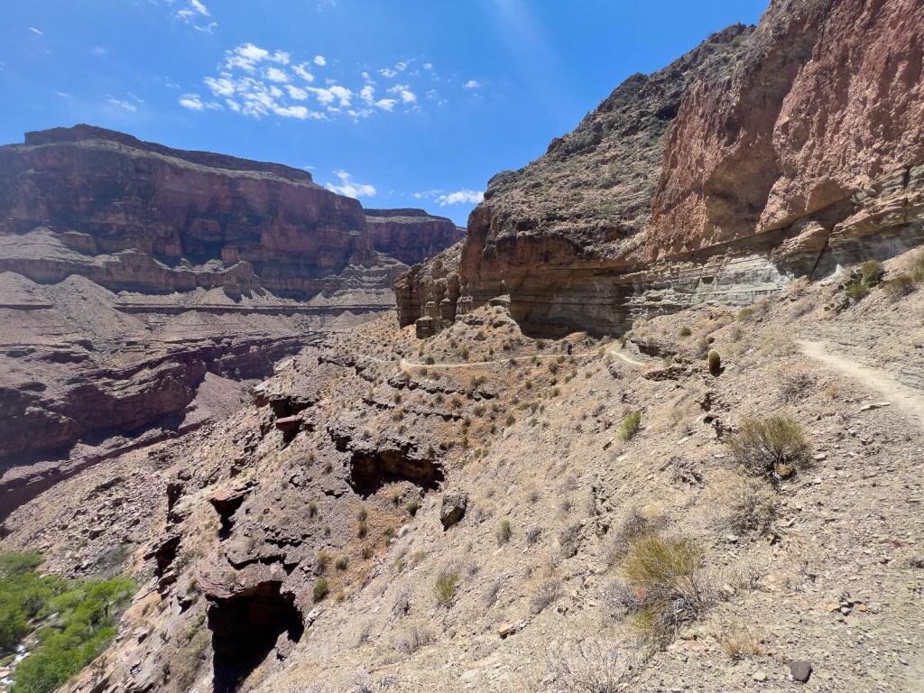
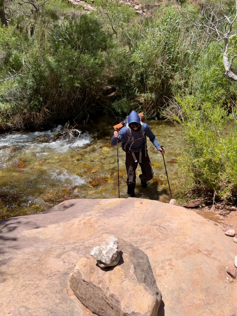
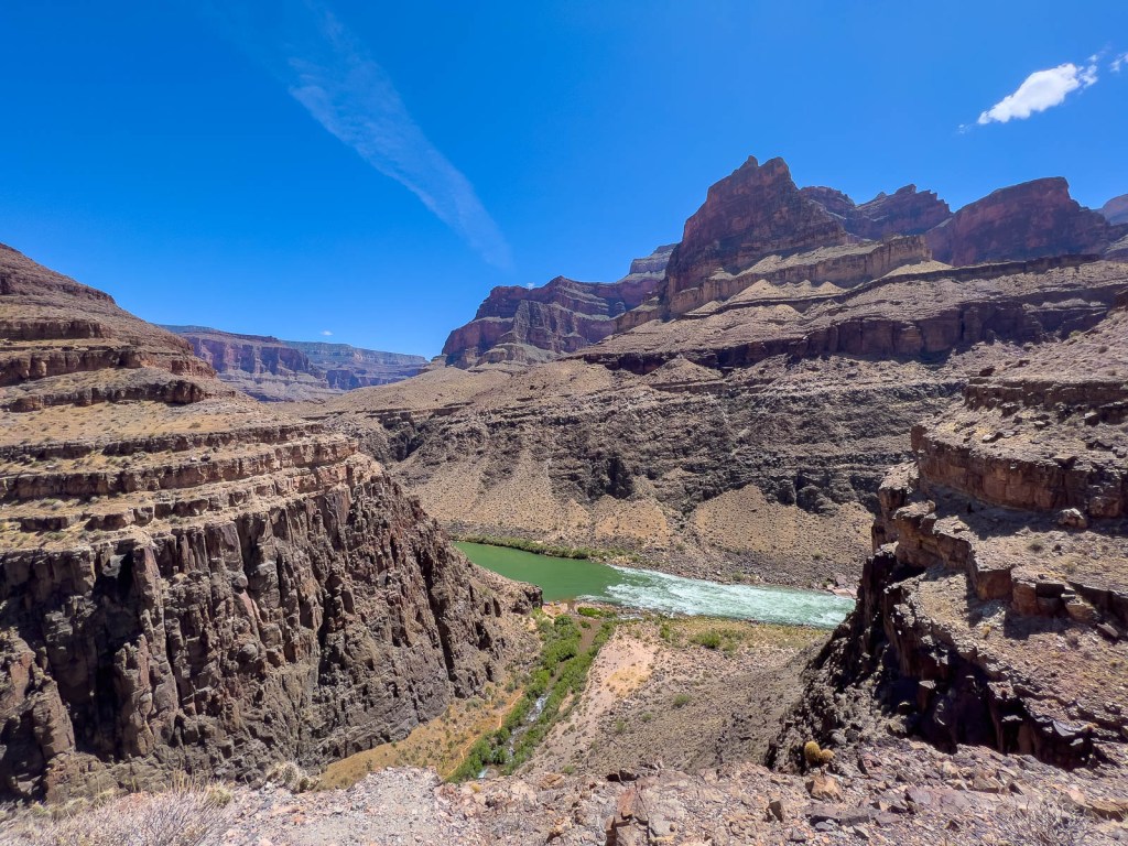
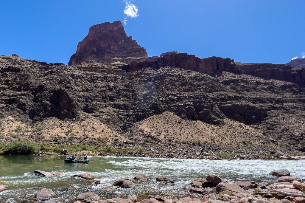
We had made good time but were uncertain how difficult the final stage would be. The maps suggested 3-4 miles and ~1200ft elevation drop, but I had a feeling it would not be simple. Upper Tapeats campsite was close, but it was a mile of cliff-hugging until Thunder River joined Tapeats River. After that campsite, we were at river level and crossed over to the East side to avoid more cliff hugging, with path obstacles evolving from cactus to abundant bushes. We saw a Big Horn sheep running off in the distance. We crossed back over to the West side of the river after about 1.6 miles with some final cliff hugging before arriving at Lower Tapeats camp on the Colorado River beach. A rafting group was leaving just as we arrived, heading downstream on day 10 of their 15-day trip, and very kindly let me send a message to Janet using their InReach satellite communicator, as mine was not functioning. We found some fantastic shade by the river, and watched the sun’s painting of the canyon walls evolve as the shadows lengthened. Finally, our campsite was in the shade and we could set up the tent, even though the sand was still warm! We probably could have just slept under the stars, but the thought of bugs or lizards crawling is still a bit too much!


So that was day 1. Wow! It had felt surprisingly good. While the legs had got wobbly and the joints had ached, the rests had worked very well. The descents had been challenging but fine, definitely helped with hiking poles and the light packs. We had chosen to leave the stove, avoiding dehydrated food and enjoying a sandwich, cheese and salami with crackers, and various snacks which worked well, though the oatmeal cream pies were the biggest hit of the day. We rated the path by how “hairy” it was, and the cliff-hugging sections were definitely hairy at times! The views of the canyon, Thunder Falls, and the arrival at the Colorado were all highlights. The lowlight was my InReach’s failure, but at least I had got a message to Janet! That was my lesson for future trips: to confirm my InReach is working each trip. One priority for this trip had been to avoid the 20-lb weight loss that Samuel had experienced in Colorado. That was a big reason we had moved away from dehydrated food, and smaller meals/snacks with greater variety seemed to be doing the job!
But this was only the first day! To find out how the plan completely changed, and what Samuel’s favorite moment was, read about day 2.
This page is linked to from my Grand Canyon Buckskin Gulch home page.

Please share your thoughts or questions!
LikeLike
WOW! WOW! WOW! What an amazing start. Simply breath-taking. Thanks for sharing. Mel
LikeLiked by 1 person