
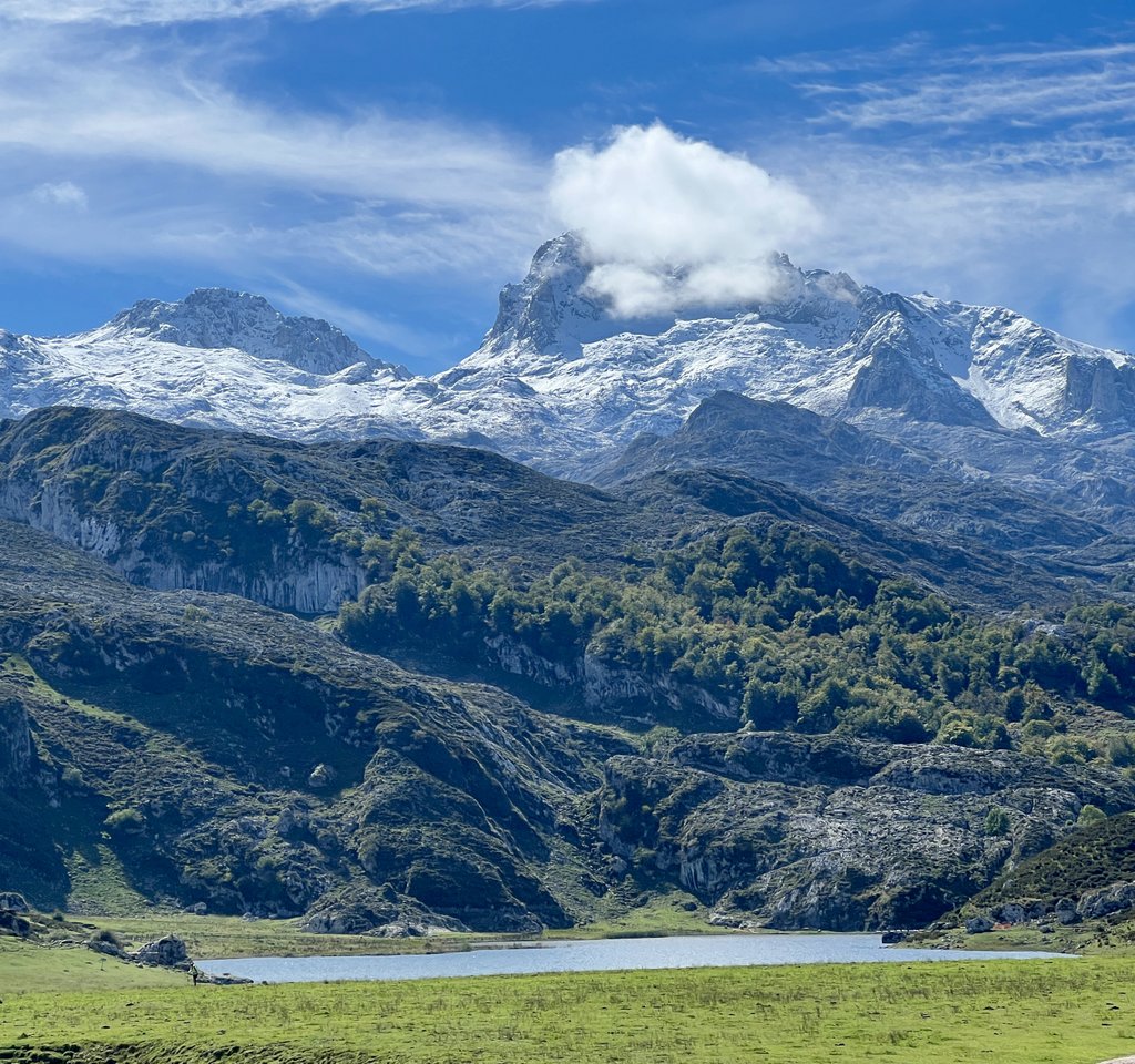
In September 2025, my buddy James and I set off to hike independently the Anillo de Picos, aiming to hike the largest ring, also known as the Anillo de 3 Macizos (Ring of the 3 Massifs). Our goal was to camp, eat some meals in refuges, and resupply in a village. I had struggled to find much information online in my planning, but I felt sufficiently prepared and that our plan was viable based on my experiences of similar distances and elevation changes in Colorado and England’s Lake District.
For various reasons, our trip was much harder than expected. Other hikers we met on-trail faced a similar experience. This resulted in us changing our plan every day, and we were fortunate that we were still able to have such an amazing experience. My goal with this blog post is to help others prepare for a trek in Los Picos de Europa, complementing other online information.
Summary
We trekked around the Picos de Europa for nine days from 17th to 25th September, 2025. My detailed account is in this blog. We started in Fuente De and went in a counterclockwise direction. We relied on transfer by vehicle twice, because the Ruta del Cares was closed after wildfires and rockfalls, and because an unexpected heavy snowfall blocked the route from Vegarredonda to Vega Huerta/Vegabano. We hiked much slower than expected, forcing us to shorten our hikes. The main reason that our progress was less than expected was that some of the trails were very difficult indeed, and I had failed to “calibrate” their difficulty beforehand. We compounded this difficulty by carrying camping gear and food. Unseasonal high temperatures followed by snowfall further hampered us, but one should expect such things in the mountains! The locals who hike these mountains are hard core.
Our Preparation and Plan
James and I are experienced adventurers in our 50s. I had previously backpacked Colorado’s Collegiate Loop (160miles/260km with 37,000 ft/11,000m ascent) and a loop of England’s Lake District peaks (87miles/140km with 23,000ft/7,000m ascent). James had some experience climbing, but we did not bring any climbing equipment (e.g., ropes). The website for El Anillo de Picos describes the ring of 3 massifs as 110 km (68 miles) with 9,350km ascent (31,000ft) ascent, so they seemed to be the same overall level of challenge. With food and a couple of liters of water each, our packs starting out weighing 27kg / 60lb total between the two of us.
Our plan was based off this itinerary published by Harmen Hoek. We purchased his guide which describes a 7-8 day loop either camping or using refuges, and complements Harmen’s YouTube video from his trek. Even though we were unable to cover the miles suggested by Harmen, I recommend his guide. We had ten days so expected that we had sufficient buffer. We planned to camp each night, as Harmen had, believing that this gave us flexibility for each day’s distance. I validated Harmen’s suggested itinerary by comparing it with other reports that I could find from takeahike in 2021, goneapp and sparklytrainers in 2022, reddit in 2023, and feedback on the loop at Hiiker and wikiloc. These seemed to align with the “official” itinerary at the El Anillo de Picos website. Finally, the “AP” trails were marked on the 1:25000 Editorial Alpina maps of the Picos de Europa. It is also on AllTrails.
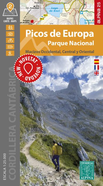
https://www.editorialalpina.com/es/mapa-alpina/parque-nacional-de-picos-de-europa-2/
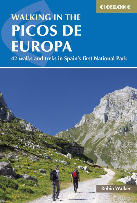
I also had a couple of guidebooks. The most useful guide was Cicerone’s Walking in the Picos de Europa: 42 Walks and Treks in Spain’s First National Park by Robin Walker. it has a useful Introduction section and many sections of the Anillo de Picos are covered by day walks. It also offers some multi-day treks including a couple of loops which are worth considering. I also bought Landscapes of the Picos de Europa: A Countryside Guide by Teresa Farino but found that it was geared towards day hikes and driving around the Picos, so was not useful for our goals.
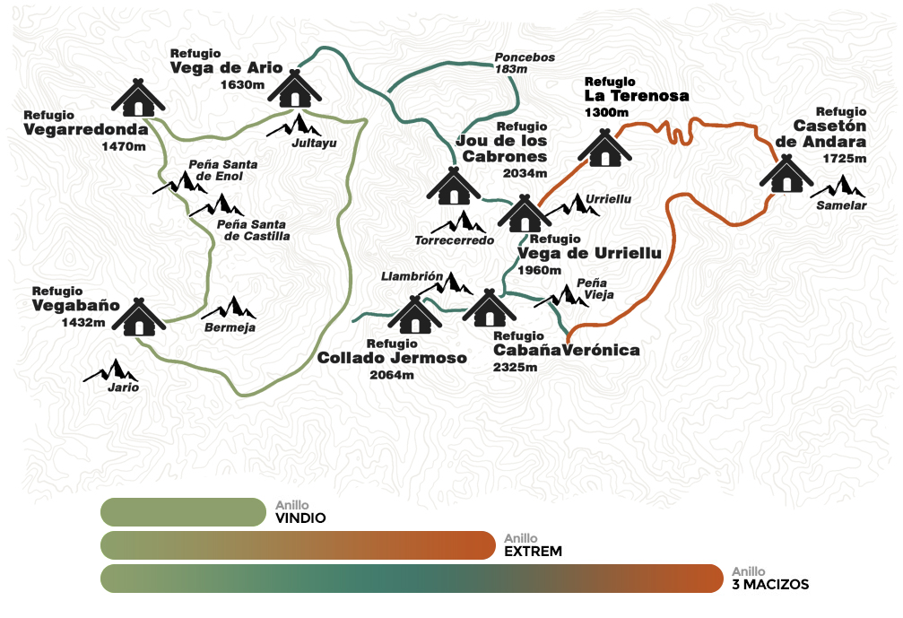
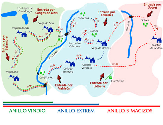
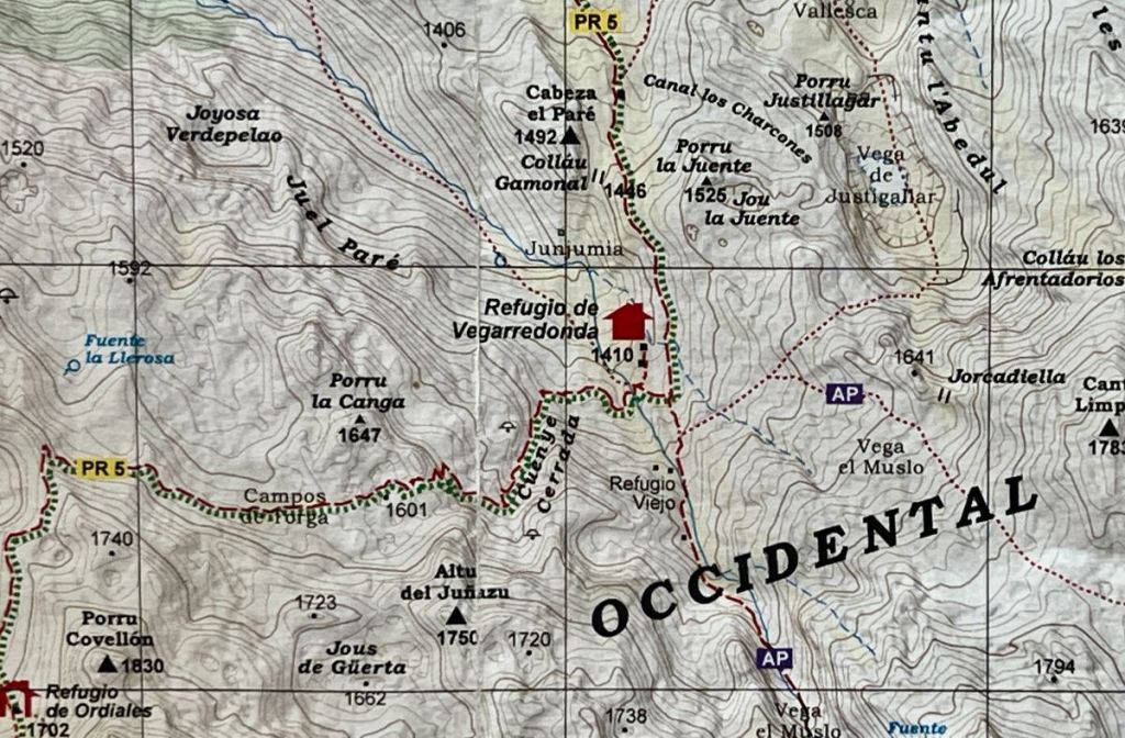
The two maps below are complementary representations of the anillos. The one on the left is from the El Anillo de Picos website. The one on the right is from https://www.alberguecangasdeonis.com/en/el-anillo-de-picos-3/.
Our Lessons
1. Estimations of Hiking Time.
By the second day of our trek, we realized that Harmen, who had written our itinerary, was significantly fitter than us. We nicknamed him a mountain goat. He was solo-camping with video gear, so was carrying at least as much gear as us (with an identical tent), but covered about twice the amount of ground. The takeahike account suggests similar level of very high fitness. The reddit reporter shortened his trip due to exhaustion. The goneapp reporter, who completed the loop with one detour due to a navigation error, also appears to be very fit. Fiona’s group, as reported in Hiiker, suffered an injury. The times for each section on the El Anillo de Picos website are probably for without a pack and with a guide. Sparklytrainers, with a guide and without camping gear, wrote, “Even with all the trekking we’ve done, we took a lot longer – sometimes double the estimate.”
Upon closer examination of our map, we identified that the AP followed two different types of trail. Some of the time, it followed the same route as a PR or GR trail. The PR stands for Pequeño Recorrido (Small Path) and we learned that these locally-managed “PR” routes were generally well maintained and not too difficult. The GR stands for Gran Recorrido, a network of marked long-distance hiking paths throughout Europe. At other times, the AP route followed a trail identified on our map as “non-defined trail; difficult stretch.” I noted that other people’s maps did not even have these stretches. Examples include the route that goes directly from Refugio Vega de Ario and Refugio Vegarredonda or the trail that goes to Refugio Andara from the west up Canal de Jidiellu over Collado de Valdomingueru. With a GPX route downloaded to a phone or watch, or even just using a base map on my Garmin watch, we did not struggle with route finding. However, we found such non-PR/GR trails much slower going due to difficult terrain due to rocks or loose gravel on steep slopes.
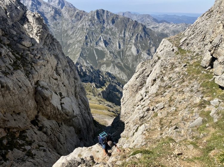
2. Dangerous Climbs
When I first read Harmen’s account of his hike up to Collado de Valdominguero, I was worried about the climb just before the top. I was concerned by his comment in his route description, which ended with “A misstep could be fatal here.” His guide only mentioned a climb up a 5m wall with a permanent rope attached. As this was on an “official” hiking route, I convinced myself that there wouldn’t be anything too dangerous.
This particular section is at the end of a long, difficult hike up loose, steep rock. We reached this point exhausted, compounded by lots of hot sun. With full packs, it was even more difficult, but it would have been worse if it was wet. Experienced and fit nimble climbers might have no problems. I suspect that guides bring ropes to help their group, and there are bolts in the rock for rope attachments. This wikiloc has photos of this section that complement my blog‘s.
My map did not flag anything for this section, but it uses the “Via Ferrata / Climbing” label on trails leading from Refugio Vega de Urriellu and Refugio del Jou de Los Cabrones to Bulnes. We skipped this section though moonhoneytravel’s blog describes it and it looks similar in difficulty and exposure to Collado de Valdominguero.
These are the only two sections that I am aware of that I’d put in the category of “climbing” and would choose to avoid with a full pack or in bad weather. Avoiding Collado de Valdominguero prevents using the shortest route to Refugio Andara from Fuente De, but the area could still be visited via Sotres. One can avoid the route from Bulnes to Refugio del Jou de Los Cabrones by taking the trails that come to Refugio Vega de Urriellu and returning a similar way. In this latter case, one could try continuing to Refugio del Jou de Los Cabrones as this sounds like a fantastic section with tremendous views. We missed this area and I really wish we’d had time to see it, and would choose it over Andara.
3. Vertiginous Sections
I am uncomfortable with certain types of exposure, also known as scared of heights! While non-hikers think that I am therefore crazy to hike in mountains, I know that there are others in a similar boat. There were a couple of hikes on the ring that might have been difficult. The first is the Ruta del Cares. Our original plan had been to take this from Poncebos to Cain but it was closed during our visit. I probably could have completed the hike, crawling through the most exposed sections if necessary. It’s difficult for me to assess how it would have impacted me.
A second hike that we missed was the hike to Pico Jultayu near Refugio Vega de Ario. We had been strongly encouraged to visit this but we were out of energy. It has tremendous views straight down into Cain and the Ruta del Cares. It would have been easy to stop hiking before the peak if vertigo was too strong.
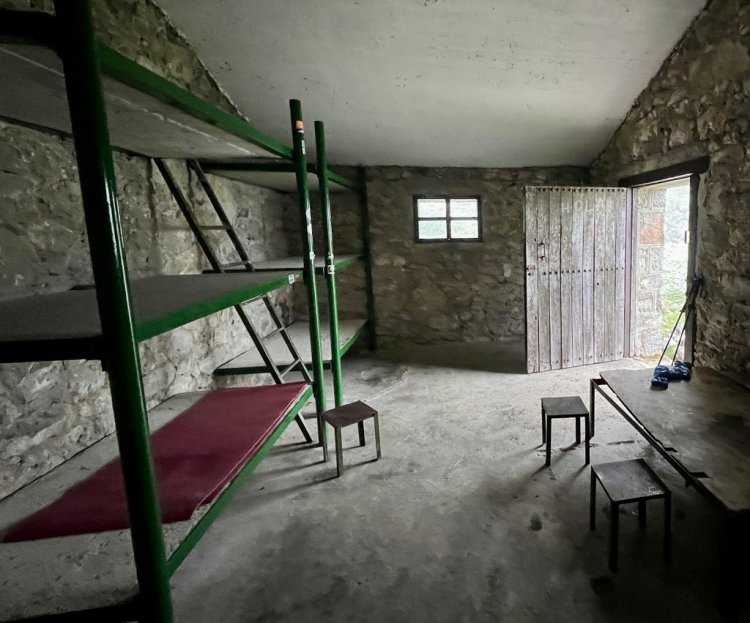
4. Camping vs Refuges
Having chosen to camp, we noted that virtually no one else in the mountains had camping equipment. Indeed, over nine days, we only saw one other tent camper, and he chose to quit early. While the links above show that there are campers, we noted that this area is better suited to staying in the refuges. First, this significantly lightens one’s load. Second, there is a good camaraderie amongst those staying in the refuges and one can pick up hints and suggestions from other hikers or the wardens. Third, sleep quality was much better than expected, except for one night (out of five) when there was a particularly loud snorer right next to us, so remember earplugs! Finally, staying in refuges while hiking the Picos de Europa seems to be Spanish way to do it. We found each refuge to have a very different atmosphere, with even the atmosphere of the same refuge changing on different nights, which added to the interest.
We had wanted the flexibility that wild camping brings. However, that flexibility was limited by wild camping restricted below 1600m and the lack of good camping spots with water. It was not as straightforward as in Colorado or the Lake District. Camping at or near refuges above 1600m is an option though. We noted that camping was forbidden at Refugio Vegarredonda, which is at 1470m.
Staffed refuges use reservations and often fill up. The nine refugios that are part of the “official” ring can be reserved at https://elanillodepicos.com/reservas/. The Vega de Enol refuge was recommended and is conveniently located next to Lago Enol. We stayed at the Refugio La Ardilla Real in Santa Marina de Valdeon which was a convenient alternate to Posada (which was full). Reserving ties you to a schedule. My learning from our trip was to commit to a conservative schedule using these reservations and embrace the many side-trip opportunities as your time and energy allows.
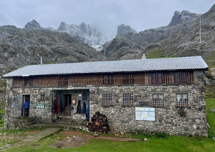
There are also unstaffed refuges in the Picos, similar to Scotland’s bothies. These are identified on maps and further internet research should tell you more. I checked out Refugio de Ordiales and was impressed. We had planned to stay at Refugio de Vega Huerta, and I think we would have loved it, but were prevented by snow. For the unstaffed refugios, you need a sleeping pad, pillow, and warm sleeping bag in addition to what you’d take to a staffed refuge. Such refuges might be convenient for an itinerary, a way to save money, or simply another way to experience the Picos.
One can mix camping with refuges. Camping gear increases the pack weight for the whole ring, while refuges lock down where you stay on certain nights. If I were to revisit the Picos for a ring, I would stay in refuges and avoid the camping weight. However, if I was 30 years younger and 30lbs/15kg lighter, the camping option is awesome, and highlighted in Harmen Hoek’s trip report and YouTube video. However, with the right conditions, it would be tremendous to do 2-3 nights wild camping above 1600m, above Vegarredonda or Veronica.
5. Food
While we planned to camp, we expected to eat several meals at the refuges. With uncertainty about resupply, we started the loop carrying four days of food. This was far more than we needed and we dumped food and gave it away as we progressed around the loop.
In addition to food, we carried a Jetboil with fuel, mugs, and spoons. We ended up fixing two dinners and two breakfasts over the whole trip. We enjoyed five dinners and five breakfasts at refuges, having booked them with our beds. The dinners were all three course (soup, main, dessert) with unlimited soup, bread, and main, and there were often spare desserts. We thoroughly enjoyed each of our dinners. Breakfasts were less ambitious with coffee, breads and biscuits, but also unlimited. Vegetarian options were available with prebooking. There is no reason to be calorie deficient. Packed lunches were available from the refuges, or you could take breakfast leftovers with you. Some refuges sold snacks. While hiking, we ate the snacks that we had brought (mainly chocolate). On arrival at refuges, we enjoyed coffee, hot chocolate, sodas, and beer, and had hot soup on the day we were weather bound. We also ate at restaurants so we did not go hungry!
Next time, I would not bring cooking gear and hike with snacks for a day or two. We had too much food so did not visit grocery stores. However, I have read reports of grocery stores in Sotres, Cain, and Posada, or , like ours did, your ring might take you to the larger towns of Arenas or Cangas de Onis. I’d need a special plan for dinner if I was staying in an unstaffed refuge, but I expect it would be a packed lunch from a nearby refuge rather than bringing my cooking gear.
6. Using Mechanized Transport
When my family walked England’s Coast to Coast, it was important to us to walk every step from the Irish Sea to the North Sea. I believe a ring in the Picos is different. The opportunity in the Picos is to experience a tremendous variety of mountainous environments, not to have walked a continuous circle. We used the following:
- We used the funicular to descend from Bulnes to Poncebos (17.61 Euros).
- We took the bus from Poncebos to Arenas (Free).
- We took a 1-hour taxi from Arenas to the Lagos de Covadonga (100 Euros).
- We rode in a new friend’s car from Lagos de Covadonga to Cangas de Onis (Free).
- We took a 1.5-hour taxi from Cangas de Onis to Santa Marina de Valdeon (82 Euros).
All of the above worked very well. We found helpful hotel receptionists who arranged the taxis for us. There was also a bus from Poncebos to Sotres. We planned to take the Fuente De cable car but we had not booked tickets in advance and they were sold out when we wanted to ride.
We did not plan using any mechanized transport, except the cable car which we did not use! It could be part of the plan, or a valuable contingency. For us, it was essential for (1) getting to a hotel to reset our plan after an exhausting first three days and (2) skipping a section that the weather had prevented us from completing, allowing us to “catch up” on our plan.
7. Using Guides
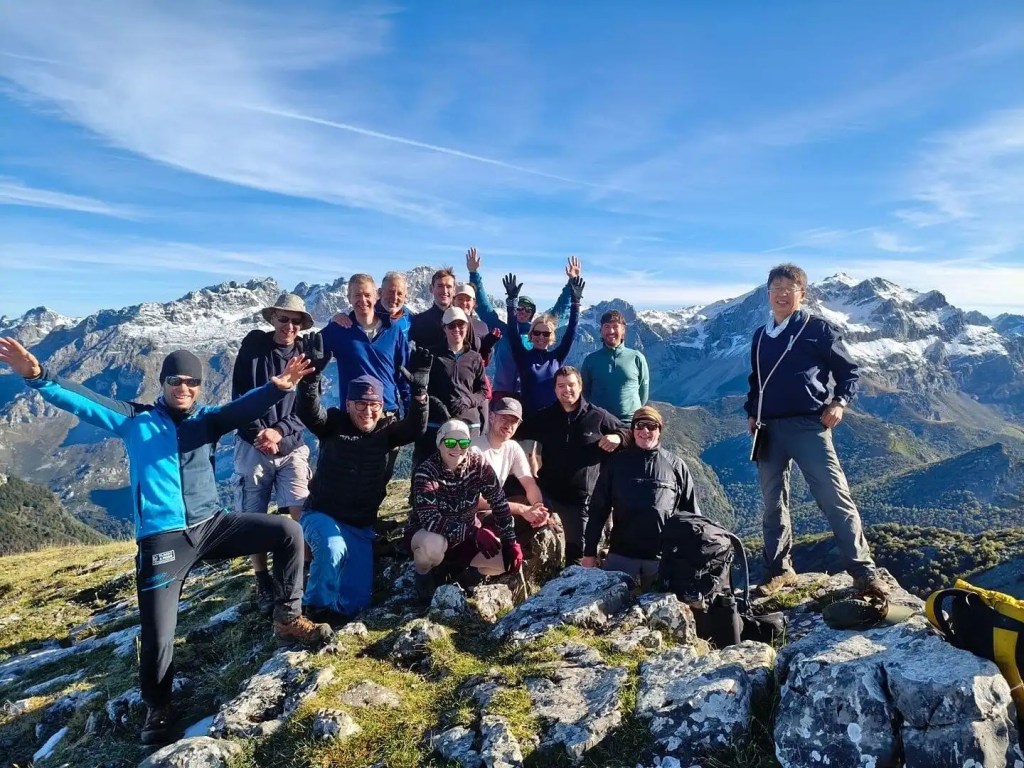
I saw a greater proportion of guided groups compared to independent hikers on this trail than I have seen on any others. The participants were both Spanish and international. This is a great option for those who wish to trek the Picos but lack the confidence or ability to self-guide. Perhaps we fell into this category, but part of my joy is self-guiding, regardless of the outcome! I am aware of the following groups:
- Much Better Adventures offer a six-night trek for up to fourteen participants. We stayed at a couple of refuges with one group. The participants looked happy, were well looked after, and the group was mainly English speaking. The one hundred reviews of this trek average 4.9/5.
- Local sites such as https://elanillodepicos.com/el-anillo-con-guias/ and https://www.alberguecangasdeonis.com/en/el-anillo-de-picos-3/ offer guided treks. At some of our refuges, there were groups of Spanish speakers which might have come from these.
The above sites are also very useful for planning an independent hike, reviewing their itineraries, options, and advice. The times associated with the itineraries presented at https://elanillodepicos.com/itinerarios/ appear optimistic or aggressive. My observation is that these treks focus on the western and central massifs and I did not see a trip advertized that includes Andara.
8. Weather Unpredictability
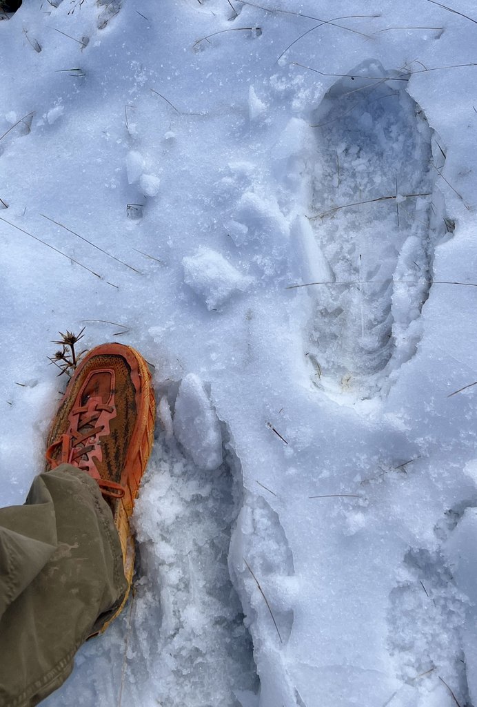
I feel that I should not need to write this, but we were caught out by the weather. It is the mountains so the unexpected should be unexpected. In September, we expected mild temperatures (5-20 degC, 40-70 degF). However, on the first three days, we were struggling with high heat (15-30 degC, 60-90 degF) . Three days later, our route was blocked by a foot of snow with cold temperatures amplified by windchill (0-15 degC, 30-60 degF). I have been fortunate to dial-in my backpacking setup so that it works across a wide range of temperatures. However, the snowy conditions were challenging in my trail runners and I’d carry microspikes next time, or even consider boots. While such weather was an anomaly, this is what shoulder seasons are about!
I got frequent weather updates with my Garmin InReach Mini, and the refuge wardens were also happy to help with their access to local online forecasts. I observed that the warden advice about the weather focused on safety, either the danger of lightning strikes (we had none), or the risk of getting lost in thick fog. Their definition of “easy” is from someone who lives in the mountains and is familiar with the trail and varying conditions. The mountain weather caused us to change our plan, and our refuge warden was able to help confirm same-day beds at another refuge that we had not booked. The weather also led us to use mechanized transport to catch up, which was a good choice.
My Suggestions
When I was hiking this trek, I asked myself how I’d underestimated the conditions so much. I hope the above helps answer that question. To supplement that, I have worked out what I would do differently next time, and that is presented below.
Harmen Hoek presents the complete loop in eight days from Fuente De. The website for El Anillo de Picos presents an eight-day loop starting from Refugio Vega de Ario. Takeahike presents a nine-day loop starting from Poncebos. Goneapp describes the loop in ten days starting from Fuente De. Hiiker suggests “~6 days” from the top of the Fuente De cable car, which sounds like an algorithm rather than a human. Below is an option for eleven days of hiking with two “zero” days.
One suggestion is to avoid attempting the whole ring, aiming for 2-4 night trips from a base. That preserves some flexibility and facilitates attempting to camp while refuges remain an option. The “base” could be Posada, Los Lagos de Covadonga, Poncebos, Sotres, or Fuente De, and the shorter trip length facilitates a lighter pack. Cicerone’s Walking in the Picos de Europa suggests a couple of via loops, though they both include the Ruta del Cares which would be an issue if it is closed. After a few hard days in the mountain, a “zero” at a hotel in one of villages is very nice.
For a “complete” ring, I propose a less-ambitious plan, providing the opportunity to add extra hikes as energy and time allows, and relying on refuges and hotels for accommodation. Just hanging out at the refuges in the mountains is cool.
- Day 1: Fuente De to Hotel Aliva. You could either take the cable car (prebook) or hike along PNPE-PR 24. The hotel and the nearby Chalet Real has interesting history. A hike up a nearby peak could be added. Having an easier initial day can help get things going.
- Day 2: Hotel Aliva to Refugio Terenosa. I propose avoiding the Andara Massif. If of particular interest, an extra day could be added by going to the Refugio Andara via Sotres. True mountain goats can take the shortcut over Collado de Valdominguero. Alternatives include staying at a hotel, having lunch, and buying snacks in Sotres. Much of the hiking from Aliva to Sotres will be along a road (GR202) and PNPE-PR-21.
- Day 3: Refugio Terenosa to Refugio del Jou de los Cabrones via Refugio Vega de Urriellu. We did not hike this section, and it sounds like one of the best with some challenging hiking. The trail to Refugio Urrellu is PR-21, though is neither PR or GR beyond. An alternative would be to hike down to Bulnes and stay at a hotel with a prior reservation.
- Day 4: Descent to Bulnes then Poncebos (funicular optional). The descent into Bulnes would be on a non PR/GR trail, but GR 202 goes from Bulnes to Poncebos if you skip the funicular. If the Ruta del Cares is closed, arrange transportation to the Lagos de Covadonga and stay at the Refugio de Lago Enol. If the Ruta is open, follow PNPE-PR3 to Cain and stay in a hotel. A “zero” day could then be taken at Cain or Arenas. Also, buy snacks in Cain or Arenas.
- Day 5: Lagos de Covadonga (or Cain) to Refugio Vega de Ario following PNPE-PR4 (non PR/GR route from Cain). Optional hike to Pico Jultayu for great views down to Cain.
- Day 6: Refugio Vega de Ario to Refugio Vegarredonda. If a clear day and you have the GPX track downloaded, the “direct” route is a fun and challenging exposure to a different Picos environment. Alternatively, you can walk back down to the Lagos de Covadonga on PNPE-PR4 and up to Vegarredonda on PNPE-PR2&5. Optional side hike to Mirador de Ordiales and Refugio Ordiales. Sleeping in Refugio Ordiales is another option.
- Day 7: The “standard” route, from Refugio Vegarredonda to Refugio Vegabano, is a long day, but we did not do this. There are several unmanned refuges in this region (Vega Huerta, Frade) near the “AP route” that are worth considering. My map suggests a more direct route using PNPE PR 5 to the Mirador de Ordiales and a connector trail to PNPE PR 7 which takes you to Vegabano. Refuge wardens would be able to advise
- Day 8: Vegabano to Posada or Santa Marina. The “AP” route goes from Vegabano to Posada. The PNPE PR 12 route goes to Posada from almost as high as Refugio del Frade. Again, refuge wardens would be able to advise. A “zero” day in Posada would be fun. Or, a “nero” (nearly zero), giving you time to check out the Ruta del Cares from the southern end.
- Day 9: Posada or Santa Marina to Refugio Collado Jermoso. The AP trail goes direct from Posada. PNPE PR 15 connects to PR 25, which gets you onto the high plateau with a connecting walk to Jermoso. This latter section is what the group from Much Better Adventures hiked, though they used transport to get from Santa Marina to the Remona saddle.
- Day 10: Refugio Collado Jermoso to Refugio Cabana Veronica. While this is short, it is high with Veronica at 2325m. Veronica could be skipped, or just stopped at for lunch, but I think it would be a great place to stay the night. Refugio Cabana Veronica is quite close to Refugio Vega Urriellu, and the Anillo Extrem loop goes between these refuges.
- Day 11: Refugio Cabana Veronica to Fuente De. PNPE PR 23 takes you to the top of the cable car, which you have the choice to ride down or walk. The cable car gets busier later in the day, so if you don’t have a reservation and don’t wish to walk, arriving there early would be a good idea.
My itinerary includes eleven days of walking with a couple of zero, or nearly-zero days, to help recovery, sample the local cuisine etc., and restock. By a lower commitment to distance each day, you have the flexibility to add side trips, or just enjoy the day’s walking, rather than exhausting yourself.
Conclusion
I have tried very hard to avoid telling you how to hike the Picos. Also, from my one visit, I am not qualified to write a comprehensive guide. However, I hope what I have shared above may complement the other information available online, perhaps from the perspective of a relatively normal human rather than someone as fit as a mountain goat! My main takeaway is to be conservative with a plan, allowing you to add stuff on the fly. The broad range of paths allows people of any fitness level to enjoy Los Picos de Europa. Getting there and enjoying the outside remains the goal.

You are a force, Peter Ireland!!
LikeLike
Great, honest,helpful write up. Sounds like you made sound decisions, and had an adventure! Well done. Cheers
LikeLiked by 1 person
Thanks, wilde dog.
LikeLike