
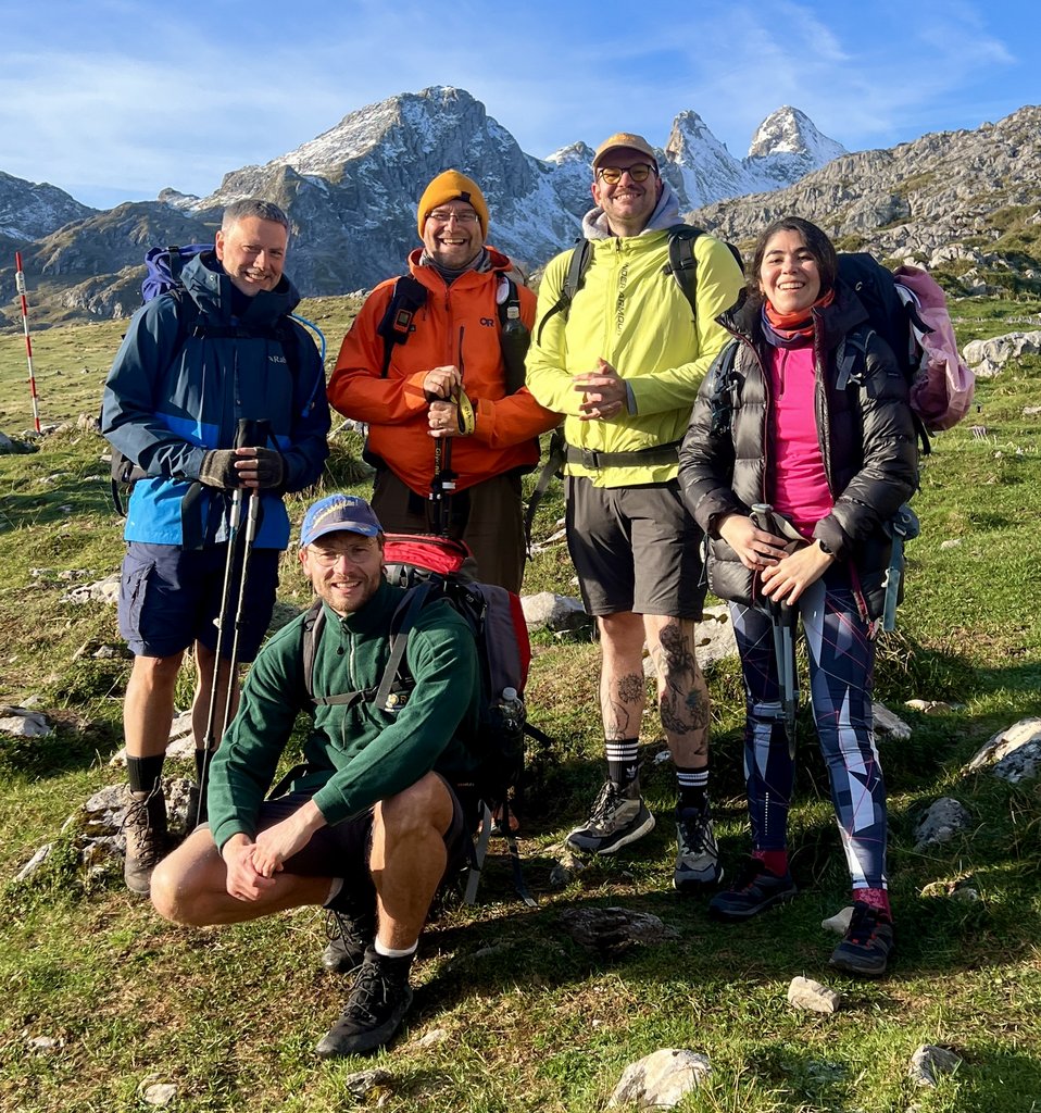
What an adventure!
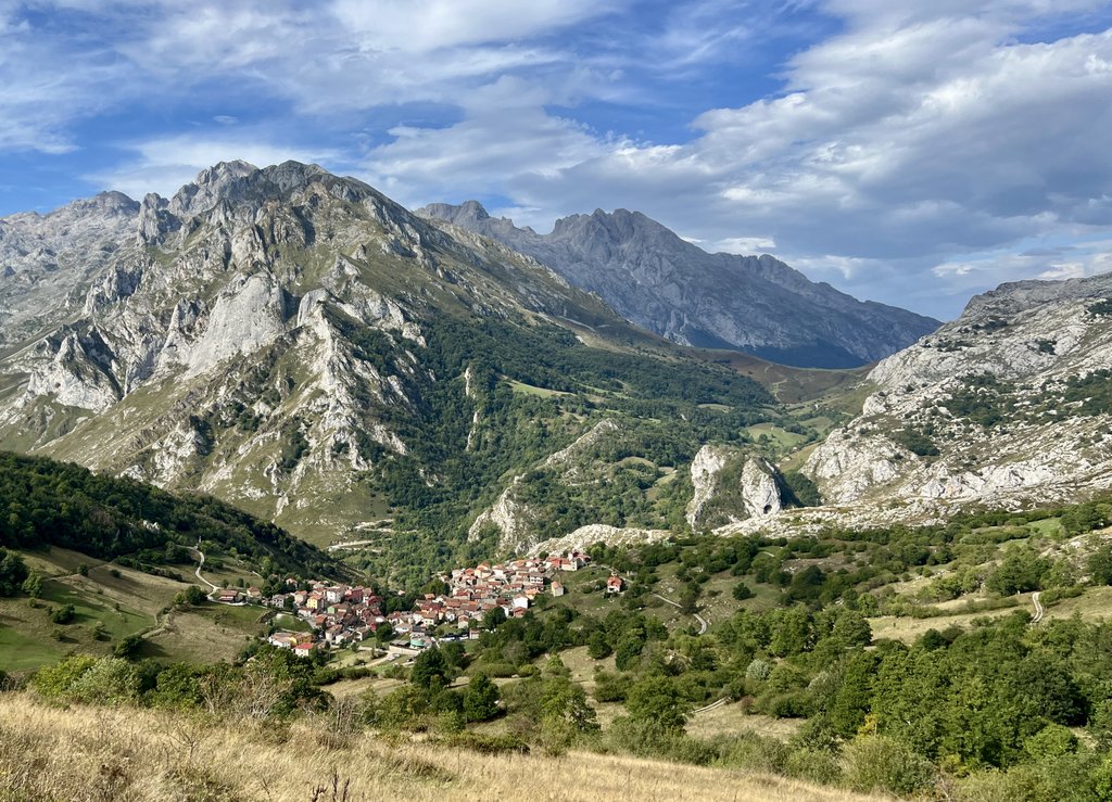
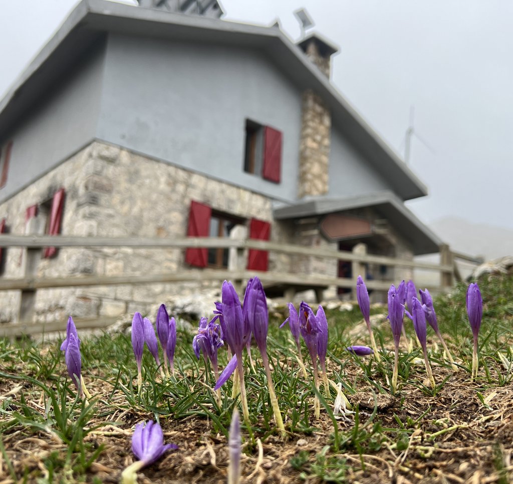
Spain’s Picos de Europa is relatively unknown outside of the country. It became Spain’s first national park in 1918. The rugged limestone mountains offer fantastic hiking and climbing opportunities against a backdrop of cowbells throughout the verdant valleys and the resulting local scrumptious cheeses and meats.
Below is the story of our adventurous nine-day trek. It is a raw, detailed, photo journal which might help others plan a Picos trek, or readers might just enjoy the scenery and sounds.
Introduction
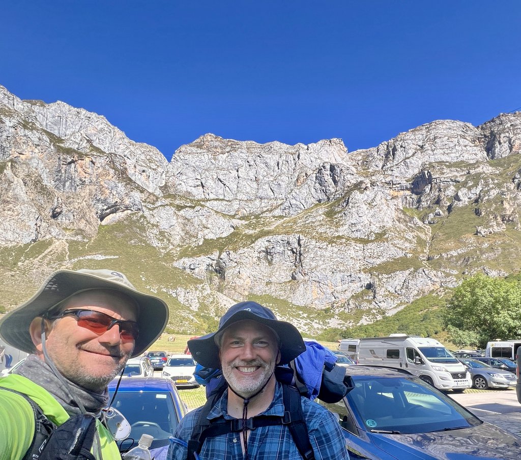
A short trek together on the Cotswold Way in August 2023 sowed the seed for a bigger adventure with James, my buddy from university in England. We’d shared fun times in Venezuela in 1990 and trekked Ecuadorian volcanoes together in May 1995. We’d formed an interesting digital connection across temperature extremes in the early 90s when James was based in Antarctica for a couple of winters while I was working in the Omani desert. It was time to catch up on the last thirty years, and what better way to do it than on a trek! James suggested the Picos de Europa, which I had never heard of, so it sounded like a great idea, and September 2025 was the perfect time.
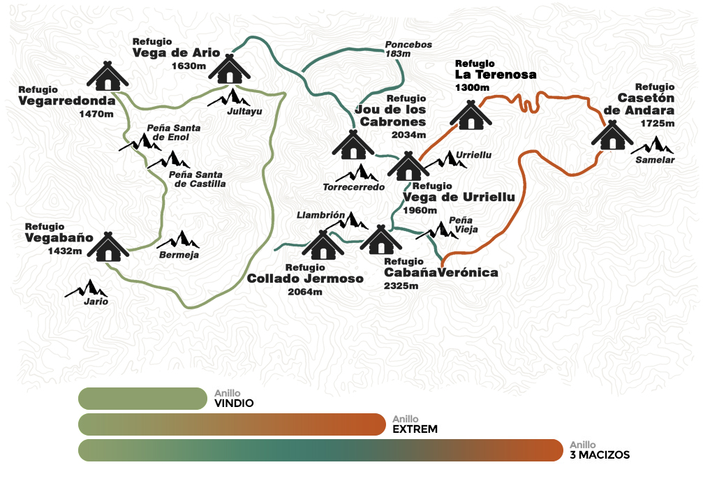
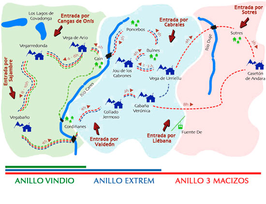
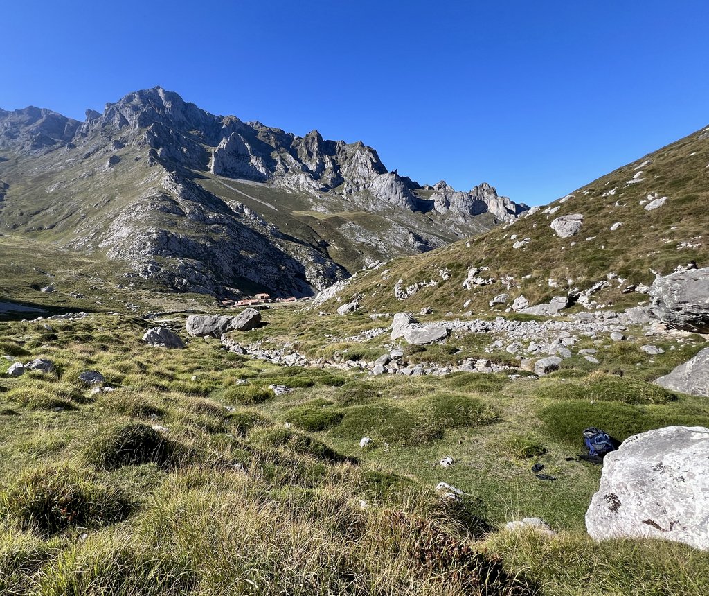
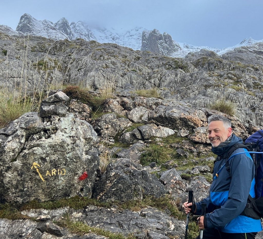
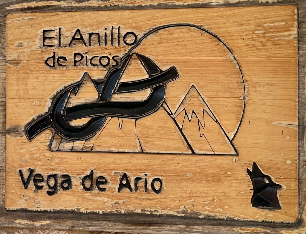
We stayed at Andara (5700ft), Vegarredonda (4800ft), and Vega de Ario (5350ft).
Planning our trek was a challenge as information was difficult to find, even with Google translate. I plan to write a separate post about planning and what we learned. Our goal was to hike the complete “El Anillo de Picos” (the ring of peaks) around the national park’s three massifs (3 macizos). We had ten hiking days and aimed to camp while eating some meals at the refugios. Our ideas were largely based on a “7-8 day” itinerary by Harmen Hoek that we had purchased, with the extra couple of days giving us a buffer. James and I coordinated our planning with a couple of calls between our homes in the US and UK, including developing a “Plan B” on the Alta Ruta in the Pyrenees when wildfires shut down the Picos in August, but most restrictions had lifted by mid-September so we went ahead with the original plan. I write “original plan” somewhat tongue-in-cheek, as we changed our plan EVERY day! The hiking was tougher than we expected, finding places to camp much more difficult, and there were unexpected weather extremes, but we enjoyed experiencing the refugios and created many fine memories.
Summary
In mid-September 2025, we took the Eurostar from London to Paris, the TGV from Paris to Hendaye, and walked over the border to stay in Irun in Spain. The next day, we picked up a rental car and drove to Fuente De on the southeast side of the Picos, did a warmup walk, and camped at an established campsite. The following three days were an adventurous and demanding exploration of the eastern and north-central massifs, with a stay at Refugio Caseton de Andara and visiting Sotres and Bulnes. We pushed our bodies to the limit and suffered from high heat. The trail from Poncebos to Cain (Ruta del Cares) was closed due to wildfires and rockfalls. Knowing that we’d need to take a taxi to continue our ring, we then took a “zero” day in Arenas (a bus-ride north of Poncebos) to reassess our plan, our packs, and our energies, while working out a new plan. We decided that continuing the loop from Los Lagos de Covadonga was viable, and hiked up to Vegarredonda the following day after taking a taxi from Arenas to the lakes. However, there was significant snowfall that night above 1800m (6000ft), unexpected for the time of year. Our path southwards climbed to 2000m (6600ft), was under about 0.5m (1-2 ft) of snow, and even turned back a local guide. A Vegarredonda refuge warden suggested hiking north to Vega de Ario, which we did the following day, and it was a great though challenging suggestion, helped by teaming up with other trekkers. After hiking out from Vega de Ario, we transferred by car to a refuge at Santa Marina de Valdeon for a final day’s hike in the central massif to Fuente De. Over the following two days, we reversed our driving and train routes and got our exhausted bodies back to London. Our adventure had differed greatly from the planned one, but we experienced fantastic hiking while appreciating the uniqueness of the Picos’s refugios, rugged mountains, animals, and cuisine, while catching up on the previous thirty years!
| Date (2025) | Title | Sleep | Measured Distance (miles) (Garmin) | Map Distance (miles) (AllTrails) | Hiking Time | Ascent (ft) | Descent (ft) |
|---|---|---|---|---|---|---|---|
| 15Sep | Travel by train from London to Iron via Paris and Hendaye | Hotel Alcazar, Irun | |||||
| 16Sep | Day 0: Warmup hike from Fuente De after drive from Irun | Camping El Redondo, Fuente De | 2.8 | NA | 1h47m | 673 | 705 |
| 17Sep | Day 1: Fuente De to Las Vegas de Sotres via PR 24 and GR 202 | Wild camping near Las Vegas de Sotres | 10.1 | 7.6 | 5h49m | 1,985 | 1,939 |
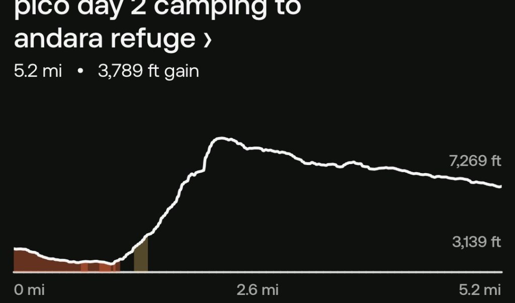
| 18Sep | Day 2: Las Vegas de Sotres to Refugio Caseton de Andara via “AP” | Refugio Caseton de Andara | 11.1 | 5.2 | 8h23m | 3,812 | 2,041 |
| 19Sep | Day 3: Refugio Caseton de Andara to Bulnes via Sotres on PR 28, PR 20, and GR 202. | Wild camping in Bulnes in front of house | 12.2 | 10.0 | 6h54m | 1,260 | 4,590 |
| 20Sep | Day 4: Funicular from Bulnes to Poncebos and bus from Poncebos to Arenas | Hotel Picos de Europa, Arenas | |||||
| 21Sep | Day 5: Taxi from Arenas to Lake Ercina; hike to Refugio Vegarredonda on PR 2 and PR 5 | Refugio Vegarredonda | 6.4 | 5.9 | 3h37m | 1,716 | 653 |
| 22Sep | Day 6: Refugio Vegarredonda to Refugio de Ordiales and return on PR 5 | Refugio Vegarredonda | 4.4 | 3.6 | 2h38m | 1,184 | 1,214 |
| 23Sep | Day 7: Refugio Vegarredonda to Refugio Vega de Ario | Refugio Vega de Ario | 8.7 | 4.7 | 7h51m | 2,694 | 2,165 |
| 24Sep | Day 8: Refugio Vega de Ario to Lago Enol on PR 4, ride to Congas de Onis, Taxi to Santa Marina | Refugio La Ardilla Real, Santa Marina de Valdeon | 6.5 | 5.1 | 3h56m | 604 | 2,516 |
| 25Sep | Day 9: Refugio La Ardilla Real to Fuente De | Hotel Parador, Fuente De | 7.3 | 6.3 | 4h12m | 2,185 | 2,333 |
| 26Sep | Drive from Fuente De to Irun | Hotel Alcazar, Irun | |||||
| 27Sep | Train from Hendaye to London via Paris | ||||||
| Totals | 69.5 | 48.4 | 16,113 | 18,156 |
I’ve also included distances that I calculated using AllTrails maps to highlight the discrepancies on the hardest sections, mostly caused by measurement inaccuracy from GPS “bounce” and some impact of switchbacks not being on the map.
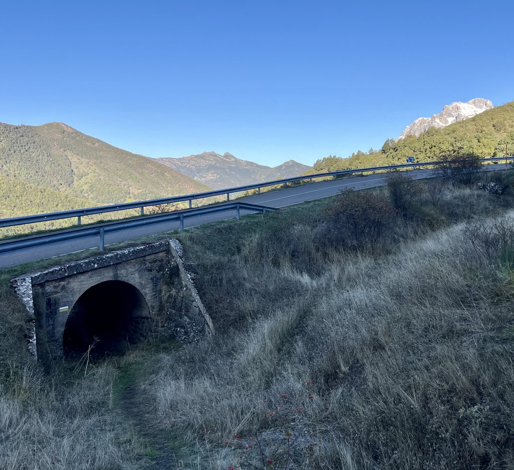
Day 0: Warmup hike from Fuente De
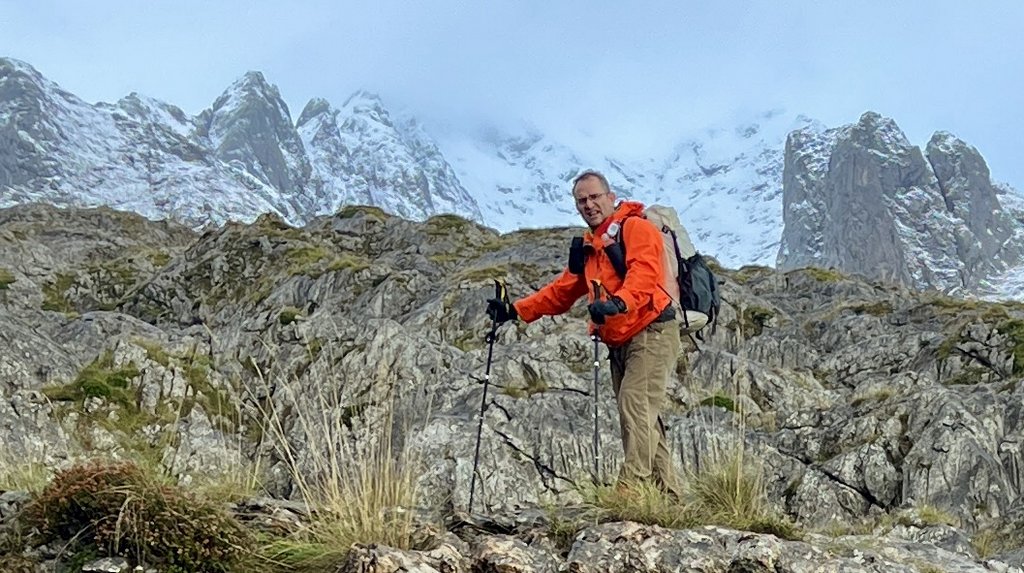
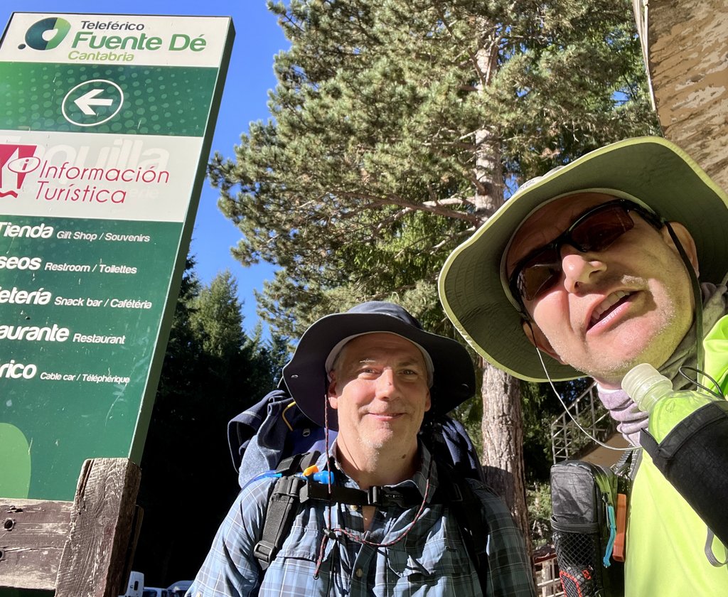
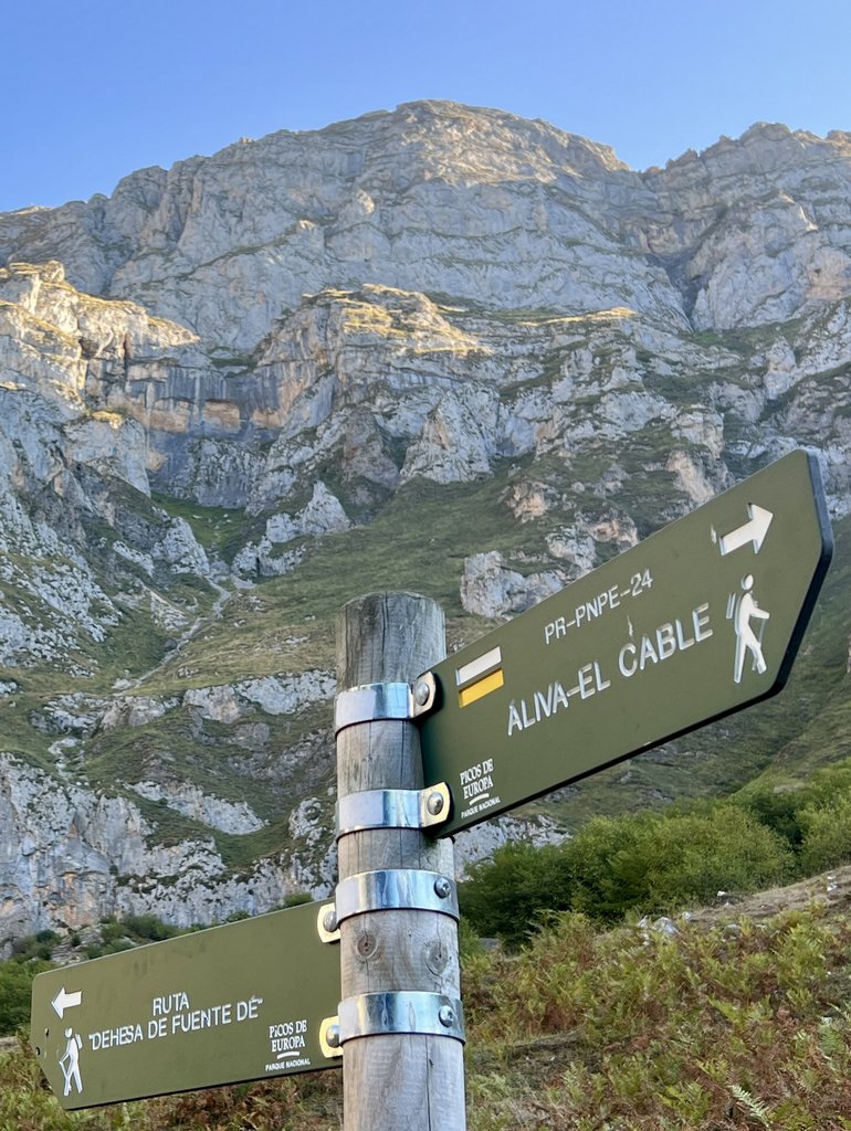
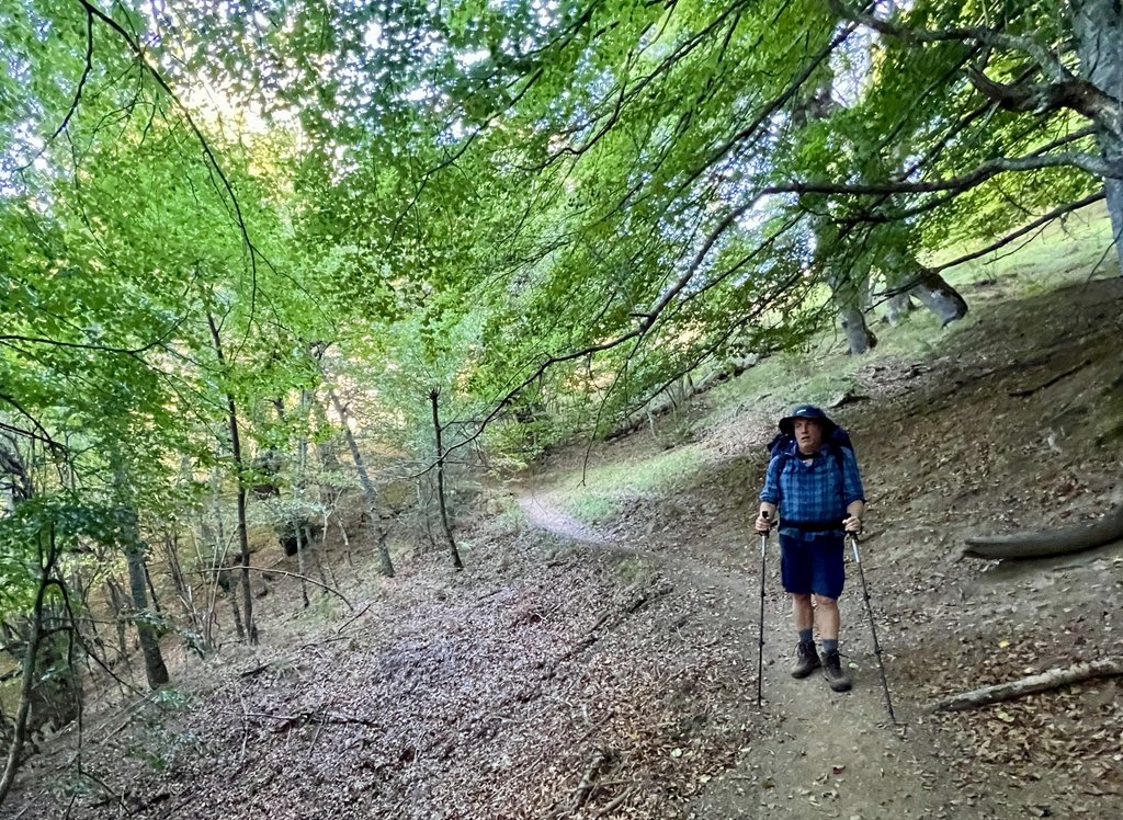
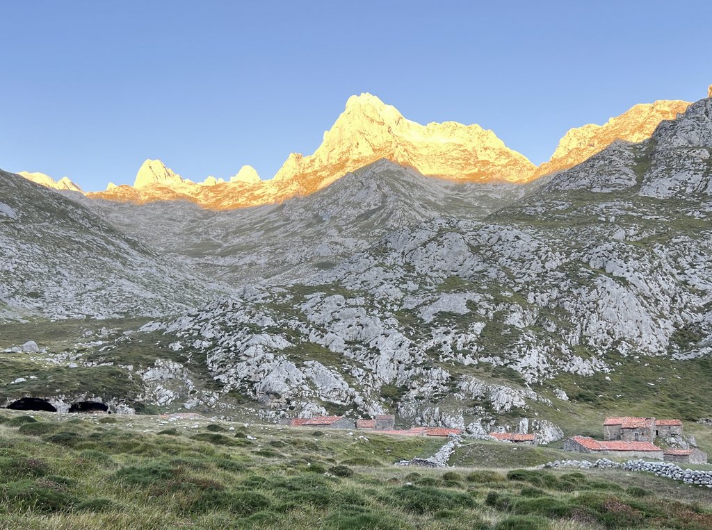
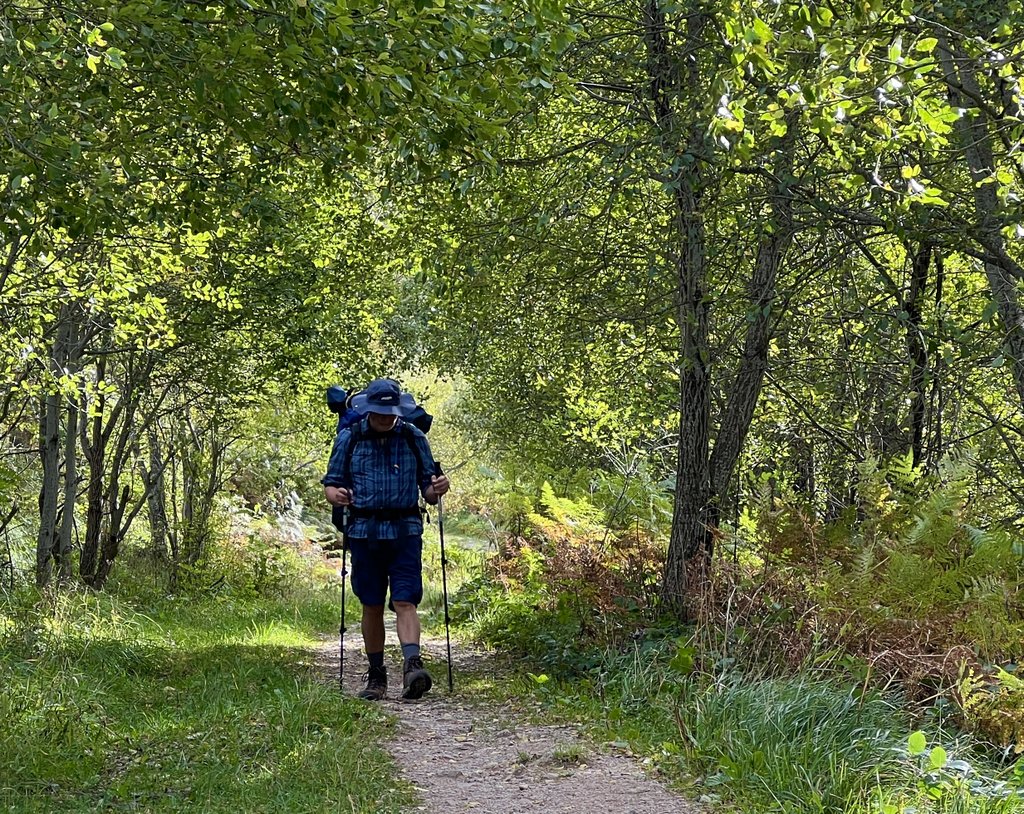
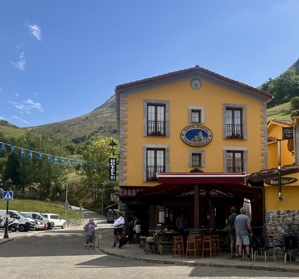
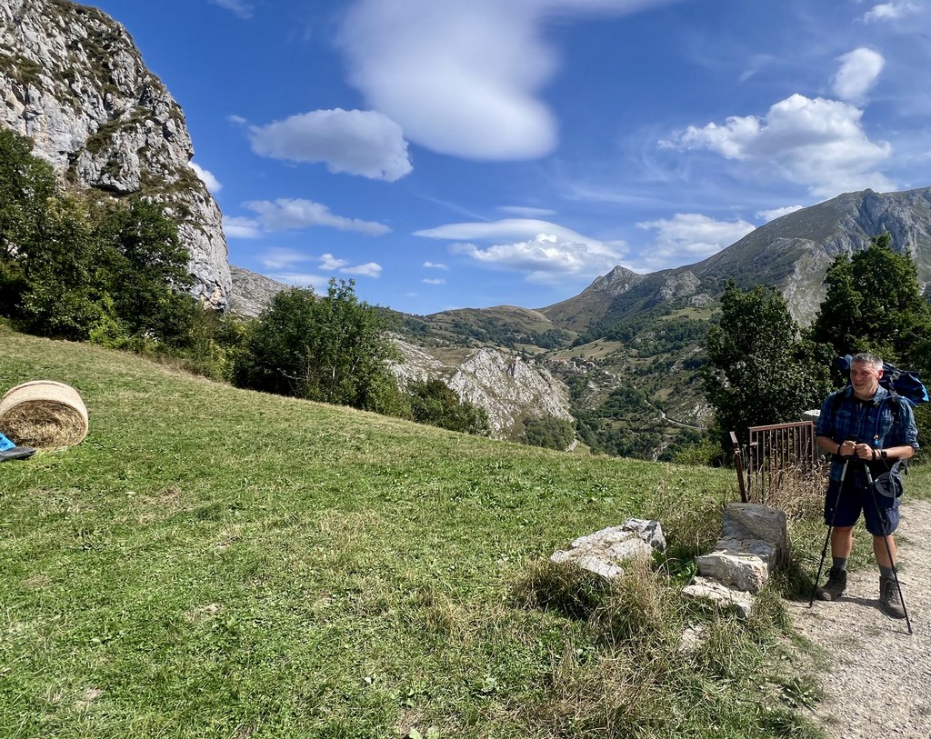
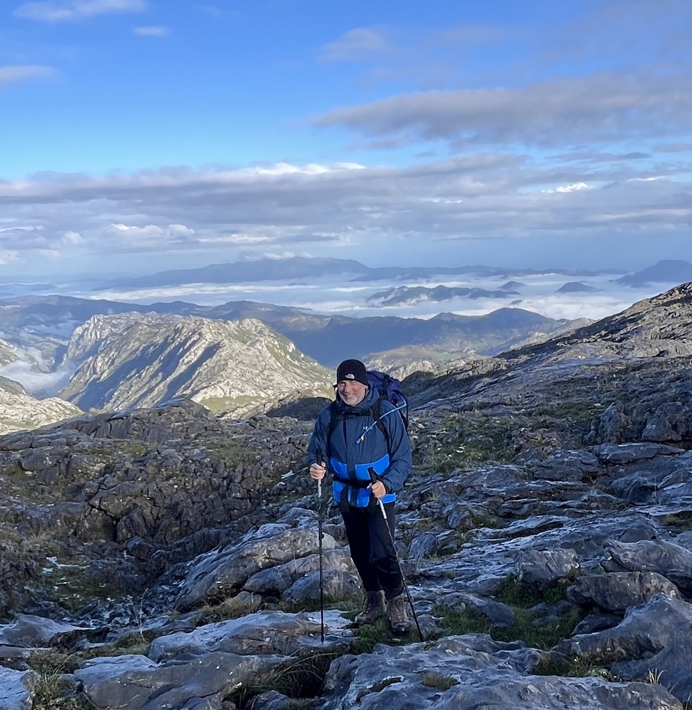
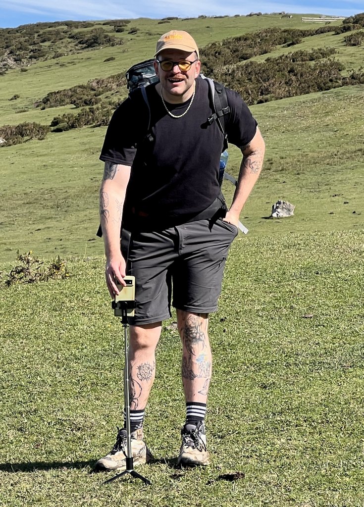
James and I met at Premier Inn’s Hub at London’s Kings Cross and bought most of the trip’s food at a local Waitrose and Sainsburys. We caught the 7am Eurostar the following morning from St Pancras and were under the channel in thirty minutes. Getting across Paris from Gare du Nord to Montparnasse was straightforward (line 4), once we’d worked out how to buy an electronic ticket (you need the Bonjour RATP app). The TGV to Hendaye was efficient, and we walked the short distance to our Hotel Alcazar in Irun, crossing from France into Spain. The following morning, the hotel receptionist helped us get a taxi to San Sebastien airport, where Hertz efficiently provided my prebooked hire car. After a stop at the nearest Decathlon to get cooking gas for our Jetboil (as its forbidden on Eurostar), we were whizzing along the autopistas. Before we knew it, we had arrived at Fuente De, our trek’s starting point. We chose to camp that night as a shakedown to help us dial in the gear we’d need. After securing our campsite, we headed off for a warmup hike.
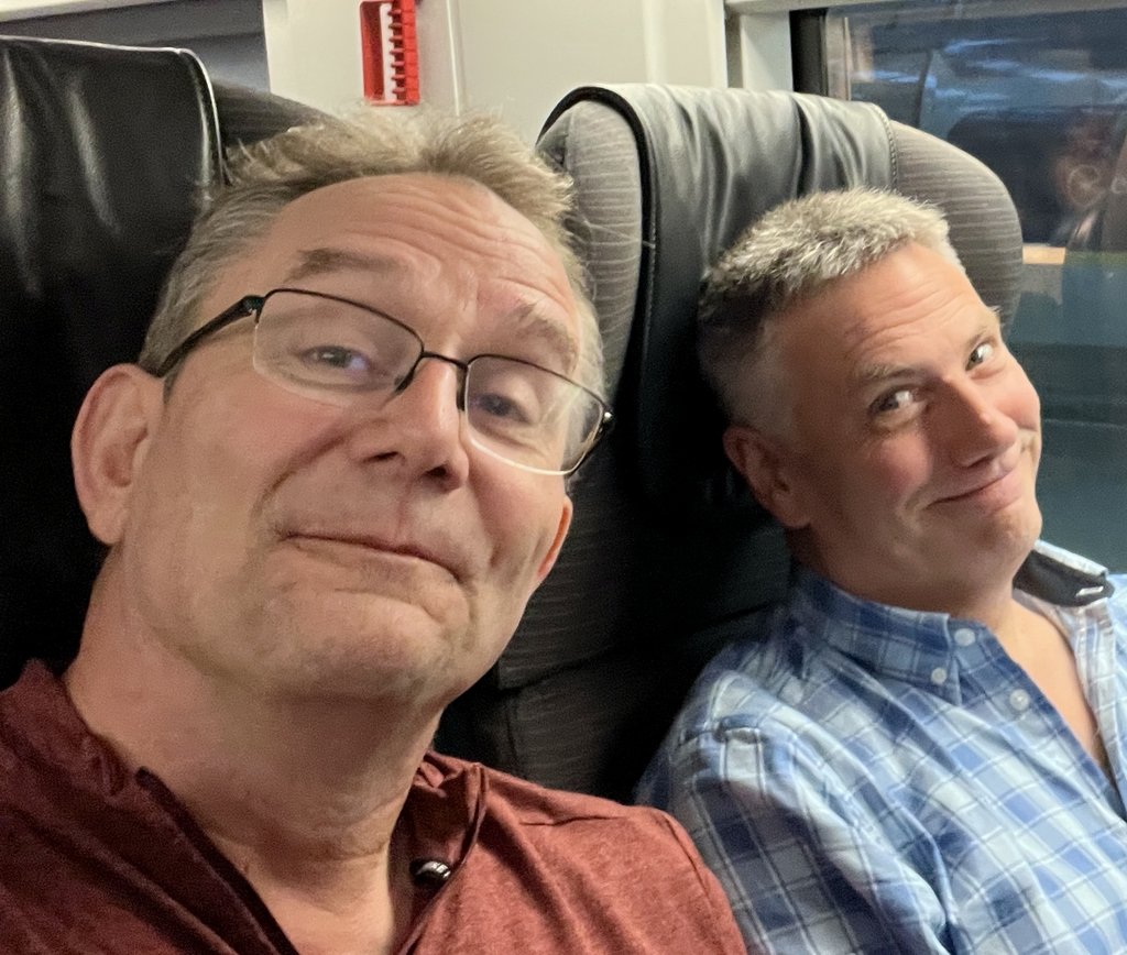
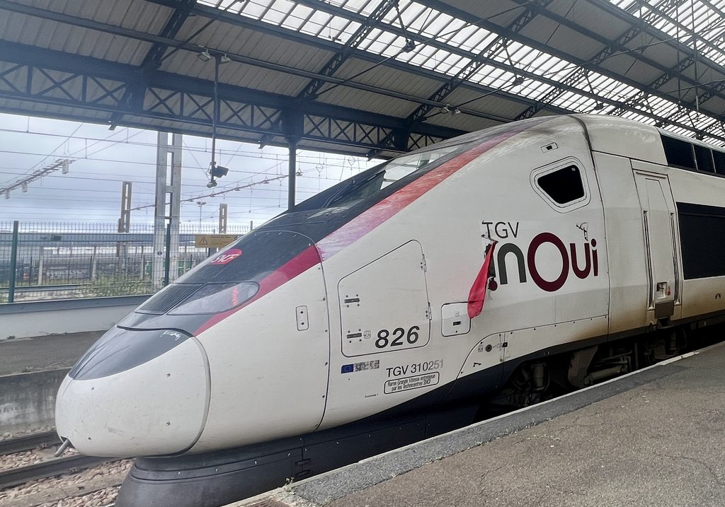
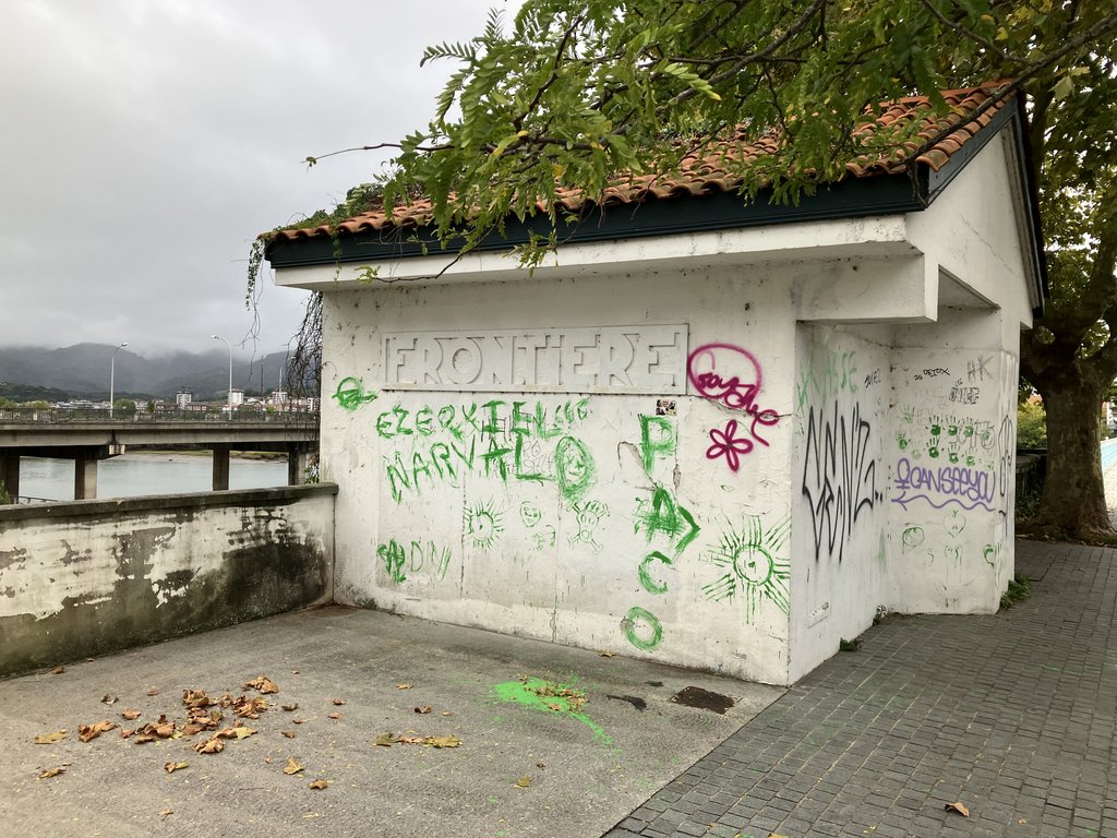
Photo by James.
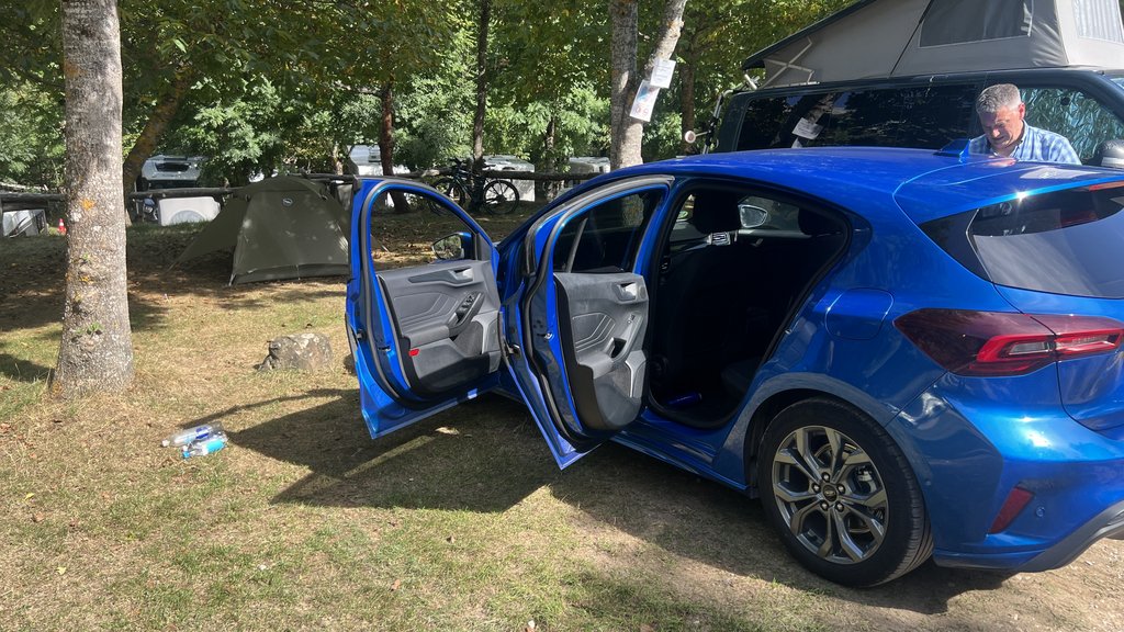
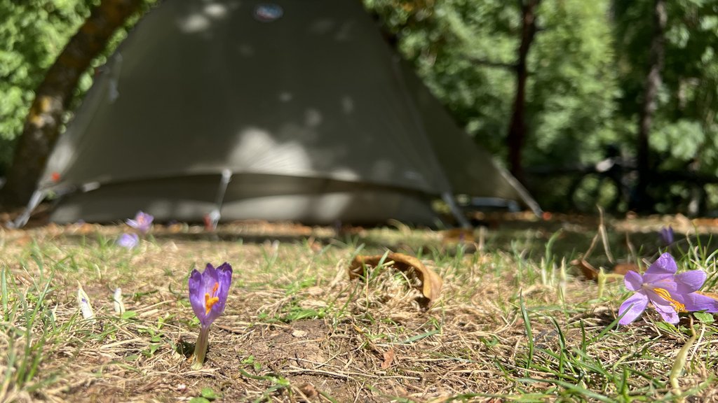
Photo by James.
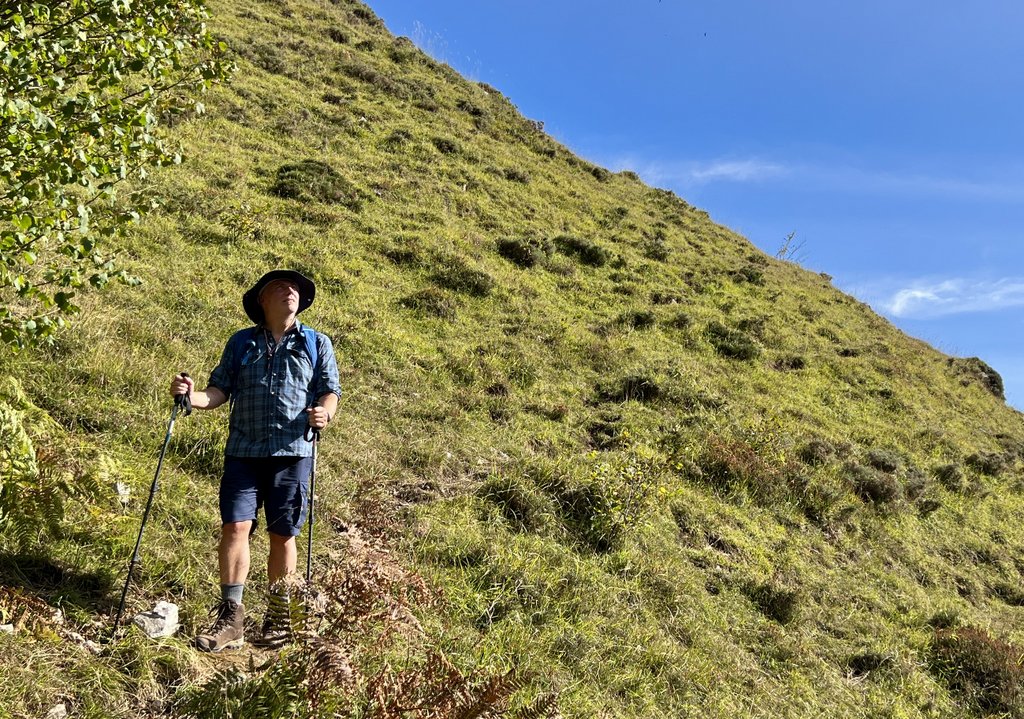
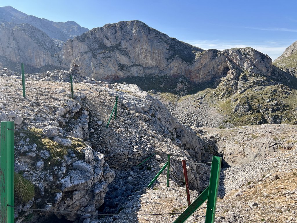
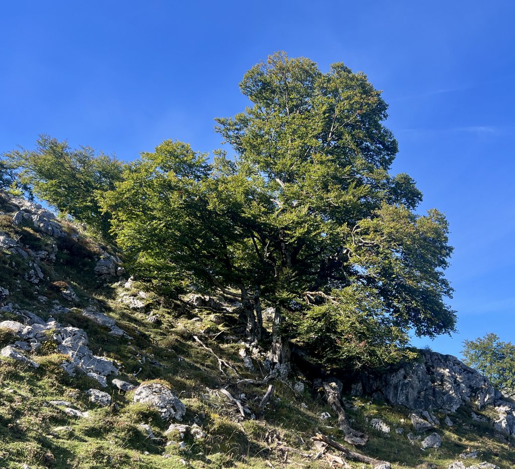
Our detailed 1:25,000 Editorial Alpina Maps of the Picos showed great detail, including contours and trails. Our first lesson during the warm-up hike was that the dotted red lines on the map were classified as either “footpath”, “trail”, or “non defined trail, difficult stretch.” We were ready for difficult route finding and steep ascents, but we quickly learned that “difficult” really meant difficult! However, our main hike was on tracks labelled “AP” (Anillo de Picos) so we remained confident that they wouldn’t be too bad, until we learned otherwise.
Link to my journal entry from Day 0, as dictated to Siri (click to expand)
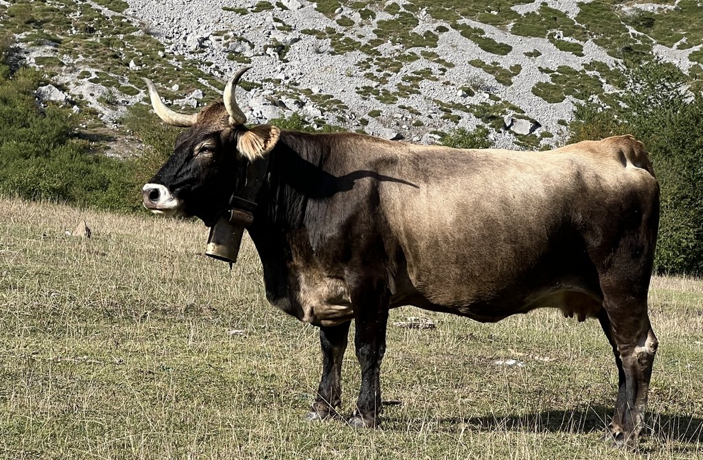
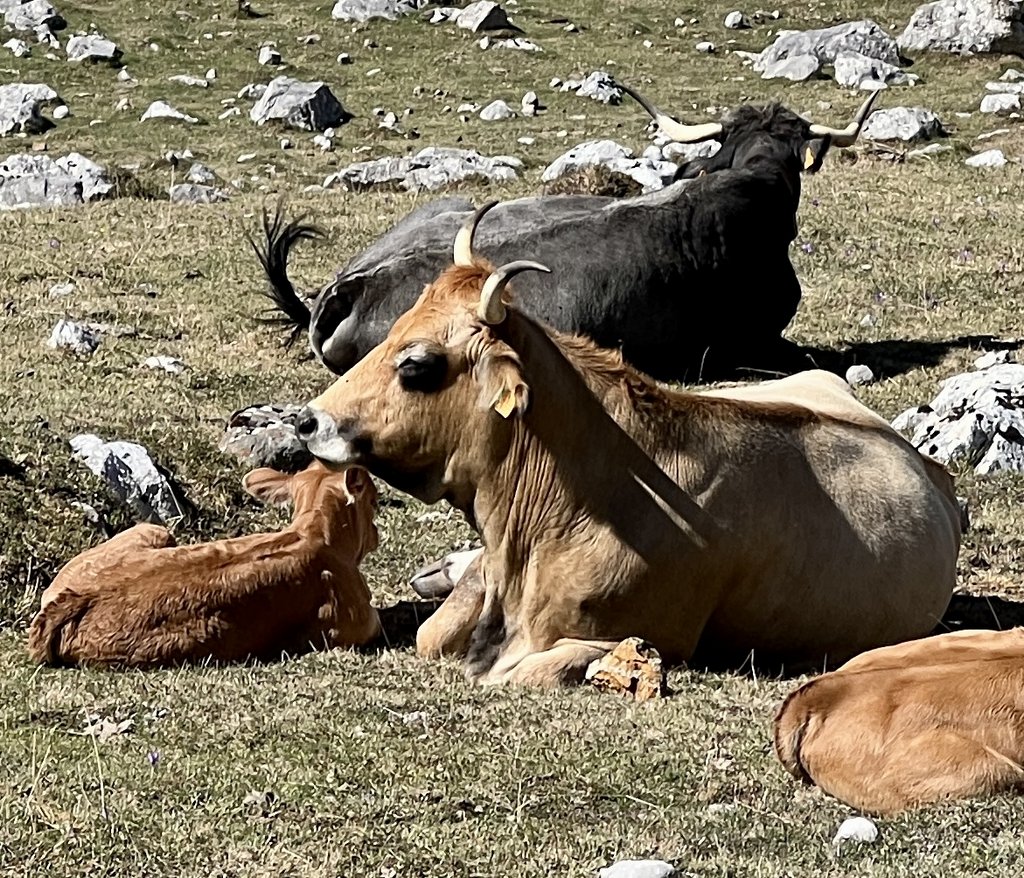
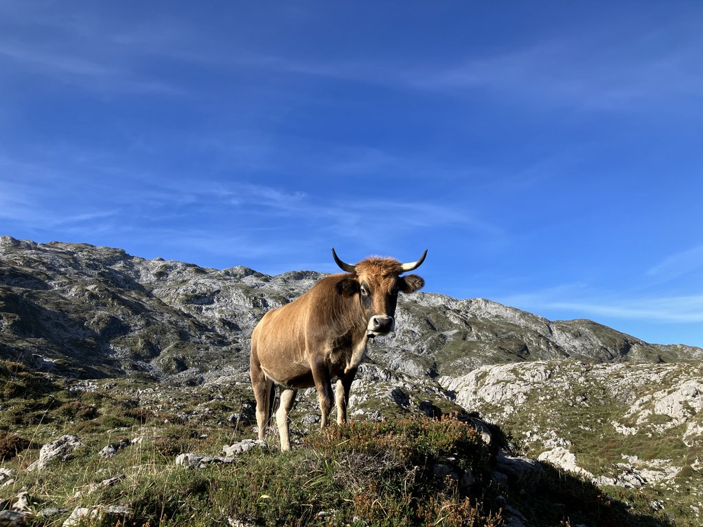
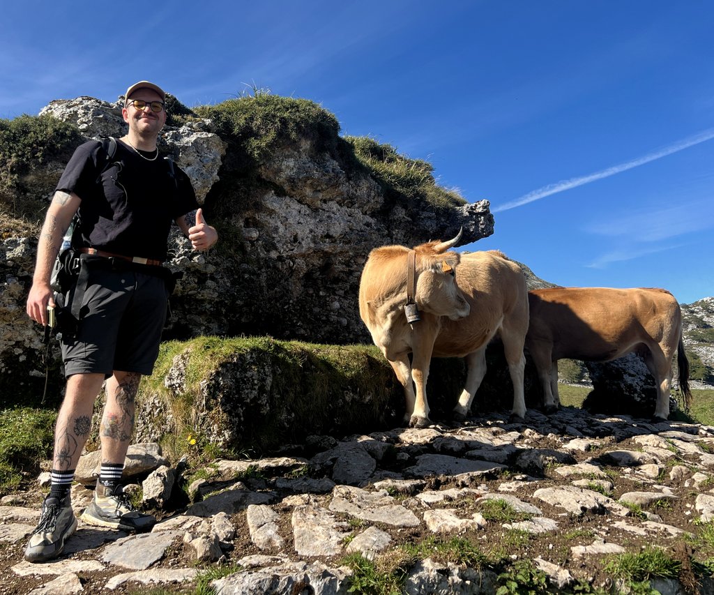
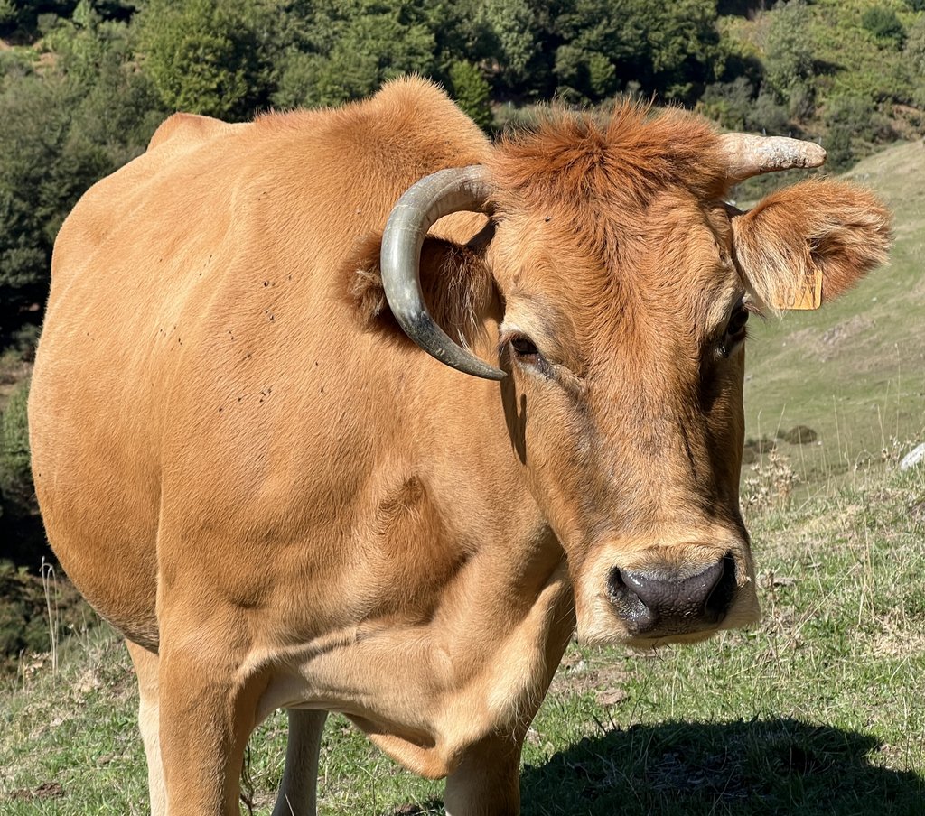
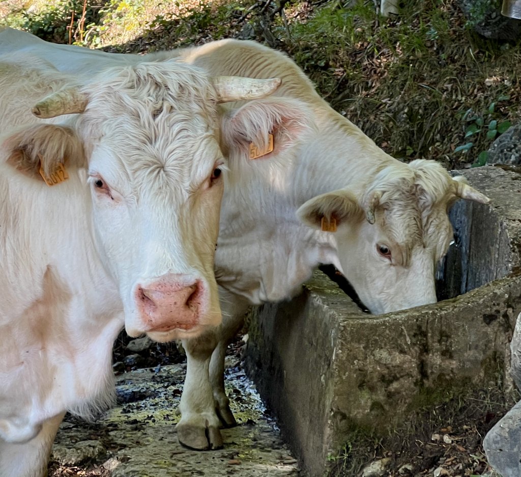
Slept well at Hotel Alcazar in Irun. Fair continental breakfast but missed good coffee. James was very happy that we ordered a taxi to pick up the rental car and I agreed. Quick smooth ride to the airport and the Hertz counter clerk knew my name on arrival. First stop was at a Decathlon store where we found the appropriate gas and tested it with our Jetboil. It was a bigger container than the smallest I was used to, so I was confident it would last our trip. We were soon whizzing down the auto pista with one stop for lunch and gas and after some delays due to major roadwork, we made it to Fuente Dé. Quickly decided that we would stay at the campground and got our pitch. Unfortunately, it was much hotter than we expected. Went for a shakedown hike, but the trail that we chose was very rough. This helped us calibrate trails on the map. A few small mountain huts were interesting and there was a cool horned cow. We enjoyed a fine dinner at the campground and got everything sorted in the tent. James was worried that his sleeping system wouldn’t be warm enough (ok down to 5degc/41degf) and tonight can be a test. It’s about 18degc/64degf as we go to sleep.
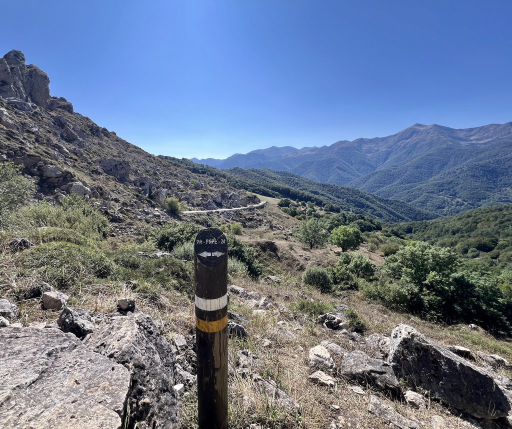
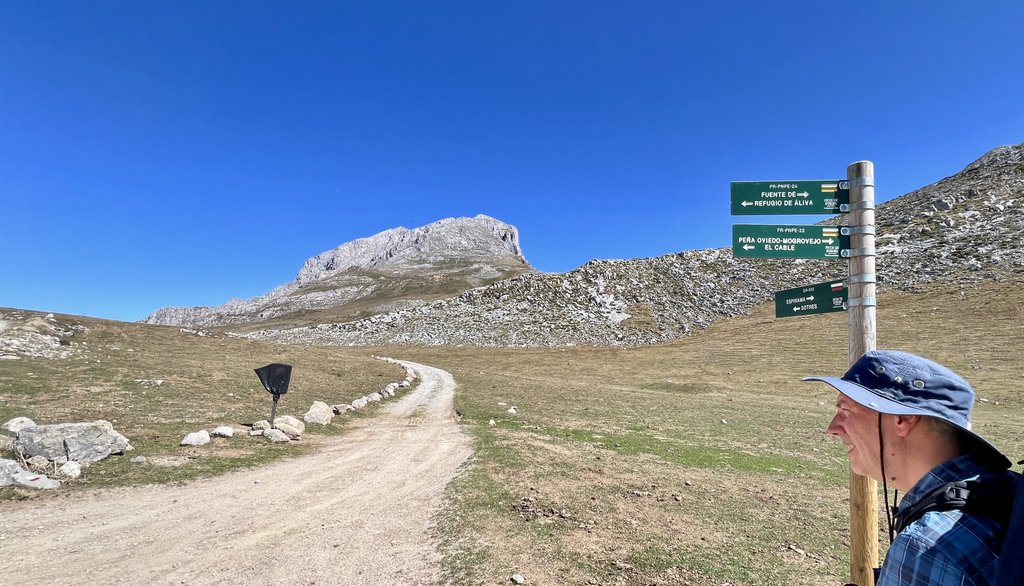
Day 1: Fuente De to Las Vegas de Sotres via PR 24 and GR 202
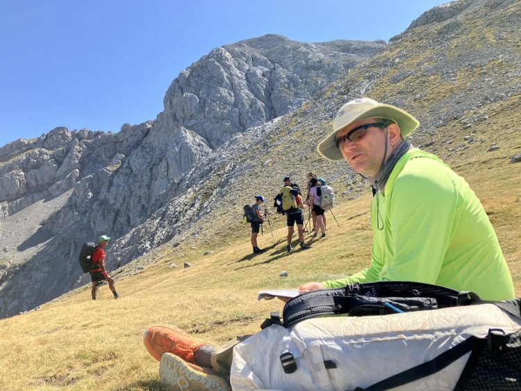
We packed our gear, expecting temperatures over the duration of our trek to be a temperate 40-70 degF, that is 5-20 degC. Over previous treks, I had evolved my gear to be warm enough to below freezing. James had chosen lighter gear over heavy warm gear. With food and water, our packs weighed about 11kg/25lb (James) and 16kg/35lb (Peter). As I had had more recent trekking experience, I carried the food to help let James settle in, knowing it would get lighter with each meal we ate.
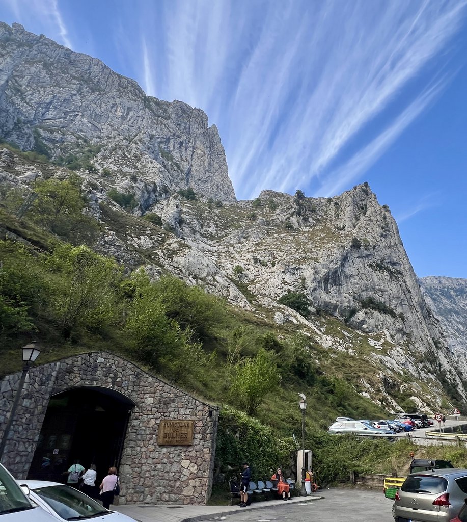
During the previous day’s recce, we’d learned that the first cable car left at 10am, counter to the 8am I had believed. We thought we’d be smart and arrive early at 9:45am but discovered a long line of people. In line, we heard someone talking in English about tickets and we learned about prebooking and that they were likely sold out until after 12 noon. It was another dent in the confidence of our planning. However, we quickly pivoted, agreeing to hike instead of wait.
The PNPE stands for Park National de Picos de Europa. The PR stands for Pequeño Recorrido (Small Path) and we learned that these locally-managed “PR” routes were generally well maintained and not too difficult.
We did not visit but it sounded like a good base for exploring from a comfortable hotel in the mountains.
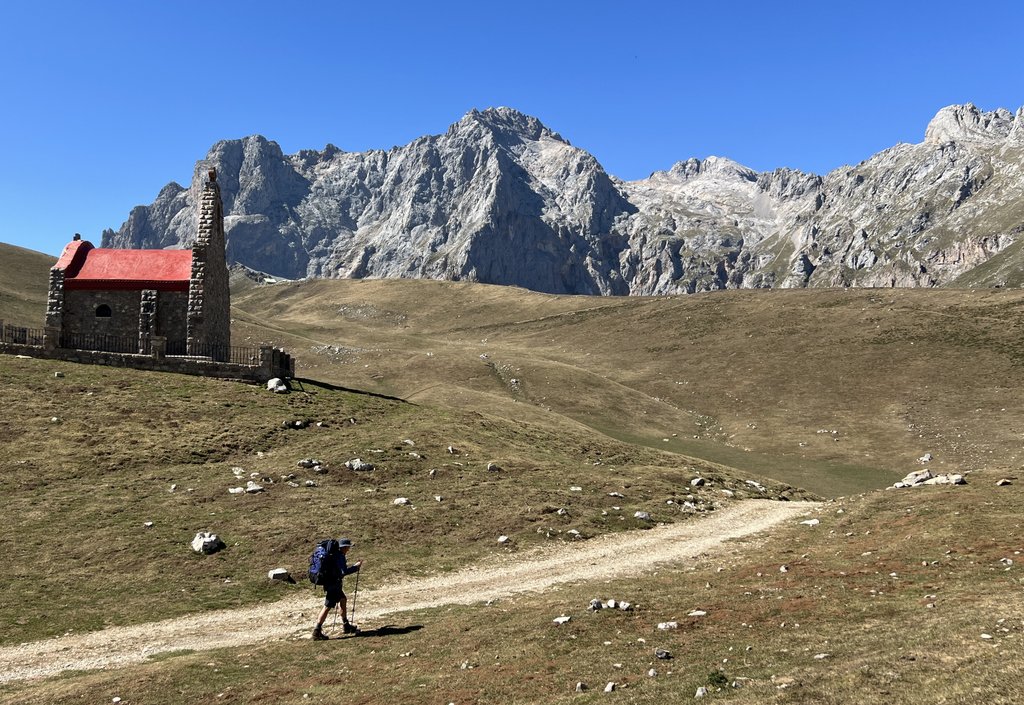
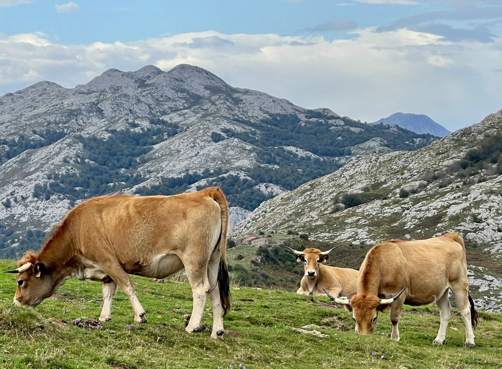
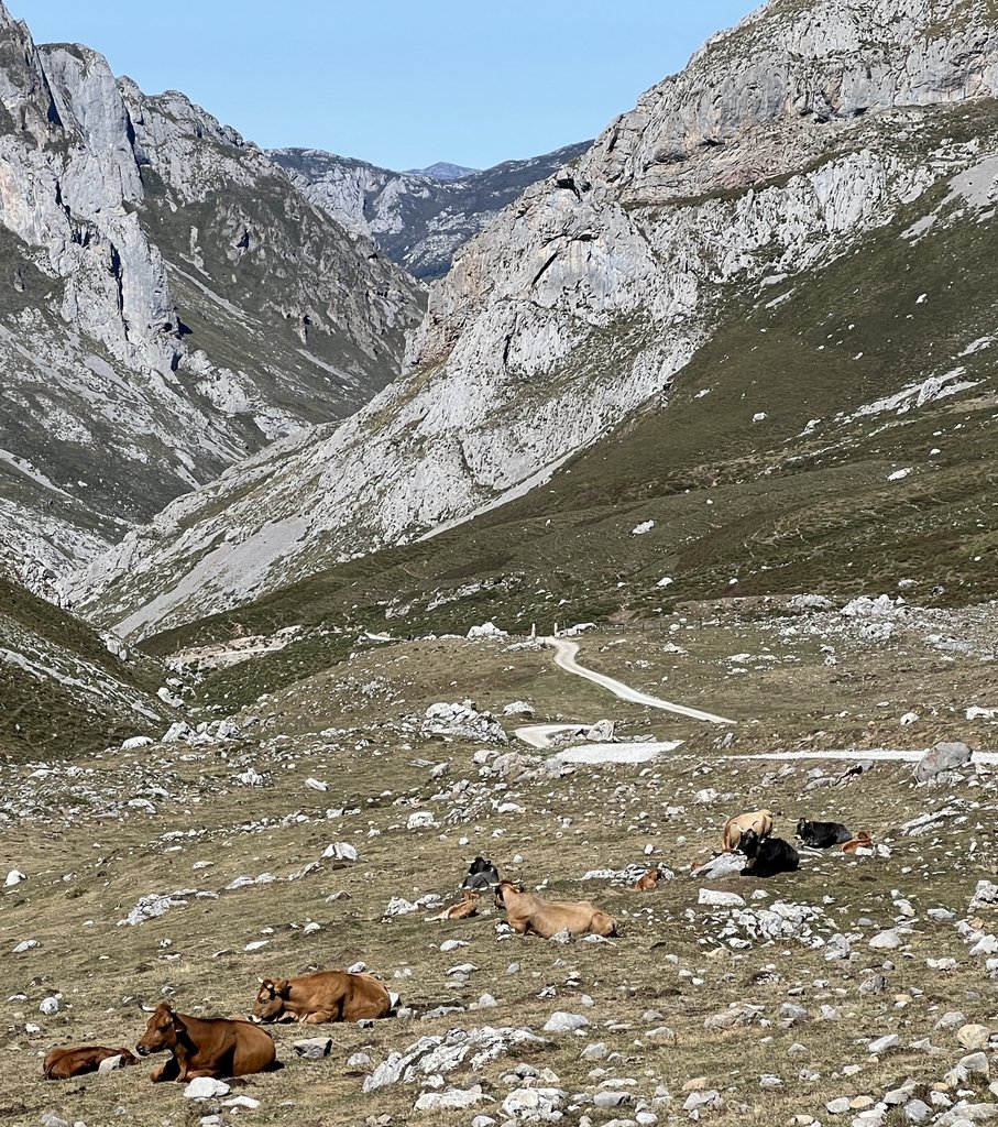
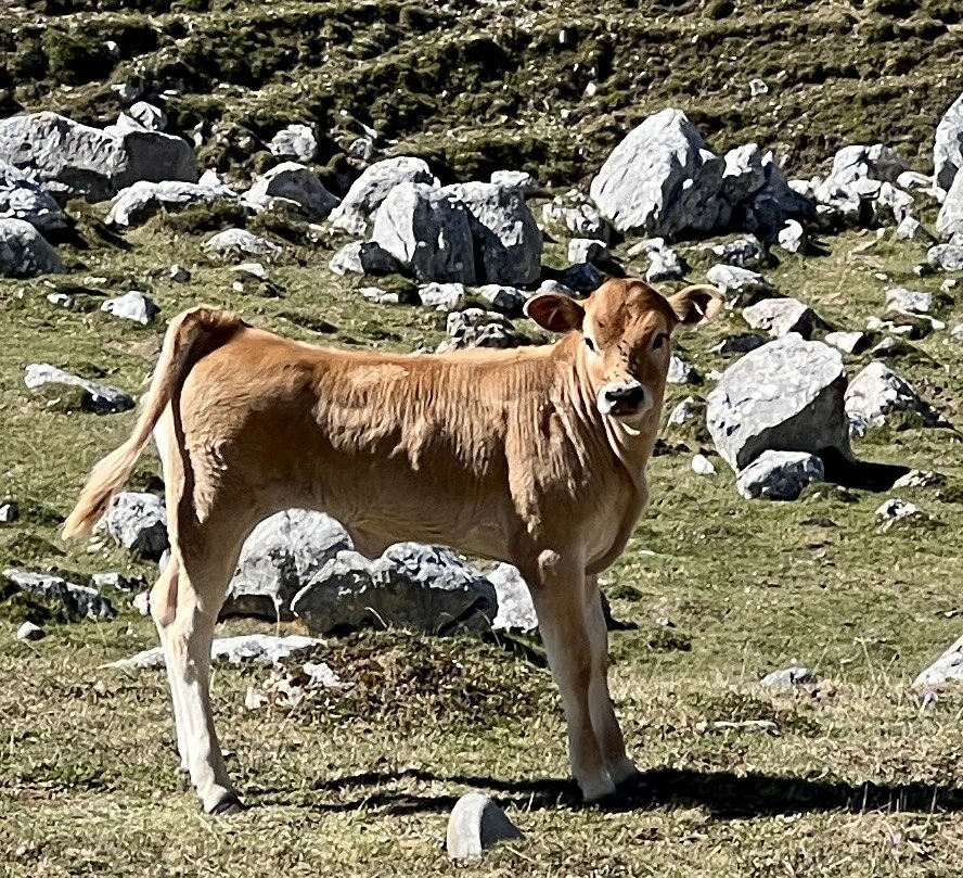
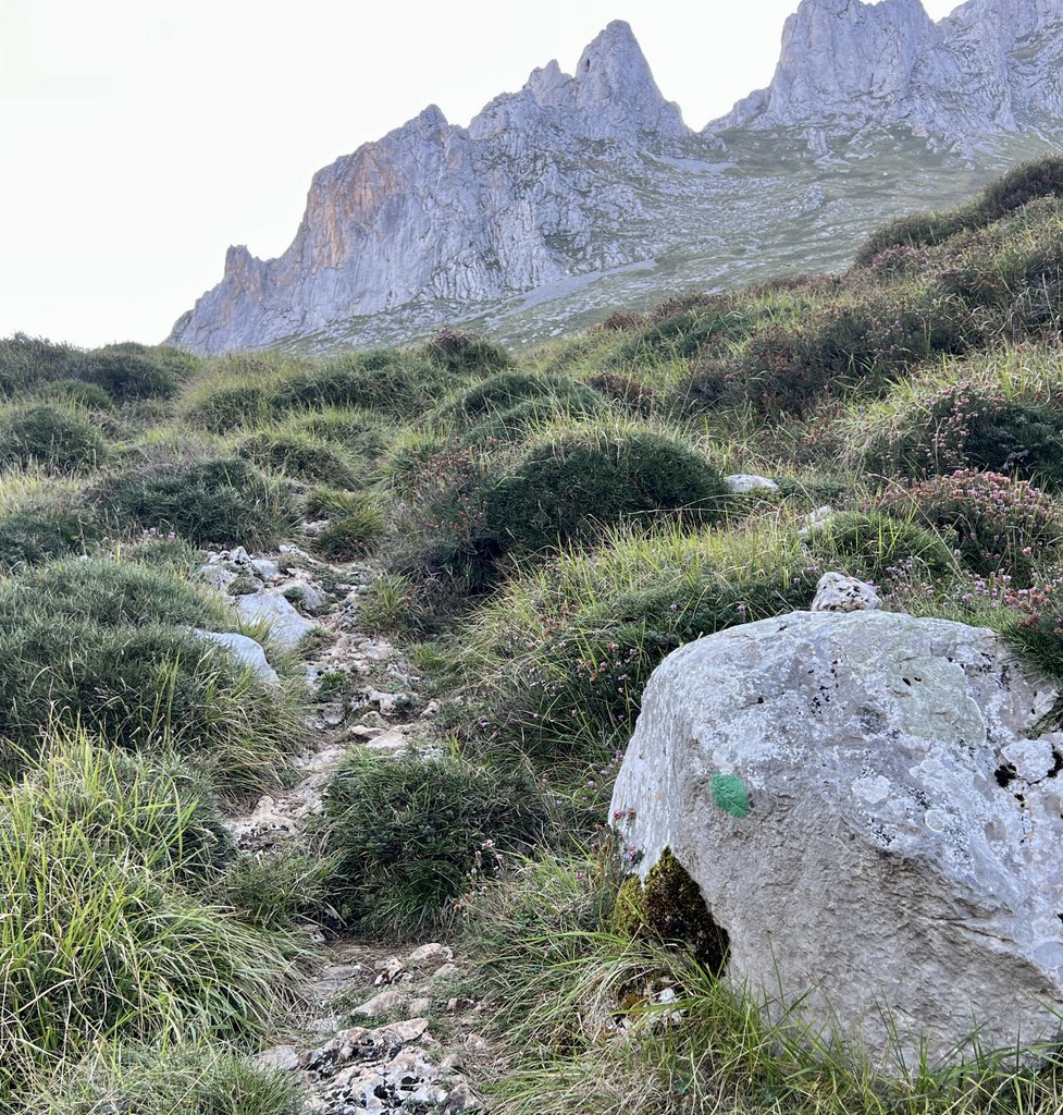
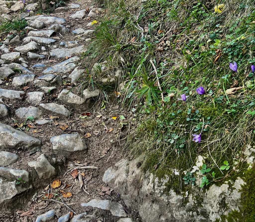
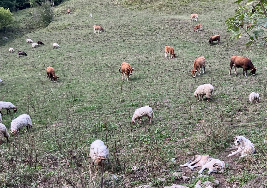
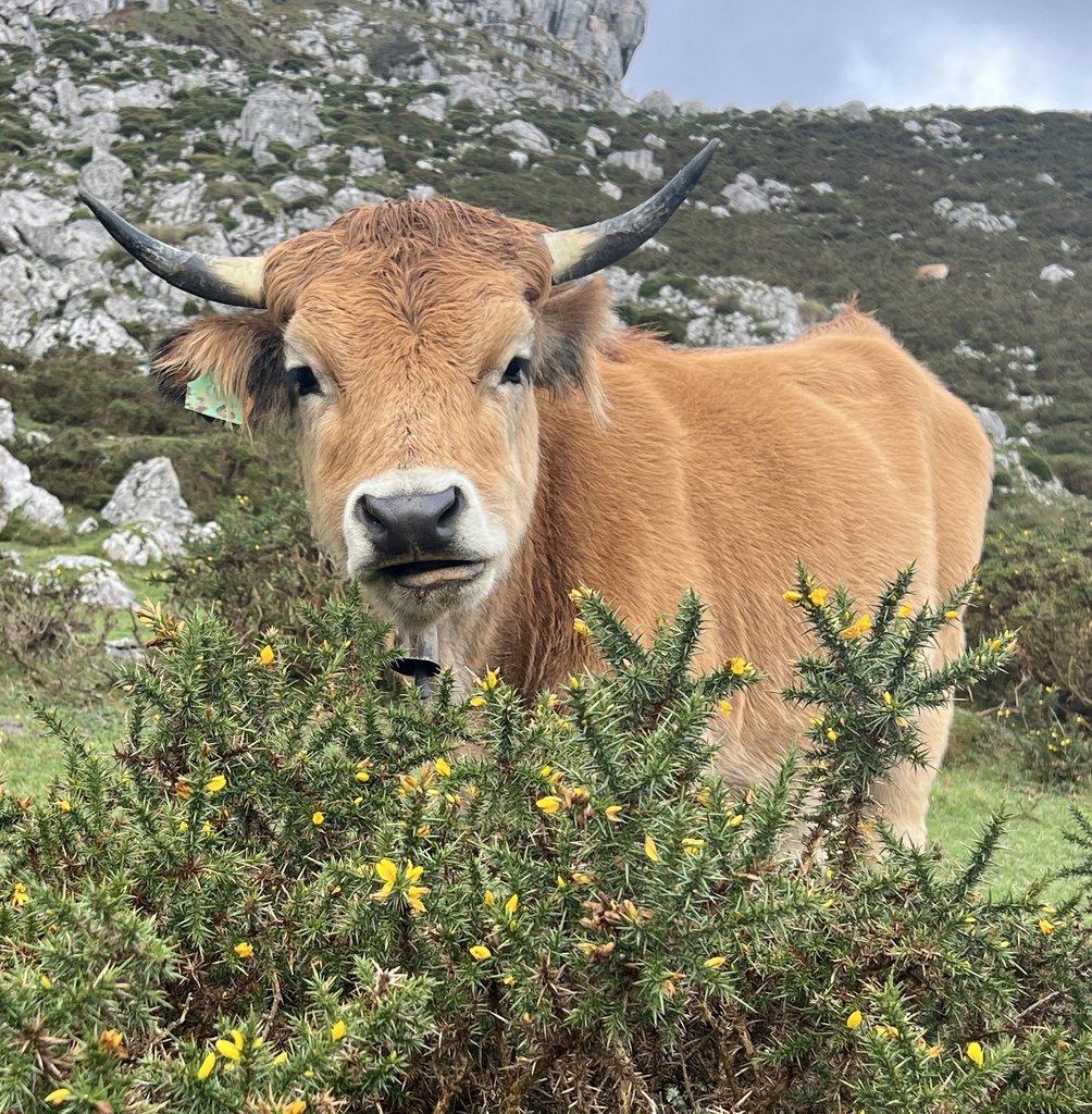
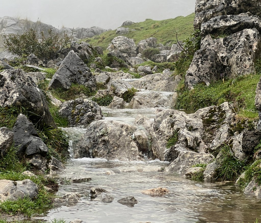
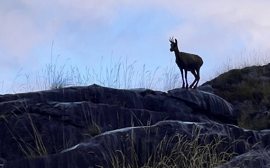
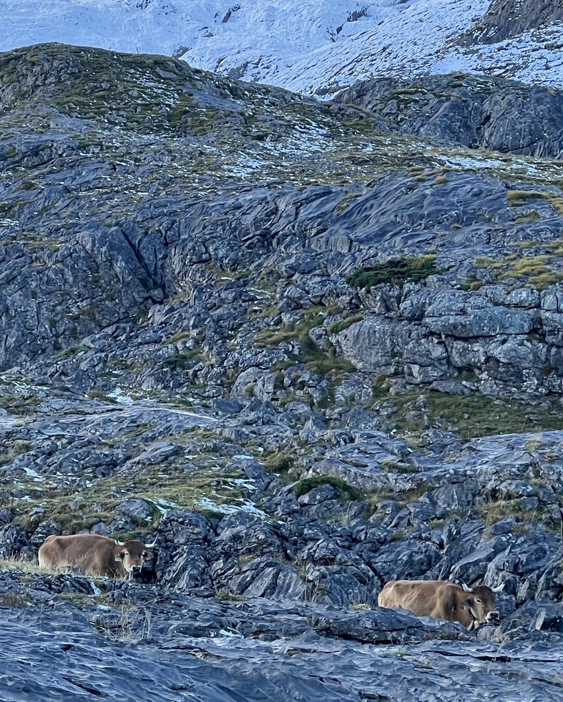
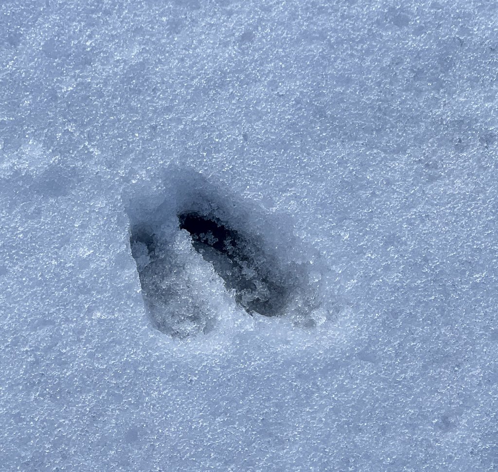
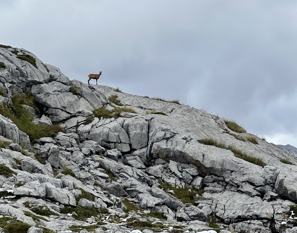
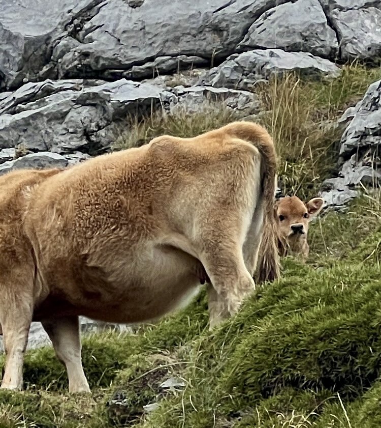
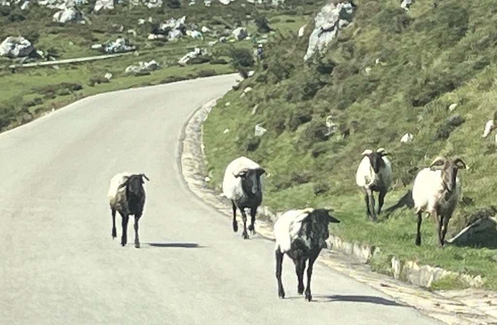
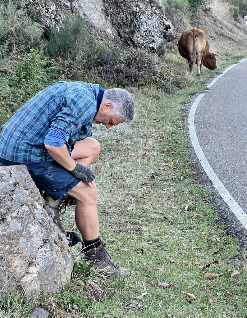
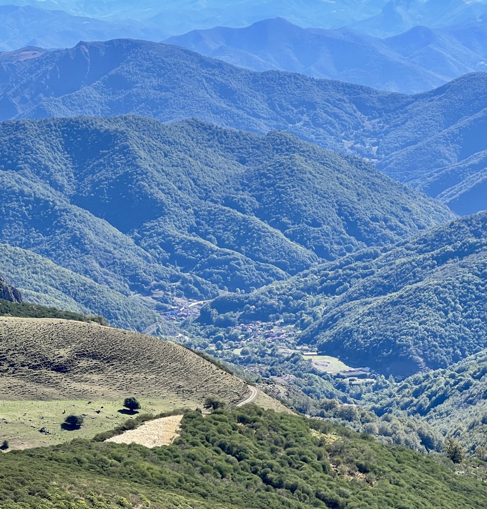
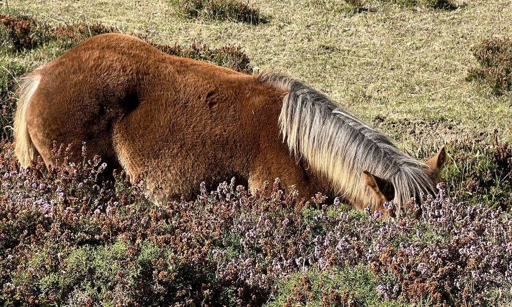
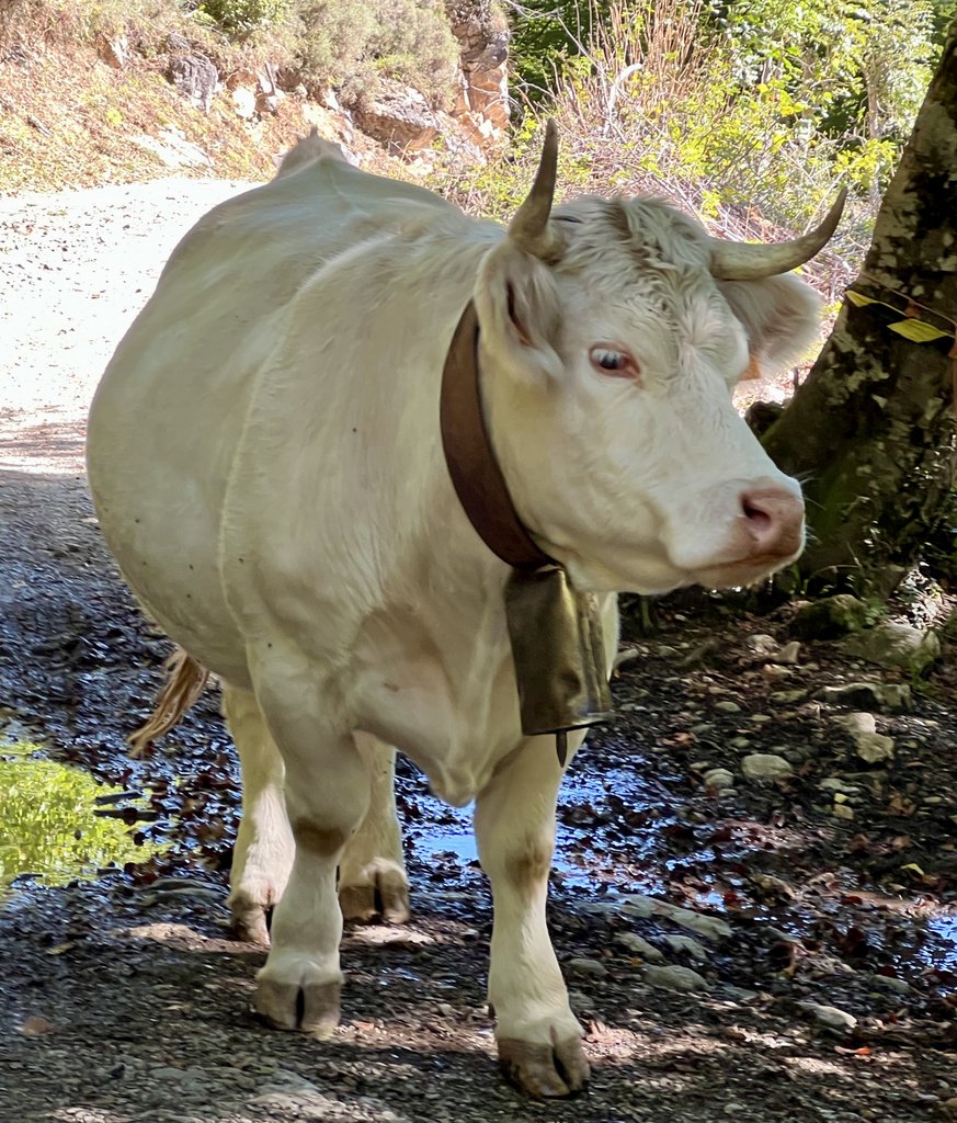
For several miles, we followed the GR 202 track, a 4×4 capable road that went to Sotres. The GR stands for Gran Recorrido, a network of marked long-distance hiking paths throughout Europe. It took us through the herd of cows shown below, including some calves. There were also some chamois deer nearby, which a farmer appeared to feed, and whose hide is used to make chamois leather. We would see cows and deer throughout our trek.

Our plan for this day had been to hike 7.5 miles from the top of the cable car to a saddle on a ridge high above the trail on the right. This had been Harmen’s suggestion. As we approached the turn off the main trail, we realized that we had neither the time nor energy to climb to the top of the imposing ridge to make camp. We had had a late start, waiting for the cable car that we did not take. We’d also had a longer walk, and were struggling in the heat. We started looking for a suitable campsite and found an area of grass just large enough. We could collect water from a river, though it was within sight of the road while away from a village below. As our original plan was to camp near refuges or high in the mountains, I had forgotten the rule that camping was not allowed below 1600m, which prohibited this site. In our ignorance, we followed the wild-camping guidance of not setting up the tent until one hour before sunset.
Link to my journal entry from Day 1, as dictated to Siri (click to expand)
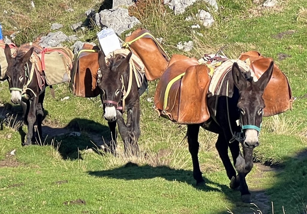
Had a reasonable night sleep in the campground though I thought the lights were a bit bright and there was a lot of cowbell noise and an owl, some screaming cats and maybe some dogs. Sunrise at about 8 AM which sounds late but even though we’re one hour ahead of UK , our latitude is 4° west. We picked up the two loaves of bread that we had ordered and immediately realized it was too much and gave one to the young British family camping next to us. The campsites café served breakfast a little after nine and we enjoyed a coffee and a croissant/potato and egg thing which got us ready for the day. We were both a bit stressed out by our final packing. We loaded our completed packs in the car, drove down to the cable car parking lot, and headed to the bottom of the cable car at least 20 minutes before the first car at 10 AM. There was a long line of people and we noticed no one was queuing up to get a ticket. I overheard someone saying something about tickets and I quickly learned from them that most tickets were already sold out until at least noon and you could only buy tickets on-line 24 hours in advance. We didn’t fancy hanging around for at least two hours. We knew we were not going to try the path straight up the mountain that we had done a warm-up on the day before but we’d seen several signs and noticeboards talking about the PR-PNPE 24 Trail that went from the bottom of the cable car to the top of the mountain and Hotel Aliva, via a somewhat roundabout route, but on a well defined and gradual path. We started walking at about 10am and very much enjoyed the first hour or two in shade caused by a combination of the trees we walked under and the mountains hiding the sun. Much of the walking was through fields of cows and horses. It was a bit of a climb, but not too bad. After 2 to 3 hours, we climbed above tree line and it started getting quite hot. I thought the map was suggesting that it was going to be level, but we still went up and down quite a bit. Our walking trail joined a road that went to the Hotel Aliva and at first it seemed a good idea, but then the rough rocks that was the bed of the road became quite slippery and loose, and it became a pretty long hard walk. We started seeing people overtaking us. At first, there were about three or four couples and a guy by himself with daypacks. Then probably 20 to 30 people passed coming down, most probably having taken the cable car up the hill, maybe the 10 o’clock ride maybe the 12 o’clock ride. We filtered some water before we really needed so that I could demonstrate my system to James and put his mind at rest. We munched a little bit on the loaf of bread that we had and it was good to get rid of some weight. The trail left the road for a while and we enjoyed the more pleasant walking through grass and lots of cows and then we joined the road as it went downhill with a steep slope down to the River Duje on the left-hand side. We passed some interesting structures ranging from a church to various cattle structures and a possible tiny refuge as well as lots of fences to separate the animals. There was also some traffic on this road, both four-wheel-drive cars, normal cars, motorbikes, and even some regular bikes. After about 9 miles of walking, we started looking for a place to stop while aligning what we could see on the ground with my paper map and the map on my phone. We knew we were approaching a small group of buildings and where we were going to head up the mountain off the road tomorrow and started looking for a campsite. Once the small group of buildings came into view, we realized that this flat bit of ground next to them was heavily populated by cattle. Before descending down to the buildings, we found a flat piece of land that was just big enough, looking down on the buildings and not far from a river that was barely flowing. The river had nice large pools of cool clear water. We chose this as our campsite at about 4 PM. The sun was strong. We managed to find some shade and filter some water, drinking lots to catch up with any lack of drinking earlier in the day. At about six, we cooked dinner. Then, a large group of motorcyclists came along the road and one of them fell off their bike close to our site, but no one bothered us. After a dinner of mac & cheese, raman noodles with leftover bread, and hot chocolate, it was past 730 which gave us the official time of one hour before sunset that we could start setting up our tent. We set the tent up and got ready for bed. The whole evening had worked out very well with no one bothering us. We had found a comfortable campsite and were surrounded by beautiful mountains that changed color as the sun set. There were lots of little birds flying around and a few annoying flies, but we got over that. Just as it was getting dark, a group of donkeys wandered past, probably heading back to their barn. As we go to sleep, we can hear the cowbells from the herd in the valley. Tomorrow’s plan is to head up and over the mountain on our right. It looks like a very scenic and exciting walk but with a climb in the early morning, it should be a lot more pleasant if we complete before the heat. Last night probably got down to about 56°. We think the inside of the tent is maybe a couple of degrees hotter than the outside though during the day, the temps got into the 90s, which was unpleasantly hot. Tomorrow looks like it’ll be very similar but if we can get the climb out of the way early that should be good. There’s a refuge we might catch for lunch then the small town of Sotres then another refuge that might be where we try to get to for dinner after maybe an 11 mile day. Today was 10 miles but with a big climb to begin with, a late start, and still trying to get our walking legs.
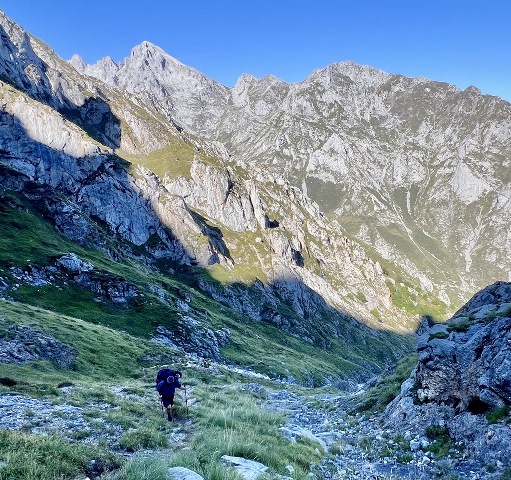
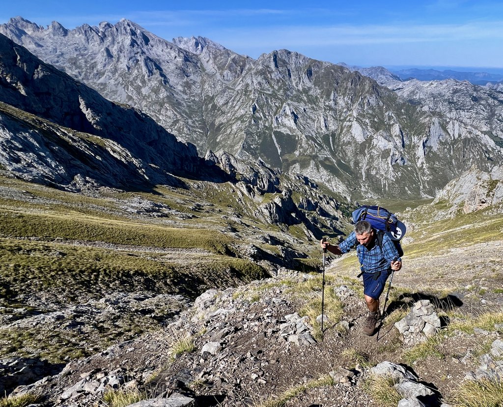
Day 2: Las Vegas de Sotres to Refugio Caseton de Andara via “AP”
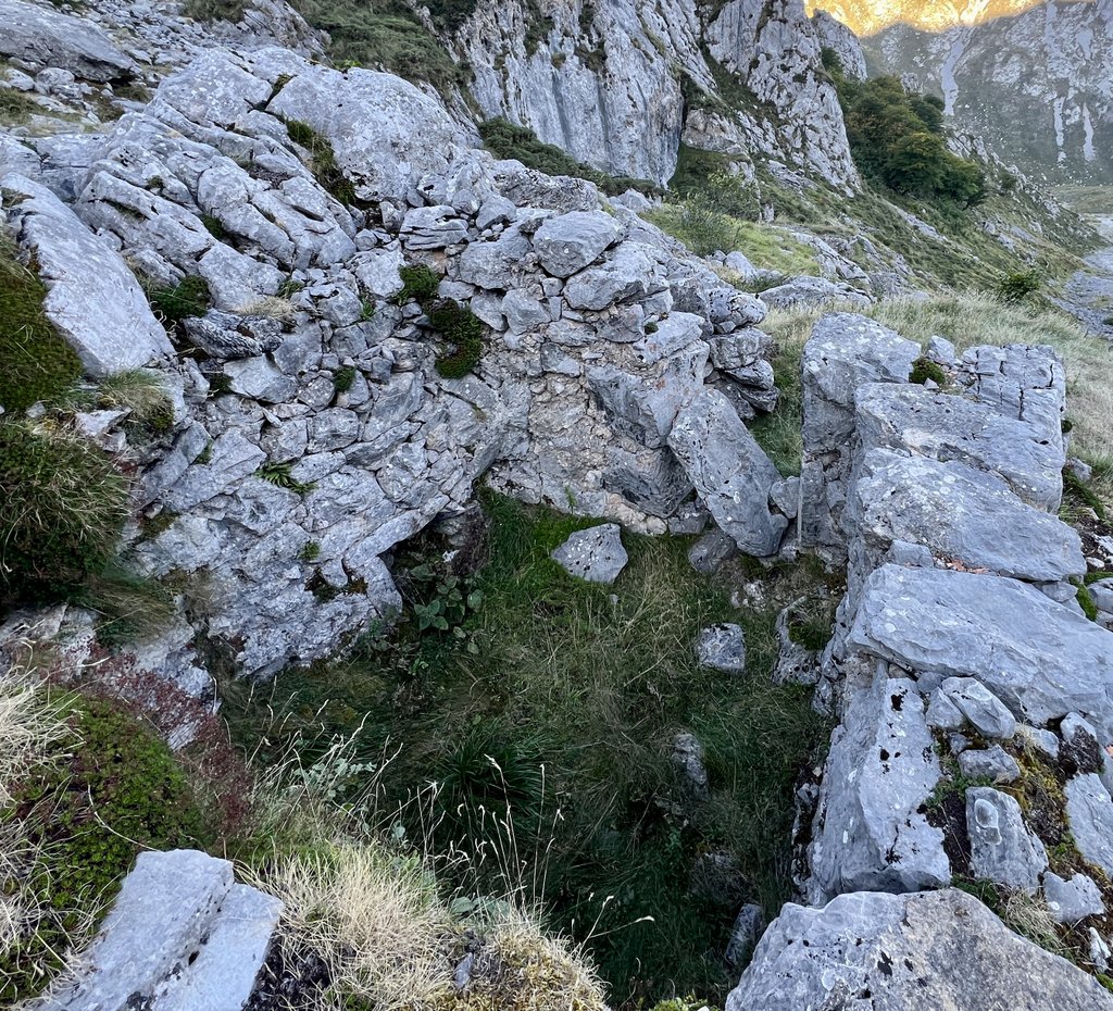
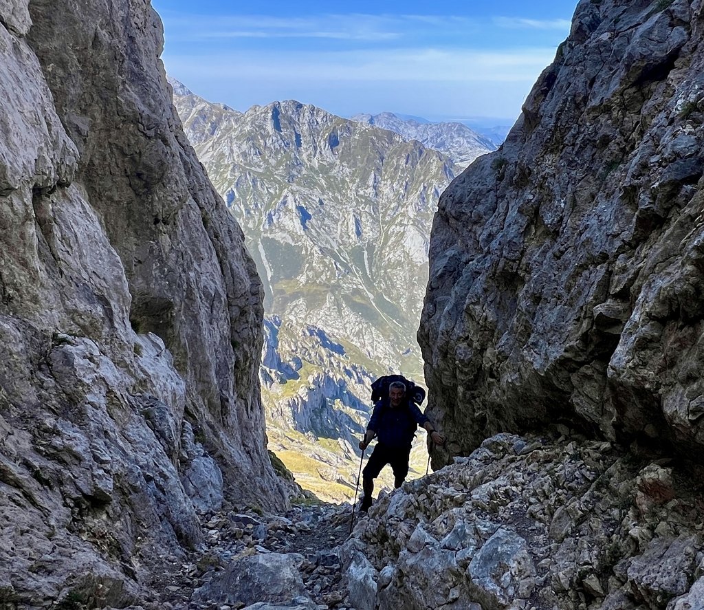
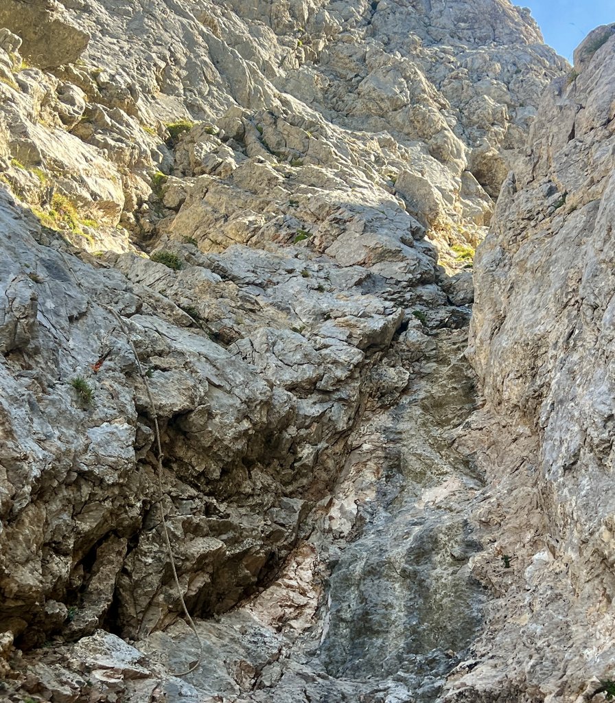
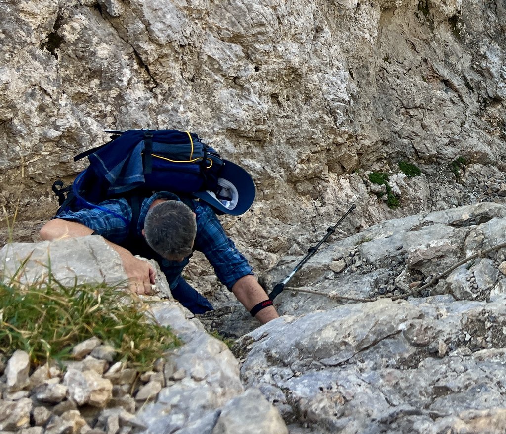
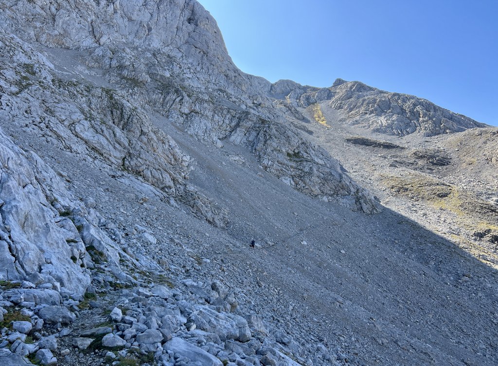
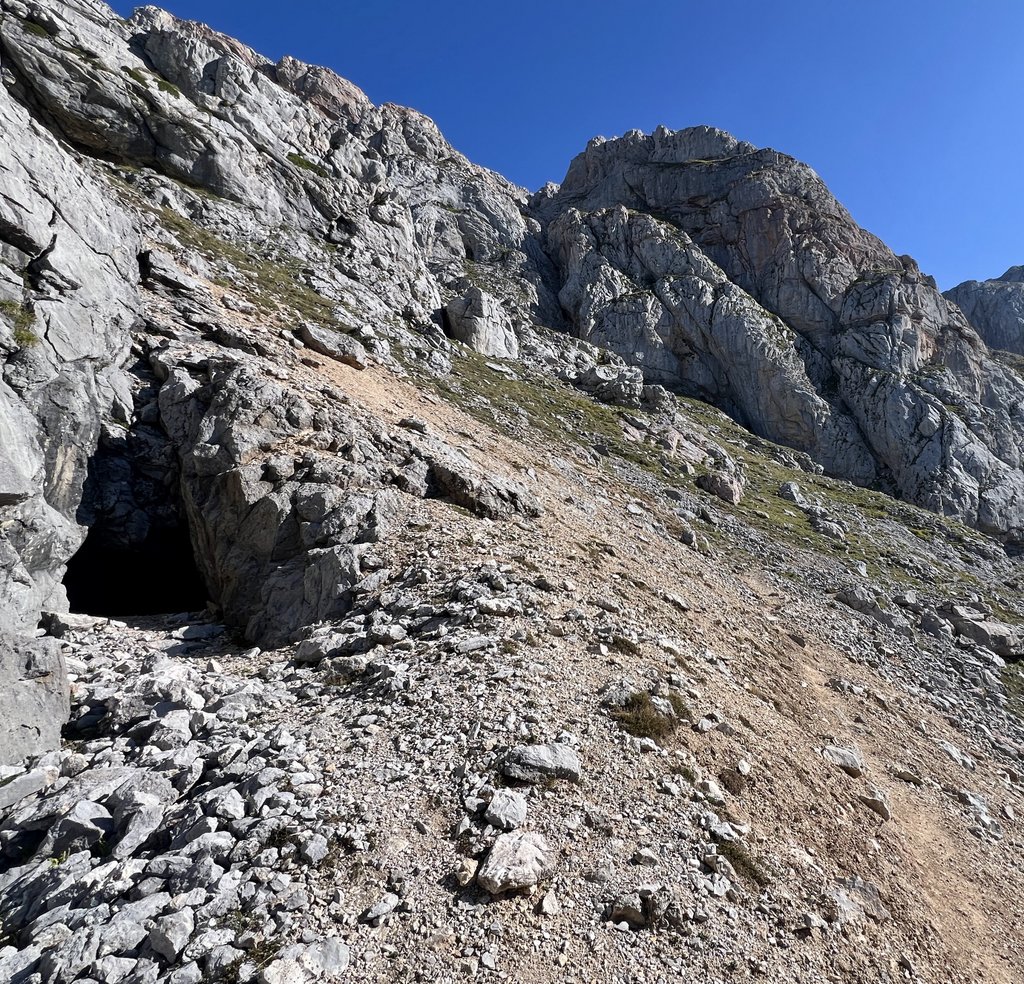
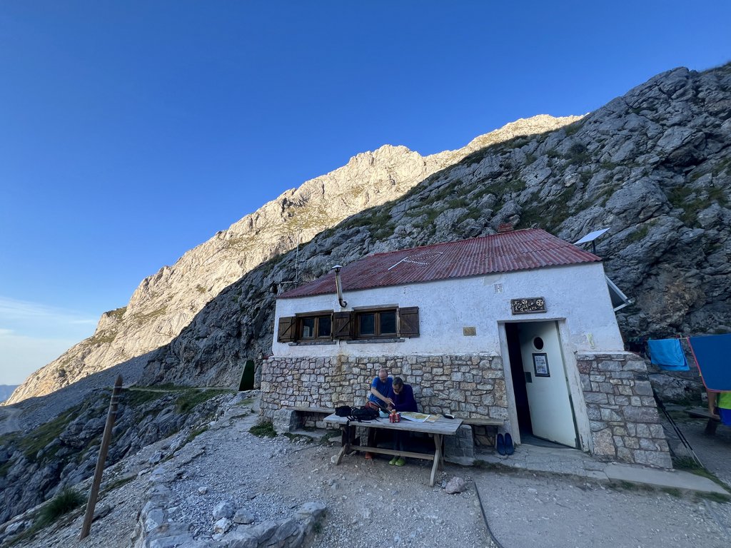
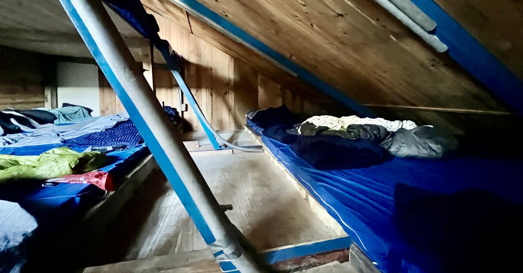
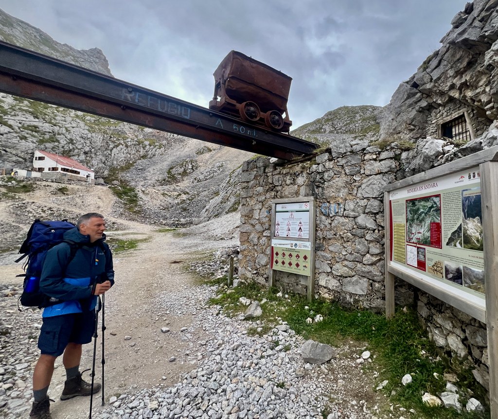
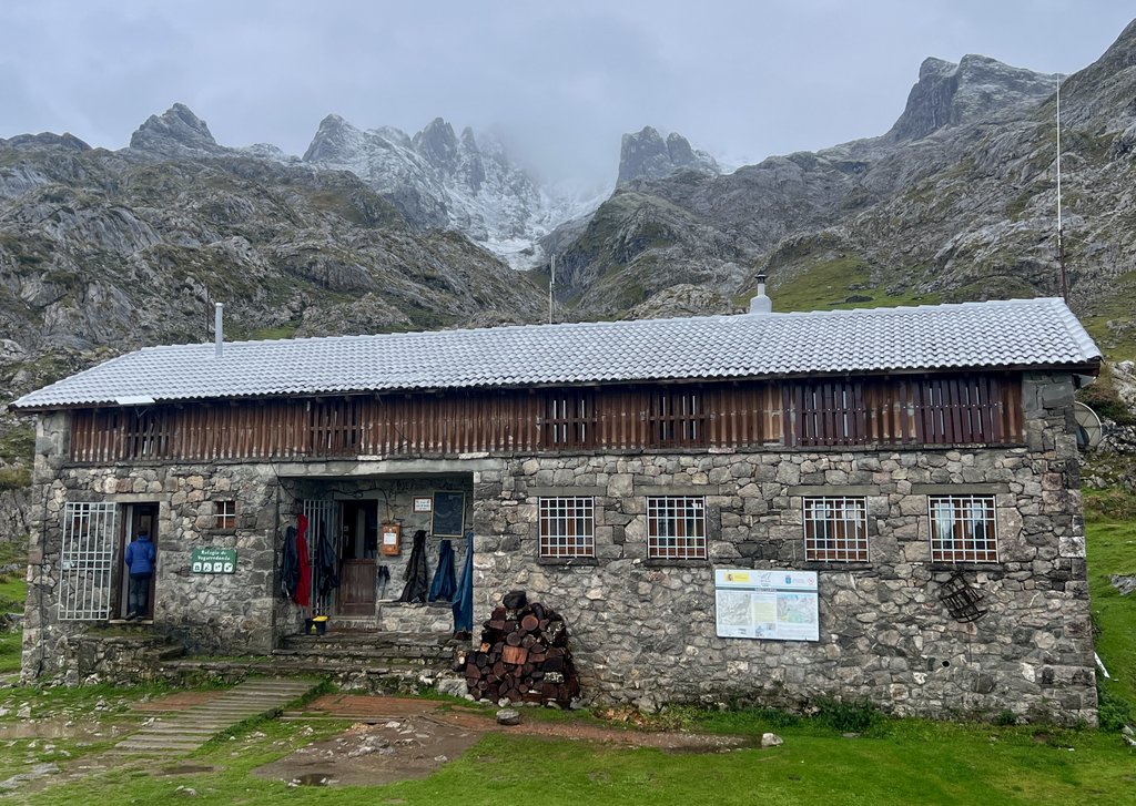
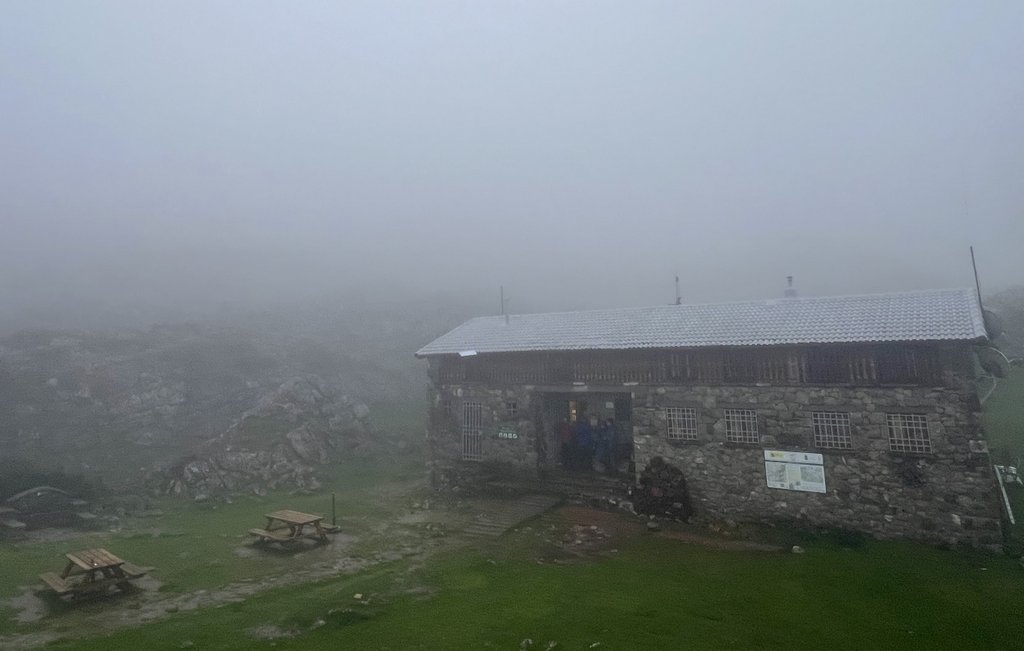
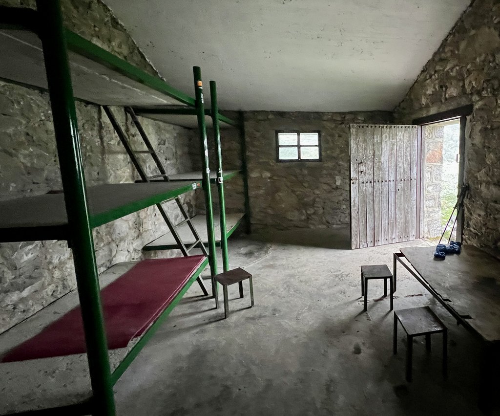
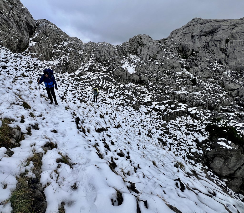
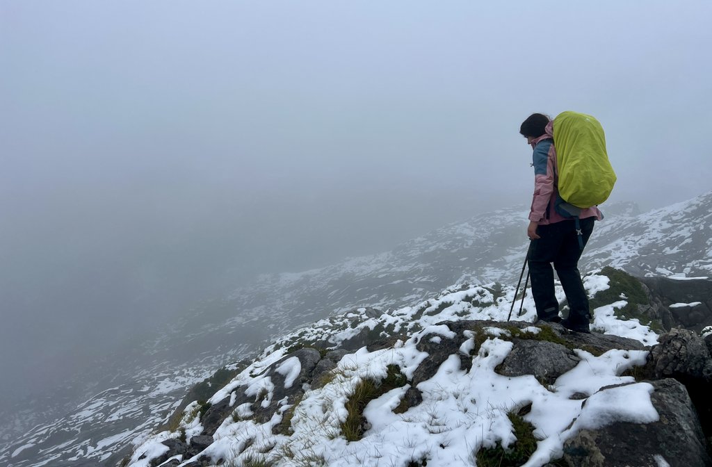
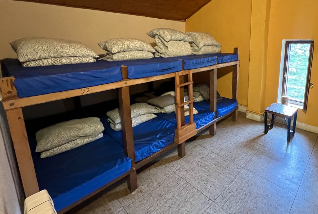
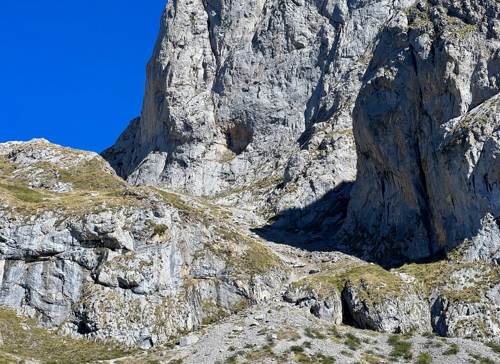
I knew that this was going to be a big day, but not nearly as big as it turned out. Harmen’s guide had said, “Just before the top…you have to climb up a 5m (16ft) wall with a permanent rope attached.” The expected climb of 3,800ft (1,160m) was going to be tough but I’d hiked larger elevation changes in Colorado, Texas, the Grand Canyon, and England’s Lake District. We had had a good night’s sleep, enjoying the clear sky and its stars. After about an hour of climbing, I got the sense that we were making slower progress than I had planned. We were still climbing when the sun rose enough to make it hot. The trail got steeper and the rock looser. A couple of groups passed us and we realized that our full packs were slowing us down significantly compared to their relatively small packs. Also, the couple of decades in age-difference did not help! Once we made it to the wall with the rope, we were tired and hot. A solo Portuguese hiker with a full pack called Pedro, who caught up with us at the rope, helped by taking my pack up the wall and guiding me. James, as a climber, thought he’d be able to manage, but the tiredness and heavy pack made it much more difficult than expected. In addition, there was a significant slope below the rope, and some tough climbing above it. Eventually, we made it past the difficult section, and staggered onto the grassy saddle at the top of the pass. However, it was still a tough hike down across loose rocks and amongst old mining shafts to the Andara refuge where we had planned to have lunch but arrived at the end of a long 8.5 hour day. We were relieved when they gave us the last two beds out of their fifteen capacity, and appreciated the meals, company, toilet, running water, and roof.
We learned that “vegas” means meadows!
Link to my journal entry from Day 2, as dictated to Siri (click to expand)
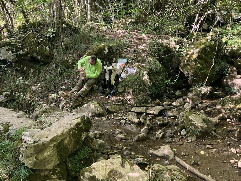
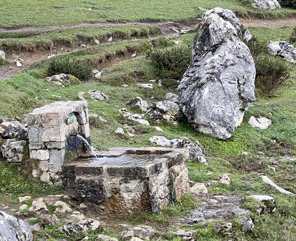
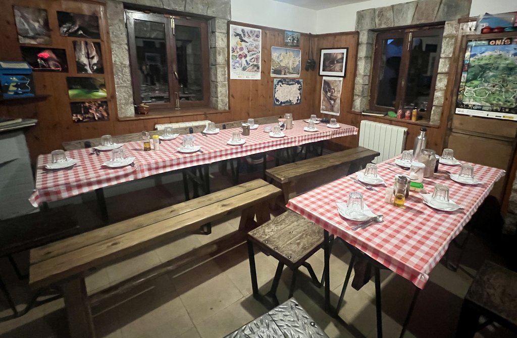
We started at 6:30 AM after a good night sleep and a beautiful starry sky. It took us a total of two hours to pack everything up and make some coffee and porridge. We chose the snacks for the day and then got hiking. It had been an 8 AM sunrise so we could have started earlier but we thought we had plenty of time. We had a pleasant walk along a trail separate from the road. After maybe half a mile, the path started bearing to the right up the hill and we saw green splashes of paint for a short distance. Then they stopped. The climb at first wasn’t too bad, especially as there was no heat, but it was still quite steep and a slog. However, as we got higher, it gradually got steeper and the trail got rougher without any signs on it We were able to make very good progress without getting off trail too many times. Looking up where we were going looked daunting, but we had confidence that, as our trail was labeled “AP” on my map, it wouldn’t be too bad. After about a mile of the expected 2 mile climb, we stopped for our chocolate break and progress had been a little slower than I planned, but I wasn’t too worried. We kept going and the views behind continued to open up amazingly as it got rougher under foot. Maybe sometimes this type of trail is called technical but this wasn’t technical (yet). It was just difficult and loose. There were two or three groups of people who passed us as we climbed, including a group of seven. The path seemed to just get more and more difficult as we got more tired, and then the sun came out. At first, it wasn’t so bad, but of course as it got later and we got higher, the sun got stronger and stronger. Sometimes our trail took us into the shadow of a rock, which was a very pleasant reprieve. As we were walking on a steep slope, our heavy backpacks made us feel a little unsteady, and the hiking poles helped. We noticed that Harmon sometimes took shortcuts which led us to give him the nickname of the mountain goat, supported by the short time he had taken to do this. He seemed to have run up! The other hikers who over took us had daypacks or nothing. As we got closer and closer to the top, it got harder, but we finally passed the final corner through a narrow gap in the rocks to find the steep bit of rock that we were expecting with a rope. As we started trying to get up that section, a very helpful Portuguese guy called Pedro with a full pack of camping gear seemed to run up the rock and then picked up my pack and placed it on the top with my poles. I was then able to climb up. James felt confident that he was able to climb with his pack, and had been talking about his rock climbing experience. Pedro called back checking that we were OK and we confirmed that we were and would see him at the refuge. Until that point, I had not realized that we’d only make it as far as the refuge today. James tried to climb the rope one time with his backpack and hiking poles and quickly aborted. Then he put his poles in his pack, passed his pack up to me using the rope, and ascended this sectino. With James up the rope, our first thought was that we had climbed the worst part. However, as I went up the next section, I realized it was almost as difficult as the rope section with several hairy reaches with hands and foot holds without a helpful rope. I threw my poles up and managed to climb to the top. James followed, hampered by a combination of tiredness and heat. At one point, I tried to help him up over one section, but just ended up being in the way. We persevered and managed to get up with a bit more scrambling. After that very difficult section, we made it to the top of the col where there was a very pleasant grassy saddle that we lay on and enjoyed the views. Looking down the other side, we could not see where the trail was going, but after about a half hour rest, we started going down. We were disappointed that there was mile upon mile of loose gravel on a steep, sloping path, slipping side to side. And the sun just got hotter and hotter. We ran out of water, got more tired, and the trail just seems to go on forever. As per the plan, we were supposed to pass a refuge after a total of 5 miles but my watch passed 7 miles, 8 miles, 9 miles, 10 miles. We were both exhausted. Finally, we arrived at a point where we could see the refuge. It was another very difficult walk down to the refuge on a slippery rough path that was not fun. But we got down to the refuge and were able to secure the last two beds that were available and get dinner and breakfast ordered. The bed was a mattress on the floor in the attic of the refuge with about 15 other people and we will see how that goes. But it was still great to know that we had a roof and then enjoyed the fine dinner of lentil soup, and chicken and potatoes, and a vanilla pudding. Down the hill from the refuge was a water tap which was very welcome except for the walk down and back up to the refuge on a loose gravel path. There was also a toilet, which, even though it was just a hole in the ground (squattie), was clean and pleasant. We don’t have to dig hole! A bonus was an electric plug to top up the charge on our devices, powered by solar panels. On arrival we sunk down a couple of orange sodas along with the water and talked to Pedro from Portugal (who camped close to the refuge), and a couple from Scotland to try to understand more about how we had assessed the days so incorrectly. Pedro confirmed that it was much harder than he had expected as well and later spoke to the group of seven hikers who seemed very experienced and they said that other places like that could be expected in the Picos. Pedro had been hiking for a couple of days, and had camped by a refuge and then got a bit lost and ended up camping somewhere else, but had enjoyed good meals at each refugee and recommended Refugio Collado Jermoso. He confirmed his understanding of the rule that wild camping was only allowed above 1600m.
Day 3: Refugio Caseton de Andara to Bulnes via Sotres on PR 28, PR 20, and GR 202.
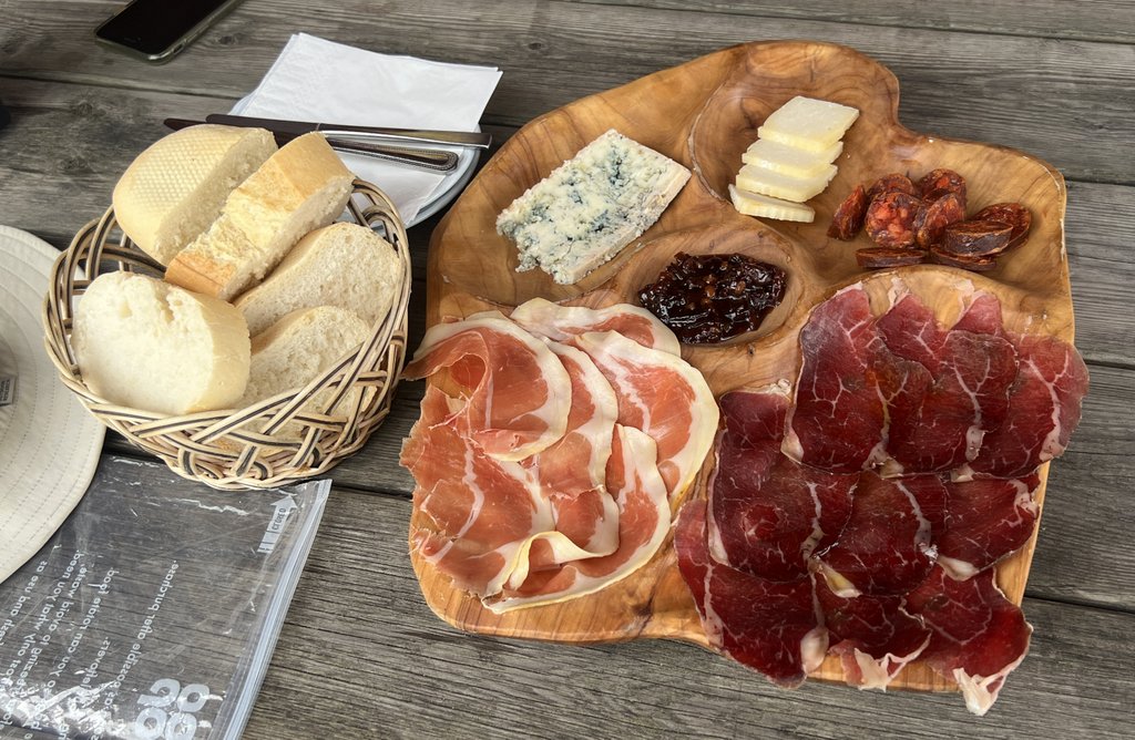
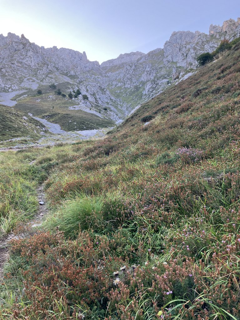
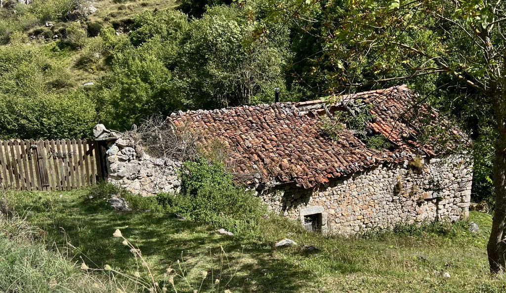
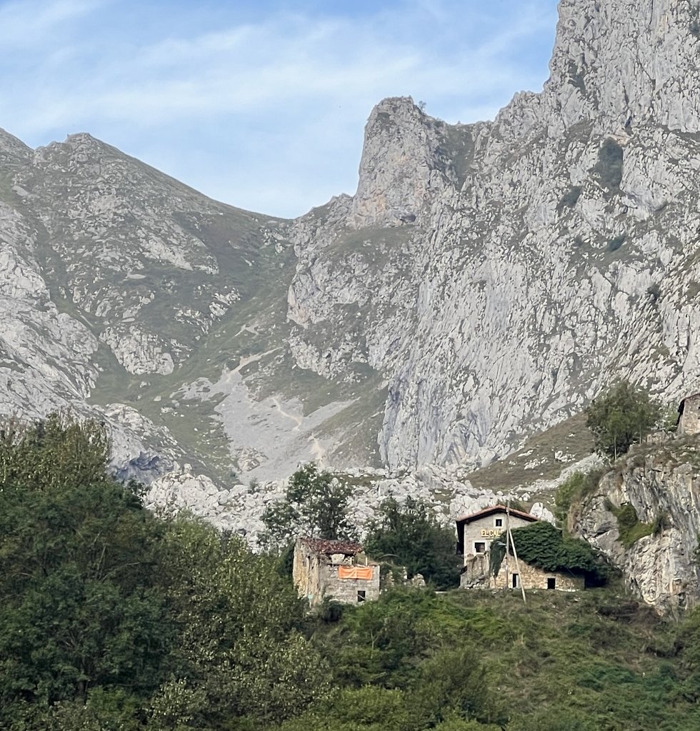
After two long, hard days with many surprises, we were thankful for our Day 3 to start easily. We had slept well in the refuge, despite being crammed in with lots of strangers. A rainy front had come through overnight, bringing down the morning temperature, and we headed out after the last shower. The initial descent emphasized the area’s mining heritage, but we were soon into pastureland. Our route changed from road to a trail and we enjoyed the shady trees and green views which reminded us of Day 1. We descended into Sotres after about five miles. It was too early for lunch (at noon!) but we could get a meat and cheese platter which was perfect. On reviewing the plan, we were about halfway to Bulnes, our destination for the day, but I had made two mistakes. First, I had thought that our trail from Sotres to Bulnes was “basically flat,” but was very wrong! While there was a steady climb followed by a steady descent, I had missed a deep valley on leaving Sotres. The valley was scenic but the climb out was hot, especially after lunch! On the high point at Collado Pandebano, we could see the official AP route going left up the mountain towards the refuges of Terenosa, Vega de Urriellu, and Jou de Los Cabrones. Our original plan was to walk this route and onwards to Bulnes, but there were suggestions that the path down to Bulnes had dangerous bits in it (like Day 2). We were already behind our plan, so aimed directly for Bulnes to catch up. After passing the high point, the trail became very slippery rocks, with a river sometimes running in the trail. The sound of cows welcomed us to the outskirts of town, though none of the businesses did! On arrival in the picturesque village, we tried to ask questions in the restaurants, but were treated very coldly. We discovered my second mistake of the day, that I had misread the map and the campsite we were aiming for was actually an albergue (hostel), which was closed. I tried to ask for help from five establishments to no avail. We assumed that they must get so many tourists every day and are fed up. Previous research had suggested a possible room at a hotel in Upper Bulnes, so as our last ditch attempt to find somewhere to stay, we slogged up 600m (2000ft) to El Caleyon. James had practiced his best Spanish, and while they were full, the proprietor pointed out a piece of grass in front of an abandoned house that we could pitch our tent on. We were very thankful as we fixed dinner and watched the farmers and their dogs drive the cows and sheep down the field above us to pasture close to the buildings. When James returned to the restaurant to get water, he met Pedro, who had booked the last available bed earlier. As the sun set, we heard the shouting match between the dogs and wolves. As I lay in the tent that night, I was in awe at the variety of experiences over the last three days. We were exhausted but had had a unique adventure. We had decided that the following day would be a “zero” and we would reassess the remainder of the trip, but that night, we reflected on how we had enjoyed the finest of the Picos.
I noticed the green saddle beyond the town. At the time, I wasn’t certain, but it was the route that we took out of town to get to Bulnes, our next destination.
Sound on!
As darkness fell, we heard the dogs gathering the cows and sheep, while barking at wolves. For the last quarter of the clip, the brightness is adjusted and you can see the cows and sheep in the field.

Thus ended a most remarkable three days.
Link to my journal entry from Day 3, as dictated to Siri (click to expand)
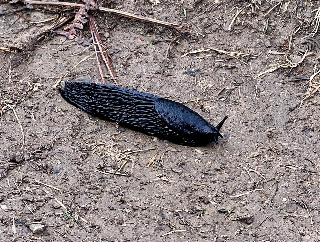
Slept surprisingly well in the refuge, despite lots of other bodies close by and various movement. I didn’t get up at all in the night, but James did and struggled with a sliding door in the darkness to get out! Up for breakfast at 7:30, which was lots of coffee with some bread, biscuits, and muffins, but neither of us could be bothered trying to peel an orange. Quite a lot of faffing trying to rearrange packs. Just as we were ready to leave, it started raining quite hard so we rushed inside with two other couples who also hadn’t left yet. The rain was brief and we were soon on our way filling up our water bottles and reading an information board about the history of mining in the region going back to the 1850s. It was an easy walk gradually downhill on a smooth road surface and it was cloudy so it wasn’t too hot. Soon we dropped below the desolateness that we had called Mordor and green returned on the pastures and with it a bunch of cows and some parked RVs. Horses too. We watched a local Basque farmer gathering his animals with his car and do various tasks. About halfway down the 5 miles, we left the road following a GR trail on an old track that was even more pleasant with shade trees and an even nicer walking surface. The official AP route was shorter and had turned off up a hill at some point which we missed, but we were OK with that and we rejoined it just before entering Sotres. We picked up some cell phone signal on the way into town and it stayed with us in town so we were able to send some check-in messages. At the first bar hotel that we arrived at, we quickly drank two fizzy orange drinks each and ordered an impressive plate of dried meats and cheese, some sweet fig jam and bread. At about 1 o’clock, we were ready to move on again. We passed the group of seven on the way through town. It immediately felt quite a lot hotter and the road walking didn’t help. We had studied the map over lunch and I concluded it was basically flat with an overall decent of 300-400m (1000ft). As we left, we could see the Pandabano saddle across the valley which did turn out to be where we went but we had to drop 300m (1000ft) into that valley before climbing up again in the heat and on dusty roads and then a rocky trail. As we got to the top of that saddle, we saw the trails going left up the mountain towards the refuges that were on the official AP. We heard it might’ve been a relatively low technical climb to the first one. However, we had already bailed on that idea because of our low energy. When we got to the top of the pass, the heat had taken its toll and hiking after a heavy lunch didn’t help. However, after the pass and a brief period of nice trail, it turned very rocky, muddy, and wet. We noticed lots of other people coming in the other direction, obviously day hiking, and only one person overtook us. We noticed that there had been been no other hikers with camping gear. It was a long slog down to Bulnes. We ran out of water, and with maybe only half mile to go, I refilled as I saw a good stream and was very thirsty. We finally made it into Bulnes and it was very strange. Just over the very pretty bridge, there were two or three establishments. They were closing up and were quite dismissive of our questions. One hotel restaurant seemed open, but not helpful. I found another restaurant with no help. Another hotel with a reception doorbell, but no answer. After an abandoned attempt to check out the funicular, which was too far downhill, we headed up the hill for 600m (2000ft) to the upper part of town where there was one last chance hotel that I had noticed on Google maps. On the way up, James practiced his best phrases to ask for a room, or a place to pitch our tiny tent. At the hotel, they were a little dismissive at first, but appeared to warm to the question and James’s asking, and the proprietor showed us a small piece of grass at the entrance to an abandoned falling down house and it was near perfect. Immediately after he had shown us the site, it started raining so we quickly put up the tent, fly-first, to keep everything dry. Fortunately, the rain shower was short and we were soon able to get ourselves properly sorted out. Next stop was dinner using the dry stone wall as a seat and we had beef stroganoff, ramen, and hot chocolate. While we ate, cows, sheep, and dogs in the adjoining field started coming down the hill for the night, making a loud racket. We heard some other animals, causing the dogs to act defensively. Maybe they were wolves which are in the Picos. As we finished up dinner, a dog wandered past and James was good at shooing it away to prevent it eating his boots. It reminded us of the dogs at the Andara refuge that had barked when they saw deer on the mountains after dinner. James went back to the hotel to ask for water and Pedro our saviour was there. This time, the roles were reversed with us camping and Pedro with the hotel. Having let dinner settle, we got into bed in the tent but there was a bright street light above us so we shall see how long that lasts. (It did not turn off, but it did not bother us much). A bunch of kids with their parents walked back down the hill from the restaurant at about 10 after their meal which left everything very peaceful and hopefully ready for a good night sleep. Just before getting into the tent, I spotted two humongous slugs which I moved out of the way. I sincerely hope we don’t stand on one in the middle of the night.
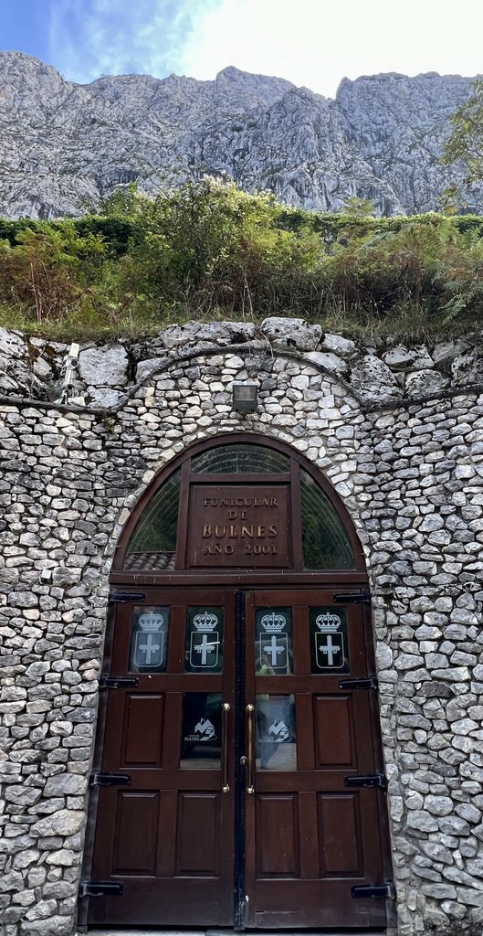
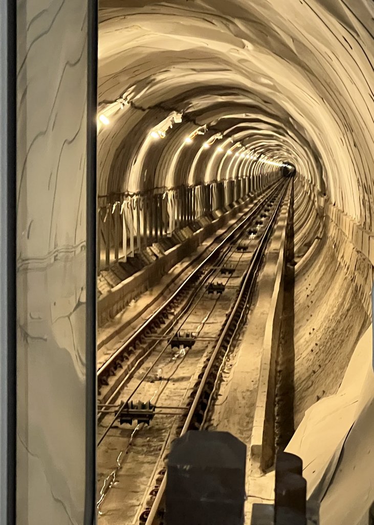
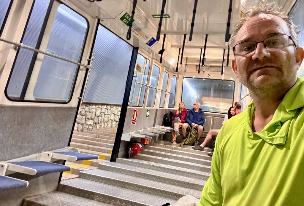
Day 4: Funicular from Bulnes to Poncebos and bus from Poncebos to Arenas
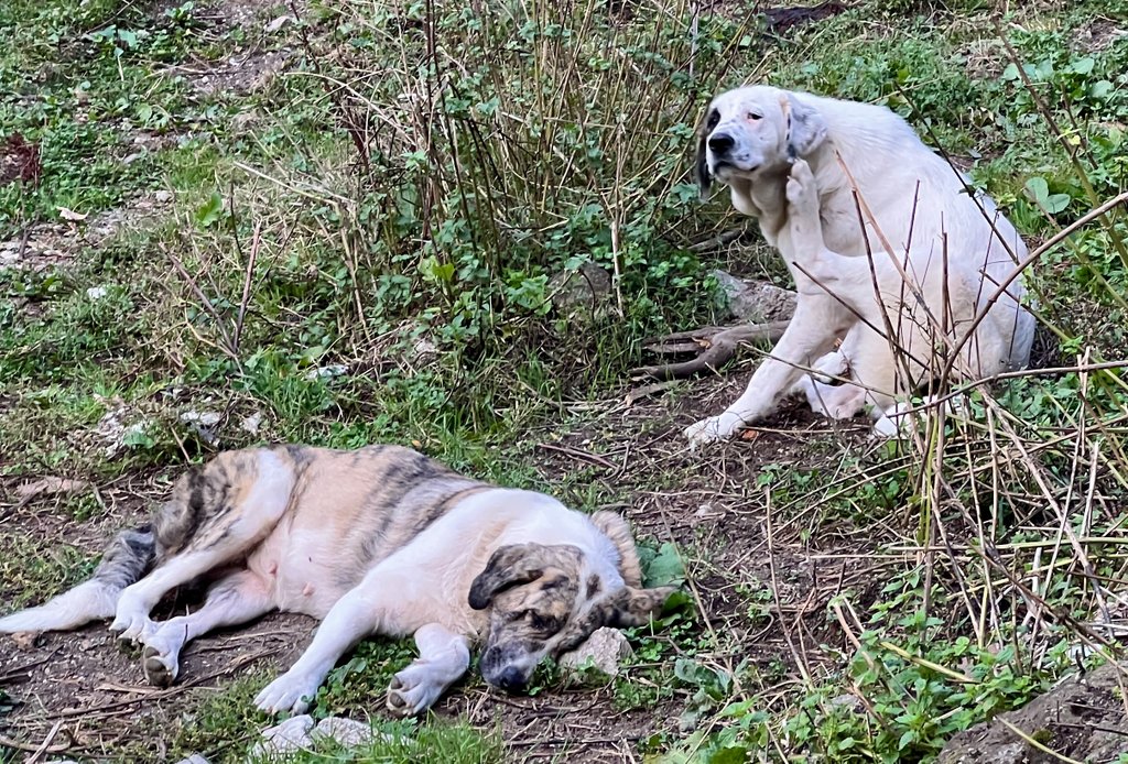
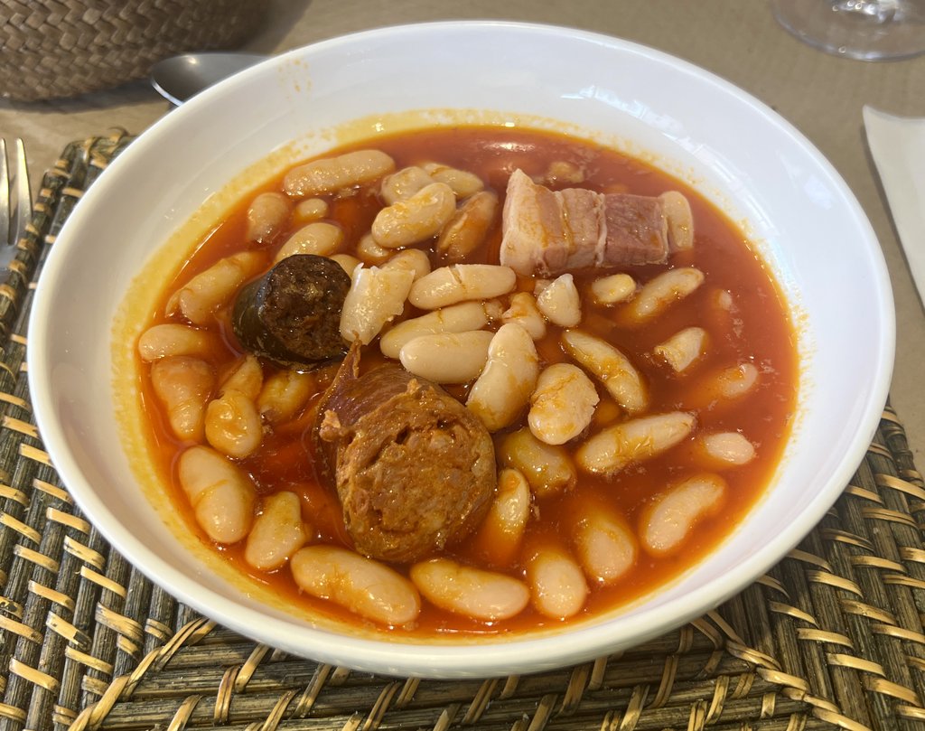
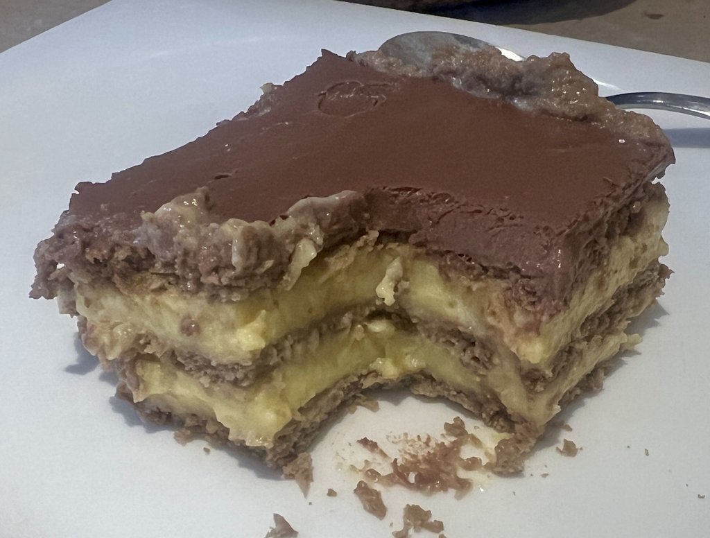
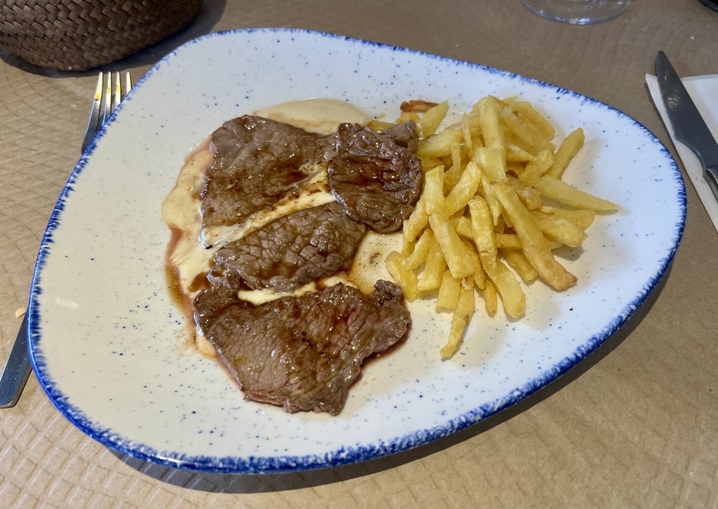
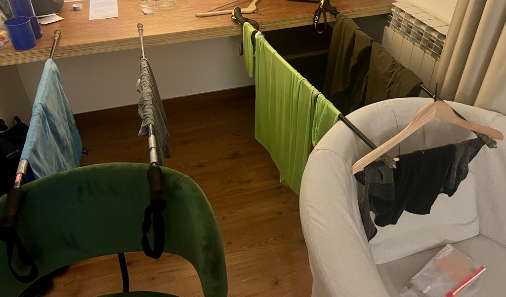
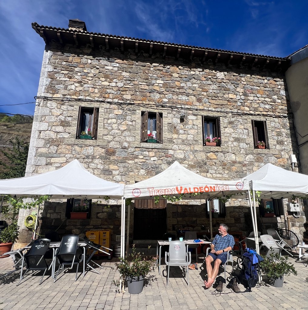
Our Zero day! The first three days of our trek had taken a lot out of us. We needed to rest and revisit our plan to decide what to do next. After breakfast, we packed up our tent just before sheep came to visit and a cow reclaimed her meadow! We took the first funicular from Bolnes to Poncebos at 10am, travelling over a mile in a tunnel carved through the middle of the mountain. The lower funicular terminal was heaving with tourists trying to see some of the Ruta de Cares, the most famous walk in Spain which was partially closed due to recent wildfires and rockfalls. Fortunately, we were going against the flow, and were the only passengers on the free bus to Arenas, the nearest town. After research over a coffee, we booked a room at the Hotel Picos de Europa. While we could not check in, they were extremely welcoming and I made use of a large table in their lounge to assess our options moving forward. We enjoyed local Asturian dishes for lunch and dinner at the Santelmo Restaurante Cafeteria next door, washed clothes, and used our hiking poles as a drying rack. We discussed our options moving forward: go back to the car and day hike, dump our camping gear and focus on refuges, or continue with our “ring” with less aggressive days. After a refreshing lunch, we felt we could continue our “ring”, and looking back, we are so glad that we did. I was able to book us into the Refugio Vegarredonda for the following night and we planned to camp above 1600m after that. We were looking forward to the forecasted lower temperatures, but did not realize quite how much that would impact us. We assessed our food and left excess behind to reduce weight, enjoyed fine hot showers, and made the most of comfortable beds for a restful night’s sleep.
Below are some fun photos of the animals we slept next to!
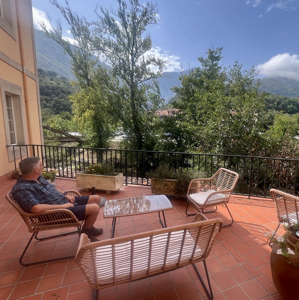
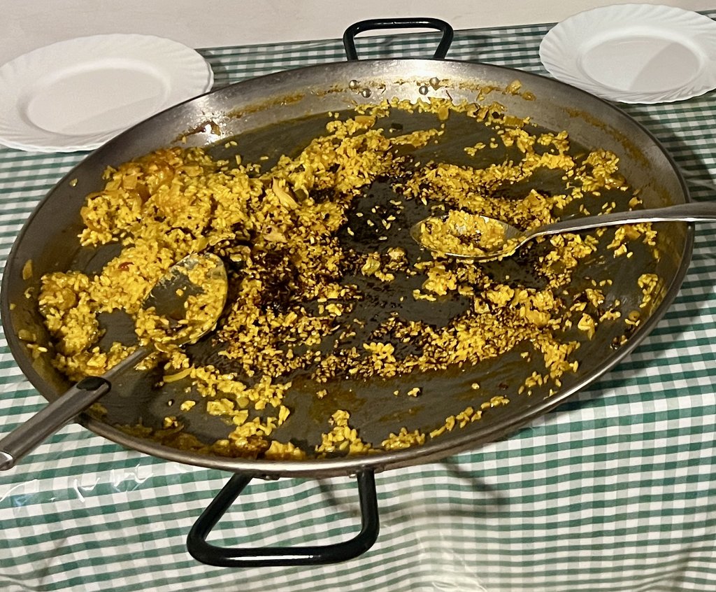
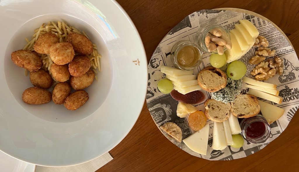
Below is the selection of local food that helped inspire us to continue hiking our ring of the Picos.

After a day of recovery, repacking, and replanning, we were ready for the next stage of our adventure.
Link to my journal entry from Day 4, as dictated to Siri (click to expand)
Woke up leisurely after a good night’s sleep in the tent, even though there had been some rain. Enjoyed breakfast, though James wasn’t feeling the porridge, and we packed up. Just as we were finishing up, some cows showed particular interest in our area and one walked right over where our tent had been. We strolled leisurely down the hill to the funicular station, making the most of this zero day, filling up with water from a spring in town. We caught the first funicular at 10 o’clock and it was a cool 2.2 km tunnel through the middle of the mountain. We went down into the mines of Moria! At the bottom, we found lots of people and cars and a busy car park. We had arrived in tourist central. It was nice to see a bit of the Cares river with the mountains towering above it. We soon worked out that a bus was leaving at 10:30 for Arenas, which was a bigger town where we could find a hotel, taxis and think about what was next for us. We were the only people on the free bus and soon arrived in Arenas. We found a bar for coffee. We did some initial re-planning while remaining uncertain about what to do next, with both of us trying to gauge which option best suited us. Options included going back to the car and reverting to day hikes, or changing strategy and just using refuges with lighter packs, or continuing to backpack with camping gear and use a mixture of refugees and camping. The first order of business was to find a hotel. We found one online and headed over there. Our room wasn’t ready, but they knew we’d booked which was a good sign and I did some initial viability planning of backpacking on a nice big planning table. They were very welcoming. We got our rooms just before two and then headed out for a nice long leisurely Spanish lunch with lots of yummy local dishes. After a long lunch, James realized that the women’s rugby was on which allowed me to plan the logistics and assess the viability of continuing to backpack. I worked out a plan with a couple of options which fit our time constraints. There remained one harder day which we will have to embrace (this was later abandoned due to too much snow). The good news is that it looks like it won’t be as hot but with that comes rain and cold so we will have to see how that goes. I also took a very nice shower and tried to wash all of my dirty clothes, hoping they will dry by morning. After a relaxing afternoon, we headed back to the same restaurant for some more Asturian dishes for dinner before heading back to the room, hanging things to dry, and hopefully having a good night. We’ve heard some thunder and there was heavy rain outside so it was a good night not to be camping. I think it’s a front coming through based on the radar maps and it looks like the temperature will be dropping. We’ve discussed dumping some food to reduce weight. We have to see how that goes. We have a lot of chocolate left. (I was later very glad that I had kept the chocolate!)
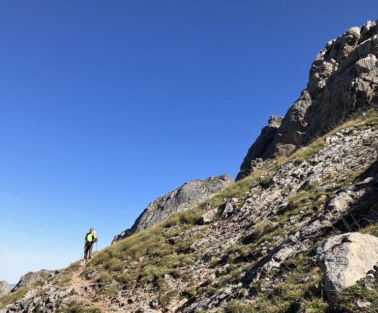
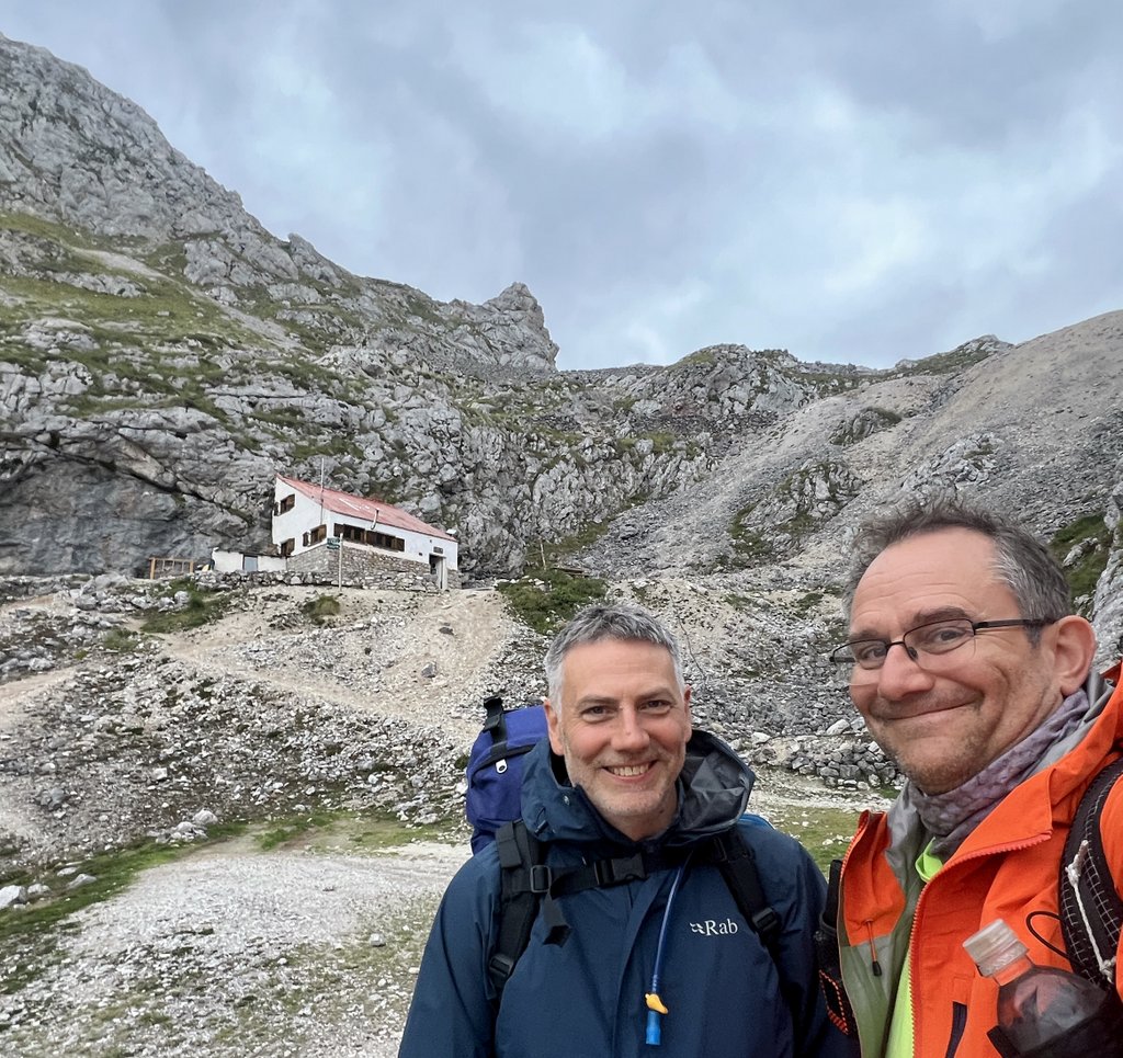
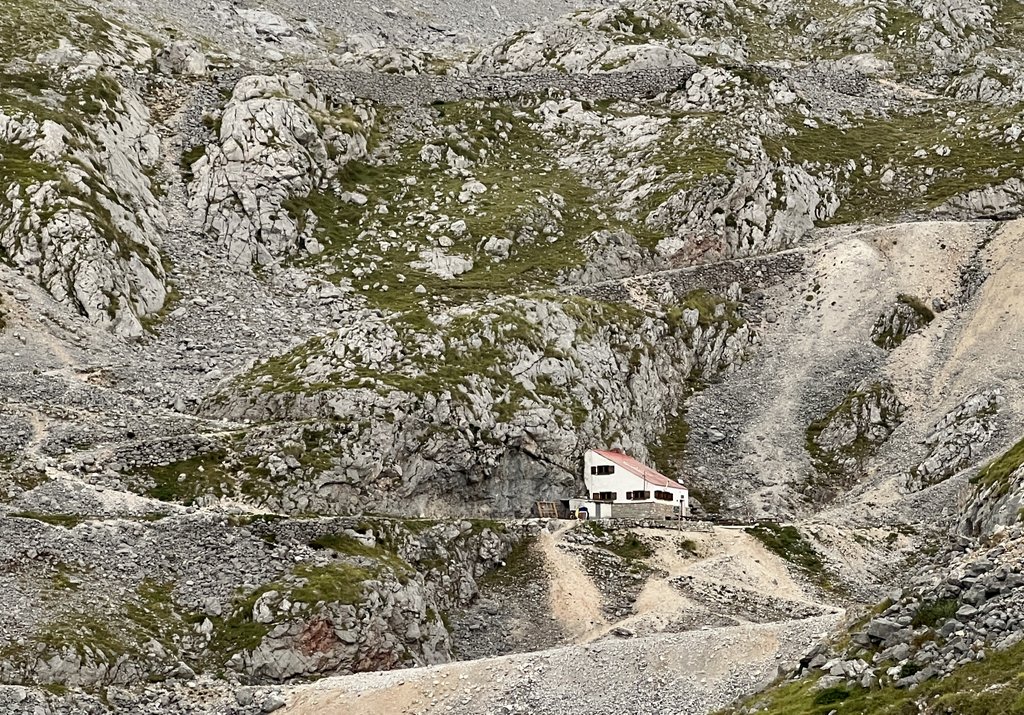
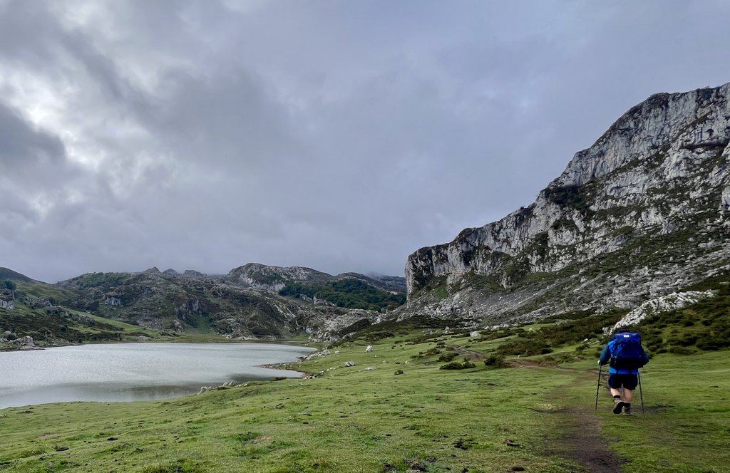
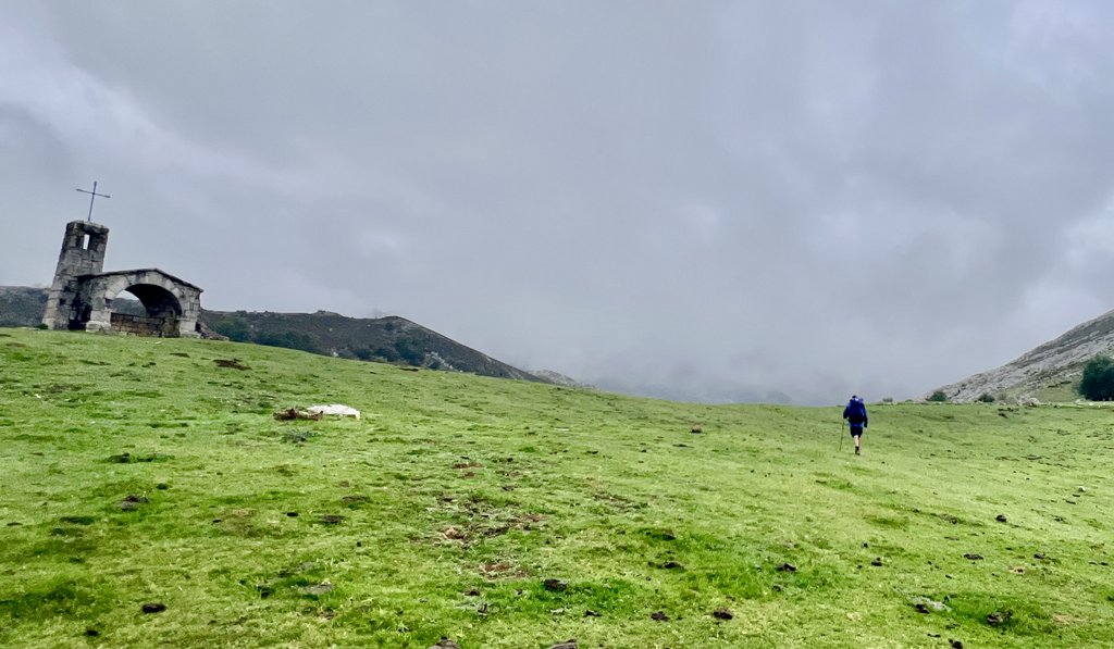
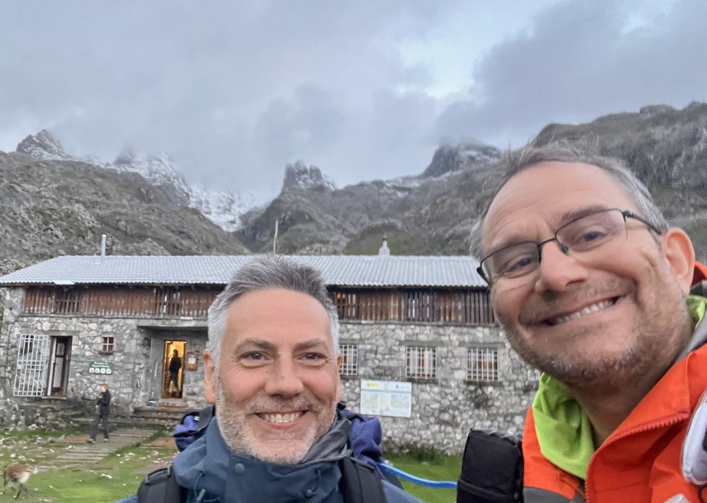
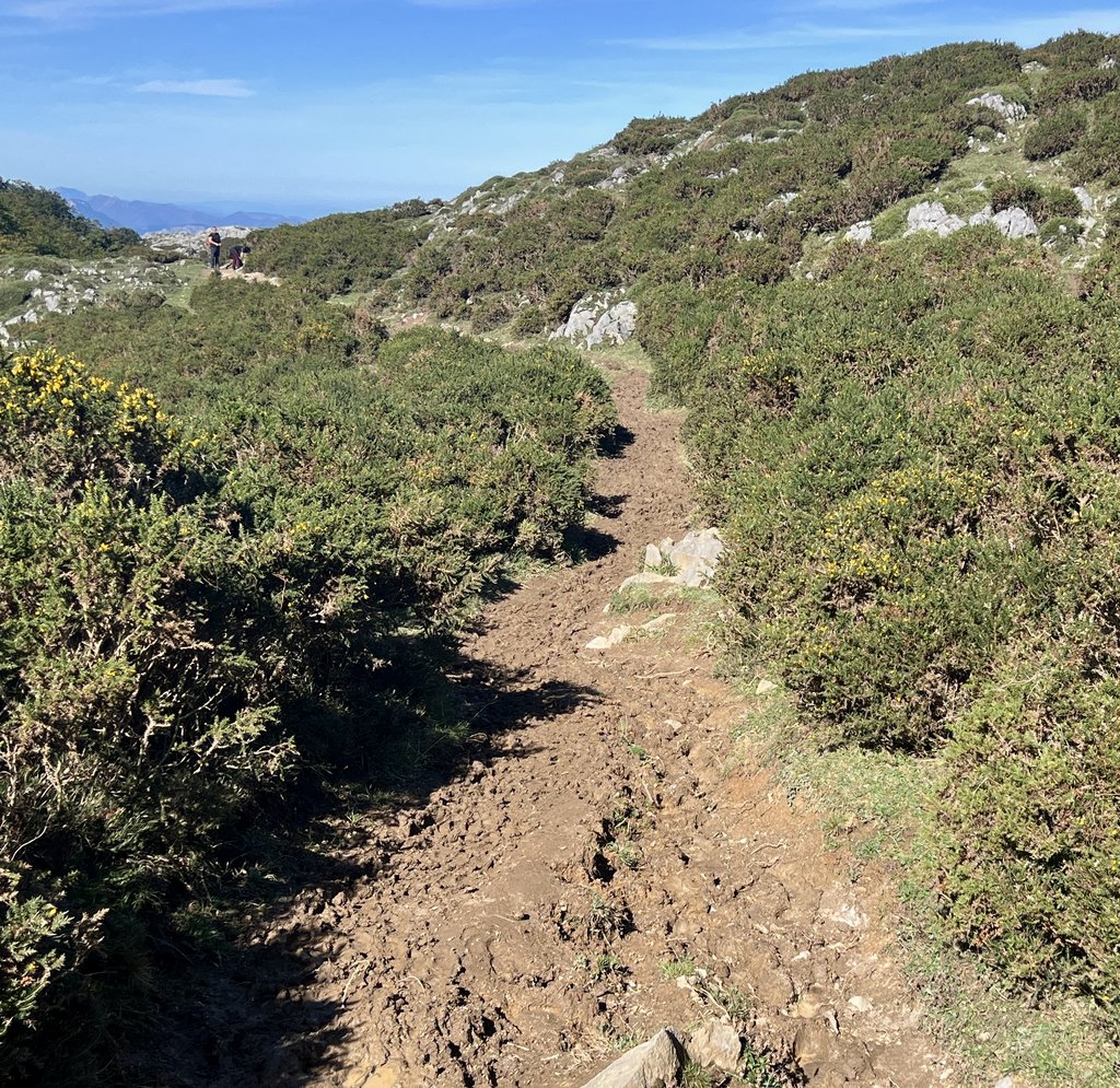
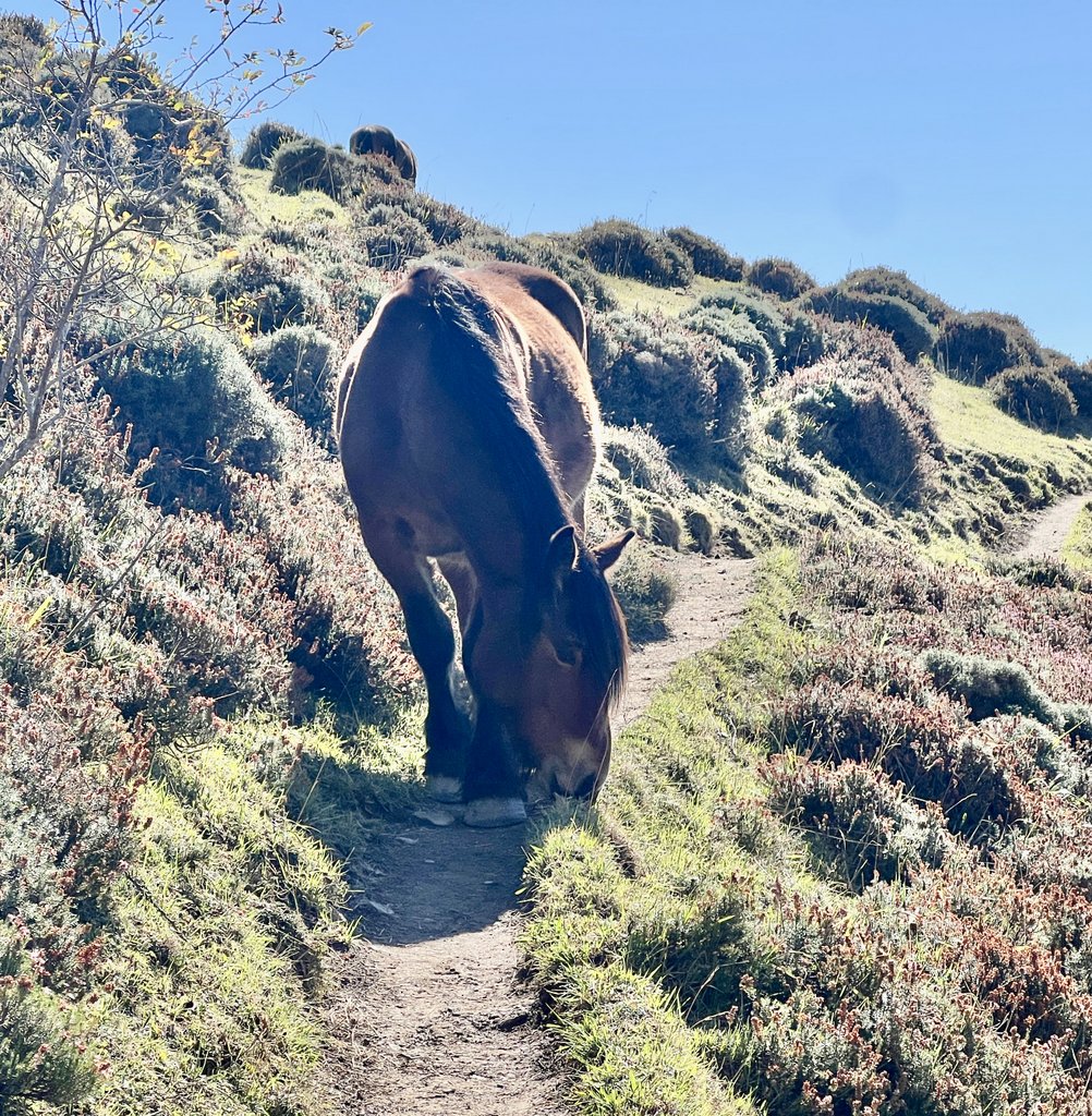
Day 5: Taxi from Arenas to Lake Ercina; hike to Refugio Vegarredonda on PR 2 and PR 5
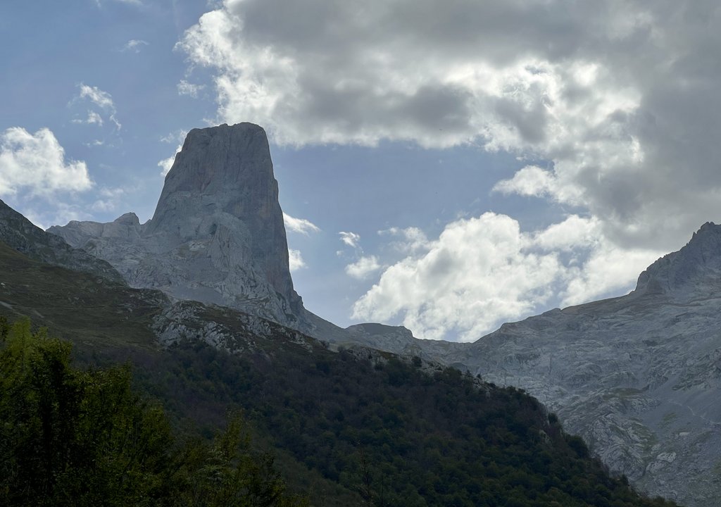
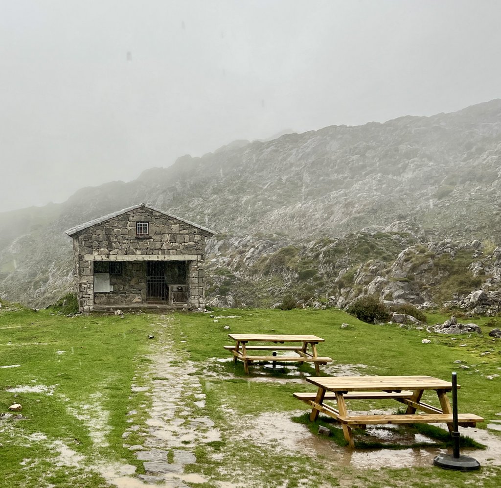
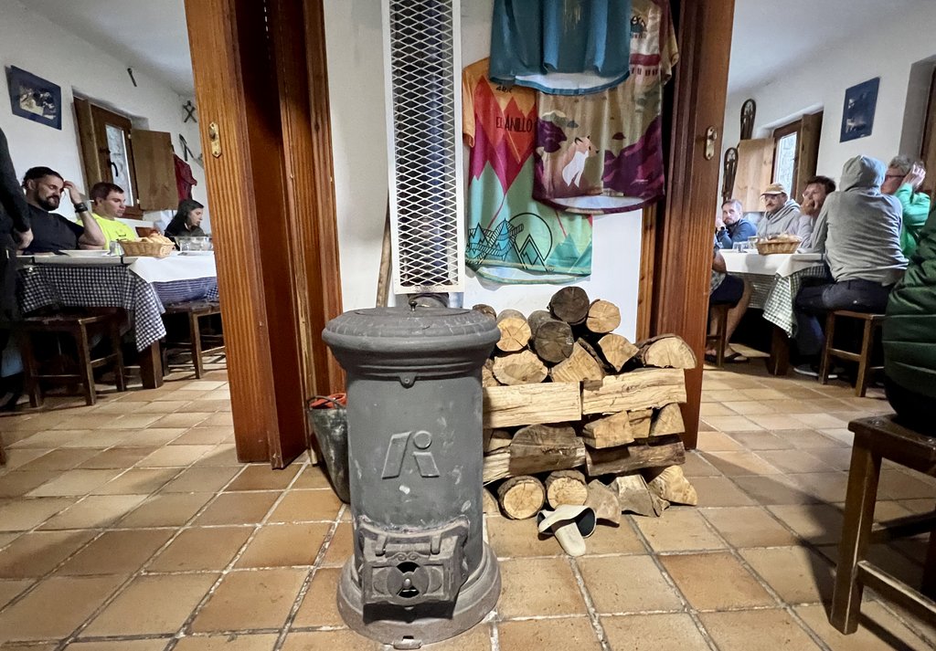
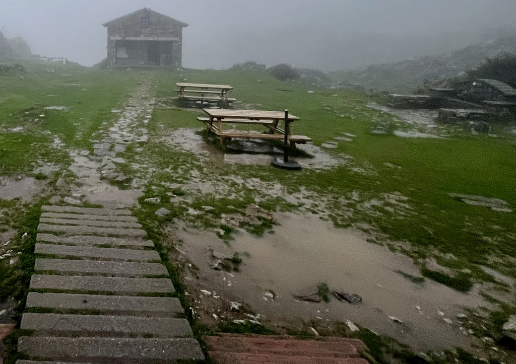
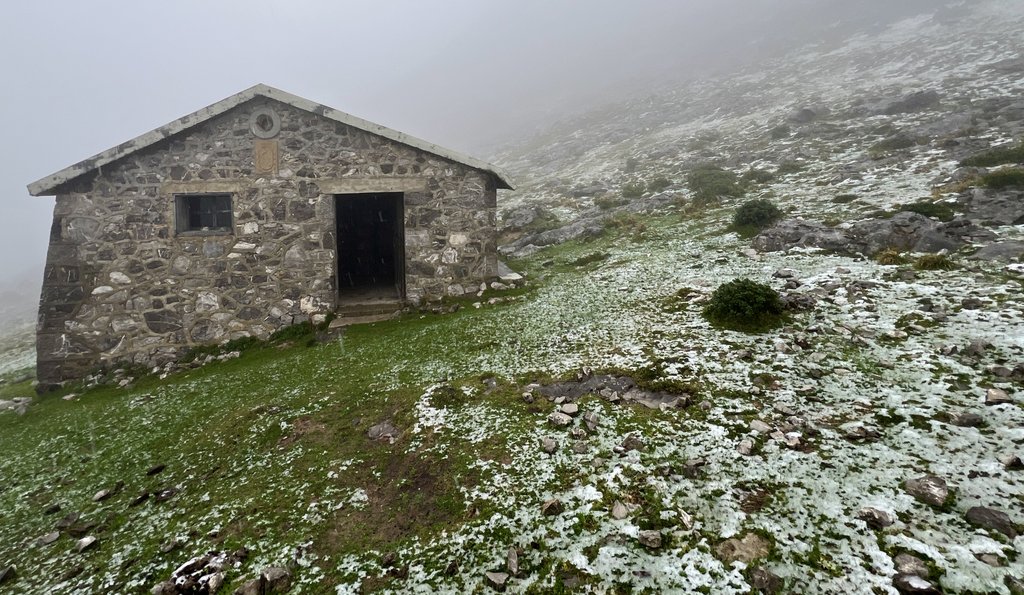
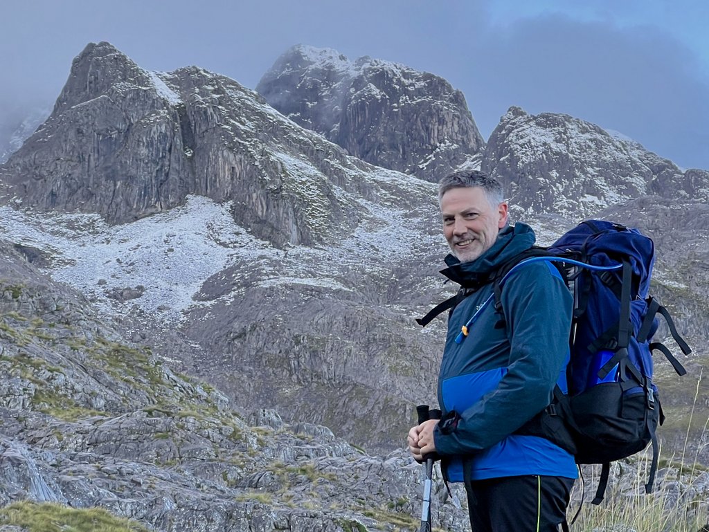
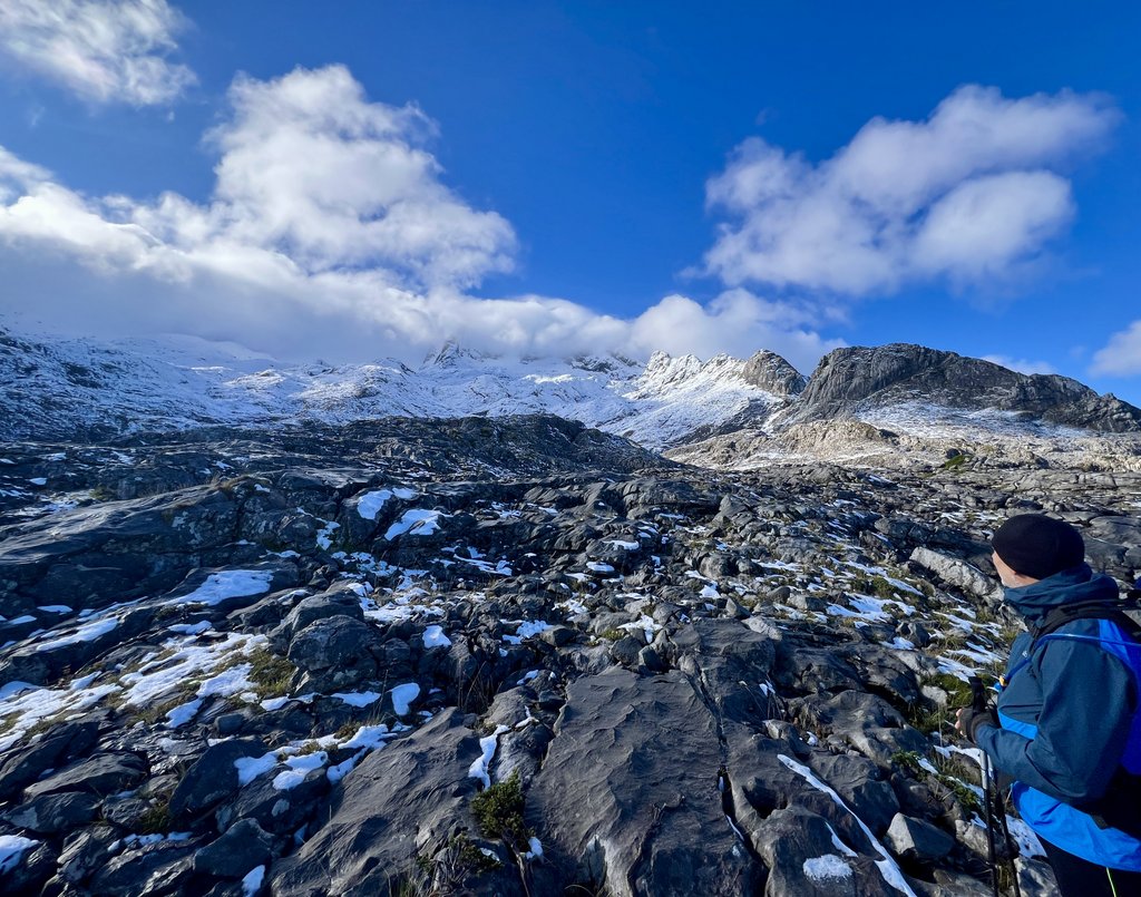
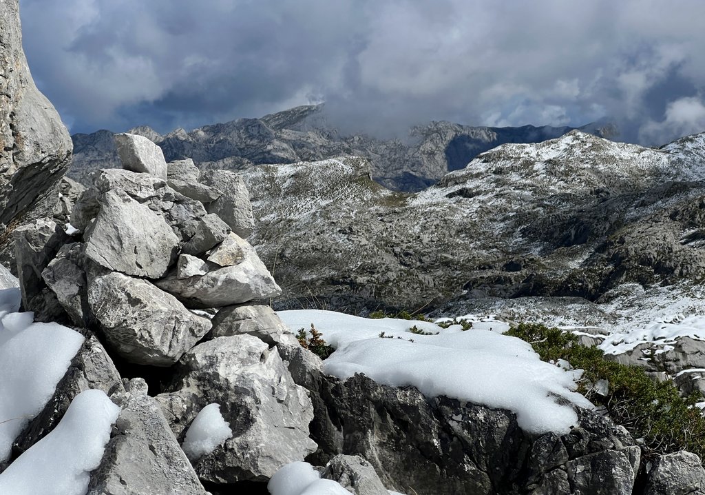
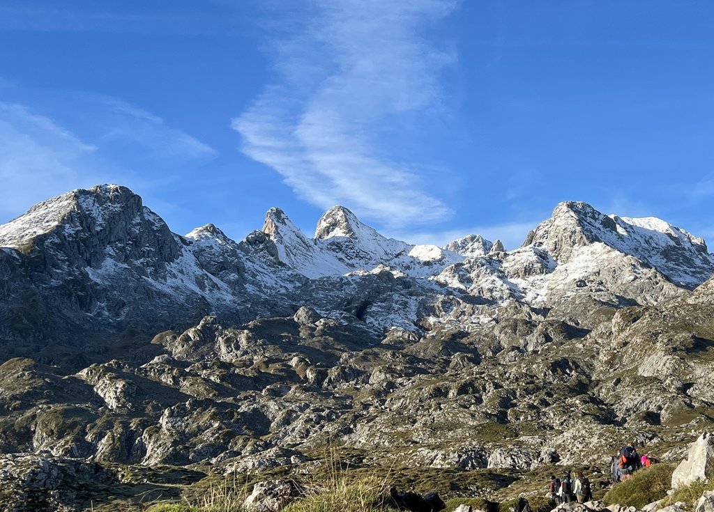
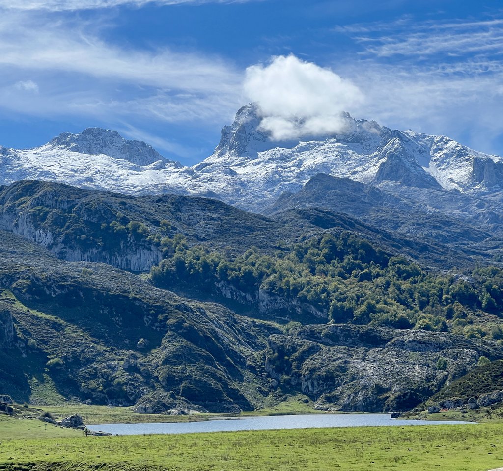
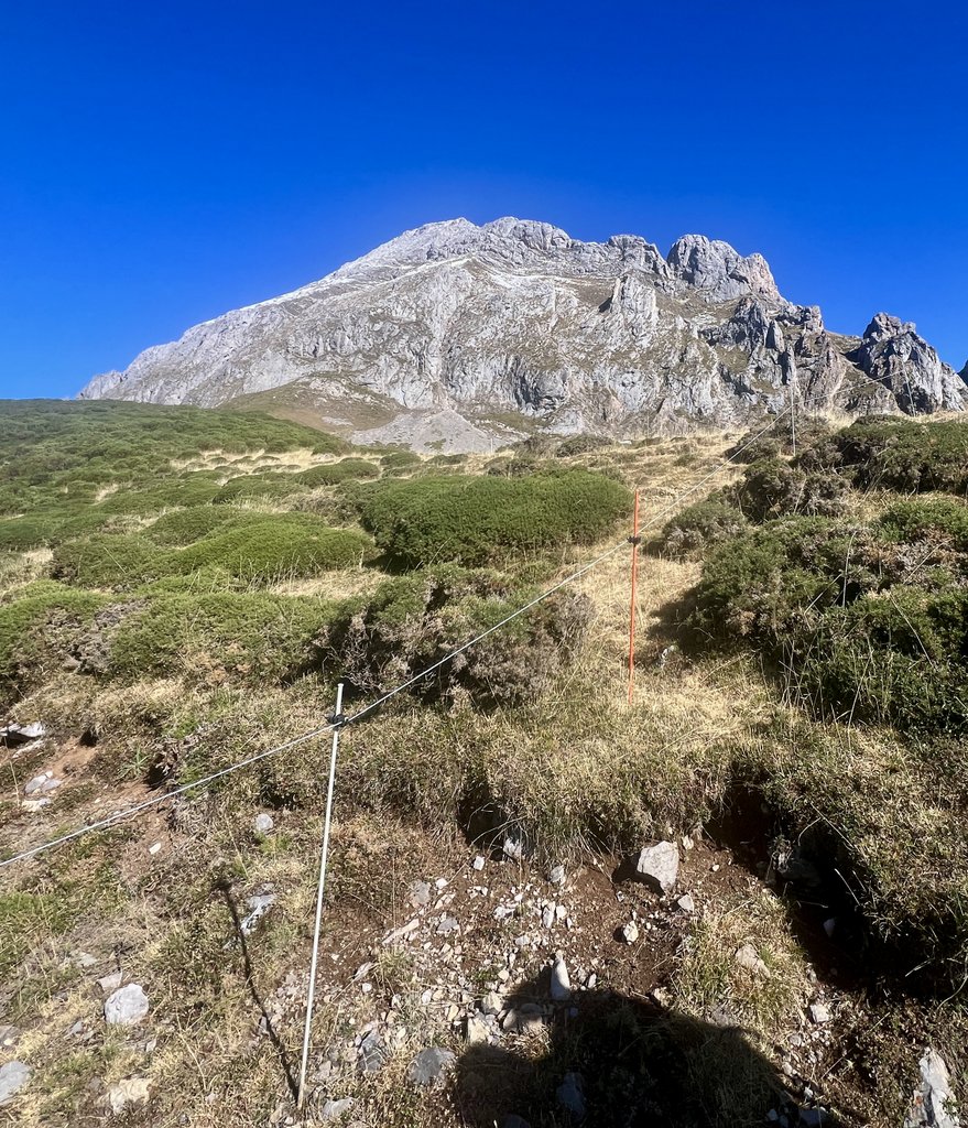
We started the day with a renewed perspective on the forthcoming hiking. The hotel breakfast set us up well for the taxi that the hotel had booked to take us to the Covadonga Lakes for 100 Euros. The one hour ride was scenic and soon we were hiking around Lake Ercina. The area felt less rugged than the east and the vegetation reminded me of England’s Lake District. The day was six miles of near-continuous climb, but on good trails. We had realized that the “PR” trails were our favourite, and were cautious of trails marked with only “AP”. As we hiked up, we passed or were passed by a couple of other groups, either day-hiking or hiking to stay in the refuge. Other than Pedro, we had not seen (and did not see) any other campers, emphasizing that staying in the refuges is the preferred way to explore the Picos. After a fine walk, we arrived at the refuge, checked in, and were shown our beds. The refuge warden confirmed that our plan to walk the following day to the unmanned Refugio Vega Huerta was a safe one. Their main concern was lightning, and none was forecast. However, with lots of rain forecast, it might be uncomfortable. Shortly afterwards, heavy rain started, which was settling snow on higher elevations. We enjoyed dinner with about twenty other people, uncertain what the morrow would bring.

Note that there is no snow on the peaks.
That night, the two beds at our feet were given to Mike and Tim, a pair of tall Germans. The following day, after we’d started getting to know each other, we compared notes about how we’d kicked each other all night!
Refugio Vegarredonda was at 1410m. The plan for the following day was to spend much of it at 2000m, including the destination of Refugio Vega Huerta, and we were apprehensive to do this with the gear that we had.
The first day of our second half of hiking had been mighty fine. Great hiking, good food, and we’d met several interesting people. However, the weather was making our plan look doubtful, and we went to bed expecting not to do it.
Link to my journal entry from Day 5, as dictated to Siri (click to expand)
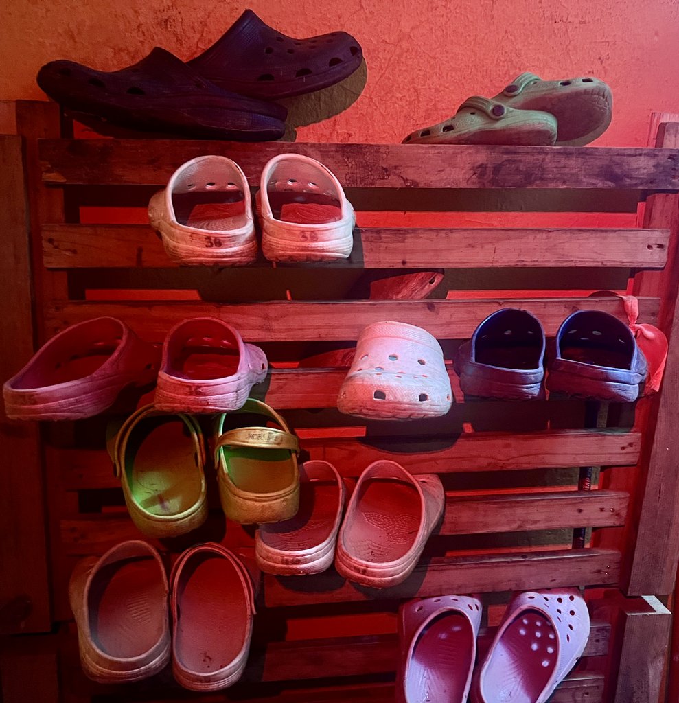
Most of our clothes had dried overnight and we were up for breakfast at eight. Hotel staff were a bit harried. James had a very satisfactory scrambled egg and bacon and I had a yummy yogurt with fruit and granola. Coffee was quite good too. Our 100 EU taxi was ready for us at 9 AM and we were soon whizzing away towards the lakes. Much of the drive was a climb, and we had fantastic views of clouds in the valleys below us. Even though the forecast for the day was wet, it looked like it was gonna be great. We arrived at the Upper Lake Ercina without incident. At 10 o’clock we were heading to the path around the lake and the views opened up very nicely. There was a chill in the air and we walked through gorse with some small yellow flowers, and it was much more similar to England’s Lake District than on the eastern side of the Picos. Lots of cows again. After about half a mile, we heard this young lady yelling at us from behind and we were very concerned that we had done something wrong. We walked back and she headed toward us. Very soon, we realized that she just wanted someone to take her picture. Quite bizarre. We continued walking along muddy tracks and around the hill and passed several old Basque structures, many of which were in pretty good shape. The trail we were on went around the mountain and met up with the road that went into the mountains from the other lake. There was a bar and a church. We turned left onto that road seeing some people walking downhill and then we met some groups walking uphill. In particular there was a group of four Italians with a lady noting that her husband was from Birmingham. Another group of eight or nine walkers walked at about our pace. One of this group approached us later when she heard our English voices. She was originally from Ireland and now lived in the area. She explained that she was part of a group that walked these hills every weekend, and that they were all very fit. Both of these groups were only day hiking and walked back down to the car park. The first three miles of the walk were relatively flat, and it was very pleasant along the road and on the trail. After crossing the river, it started to climb quite steeply, but James had got his groove back and set a brisk pace, probably due to a combination of low temperatures, good trail, and other groups of walkers that he felt obliged to beat. Indeed, at times I struggled to keep up and later had a slight tightness in one leg. We passed cows and a particularly friendly group of horses. We continued climbing, at one point briefly putting on waterproofs for a short shower, but then the sun came out again. At least it was dry. We climbed, and then suddenly the refuge came in to view. We enjoyed just sitting down in the sun on the grass outside the refuge drinking a coffee and contemplating surroundings. There appeared to be a lunchtime rush of day hikers, and once they had cleared, we checked in and got a tour of the refuge. This was just in time as the rain, that would continue through most of the afternoon, arrived. The refuge had a nice sitting area inside with a wood-burning stove that was surprisingly pleasant to sit next to considering we had been too hot on the previous days. At check in, we asked the refuge manager about our plan for Vega Huerta the following day, and he was confident it would be safe. We had also seen the route on a couple of maps on the wall, though it was neither a PR or GR. It was nice having several hours to kill in such a refuge with 18 hikers around. The refuge’s capacity was 55 which would have been very full. At one point, the rain turned to snow on the high elevations and the mountain above us was covered in the white stuff. It brings a bit of concern for tomorrow as that is the way we are going, climbing 600 m and there might be some ice so we will have to be cautious. We enjoyed some hot chocolate and got the snacks ready for tomorrow. We were psyching ourselves up for a big day tomorrow, which was only going to be five miles, but with 900m (3000ft) of climb and some questionable terrain, the stats look a little bit like our very difficult day two. Our destination is an unmanned refuge which has a couple of concrete bunks supposedly. At least it will be shelter from rain, wind, or snow for cooking and maybe warming up. Was able to check in with the InReach and get a weather forecast update. The refuge also has plenty of power outlets for charging things and we enjoyed the hot chocolate and there were drinks and snacks. We could’ve ordered a lunch for the following day, but decided we had enough snacks. We were given a couple of beds by a window with some great views of the mountain. Quite the bonus. It was tempting to have an afternoon nap, but I resisted the desire so that I might sleep better at night. The refuge has a couple of flush toilets and a couple of showers in a room attached to the main refuge, but you have to go out and in again, which is awkward in the rain and I slipped in the refuge crocs, but managed not to go down. Dinner was noodle soup and a bean soup followed by another hearty dish. There was plenty of bread and vegetarian options. Also pudding. Soon I went to bed.
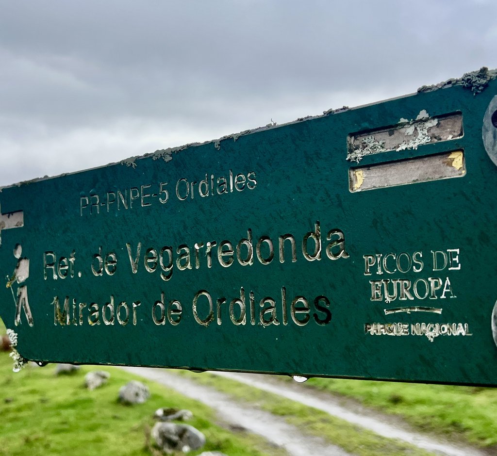
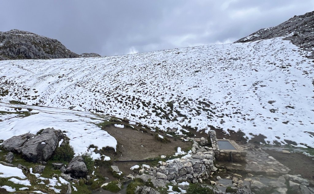
Day 6: Refugio Vegarredonda to Refugio de Ordiales and return on PR 5
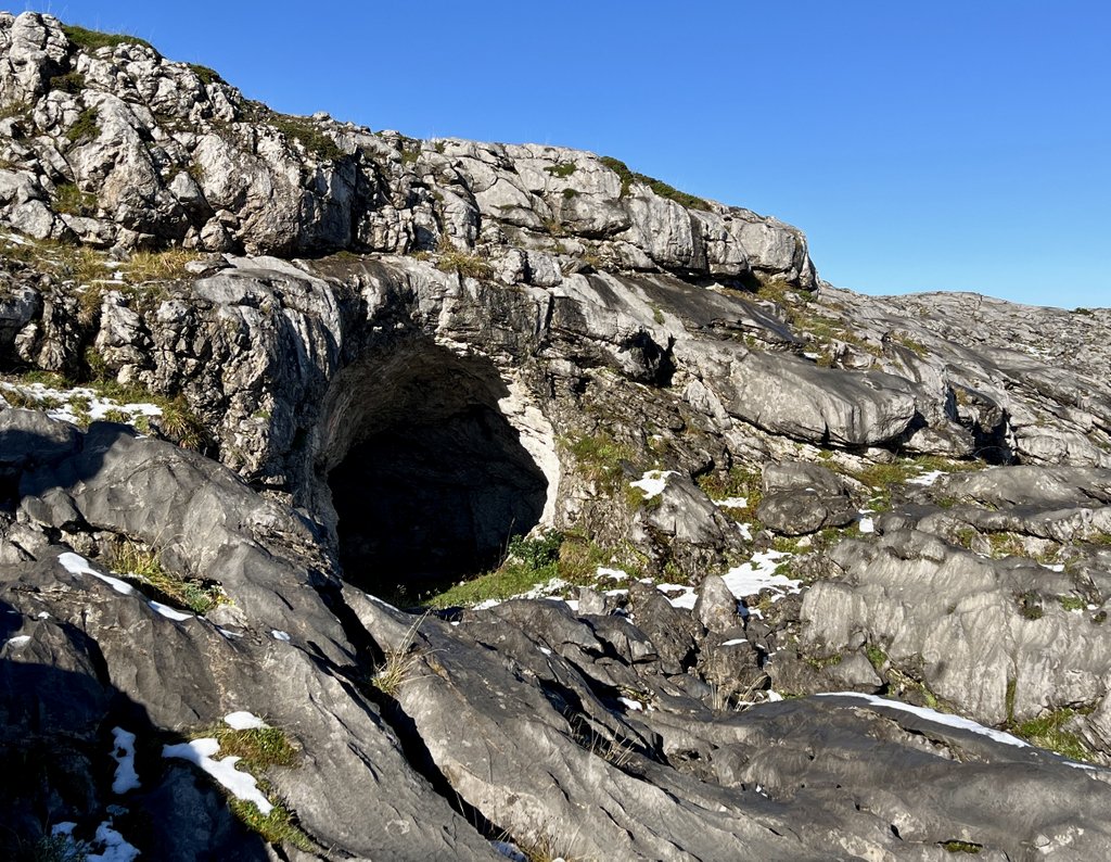
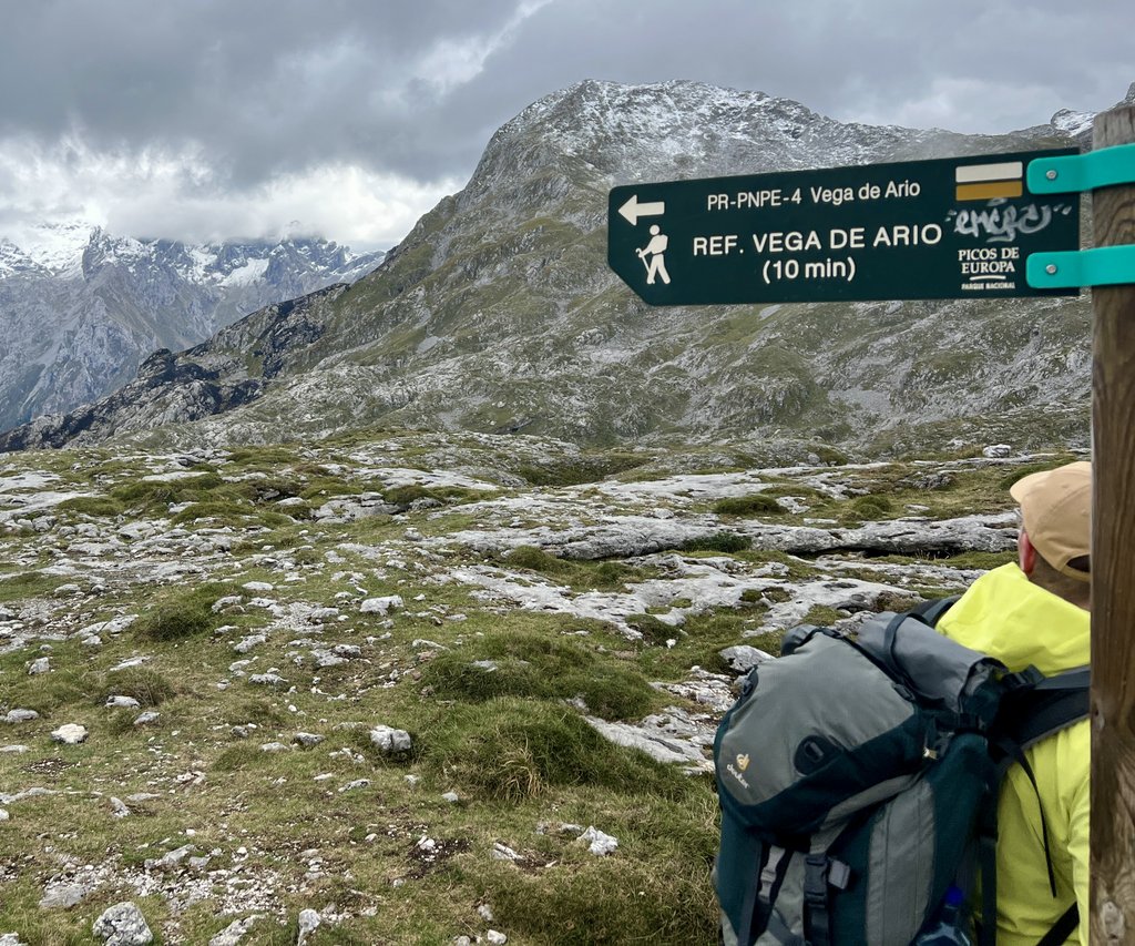
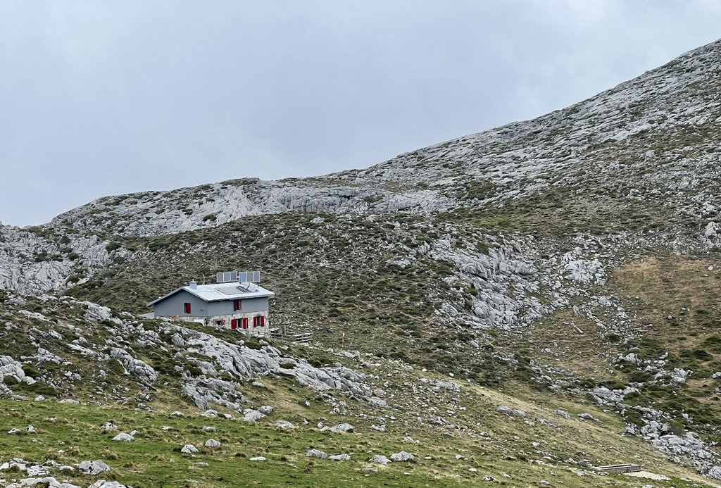
There had been much rain overnight, helping us to confirm our decision to cancel the day’s hike to Vega Huerta. A couple of groups, the Germans Mike and Tim and a group with a guide, headed in that direction towards Refugio Vegabano. After a few hours, they all returned, having been turned back by about a foot of snow, covering the path, and getting deeper. I was able to sew a hole in my hiking trousers, thanks to a needle and thread from a pair of Dutch girls, Nora and Nina, who were in the Picos to brush up their Spanish before heading to South America. After a lunch of our snacks and soup from the refuge, I headed out for a walk towards the Ordiales Viewpoint and the burial site of Pedro Pidal who founded the park. With fog and rain, I wasn’t expecting views, but I had fun in the wet and was impressed by the unmanned Refuge Ordiales which my map labelled as in poor condition. On my return, we asked the helpful lady at the refuge about her favourite hikes in the Pecos, and she suggested the hike from Vegarredonda to Refugio Vega Aria, which was a route I had not considered as it went “the wrong way.” She confirmed a couple of beds for us at this other refuge. I was able to book a room at a refuge in Santa Marina the following day, setting us up for a final hike into Fuente De. We enjoyed a fine dinner and slept well, planning to head to Aria in the morning.
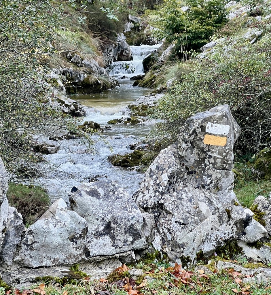
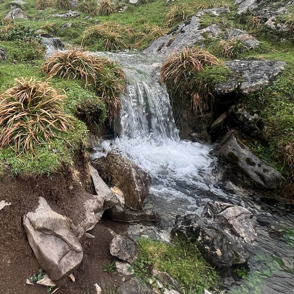
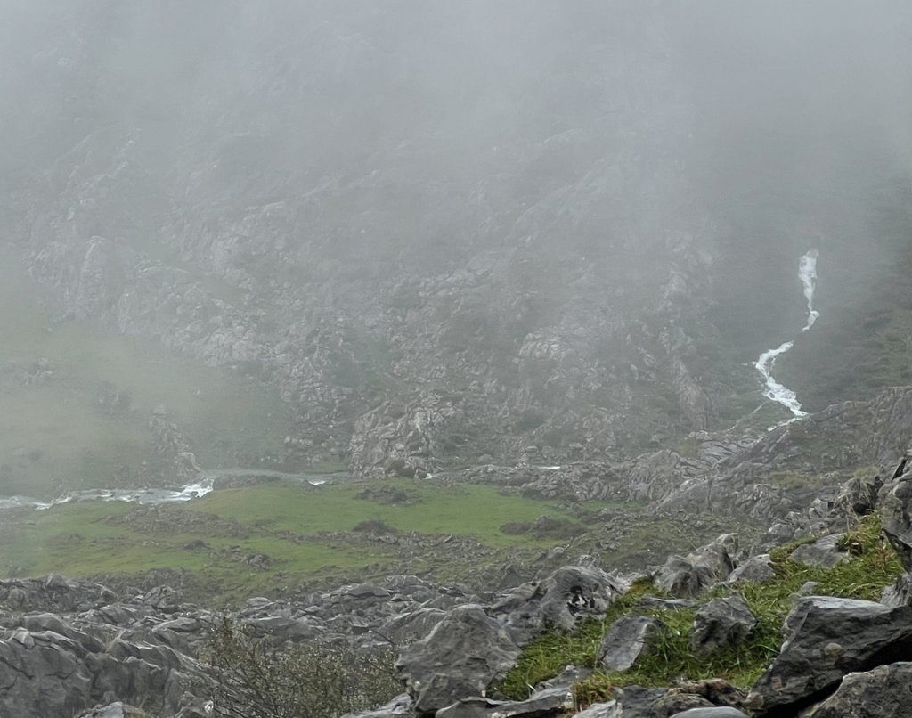
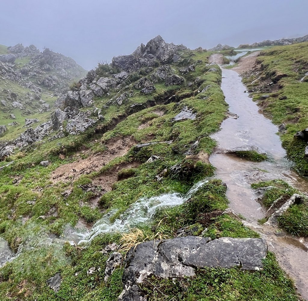
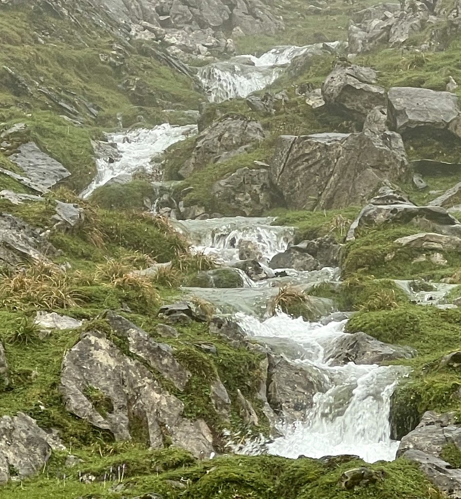
After lunch, I headed out for a walk, and enjoyed swollen rivers and paths transformed into streams.
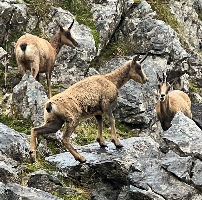
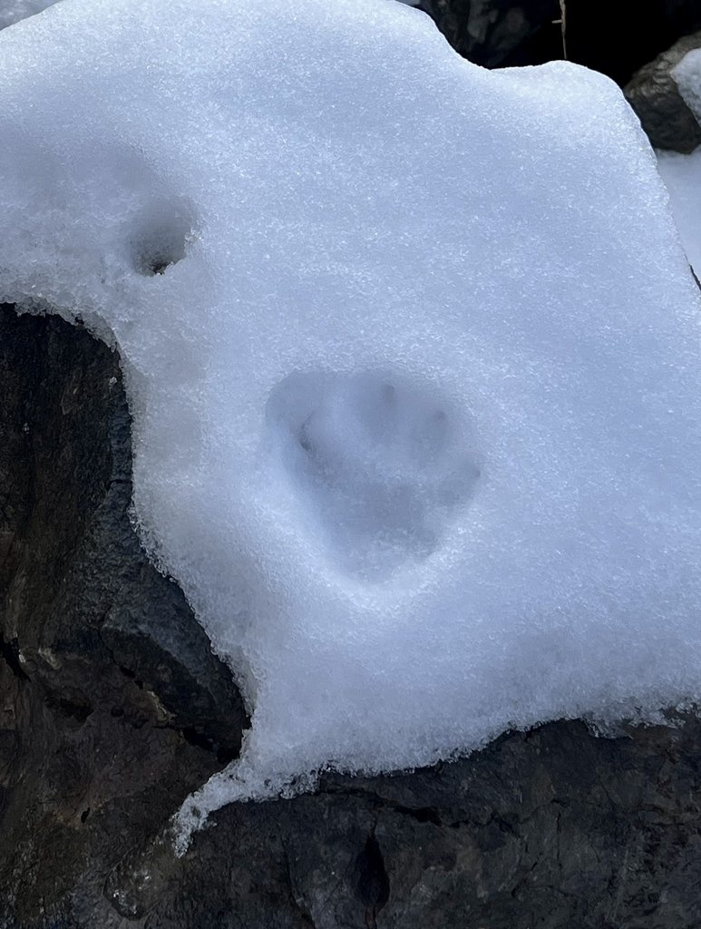
Hiking alone in the rain, I enjoyed the solitude, especially with a herd of chamois deer.
The day had been surprisingly fun. Spending a second night at the refuge made it feel like “ours”, but it emphasized how the ambiance changes each day as different hikers come to stay. We had enjoyed getting to know Nora and Nina, and Tim and Mike. I had enjoyed my solo walk in the fog, discovering an unmanned refuge, and we had a good plan for the morrow.
Link to my journal entry from Day 6, as dictated to Siri (click to expand)
By the end of the previous day, we had decided that we would not hike to the next refuge as per plan. We still got up at seven and joked over breakfast with the two Germans (Mike Vonzi and Tim) as our feet had kicked each other all night. It was cold and wet as we watched groups leave. We had a chill morning, relaxing, and editing this journal and after about three hours, the two groups that had left came back, having turned around in foot deep snow up the mountain, including a group with a local guide. I sewed up a hole in my pants (thanks to sewing kit from Nora and Nina from Holland who were in the Picos to improve their Spanish before heading to South America) and ate some snacks and some soup for lunch. I got a bit restless so I headed out to walk to the viewpoint, even though I knew there would be no view. It was cold and wet with lots of fog, but still surprisingly fun. There was a cute herd of deer and I could hear cowbells through the fog. I stopped at a cool unmanned refuge which was surprisingly warm. The snow on the grass was slippery. I turned around and the rivers were much fuller on the way back. It was fun hiking alone, listening to the sounds of just nature and getting lost in one’s own thoughts. The refuge was fuller on my return. I tried to dry my clothes wearing them while sitting next to the wood burning stove. We asked the very helpful lady at the refuge about her favorite hikes in the area as we considered our options. Her recommendation was the hike to Aria which I had not considered as it was the “wrong way” but it fit well. Very easy, she said. Another hearty dinner then bed. Forecast is clearer tomorrow with little rain and warmer so we are hoping to hike to Refuge Vega Ario.
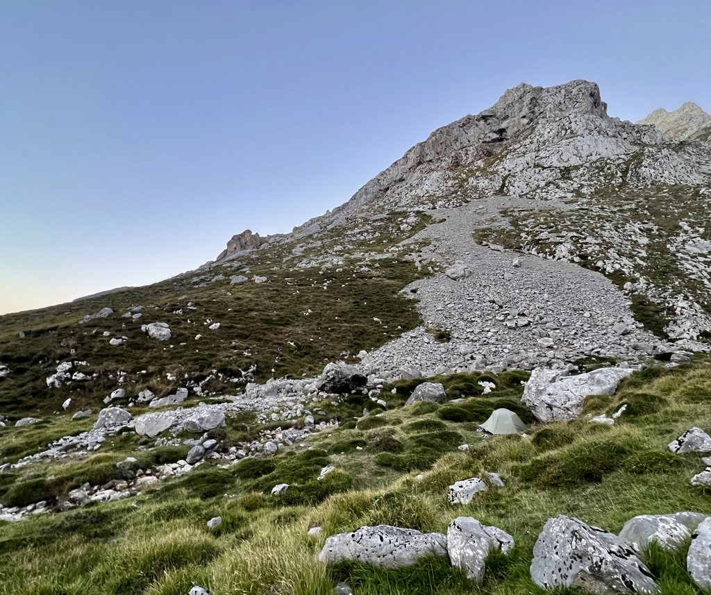
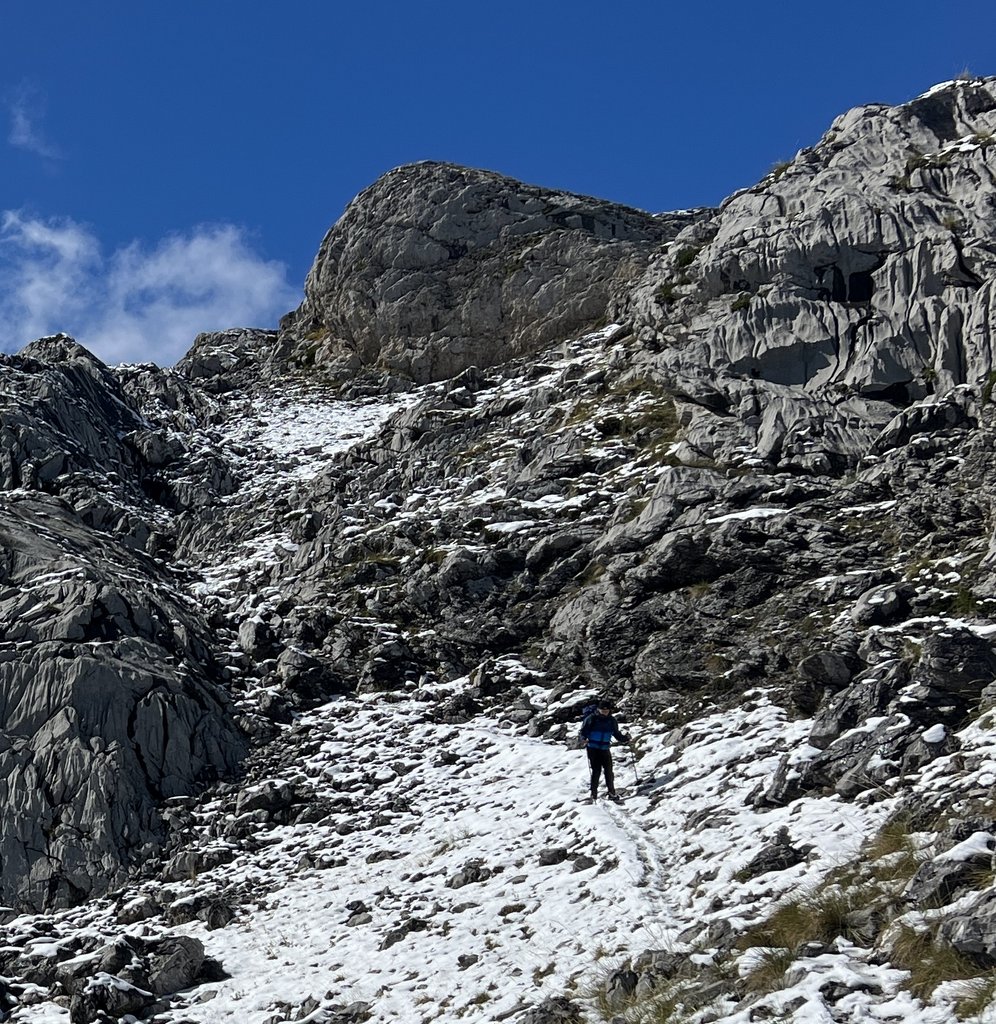
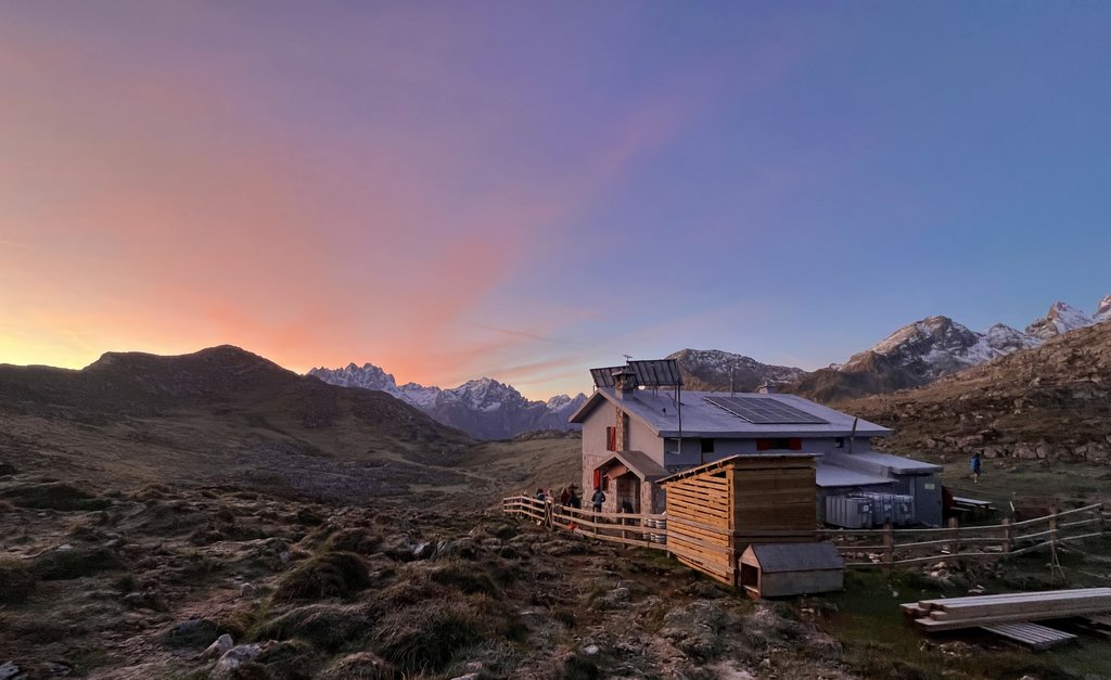
Day 7: Refugio Vegarredonda to Refugio Vega de Ario
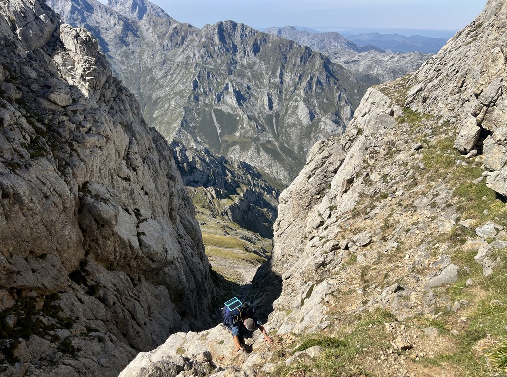
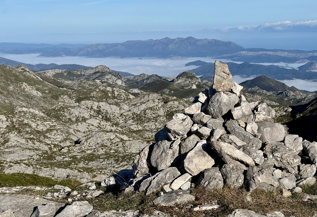
It was a somewhat restless night with a dog barking at wolves on several occasions. With high expectations for the day, we enjoyed our breakfast and packed up after two nights in the refuge. The weather had cleared. As we headed off at 8:30am, crowds of people were heading in other directions, either toward the viewpoint, or back to the lakes. A couple of Brits headed towards Vegabano, and I don’t know what they found at altitude. James and I were glad that we started off on our trail by ourselves. Even though the lady at the refuge had said the route to Aria was easy, we had learned to calibrate such comments. If we added the handicap of our packs and our ages, it was less easy! This was only an AP trail on the map – not PR or GR – but we found the trail well marked with a combination of red dots and cairns. The first half of the hike was climbing, and we soon found snow on the ground, which got thicker and thicker. The wind gusts bit into my cheeks. The trail varied from clear ground to sharp limestone rocks to a rough route across limestone pavement while avoiding large sinkholes. After an hour or so, Mike and Tim caught us up and overtook, but this allowed us to follow their footprints in the snow as they were soon out of sight. They were following tracks made by a deer and probably a small wolf. After about another hour, Sara from the Canary Islands caught up with us, and also overtook us but stayed in sight. I found the snowy trail slippery in my old trail runners, falling backwards a couple of times and sideways once, with a slide on my bum down one slope. The weather closed in, but it was never so foggy that we could not see the next cairn. Fog led to snow but some visibility remained. Our hike to the high point at three miles took five or six hours, much longer than I had expected. Once over the top, the snow continued to be a challenge but it was easier. A spring indicated we were about two miles from the refuge. Mike and Tim’s footprints took a trail to the right towards a viewpoint, and we bore left on the shortest route to the refuge. As the snow thinned, we were greeted by grazing cows. At a sign that indicated we were ten minutes from the refuge, we saw Mike waving at us from a side path. He had given up on trying to get to the viewpoint, leaving Tim to go by himself, and was happy to see us. We arrived at the refuge soon afterwards. We had all found the day harder than expected, with the snow being a challenge. We were the first to arrive at the refuge for the day, and enjoyed its fire and drinks while we all brought out our food and persuaded others to eat theirs so they had less weight to carry. Sara had an especially good selection of meat and cheese, so I felt obliged to help reduce her pack weight as much as I could! We were shown our beds at 6pm and ate at eight, with falafel and meatballs making dinner interesting. There was a group of five Brits from Manchester hiking refuge-to-refuge, and one always hiked with his pot, stove, and thermos so he could make a proper cup of tea! There was also a group of nine women from Holland with a guide. The hike, wind, and cold had taken a lot out of me so I went to bed early.

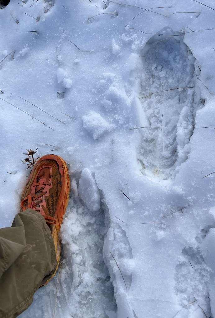
These foot prints of Tim and Mike helped with my navigation.
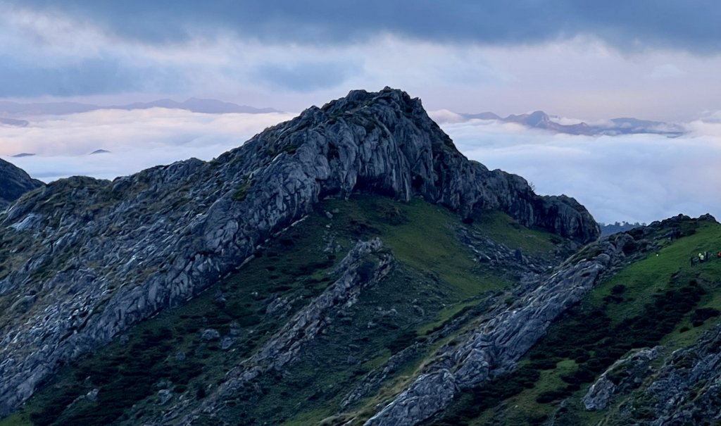
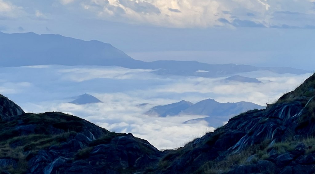
The weather cleared and amazing views opened up in front of us.
I learned the hard way that they are very slippery on wet rock!
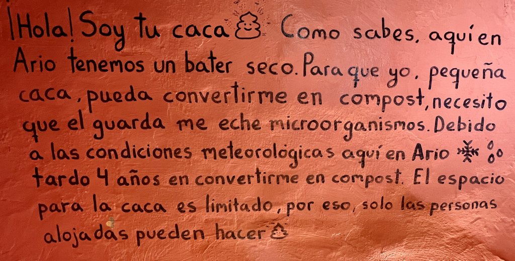
“Hello! I’m your poop. As you know, here at Ario we have a dry toilet. In order for me, little poop, to become compost, I need the guard to add microorganisms. Due to the weather conditions here at Ario, it takes me 4 years to become compost. Space for poop is limited, so only those housed can do so.”
While some hiked up a hill after dinner to get phone signal, it took all my strength to dictate my journal notes before collapsing in my bed. It had been another fine day in the Picos – as a standalone day, and as an amazing contrast to our previous days.
Link to my journal entry from Day 7, as dictated to Siri (click to expand)
Slept pretty well, though a dog was barking quite a lot of the night because there were wolves around. Enjoyed coffee with the usual minimalist breakfast of toast and butter and jam and we headed out of the door at 8:30. Big crowds of people seemed to be going to either the viewpoint or back to the lakes and James and I enjoyed the solitude of heading off on our trail and saying farewell to a couple of Brits who were braving the trail to Vegabano. It was a pleasant morning walk at first with a bit of a climb, but the cold air at a few degrees above freezing made it quite pleasant. I wore just my dry fit top under a rainproof jacket, which was perfect, though James also wore his thermal top, which got sweaty, as mine had on my solo hike the previous day. After a little climbing, we started to see some snow on the ground, and as we continued to climb, there was more and more. At first, it was pretty, but then it started impacting our ability to walk. We needed to navigate very carefully across a large limestone pavement, which went up and down a lot, as well as having some very large deep sinkholes. About this time, Tim and Mike overtook us, and then Sara, a lady from the Canary Islands, walking by herself, came up behind and we persuaded her to go ahead of us. Tim and Mike were soon out of sight, but we kept Sara within sight most of the time. It was a 3 mile climb to the trail’s highpoint and I had estimated it would take a couple of hours, but it took us five or six hours and my watch registered it as 6 miles. The snow got deeper up to maybe three or 4 inches. It was never icy, but I fell backwards two or three times and to my side once. The side fall could have broken my wrist but I was ok! I did a bum slide down one smooth piece. We were both having to concentrate hard for every step not to fall over. At one time, it started snowing quite hard, but it was never a downpour. Also, the clouds descended, and it got quite foggy, reminding us that the warden at the previous refuge had said they would not send people this route when it was foggy. However, the fog never closed in a lot and we were always able to see the next cairn or red dot. In the snow we were often following a trail that also had both deer and wolf prints in it. Of course, I was following Tim and Mike’s footprints for most of the way and then also Sara’s. We saw some lovely deer, looking down on us, though they were a bit skittish. Some raptor birds came close overhead too. Finally, we made it to the highpoint and started descending on the other side, though it continued to be tough going. We reached a meadow like area with a spring which, based on Harmon‘s guide, told me that we had 2 miles left. For the section from there to the refuge, there were three or four options of trails that intertwined with each other. My track was the one on the left, but I think I missed a turn and we ended up taking a later one. At one point the trail that had most cairns went left whereas the German footprints went right. But the left trail was shorter to the refuge so we took that. I later learned that the Germans went off to see the view point looking down on Cain and the Cares Gorge. We carried on walking, and eventually the snow was no more which was nicer walking, though navigating was still somewhat challenging. As we approached a sign post that said 10 minutes to the refuge, we saw Mike waving at us and he joined us. He had given up trying to get to the viewpoint and was happy to see us to walk together to the refuge. It was great to see the refuge and we were the first to arrive for the day. It was quite different from others, halfway between Andara and Vegarredonda, with enough room for maybe 20 people,. We were able to sit inside and we all brought out our food and shared. Sara had lots of yummy cheese and meat. I made some hot chocolate and encouraged people to eat my food as it was weight though Sara had the same mindset, encouraging us to eat her meat and cheese. There was hot water for showers, but I took a wet wipe bath, which was nice. After a while, the other 15 people staying the night arrived. It was mainly two groups of people which included nine Dutch women with a local guide man and a group of five British guys from Manchester who do some form of trek every year. One of the British guys always brings along a stove and thermos so he can make his cup of tea. Brilliant. The main dining living room, which had a small fire, got very crowded and very noisy and loud and it was nice just to step outside. We were shown our bed at 6pm, which hopefully leads to a good night sleep. We were surrounded by hills with a distant ring of cowbells so it’s likely to be another relaxing night though chef likes to play loud music. The five of us stayed together for dinner with a variety of lentils and some meat and veggie falafels though I was nearly falling asleep at the table. I was so exhausted. There was supposedly cell phone reception at the top of a nearby hill, but I wasn’t going up there. I checked in with Janet using my InReach and updated my weather forecast. Sara had a car at the lakes and offered us a ride tomorrow which will be great. It’s remained pretty chilly outside, but as I typed this after 9 o’clock, the wind has dropped and it was dry. Hopefully a warmer and clear day tomorrow for our walk down to the Covadonga Lakes, and then probably onto the refuge I had booked near Posada so that we can walk the final leg into Fuente Dé. Mike shared this great joke: “Man with two left feet goes into a shoe shop and asks for pair of flip flips.”
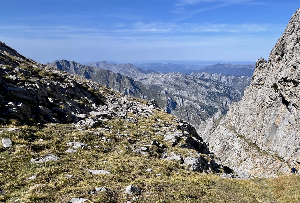
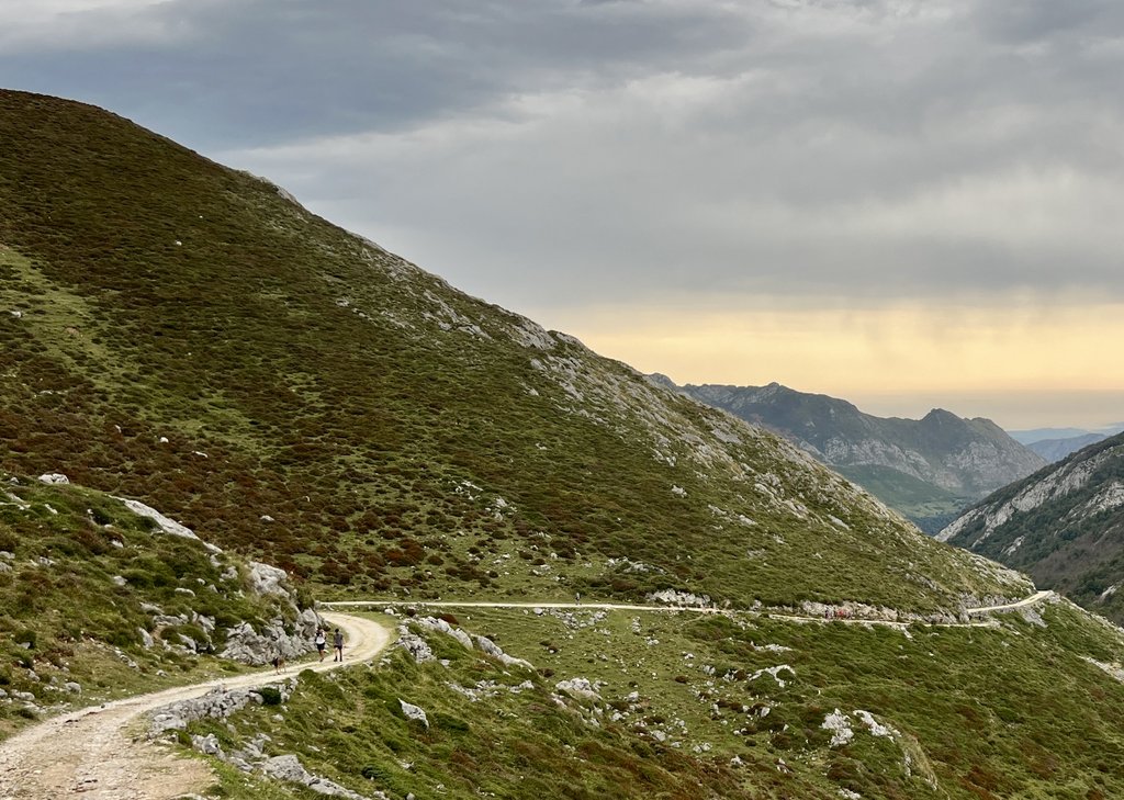
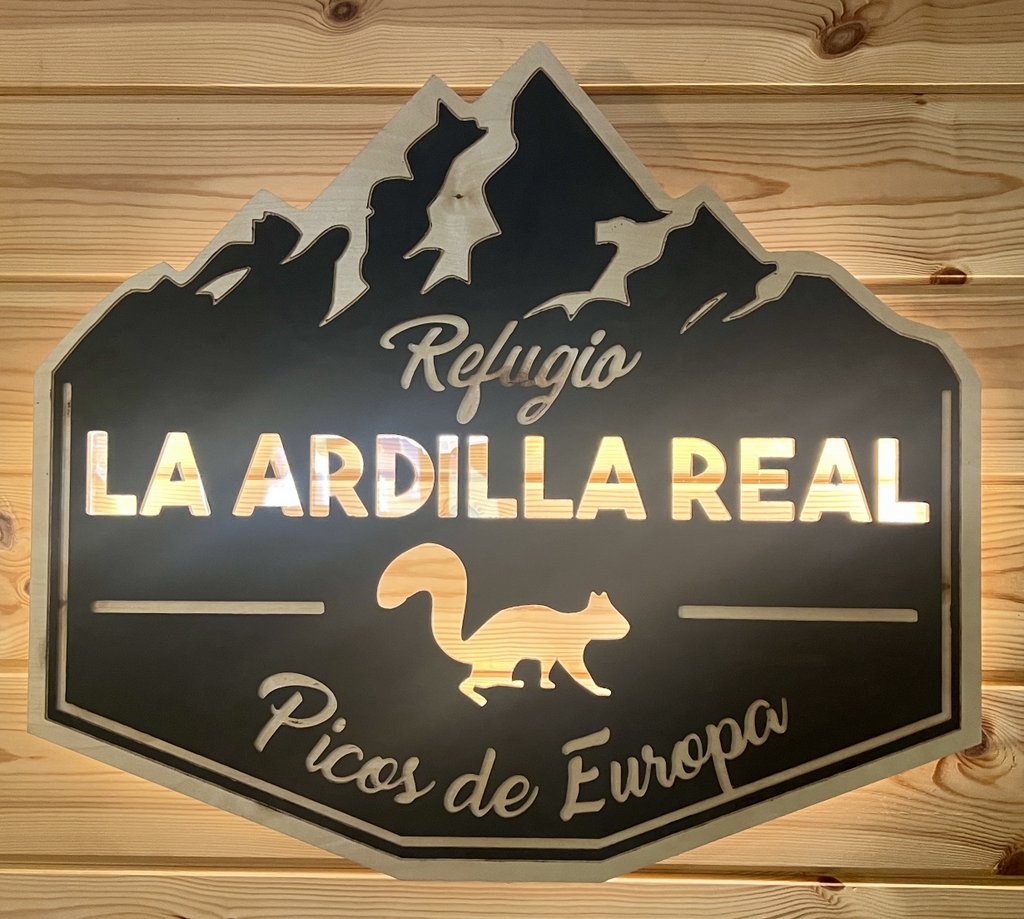
Day 8: Refugio Vega de Ario to Lago Enol on PR 4, ride to Congas de Onis, Taxi to Santa Marina
After a rough night’s sleep due to a loud snorer right next to James, the crisp morning air with a clear sky welcomed us outside. This was a particularly fun day as the walking was easy, with fantastic views, and having interesting company changed it up. As we hiked down to the lakes, I enjoyed Mike’s dry humour, a philosophical discussion with Tim about the US, and tried to understand Sara’s jokes that I struggled to translate. The terrain was kind and we were all a bit sad when we reached the lakes at the end. Sara led us to her rental car, and we were so thankful for the ride to Cangas de Onis where we said our farewells and went in different directions. The receptionist at the Hotel Los Lagos was very helpful and called a taxi for James and I, after an attempt via the Tourist Information Centre led to a couple of empty taxi ranks. An hour and a half and 82 Euros later, James and I were enjoying the evening sun while sitting outside the Refugio La Ardilla Real in Santa Marina de Valdeon. We enjoyed the privacy of our own room, though there was no soundproofing from other rooms. We had a fine dinner with one other group who were about fourteen people from Much Better Adventures. We had seen them at Vegarredonda, and they had had to abandon their hike to Vegabano because of the snow. Their itinerary included hiking five days with guides and staying in refuges. We slept well that night, looking forward to our final day’s hiking while also wanting the trip to continue.
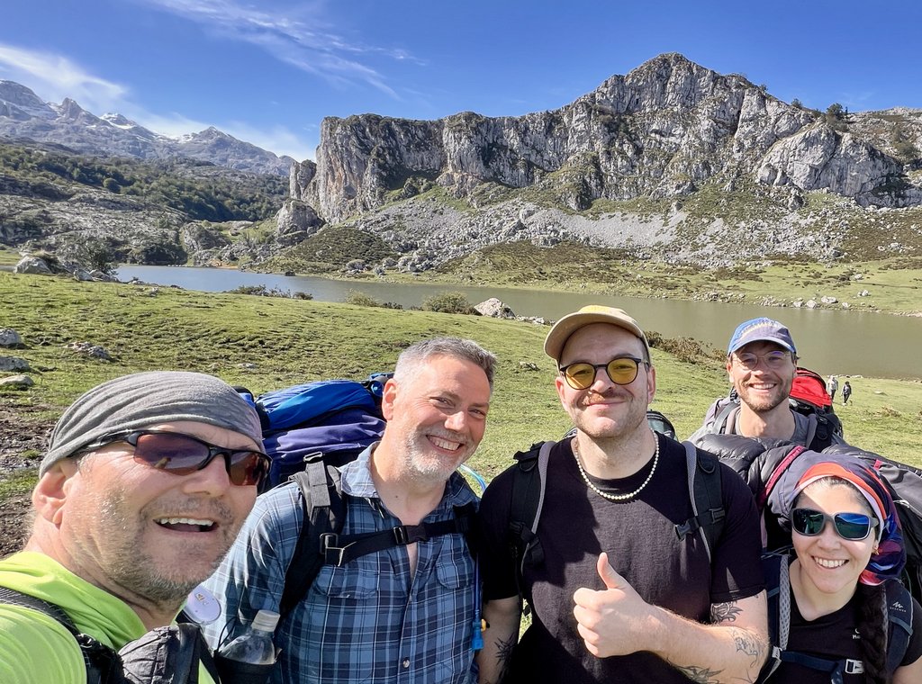
It was an interesting ride down the hill with the five of us squeezed into Sara’s rented Kia. Very many thanks Sara! We said our farewells in Cangas de Onis, and James and I got a taxi to Santa Marina de Valdeon where we were staying that night.
It had been a pleasant yet fun and rewarding day. We were well setup for a final day’s walk. It was interesting to observe how an organized group was hiking the Picos. Even though there was no soundproofing between the rooms, we were very happy not to be bothered by snorers!
Link to my journal entry from Day 8, as dictated to Siri (click to expand)
It was a rough night’s sleep with a very loud snorer right next to us. Breakfast was at eight, but many people were up beforehand. Our crew of Tim, Mike, Sara, and us had breakfast together and were ready to head off at about 9 o’clock. Sara had planned to go to the highly-recommended viewpoint above Cain but changed her mind. It was a beautiful sunrise and a crisp morning with a frost on the ground and a very clear sky. As we began to walk, we made slow progress as we took some photos and selfies and tried to work out which was the way down, with four out of the five actively navigating. It was a bit complicated and everyone was competent and happy to let others decide. I ended up walking in front but missed the route that I had chosen, but it didn’t really matter. It was a beautiful walk down to the lakes, going through a variety of landscapes from dry to wet, muddy to rocky, gorse to trees, and plenty of cows. It was all sunny and a great experience to have such a fantastic walk with a variety of people. Once the upper lake came into view, we knew the walk was finishing and Tim suggested we stop for lunch, but Mike was struggling with blisters that he had not mentioned. So we plodded on. As we came to the lake, Sara took over the navigating to her rental car by the visitor centre. We squeezed everything into her car, which just fit, and she drove us down the hill, including through a very large herd of sheep. Tim, Mike, James and I were dropped off at a tourist information center and we said our farewells. We sought advice from the TIC on how to get a taxi to our next destination who pointed us towards a couple of taxi ranks that were of no help as they were empty. We found a very helpful receptionist at Hotel Los Lagos who called a taxi and within 20 minutes we were headed towards Santa Marina for 82 EU. The road was windy and our taxi driver drove fast and the scenery was fantastic. After an hour and a half, we arrived at our refuge for the night, but it was an hour or so before it opened. We enjoyed the sun on their patio with our remaining snacks before it opened. At 5, we checked in and were shown our room and enjoyed a couple of drinks before supper and some varied and deep conversation. The refuge manager confirmed that our plan to walk to Fuente Dé was easy, increasing our confidence for our final walk. We saw a crowd of people who had been at a refuge on the mountain, but we are unsure what they have done. The weather forecast looks good for our final 6 mile hike.
Day 9: Refugio La Ardilla Real to Fuente De
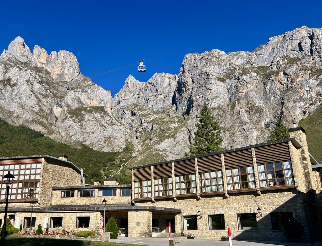
We headed out the door and climbed continuously up about 600m/2000ft for a couple of hours. Even though it was steep, the good PR trail and cool temperatures allowed us to make steady progress much faster than the climb on day 2. We enjoyed the frosty views and the landscape’s change as we ascended and the sun rose. Just as we arrived at the high point for our walk before our descent to Fuente De, we noticed the group from Much Better Adventures starting their climb from that point up the next big hill. We presumed that they had been dropped off by vehicle and were hiking up to Refugio Jermoso. Our descent toward Fuente De started through pastures with cows and horses, joining a road for the final approach. A few solo dayhikers passed us going each way. At 1pm, we arrived at our car in the cable car parking lot, and all was fine. A final weigh-in of our bags showed both were 11kg (25lb), including about 1liter of water each. We drove to Hotel Parador in Fuente De, that I had booked the night before, and I made the most of the comfortable hotel room with a long hot bath. Dining options were limited, and the first reservation we could get for dinner was 8:30pm. The next town down the hill, Espinama, looked like it had more options for both staying and eating, but it was too late now! After dinner, we both sighed very loudly as we got into the clean sheets and had a fantastic night’s sleep.
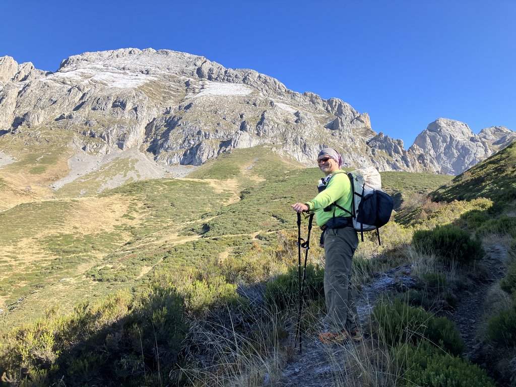
As we approached our highpoint at the saddle, we could see the path coming from Posada.
Photo by James.


There is something particularly satisfying about hiking a loop, even with some sections completed by motorized transport. We had survived nine days carrying just the items on our backs. At times, we had even thrived! We had pushed ourselves beyond what we thought was possible and had enjoyed fantastic scenery and great company while catching up on the previous thirty years.
Link to my journal entry from Day 9, as dictated to Siri (click to expand)
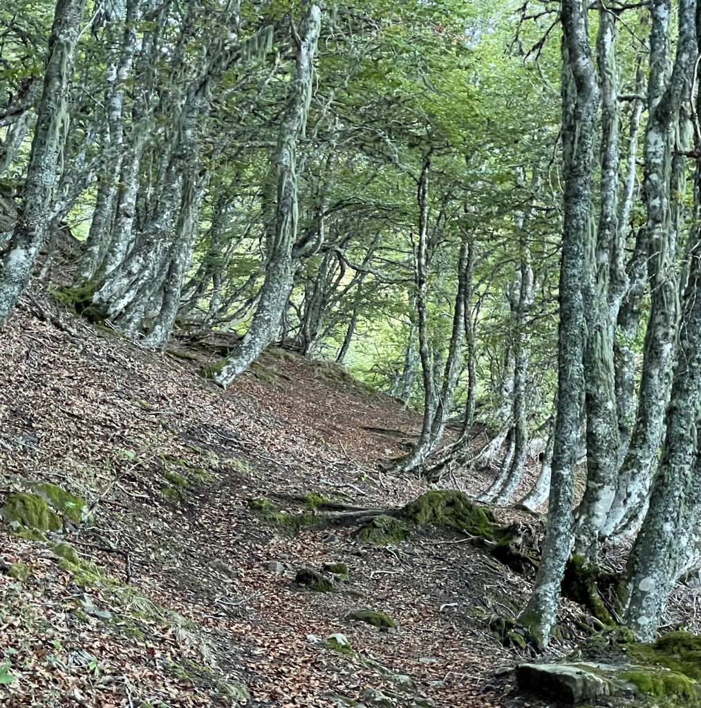
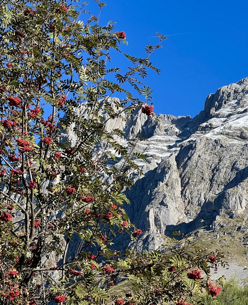
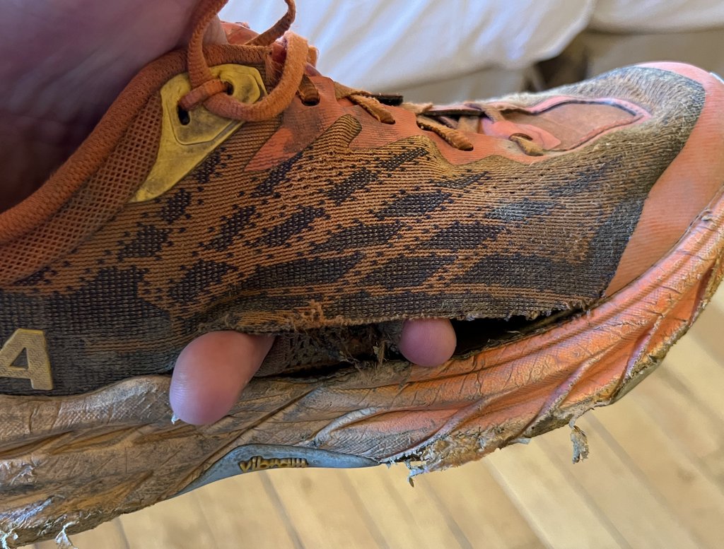
The private room at the refuge had been a nice change, but both of us had a somewhat restless night. I enjoyed a shower before breakfast and we made the most of some toast and cereal and coffee before heading out of the door at about 9 AM. We spoke briefly with the large group of 16 people who have booked their trek through Much Better Adventures. It was a crisp morning outside and we immediately started heading uphill. Over the climb of about 600m / 2000ft, we passed through multiple types of vegetation, including forest and ferns and meadows and lots of red berries and grassland. As we got higher, the frost got deeper, but we did not see any snow around us, though there was plenty on the peaks. As we climbed up the hill, the sun rose sufficiently to warm us up, and it turned into a fine sunny day. While the first half of the walk was a continuous climb, it was straightforward with amazing views opening for us. After a couple of hours, we were on the saddle. We arrived just before the group from Much Better Adventures headed off up the mountain to the refuge Jermoso. For us, the saddle was the highest point of the day and we started descending towards Fuente Dé. The first obstacle was an electrified fence which we managed to get past with only a mild shock. This second half of the walk was very different from the first with many more cows and horses, often blocking the path. There were multiple springs as well, and about halfway down, our path joined a road so the last hour or more of walking was on road. This got a bit old and added to the tiredness. At about 1 o’clock, our road joined the road to the established campsite that we stayed at on our first night in the Picos. Soon we popped out by the cable car station and were at our car. I was able to quickly fish out the key for my pack and it was very nice that the car opened without any mishap. We weighed the packs and they were the same at 11kg/25lb. We took a final selfie, then headed to the Parador Hotel which I had reserved the night before. We checked in, got our room, and enjoyed a lunch of cheese, croquette balls, and beer to celebrate the completion. The next challenge was getting all of our luggage to the room which we managed slowly and painfully. I enjoyed a long hot bath before repacking my bags. Earlier in the day, I had noticed that my right shoe was torn and nearly falling apart, so I researched and bought the same type of shoe so that it can be delivered and ready for my next trek. Our reservation for dinner could not be before 8:30 so we had some time to kill just twiddling our thumbs. We managed to get seated for dinner early and enjoyed our one course before very happily falling into bed with clean sheets, and the prospect of a good disturbed sleep.
When planning the trek, I had considered driving back to San Sebastien on the same day that we hiked out, but we were so glad we stayed the night. We were both exhausted and very stiff, and driving five hours without a good rest would have been dangerous. Our journey back to the Hotel Alcazar in Irun was smooth and we returned to the same restaurant for dinner, though both of our stomachs were a little insecure, though fortunately, they behaved. It was an early start the following morning, walking to Hendaye in France to catch the 7am train for Paris and then onward to London. As we got off the train in St Pancras, we each had to go our separate ways so bid our farewells. Our Picos trek had been much harder than expected and had required changing the plan daily, but it had been a fantastic adventure with extremes, multiple new experiences, and a perfect way to catch up on thirty years!
