
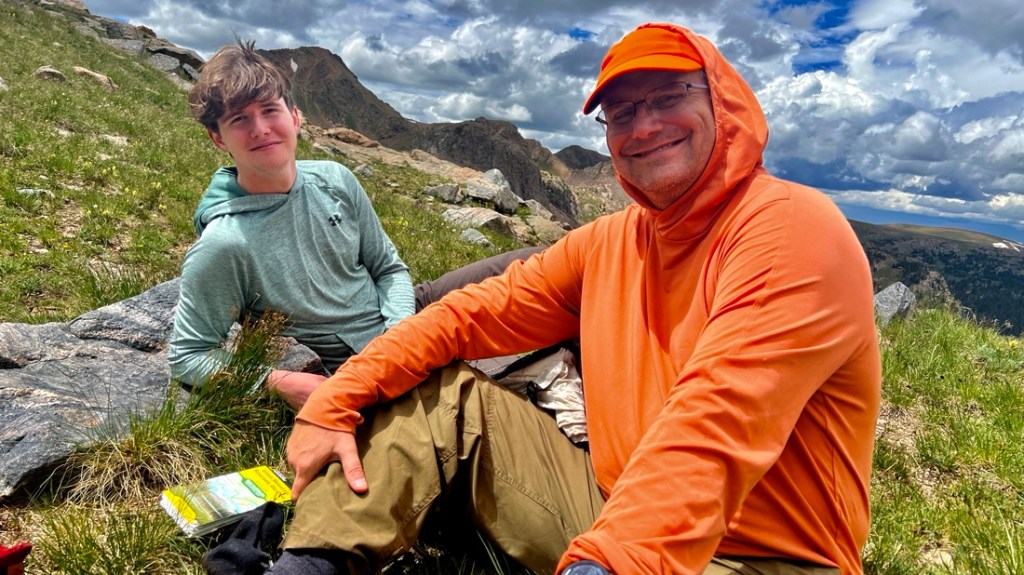
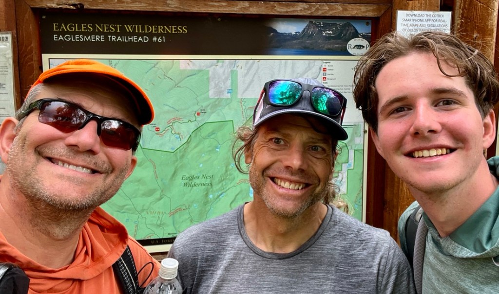
Samuel and I were hungry for an adventurous backpacking trip. It had been a couple of years since we had completed Arkansas’s Eagle Rock Loop and three years since the epic Collegiate Loop on the Colorado and Continental Divide Trails. Samuel had spent his first year in college living in Golden, on the Western outskirts of Denver, and had day-hiked a few 14ers, but I felt we were missing out on opportunities. As we started planning a trip for the week before college restarted, I reconnected with Martin, a friend living in Breckenridge whom I had not seen for a couple of decades. He suggested we check out the Gore Range and I went looking for a suitable loop.
Given its proximity to I70 and the resort towns, the Gore Range is surprisingly off the radar, perhaps because it does not have a 14er. It lies within the White River National Forest, and much of it is in the Eagle Nest Wilderness. The combination of wilderness area and being off-the-radar makes it attractive for those looking for that sort of thing.

There is the Gore Range Trail which is a 45-mile point-to-point thru-hike that requires shuttling and remains relatively quiet. This was an option but we like loops. The only paths that mapping apps, such as CalTopo, CoTrex, or AllTrails, show going over the range are in the South (over Red Buffalo Pass) or in the North (over Elliot’s Ridge). CalTopo’s “Shared CalTopo Maps” suggest off-trail routes over the mountains are possible, but online reports varied from horror stories, to intentional obfuscation to prevent followers. While August brought the kindest weather (albeit with afternoon storms), our recent experience, hiking fitness, and altitude acclimation (coming from Houston) meant we did not want to be over-ambitious.
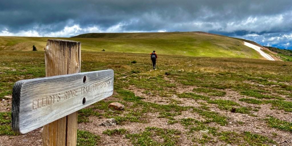
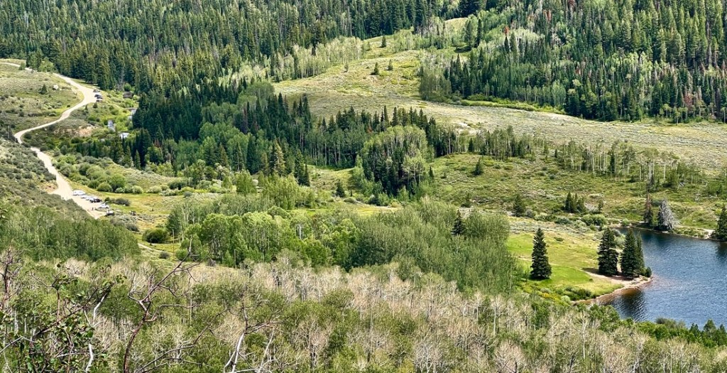
The only loop that jumped out at me was from Lower Cataract Lake to Elliott’s Ridge, via Upper Cataract Lake and back via Mahan or Eaglesmere Lakes. I was surprised that I could not find an account of the loop, which also made me a little cautious. The Colorado Mountain Club (CMC) describes a similar 3-day loop covering 20.5 miles from the Elliott Ridge TH, and that is a robust alternative that follows much of what we hiked, and increased my confidence in our route.

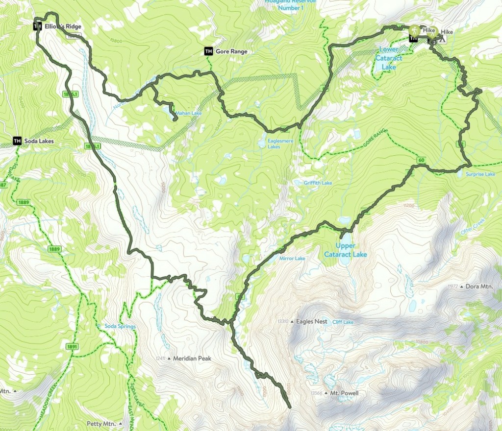
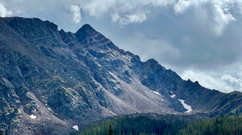
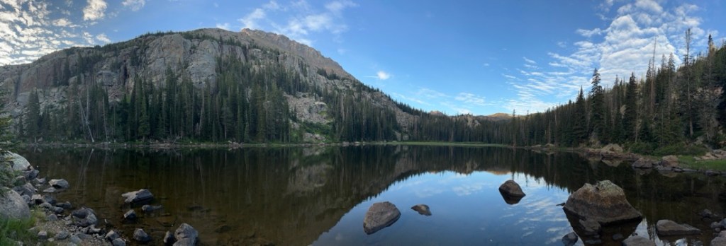
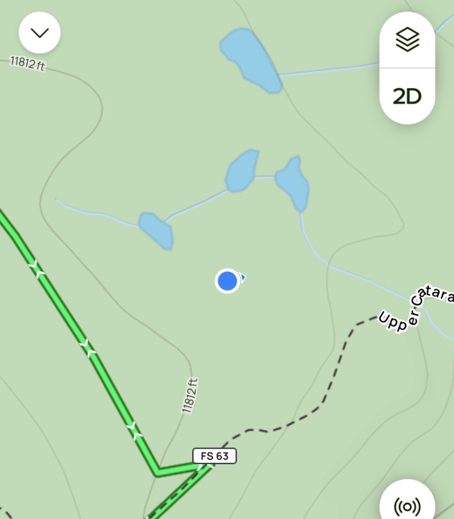
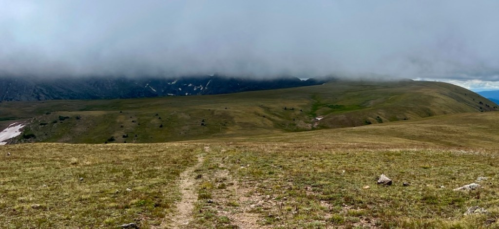
The image on the left shows the available trails, with the wider line showing the Wilderness Area boundary.
The image on the right shows our route, starting in the Northeast corner and hiking clockwise.
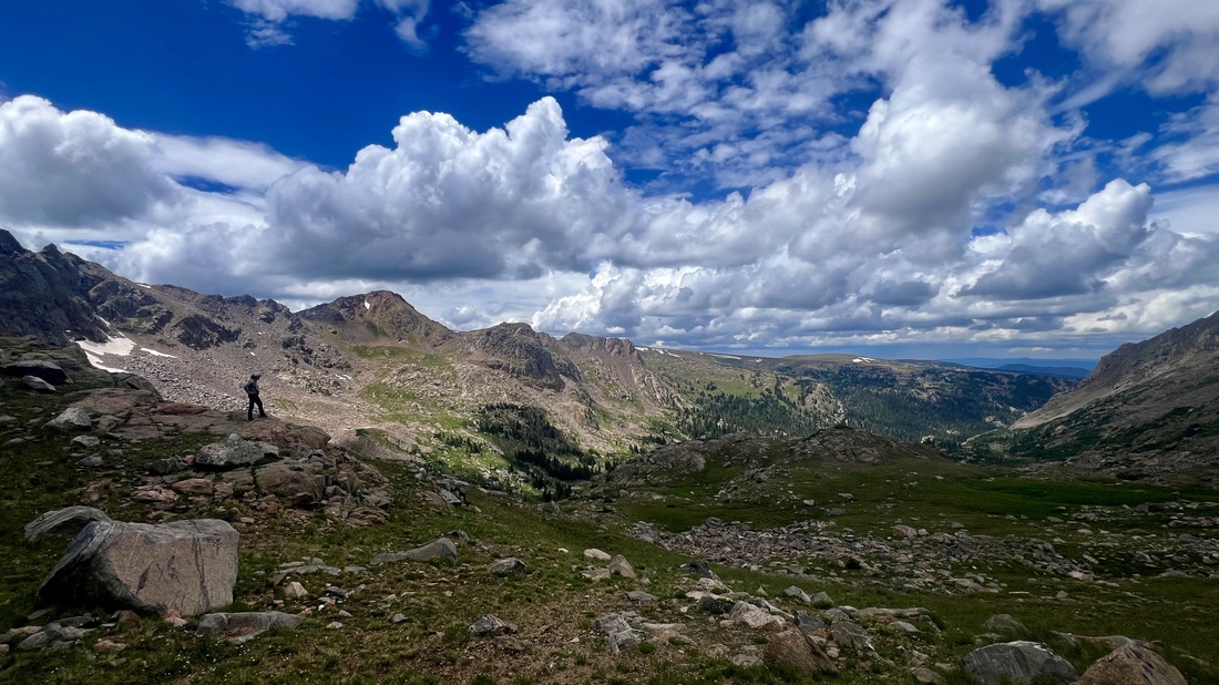
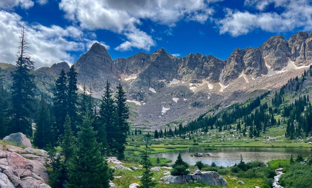
We started the hike with an eye on summitting Mt Powell. AllTrails describes a Class 3 Eagles Nest Summit hike which sounded more than what we wanted. A similar route to Mt Powell appeared viable and more like a Class 2. However, we chose to hike to a saddle on the ridge below the peak due to timing and fatigue. This was a fantastic off-trail side-trip, and a scramble up toward the peak looked viable. The 13ers website only describes a route up Mt Powell / Eagles Nest from the western side, which looks like fun for another trip.
Summary
Three of us hiked what I call the “Elliott’s Ridge Loop” mid-week in August 2024 over four days and three nights. Total distance about 36 miles with about 7,000 ft of climb. Stats are from my Garmin watch, with inherent inaccuracies.
Day 1: Drove to Surprise Lake TH by Lower Cataract Lake at 8,600 ft. Hiked 9 miles, climbing 3100 ft, to Mirror Lake at about 10,600 ft.
Day 2: Followed the trail along Cataract Creek, and continued following the creek off-trail past an unnamed lake to the unnamed saddle on the ridge below Mt Powell at a little over 12,000 ft. Returned to the trail and hiked up to unnamed lakes just below Elliott’s Ridge at 11,800 ft. Hiked 9 miles, climbing 2,500 ft.
Day 3: Hiked along Elliott’s Ridge to its TH, then followed the jeep track to the Mahan Lake trail, camping at Mahan Lake at 10,840 ft. Hiked 9.5 miles, climbing 978 ft and descending 1,893 ft.
Day 4: Hiked out from Mahan Lake, joined the Gore Range Trail past Eaglesmere Lakes, then hiked the Eaglesmere Trail to its TH then a short road walk to Surprise Lake TH. Hiked 8.6 miles, climbing 600 ft and descending 2,835 ft.
Cautions
Most of this hike is between 10,000 and 12,000 ft so appropriate altitude sickness precautions are advised. These are personal. Martin, living at 10,000 ft in Breckenridge, had no issues. Samuel and I had driven up from sea level and spent 2 nights in Golden at about 5,800 ft with one hike up to 6,200 ft. From previous experiences, we know that Samuel handles the altitude well whereas I have struggled, and I take Diamox which works very well, though I have noticed the side-effect of pins-and-needles in my fingers. Samuel’s hands tend to get cold, and we are starting to think he has Raynaud’s syndrome. Even though the temperature did not drop below 40 degrees, there was a real risk of hypothermia.
This area is isolated, and we did not see another soul for over forty-eight hours. We only saw another tent at the Elliott Ridge TH (with a truck) and at Mahan Lake. About eight groups passed us hiking out from Upper Cataract on our first day, which was a Sunday. I used my Garmin InReach to check in with family, though most times Samuel received the text as his phone had signal! However, there was insufficient phone signal at one of the campsites. Samuel has ATT, whereas my Mint Mobile phone, which uses the T-Mobile network, never picked up sufficient signal. The InReach was also useful for weather forecasts from the National Weather Service which were accurate.
August is afternoon-storm season with extra care required above tree line. Our campsite just below Elliott’s Ridge was very exposed but the forecasts looked OK. The CMC trip suggests camping at lakes that are a little lower. We were lucky with the weather and started our hike just after some bad storms. On the first day, we passed a couple that were hiking out from Surprise Lake, with what looked like new gear suggesting novice campers, and residual fear on their faces from the previous night’s storms.
We had a couple of minor navigation issues. First, when passing Upper Cataract Lake, the onward path is not clearly signed. There is a junction showing Upper Cataract Lake to the left and Cat Lake to the right. We went left and lost the main trail for a bit. Second, we struggled a bit to find the lakes just below Elliott’s Ridge. We found some dried-up lakes and were briefly worried. Finally, while not an issue, we chose to cross Cataract Creek at the outflow from Mirror Lake (which was fine), rather than downstream where the maps show FS63 crossing it. For all of these, having a previously downloaded map on a GPS-enabled phone showed where we were, complementing the paper maps. Different apps have their own strengths, and I used CalTopo, AllTrails, and CoTrex offline maps and satellite imagery, having downloaded them before setting out.
When hiking on the Forest Service trails, there will be evidence of Forest Service maintenance, i.e. sawn trees. In the Wilderness areas, these are all sawn by hand, which is a testament to the Forest Service. You can use the presence of sawn trees as an indication that you are on the FS trail!
Opportunities / Alternatives
It appears possible to climb Eagles Nest Peak or Mt Powell from this route over Class 3 terrain.
An easier peak is Meridian Peak, which is an option on the CMC trip and is on AllTrails and Summit Post.
The maps suggest it is possible to descend from the saddle on the West side. This could lead to a bigger loop, though there is no evidence on the Shared CalTopo maps that anyone has tried it.
While Mahan Lake was a beautiful lake, the camping options were not the best. We struggled to find a good spot for two tents that didn’t have puddles, with the best site taken by someone else, which was the only time we saw another tent on the hiking route. The CMC trip recommends Eaglesmere Lakes, though that would have made our wet day 3 longer.
Trip Notes and Photos
Day 1: Surprise Lake TH to Mirror Lake.
There were about 15 cars at the trailhead with a couple of open spots, but I had expected it to be a little busy as today was Sunday. We started hiking at 11:30 and it was a steady climb for the first three hours.

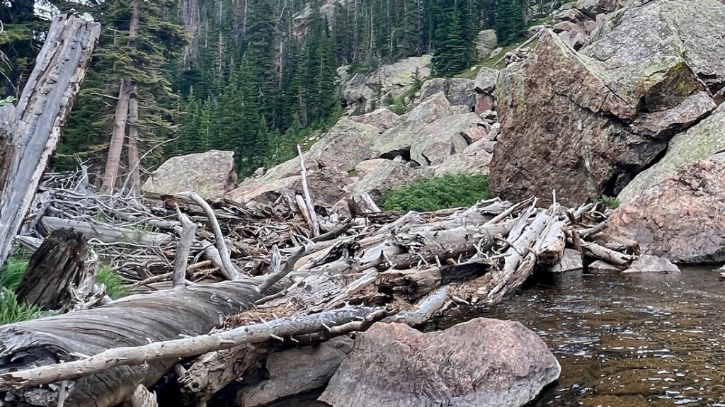
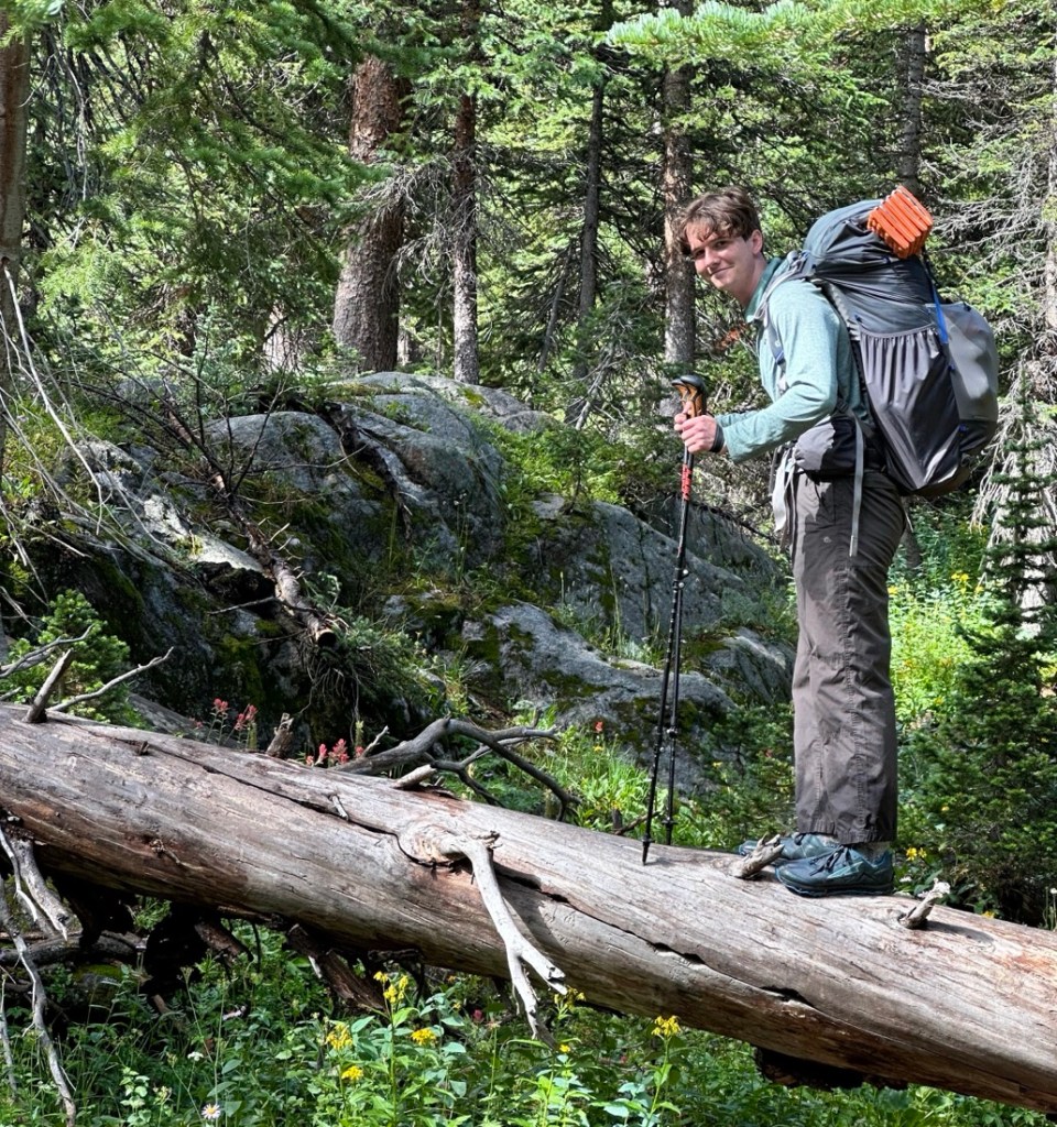
There were lots of fallen trees, but the vast majority had been cleared off the trail.

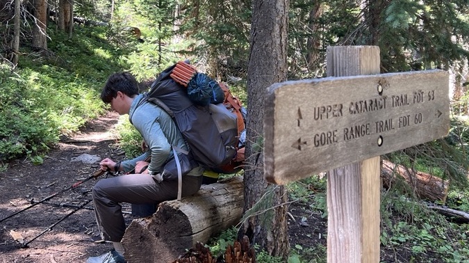
Navigation was generally straightforward, following FS62 (Surprise Lake Trail) to FS60 (Gore Range Trail) and then turning onto FS63 (Upper Cataract Mirror Lake Trail).
Between the trailhead and surprise lake, we met eight groups of people which was a mixture of day hikers, a scout troop, and other campers. The last couple we met had camped at Surprise Lake and appeared to have had a scary night with the storms and we noticed most of their gear looked new. Surprise Lake was pretty with good campsites.


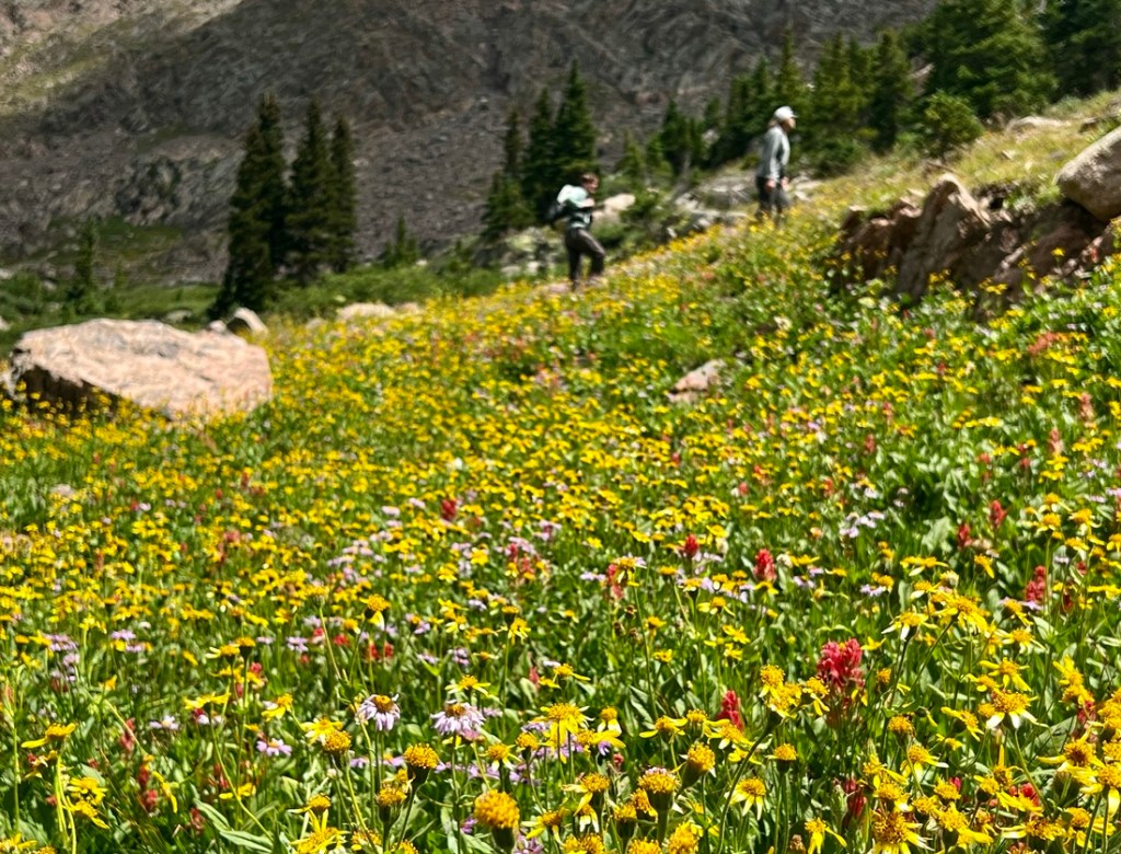
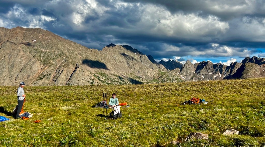
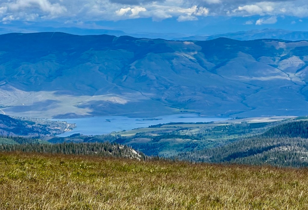
We continued to Upper Cataract Lake and stopped for a snack at a great overlook.
At the lake, we lost the main trail as we followed other trails to campsites and the lake, with a great view of Eagles Nest towering above the water.


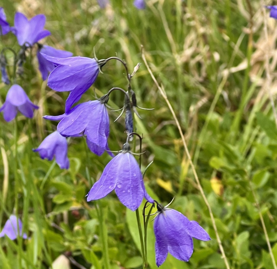
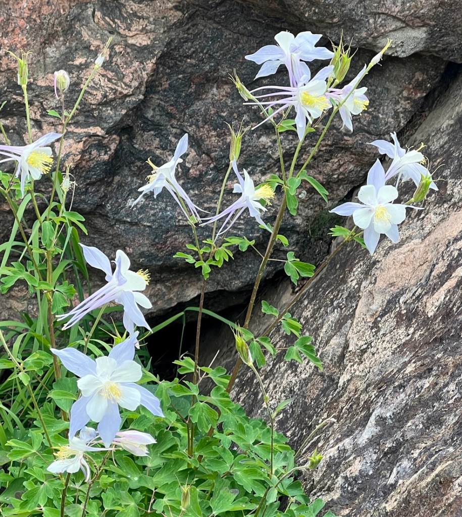
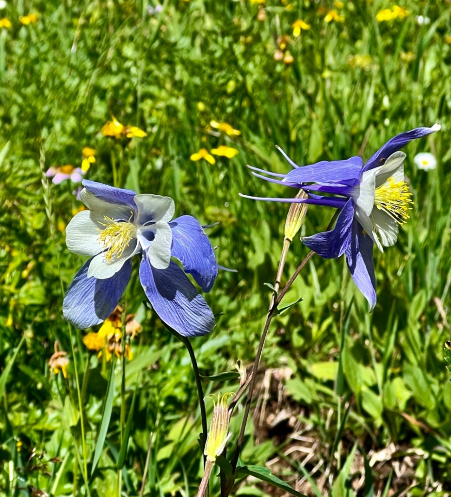
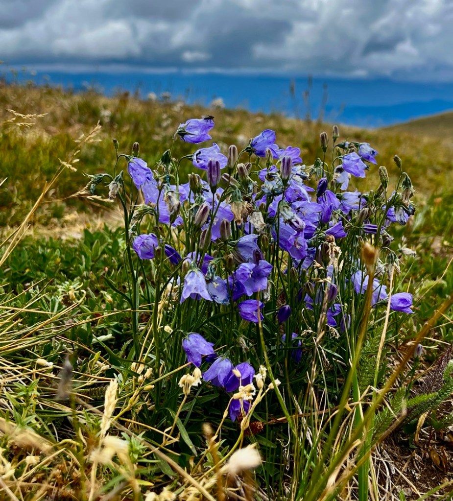
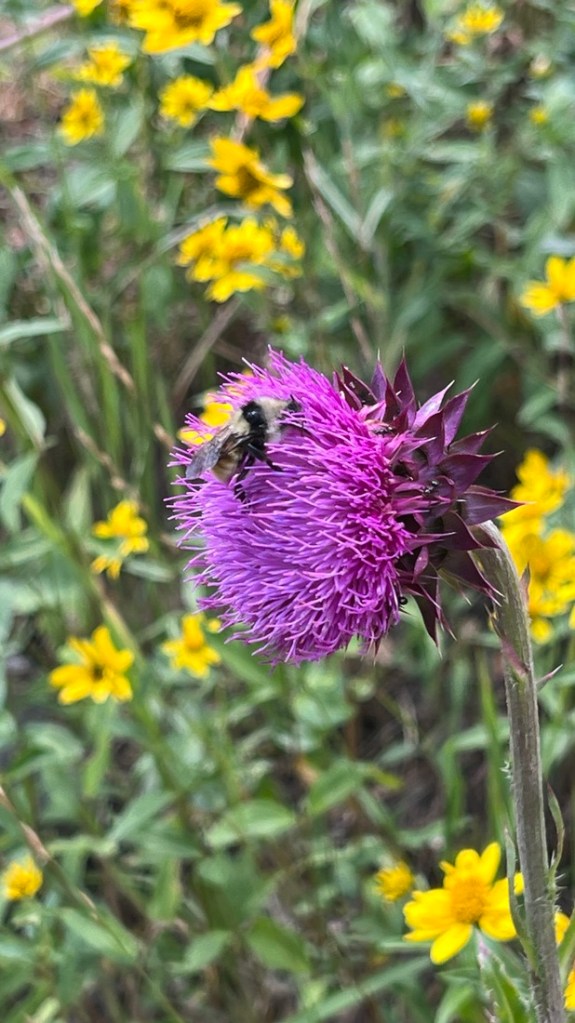
Complementing the vista were a few wildflowers.

I love seeing the columbines, as for many years, I only associated the word with the high school shooting.
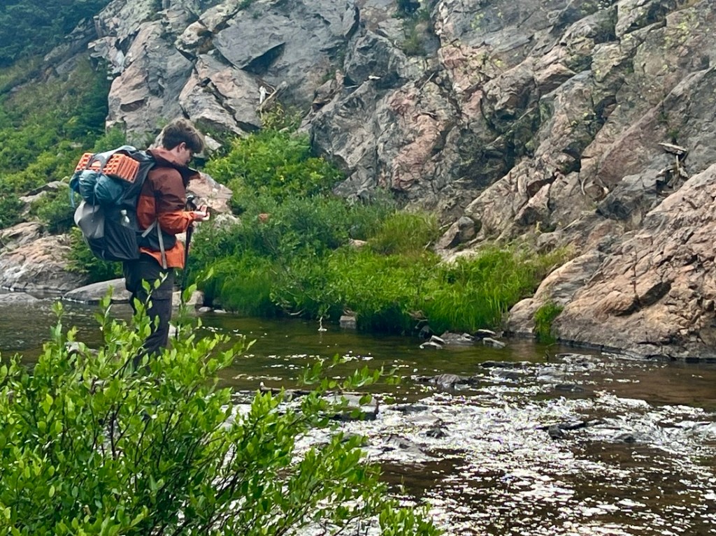
Just before Mirror Lake, there are multiple options to cross the river. We followed the bank up to the lake’s outflow with rock-hopping and log-jam options to cross.
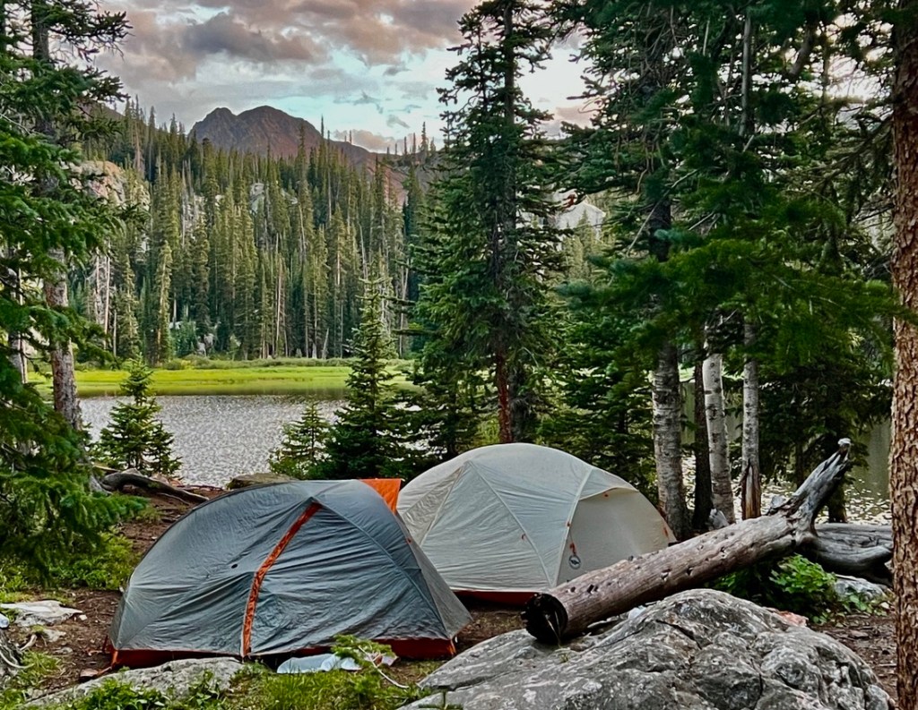
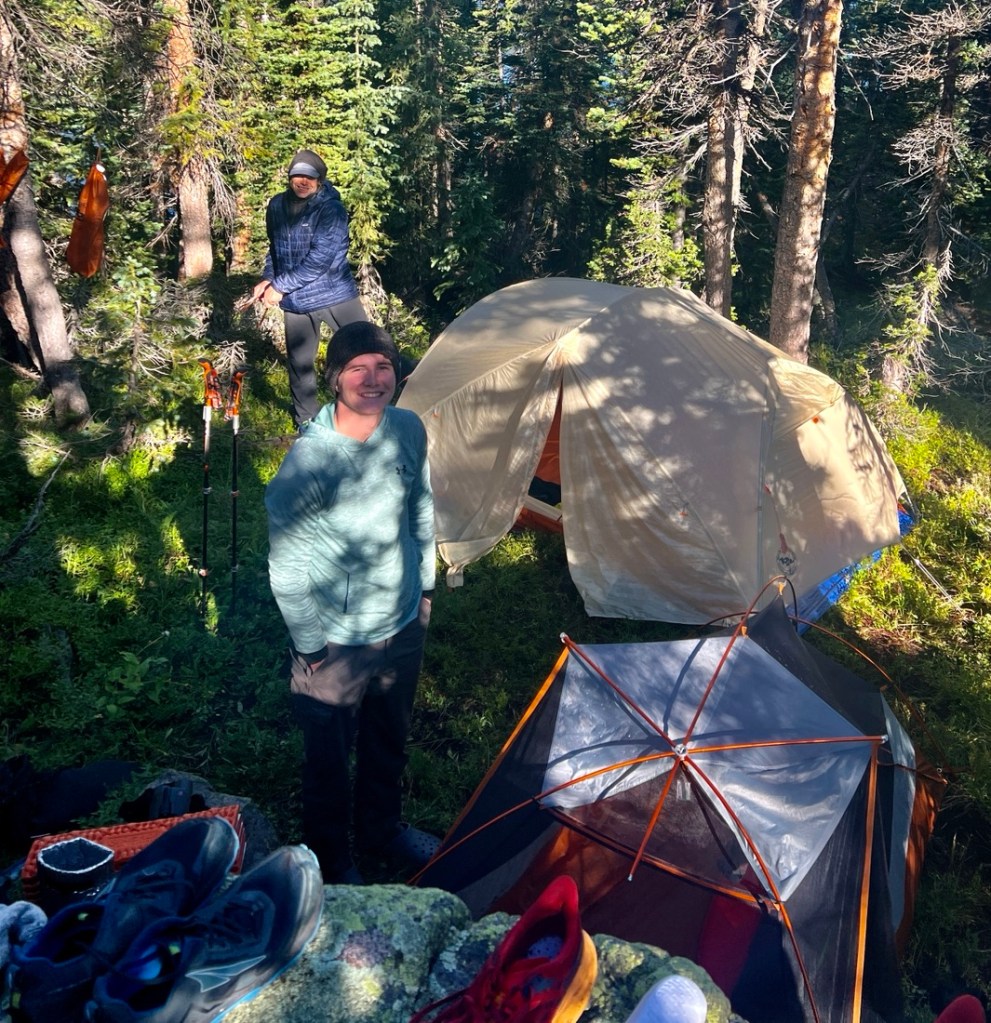
There are a couple of great campsite options on the lakeshore.
Dinner was a Peak Refuel’s Beef Stroganoff which was great, well complemented with a side of Raman plus PB2 powder. We enjoyed fine commentary about every passing bird from Martin, and the moon over the non-reflective lake.

The weather forecast suggested we might see the Perseid meteor shower, which was supposed to peak that evening, but we were not so lucky. We were still open about the following day’s plans, and what we might do with Mt Powell.
Day 2: Mirror Lake to Elliott’s Ridge
A leaky pillow and mattress hampered Samuel’s and Martin’s sleep, but I slept well. I brought my Thermorest Prolite Plus rather than my Neoair Uberlite. Even though the Uberlite is much lighter, I had been cold when using it on the Colorado Trail. I was much more comfortable with my Prolite Plus.
The mirrored reflections on the lake made up for our missing the meteor shower.
I experimented with a Kodiak cinnamon roll mix for breakfast though unfortunately the resulting mush was not appealing. Leftover snacks helped inspire us to start the day. It was only about 1.5 miles until we were heading off trail.


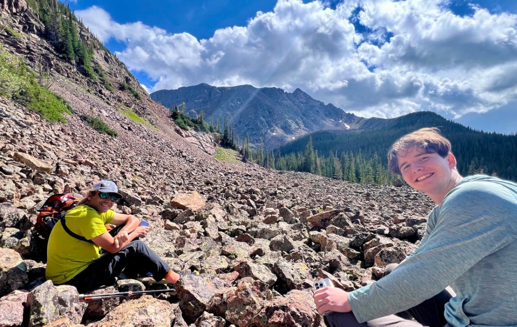
At this point, we decided that the saddle would be a good target rather than Mt Powell, using a combination of the weather forecast, how we were feeling, and the time. We followed the river up to a small lake and then to a large lake and enjoyed waterfalls and few fallen trees.
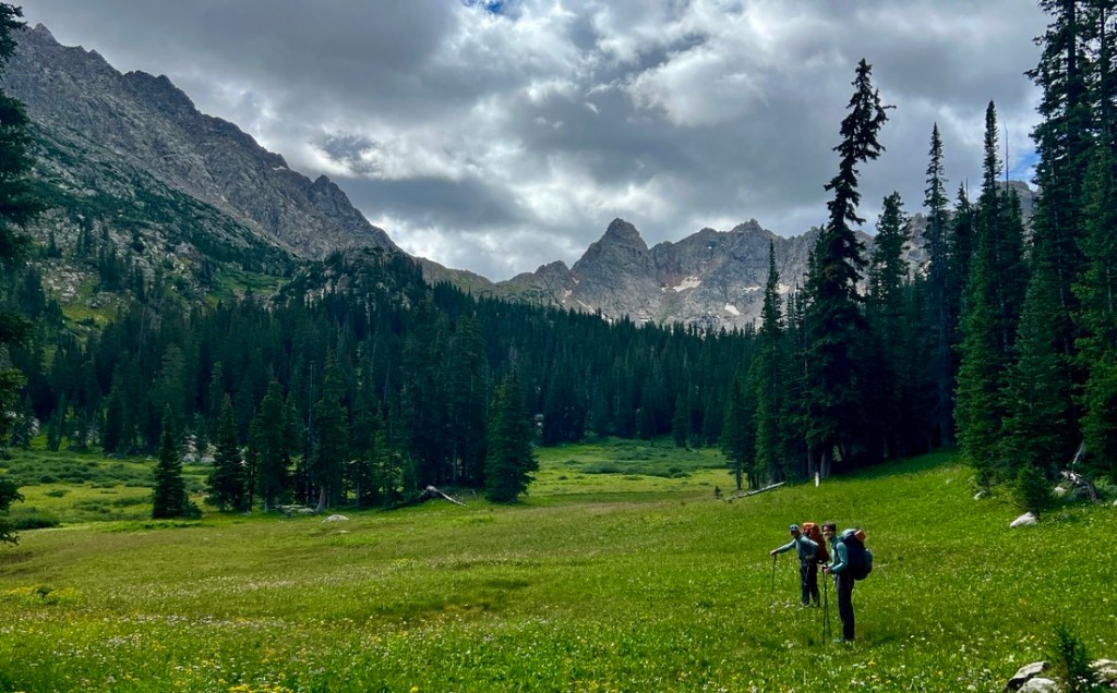

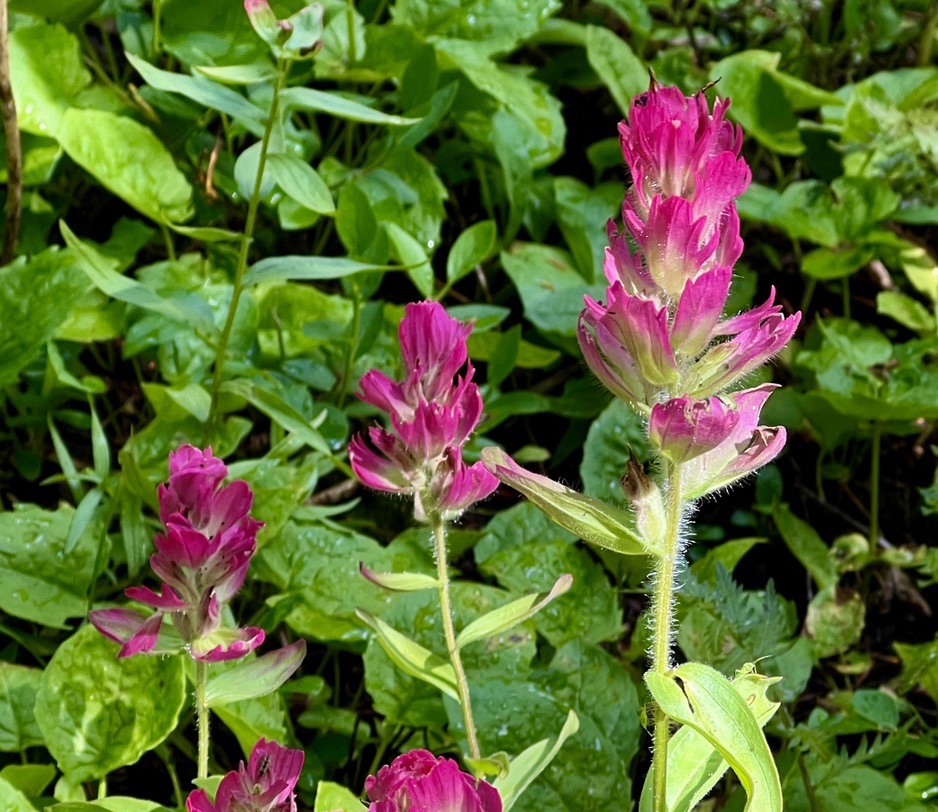
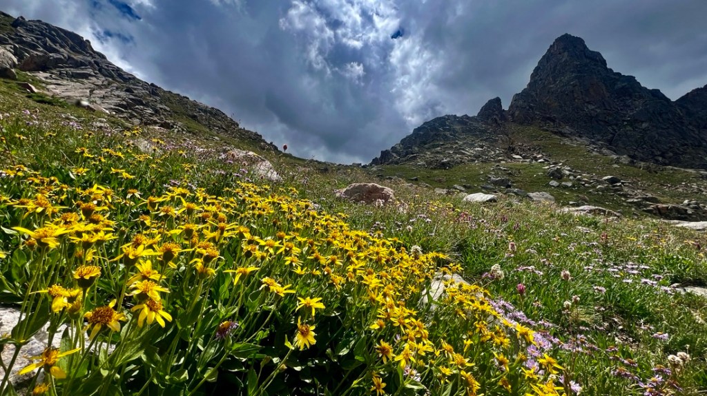
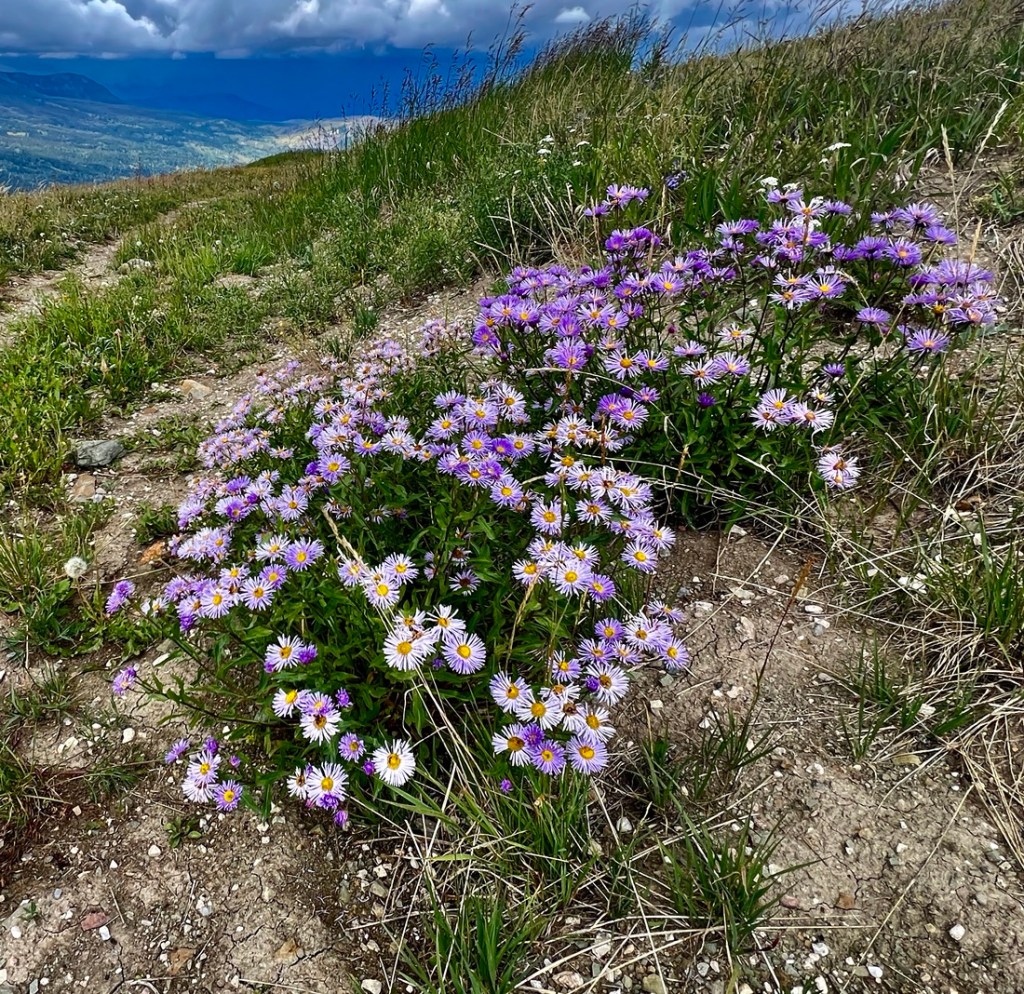
The highlight was the amazing meadows of wildflowers, especially Indian paint brushes, daisies, some late blooming columbines, orchids, and a bunch of other flowers that got Martin excited.


There were also tons of birds and Martin identified the American Dipper aka Water Ouzel (as well as others), and we saw a really cute group of mallards hide in the grasses. We saw marmots a few times and heard pikas and saw moose footprints. We wanted our SLR cameras with big zoom lenses! The off-trail hiking was not as hard as expected. We walked past a fine campsite at the Northeast corner of the lake.

Beyond the Southeast end of the lake, we left our bags to make hiking to the saddle easier. Though it was never too steep, I was very tired when I made the saddle, but I think much of that was due to altitude (and my lack of fitness!). Plenty of snacks and water helped.


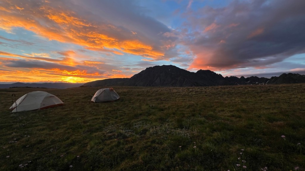
We had thought about camping at the campsite by this unnamed lake which had beautiful views, but that would’ve made the following day too long and it would’ve meant another day of wet shoes from bushwhacking through long grass. So we headed back to the path (FS63) and followed that uphill for about 1.5 miles, ascending 700 ft, to some lakes just below the ridge. We were at our campsite by 6pm and enjoyed the sunset though our positioning on the East side of the ridge diminished the view.


My experiment of a peach cobbler using freeze-dried peaches was successful! The site’s exposure made it a 45 degF overnight though we were very glad there are no storms forecasted as we would have been very exposed. Martin started the night without a rainfly, in the hopes of seeing the meteors, but some showers rudely awakened him.
Day 3: Elliott’s Ridge to Mahan Lake
I set a 5:40 alarm to get us up for a fantastic sunrise at 6 am, for which we were on the best side of the ridge, but it was very cold in the dawn wind.


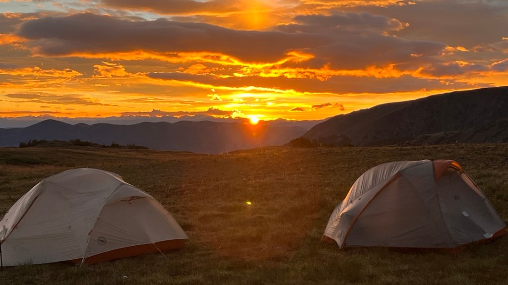
After watching all the colors, we took down the inside of the tent, so we could use the fly as a wind shelter and made some French vanilla lattes. We weren’t feeling the slop for breakfast, so it was more about the snacks and trying some First Ascent instant coffee which was good. We filtered three liters of water, but the filter was getting very slow and required us to sit on the bladder, but we got there in the end. With everything packed, we headed up to the ridge and briefly disturbed a ptarmigan. We quickly found the trail and were soon marching along Elliott’s Ridge. This is a fine five-mile walk along an easy path with 360-degree views above tree line.

Behind us, we saw the clouds descend upon Eagles Nest and Mt Powell and were glad we were not up there.
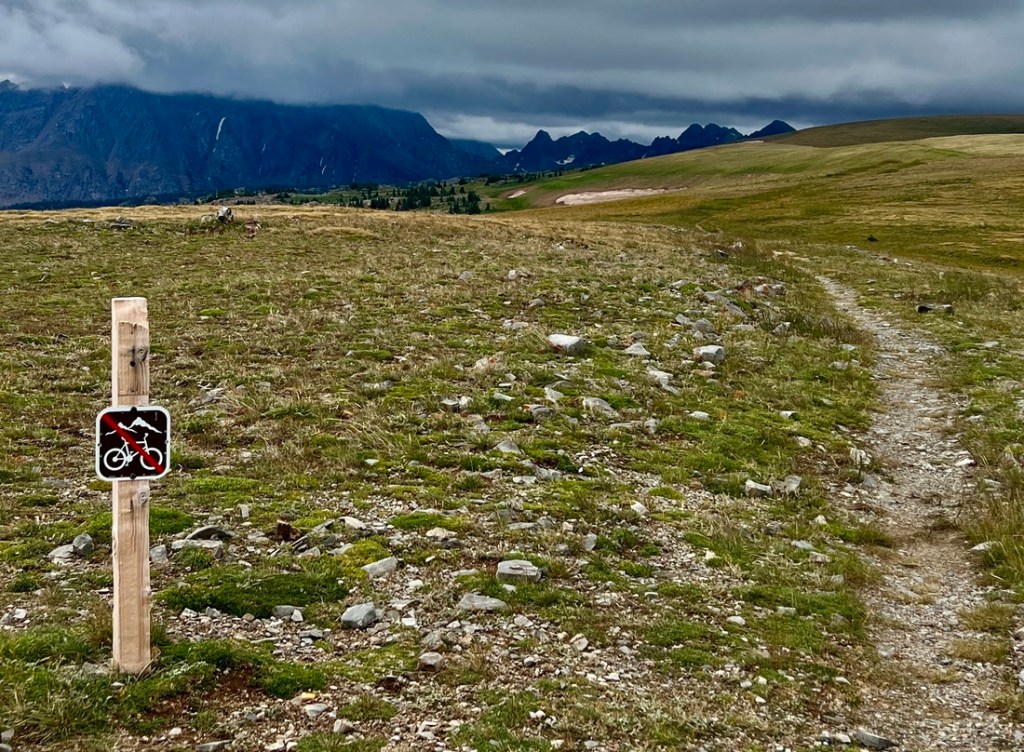
We passed through the wilderness area boundary marked by a no cycling sign and arrived at the trailhead shortly before the rain started. It seemed heavy so we put on full waterproofs, waited for it to subside a bit and headed on.

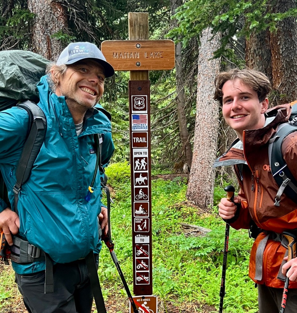
At the turning for Mahan Lake, at the junction of 1834.1 and 1831.1, there was a truck and a tent. It was the first people we had seen in 48 hours.

We kept marching a couple of miles up a very clayey Jeep trail with intermittent showers, some heavy. Close to the end of the Jeep trail there was an abandoned car that appeared to have taken a wrong turn and got stuck many years ago. The Jeep trail narrowed to a single-track path which we kept following for about a mile. In places we could see that it was once a Jeep trail and could see the young fir trees sprouting.
As we arrived at the lake, we saw one other tent though no sign of the people who were likely hunkered down inside. We followed the trail down to the far side of the lake looking for optimum campsites and found one after a while.
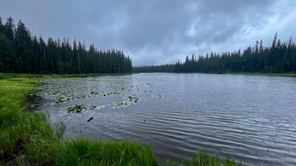
The rain stopped and we got our tents pitched and then the tarp pitched which provided good wind shelter.
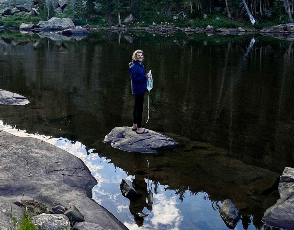
All of our shoes and socks were soaked and Samuel in particular was suffering from cold hands and feet and just wanted to go to bed (it was 4:30). So we changed him into dry clothes fixed some hot chocolate, and he perked up. Then we enjoyed snacks including cheese and crackers, a sweet chicken teriyaki and rice, and a ramen, and discussed multiple different ways to keep his hands warmer. Martin went for a long walk and got cool photos of the lake as the sun was setting. We took down the tarp before going to bed and I immediately started shivering and chattering as the small amount of wind made him feel much colder. Fortunately working to put the tarp away and sort out everything warmed me up. I joined Martin lakeside to filter water and it was so peaceful. It was interesting getting back to camp in the moonlight.
Day 4: Mahan Lake to Eaglesmere Lakes TH
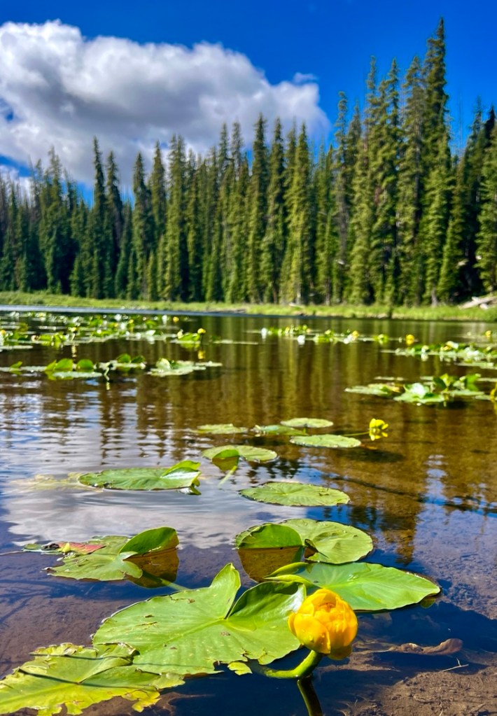
We had started the hike with enough food for four nights, but we decided to head out to the car as there was nothing much new to see and any camping would be pretty close to the car. Samuel and I were feeling more tired than we expected which I suspect was a combination of the altitude and cold temperatures amplifying tiredness. We had fun photographing some waterlilies on the lake and spoke to one of the other campers before heading out. It was warm and sunny and a fine leisurely walk.


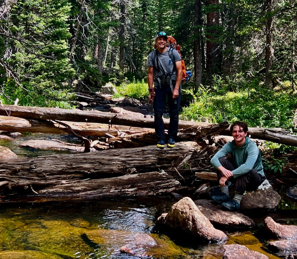
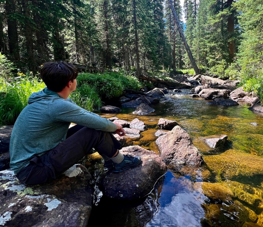
We crossed Elliott Creek, appropriate after the ridge. Samuel decided that rivers (or streams, creeks, or brooks) are his favorite places to hang out at. I can’t argue!
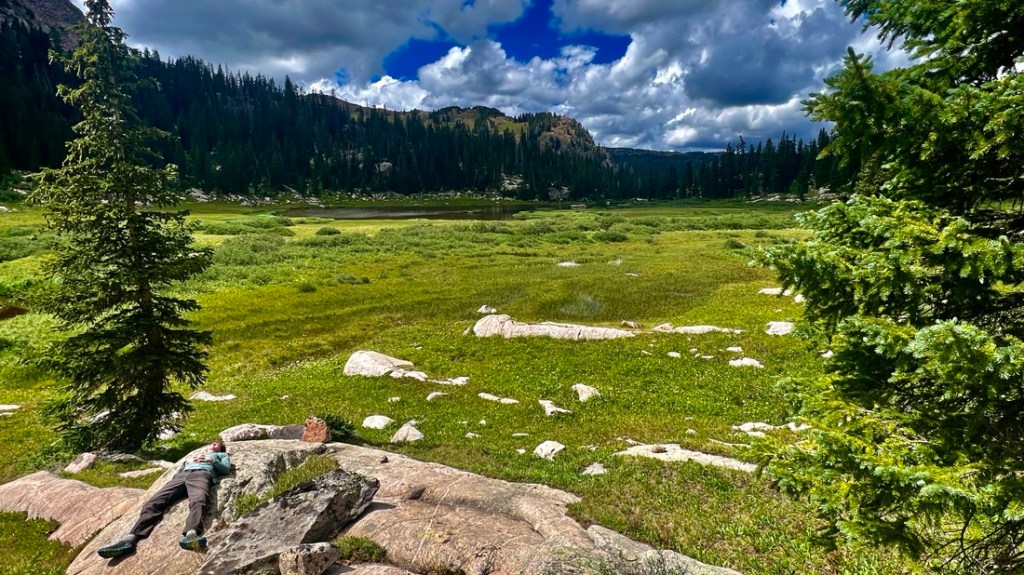
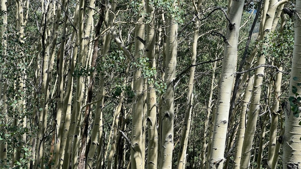
On the final descent toward Lower Cataract Lake, the steep hillside was covered in wildflowers and Aspens, a beautiful end to the hike.

There were some thunder rumblings as we descended but we avoided rain.

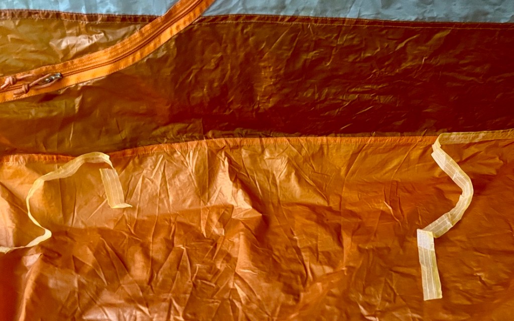
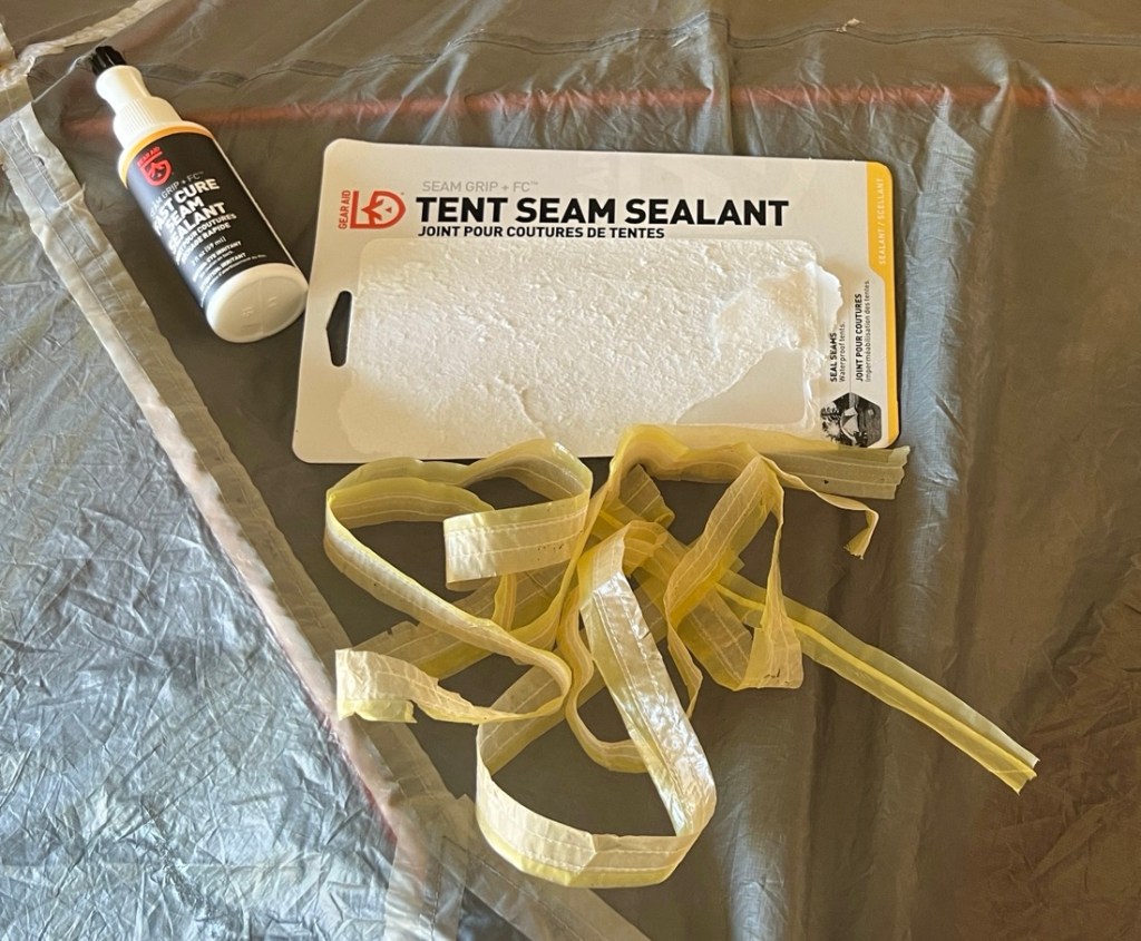
We were soon on our way to Moose Jaw in Frisco for some fine burgers before saying farewell to Martin and heading back to Golden. As well as drying out and washing gear, we’d noticed the seam tape was coming off some places in Samuel’s REI Quarter Dome tent, which has been serving him well since 2016. However, we have used Gear Aid’s seam sealant in the past, with success, so it was time to use some more so we are ready for the next adventure, whatever that might be!
Closing Thoughts
This was a great loop for great views and not many people. Trekking with Martin brought back happy memories from decades ago while enjoying making new ones. The reaction of Samuel’s hands to the wet and cold at the end of day 3 has emphasized our need to do even more to keep his hands warm. My inability to keep up with Martin and Samuel emphasized my need to lose weight and get fit, but with several more trips planned, there is hope! The food experimentation was a mixed bag, with breakfast still a struggle, Raman and Mac and Cheese continuing to work well, and the Peach Cobbler (after Scott’s inspiration) being a hit!
One memory sticks out. Martin mentioned how well Samuel and I work together in the backcountry. It wasn’t something I’d thought about, but it made me realize how blessed we have been to develop our backpacking skills together. It’s been nearly ten years since we started backpacking together, reinforcing how such things do not happen overnight. There is truly something special about backpacking with your son, enjoying the high points and working through the low points together. This page shows the progression of eleven hiking trips over the last ten years.
Please follow us on this journey by subscribing below, and we would love to hear your encouraging feedback.

I had been wanting to go back and read this (busy moving my own son into college this past week; my wife is dropping our daughter off in upstate NY as we speak) and—wow! What a great trip. Beautiful pictures. What an experience.
I would have to agree with Samuel that I love hanging out near water!
And your closing paragraph—I couldn’t agree more. My son Tom and I have been backpacking for 5 years, and camping for a total of 12 years now. There is really nothing like working through a backpacking trip together, especially once you have a few under your belt and can anticipate both the highs and the challenges. It is indeed a blessing. Tom is a freshman this year and he’s living on campus, but one positive is that now he’s actually closer to our favorite local state forest than I am now, so I reckon I’ll be driving down there to meet him once in a while.
LikeLiked by 1 person
Sounds like a nice two night loop hike (without the Mt Powell day). Thanks for the intel on where you camped.
LikeLiked by 1 person