Samuel’s interest in the Glen Canyon Dam made me think of visiting Hoover. It looked like they had a cool tour inside the dam, with tickets only available in-person, on the day. With a 3:48pm flight out of Vegas, which was 30 mins away from Hoover, we had time. While it meant another 5:30am start, Samuel managed to be awake for about 5 minutes to get from the hotel to the car, and then fell straight back to sleep.
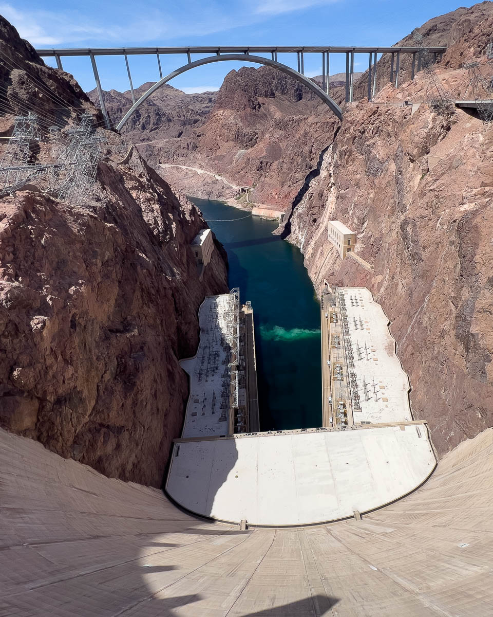
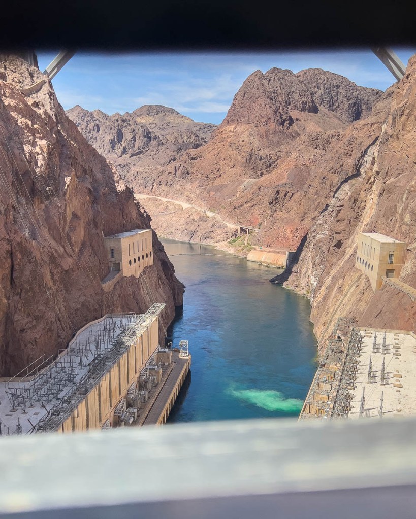
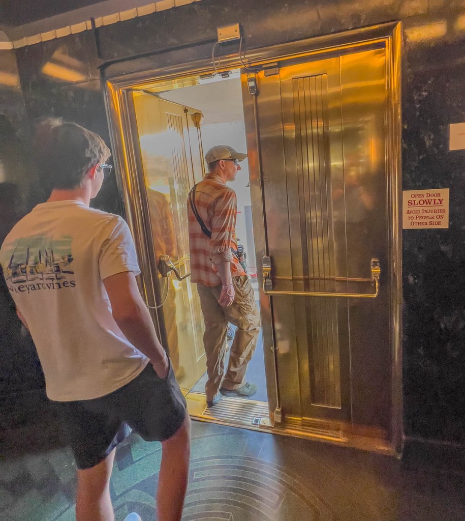
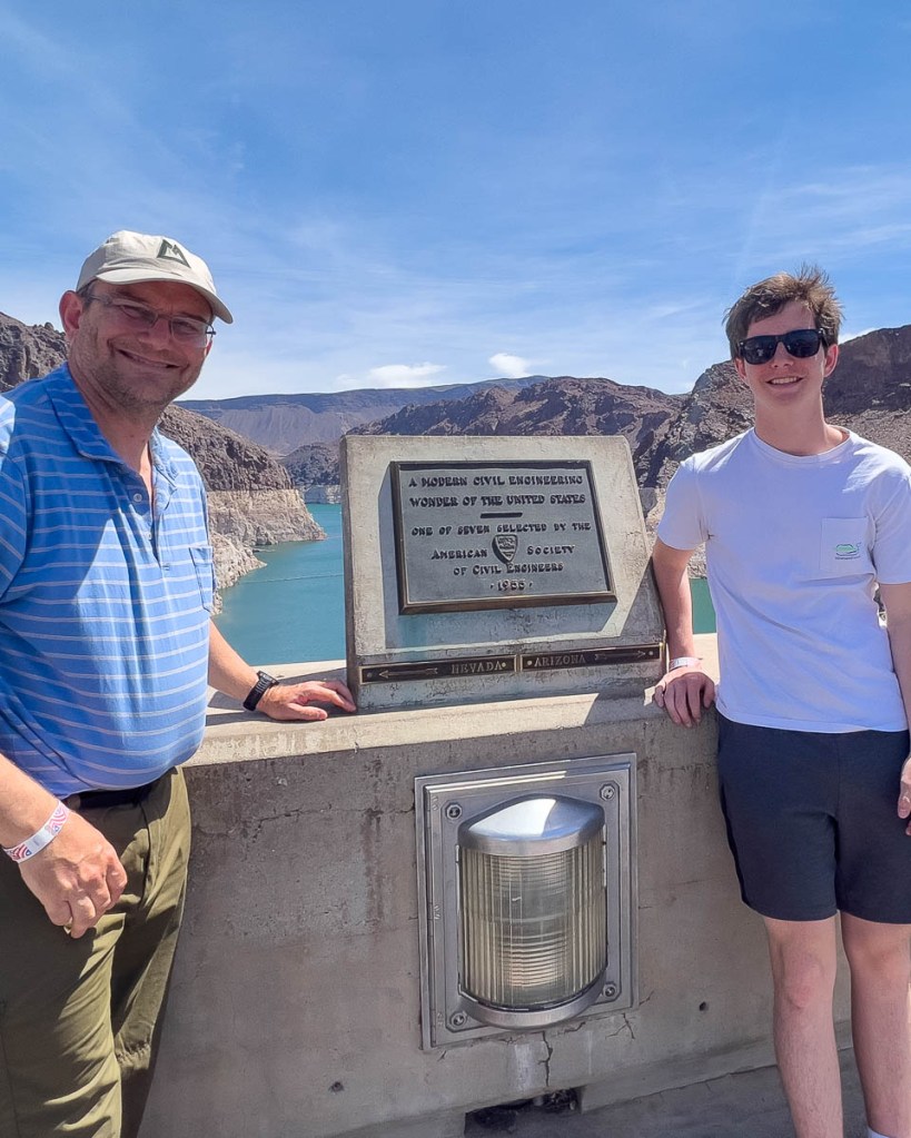
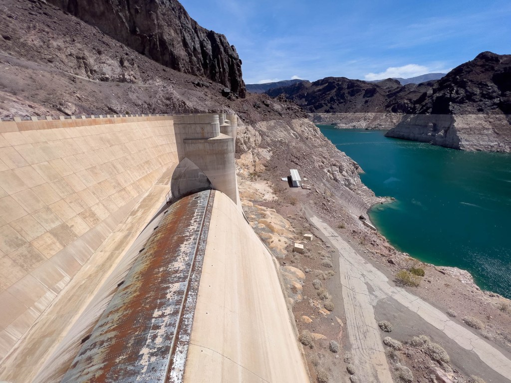
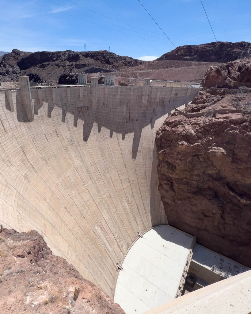
We arrived at Hoover Dam at about 8:45am and were able to drive over the dam itself before queueing for the visitor center to open. We got the first tour at 9:30am, limited to 30 guests. A 10-minute film was followed by a descent inside the 726-ft. deep, 660-ft. thick dam to visit the powerhouse, inspection tunnels, and a ventilation window looking out of the face. After the tour, our walk outside included one of the two spillways which are designed to handle the flow of Niagara Falls! While the spillways were last needed in 1983, the issue is currently extended drought with Lake Powell levels continuing to drop to dangerously low levels. There is a visitor center with exhibits, but that is not really our thing. It was definitely a very cool visit!
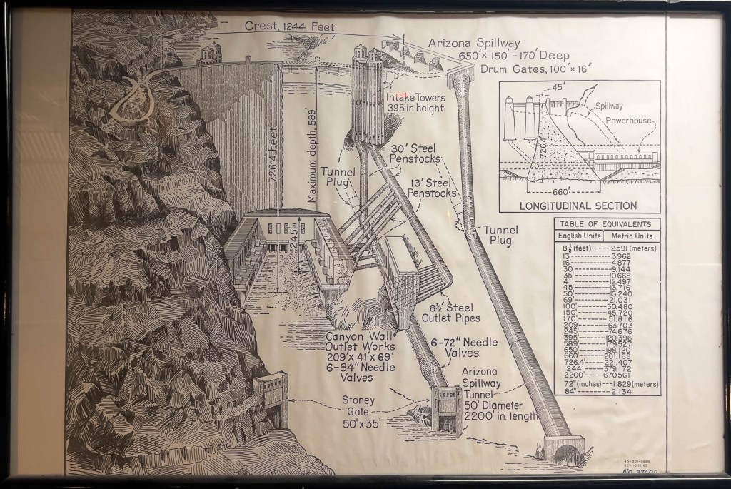
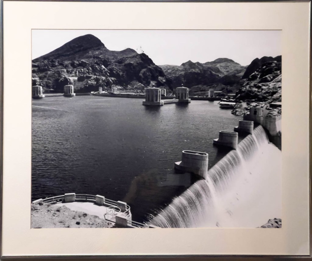
The tour started with an overall explanation.Diagrams provide good backgroundThere are pictures of testing the spillways shortly after construction had completed in 1936.To build the dam, they blasted four large tunnels through the rock to divert the water away from the construction site. This is one of them. 8 turbines can be used to generate electricity. N3 (N for Nevada, with A for Arizona on the other side) was being serviced.The N3 turbine assembly being maintained.The turbine needs 600 tons of lift capacity, so both of these cranes are required.A smaller generator to provide the electricity needs of the dam itself.How the area looked in 1922 before dam construction began.
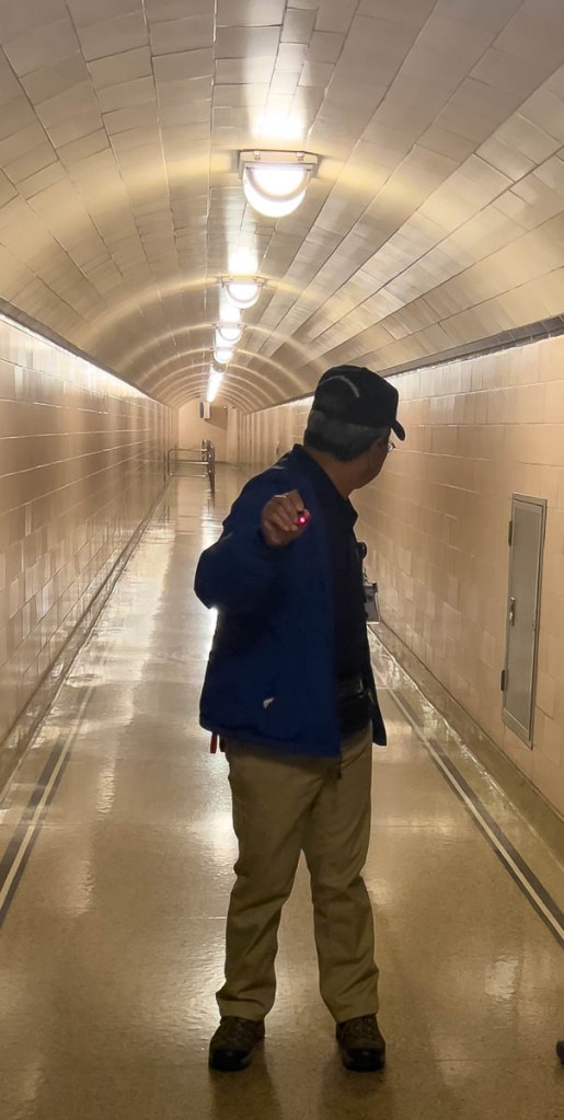
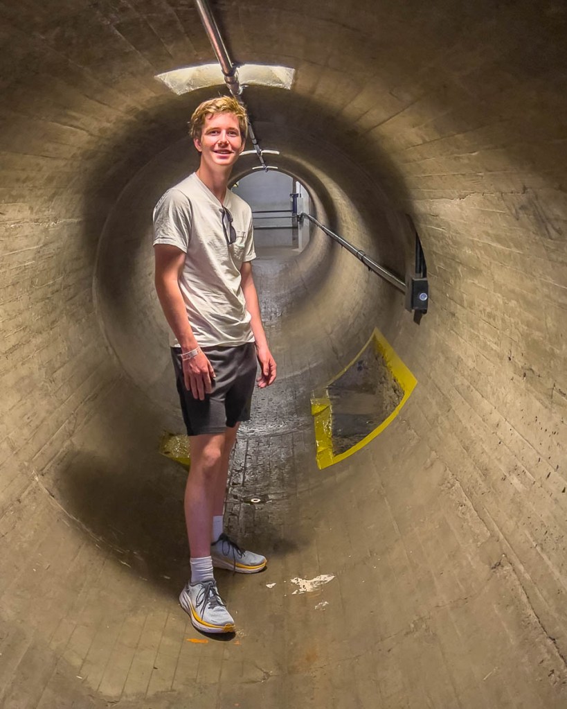
Eno showing us the tunnels.
When they built the dam, they expected water to seep slowly through the concrete, and a drainage system was put in place. In the end, the seepage has not happened, and the inside remains dry.
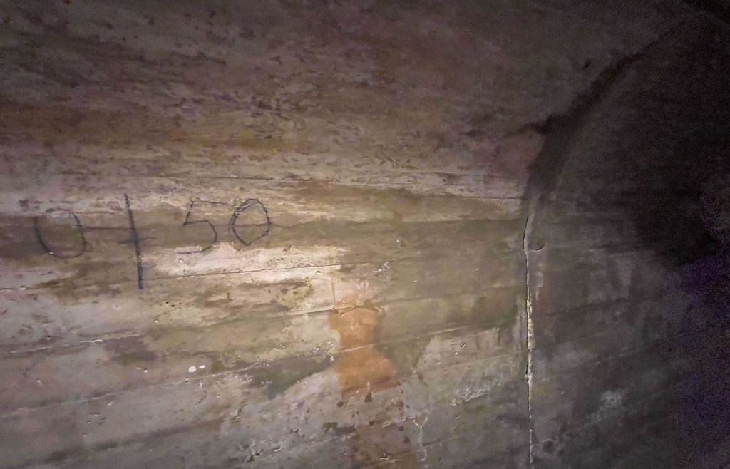
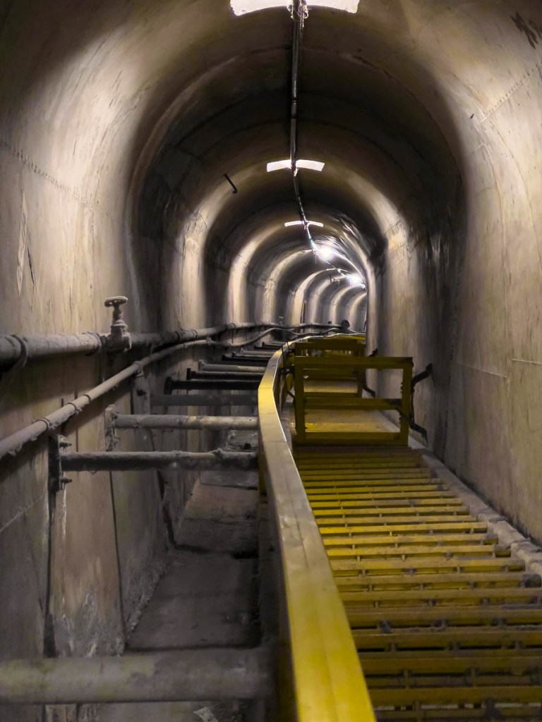
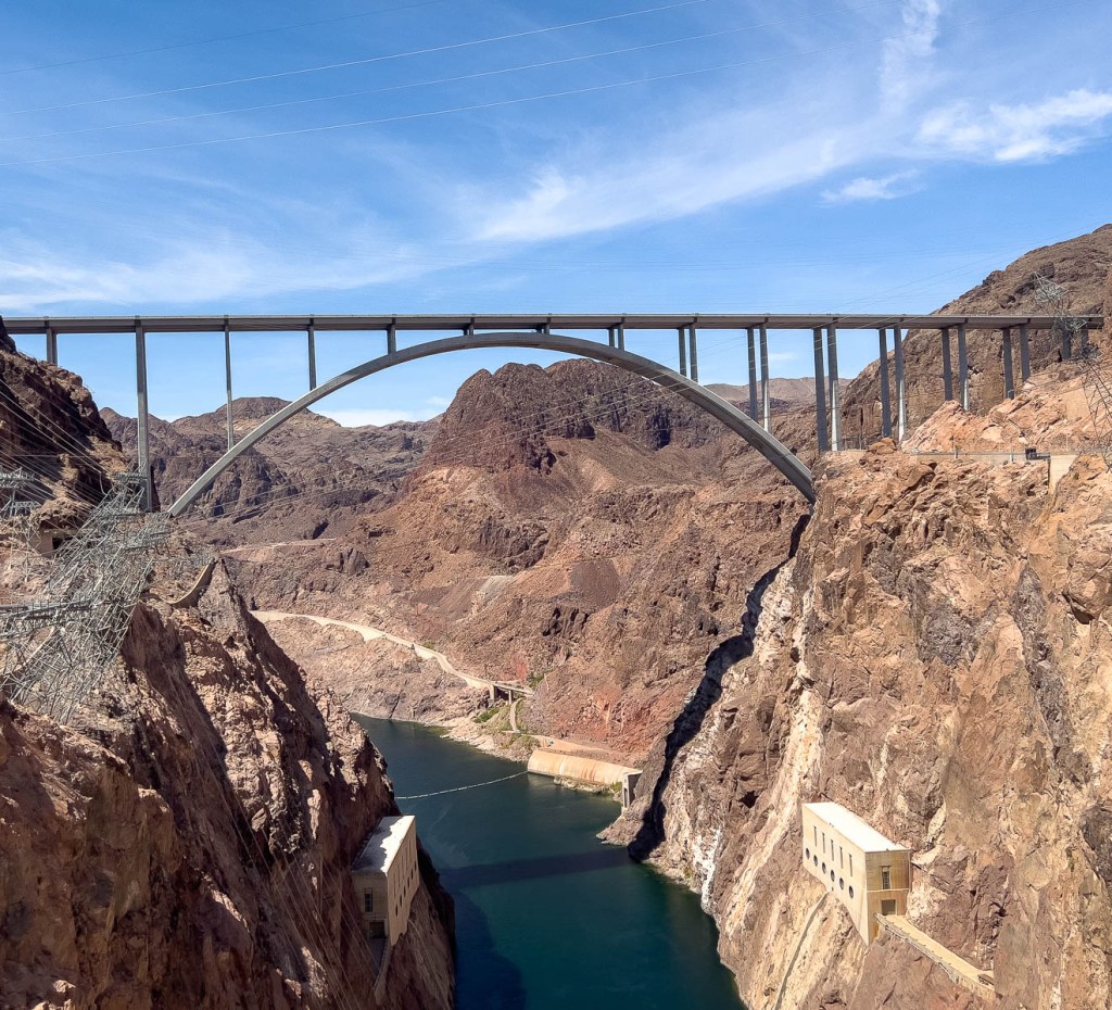
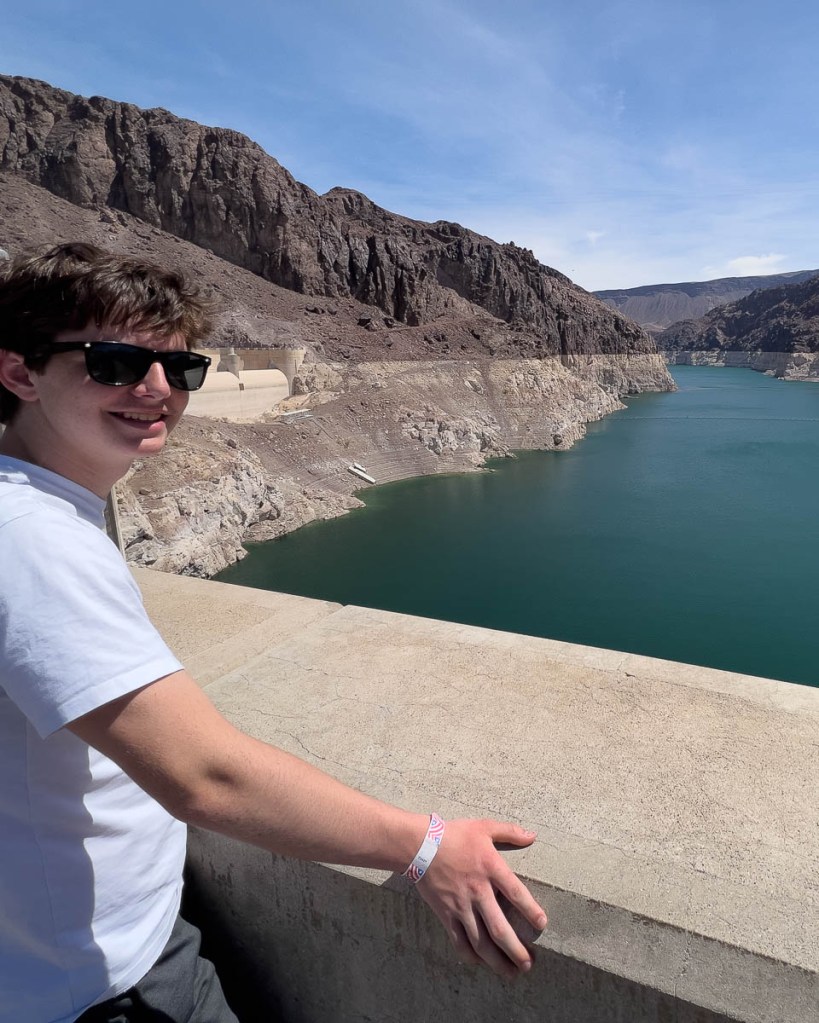
The view from the ventilation shaft window was cool!The tunnels were built using wood to hold back the concrete until set. The planks, the outlines of which can be seen, were removed afterwards and used in construction in the workers’ town of Boulder.Most of the dam was built using cubes of concrete 50ftx50ftx5ft, poured in place. The 5 ft height helped with the setting, which needed to be assisted by special pipes. The dam is in an earthquake zone. Any tremor over level 3 required a full inspection of the dam. Did Samuel kick this sensor? What do you think…?In the 1930s, they developed ingenious ways to detect movement of the concrete blocks. A copper wire was wound tight between the posts above the letters Q and P to detect relative sideways movement, while the gap between the metal bar and the concrete was measured to check for back and forth movement. Also, a bowl of mercury was used to check for tilt. Since construction, the dam has remained stable!One of the tunnels descending into the depths. The left side was designed for water which has not been required. The periodic gates are not original, having to be added for OSHA safety, to stop someone falling all the way to the bottom!The dam’s designers included access for visitors, and some of the original decoration from the 1930s remains.Outside, one appreciates the dam’s size.The bridge bypassing the dam was completed in 2010. Security at the dam significantly increased after 9/11.The white rock shows where the maximum level has been.The dam straddles the Nevada/Arizona border.The towers are the water intakes.The spillways haven’t been used since 1983, but are designed for the flow of Niagara Falls!The focus is on water “reclamation,” so that it can be used in the arid west.The front of the dam. The ventilation window that we looked out of is barely noticeable.The pylons lean to ensure the power cables are tight and do not touch the canyon walls.We caught a glimpse from our plane window.
And that was the end of our 6-day adventure! We know that our Coast to Coast trek across England is next, but I need to work out what I will do next with Samuel…
"Cajunlimeys" combines Lousiana (Janet) and Britain (Peter). British sailors in the 19th century were nicknamed "limeys" as they drank lime juice to prevent scurvy. However, while Janet is a fine cook, she has no Cajun blood, but the name fit.
We love adventures and use blogging to write a photo diary to preserve our memories. Some crazy friends enjoy following us, and my notes might help others plan.
View more posts