

Waking up this morning before dawn to catch the sunrise, my first thought went to Louisiana as Hurricane Ida bears down on them. My photo feed yesterday brought back memories of Harvey, and there are many comparisons between Ida and Katrina which made landfall 16 years ago in the same week. I prayed for safety and what will soon be recovery.
It seemed fitting that to catch the sunrise, I was looking East towards Ida. With the hurricane over 200 miles away, there is little evidence in our sky, as confirmed by the satellite photo.
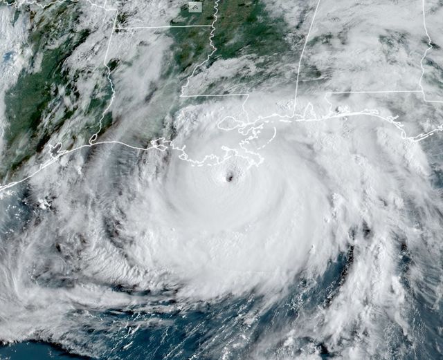
From Space City Weather. https://www.facebook.com/spacecityweather/posts/390937889059327.
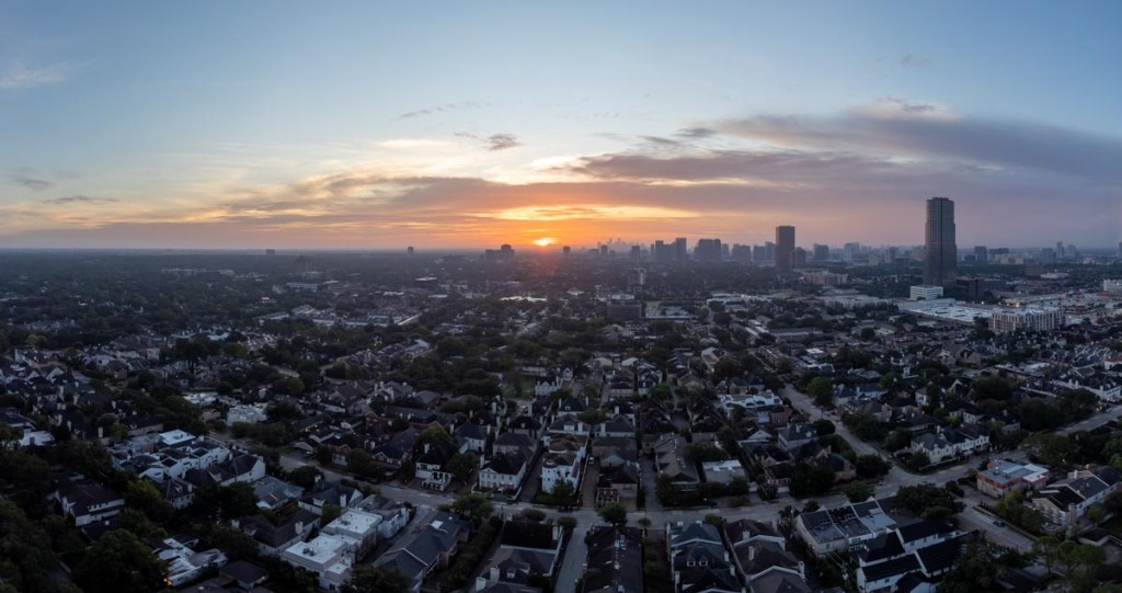
This was my second attempt at photographing the sunrise. It would normally be most challenging living in a two-story house near central Houston, but there is a great view from about 300ft above our house! I took the photos using my new DJI Mini 2 drone. I’ve written a separate post on “how-to” . Without getting into the details, the photos below are a combination of between 18 and 26 individual photos.
Below is the predawn photo, taken 32 minutes before sunrise. In the middle, you can see a line of lights which is our driveway; our house is at the end. The bright lights to the right is the parking lot for our grocery store (HEB). The closer skyscrapers are around the Galleria area, and the skyscrapers in the distance are downtown Houston. 200 miles further is Lafayette (which appears safe from Ida), and about another 100 miles to New Orleans.

The next shot is from 3 minutes after sunrise. It’s always unpredictable quite how the colors will play out, but that is part of the adventure of getting up so early! Today, I think I prefer the predawn. Last time, it was about 20 minutes after sunrise. What do you think?
Below is another way of looking at the sunrise, with a 360 view and interactivity.
Finally, DJI have a website called Skypixel that has a cool way to show their 360 degree photos.

Hope the hurricane doesn’t head your way
LikeLiked by 1 person