

It had been great spending some time with Paul (and enjoying the use of his truck for trips to stores and a hotel in Salida!), which was a good indicator for the trip. We struggled to “land” on the right plan, working around the constraints of Hope Pass, Lake Ann Pass, the 15 miles of CW03 above tree line, and trying to summit Mount Huron. We set off intending to hike Mount Huron on the second day, so chose to park at Willis Gulch Trailhead. As the day progressed, we all agreed to change the plan:
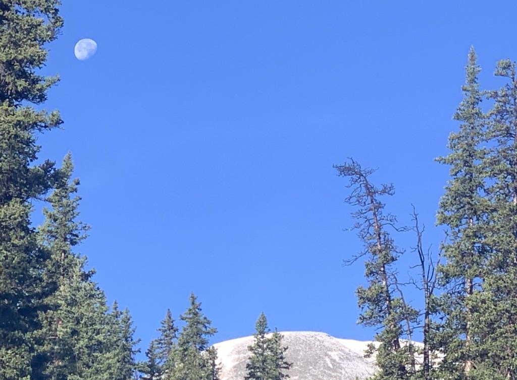
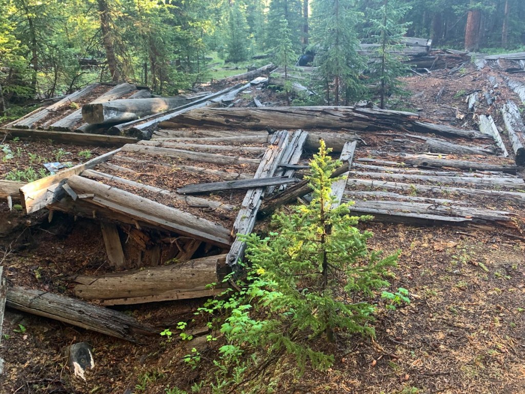
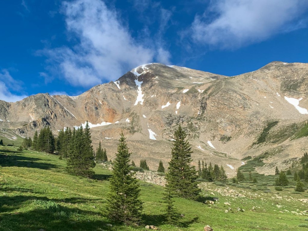
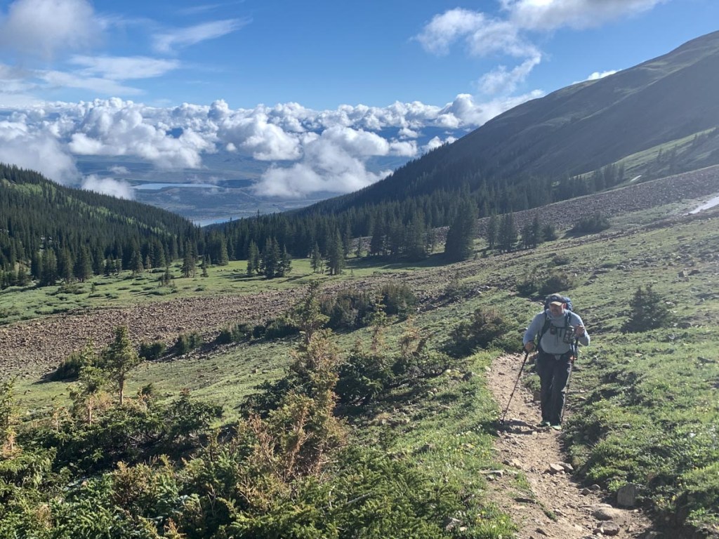
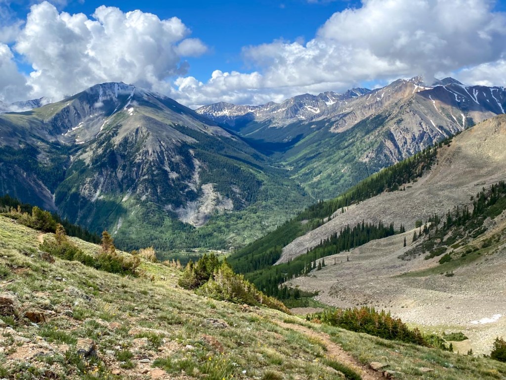
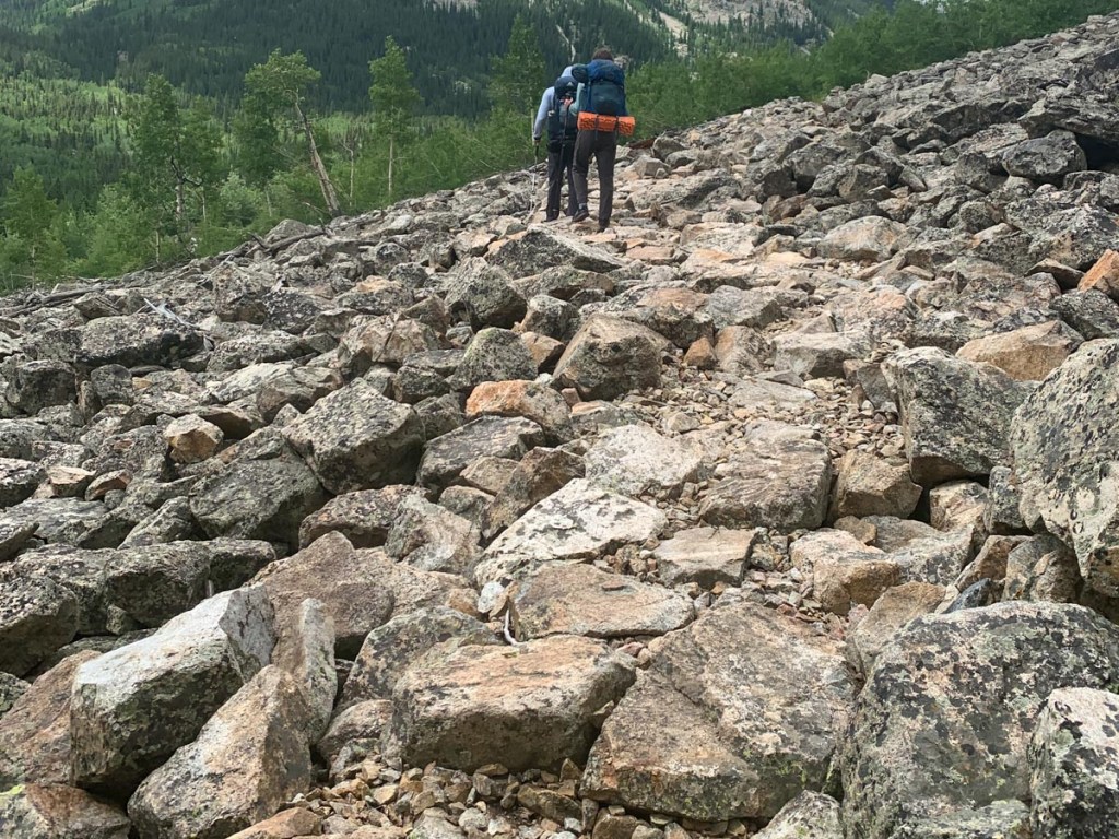
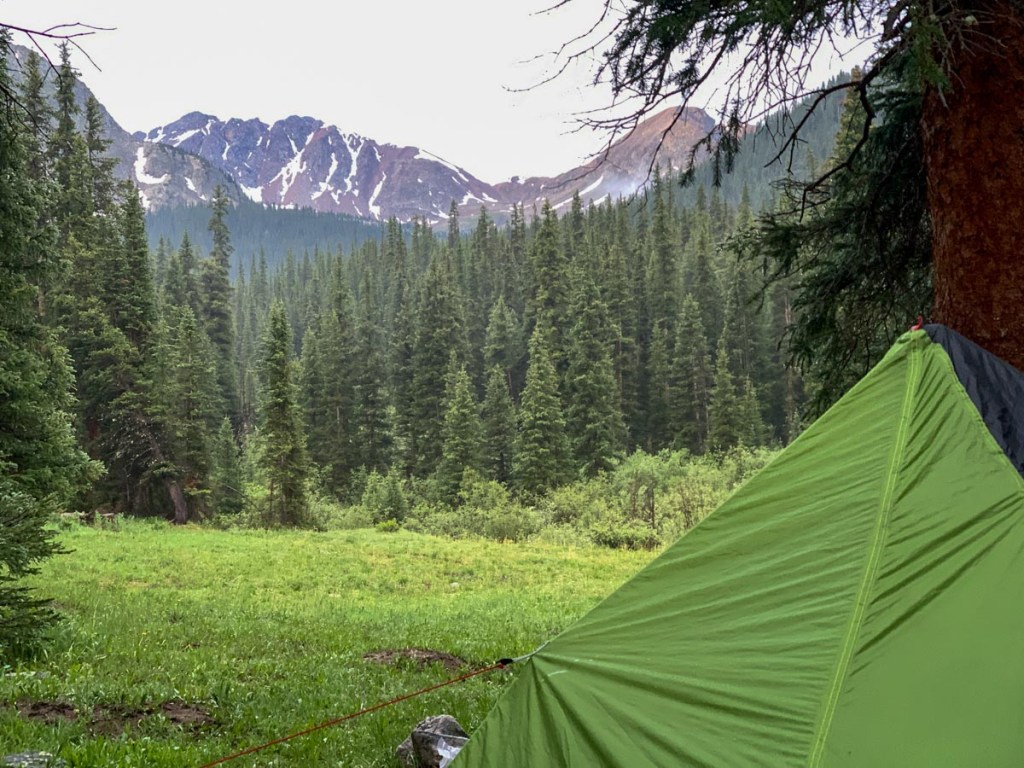
Both of us slept very well in the hotel and woke up to a 3:30 alarm and then on the road at 4 and Willis Gulch trail head by 5:15 so hiking before 5:30. Some clouds in the valleys but otherwise clear and crisp. Quite a climb up to the CT trail and then a long steady plod up Hope. As we gained elevation there was more and more snow on the ground and it got colder. We found a cool old log cabin right by the pass including a cellar and an outhouse. As we got higher and went above tree line fantastic views opened up and the march up hill was keeping us warm. Had to travel through a couple of snow drifts but nothing too serious. The views of Hope mountain and the overall landscape just can’t be described because it was so beautiful. We made it to the pass where there was an older gentleman who was very experienced in the mountains. We nicknamed him Billy Goat out of respect because he could just go up the mountain. We attacked our snacks such as cashews, pistachios, raisins, Texas trail mix, and dried mangoes but had to keep reminding ourselves that we needed them the whole week. We started descending the other side of Hope Pass. We met two cheerful female day hikers who had been told by another hiker that there was a bear around and they had seen a marmot. As we hiked down Paul could identify bear paw prints on our path and we saw a marmot which P misidentified as a beaver. We met a lone female CDT hiker who didn’t seem very happy, just like laundry rain gear girl the day before. But then we met a couple that were hiking hard that seemed very happy. And then there was a dispersed group of five marching hard trying to get over Hope Pass before the weather turned which we thought was overly optimistic. It was a long and difficult walk down off Hope Pass. Though the views of the mountains in the distance continued to be fabulous. At the bottom we enjoyed our mint KitKat and Cadbury chocolate and carried on plodding. We found a good pace that suited all of us. We found a nice spot to lay down by a river for lunch where we replanned the rest the hike in which we agreed not to attempt Huron as it just didn’t work and the main objective was Collegiate West. So we marched on hoping to get to Lake Ann but day 1 started taking its toll on Paul especially so we decided on a campsite at the junction with the Apostle Basin trail and a river. We had been told there was a good campsite and it started bucketing down with rain before we arrived and it took us some time to find even a reasonable campsite (off the trail about 100 yards East of the trail junction, on the edge of the trees) . We put a tarp tent in a lean-to configuration and it was a very welcome protection from the rain. After quickly grabbing some water we cooked dinner but Samuel’s was too spicy. We enjoyed some of Paul’s cheese and filtered some water and put the tents up and the rain stopped. Everything was nearly ready for bed just as the rain started again which soaked P as he rushed to hang the bear bags, brush teeth, and then find a way to get into the tent while keeping the wet stuff outside while it was pouring. (I learned you need to wear the tops and bottoms to stay dry!) The rain had dampened everyone’s spirits but once cozy in bed we agreed on a 4:30 alarm to get in some miles in the morning. The forecast for the next couple of days is similar to today so we’ll have to see how that turns out. A lot of cold rain will make this very difficult but we are hoping the morning will be dry so we will need to make the most of them. As we type this we are staying dry in the tent as it continues to rain outside but have a few worrying condensation drips. (This was the day when Samuel’s hands started to get really cold. While the doctor identified later blisters as sunburn, we are convinced the cold also was a factor.)
GPS Hiking stats:
14.8 miles, 8 hours 22 minutes
Ascent 5291 ft., Descent 3638 ft.
Campsite altitude 10830 ft.


This page is linked to from my Collegiate Loop home page.
