The fifth installment of my West Texas adventures takes Samuel and I back to Big Bend’s Outer Mountain Loop (OML) and to “The Top of Texas,” Guadalupe Peak. The primary goal of the trip was to be the highest person in Texas at the beginning of 2020. The rest was just for fun! You can read about our previous trips to do the OML in 2017 and Guadalupe Peak in 2015.
The tone of the on-trail trip report from this adventure is quite different from the previous ones, sounding like we didn’t have a great time. My reflections at the time blamed this on repeating previous adventures and how the lack of discovery of new trails was the primary reason for this being rather meh. Certainly, discovery adds a tremendous amount to the exploration. However, in rereading my trip report, I sense there was more going on. Samuel sounds under the weather, it seems very cold, neither of us seemed to have much energy, and I injured my calf. It was the end of a very busy year, with kids and family activities and work, so perhaps it was just too much to squeeze this in after Christmas. Little did we know that a worldwide shutdown was looming!
The trip plan looked good. Since the previous OML, we had hiked even more adventurous loops in Colorado and England’s Lake District. The equipment list was maturing down to 14 lbs dry weight, 22 lbs total weight each, and Samuel was now carrying an equal load, and ended up carrying more when I was injured. I sense I was insufficiently fit going into this, overconfident from having completed it before and getting too busy doing other things.
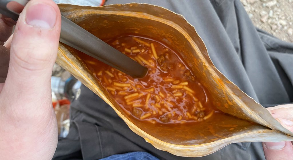
Our equipment list was stable and about as low as we wanted it to go. There is always room for some evolution, either finding something lighter, or using something for two tasks to leave something else behind. There are some weight reductions we opt out of, from leaving behind the stove or the inflatable pillow to using quilts instead of sleeping bags. Our camera had evolved to a fairly new iPhone 11. We had added a Garmin InReach for emergency satellite communications. We learned from this trip that we didn’t need the tent light but that two spoons are worth the extra weight! We were familiar with the trek and ourselves so we carried only the fuel, water, and food that we would need. My records suggest that this is the same total dry weight as our first backpacking trip to Big Bend, even though we have lighter equipment. I think I did not include everything in my lists at first, and there were also the things that get added to the pack last minute that you do not weigh. Experience brings discipline in that area too.Our food list was also converging on the most efficient we want. Focusing on food based on its “calories per oz” ensures we only carry the most calorie-dense food. The above is about 2000 calories per person per day, with Samuel normally eating his “half.” This is fewer calories than we will consume, but we can be calorie deficient for trips this short. This was our last trip with breakfast that included dehydrated eggs, and I am surprised we kept taking them this long. The Spaghetti had been a favorite but then Mountain House changed the recipe. We brought some Tony Cacheres to add a bit of Cajun seasoning to the food but it did little to help. The above shows a lot of variety in lunch and we have found that is essential to keep the food interesting. The above plan still has the same items for meals each day, and variety is valuable there. We had moved on from Nutella and summer sausage! Food remains my greatest planning weakness for any trip.
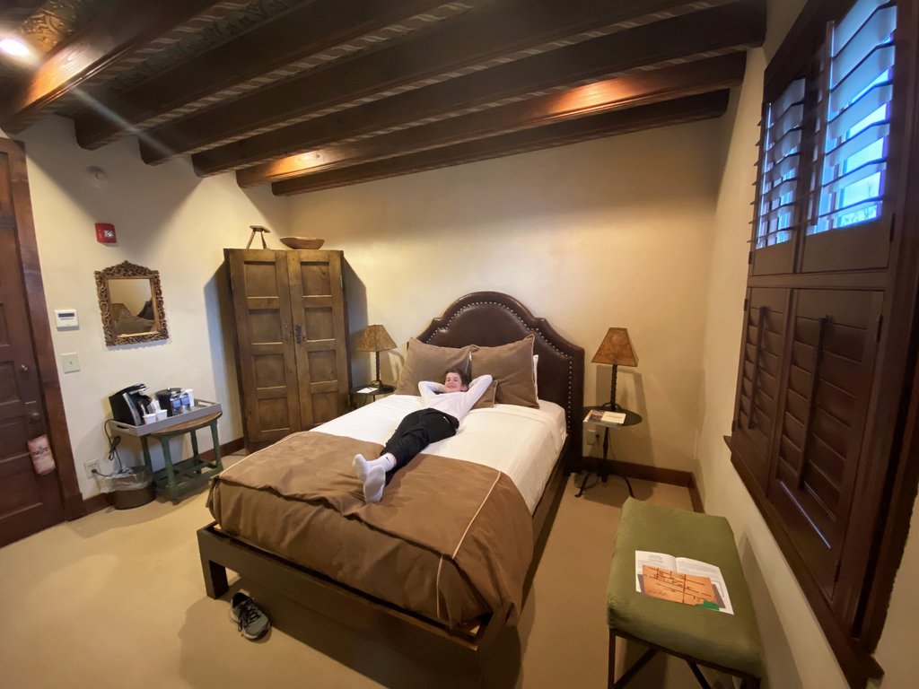
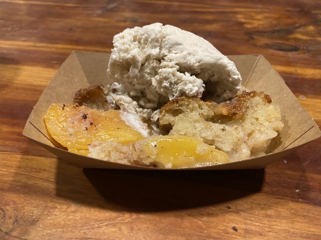
Day 0 – 26 December – Louisiana to The Gage Hotel. After Christmas with Janet’s Mom and family, we embarked on our 850 mile, 12-hour drive. With time being short, we did not want to camp, but the Chisos Mountain Lodge was full, so we stayed at the historic Gage Hotel in Marathon. This worked well as we needed to get permits early in the morning, as there was a risk they would run out. We also enjoyed a fine dinner, but we were eager to get into the mountains.
Food for the trip. Though it is well organized and efficient, we need more variety and pizzazz!The Gage Hotel in Marathon is nice, but not really a backpacker’s place!Samuel was ready to make the most of his last night with a bed for a while.Evening brought a beautiful sunset and brought back happy memories. You don’t see these skies in Houston!The Brick Vault Brewery and BBQ provided us with a fine “final meal.” Look how blue that sky is!Peach cobbler and ice cream. Why can’t we take that camping?
Notes from the Trail.
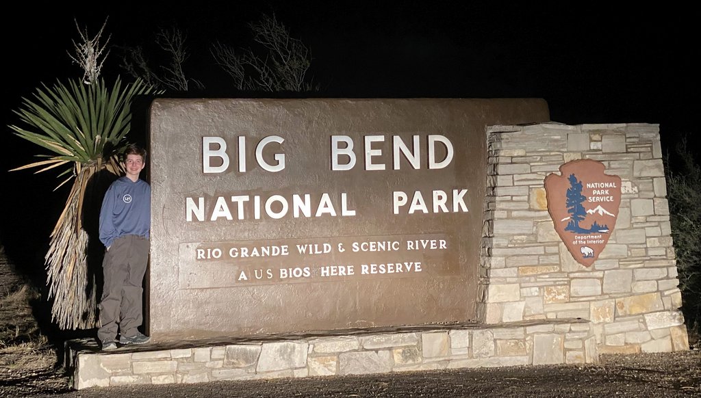
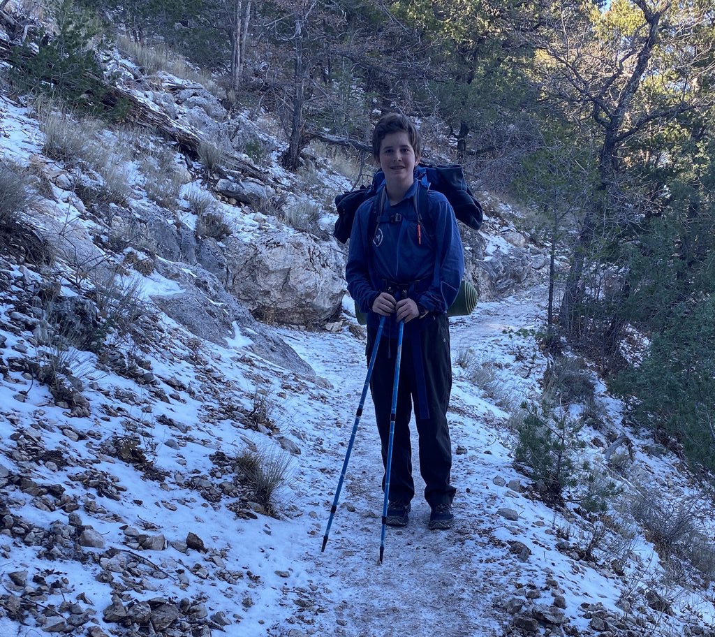
Day 1 – The Dodson. P-24lbs; S-22lbs. 2l water each. 2nd in line for permits at Panther Junction at 7:15am. When we left, there were at least 16. No real breakfast – felt it later. Good temps. Hiking @ 9:30am. Leisurely walk. Shoes light – easier than boots, bad for cactus, rough trail. Dodson before Fresno less interesting and harder than after. Some areas completely full for permits, saw 14 people. Full=40. Expect more tomorrow. Garmin InReach and Samuel’s phone with Earthmate app worked very well.
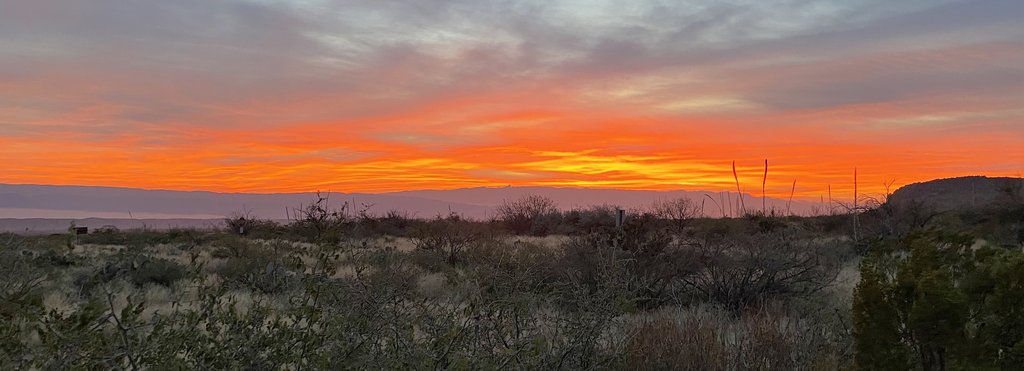
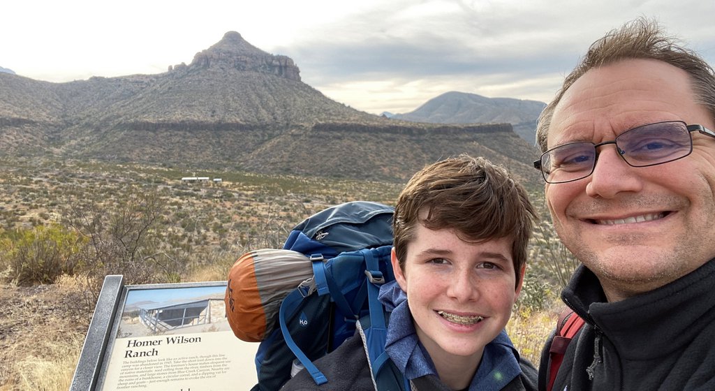
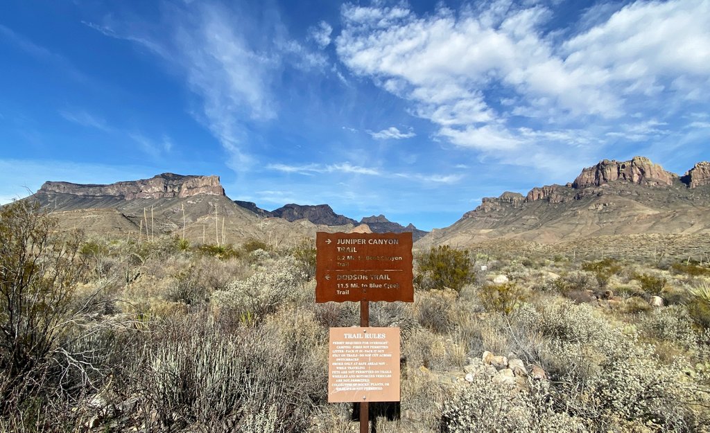
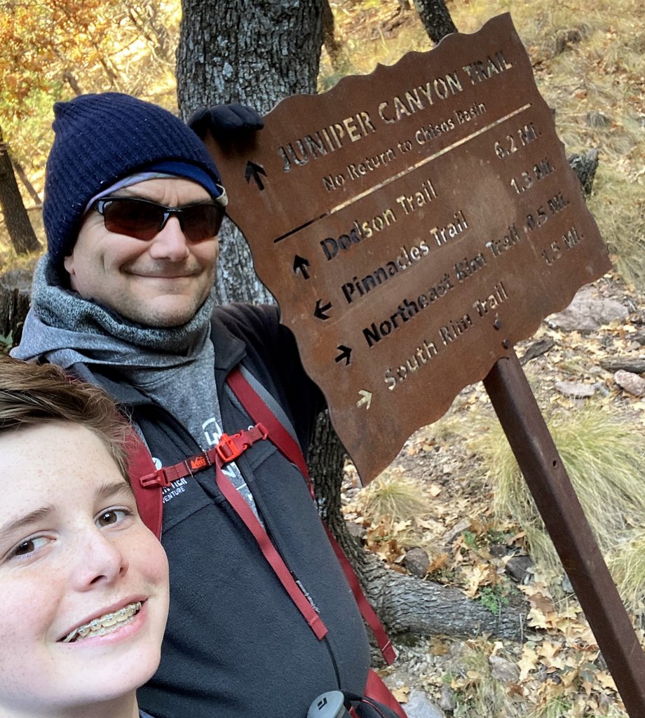
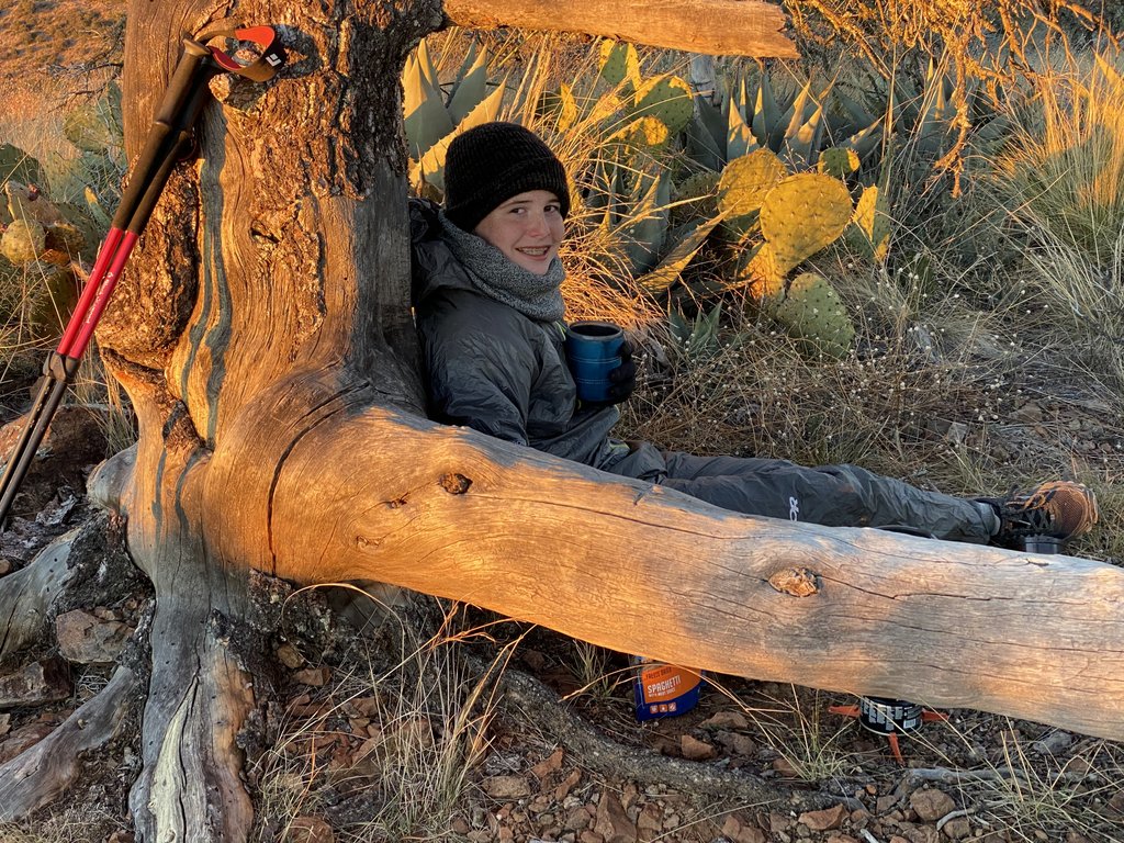
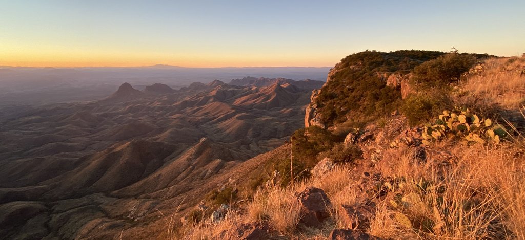
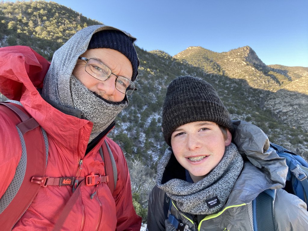
This time, we entered the park well before sunrise. We wanted to get to the Panther Junction Permit office before it opened.Not a bad view when waiting in a queue for the permit office to open.We got our permits quickly as we were 2nd in line. When I outlined our plan to the ranger, he started quizzing us in detail about our water plan and contingencies if the springs were dry. However, once I mentioned that we had done the OML before, he was easy on us. In 2019, you needed to visit the permit office to book any backcountry campsite. Those sites have now gone online which helps planning but you still need to get a permit in person and for zone camping.To make this OML different from the last one, we (a) started at Homer Wilson Ranch and (b) went counterclockwise. Logistically this is easier as we did not need to cache any water. However, I think starting the loop with the hardest part of the Dodson is not the best idea and prefer the route starting from the Chisos Basin, like last time. It was early days experimenting with selfies and Samuel’s new iPhone!Am I happy to be back on the trail, or regretting that we will be repeating the Dodson?After hiking in a few miles, this was the view back towards Carousel Mountain and our starting point. The consistency of the National Parks and their preservation is a large appeal. This view does not change!Filtering water at Fresno Creek, with the CNOC squeeze bladder. I’m wearing my buff which I have found an indispensable piece of clothing with many uses. Bailey objects to it on stylistic grounds. Plenty of water at Fresno Creek. It wasn’t flowing over the trail this time but there were still pools with flow. We have tried various ways to get water into the bladder when the pools are shallow and we wish to avoid stirring up the bottom, but I think a simple ziplock is best! We did not see any whirligig beetles this time. Indeed, I was surprised at how different the area around the creek looked. Even though it was a similar time of year to last time, the vegetation was such that I did not recognize it.After just over 10 miles by my GPS, we found a nice campground so called it for the day. Even though it had been a lot easier walking with shoes vs boots and lighter packs, I was still exhausted!I love how the setting sun catches the Sierra del Madre mountains in Mexico.Dinner time, but don’t back into that cactus!Mountain House spaghetti was Samuel’s favorite. Then they changed the recipe and added large chunks of tomato. We had decided to just bring one spoon on this trip, but decided a second spoon is worth it for the extra ounce of weight. However, I had noticed that the weight of our trash was significant at the end of trips, even over a pound. The Mountain House pouches are heavy and don’t pack down well. On future trips, I have transferred the food into gallon freezer Ziplock bags which are much lighter, and the freezer ones don’t melt with boiling water.I just wasn’t feeling it!
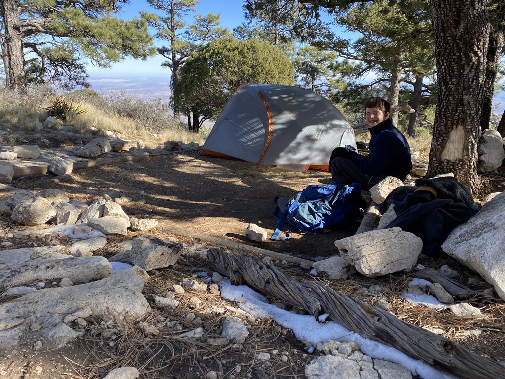
.Day 2 – Juniper Canyon. Neither of us slept well. Leisurely start – eggs yucky! 1.5 miles to car park @ Juniper/Dodson junction, not a remarkable sunrise but pretty. Cool but warmed up. Previous campsite overgrown. No long grass like last time – couldn’t spot rest spot. Up to spring – still running and cool. Both feeling very tired – S – allergies and P – calf. Hungry – need more lunch! Steep climb to saddle, then steep down to boot spring – ~1l/min of water. Saw 49 people on OML. Over to Boot Canyon site #2 (BC1 previously) – which we preferred. S feeling cold and tired. Dinner, no hot choc. No Emory Peak as not feeling up to the 5-mile round trip. Watched first half Behind Enemy Lines. Ready for an early start to catch sunrise.
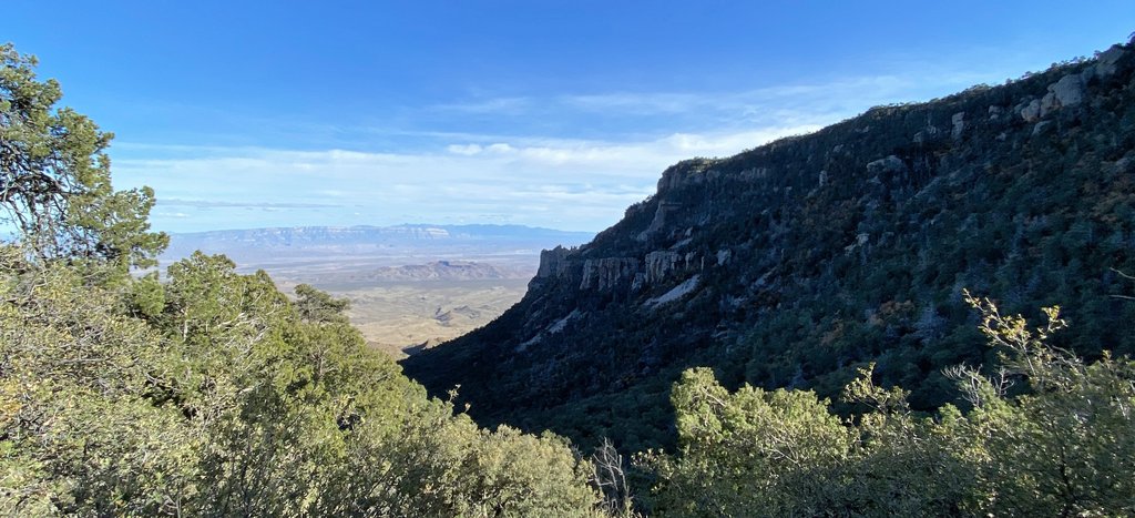
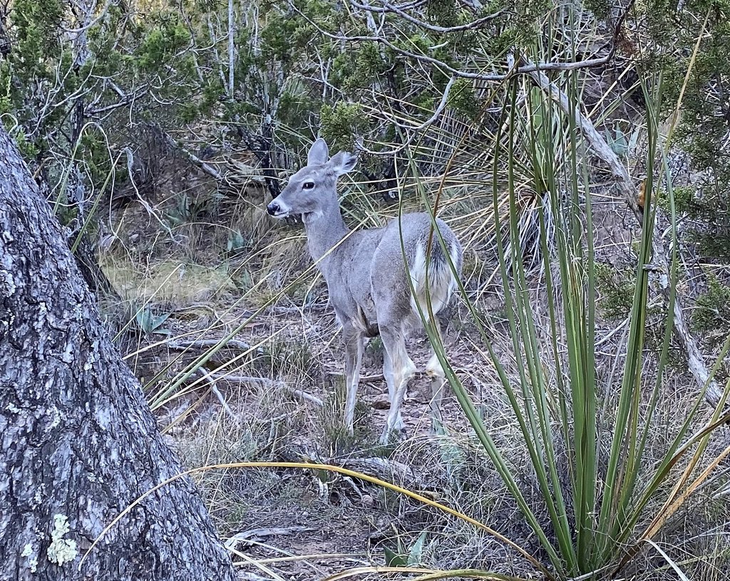
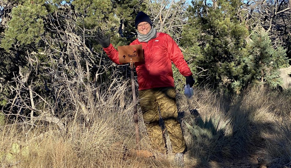
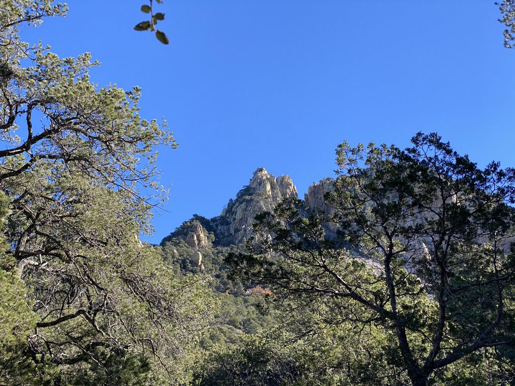
The sunrise lighting up the rim did not inspire us to get moving very quickly in the morning. You can see a couple of patches on the tent in this picture. the lower one was necessary after pulling on the guy line too much. Taking some Tenacious Tape to repair things is a great idea.Back at the junction between the Dodson and Juniper Canyon trails. We knew that we would start climbing soon.We remembered when Samuel’s feet hurt last time after coming down Juniper but the vegetation was much different, and we did not recognize the area. In this spot, we are in line with the tip where the East and South rims meet.Puddles of water at Upper Juniper Spring, with a little flow. Suitable for filtering!Marching up Juniper CanyonThe end of the Juniper Canyon trail. I feel that the “No Return to Chisos Basin” makes this the psychological start of the Outer Mountain Loop when you do it in the traditional way, like last time.Close to the top of Juniper Canyon, with the North East Rim in view.Oh deer! We filtered some water from Boot Spring.We stayed at Boot Canyon BC2 as I thought it was where we stayed last time, but that was BC1. BC1 is less far down the Boot Canyon trail and closer to the pit toilet, but BC2 is considerably bigger. I think BC1 is more exposed to wind too.
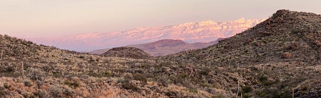
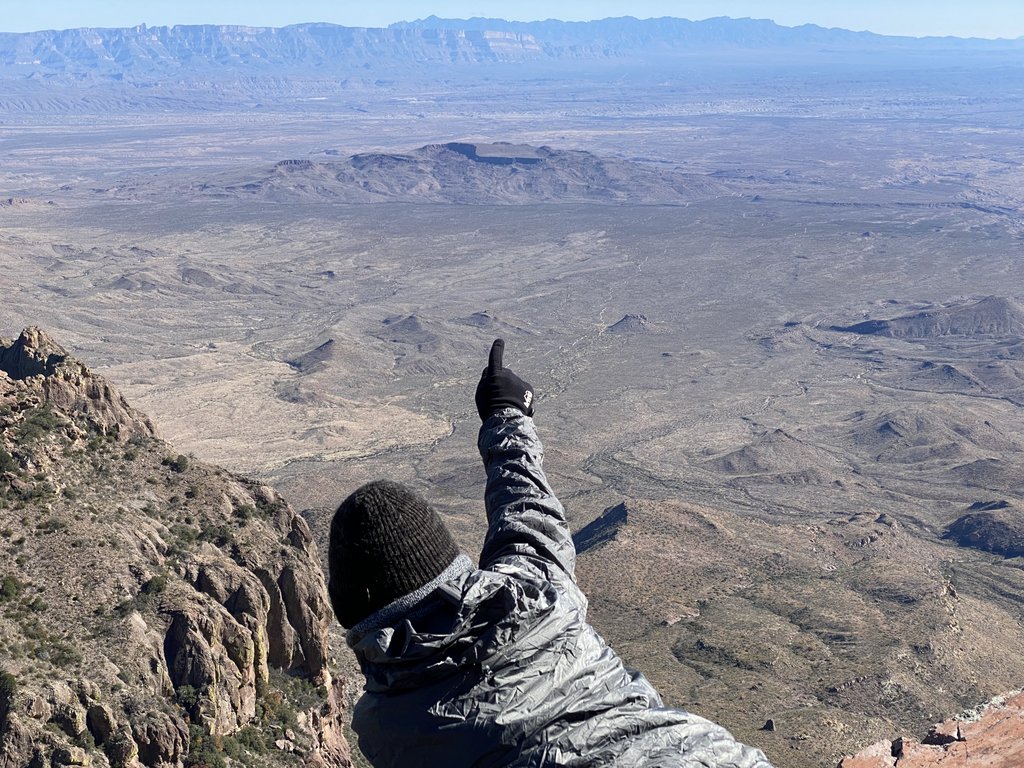
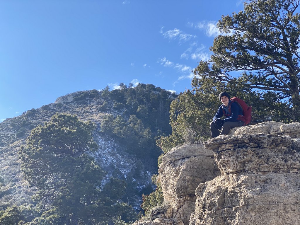
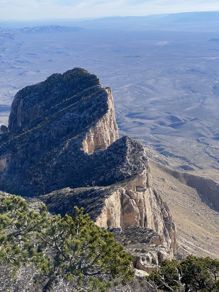
Day 3 – NE and SE Rim. Woke at 6 but back to sleep until 8:30am – we were both tired. Saw a couple of deer. Puddles of water above Boot Spring frozen. 2-mile hike to rim – S grumpy with no breakfast and loose pants falling down. Breakfast with great view – made belt with rope. Very leisurely walk around, spotting Juniper/Dodson junction car park. Pitch in SE1 – nap 3-3:30. Then took pack for dinner to protruding part of rim which we named Pride Rock. V. cold and windy – we wore EVERYTHING we had. We saw a couple of other pairs of people, but all alone for sunset. Made dinner – it was v.v.v. windy and cold, but we had phone service so we called home. Fantastic colors. Finished watching Behind Enemy Lines in the tent. Enough water so no need to refill in the morning – shorter hike!
The puddles above Boot Spring were frozen. We had thought the night was cold :).The North East Rim has great views. The weather was perfectly clear.The South RimWe spotted the car park at the junction between Juniper Canyon Trail and the Dodson Trail, and tried to point it out for the camera. However, I can’t see it…Our campsite close to the South Rim. They had just changed the campsite names so hadn’t updated the iron signs and some old maps continue to use the old names. This site was not huge but plenty of room for us and our one tent.
The map showing our campsites at BC2 and ER9, the blue dot is Boot Spring, Juniper Canyon trail comes in from the top right and Blue Canyon trail leaves bottom left.
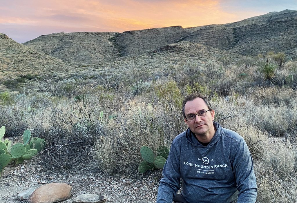
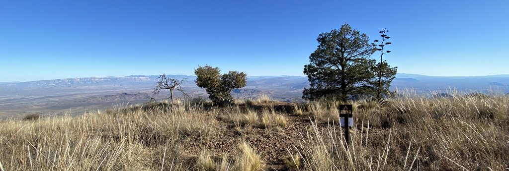
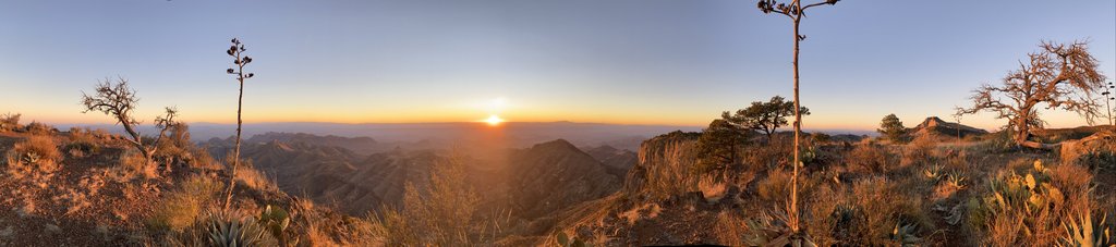
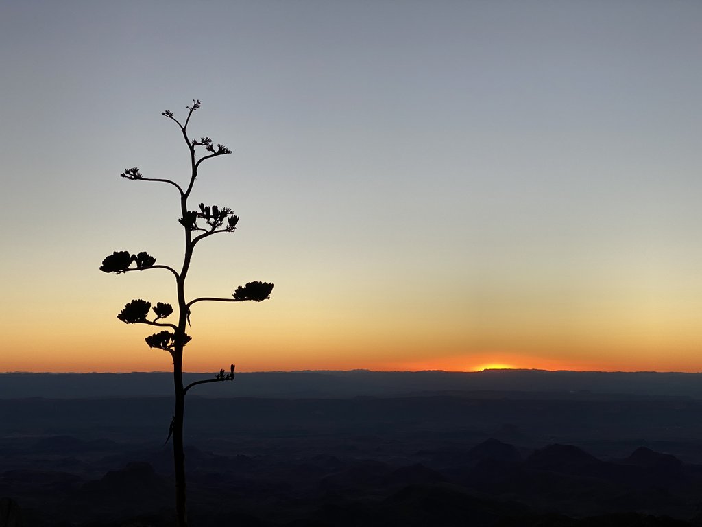
The camp sites are not on the rim, but pretty close. However, the best view of the sunset is from the southern tip of the rim.Our campsite was conveniently located close to the pit toilet near the southern tip of the rim. However, that toilet was destroyed in the 2021 fire, and campers must now carry their own wag bag… This photo also shows how bundled we were. The waterproofs are an effective outer layer against the wind and the neckscarf was surprisingly effective.I can spend hours watching the view off the South Rim change as the sun descends.Elephant Tusk and Mexico!Agave seed pods and Emory PeakPreparing dinner in the wind shadow of the tree. The wind was brutally cold.Our tree for the evening. There were a couple of other people around, but otherwise we had all of this to ourselves.We did not climb Emory Peak this trip, but we got great views of it.Hot chocolate. We were torn between staying to watch the sunset while nearly freezing and getting back to the tent. We stayed and tried to stay warm!Having fun with the iPhone panorama.Farewell, sun.This was the view closer to our campsite, showing the rock where we had been previously which we named Pride Rock.Another great night sky.
Day 4 – Blue Canyon. Up @ 7 to pack and catch great sunrise at rim over breakfast. Hike to the loo by Pride Rock (which was destroyed in the 2021 fire) then start marching out – down steep and then fast on flat. > 3mph at end. Got photo of shadows. 29 OMLers. Samuel ran last stretch to Homer Wilson at 1pm. Got a hotel in Van Horn so headed there via Sonic and a grocery store in Alpine. Ate snow peas, oranges and apple. Saw Border Patrol blimp, Prada Marfa, Marfa Lights viewing area.
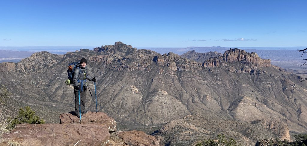
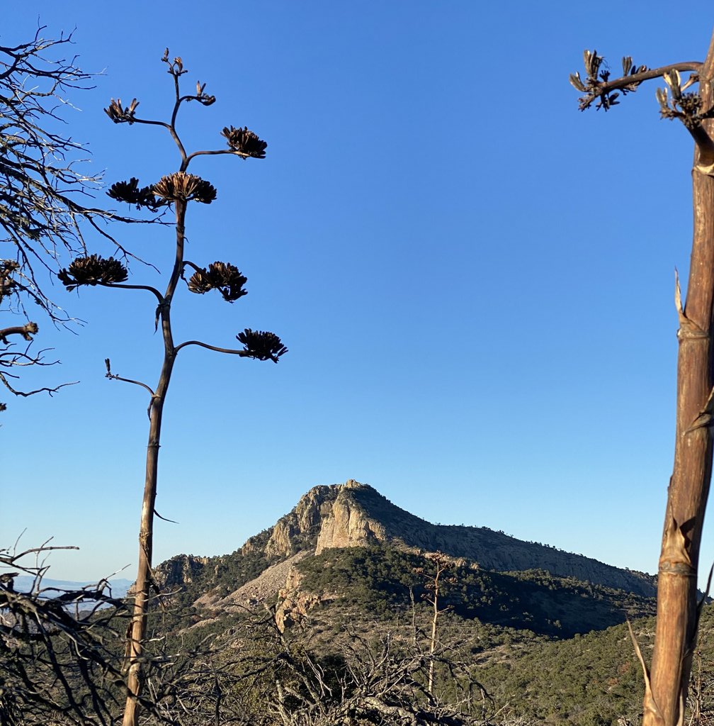
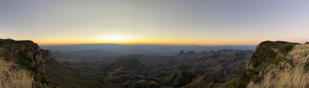
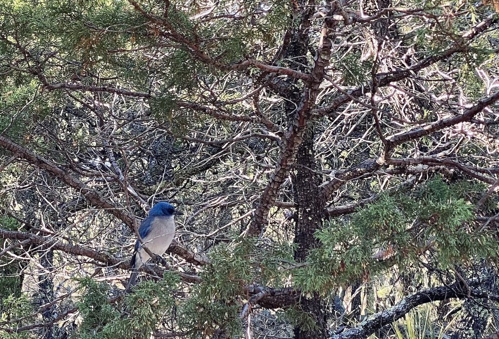
A sunrise panorama.A new day starts on the plains and the Dodson Trail below.We found this fine spot on the rim, right next to our campsite, to make breakfast. However, I found out the hard way that the rocks are sharp, and they tore a hole in my waterproof pants. The Tenacious Tape was useful, and I now always carry a trash bag as a seat as it is nice and light :).We were soon looking down Blue Canyon with Carousel Mountain marking our finish.Another great view of Emory Peak from a different angle.A Mexican Jay came to say hello during a snack break.Cacti grow across the path. The one advantage of boots over trail runners is better resistance to these spikes. We just had to be careful.This looked like a fine shade tree for lunch.
Nilla wafers were a great snack.
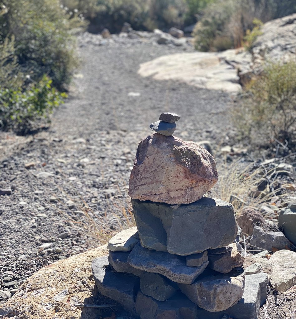
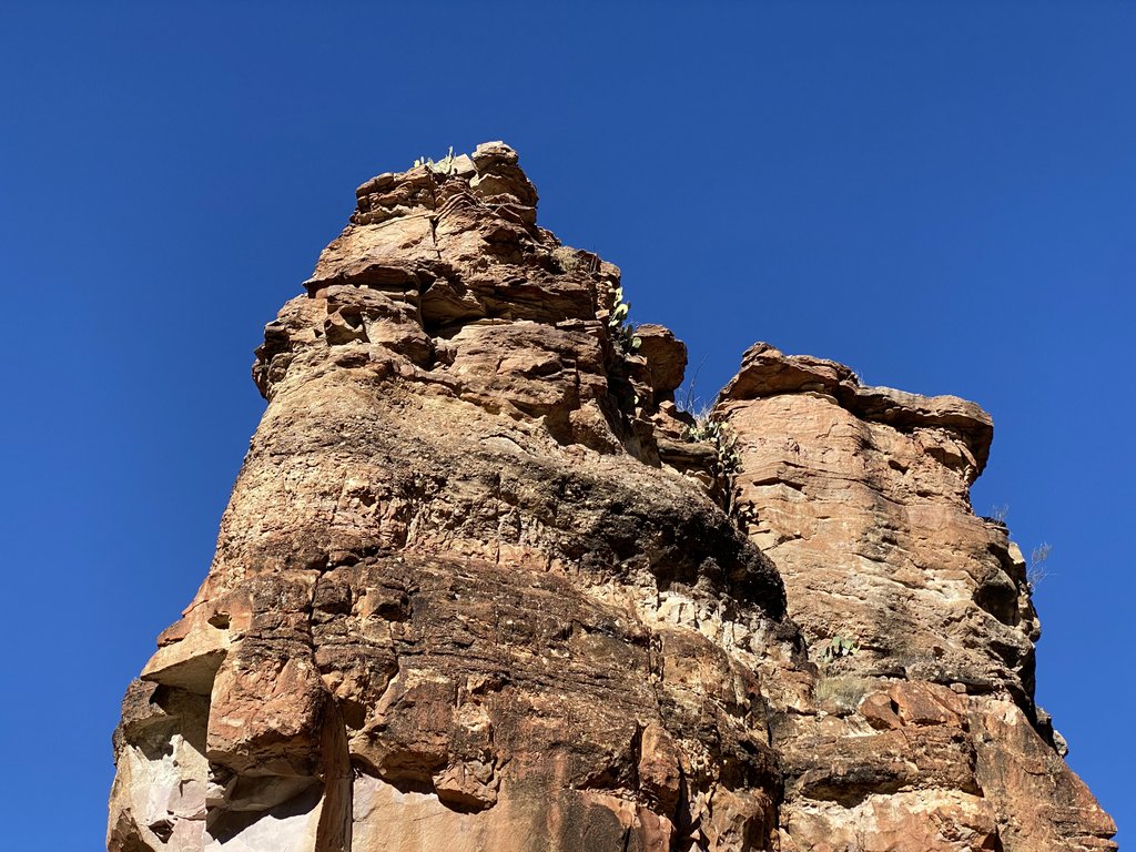
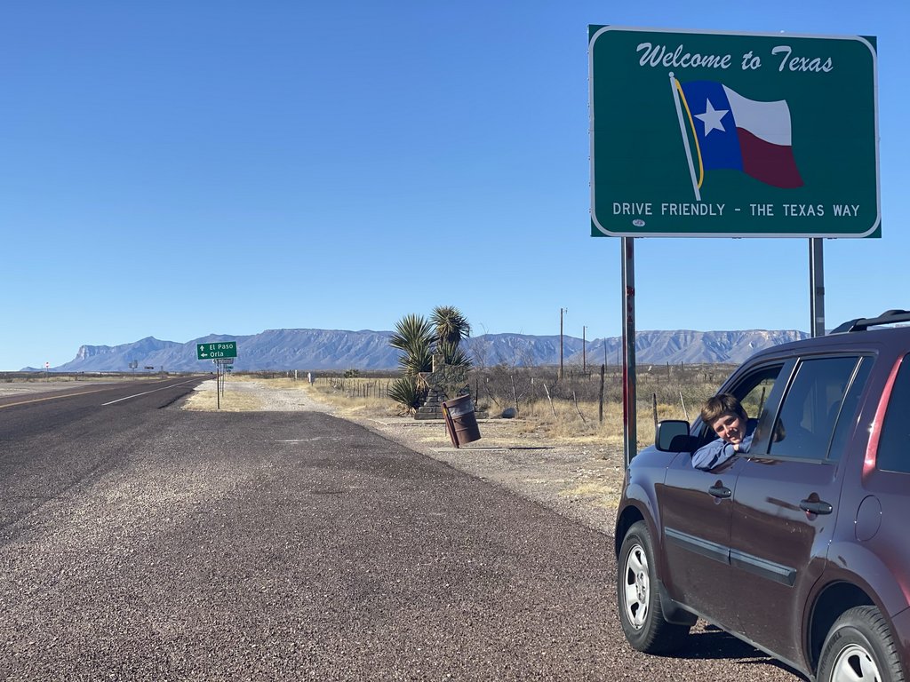
The Blue Canyon trail is easy to follow as it tracks the canyon floor, more or less. Rocks help direct you.An attempt at an artistic photo of a cairn?These fascinating rocky outcrops tower above the canyon floor.We had to get our silhouette photo. We were lucky to get this just before finishing the loop and returning to the car.OK, so not a great photo, but we could see this blimp for miles as we drove north from Big Bend toward Guadalupe Mountains.A bed for the night in Van Horn!
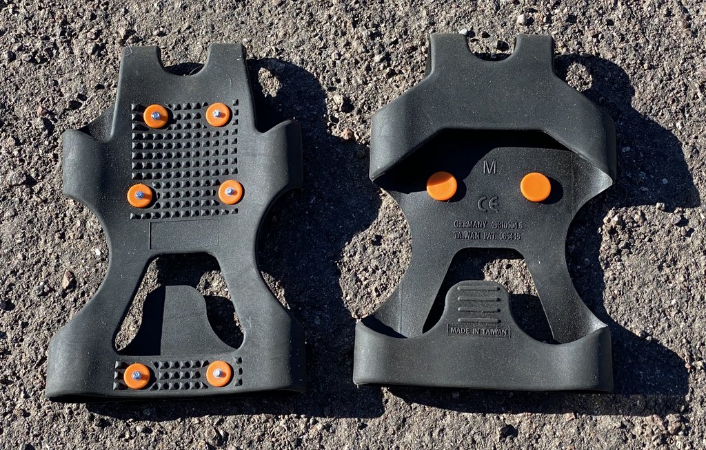
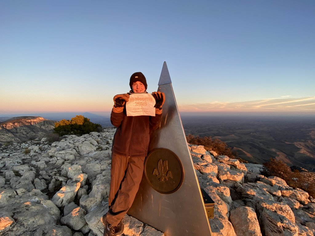
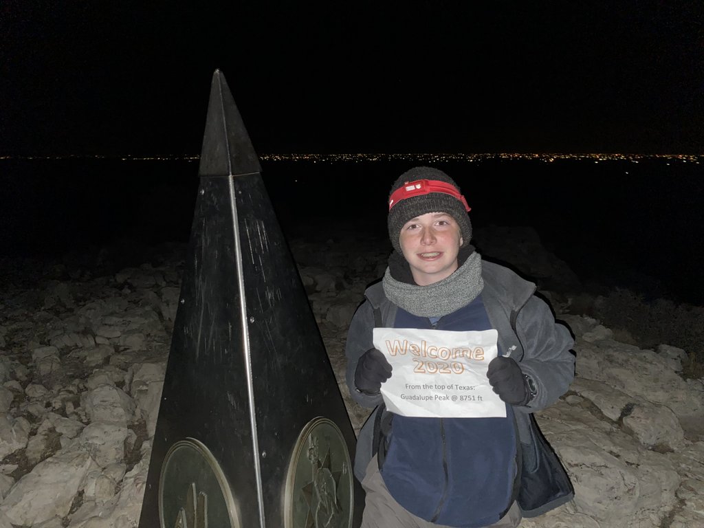
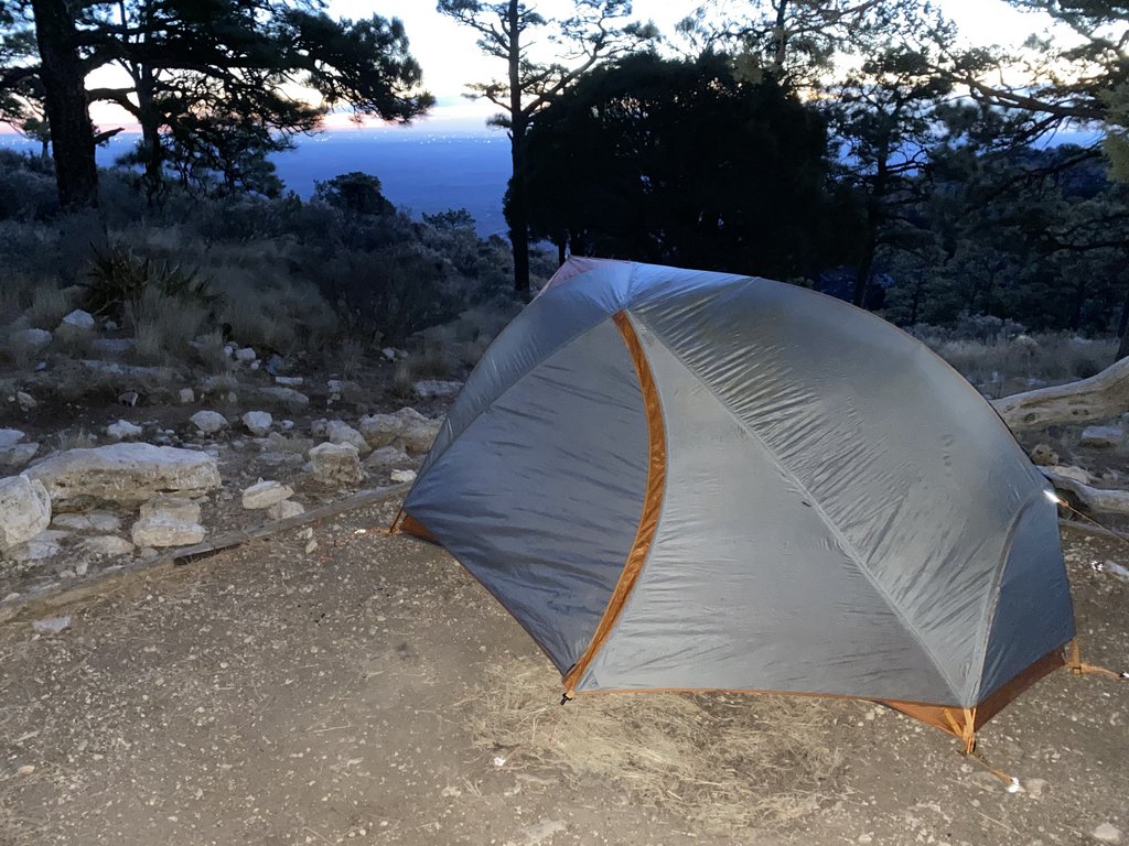
Day 5 and 6 – Guadalupe Peak. Got permit – worried of temps in 20s and windchill. Packs were 23 lbs each. Calf sore. Good temps for hiking up busy trail – a few campers coming down – we were first to camp but a couple of others joined. Headed for peak after setting up camp and looked at route to El Capitan, but decided no way. Enjoyed beautiful temps at peak for sunset with no wind, back to tent for dinner and tried watching Lord Of The Rings but fell asleep. Got up in noisy winds for midnight on the peak – cold but not too bad. Great hot chocolate but felt completely exhausted. Hobbled down in the morning with my very painful calf, caused by lack of fitness/strength and which took > 6 weeks to fix. We had brought mircospikes, but after carrying them around the OML and not using them, left them in the car for Guadalupe Peak, but I would have liked to have them very much on a very icy stretch of path.
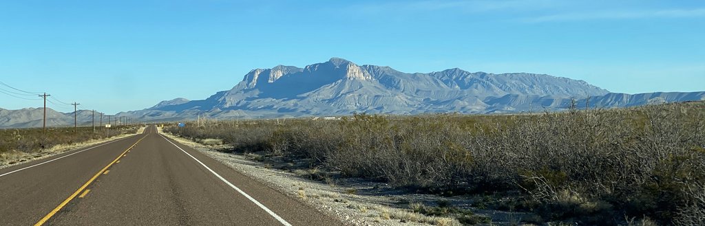
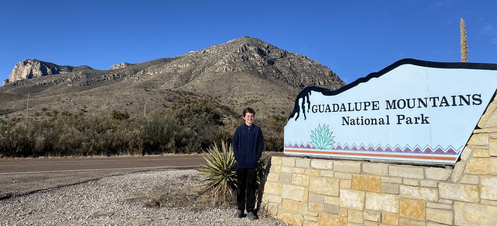
The sign at I-10 in Van Horn.It’s an hour-long drive from Van Horn to the Guadalupe Mountains, and the straight flat road gradually takes you closer, enabling you to make out the peak and El Capitan.Have to get a photo of the sign! Note how the top of the sign matches the mountain’s profile behind.The view back down the mountain after the first ascent. You can see the car park and the switch backs. Note the large wash in the top left of the photo.We had seen no snow on the trails in the Chisos Mountains this trip. As they are higher, we decided that there probably wouldn’t be any snow on the trails in Guadalupe, but…… it would have been really nice to have had our microspikes for this! Fortunately, we did not slip over.Cheese and crackers for lunch. This has become a favorite, though the cheese tends to sweat in warmer climates. That wasn’t an issue on this trip!We chose the same site at the campground as we had used previously, and it all looked familiar! The remaining snow was representative of the temperature, but it wasn’t actually as cold as we had feared.The daytime view from the campsite, back towards Pine Springs.On the hike up to the peak, Samuel had to do a Man of the Mountain pose. We took one backpack to the peak with our stuff for dinner, and Samuel is turning into my pack mule nicely, thank you!We are heading up there.Back on the peak with El Capitan. We had thought about a side trip to check it out. The trail looked hard and as we weren’t feeling the best, we decided against trying.
You can see the road below from where we took the photo above of the peak.
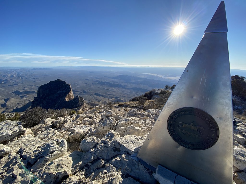
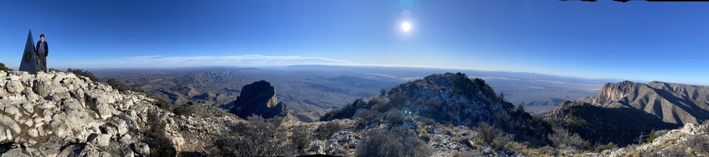
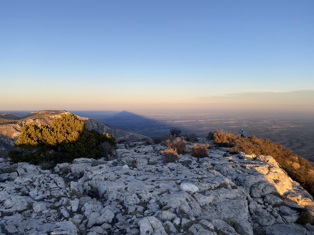
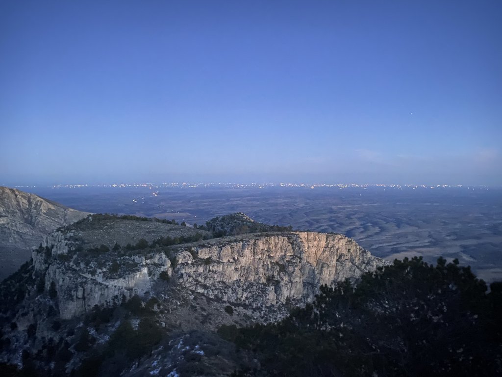
Cool panorama, but somewhat deceptive as this represents more than 180 degrees of view!This photo shows the change in landscape on the plains. This also represents the subsurface geology, with the area on the left having a lot of oil and gas activity but the right hand side not.I love the shadow of the mountain, but what is someone else doing on the top of our mountain and getting in my photo!The sun and the monument, and another of the other visiting humans.A different style of silhouette photo!A warm up picture. We argued it was still valid as it was 2020 in England by now!We headed back to camp to relax and warm up a bit before returning for midnight. There are many more oilfield lights than during our last visit.Happy New Year!
You can hear the wind!Walking on the very slippery ice seemed even more difficult at night. An early start in the morning as we had a long drive home.It’s still cold and we are bundled. With my calf hurting so much, Samuel was carrying almost everything!The Top of TexasThe lack of cars makes it a good place to learn to drive!I love the distinctive shape of these mountains.After several days camping, any cooked food is welcome. We found this limbo comment to be hilarious, which is an indicator of our state of mind after the hiking and before a ten-hour drive home.
Thoughts. Food – need cheese, meat, salty saltines; nilla are good, squeezy PBJ a good idea, more hot choc. No scrambled eggs. Need fixing tape, allergy meds for Samuel and plenty of Advil. Beano. Need to drink more.
Worked well. Warm neck scarf, CNOC bladder, flip lid for smart water bottle, filter, waterproofs (but tore pants when sitting on sharp rocks), layers, handkerchief, Samuel ski gloves (hands get cold very easily), paracord for belt. Not need tent light (unnecessary extra weight).
Ideas for the Car bag It’s valuable to think about what you want in the car when you finish hiking. Salty snacks, Salt and vinegar crisps, soda, oranges and apples, wet wipes, charging blocks for hotel, clean clothes.
Equipment Need to fix tent bag (it tore trying to stuff tent in), torn waterproof pants (sit on trash bag in future!), tent pole shock cord (elastic gone; it was an easy fix). Buy thermometers to get temperatures.
Conclusion: With every previous hike being a significant increase in distance or challenge, this repeat was different. Bringing in the New Year at the Top of Texas was really fun. I sense we were overtired which put a dampener on things, and I need to ensure I am fit and strong for future trips so I don’t injure myself (and my PT has taught me a lot!). While I initially dismissed the lack of excitement due to a repeat of the trail, I’m uncertain that was such a strong contributor and look forward to revisiting these hikes. I do think that the OML loop starting from Chisos is better, but I have read others who think differently.
If you have any questions about our adventures in Big Bend, don’t hesitate to leave a comment below, but remember to include your email address!
To read about our other adventures in West Texas, go to our West Texas page.
"Cajunlimeys" combines Lousiana (Janet) and England (Peter). For "limeys," check out scurvy in the English navy.
We love adventures and use blogging to write a photo diary to preserve our memories. Some crazy friends enjoy following us and my notes might help others plan.
View more posts