
I waited far too long before I backpacked the Good Water Loop in central Texas. I had some misconceptions about the trail, and had struggled to find an informative guide, which this post aims to help remedy. Below, I share what I have learned and include links to trip reports at the end, which include some great YouTube videos. The hike significantly exceeded my expectations.
What Is the Good Water Loop?
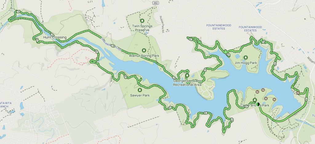
The Good Water Loop is a 26-mile circular walk around Lake Georgetown, about thirty miles north of Austin in Central Texas. The trail has many access points and camping options. It offers great hiking and backpacking opportunities. On trail, one feels surprisingly isolated given its proximity to Austin.
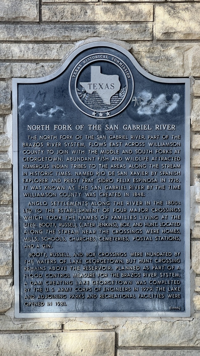
The trail was established in conjunction with the creation of Lake Georgetown, which was built to control flooding in the Brazos River system. The lake’s dam on the North San Gabriel River was completed in 1979. The Army Corps of Engineers owns and manages the lake and the surrounding land. The trail is available for hikers and mountain bikers, and motorized vehicles are prohibited.
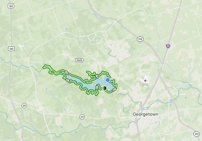
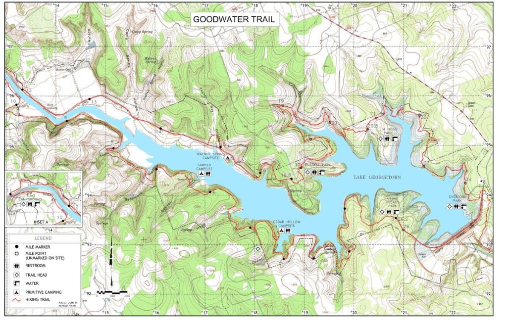
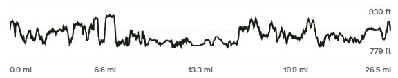
Map from https://www.alltrails.com/trail/us/texas/good-water-loop.
Mileposts mark each mile of the trail, with the Cedar Breaks Park trailhead as the beginning and end of the loop according to the mileposts, though one can hike the loop from any of the five trailheads.
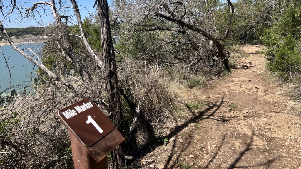
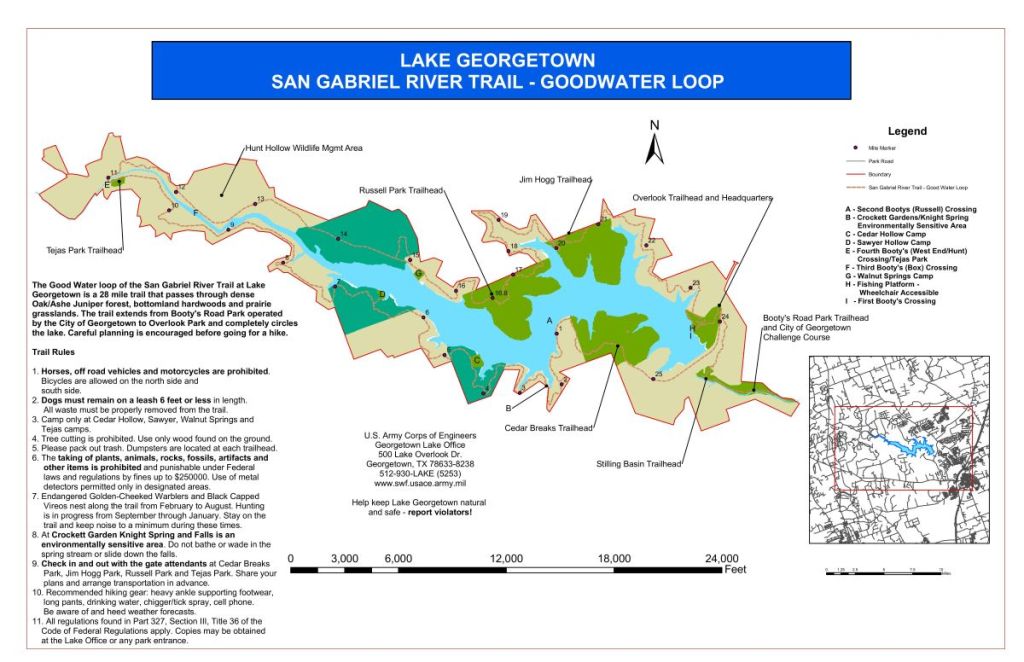
From https://www.swf-wc.usace.army.mil/georgetown/Information/Maps.shtml.
Note that it only shows 25 mileposts!
What About the Lake Level?
As the lake was built to control downstream flooding, its level will change over time. The plot below shows the lake’s level over the last three years, plotted with the median from 2000-2026.
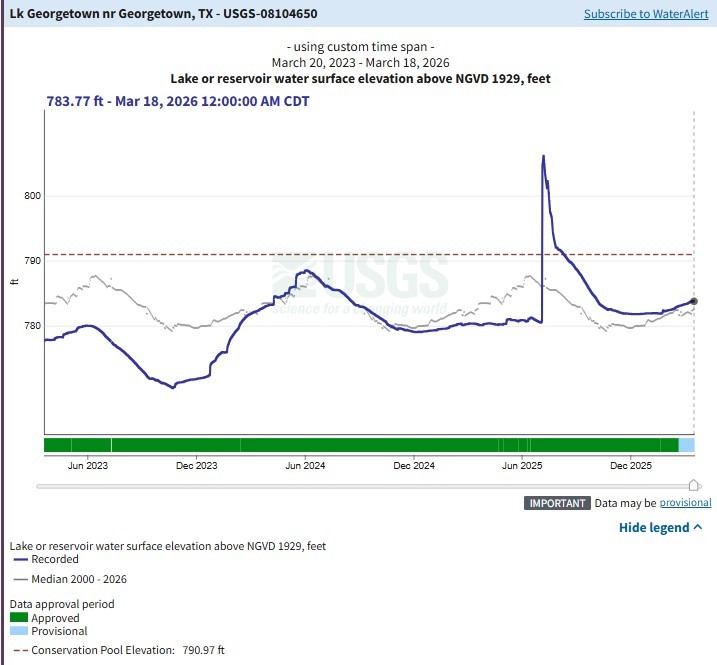
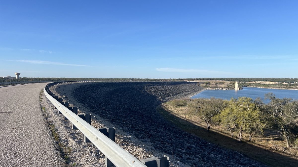
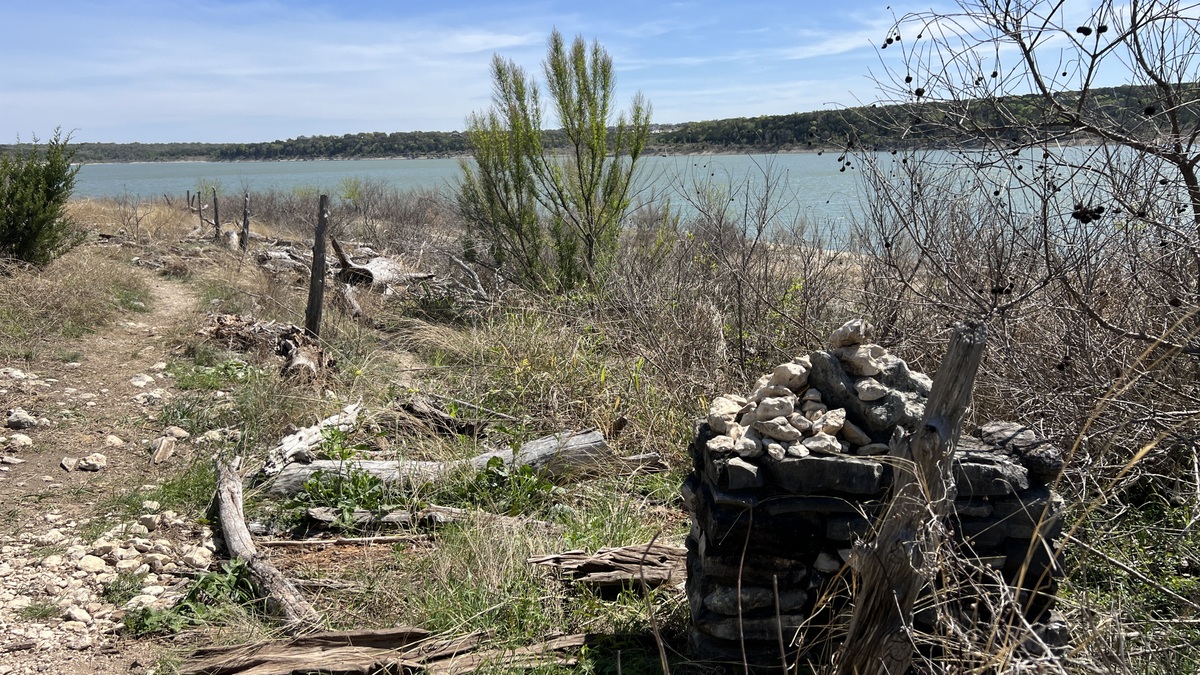
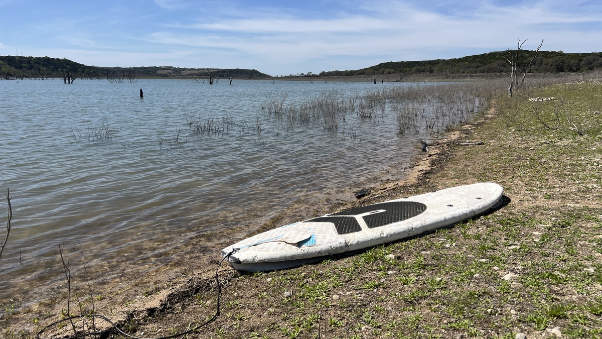
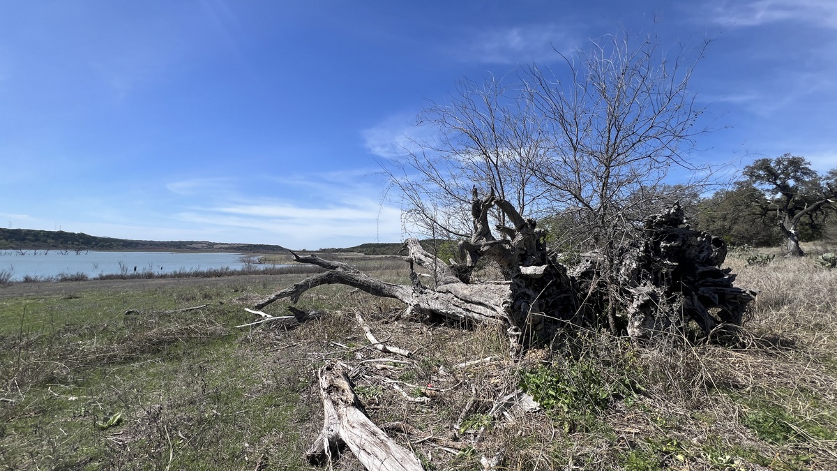
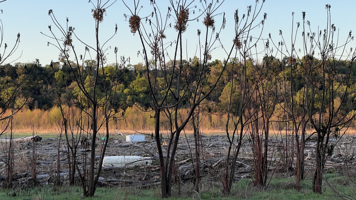
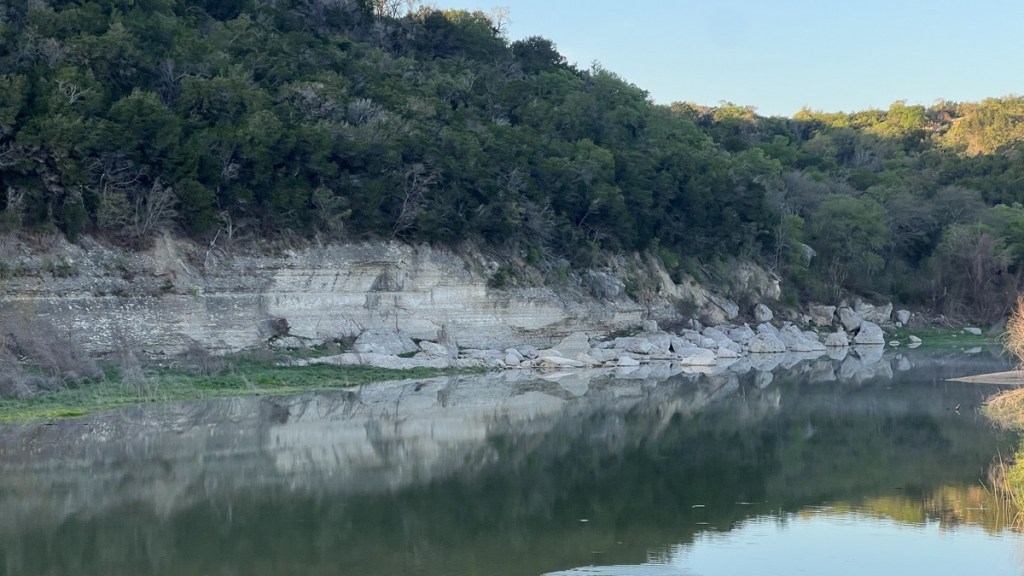
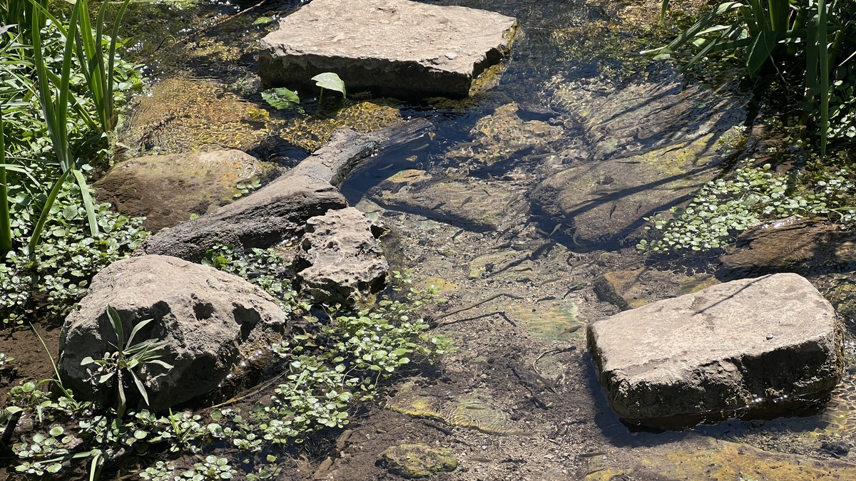
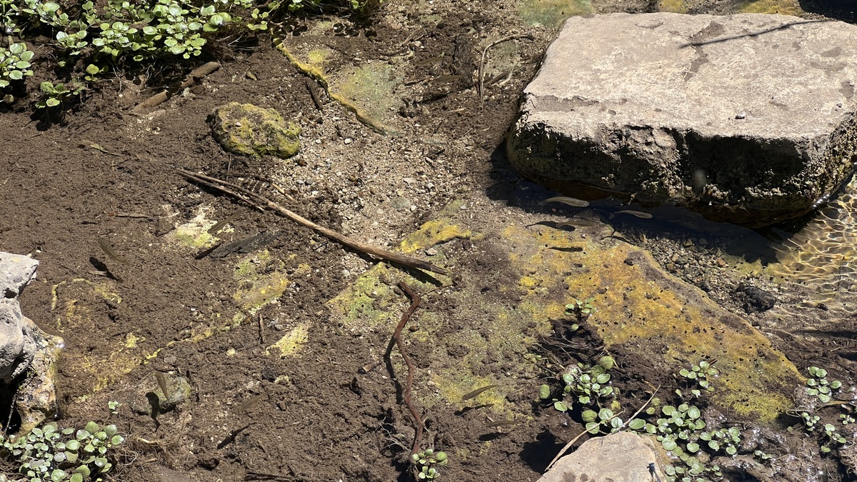
The “Conservation Pool Elevation” of 791 ft is the target maximum water level. The data shows that the water level in 2024 started below the average before closely tracking it. 2025 started dry, but the catastrophic floods in early July caused the lake level to rise 26ft from 780 to 806 ft. This was still a long way below the dam’s spillway at 834 ft. As one walks around the lake, one finds driftwood and trash marking the high tide mark, as the pictures below show. I hiked with a lake level of 784 ft.

Trail Overview
AllTrails suggests the trail has 1,486ft elevation gain. The trail is flat in parts, especially on the western side, and any hills are neither steep nor long.
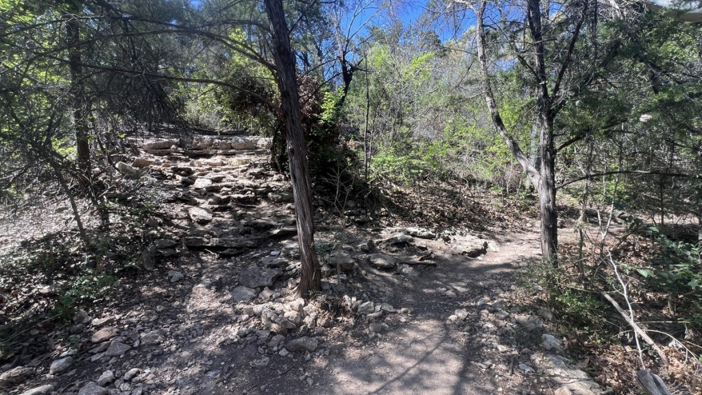
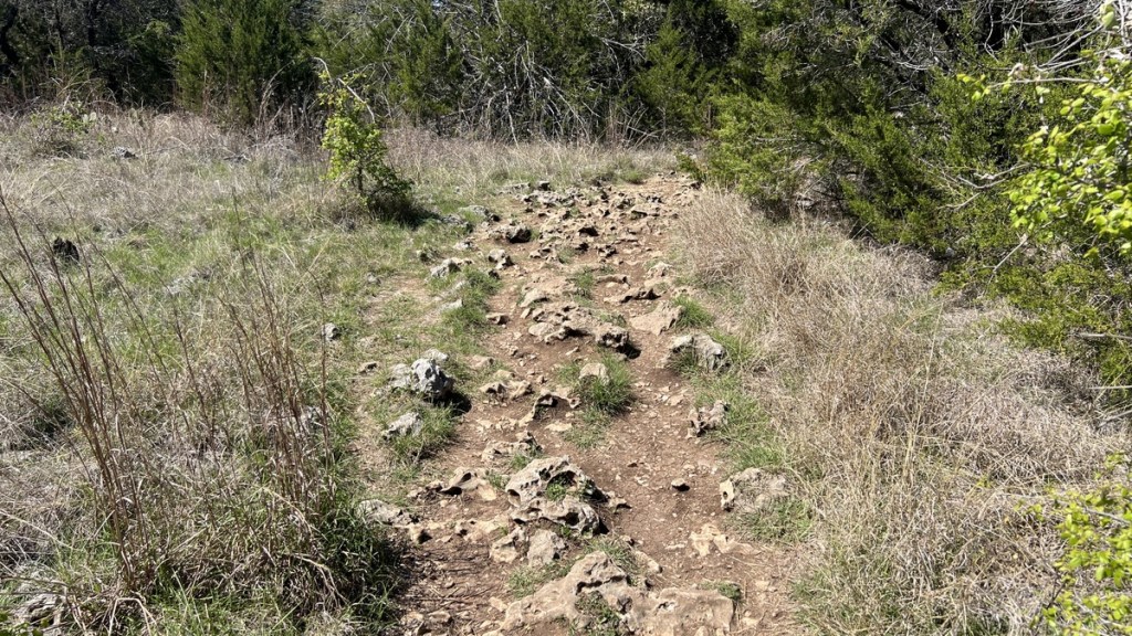
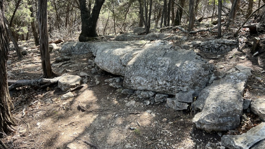
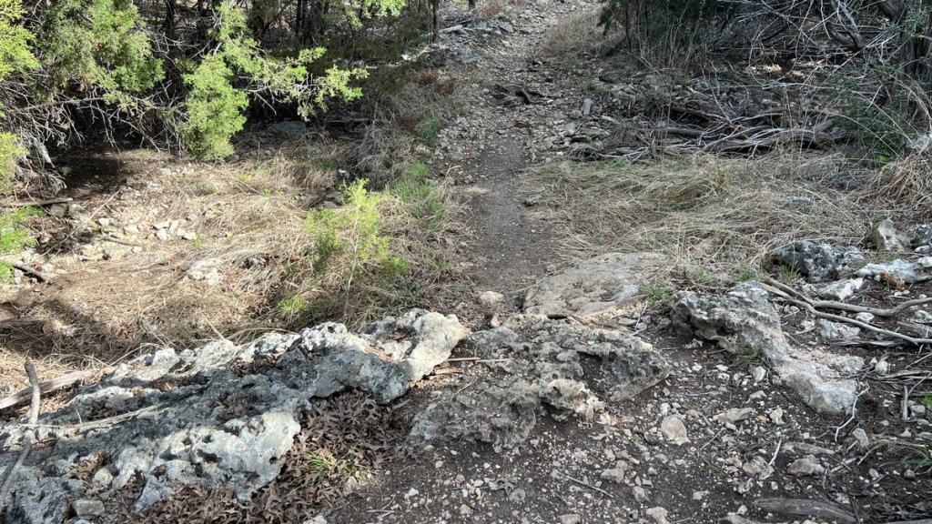
Some sections of the trail comprise sharp limestone, which I found tiring to walk on. It might cause some to prefer walking boots but I was fine in trail runners.
Even though the trail circumnavigates a lake, it is generally not possible to access the water due to cliffs, and a backpacking trip needs to plan around water availability.
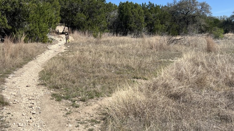
The trail is well formed and is easy to follow. However, there are some junctions without signage where the trail’s route is not obvious. A GPS-enabled map, such as https://www.alltrails.com/trail/us/texas/good-water-loop, makes navigation very easy, and there is cellphone signal throughout. A printed map, such as https://www.swf-wc.usace.army.mil/georgetown/maps/Goodwater%20Trail%20LGT%202012.pdf, is also useful.
As with any hiking in Texas, the summer is likely to be miserably hot. Significant portions of the trail are not shaded, but shade provides little respite in Texas’s hot and humid summer months.
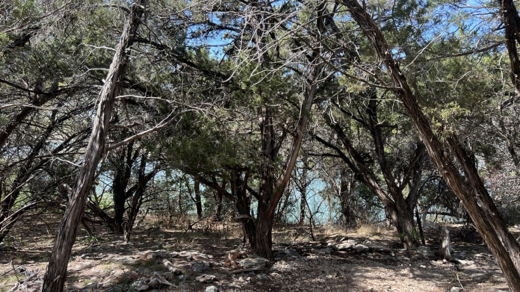
There is surprising variety throughout the trail. I divide it into the following five sections to highlight the variety and to help others plan. I use the trail’s mile markers, which are aligned with a clockwise trail starting at Cedar Breaks Park
| Sections | Terrain | Notes |
|---|---|---|
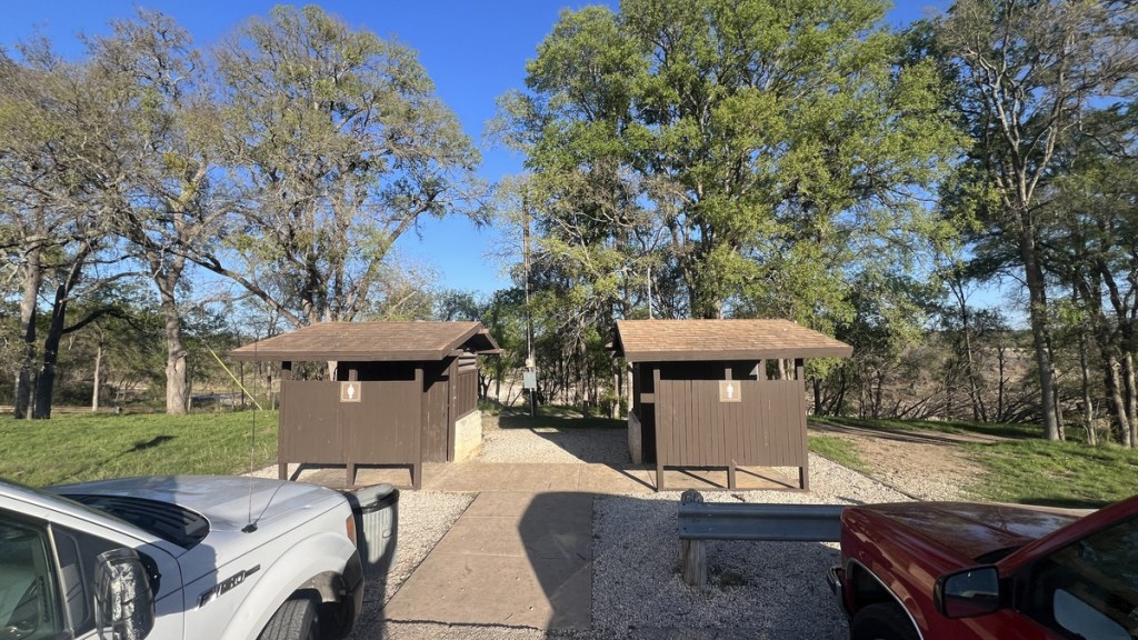
| Mile 0 to ~3 | Hilly, shaded, sharp rocky limestone. | Parking and trail access at Cedar Breaks Park (mm0). Water and toilets off trail. Scenic waterfall and filterable water at Crockett Springs (mm2.5). |
| Mile ~3 to ~7 | Hilly, shaded, less rocky. | Primitive Campsite on the lake at Cedar Hollow (a short distance off trail at mm4.5) and at Sawyer (a short distance off trail at mm6.5). Only access to the lake is at the primitive campgrounds. |
| Mile ~7 to ~16 | Flatter section of trail with less shade and fewer rocks. | Tejas Campground/Trailhead with water and pit toilets (mm10.5). Cross the bridge over the San Gabriel River (mm11). Primitive Campsite on the lake at Walnut Springs (right next to trail near mm15). Lake access possible from mm10 to 16 |
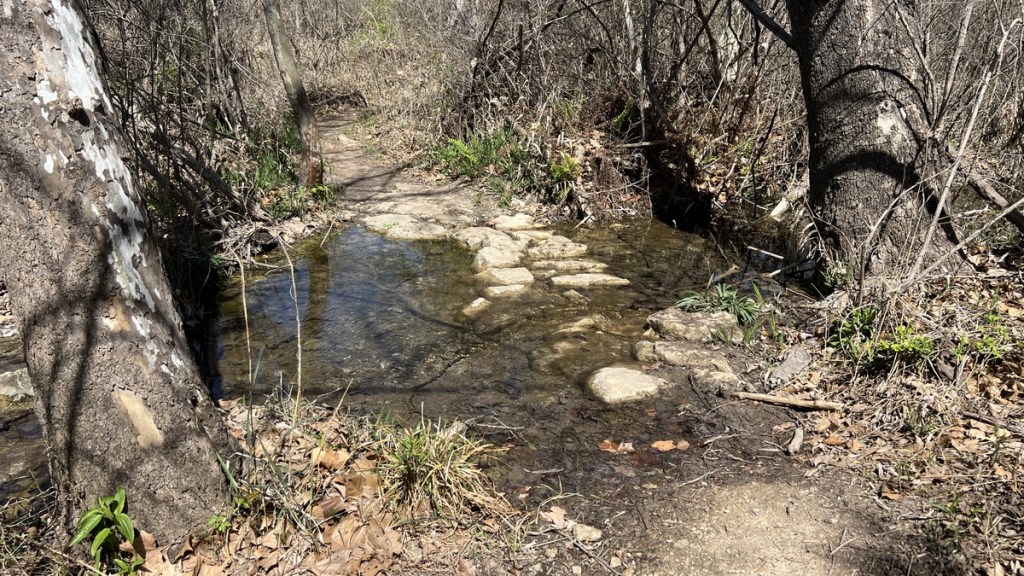
| Mile ~16 to ~24.8 | Undulating section of trail with shade, some sections are quite rocky. | Russell Park Campground/Trailhead (mm17) with water and toilets a short distance off trail. Stream crossing between mm19 and 20 (might be seasonal). Jim Hogg Park Campground/Trailhead (mm21). Water and toilets off trail. Overlook Park with water and pit toilets (mm24.5). |
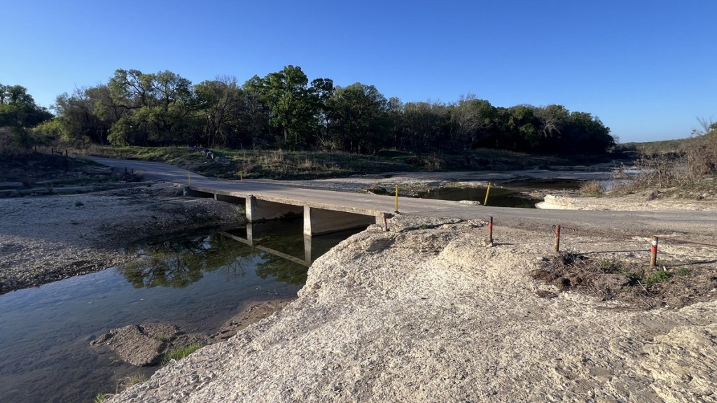
| Mile ~24.8 to 26.2 | Road walk across the dam. No vehicles. No shade. | Parking and trails access at Cedar Breaks Park (mm26.2 = mm0). Difficult access to lake. |
How to Hike the Good Water Loop
With five trailheads and multiple campsites, there are plenty of options for hiking the loop. While some reports recommend starting at Tejas Campground, most of the accounts that I found started at Cedar Breaks Park.
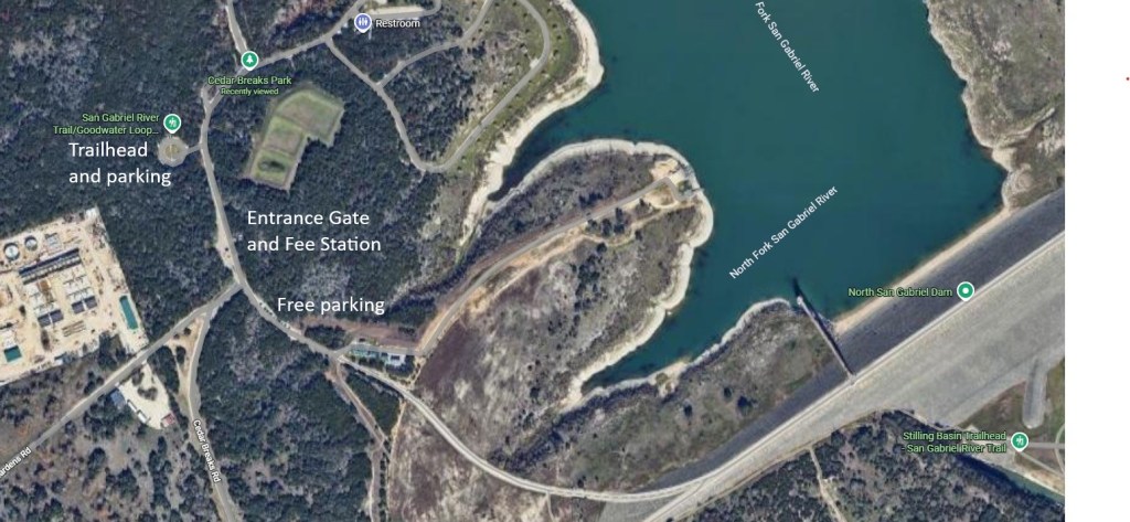
At Cedar Breaks Park, there are two parking options. The first is inside the park at the trailhead, where there is ample parking, though a day-use fee applies (currently $5). Some hikers have been concerned about their car getting locked inside the park, but signage at the gate suggested that exiting after hours was possible. The second option is just outside the gate where it is free (Google Maps pin = https://maps.app.goo.gl/3w8rdeMzU8wF5Hmi7). Parking inside the park might provide extra security, though I did not find reports of break ins, and the parking might fill up with daytrippers on very popular days.
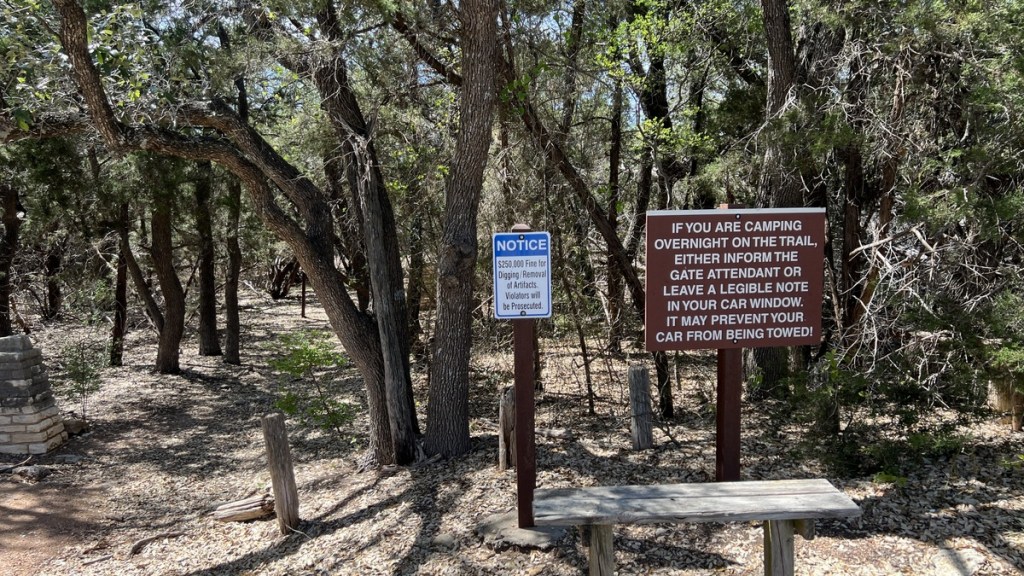
There is lots of parking at Tejas Park (Google Maps https://maps.app.goo.gl/LBrhwHeoY3eZYfVG8). There is also plenty of parking at the Russell Park trailhead, where there is a notice advising trail campers to leave a note on their car to prevent it being towed. (I did not see that sign until it was too late!). However, I did not find any reports of cars being towed.
As well as deciding where to start, one needs to decide on which direction to hike, and over how many days and nights. Some backpacker’s decisions are influenced by the terrain, for instance wanting to avoid hiking over the dam in the heat of the day, or tackling the rockier/hillier sections earlier in their itinerary. Other factors might be camping, water, and restroom accessibility, which the next section discusses.
Camping Options
There are are seven campsites close to the Good Water Loop. Camping outside of these campsites is not permitted.
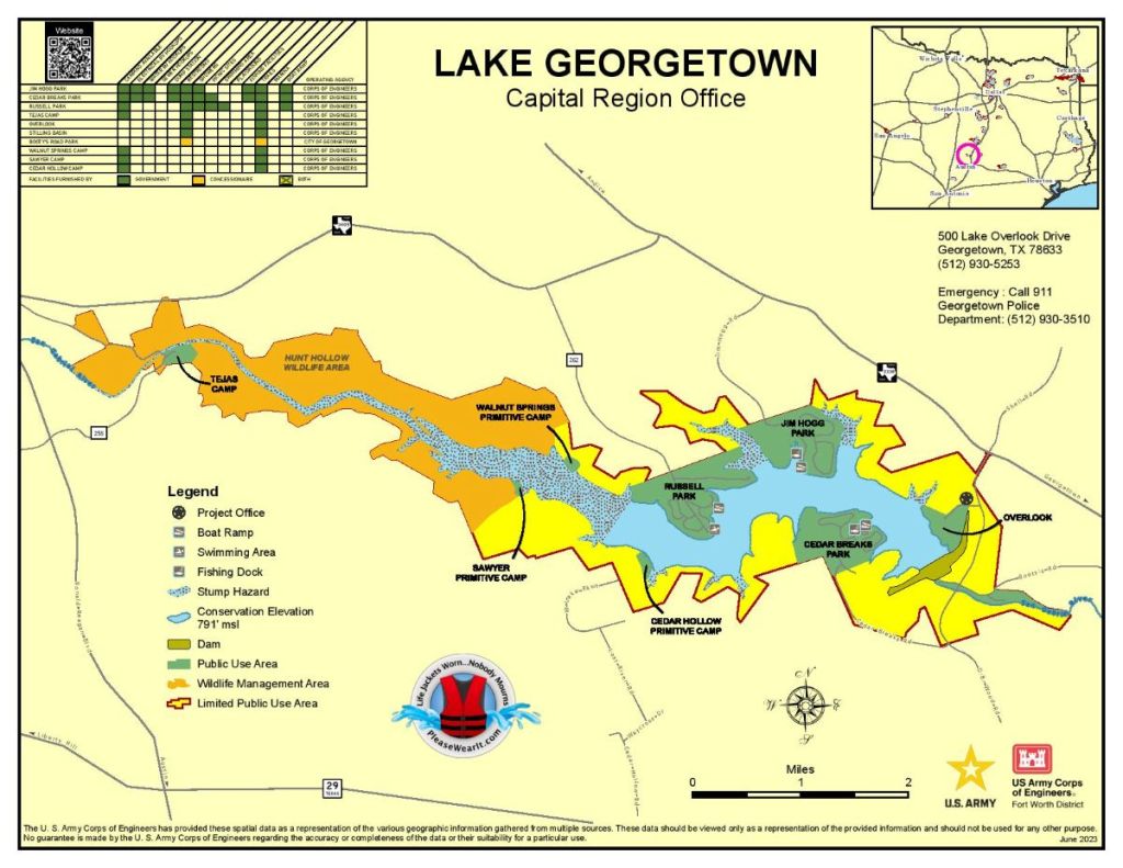
Full size image at https://www.swf-wc.usace.army.mil/georgetown/Information/Maps.shtml.
Note the locations of Cedar Hollow, Sawyer, and Walnut Springs primitive camps.
The map above includes a summary of the campsites’ facilities. More details are provided in other maps at https://www.swf-wc.usace.army.mil/georgetown/Information/Maps.shtml. These detailed campground maps show the location of water, toilets, and the hiking trail.
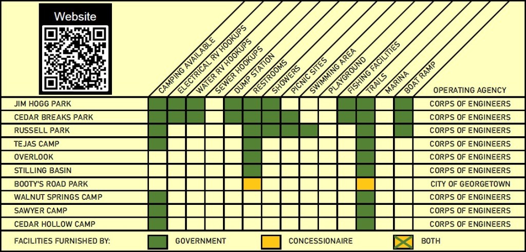
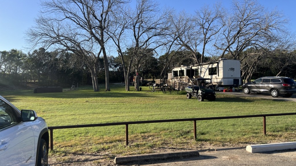
Sites at Jim Hogg Park, Cedar Breaks Park, Russell Park, and Tejas Camp need to be booked through https://www.recreation.gov/gateways/516.
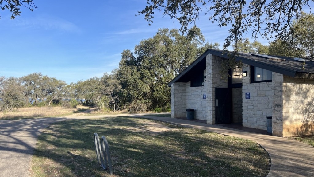
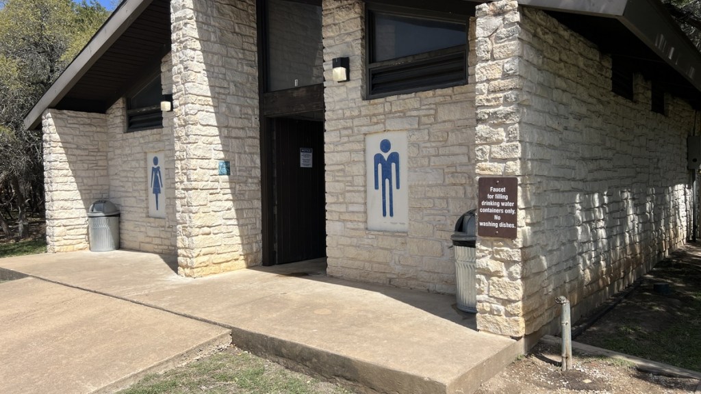
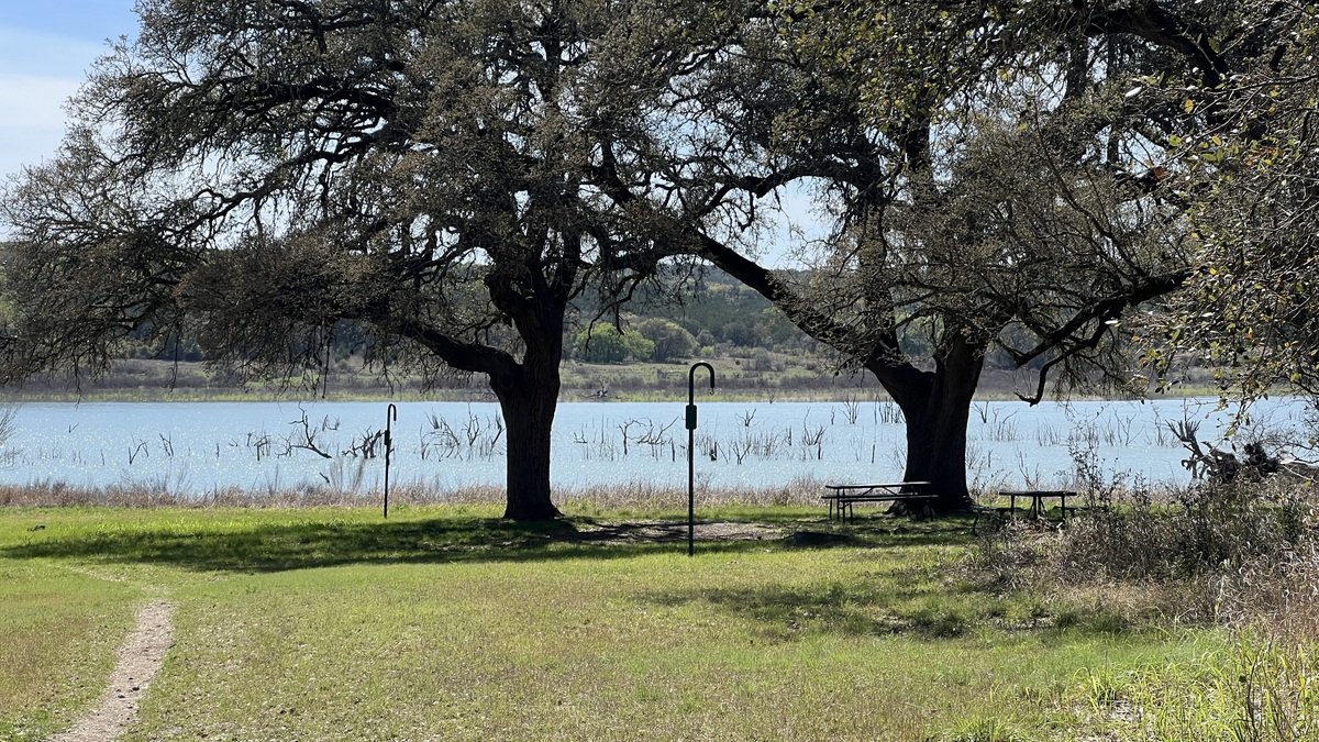
Overlook and Tejas have restrooms and running water on the trail. Russell Park has these facilities a short walk off the trail, and Jim Hogg and Cedar Breaks have facilities a longer walk from the trail. The primitive campsites at Walnut Spring, Sawyer, and Cedar Hollow do not have running water, but they have access to water in the lake, which can be drunk after filtering. Sawyer and Cedar Hollow have open-air pit toilets! I did not see a usable electric outlet anywhere on the trail.
https://maps.app.goo.gl/jVrNHDZttq5amSLe9
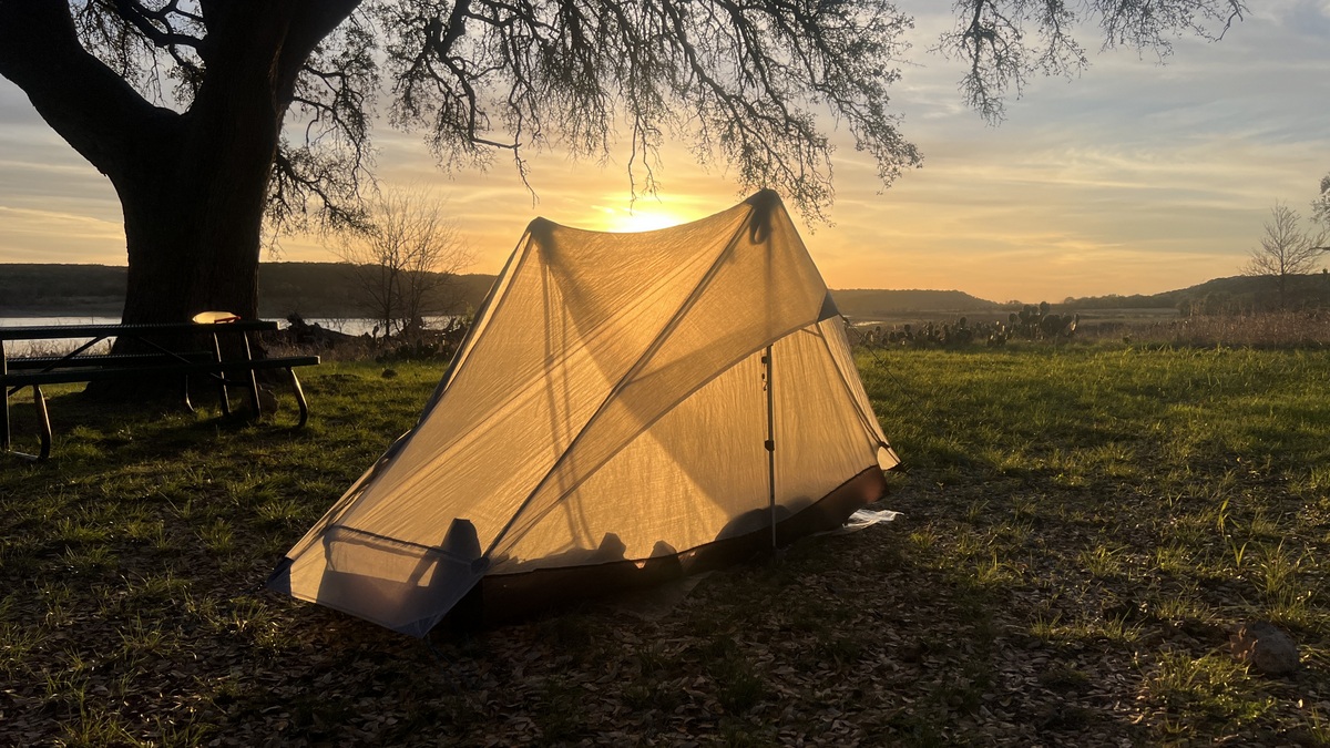
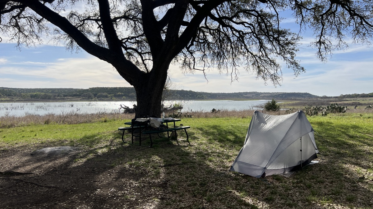
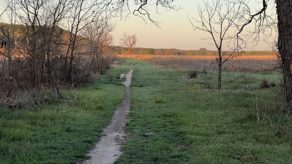
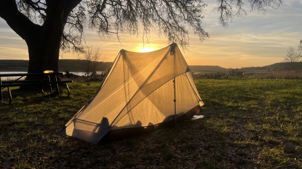
I camped at Walnut Springs and it was a fantastic site right next to the trail. There was plenty of space with many level spots and a great sunset. The sites include a picnic table and hook to hang food or a light. I did not visit either Sawyer nor Cedar Hollow. Other people’s reports suggest that they have lots of space with picnic tables and pit toilets but that there aren’t many level spots. Below are some of my pictures from the Walnut Springs campsite.
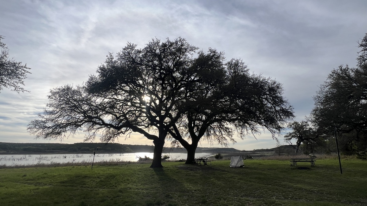
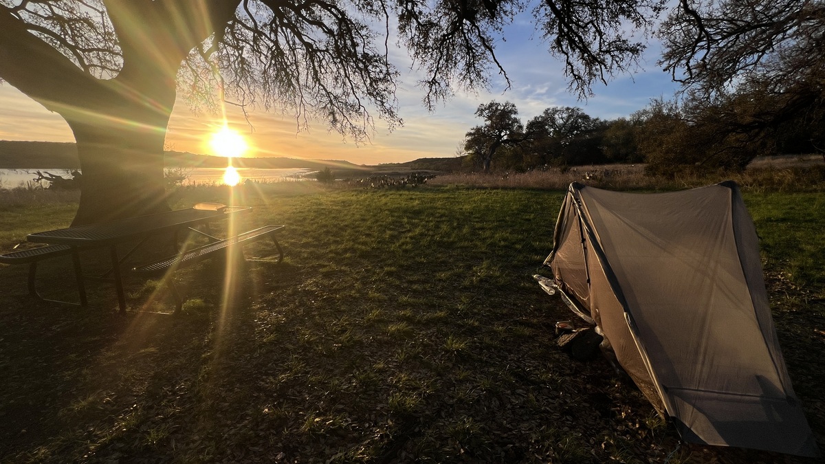
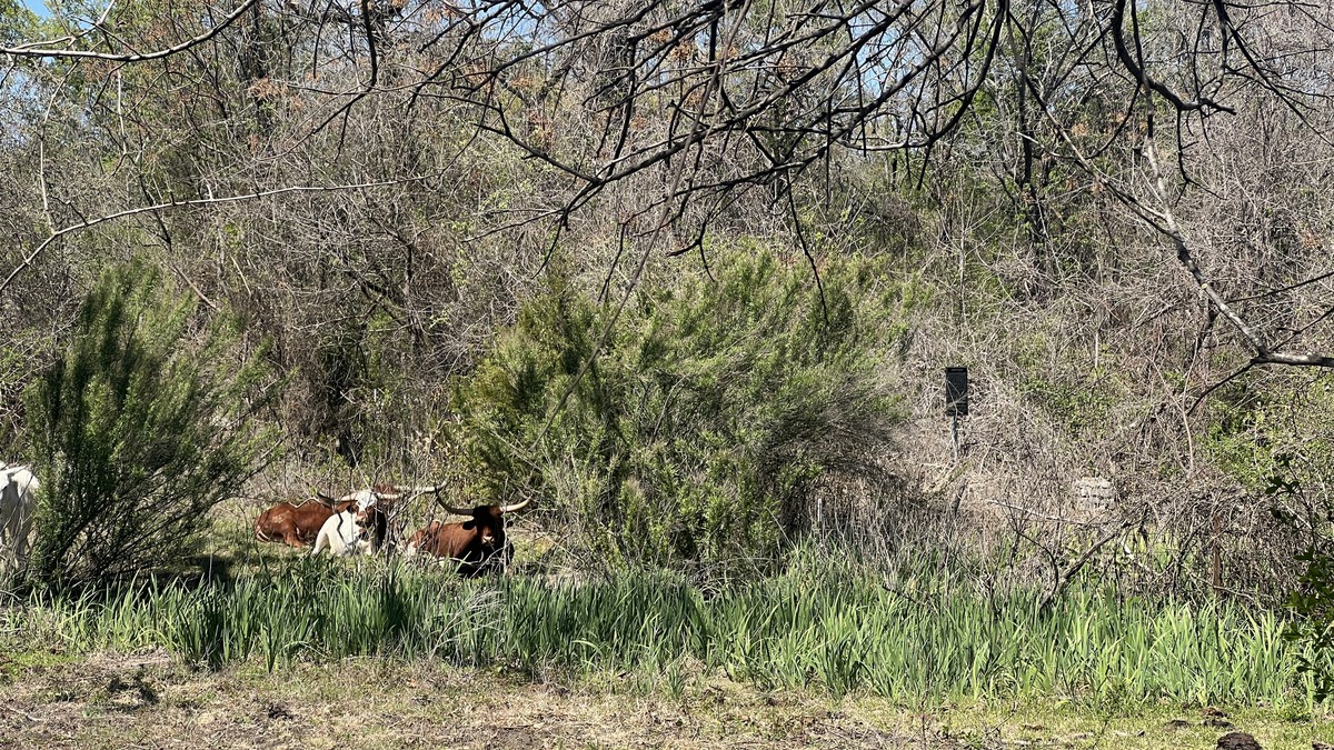
When I hiked the loop in March, there were minimal insects. I saw several deer and heard coyotes at dusk. All day I heard Northern Cardinals and vultures often circled overhead. I heard an owl right next to my tent as I went to sleep.
Itineraries
Five possible starting points, two directions, and seven campsites give lots of options for a one to three night trip. CW=clockwise and CCW=counterclockwise. Actual hiked distances will be longer, and GPSs will also measure further. I suggest a few itineraries below, but these are just examples. Each itinerary can also be hiked in the opposite direction. Some hiker reports indicate they chose their itinerary to avoid hiking the road in the heat of the day, though it is less than two miles.
I hiked the first itinerary, starting from Cedar Breaks Park, hiking counterclockwise, and camping at Walnut Spring primitive campground, and I recommend it. I started with 2 liters of water, and refilled my bottles and a 3-liter bladder at Russell Park, which was plenty for me with daytime March temperatures creeping into the 80s in the afternoon.
| Start/End | Route | Campsite(s) | Daily trail mileages |
|---|---|---|---|
| Cedar Breaks | 1 night, CCW | Walnut Spring (mm15) | 11 and 15 |
| Cedar Breaks | 1 night, CCW | Tejas Campground (mm10.5) | 15.5 and 10.5 |
| Cedar Breaks | 2 nights, CW | Cedar Hollow (mm4.5), Walnut Spring (mm15) | 4.5, 10.5, and 11 |
| Cedar Breaks | 2 nights, CCW | Russell Park (mm17), Tejas (mm10.5) | 9, 6.5, and 10.5 |
| Cedar Breaks | 2 nights, CCW | Russell Park (mm17), Sawyer (mm6.5) | 9, 10.5, and 6.5 |
| Tejas Campground | 2 nights, CW | Jim Hogg (mm21), Cedar Hollow (mm4.5) | 10.5, 9.5, and 6 |
Why Hike The Good Water Loop?
I think I was discouraged from hiking the loop because of an incorrect perception from looking at the AllTrails map. I thought it was going to be a monotonous walk around a lake’s shore along a narrow strip of land between the lake and private land. However, the topography creates tremendous variety, and hiking along the thin strip of land was cool!
So, why do this hike?
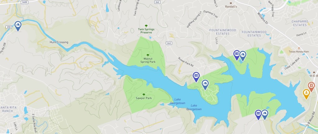
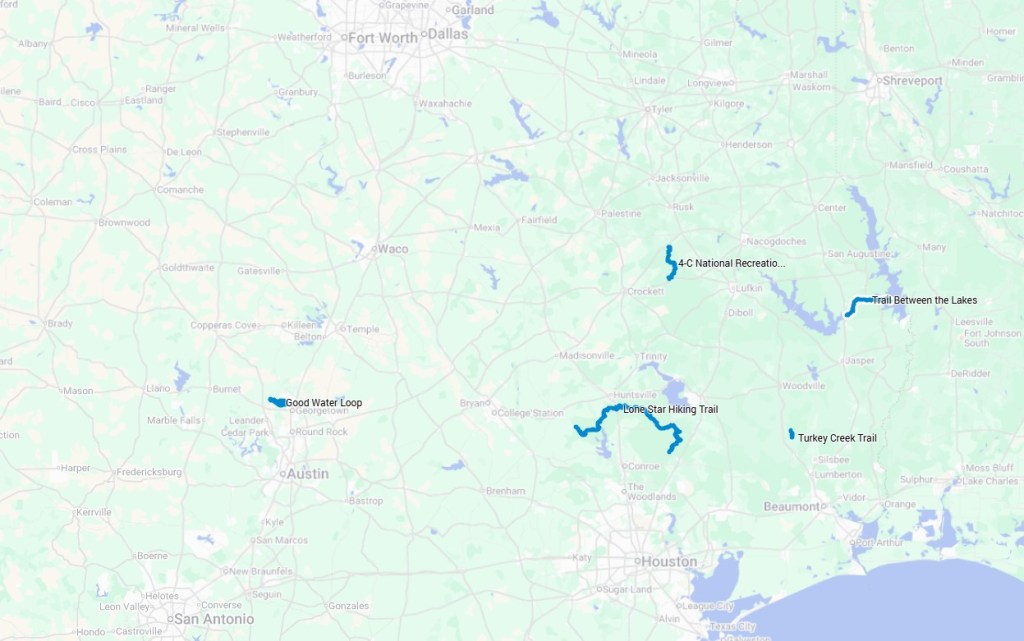
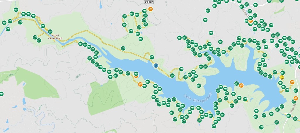
1. Location. Backpacking options in the southeastern half of Texas, such as the 28-mile Trail Between the Lakes, 96-mile Lone Star Hiking Trail (and nearby hikes), the 20-mile 4-C National Recreation Trail, and the 14-mile Turkey Creek Trail in the Big Thicket National Preserve, are all great backpacking opportunities, but they are fairly flat forest hikes crossing multiple creeks. There are restrictions during hunting season and it is often humid with lots of mosquitoes. I have driven 7 hours to hike the 27-mile Eagle Rock Loop in Arkansas, 9 hours to hike Big Bend National Park’s 30+ mile Outer Mountain Loop, and 9.5 hours to hike up to Guadalupe Peak. The Good Water Loop is conveniently located. For backpacking opportunities in Texas, check out Reddit’s ULTexas list or my Google Map (partial screenshot below).
2. Accessibility and Options. It is easy to get to the loop’s trailheads, no permits are required, and there are no additional restrictions on hiking and camping during hunting season. The choice of trailheads and campsites allow for a range of itineraries.
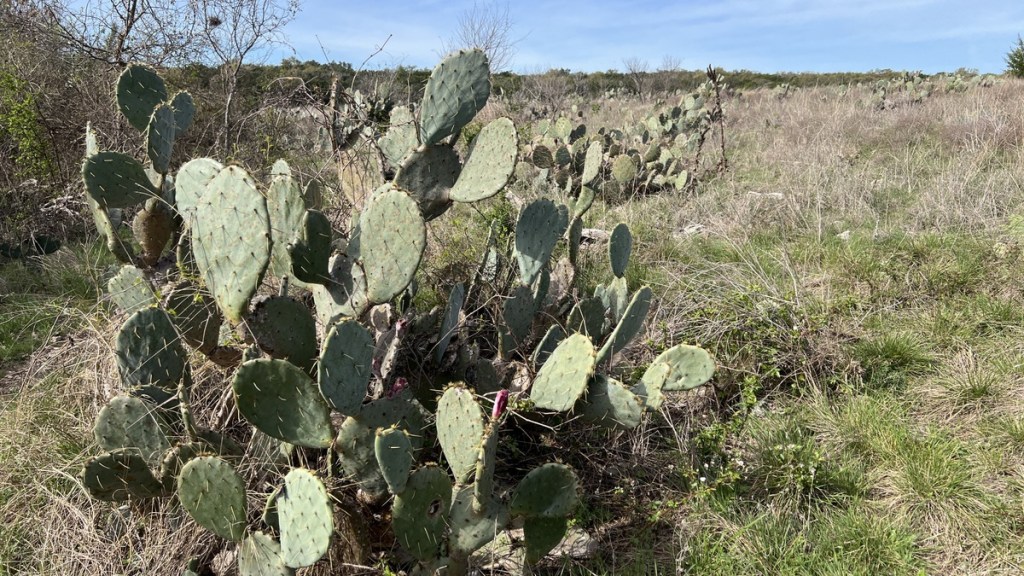
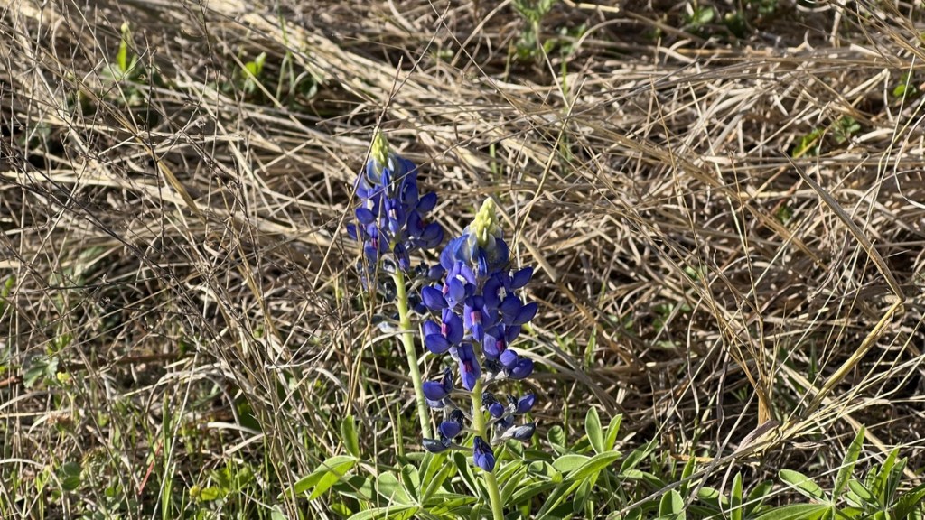
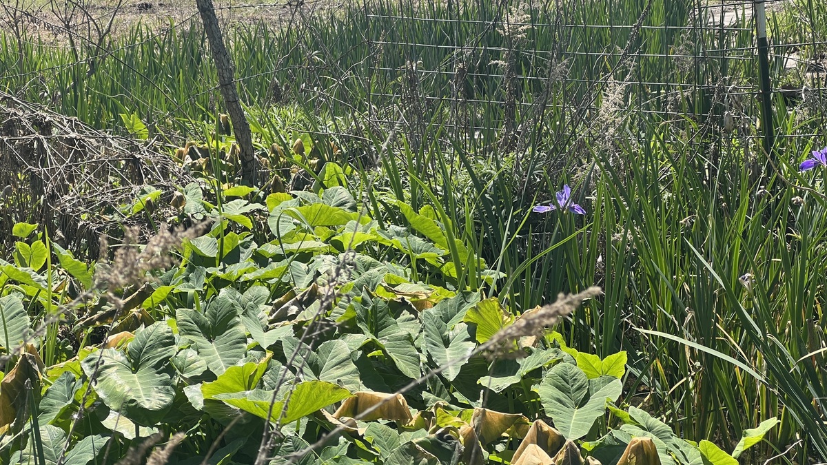
3. Variety. The loop offers tremendous variety. At times, it felt similar to hiking the rolling hills of England, and then I’d see bluebonnets and cacti. Vegetation ranges from juniper and oak forests to open meadows. Underfoot, it ranges from sharp limestone to compact mud.

4. Walnut Springs Primitive Campsite. Sleeping overnight at this site is enough to justify the hike. It was dry with plenty of shade from the trees and a breeze coming off the lake. Other than a few passing hikers, I had the campground to myself, though it might get busy at weekends. I had one of my best nights’ sleep here while camping.
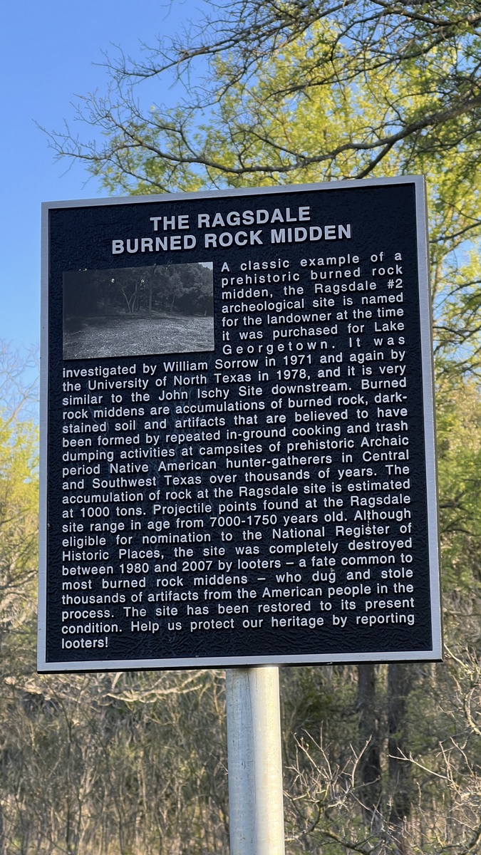
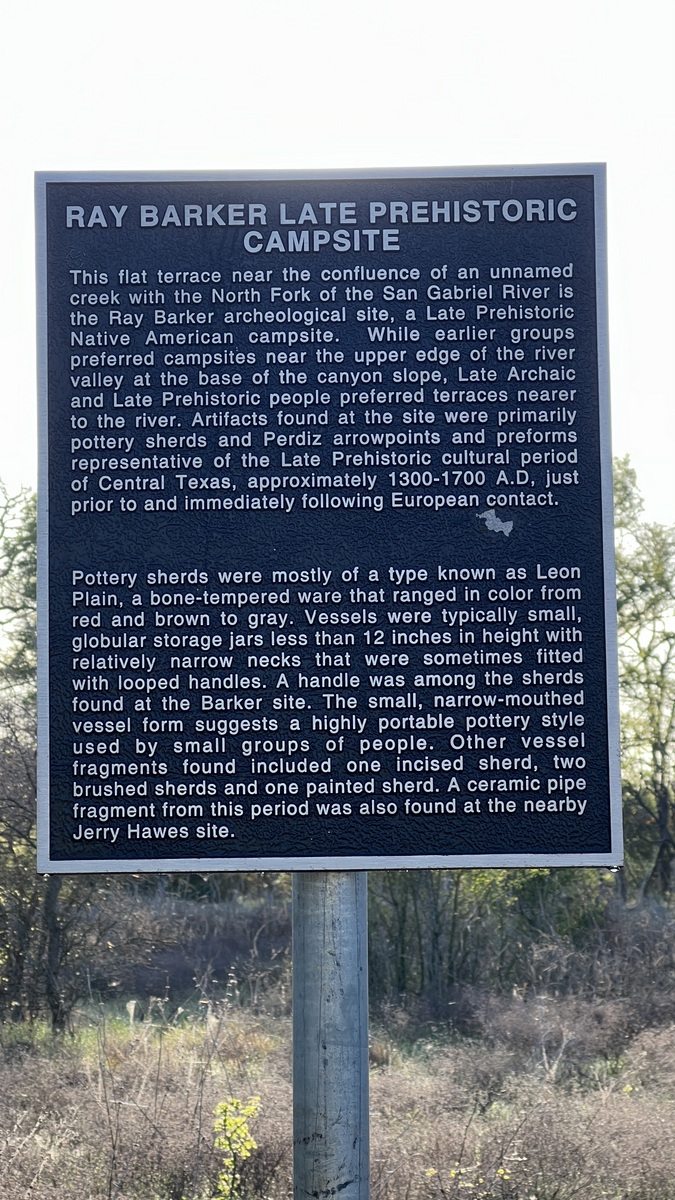
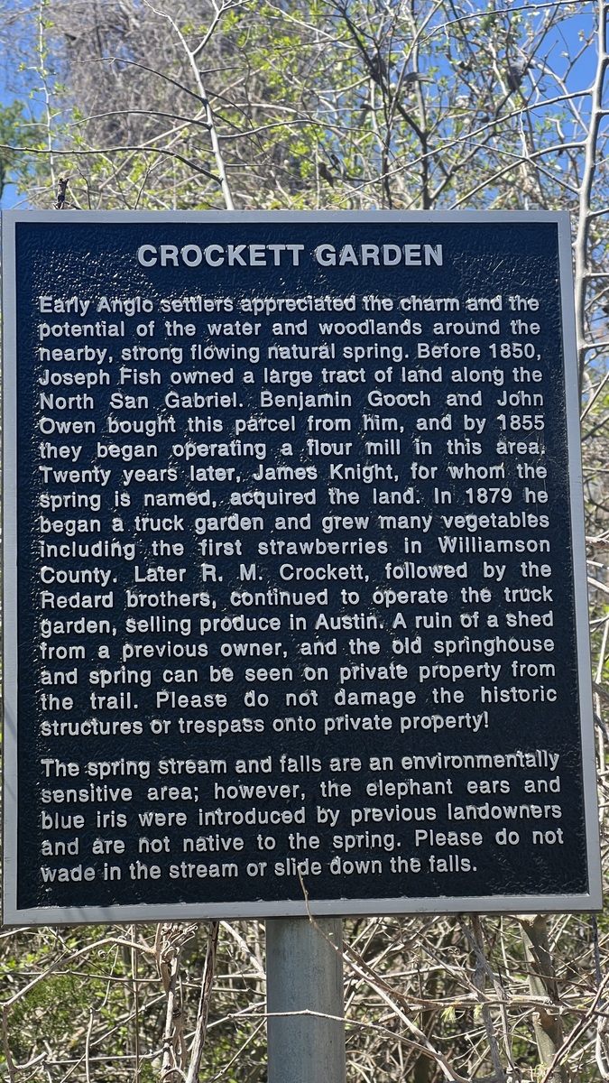
5. Historical Points of Interest. There are multiple information signs around the loop explaining the area’s history. This includes the background to the lake, the historical crossings, and ancient burned rock middens.


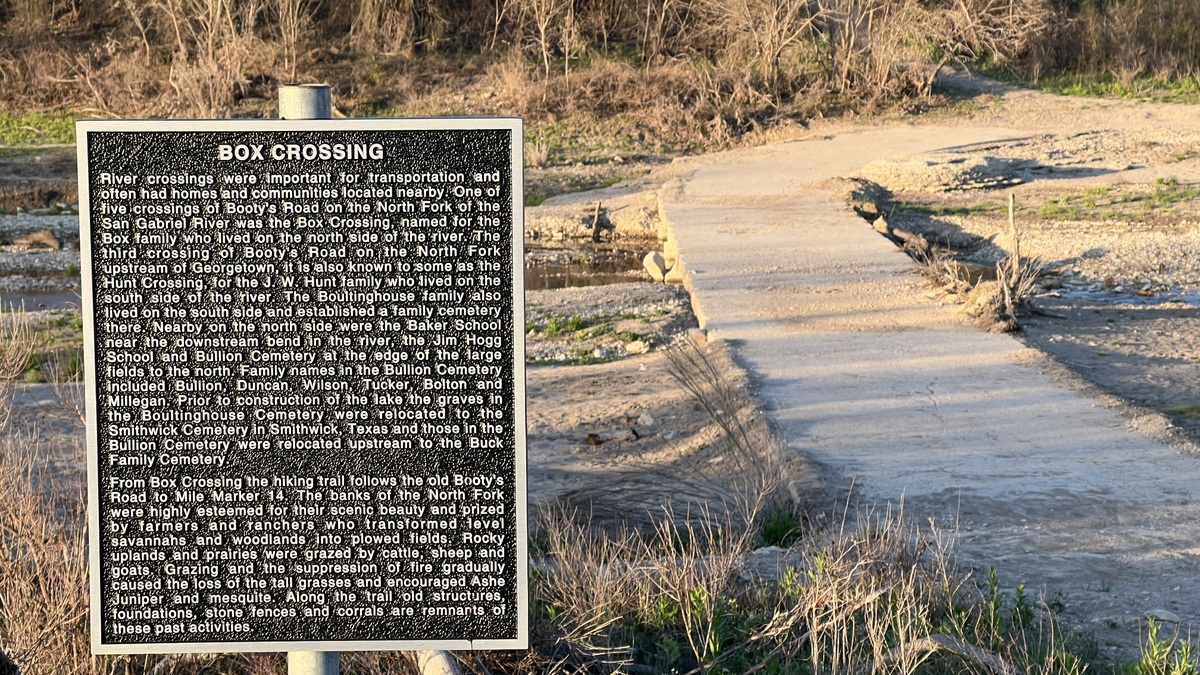
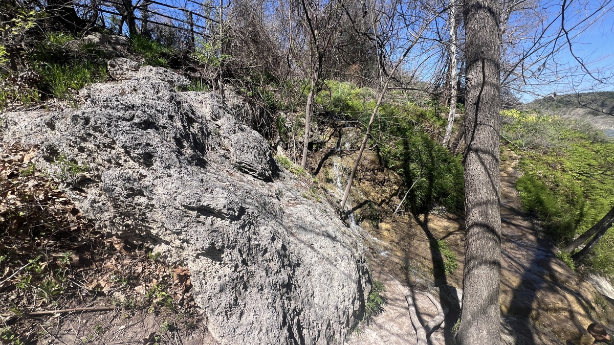
6. Crockett Garden. A natural spring crosses the trail near mm2.5. It is a beautiful area, made special with a waterfall. The waterfall used to have an impressive overhang but this collapsed in an ice storm.

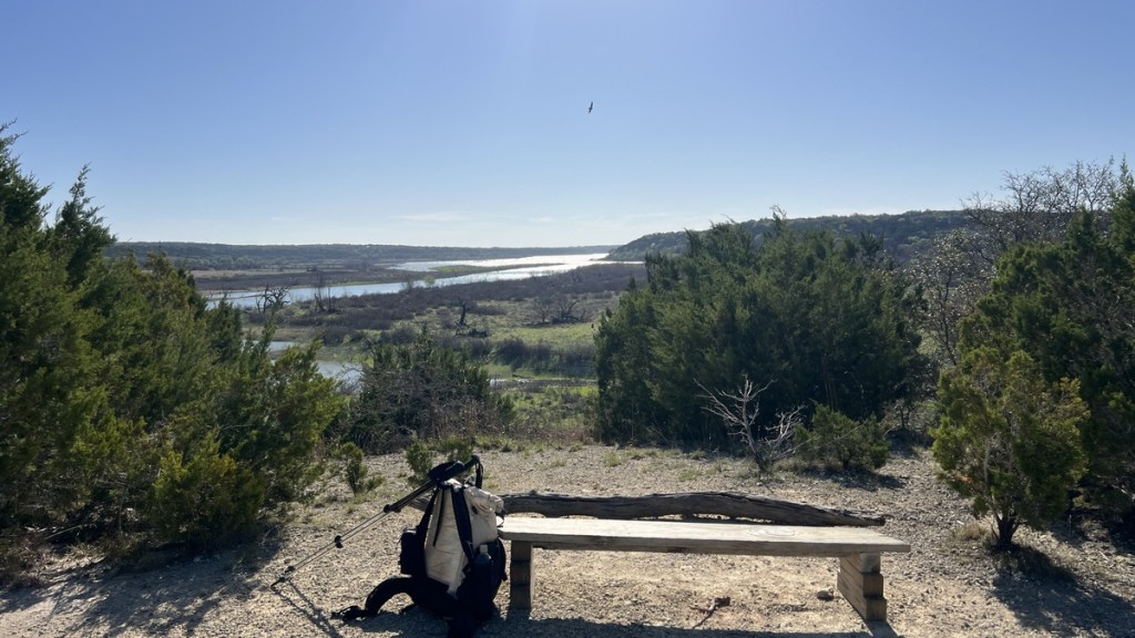
7. Unnamed viewpoint. I stopped for lunch on a perfectly-located bench between mile markers 9 and 8. I believe it is one of the best views in the southeastern half of Texas.
8. There are lots of Geocaches! I enjoyed the multi-virtual called The Goodwater Loop, which involved taking a selfie by every milepost. There are many physical caches throughout the trail.
In addition to the above reasons to hike the loop, I need to share some cautions. First, the rocky terrain is sharp, and walking on it is quite tiring. Second, a water plan is important, and might involve walking off the trail. The lack of shade on parts of the trail would make it a difficult hike in the hotter months. Third, there might be sounds of construction on the private land, or of vehicles in Georgetown or on roads. Fourth, the trail’s signage is often lacking at junctions, so a map to navigate is required.
Trip Reports
Below are trip reports that provide additional information about the trail. Other videos can be found by searching YouTube for Good Water Loop. AllTrails also has lost of reviews of the trail at https://www.alltrails.com/trail/us/texas/good-water-loop.
| Link | Description | Itinerary |
|---|---|---|
| Coming soon on cajunlimeys.com. | A blog describing my trip in March 2026 | CCW from Cedar Breaks, one night at Walnut Springs. |
| https://www.youtube.com/watch?v=BZVCJ88iR28 | A 61-minute video by Cameron Hall from December 2023, shortly after an ice storm. | CCW from Cedar Breaks, one night at Walnut Springs. |
| https://www.youtube.com/watch?v=-ZN1LFi_3nM | A 36-minute video from April 2023 by Jetgirl Hikes. Thorough overview with lots of history. | CCW from Cedar Breaks, one night at Tejas. |
| https://www.youtube.com/watch?v=CB8CyaBs5gI | A 29-minute video by Tangent Trails from April 2023 | CCW from Cedar Breaks, camping at Cedar Breaks and Tejas. |
| https://www.youtube.com/watch?v=CB8CyaBs5gI | An 11-minute video by AdventureBegins from November 2020. | CCW from Russell Park, camping two nights. |
| https://nuttyhiker.com/goodwater-loop-georgetown/ and https://www.youtube.com/watch?v=yRXvykYjHUk | A very informative blog, and a 1h51m video by Nutty Hiker from May 2018. Includes details about Cedar Hollow campground. | CW from Cedar Breaks, camping at Cedar Hollow and Walnut Springs. |
