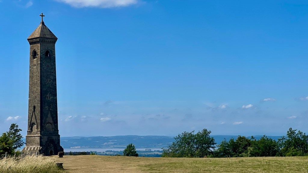
Three steep climbs on a blistering hot day made just finishing the 11 miles from Coaley Peak to Wotton-under-Edge a very satisfying accomplishment. The day’s highlight was the Tyndale Monument recognizing local man William Tyndale who was burned at the stake in 1536 after publishing his English translation of the Bible. We also enjoyed cows, woodland, and big views.
Our day started humbly by avoiding a near-death experience. The plan was to walk back to the Cotswold Way from our pub in Frocester. Our waiter, who cycles these roads, strongly advised against that as the road was narrow and cars would be whizzing during rush hour. He recommended a taxi to Coaley Peak. Janet and I had previously come way too close to cars on a road in a similar situation on the northern Cotswold Way so we took his advice and booked a taxi for 7:30. With record high temperatures in the upper 80s degF (31 degC), we wanted as early a start as possible. Breakfast started at 7 so our omelette and full English breakfast had to be woofed down too quickly! After mixed qualities of sleep in the heat, it started the day with a jolt.
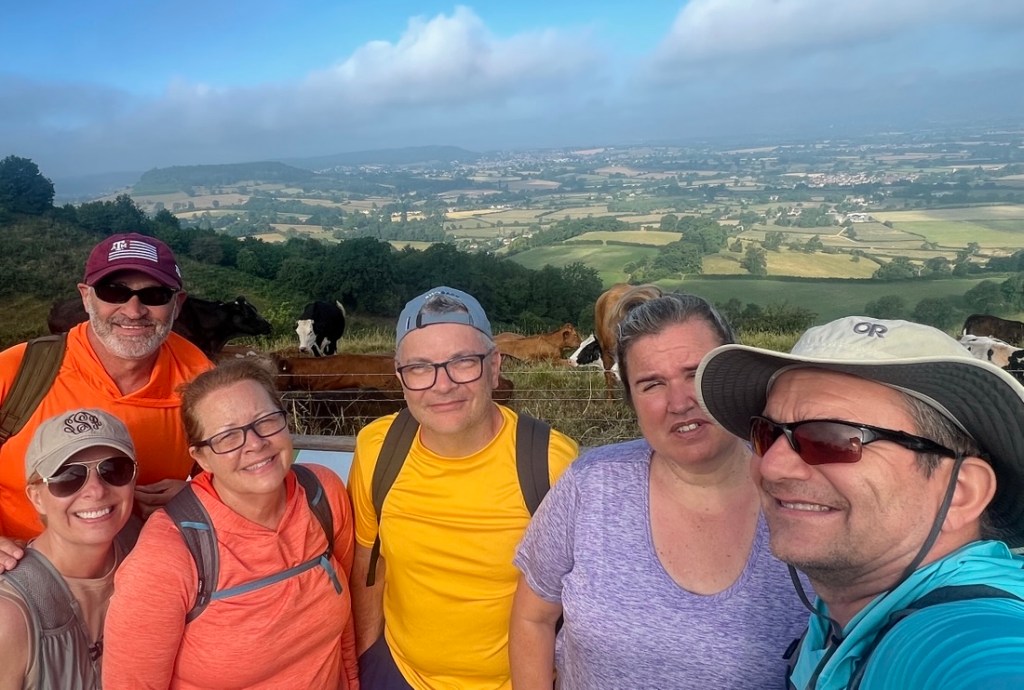
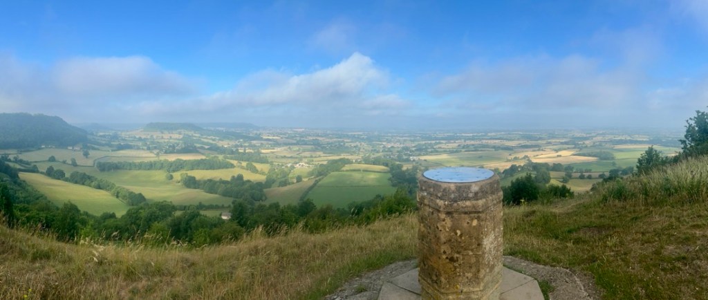
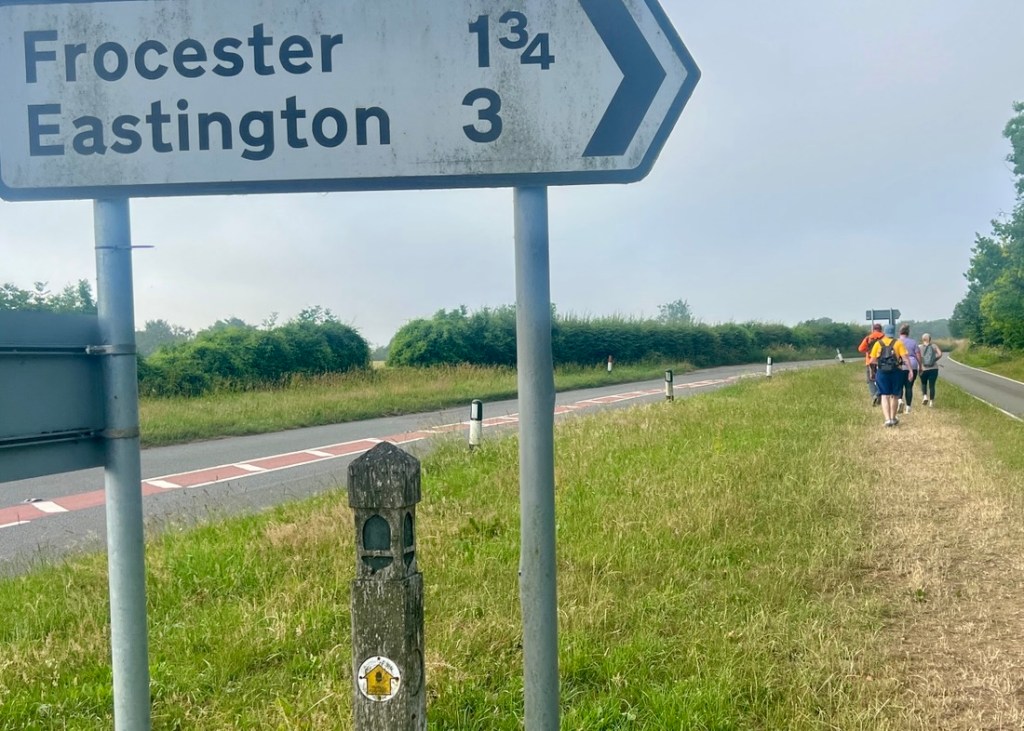
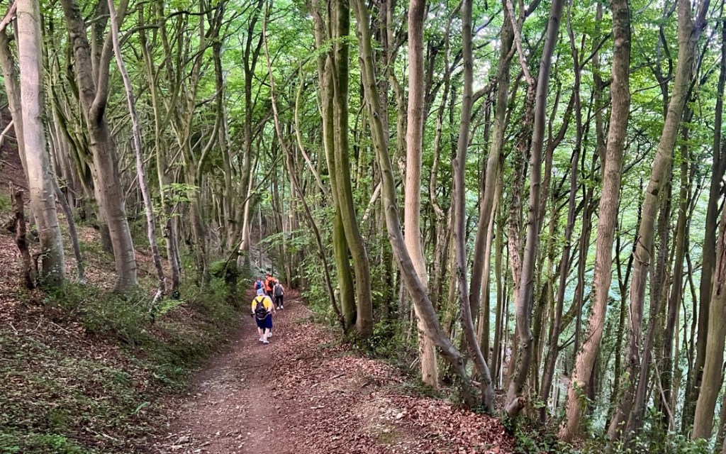
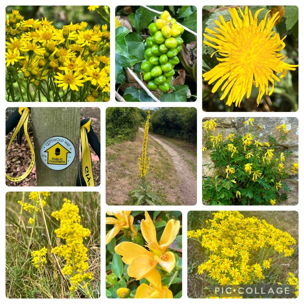
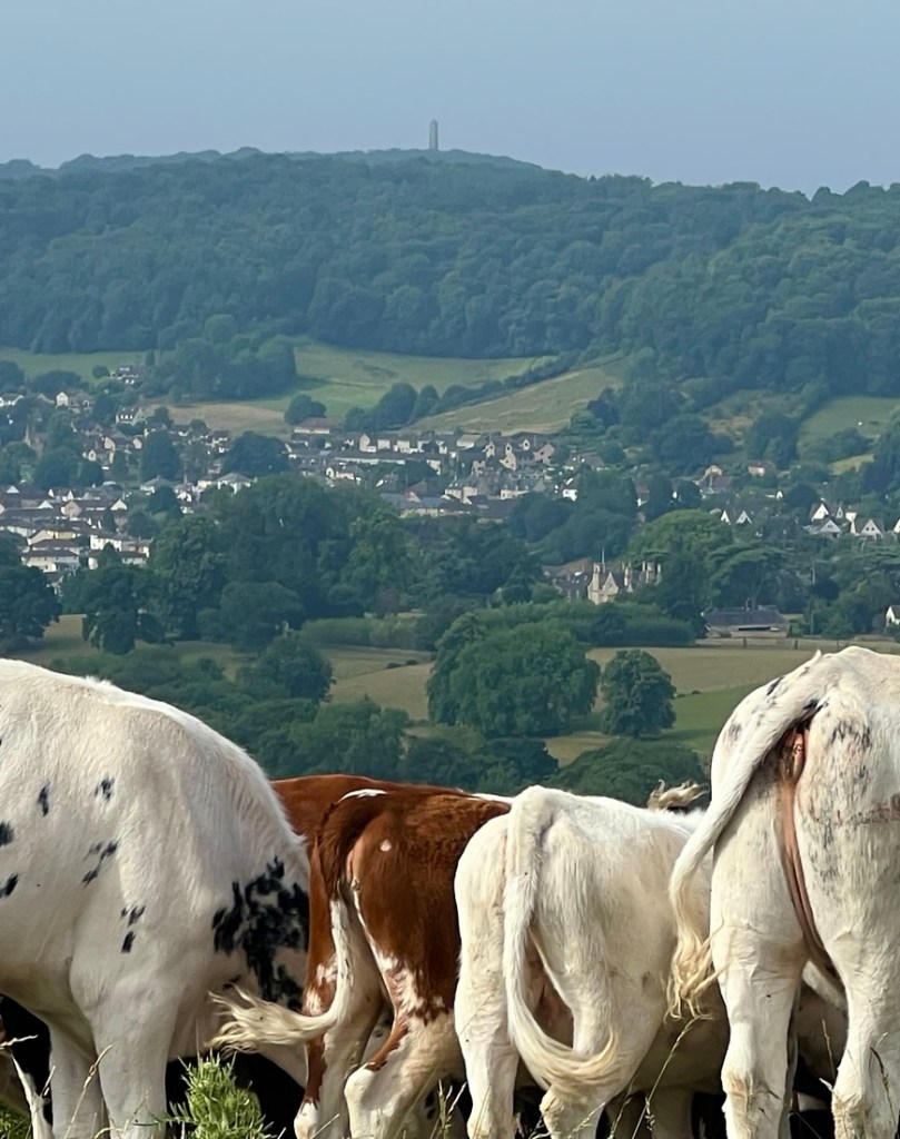
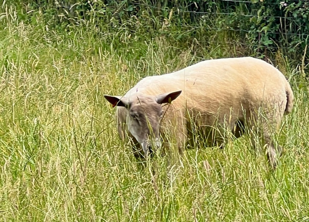
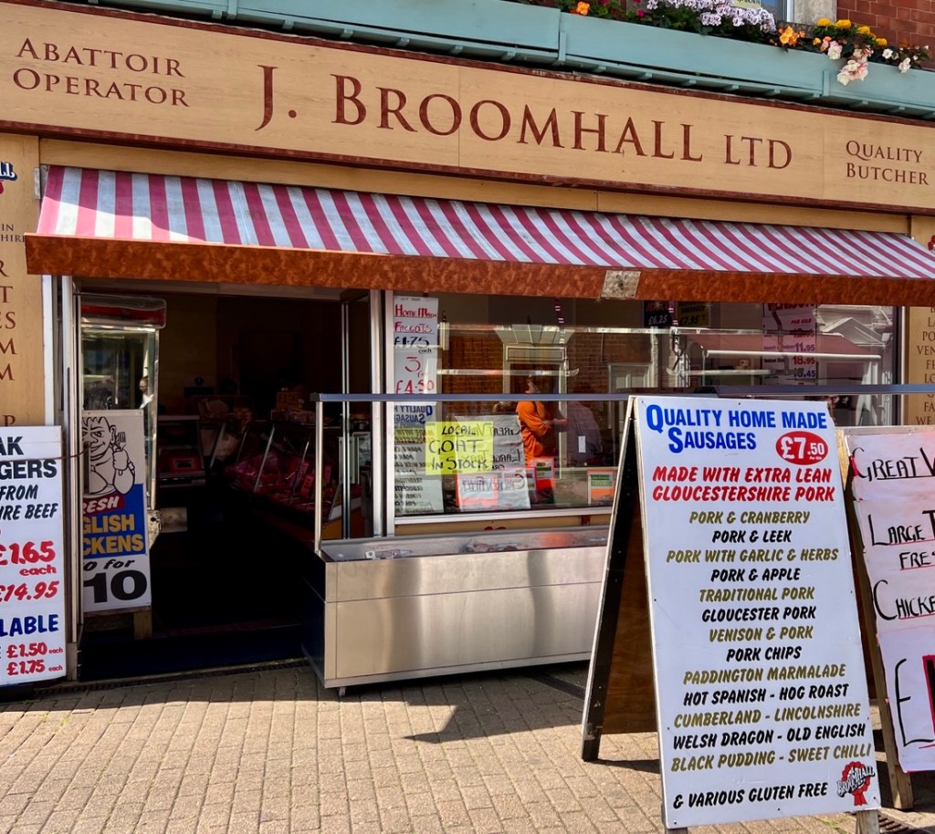
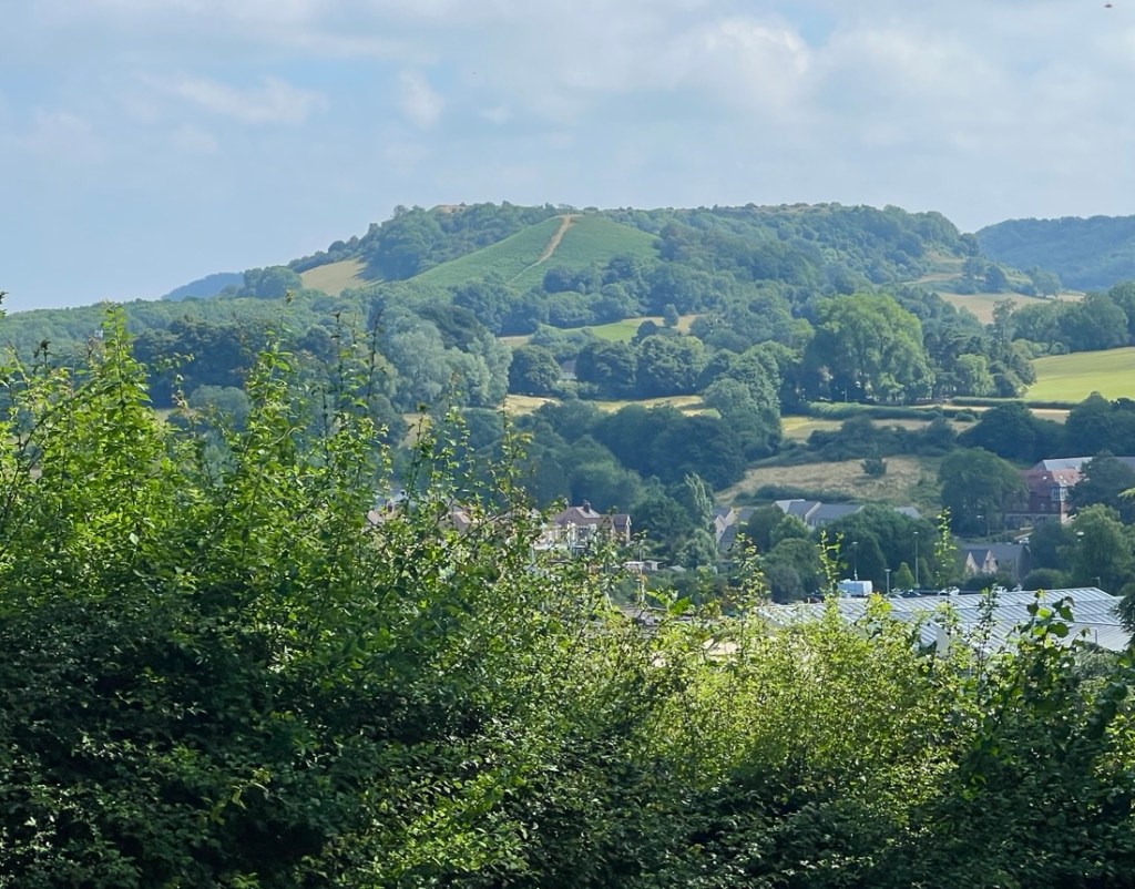
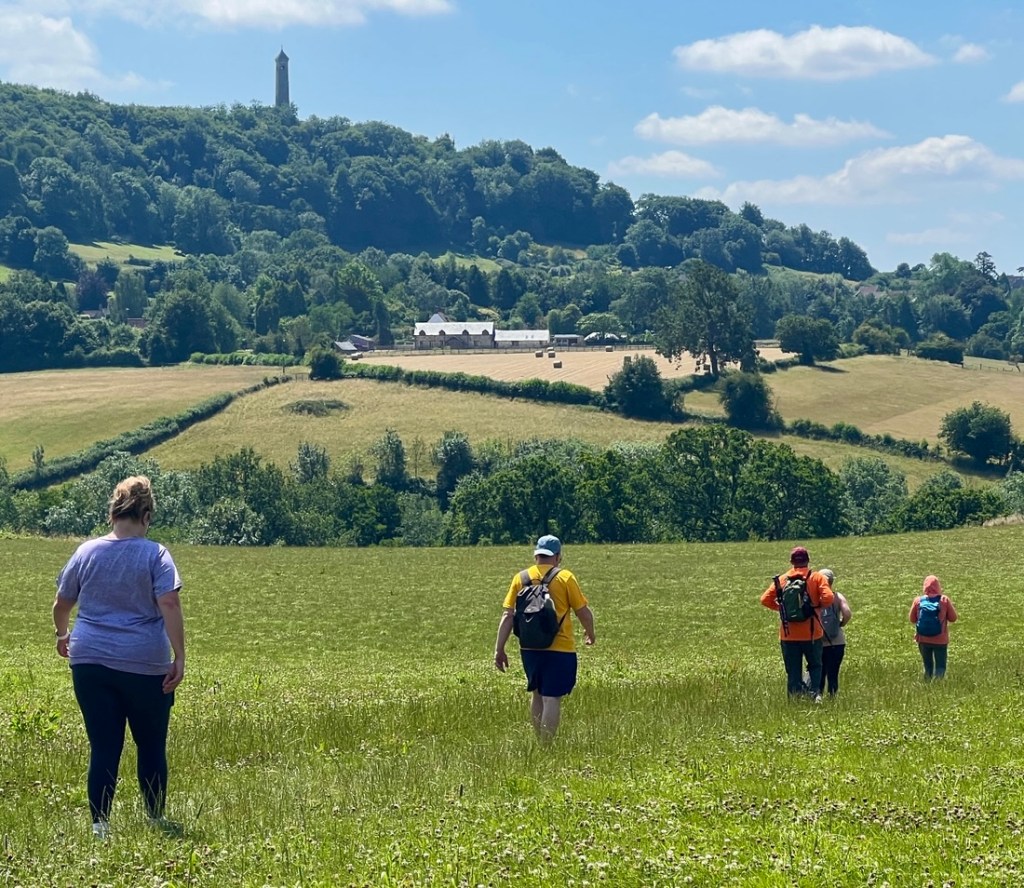
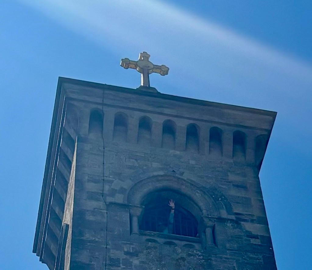
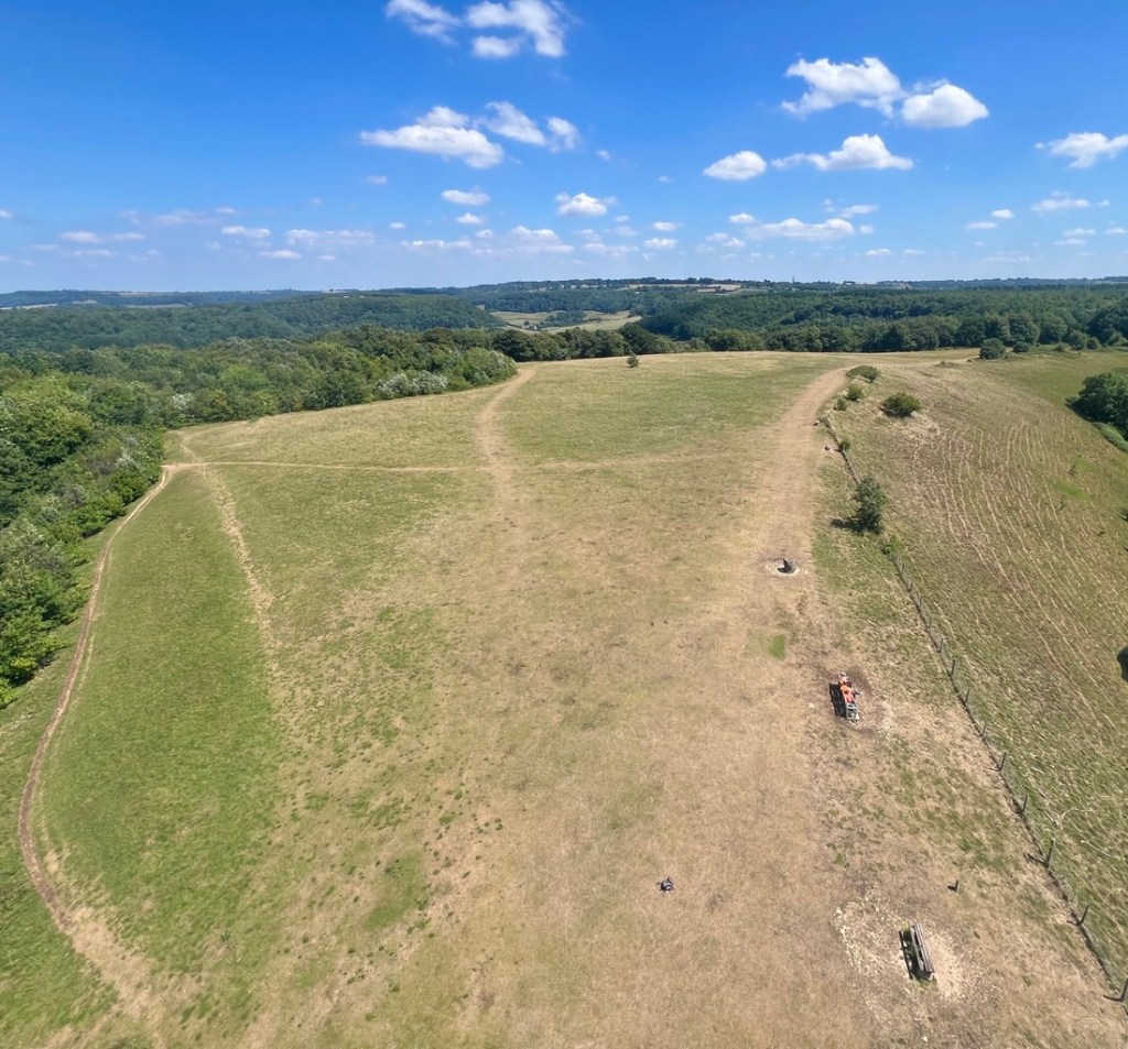
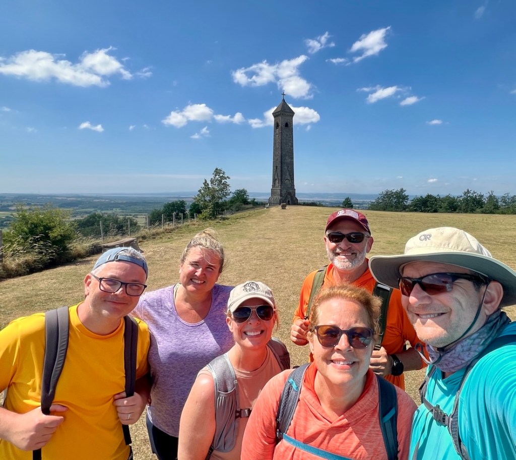
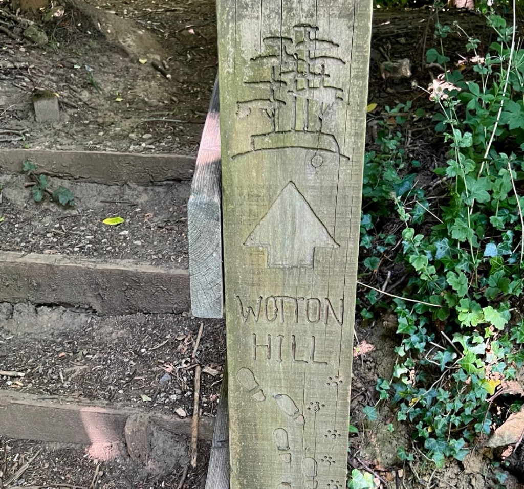
The view back down the escarpment from Coaley Peak toward Frocester and beyond. The road our taxi brought us was below and cars (including our taxi) whizzed along and would not be expecting walkers! Our taxi from Apollo Taxis squeezed our trip in before doing a school run and was perfect.In the rush we had not been able to take our starter photo at the pub, yet it seemed more appropriate here as we took a taxi. What a colourful bunch!Dean was excited when he saw that the map labeled the Forest of Dean (where my dear uncle used to live) in the distance.The first of several groups of cows. Many of these were lying down, normally suggesting rain, but I think this lot were just tired and hot!Coaley Peak’s marker looked down on a patchwork of fields.Farewell Frocester! The path followed a busy road briefly before heading off into the woods.While the day’s walk had three big climbs and four descents, we started with quite a bit of undulating through this entangled Coaley Wood. There might have been a few times that I was asked if this was one of ups or downs when it wasn’t.Throughout the trail we’ve seen abandoned old quarries such as this, labeled on our map as disused.As yesterday’s colour was purple, I chose yellow for today. There were yellow daisies everywhere! There were also poisonous berries (known as Lords and Ladies) that were often red, but we spotted these immature yellow and green ones. Climb number one up Cam Long Down. It’s a bump on the valley floor below the escarpment and a very steep climb. I now realize we could have easily walked around, but we would have missed the view. Just don’t tell Tracy! We weren’t able to walk around subsequent hills.Stephanie elegantly climbs a stile in style over a style of stile that we did not see yesterday.Our view down Cam Long Down back toward Coaley Peak. Cows in the barn were making a racket. We could not work out what was going on!As yellow was the colour of the day, and orange is close (?), I asked for this posed photo which wasn’t met with the most enthusiasm.While this shows the rear ends of several cows, you can also see the Tyndale Monument in the distance. That was where we were heading!During our descent from Cam Long Down on our way into Dursley, we were faced with this traffic jam. Much encouragement was needed to get these bovines to moove along.We hiked past our first sheep! I’d seen a tasty lamb last night – on my dinner plate…Dursley is a good sized market town with a pedestrianized Main Street and this traditional butcher. I liked how he highlighted the supply chain by pointing out he was an “abattoir operator” (i.e. slaughterhouse). Raw meat wasn’t our need so we picked up our lunch at a large Sainsbury’s supermarket, which also had fine facilities!As we climbed out of Dursley, we looked back toward Cam Long Down with Coaley Peak beyond.At the top of “hill 2”, we had the choice of the long or short route. The long route added two miles following the escarpment. The views would have been great and we would have considered it if we weren’t so worried about the heat.The short cut took us across a golf course, one of several we’ve crossed on the Way. Half way down the other side, we found a bench and some soft grass in the shade for lunch where we had a few visitors. Onward to North Nibley and its monument.Before the next climb, we crossed the Doverte Brook where we saw this ~2 ft eel swimming.Climb number three to the monument was a tough one and Janet was thankful to stretch her back on this bench.There was an informative sign at the bottom, explaining William Tyndale‘s local roots before joining Luther in Germany to help get his English translation of the Bible published and smuggled back to England as it was illegal at the time. He was burned at the stake for such heresy but English Bible readers are thankful for such sacrifice.Max and I climbed 121 steps to the top.Great views from the top!My blue arm matched the sky!The view from the top toward Wales.Hello down there.The Cotswold Way below the tower.Group selfie of the day!Good bye and thank you, Tyndale monument.Max found a convenient hole on the path, bringing him down to Stephanie’s level.I loved this carved signpost, highlighting the monument and both human and canine hikers.After 11 miles, 2300 ft of climb, and 6.5 hours, we arrived with thanks at The Swan in Wotton-under-EdgeAn essential device in each of our rooms.We enjoyed a fine dinner in the bar, but we did not force Max to sit in this corner for too long!The British taps can confuse Americans. How do I get warm water? The hot is near boiling, the cold often near freezing. You can either use the plug, or “do the dance” moving your hand between two streams to avoid burns or frostbite. To cool off, I took a cold shower and, oh boy, was it cold! I might have screamed…
The weather forecasts have suggested this was the hottest day, which we hope! Onward we go on this fine stroll through fantastic English countryside.
"Cajunlimeys" combines Lousiana (Janet) and England (Peter). For "limeys," check out scurvy in the English navy.
We love adventures and use blogging to write a photo diary to preserve our memories. Some crazy friends enjoy following us and my notes might help others plan.
View more posts
2 thoughts on “Southern Cotswold Way: Day 2”
thanks so much for sharing this journey. It is such a beautiful place and your photos and commentary are inspiring and sometime goofy —- if it makes you guys feel any cooler it is 96 degrees in Texas today 😎


thanks so much for sharing this journey. It is such a beautiful place and your photos and commentary are inspiring and sometime goofy —- if it makes you guys feel any cooler it is 96 degrees in Texas today 😎
LikeLiked by 1 person
… but there is no air conditioning here! These are record high temps. It’s like when Houston has an ice storm…
LikeLike