Golden’s Clear Creek Canyon Park

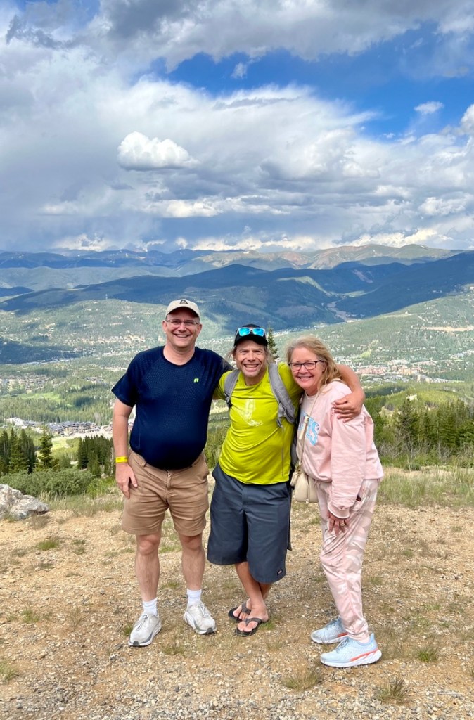
During our trip to help Samuel prepare his apartment for his second year at the Colorado School of Mines, we’ve finally been able to do some exploring! Earlier in the week we’d visited our friend Martin in Breckenridge who took us up a chair lift for a very cool hike, and yesterday, we used a spare 30 mins to drive up close to the “M” in Golden. The “M” climb is a rite of passage for freshmen at Mines. However, the area is popular way beyond the school, with views of downtown Denver and good conditions for paragliding. My photos were limited to my ability with my iPhone.

Below are a few family photos then a description of today’s walk in exploring the Clear Creek Canyon along the Peaks to Plains trail.

It was fantastic to catch up with Martin who we hadn’t seen for maybe 20+ years.
A surprising (to me) joy of the Colorado mountains is the wildflowers. This photo is of the majestic columbine, Colorado’s state flower. I was excited when I learned that a columbine was such a beautiful flower as I had previously only associated it with the 1999 school massacre.
The evening before our Clear Creek hike took us up by the “M”. Golden is below. The large buildings in the valley between the two table mountains make up the Coors Brewery, which is the largest brewing facility in the world. Most of the foreground is the School of Mines, from the football field above my head (on the left) to some new dorms being built above Kylie‘s head (on the right). On the right hand side, you can spot downtown Denver’s skyscrapers.

And so to today’s hike which was 3 miles with 200 ft elevation change and took us 1 1/4 hrs. It was a pleasant stroll along either concrete or wood in the flume. We also found four geocaches which added a fun dimension and they were all easy and in good shape, though the one by the parking was cunning. The walk was a fine blend of history, wildflowers, birds, and rocks, all with the rushing river’s backdrop. The only issue was the mid afternoon’s heat, but it was still pleasant compared to Houston, especially when in the shade which was maybe half the time. We feel for the millions of Houstonians who are without power after hurricane Beryl.

The AllTrails maps of the Peaks to Plains Trail East, which AllTrails labels as temporary closed but nothing was closed. The trail was in great condition and would be accessible any time of year. There are some steps if you choose to take the loop which might be slippery with ice in the Winter. The map shows how the trail is kinda underneath the Mines “M”.
There is plenty of parking at a trailhead just East of the US 6 junction with Highway 93. You can walk from downtown Golden. If the parking is full, there is an additional parking area west on US 6. There are restrooms at each of the parking areas.
The trail follows Clear Creek and is paved with some fine bridges. You have to watch out for bikes, which are respectful, though we had a couple of e-bikes whizz by which we were less impressed by!
The first bridge comes soon after leaving the parking area.
We crossed three dramatic bridges over Clear Creek
The same bridge from below.
Cool views from the bridge

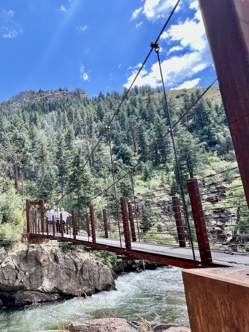
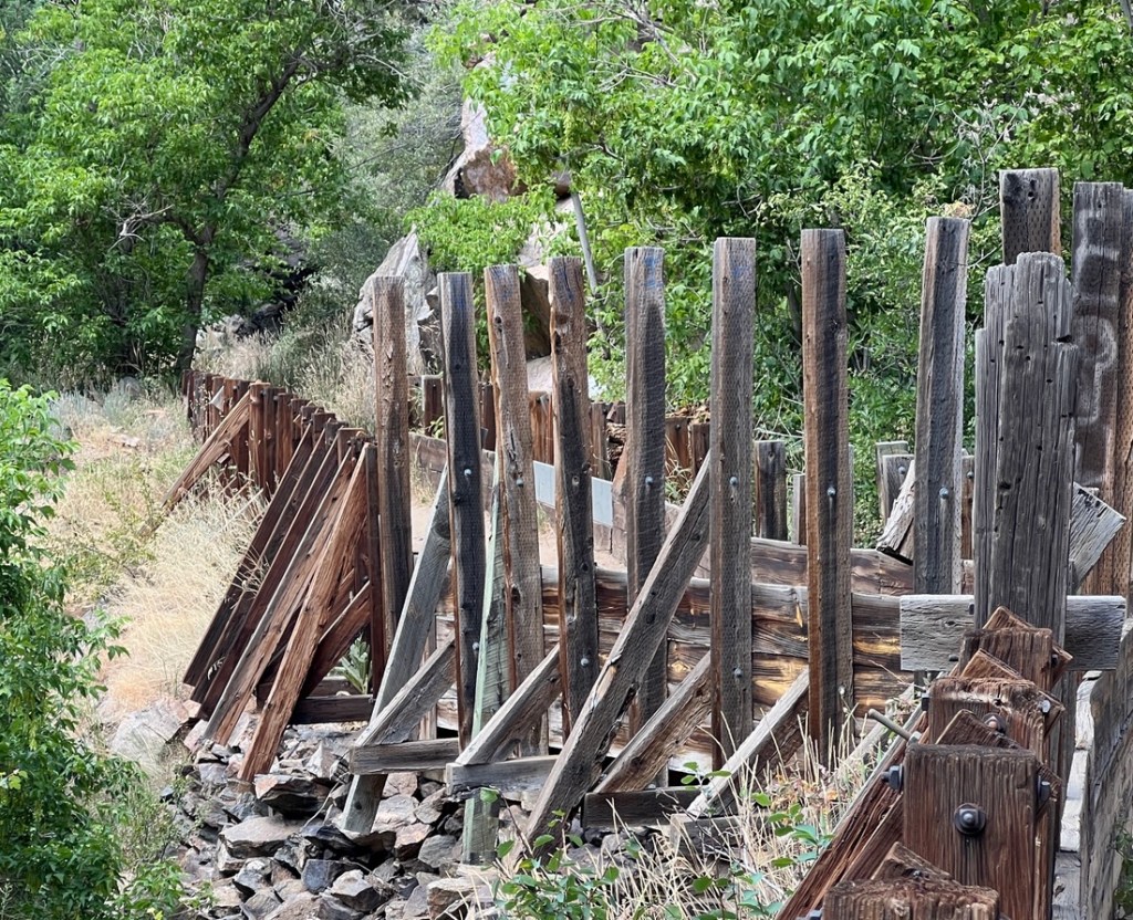
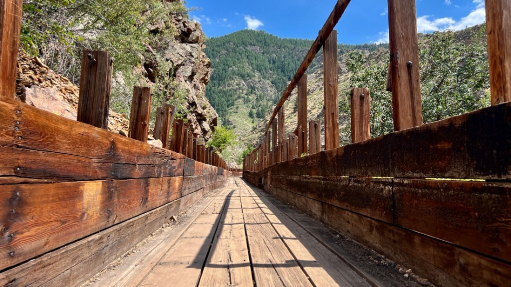
After about 1.2 miles, we took the suspension bridge South over the river onto the Welch Ditch trail. This trail follows an artificial channel that was created to carry water and is known as a flume. We walked inside the flume for most of the way back.

Inside the flume
The flume supports.
The flume with a scenic backdrop!

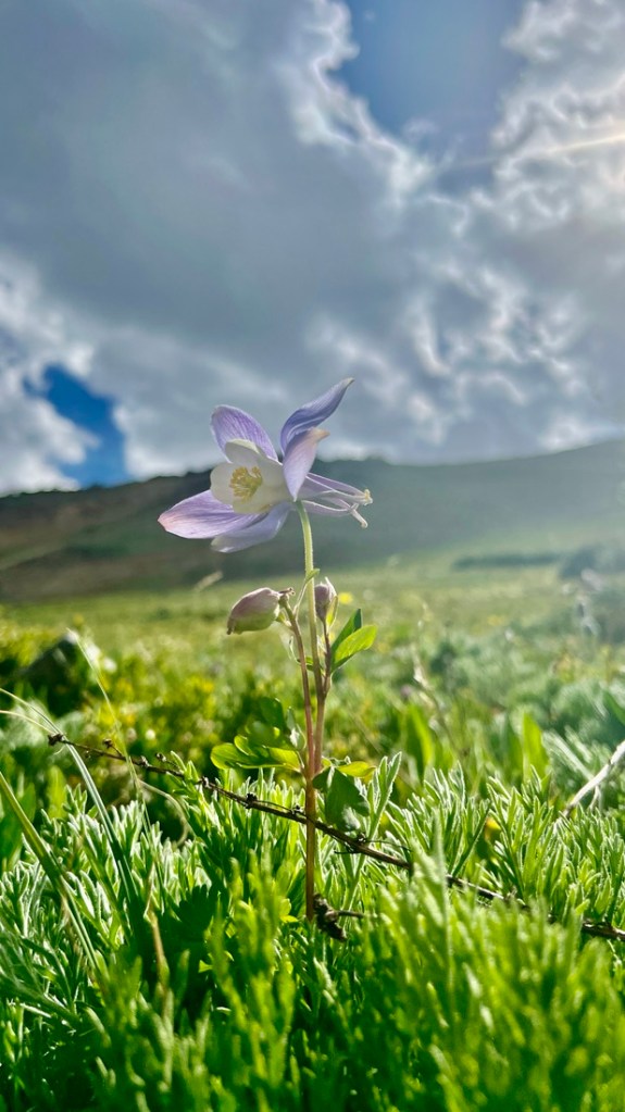
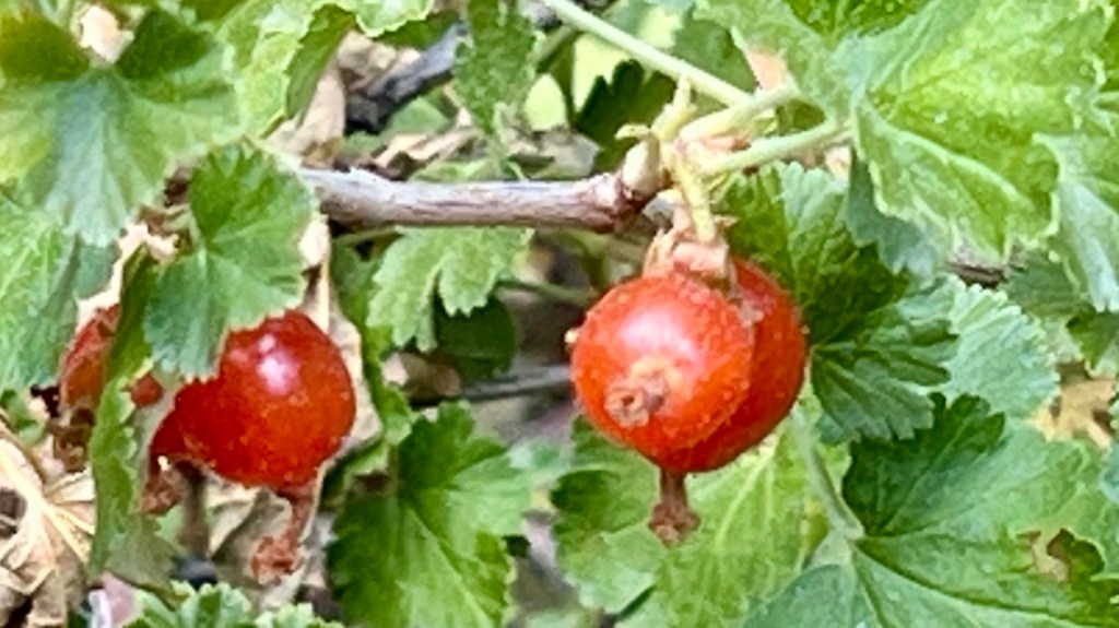
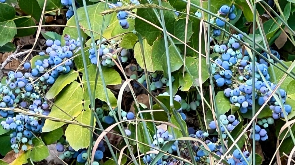
We enjoyed the wildflowers along this part of the trail, which will change throughout the year. Here are a few:

A musk thistle which is native to Europe and invasive in North America
A sweat pea, also not native.
Wild lettuce, introduced from Eurasia.
A red currant
A wild blue berry. I cannot be sure of any more details.

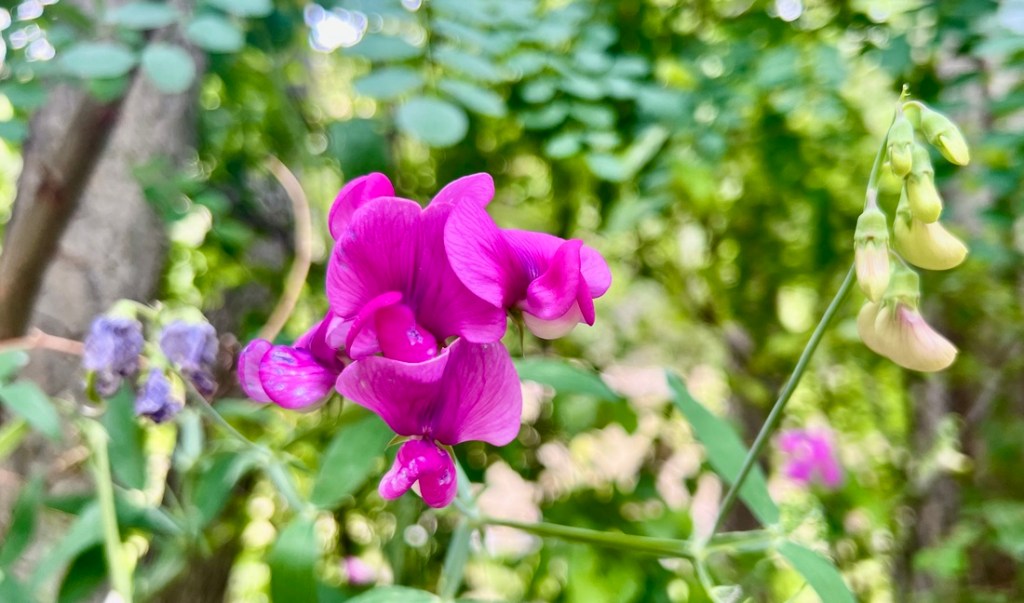
I was surprised to learn that many of the flowers are introduced. I assume the remnants of this machine were also introduced, but how is more intriguing!

How did you get here? Flood waters, or you drove off the road way up the mountain?

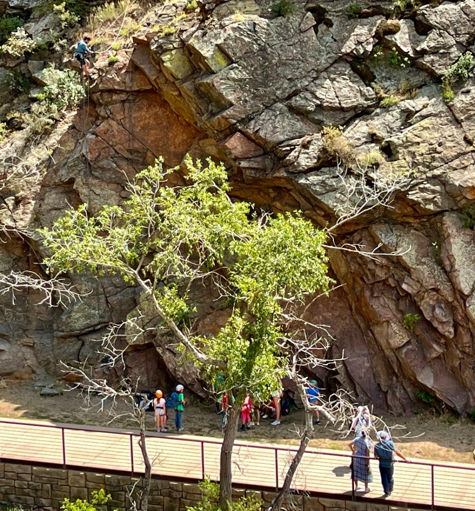
This area is very popular with rock climbers and we saw many side trails and passed lots of rocks suitable for the sport.

A climbing instructor prepares some ropes for a climbing lesson with a kids group.
Our route.

We were hot after the hike but it was short enough not to be an issue. We passed some tubers in the river which might be a better choice on a hot day! Even though the creek looks clear, don’t drink it without filtering it, unless you like rolling the dice!

Li Janet and I agreed that this was very much the type of walk we’d like as a daily walk. It was great being in nature and it will change through the seasons. I look forward to trying this in the Winter. For now, we enjoy the views and prepare for our next adventure!

Samuel’s apartment might not have a couch yet, but the view from his apartment window reminds him of the mountains. Also, behind the fence is a prison, which also serves as a reminder!

Published by Peter Ireland

"Cajunlimeys" combines Lousiana (Janet) and England (Peter). For "limeys," check out scurvy in the English navy. We love adventures and use blogging to write a photo diary to preserve our memories. Some crazy friends enjoy following us and my notes might help others plan.

Leave a comment for the Cajunlimeys