This is the second of several posts that describe our multiple exciting adventures in West Texas.
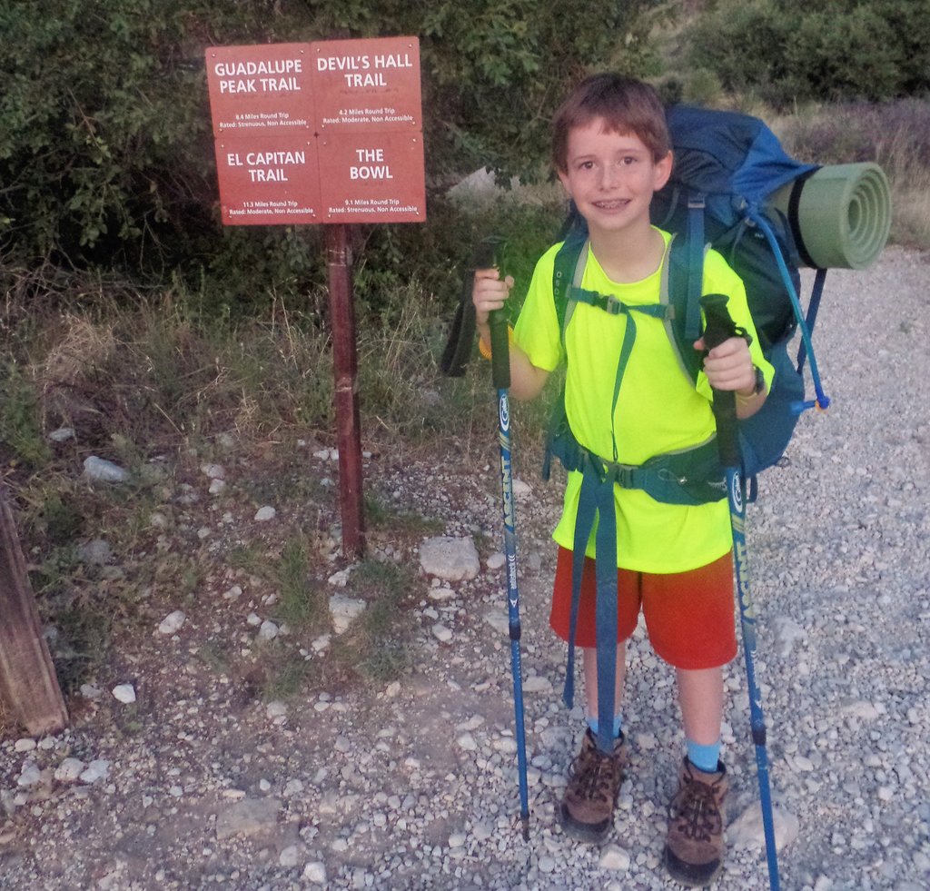
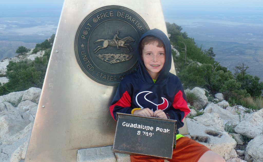
Ten-year-old Samuel’s interest in hiking and camping was growing and I was very much drawn to climbing Texas’s highest mountain, Guadalupe Peak. At 8,751 feet, it is nearly three times higher than anything in Great Britain. “Climb to the ‘Top of Texas’ with a hike up Guadalupe Peak. Guadalupe Peak is a rewarding, although very strenuous, 8.4 mile round trip hike with a 3,000 foot elevation gain. It will take from six to eight hours to complete the hike” says the National Park website. It’s an even longer drive from Houston than Big Bend, situated on the Texas/New Mexico border at 650 miles. It’s even in the next time zone!
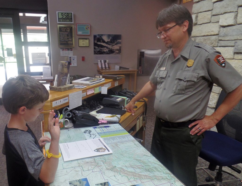
The logistics are relatively straight forward and the National Park website provides all the necessary information, and plenty of suitable warnings. There is a campsite near the Pine Springs visitor center, where you pick up a permit for backcountry camping. There is a wilderness campground about a mile below the peak which needs reservations. There is no water in the backcountry and bad weather should be expected.
The Guadalupe Mountains National Park is a lot bigger than this map, but this shows the primary area of interest – the hike up Guadalupe Peak from Pine Springs, with Devil’s Hall and El Capitan also visible.
I was most concerned about pack weight, how much Samuel could carry as well as me! Spending about 24 hours in the backcountry meant we needed 2 gallons of water, if we were to follow the NPS advice. Each gallon is a little over eight pounds. While our camping gear was not the lightest, I surmised that the June temperatures meant we would be more worried about heat so did not take heavy sleeping bags (more on that later). We did some trekking around home to check packs.
Samuel did not enjoy hiking in Houston’s June heat. This photo reminds me that we were staying in an apartment at this time while our house was remodeled!
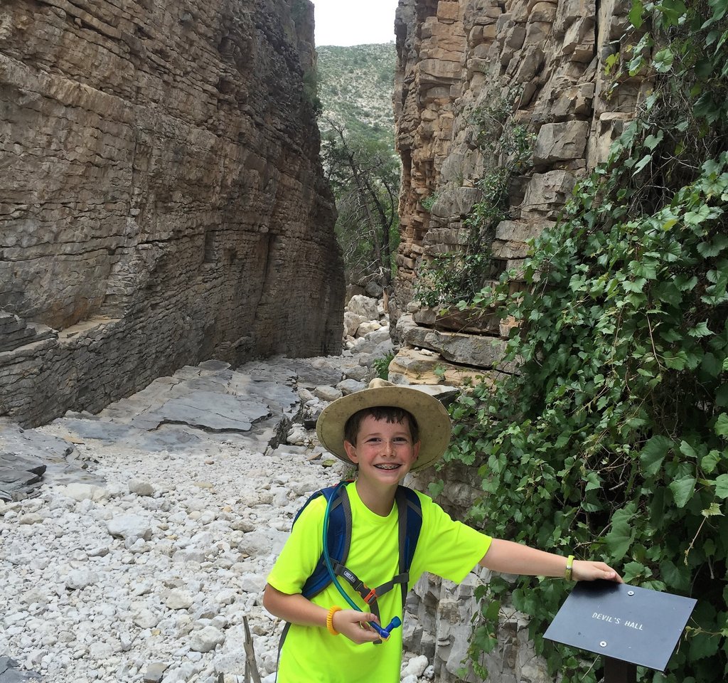
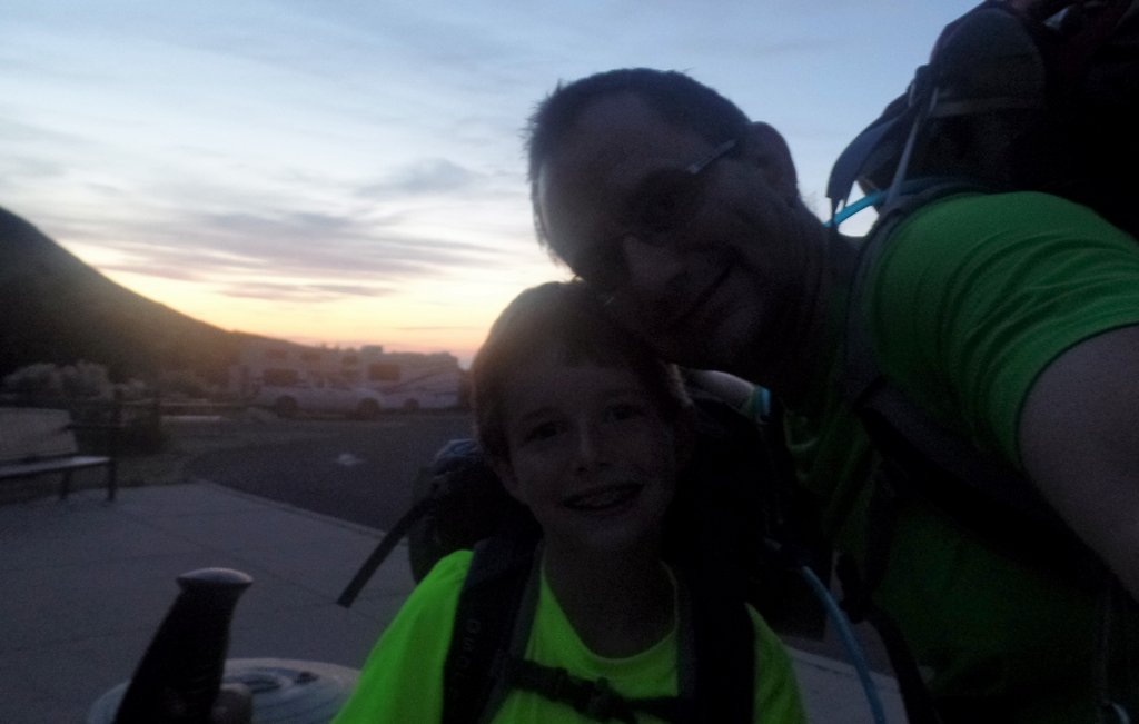
We headed out west early on June 4th. We had to arrive at the visitor center before they closed to get a permit for an early start the following morning. I, of course, drove the whole way, while Samuel slept most of it! When heading west, getting past San Antonio before rush hour is wise, and then it is just open road. It was an uneventful journey and we arrived in time to get our permits, find our campsite by the visitor center, and have enough time for an evening hike of “Devil’s Hall.”
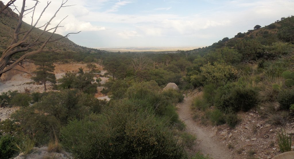
Do you think Samuel is having fun?Long gone are the days when Samuel was happy to wear things similar to me. He was especially proud to have a hat the same as me and was heartbroken when he lost it on a later trip. More on that in another blog.Just a puddle? This was the only water we saw all trip. The rules for this national park are that humans have to leave any water for the animals to drink. While we couldn’t drink this, I have filtered similarly dodgy water on other trips!Tomorrow’s challenge is somewhere up there.The hike out from Devil’s Hall, back to the campground.The prickly pear cactus has beautiful flowers.There were several bunches of apache plume flowers around our campsite.We have to enjoy some hot chocolate!
After a restless, warm night, we were up before dawn. To avoid too much heat, I wanted to get some climbing behind us before the sun was up and before it got too hot.
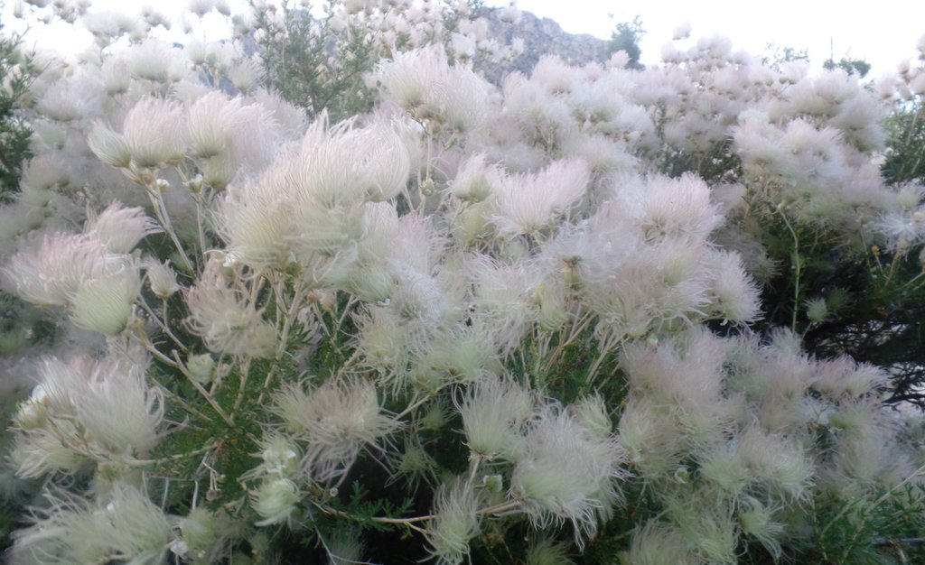
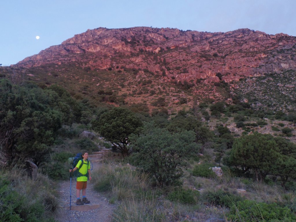
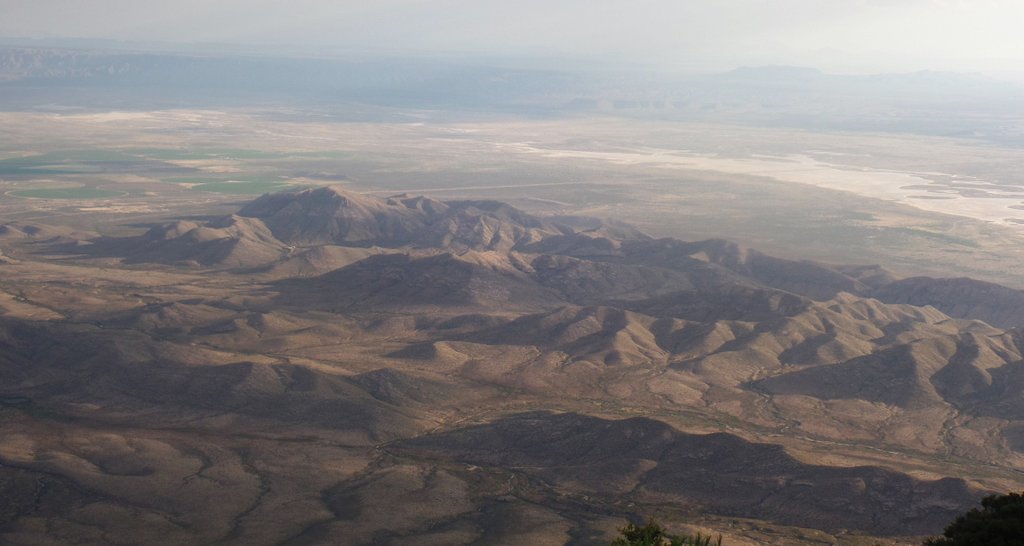
At the trailhead before dawn. I remember that there was a weighing scale at the trailhead to weigh packs, but I can’t remember what they weighed!Samuel was ready!The path heads up the hill immediately. The moon showed us where to go.We had gained some elevation before a beautiful sunrise, looking back at the Pine Springs visitor center. and campground.I was surprised to see this beautiful thistle, quite common in Britain and the national flower of Scotland.As the run rose, the temperature rose. The initial climb is all exposed to the morning sun and it was a long slog. We took rests and made the most of the view yet were very happy to follow the path into the first valley which brought shade. While hiking up, the only other person we met was a trail runner from Dallas who was doing three up-and-down circuits as training for a race in the Colorado mountains (Leadville 100).
It took us about six hours to hike to the campsite. We were taking it slowly and enjoying the scenery. There are five tent pads at this site and we were the only people there when we arrived. A group of three guys from a nearby military base arrived later, and then another guy.
This photo of our campsite shows our REI tent (without its rainfly yet), our hiking poles, the jetboil, the gallon water contains that I prefer to carry as they have robust screwtop lids, and our two backpacks.
After the hard hike in the heat, we took a nap enjoying the breeze through the tent. After an hour or so, we heard the distant rumbling of thunder, which became not-so-distant.
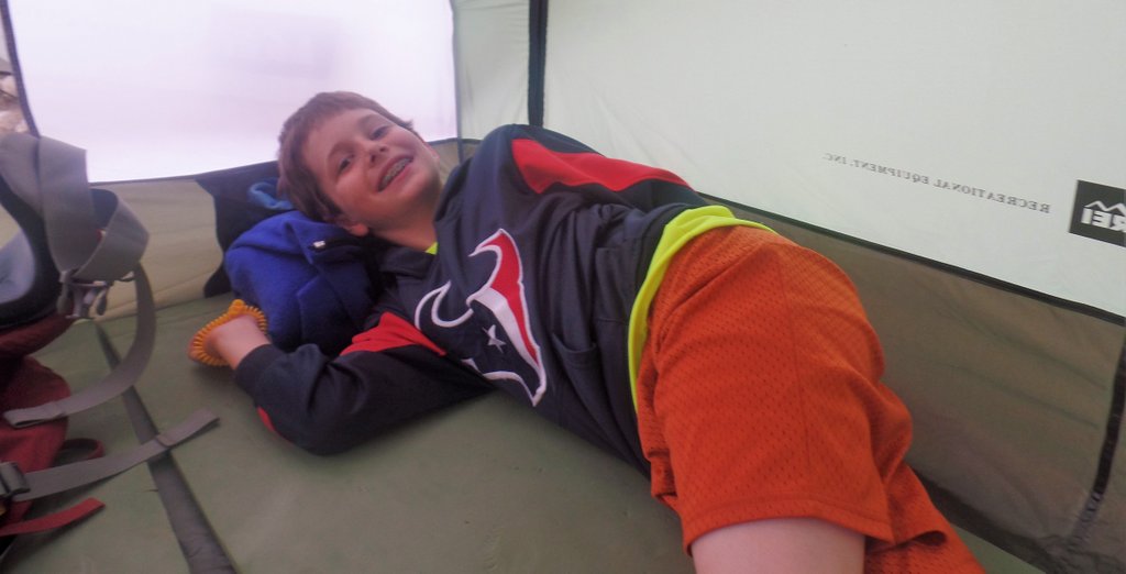
The view back towards the tent which dark clouds forming. We had already put the rainfly on which was a good thing as the storm arrived.The storm passed right over us, or I could even say through us. There was zero delay between the lightning flash and the crack of thunder. We could smell the lightning! I have to admit I was worried, and we prayed. We were not on the very top of the mountain, but I felt very exposed. However, I did not want to scare Samuel. I made a point of being on the roll mat, thinking that it might provide some semblance of electrical insulation if we were struck by lightning. Samuel is still happy! In this photo, the blue fleece that he is using as a pillow was his sleeping bag, and more about that later.The storm brought hail.
The storm passed as quickly as it arrived and left behind lower temperatures, for which we were thankful at the time. It was time to head to the peak.
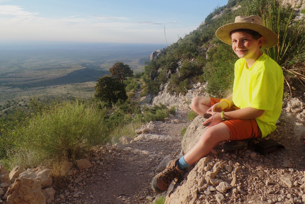
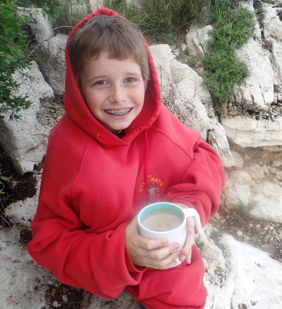
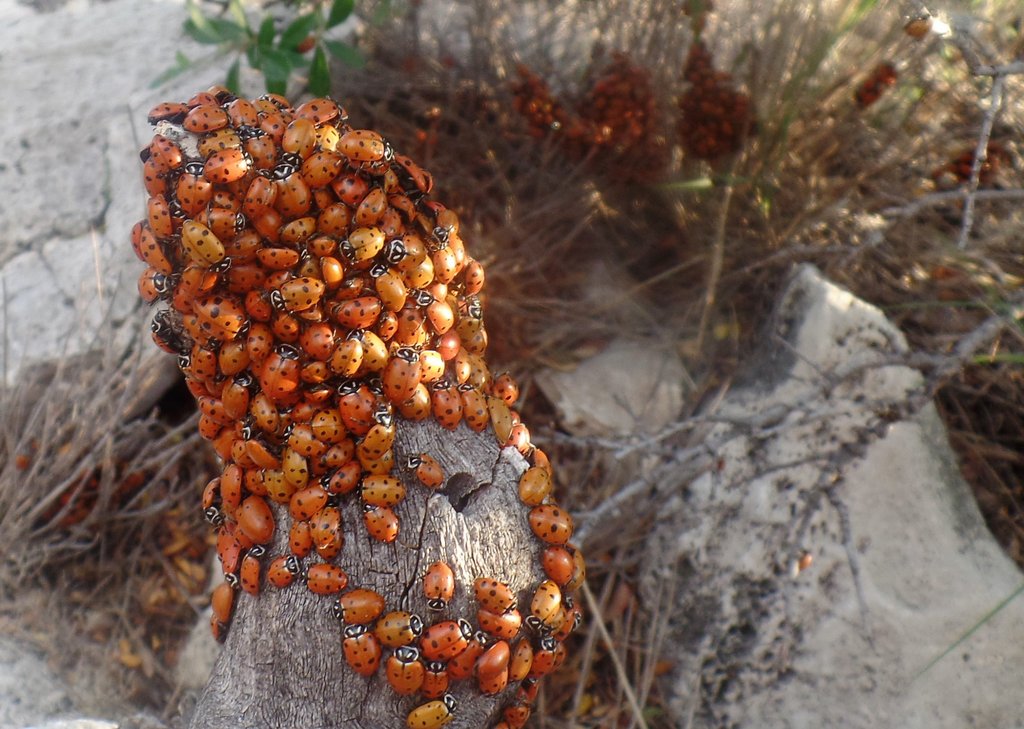
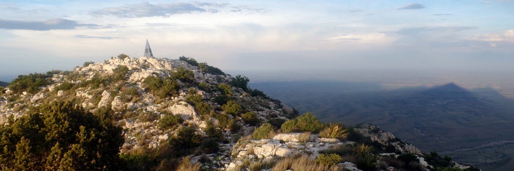
I was worried about animals stealing our food and the site had no bearboxes. I did this very basic hang, and now that I see this picture, it would not have done much to protect against the squirrels or raccoons that I am now more familiar with! While animals have not been a problem for our food in any of the trips to West Texas, I have since used an Ursack as protection.On the way to the peak.El Capitan is the mountain next to Guadalupe Peak and dominates the view across the plains. The view gets breathtaking as you approach the peak.On the top of Texas! The clouds looked ominous, but we did not get any more storms, so we stayed to watch sunset.I had to get a selfie! A stainless steel pyramid marks the summit. It was erected by American Airlines in 1958 to commemorate the 100th anniversary of the Butterfield Overland Mail, a transcontinental stagecoach route that passed south of the mountain.As the sun sets, the shadow lengthen across the plain. It is such fun to watch this view change as the sun dips towards the horizon.We enjoyed watching the landscape change. A few day hikers came and went, but most of the time we were by ourselves on the peak.As the sun gets lower, the temperature drops and an evening wind picks up. We had brought the stove for hot chocolate and crouched behind a rock to get out of the wind, but Samuel still needed to wear my old sweatshirt which was from my time playing underwater hockey in Aberdeen twenty years earlier! But look at those braces!Close to the peak was this remarkable cluster of many ladybugs. The gather together to aid survival. They are nearly dormant and they don’t attack!As the sun gets very low, you can see the shadow of the mountain you are standing on. Very cool.More shadows.The shadows continue to lengthen.A final photo before leaving. I took so many photos from the peak as it was so cool. I was a bit worried about getting back to the campsite in the dark so we headed down before it was dark.
While we started heading down before it was dark, the light faded quickly. Samuel and I were having a lot of fun, and as we walked down, I was telling Samuel about some of my youthful exploits. In so doing, I missed the turn off from the main trail to the campsite. After walking down for too long and it becoming completely dark, I stopped and we discussed at length whether we had missed the turn. Even though I had a GPS with me that I used for geocaching, I had not marked the campsite and the preloaded maps were very low detail (good lessons for next time). However, I used its altimeter to work out that we were a few hundred feet below the campsite’s elevation. While I knew such things were inaccurate, it was enough to persuade me to head back up the hill, and we were very thankful to find the turn off to our campsite.
As we got into our fleece sleeping bags, I realized it was much colder than I had expected. The rule of thumb for change of temperature with altitude is ~3.5 degF every 1000 ft, making this about 10 degF colder than at the bottom of the mountain. However, a strong wind picked up as well and it felt much colder. While our tent stood up to the wind (whereas someone else’s trekking pole tent did not), we did not have a great night’s sleep as we were so cold, even wearing all of our clothes and the sleeping bag. The army guys were in hammocks which looked cool but were even colder. Welcome to the massive temperature shifts in the West Texas desert!
In the morning, we headed back up to the peak before heading off the mountain.
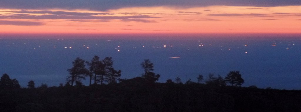
The pre-dawn view from our campsite. The specs of light are gas flares from the oil and gas activity on the plains.Samuel holding the summit register. The morning lighting wasn’t as impressive as the previous evening’s. There is one bridge on the route up, but the route goes around a rocky outcrop near the top that is a bit hairy, though its hairiness is amplified by my fear of heights and a strong wind. A fun part of the hike up (or down) is the variation in the vegetation as you change elevation.The view of the parking lot as we descend.Yay! We did it.Looking back up the mountain, it looks like another storm is forming.Samuel completed one of many Junior Ranger badges.It was a very cool trip. I was confident we would return (and we have!).The mountains have a distinctive profile that I have recognized in the background of photographs of oil rigs in West Texas.
And then I drove 600+ miles to get home! While in later years, I appreciate having Samuel share the driving, the rawness of his joy completing his first backcountry camping trip was special. We started to appreciate the terrain and climate of West Texas and fell in love with the views. There is something special about the desert, and this trip broke my assumption that it was just desolate and hot. However, I recommend better sleeping bags!
To read about our other adventures in West Texas, go to our West Texas page.
"Cajunlimeys" combines Lousiana (Janet) and England (Peter). For "limeys," check out scurvy in the English navy.
We love adventures and use blogging to write a photo diary to preserve our memories. Some crazy friends enjoy following us and my notes might help others plan.
View more posts