
This is the last of my “catch-up” posts for now, and this adventure with Samuel from 2018 is perhaps the most memorable trip we have done. While we have done longer trips since, this adventure had a combination of challenge and remoteness that were a stretch for each of us. We avoided crowds and enjoyed not just one, but two amazing trips that we strive to replicate: The Capital Creek Circuit and Fool’s Peak.
As I look back on the year, I don’t know how we squeezed everything in. Bailey started the year playing club volleyball and ended playing for her school’s varsity team as a sophomore. She started to drive and was on the Homecoming court. Samuel was very active in scouts with many activities and campouts, learning to SCUBA dive in the summer and completing his Eagle Scout project in December. He was Timon in the middle school performance of The Lion King. Samuel had multiple camps in the Summer and Janet traveled with Bailey and her friend Caroline to England. I had an intense year at work with trips to India, Australia, and throughout North America. Years of work came to a climax on August 1. We had family trips to Montana for Spring Break, Lost Pines Resort for Labor Day weekend, ended the year with a trip to Israel, and had an unplanned trip to England for my Dad’s funeral in October after I had spent time with him at the hospital in September.
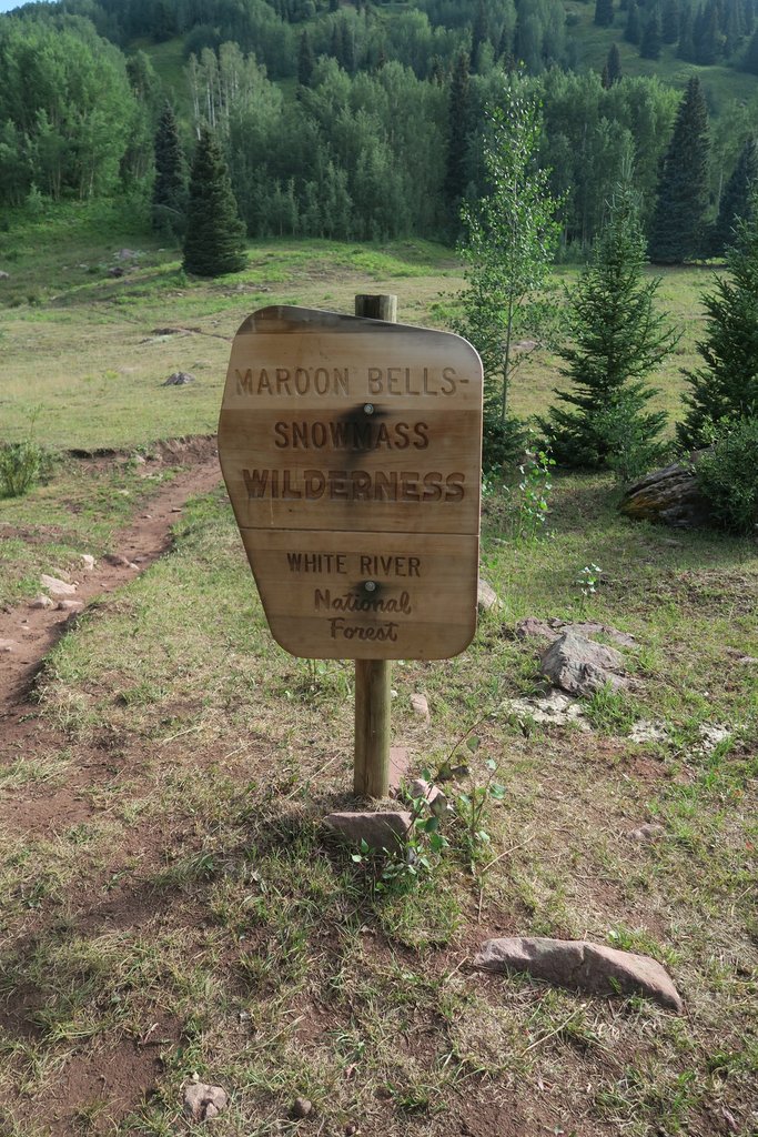
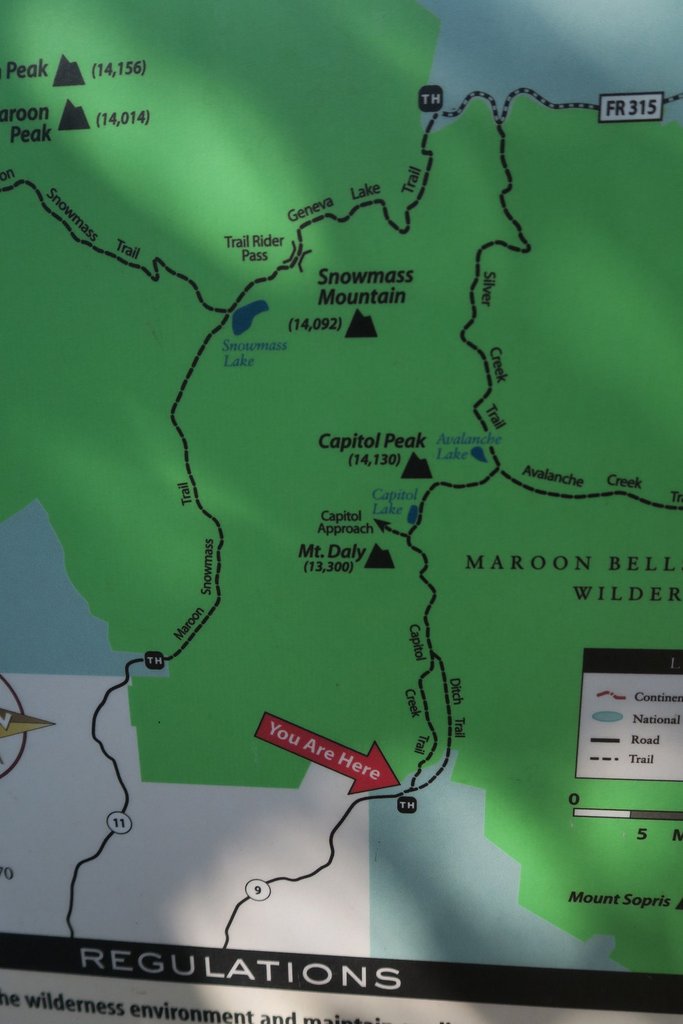
Somewhere amongst that, Samuel and I wanted a backpacking trip. After completing Big Bend’s Outer Mountain Loop at the end of the previous year, we were hungry for what was next. The major milestone at work meant that a trip immediately after that could work, so we could squeeze in ten days at the beginning of August. The timing meant Texas was out and we were drawn to Colorado, especially as we were attending scout camp there earlier in the summer. My internet research for a 50-mile backpacking loop led me to “The Capital Creek Circuit” (aka Capitol Creek / Snowmass Loop). For example, this site. While a similar length to our Outer Mountain Loop trek, this was the opposite type of terrain and was relatively unregulated compared to a National Park. We had also wanted some scrambling, and a work colleague Paul Thomas had suggested Fools Peak. This included some out-of-this-world camping by an alpine lake and was very accessible. We had also planned to climb Mount Elbert, Colorado’s tallest mountain, but changed plans due to tiredness, which showed we made the most of our time!
While this account is prompted by a Shutterfly photo book I created shortly after the hike, so much of this adventure remains vivid in my memory. This Google map shows our locations and includes .gpx tracks.
- Day 1: Arrive Denver Airport and stay at hotel
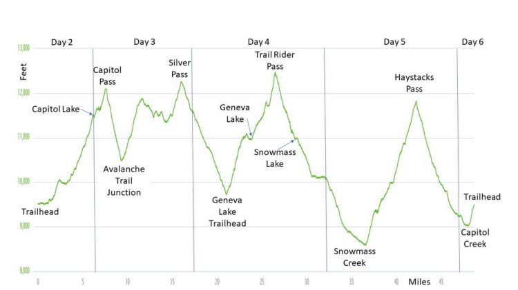
- Days 2–6: Hike the Capitol Creek / Snowmass Loop
- Days 7–9: Hike Fools Peak
- Day 10: Drive up Mount Evans; fly home

Preparation
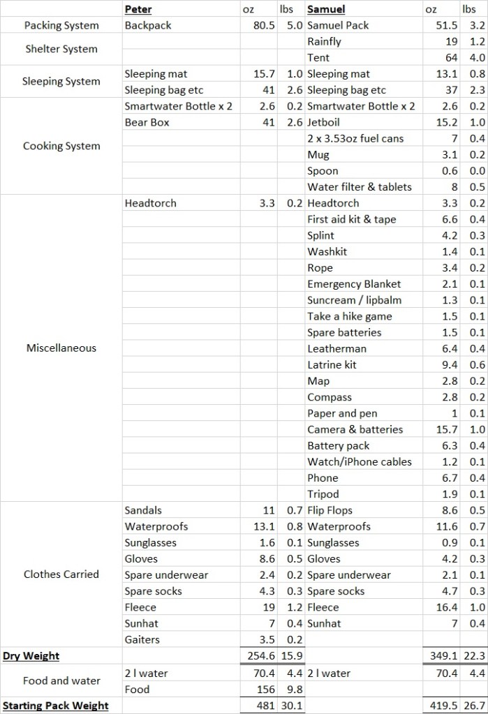
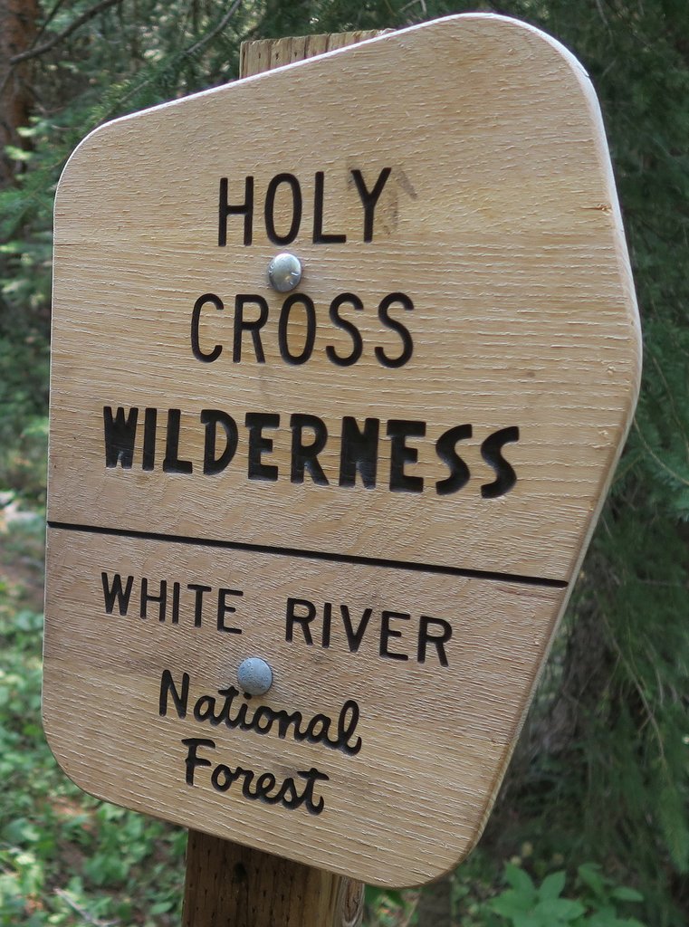
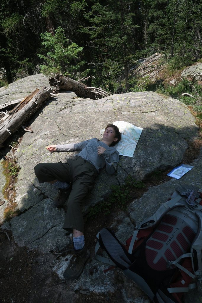
There are three aspects to the preparation. The first was the itinerary and the internet helped me create a robust, detailed plan. While the Capitol Creek Circuit is not a formal loop, there were unofficial accounts that gave sufficient guidance. There are more now. We did not require any prior permits, though I understand they are now required in some areas. The second aspect is what to take. We had momentum on our equipment after Big Bend. We did not upgrade anything but purchased the required bear box. The third aspect is fitness. Our hectic schedules didn’t leave much time but kept me active. I squeezed in some practice hikes on the flat land around home but nothing hard core.


Day 1: Arrive in Denver
We stayed the first night at a hotel in Denver as it was 5400ft in elevation, so we had some initial altitude acclimatization. I was worried about altitude sickness as we would hike to over 12,000 ft and we didn’t have much time to adjust. We did not have prior experience at altitude. We picked up a regular 2WD hire car from the airport which worked well for our plans. We had checked our backpacks on the plane inside large tote bags for protection, but had been unable to bring fuel, a lighter, or bear spray.
Day 2: Final Purchases, Warm-up Hike, and First Night at Capitol Lake Camp
We arrived at the REI in Dillon when it opened at 9am to buy the supplies we could not fly with. This included two 3.5 oz gas canisters, though one sufficed. I also got bear spray which also ended up being dead weight.
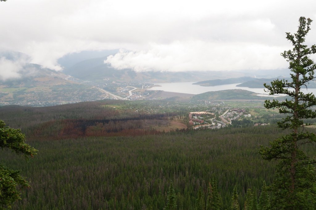
I planned a warm-up hike from Dillon. The plan was to climb Buffalo Mountain at 12,781 ft to help acclimatization, using the strategy of sleeping below your highest point of the day. The hike started though some recently burnt forest from a June forest fire, which was a new experience for us. However, the weather was rainy, and we were keen to start the proper hike, so we turned around without reaching the summit. I’m unsure how much this hike helped but it was still fun.


After the warmup, we drove via Snowmass to the Capitol Creek trailhead which is at the end of a dirt road that we drove with no issues.
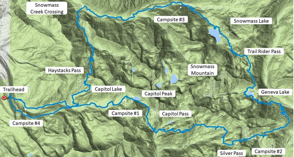
Note that “north” is to the left of the map

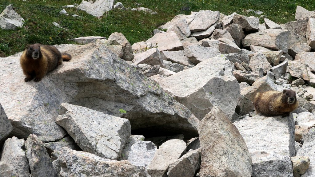
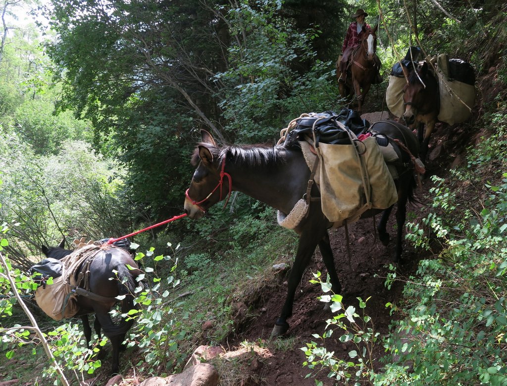
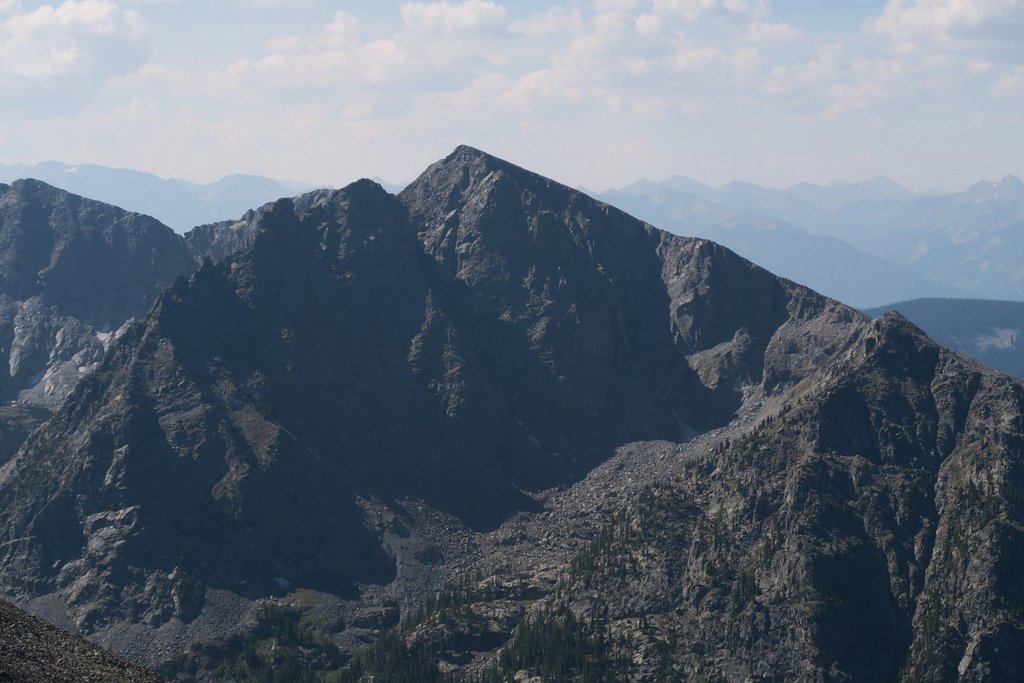
There were maybe twenty cars in the parking lot. I think most were for people camping along Capitol Creek or climbing Capitol Peak. The peak is the most dangerous Colorado 14er with fatalities each year. It was not part of our plan!


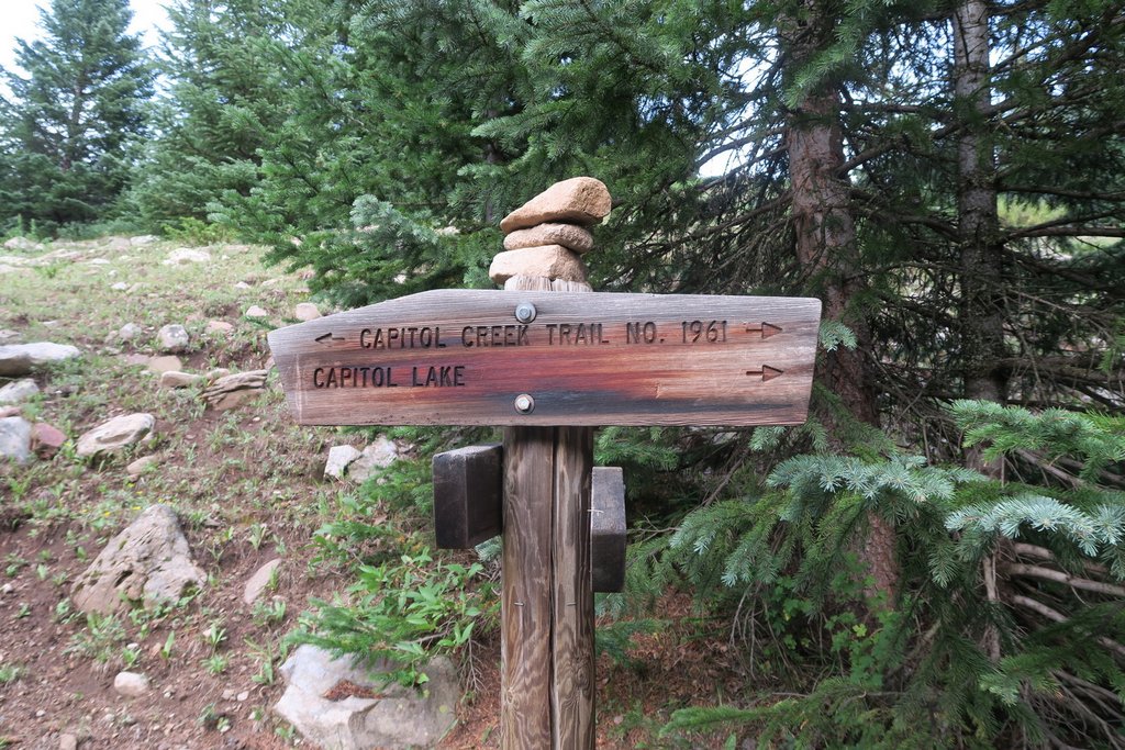

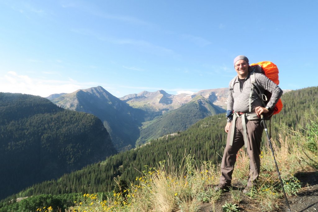
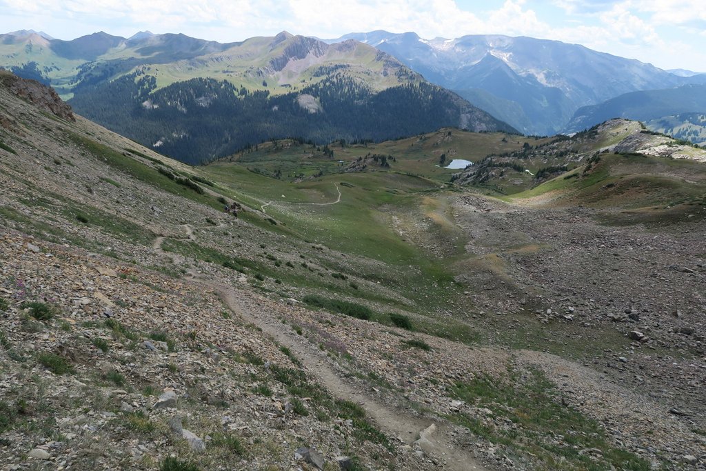
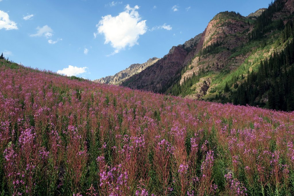
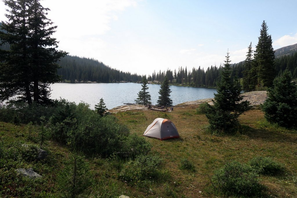
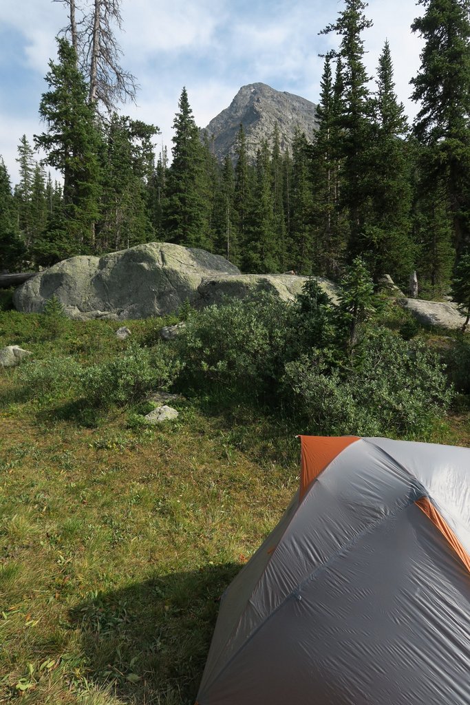
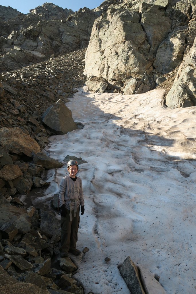
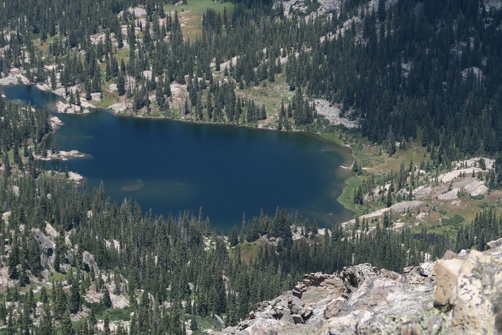
The hike into the campsite was 6.3 miles which took 3.5 hours. We camped at 11,520 ft. Even though we hiked twice in the day, we recovered well during the break between the hikes as we drove to Capitol Creek trailhead. However, we arrived at nightfall – this photo is from the following morning.
Day 3: Capitol Lake Camp to Silver Pass
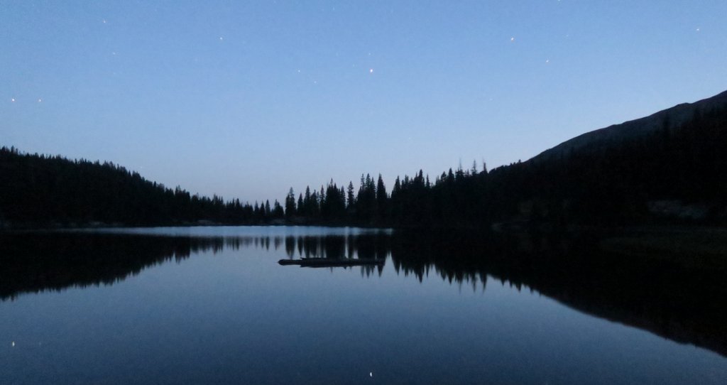
In the morning, we woke to fantastic views of the sunrise catching Capitol Peak.

We decided to break camp and eat breakfast as we filtered water from the lake.


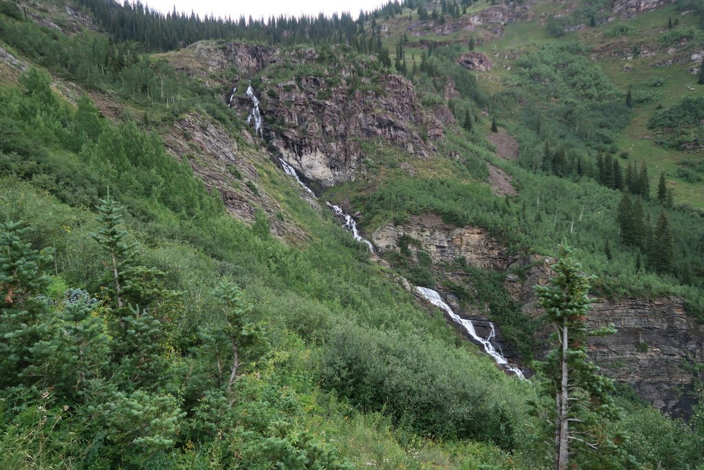
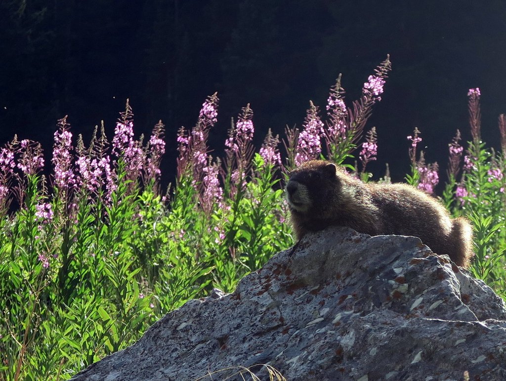
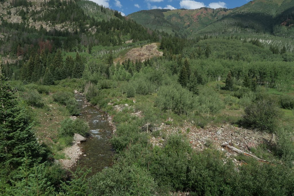
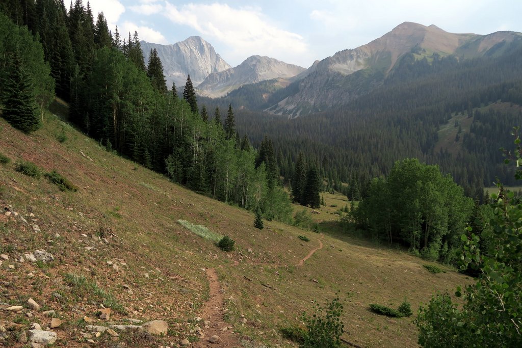
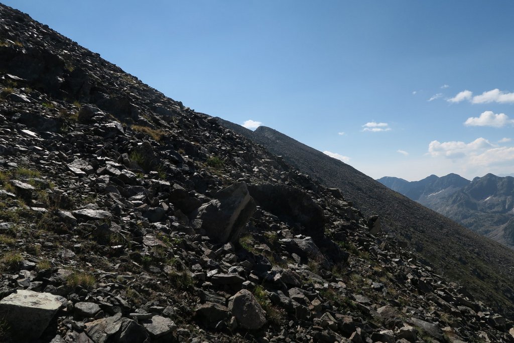
After going over the second pass (between Capitol and Silver), the trail slowly descends before crossing over East Fork Avalanche Creek. This was the only time we went off trail on the whole trip (i.e. were lost). We were not routinely navigating by GPS, to save battery, and just recording with my watch. Our GPS track shows that, for some reason, I turned right when the trail did not. After a few minutes, we realized we were not following a trail, so we used the GPS to get back. Other than this mistake, the navigation of the whole loop was easy.
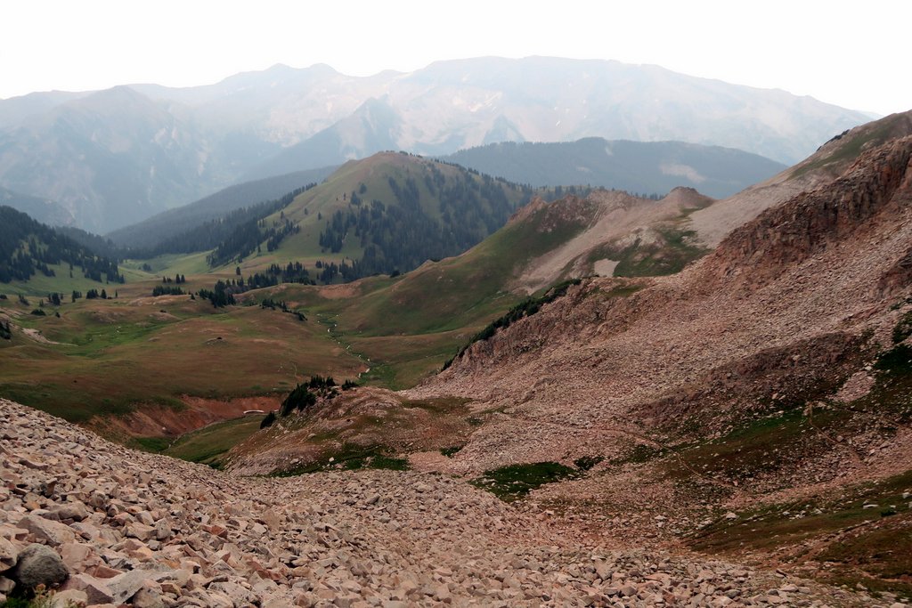
We had rushed to make this pass before storms came, and now we had to rush to get off the ridge!

We had hiked 11.5 miles over 10.5 hours and had gained over 3,000 ft in elevation. We were happy to rest! Our plan had been to continue to Geneva Lake for this night, but we were happy to stop, and our plan was flexible enough to allow it.
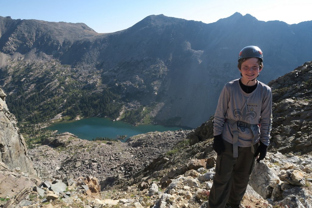
Day 4: Silver Creek to Snowmass Creek
This was our longest day with a tremendous variety of trails and views. Our track shared the trail with the Four Pass loop for a section which is very popular and was the only time in the loop when we consistently saw other people. There is quite a bit of road walking along FS315 from the Silver Creek trailhead to the Geneva Lake trailhead (aka Lead King Basin Trailhead). There is a “Meadow Mountain Traverse” that avoids the roadwalk, but I did not know about it at the time. Routes on CalTopo show what others have done.

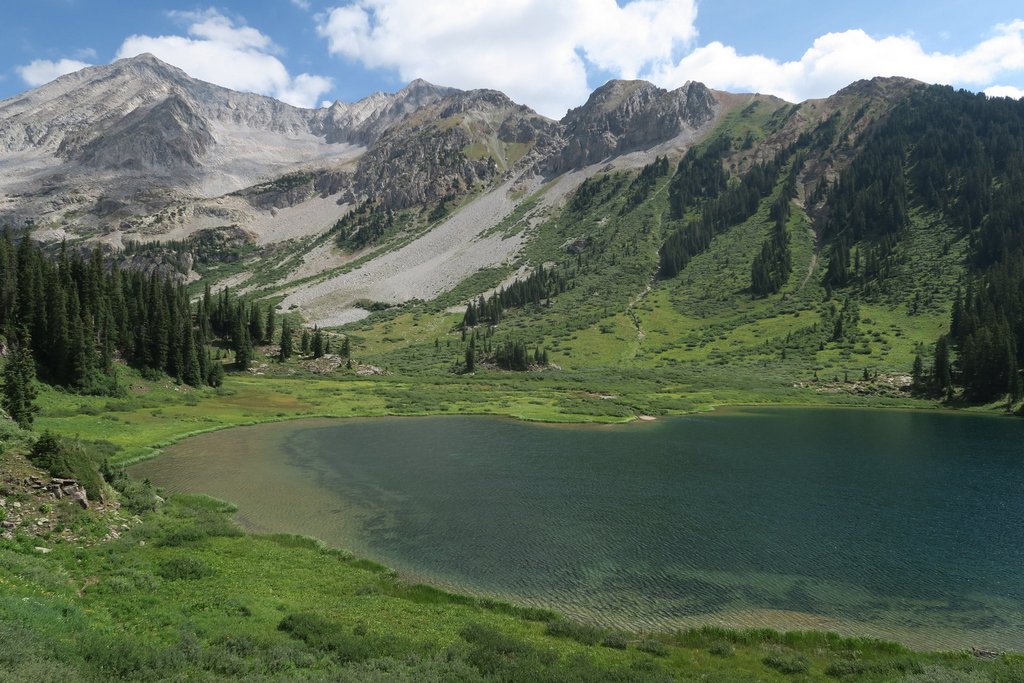
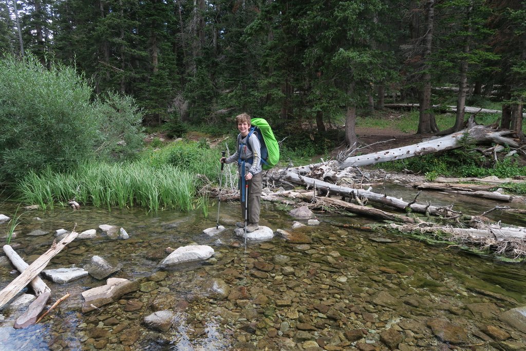
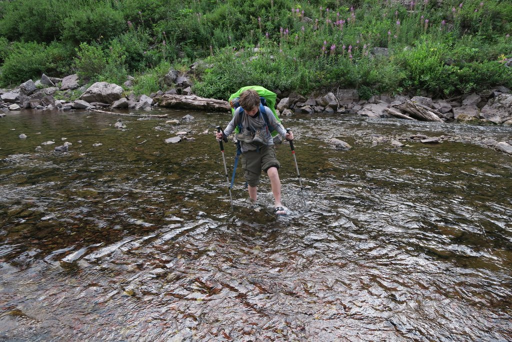
We crossed the river that enters the lake at the top end.


We had brought shoes specifically for this crossing and later ones. Samuel brought some slides which absorbed water (adding weight), so that was a lesson for next time! If hiking in boots, as we were, we did not want to get them waterlogged as they would take too long to dry out. Now, we hike in trail runners which dry out much quicker, so I’m more willing to get them wet!


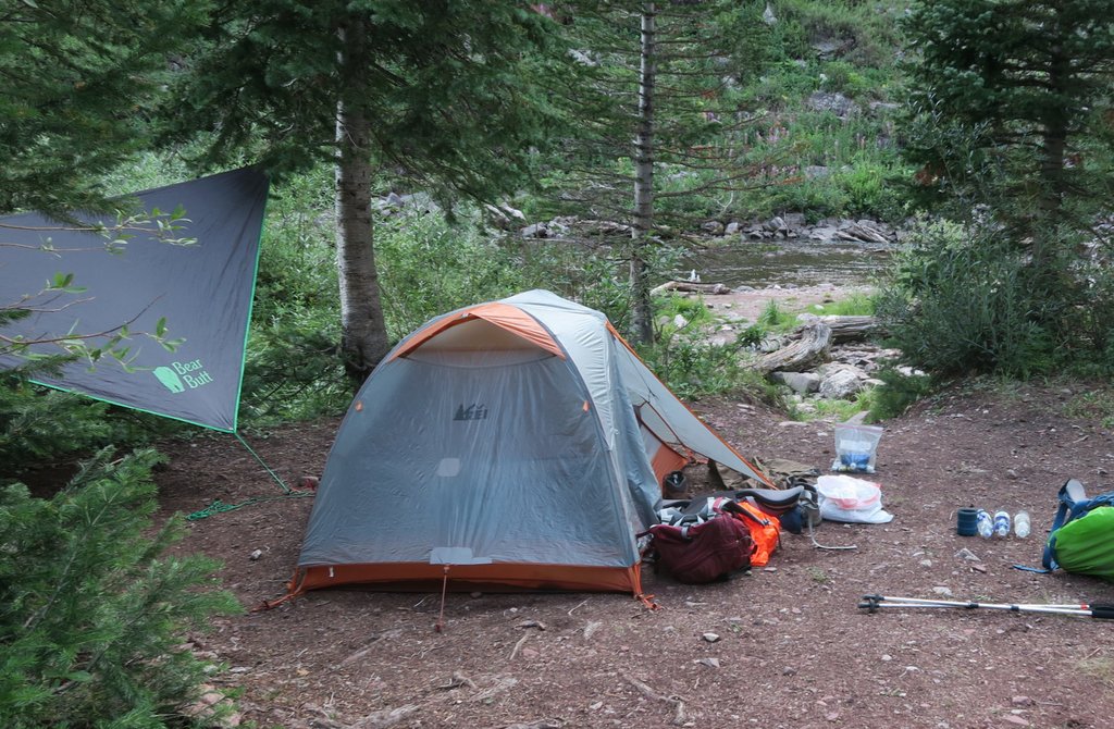
We had walked 14.6 miles in a little under 12 hours with an elevation gain of 3,000 ft. It had been a long, tough day. My original plan had been to camp at Snowmass Lake, having hiked there from Geneva Lake. Even though we had walked to Snowmass Lake from further than Geneva Lake, the crowds at Snowmass Lake encouraged us to keep hiking. The campsite above, where the trail crosses the creek, was the first viable campsite after Snowmass Lake, and it had obviously been used previously.
We enjoyed a bigger supper than normal, but the highlight was lying down in bed!
Day 5: Snowmass Creek to Capitol Creek
We woke up knowing that we were more than halfway. The plan was to camp close to the car, and we were already closer to that than the plan. First, we made the most of the peace and a beautiful sunrise.


And that was the end of Day 5 which had been a long 15.6 miles taking 12 hours with over 3,000 ft elevation gain.
Day 6: Capitol Creek to Trailhead; Eagle Best Western
Having avoided a cow trampling in the night, it was a short and flat hike out to the car of a couple of miles that took us about an hour. The only challenge was getting over Capitol Creek. Well, not much of a challenge for one of us!

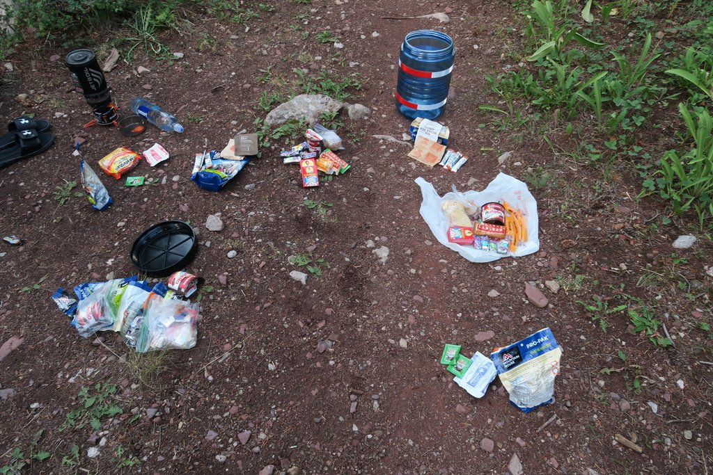
Back at the car, our packs were 24lb and 18lb dry having started at 16lb and 22 lb. We had each “gained” a couple of pounds. That was probably a combination of trash (weighed with the food at the beginning), some clothing, and not measuring everything. It shows the ease of a pound of two slipping in!
Overall, we had hiked 48.7 miles over 4.5 days with an elevation gain of 12,869 ft. It had been epic!
We were back on our plan which was to stay at the Best Western in Eagle as the location was convenient to Fools Peak. We enjoyed a fine dinner with desert at The Eagle Diner and enjoyed the hotel beds very much!
Day 7: Eagle Best Western to Lake Charles
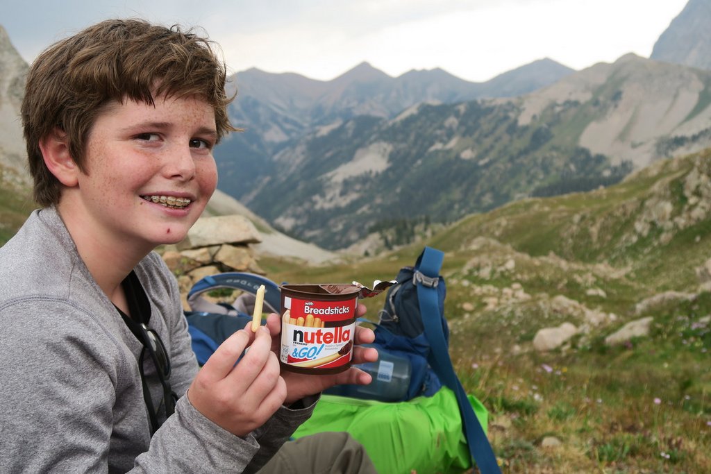
It was time for adventure #2. Dziezynski’s Best Summit Hikes in Colorado describes the route that we took though he admits that he could not find the source of the name Fools Peak. We adjusted our packs a little, leaving behind a couple of things, restocking food, and adding our climbing helmets as we were looking forward to some healthy scrambling. We had a relaxed morning before driving to the trailhead at Fulford Cave campground. While most visitors are here for the cave, we were heading back into the Wilderness.

We were still feeling the effort from the previous days.
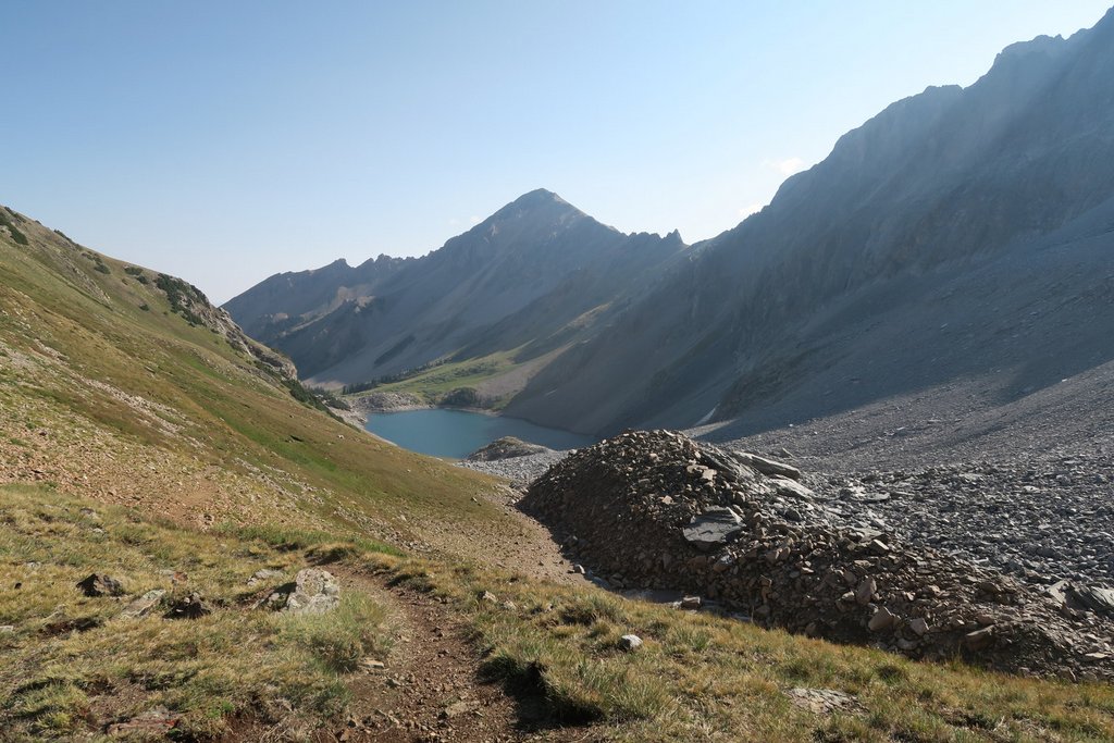
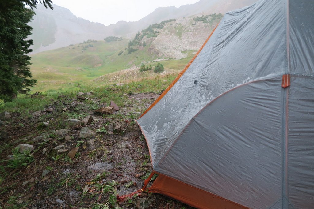
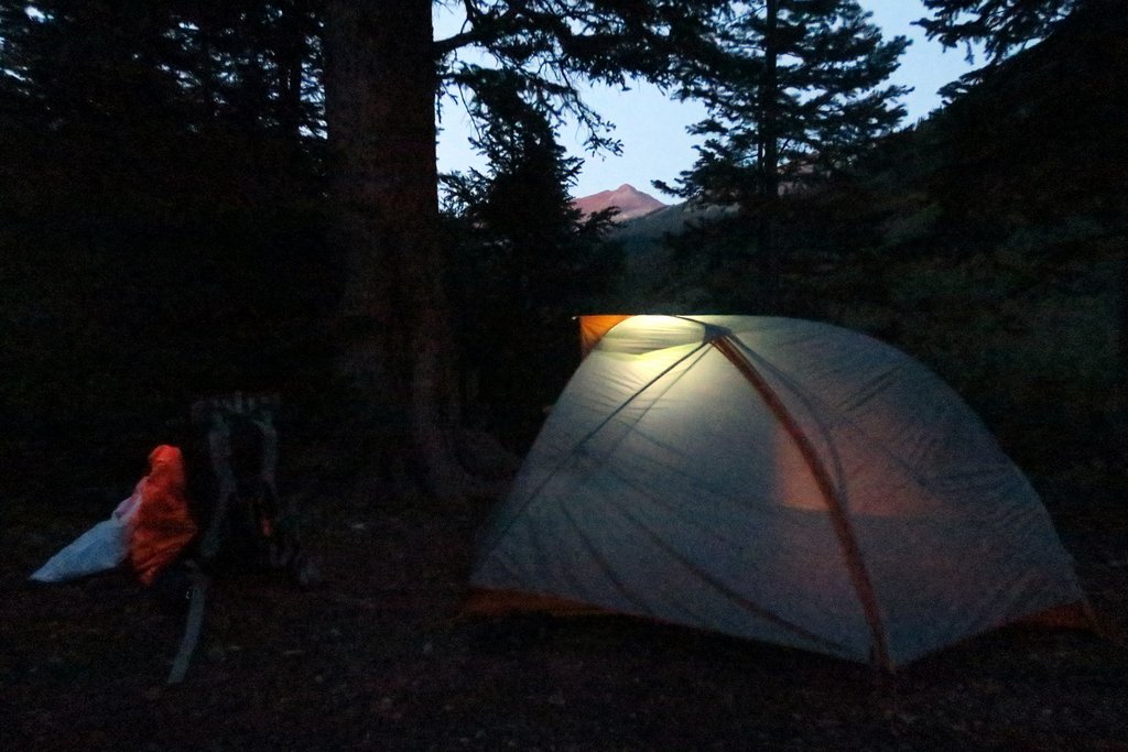
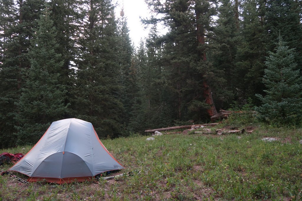
When we arrived at Lake Charles, we walked to the top edge where we found the perfect campsite. This Google map shows our locations and includes .gpx tracks.

We debated whether it was a false peak, but Samuel has been more than happy to remind me how wrong I was as I thought it was false until we could see the tent from the top.


It had been an easy day with 6.2 miles of hiking taking 5.5 hours with 1800 ft of elevation gain.
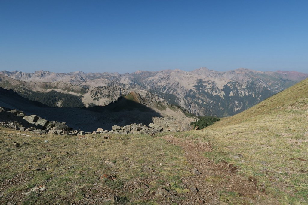
Day 8: Lake Charles to Fools Peak and Back
With the threat of storms always present and being uncertain about how long it would take to climb Fools Peak, we were up well before dawn so we could hike to the bottom of the scramble for first light.


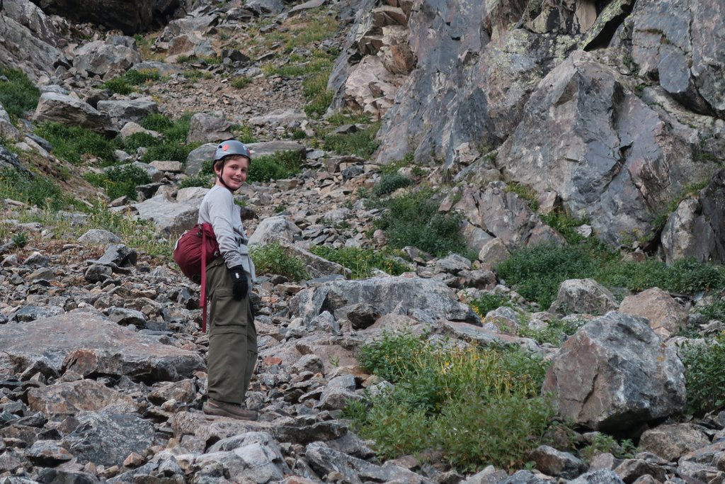
Samuel was in his element!


We made it over to Fools Peak without incident.


This day we spent 12.5 hours hiking 10.2 miles with an elevation gain of 2,500 ft.

Overall, the Fools Peak trip was 16.8 miles over 2.5 days with an elevation gain of 4,500 ft.
Day 9 & 10: Frisco Holiday Inn, Mt Evans, and Home
We started day 9 with a leisurely 2-mile hike out to the car and then headed to Frisco’s Holiday Inn (now The Grand Hotel), which had space even though we had not reserved. We played chess for about two hours on Starbucks’s patio which had amazing views of the surrounding mountains. We also enjoyed the hotel’s pool.
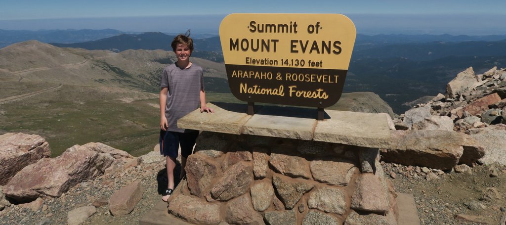
The relaxation made us realize we did not have another big climb in us. The plan was a 2am start for a 4,000 ft climb up Mt Elbert before heading to the airport. We both realized enough was enough. However, we still wanted to summit our first 14er, so decided to drive up Mt Evans the following morning “on the way” to the airport.

We headed to the airport satisfied. We had completed two amazing hikes. I’m still not sure what made these two hikes quite so memorable as I try to repeat the recipe, but I think it was a combination of many factors that prevent it being so easily repeatable. Three years later, Samuel and I returned to Colorado to complete the 160-mile Collegiate Loop which was fantastic in different ways. With Samuel now based in Golden on the western outskirts of Denver for college, we need to make the most of this opportunity. With that in mind, I have some ideas for this August, six years after the above trip, and we will see if we can replicate the fun!

I have enjoyed reading your adventures. I discovered you while researching Eagle Rock Loop. I am planning a solo backcountry hike this year. I was fascinated with the drone pictures. Thank you for sharing your experience. God bless you, your family and to many more adventures to come.
LikeLike
Thanks! I’m glad you have enjoyed them and hopefully find some inspiration. Thank you for taking the time to leave a comment!
LikeLike