This is the fourth chapter of our experiences in West Texas. While our 2016 trip to Big Bend had been an epic collection of adventures, completing the Outer Mountain Loop added a tremendous sense of achievement. I had pictured doing the hike ever since a work colleague, Tim Long, had described hiking it with his son. The necessity of water-caching and filtering from remote desert springs fascinated me. It wasn’t at all as I imagined as it is impossible to imagine. My photos and description below do not do it justice.
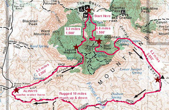
The NPS’s suggested route. Reported mileages tend to be higher and there are good variations to this route.
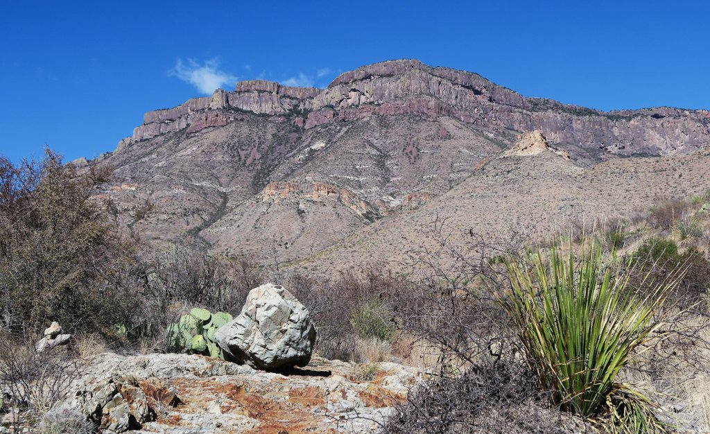
A large part of what makes the loop amazing is its challenge and associated risk. This is not a walk in the park! If you are considering doing it, start by reading the NPS Guide and associated route description. Read reports from All Trails (and here) but remember that those who fail to complete the loop or get rescued (of which there are many each year) generally do not write a report! Then, use the Big Bend Chat forum, and heed its warnings. It is both a physical and mental challenge, though it is certainly doable in the right season. Big Bend Chat is an invaluable resource for water reports from other hikers and it increases your confidence in finding water at Boot Spring, Upper Juniper Spring, and Fresno Creek, but you still need a robust plan B if they turn out to be dry, and the ranger will quiz you about your plan when you are getting your permit. And be prepared for cedar allergies!
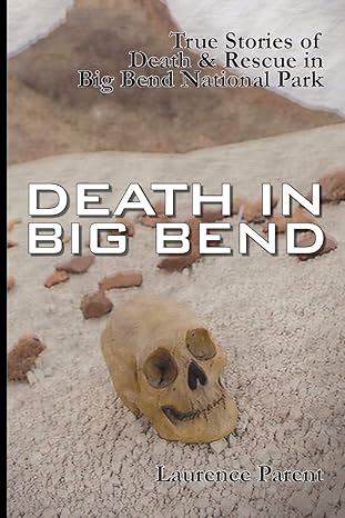
This is an informative read for those unfamiliar with desert hiking. The main issue is dehydration with multiple avoidable reasons for it. With proper planning and preparation, attempting the OML is low risk. https://www.amazon.com/Death-Big-Bend-Laurence-Parent/dp/0974504874
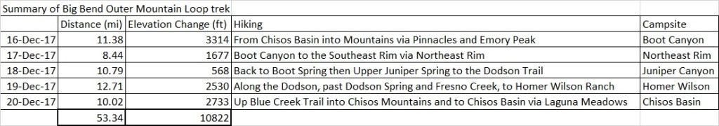
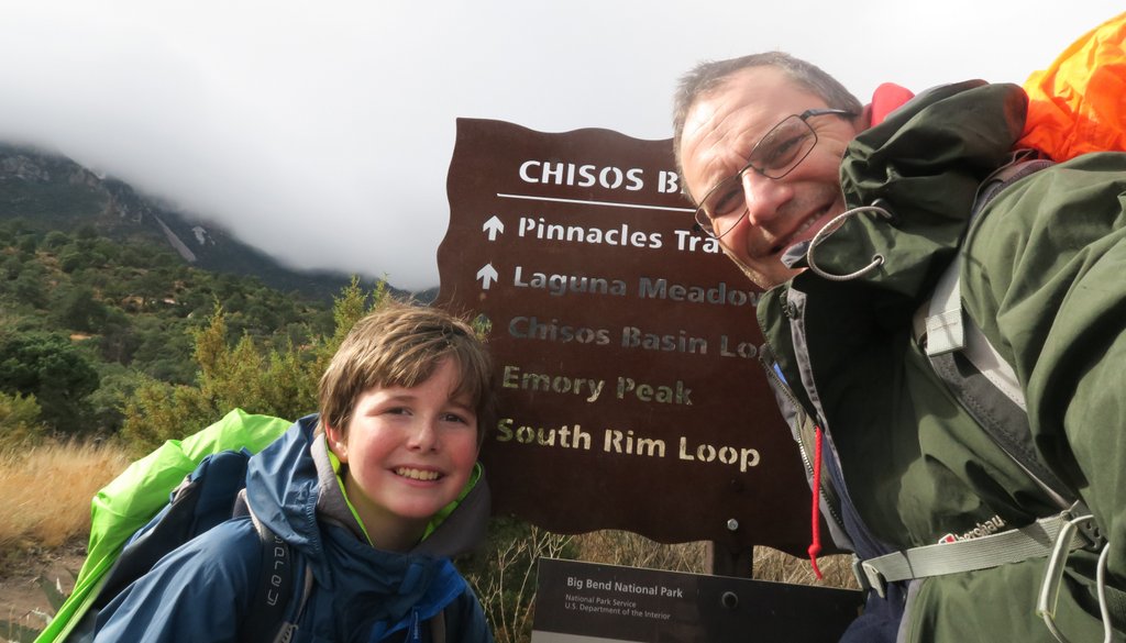
Samuel and I completed the loop with five hiking days and four backcountry camping days (two in Chisos and two in the wilderness). The NPS route includes just two in the wilderness but does not include the South Rim. Samuel and I added two nights in the Chisos to enable us to climb Emory Peak and experience sunrise and sunset and the rim. Below is what we did, using the notes that I wrote on-trail and posted on Big Bend Chat. I post it in my blog to help prepare and inspire others, as well as preserve an awesome memory.
Summary
A 5-day hike from Chisos Basin covering Emory Peak, the South Rim, and the Outer Mountain Loop – led by my 13-year-old son. My GPS watch says we hiked a total of 53.4 miles, gained an elevation of 11,627 ft. 42.5 hrs hiking time, of which 23.5 hrs were moving. We camped at Boot Canyon 1, North East Rim 4 (now called East Rim 4), at the beginning of the Dodson, and at the beginning of Blue Creek Canyon. We filtered water at Boot Spring, Upper Juniper and Fresno, and stashed water at Homer Wilson Ranch.
It was an awesome experience. It was tougher than expected, but not more than we had planned for. There were more other hikers than expected. I had expected to go 24 hours without seeing another soul but saw 3-4 groups of other hikers each day. A highlight for my son was he didn’t get any comments from other hikers about his young age. We had spent a week in Big Bend a couple of years ago, with a couple of nights in the Chisos, and some zone camping – so were mentally prepared – but the hike, especially coming down Juniper and the length of Dodson, takes its toll on the body! And the information on the Big Bend Chat website was particularly helpful in planning with confidence – so I hope this can help others with their planning.
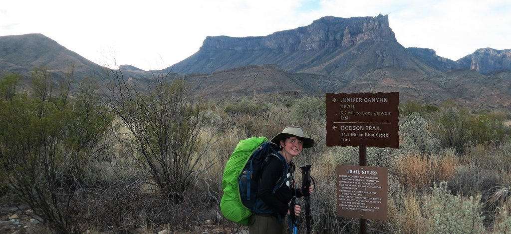
Day 0 – Permits and Chisos Mountain Lodge
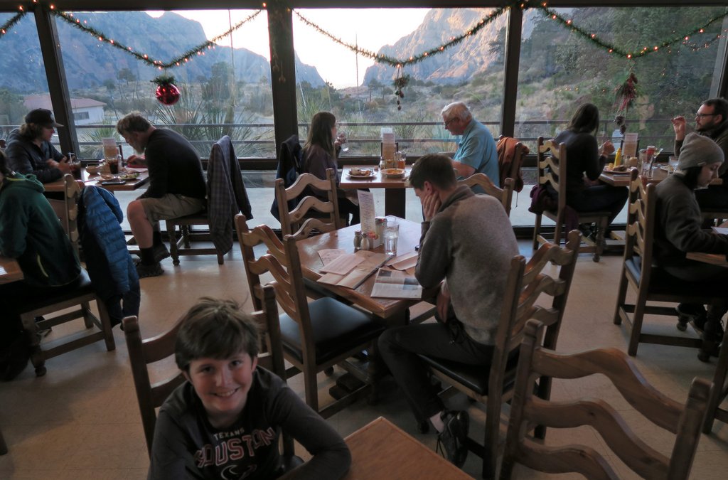
Friday Dec 15th. We’d picked up permits on arrival at Panther Junction, having left Houston at 5am and arrived about 3:30. The volunteer ranger was friendly. An OMLer was checking in, so I could get my planned water sources confirmed by him (thanks!!). We stashed water at Homer Wilson (3 gallons for 2 people to be safe), found our pre-reserved campsite in Chisos Basin (#34 – not recommended as too close to bathrooms, and not a great tent location). Then a treat dinner in the lodge.
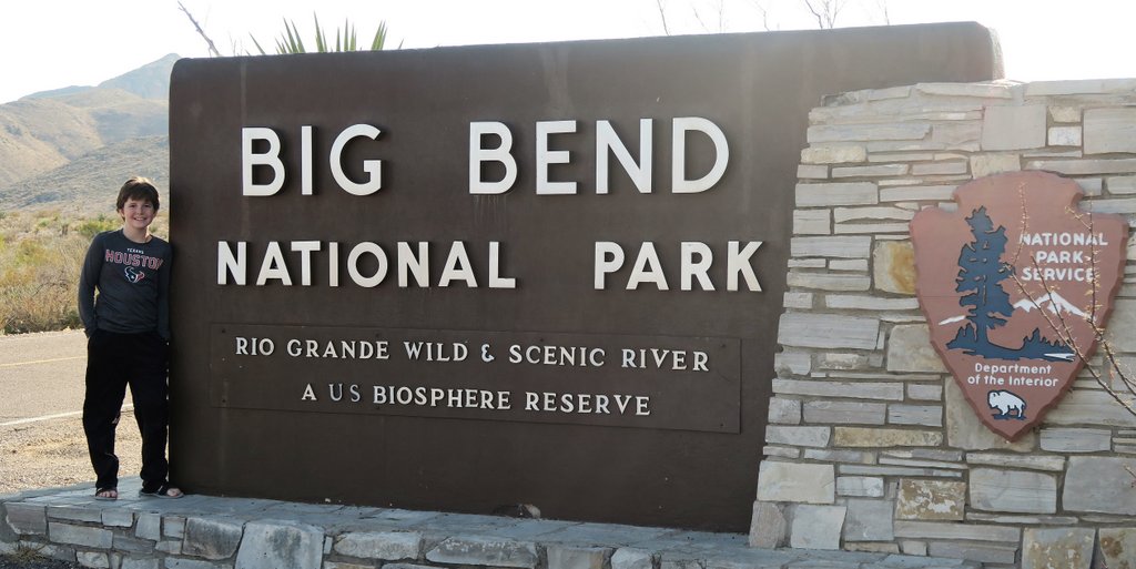
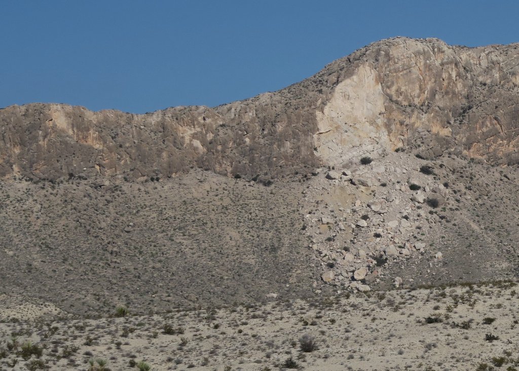
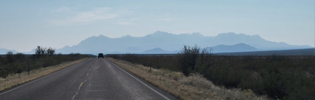
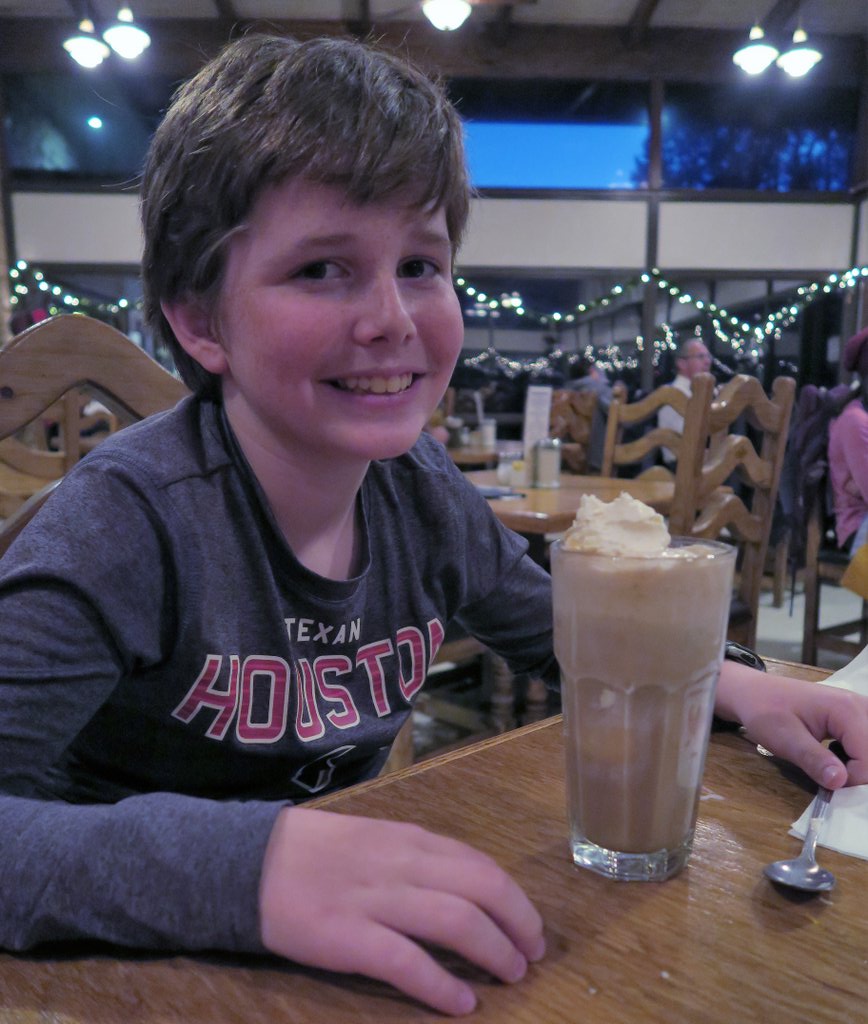
We always have to get a photo by the park sign.On entering the park from the North, look out for this scar on the mountains to the East (left). It was caused by a lightning strike – thanks to Max Sems for this info!Even after entering the park, the Chisos Mountains are in the distance. They are a welcome change from the flat West Texas roads.Peering into the Chisos Mountains, you get a fine view of Casa Grande. The clear skies boded well for our trip.Despite the clear skies and pleasant temperatures, snow still lay on the North-facing slopes. How cold is it going to be? This view was from Panther Junction where we got our permits.When you live in Houston, it is always exciting to see snow. This was outside the restaurant at the Chisos Mountain Lodge. It is much colder in the mountains than on the plains.The Chisos Mountain Lodge has a fine restaurant, and it is a treat to have a hearty meal the night before. The restaurant looks out toward “The Window.” However, the lodge and associated buildings are being knocked down in Spring 2025 to make room for a replacement.The WindowWhile “The Window” is the famous view, I prefer looking at Casa Grande and remembering our adventure during our last visit.A final milkshake – just like last time!
Day 1 – Chisos Basin to Boot Canyon and Emory Peak
Saturday Dec 16th. With uncertainty about the weather, we’d brought rain gear and extra layers, not planning to use them. However, the morning greeted us with temperatures around freezing, and then the heavy rain started. Good news for the springs – not so good for the pack weight… My pack was 36lbs, my son’s was 32lbs – with 5l of water each.
When planning, our total dry weight was 28 lbs, food weight was 13.5 lbs, and 10 liters of water was 22 lbs. This illustrates the weight of water!
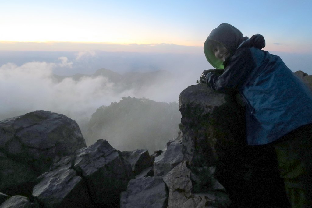
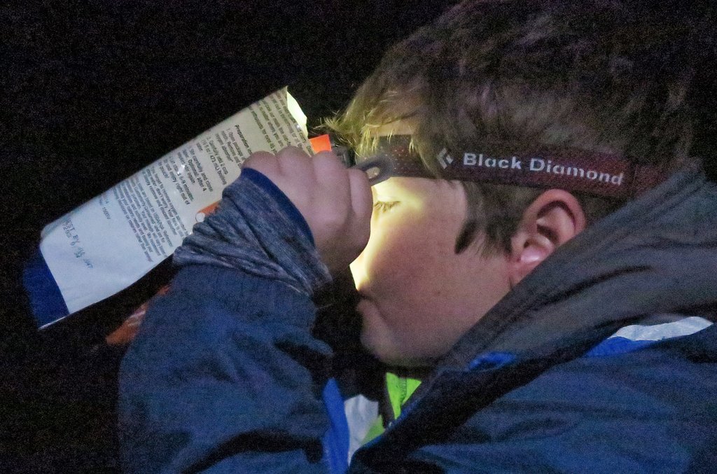
Up the Pinnacles, and into the clouds, and to Boot Canyon campsite #1 – recommended. We wanted Toll Mountain 1, but that would have been much more exposed (and cold) in the weather. Set up camp and with all food in the bear boxes headed up Emory Peak. Quite a bit of snow remaining, and cold and windy. We arrived about 15 minutes after sunset – we’d scrambled to the peak during our last visit so chose to go to the top – even though it’s pretty hairy. Fantastic views from the top – with the peak above the clouds, and the wind driving the remaining clouds below us. The rush to get to the top before it was dark was a stretch but was worth it. GPS says 11.4 miles, 3,314 ft climbed, 9 ¼ hrs hiking, 5 hours moving. For the trail to the peak, the Nat Geo maps says it’s 1 mile, but the sign says 1.5 miles. My GPS showed it as 1.5 miles.
This sign looks familiar, though the irony is that we temporarily were lost as we left the car park… The unexpected rainfall delayed our start on day 1, even though dawn was late at about 8am. The Chisos plateau is in the clouds in the backdrop, and we are wearing rain jackets, gloves, and pack covers. We each use two hiking poles which really help on the downhills.Some of our “treat” food for day 1 was HEB tortillas with Nutella. At the low temperatures, the Nutella was close to solid, but still yummy! We were motivated to eat, as each ounce we ate meant one less ounce to carry!!On the ascent along Pinnacles to the Chisos plateau, one can see the switchback on the other route from the plateau into the Chisos Basin, the Laguna Meadows trail, that we would be descending on Day 5.For a short section of the climb, it felt like fall in deciduous woodland. Once on the top, we were in the clouds and visibility was minimal. It had stopped raining, so we ditched the waterproofs as we warmed up during the climb. The trail to Emory Peak starts where the Pinnacles Trail reaches the plateau, and there are large bear boxes there to store packs. However, our plan was to get to camp first and return to the peak for sunset, even though it was a further mile along Boot Spring Trail, but it is relatively flat.At the campsite, as I was preparing my sleeping stuff, I heard a strange noise above me that I had heard during our last trip!As sunset approached, we headed back toward Emory Peak. We left plenty of time because (1) the early sunset at 6pm and (2) the trail to Emory Peak is longer than some maps indicate at 1.5 miles due to a trail reroute. As the view opened up, we could see the cloud ceiling lifting, so we were hopeful for a good sunset.The trail to Emory Peak is straight forward, except when it is covered in snow! Fortunately, this wasn’t too icy, but at this time of year, traction assistance (like Yaktraks or microspikes) is advisable.After the final hairy climb onto the peak, which Samuel attacks like a mountain goat, we were rewarded with this moody sunset. This is one of my favorite photos. While the weather had not been what we would have asked for, it had given us a fantastic first day. And we hadn’t even started on the Outer Mountain Loop yet!A long day of hiking and a cold evening make dehydrated food taste great, as well as the second course of Raman noodles in the same pouch! Having carried the water up the mountain, none of it is going to waste.
Day 2 – Boot Canyon to the Northeast and South Rims
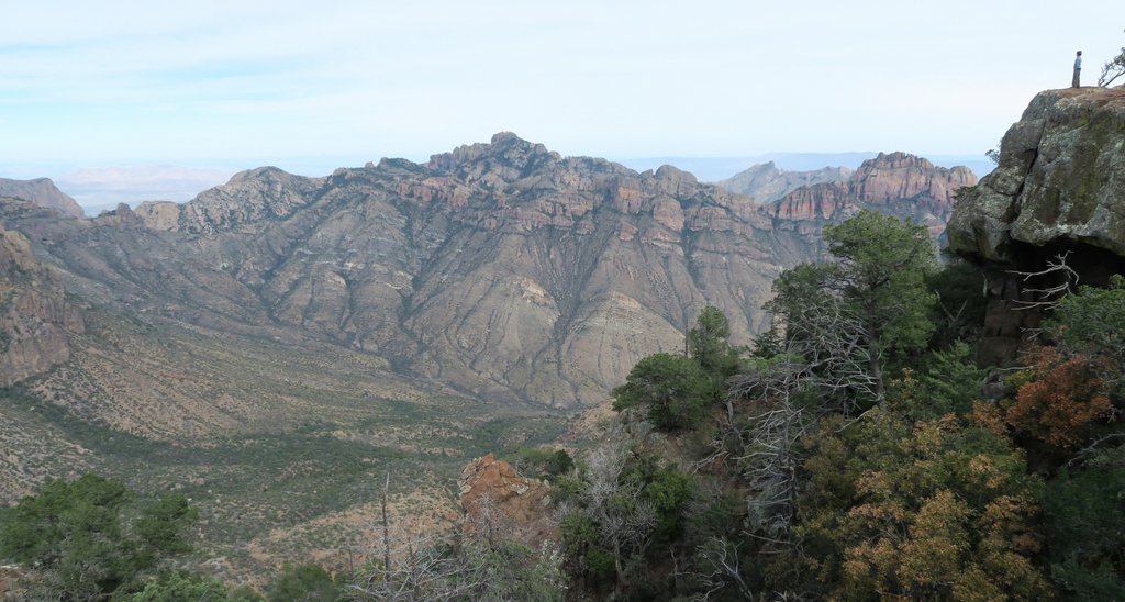
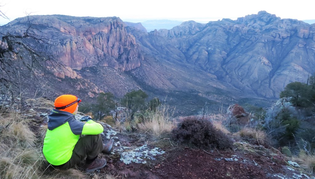
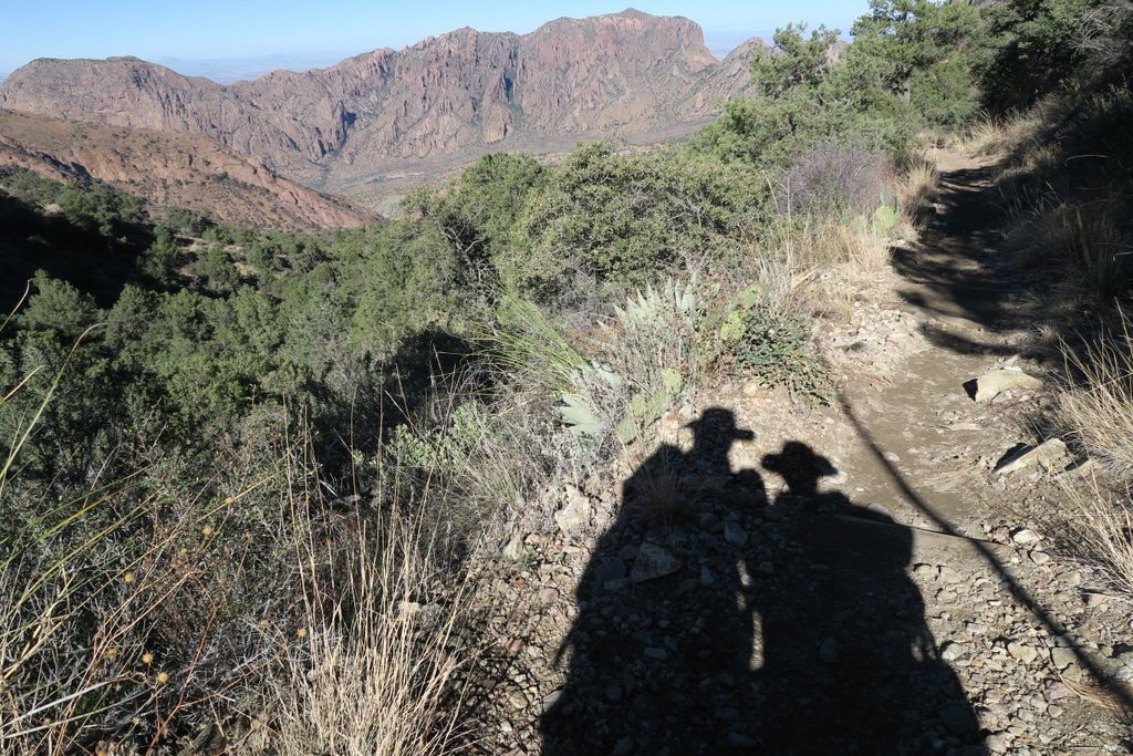
Sunday Dec 17th. We’d originally planned to head back up Emory for sunrise, but we needed the rest instead – but we missed a fantastic one! Beautiful and very friendly blue birds (Mexican Jay) joined us for Breakfast, but looked disappointed not to join in. Filtered 4l of water from Boot Spring pipe, and followed NE Rim trail to NE4 campsite, food into bear box and hiked South Rim without packs, watching the sunset from various locations along the rim – trying to work out where the Dodson was below us, and stumbling upon a rabbit. GPS showed 8.4 miles with 1677ft elevation gain, 8.5 hrs hiking with 3.5 hrs moving time. Campsite NE4 comes highly recommended – good access to both the NE rim and the SE rim – and off the main track.
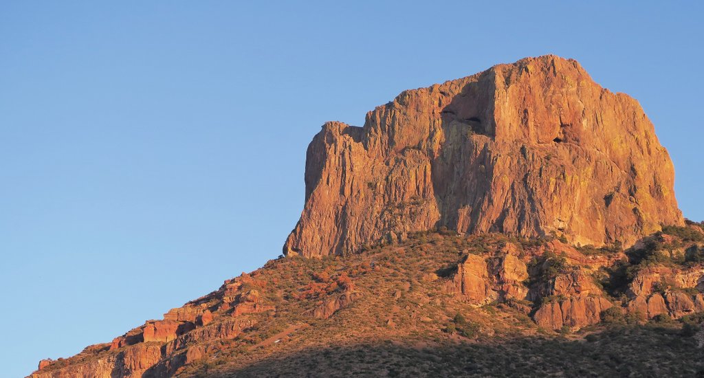
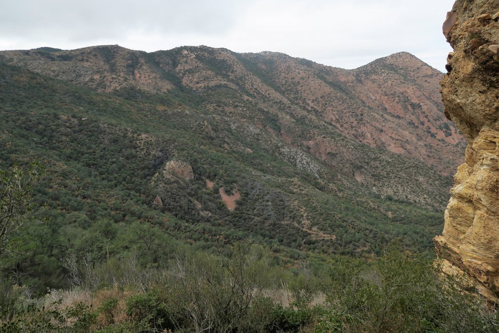
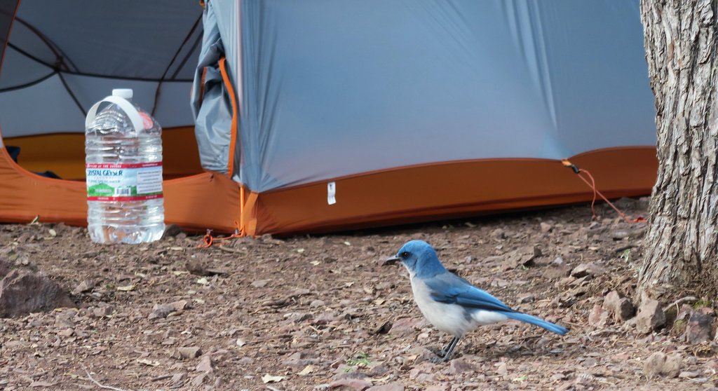
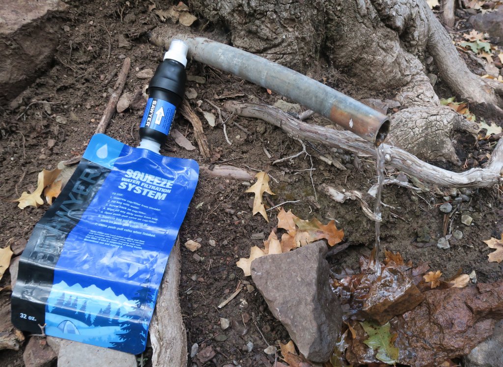
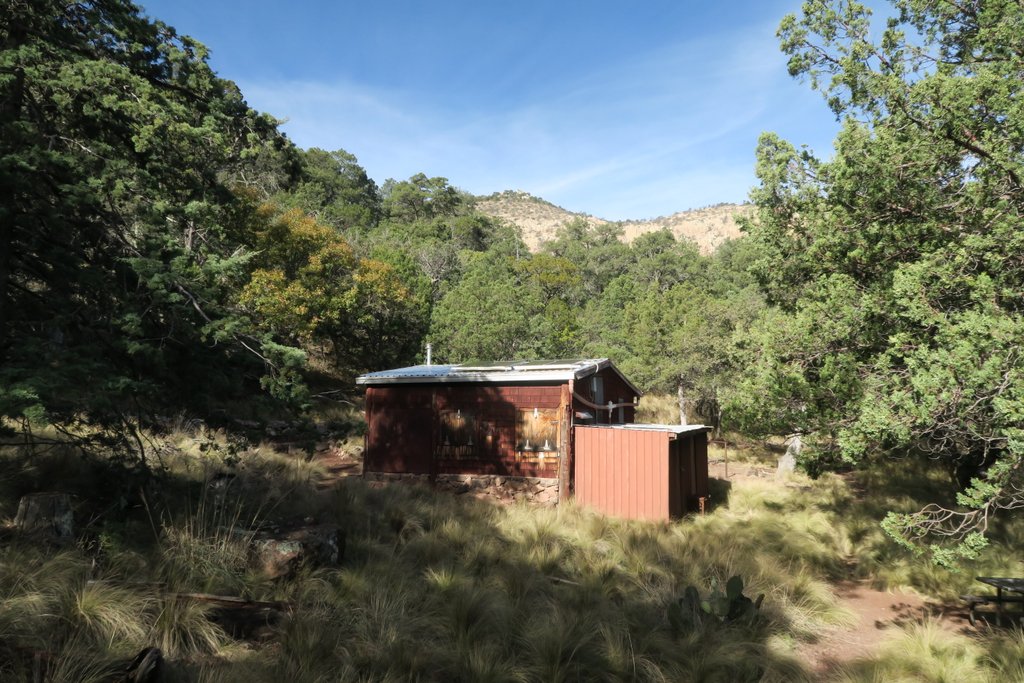
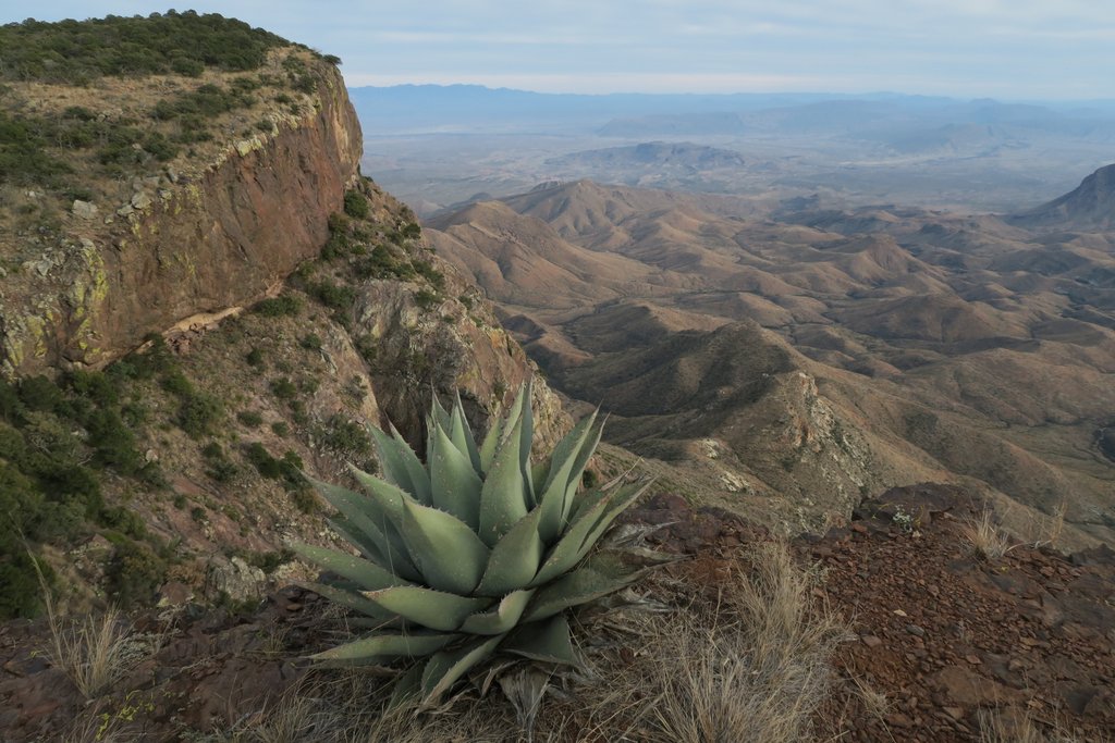
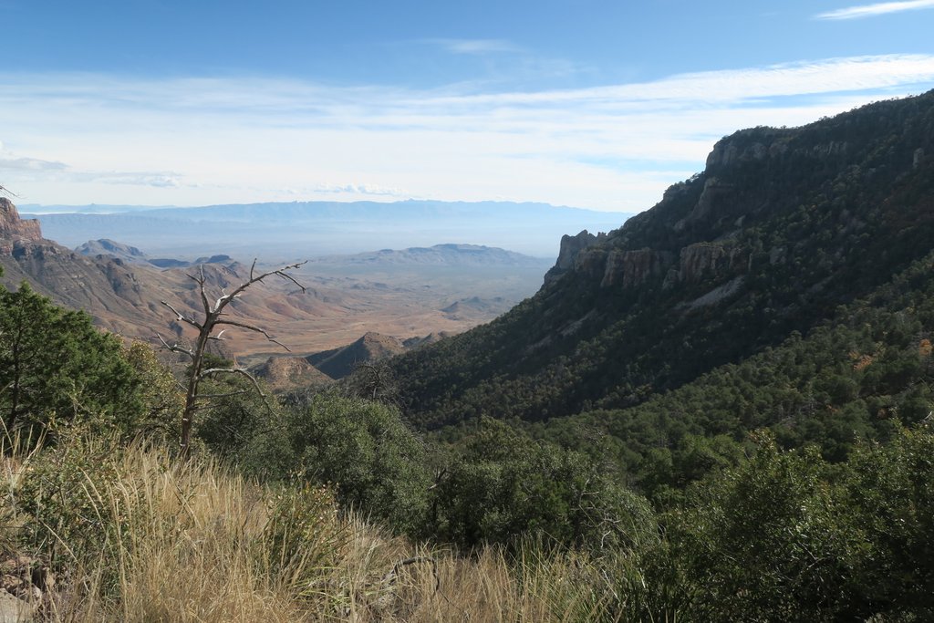
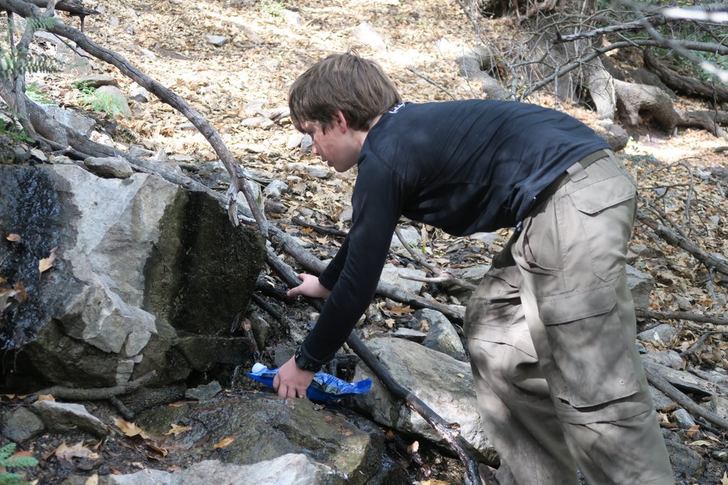
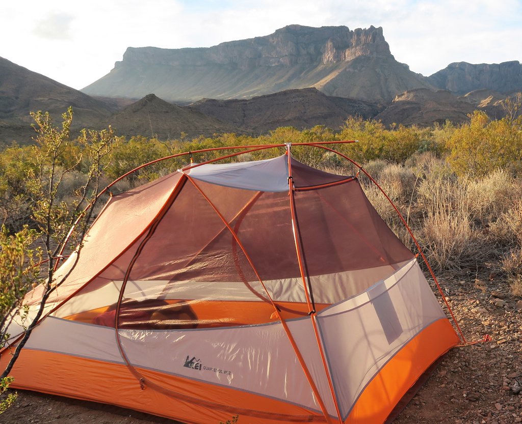
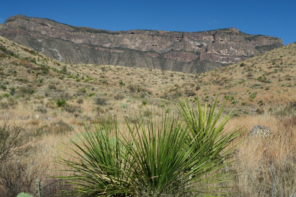
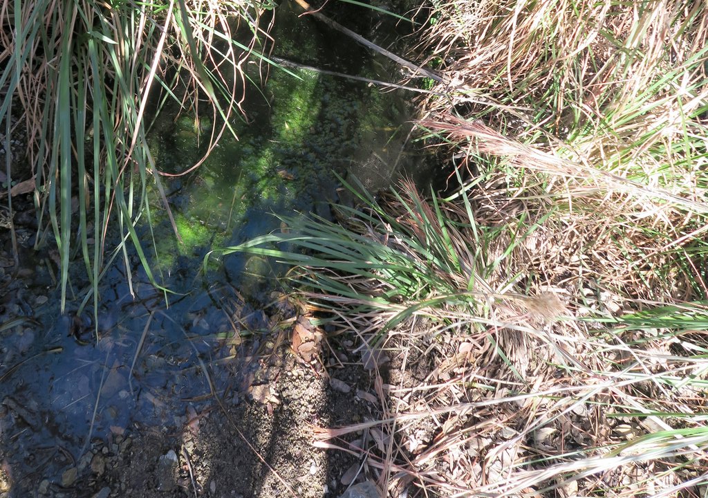
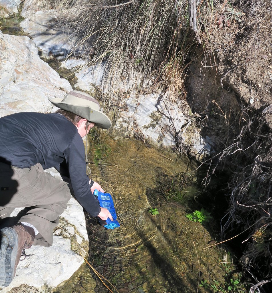
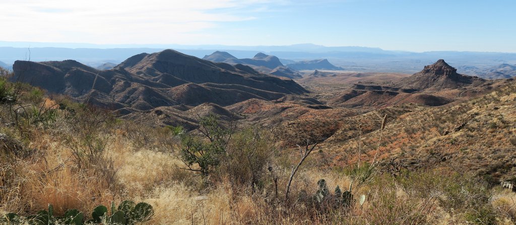
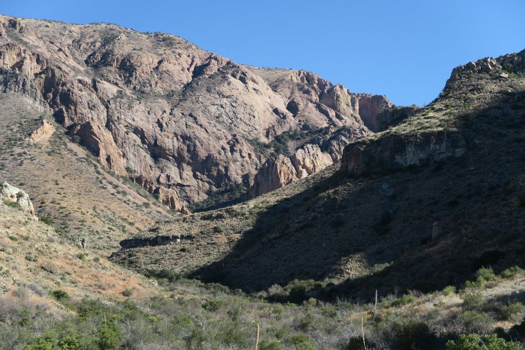
Happy campers at Boot Canyon #1 campsite. The metal boxes are for storing food for protection from bears and other creatures. We organized our food into gallon ziplocks by day which works well. We had not had a great night’s sleep with strong winds. Also, this day was relatively easy as we were staying on the Chisos plateau, so we did not get going at the crack of dawn.This Mexican Jay was very inquisitive and gradually overcame its fears to say hello. The picture shows Samuel’s upgraded tent, the REI Quarter Dome 2, which was a couple of pounds lighter than our previous tent and has great vestibules. However, it is more delicate and requires handling with greater care. The picture also shows my preferred one-gallon water container. When needed to carry more than the normal water bottles, these bottles are great as the screw top makes them stronger than others, but don’t drop them! Great value at about $1 each. While the bottle is quite light, the water remains heavy….Boot Spring was running! At the bottom of the ravine there is this small pipe that comes out of the ground. While it often is either dry or frozen, it was running continuously for us allowing us to replace the 4 liters of water we had used. The picture shows the Sawyer Squeeze filter, which is brilliant, and I have used it with the dodgiest-looking water. The Squeeze comes with a couple of 32-oz bags that you fill with water and squeeze to push the water through the filter. On subsequent trips, I have upgraded the bag to CNOC’s version which is much better.A mule deer came to say hello as we filtered water.There is no access to this hut which is close to Boot Spring. It is used for various purposes such as scientists performing research and is not available to the public. It has a convenient picnic table though!The sign to Boot Spring is difficult to miss, but it is a climb down into the ravine to find the pipe.There were many puddles of water in Boot Canyon above the spring. At first, these were right next to the path, but then the path climbed out of the canyon, as you can see at the top of the photo. At other times that I have visited, there has still been water in these puddles when the pipe is not flowing, and I have trusted my water filter to do its job and lived to tell the tale.About a mile up Boot Canyon, having passed the turn off to Juniper Canyon (which we will return to), you come to the turn off for the Northeast Rim trail. This makes for a great loop to the South Rim when it is open. The South Rim is closed between ER3 (was NE3) and ER9 (was NE9) between February 1st and May 31st each year to protect nesting Peregrine Falcons. I am glad we were visiting in December. It is a steep climb out of Boot Canyon for about a mile, and then it levels off on the Northeast rim.There are fantastic views toward Lost Mine Peak from the Northeast Rim. Note Samuel in the top right of the picture for scale.Below us is Juniper Canyon, and somewhere down there is tomorrow’s trail. We thought we could see the trail in places, and thought we located the extra greenness around Upper Juniper Spring.At the Eastern tip of the plateau, at the beginning of the South Rim, we got our first glance of the desert floor below us that extends to the Rio Grande and Mexico in the distance. The picture shows some curved lines above the dead tree which are either washes, roads, or trails. Somewhere down there is a small parking lot and the junction between the Juniper Canyon trail and the Dodson trail. The lack of certainty about the path makes it all the more exciting, but with some trepidation.We stayed at NE4 (now ER4). It was not our first choice but it become a favorite. It is right next to both the Northeast and South Rim, so you can easily access both for views. It is a large site with plenty of room for multiple tents and has several shade trees which are rare.
As the afternoon turned to evening, the desert plains became ominously dark, with the landscape dominated by the easily recognizable Elephant Tusk peak. The Fresno Creek drainage lines up with the Elephant Tusk peak. The Dodson crosses the Fresno Creek somewhere in the foreground, and that is where we hope to find water in a couple of days.
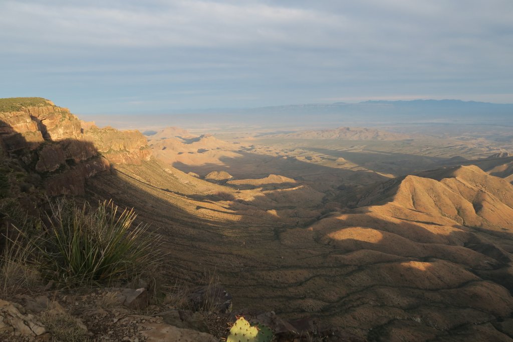
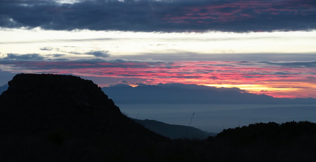
From the rim, we can look back towards Emory Peak. The views from the peak are not as dramatic as from the rim.The South Rim is a sheer cliff.The clouds break as the sunsets. When on the Dodson on a hot day, I am sure the long shadows are most welcome.I love seeing the shadow of our mountain on the clouds in the distance, reminding me of Guadalupe Peak.After the wet and cloudy weather, a pretty sunset is a treat. However, we are conflicted with time. We have walked about a mile from our campsite and need to eat dinner and get plenty of sleep before heading down Juniper Canyon tomorrow but want to keep watching the sunset! I like such dilemmas.
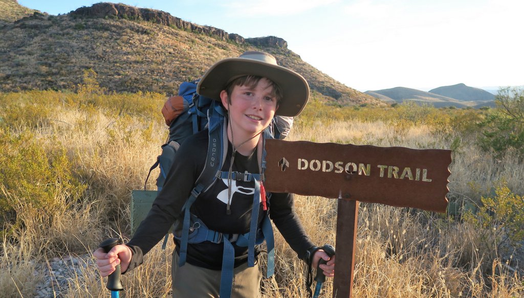
Day 3 – Juniper Canyon to Upper Juniper Spring and the Dodson.
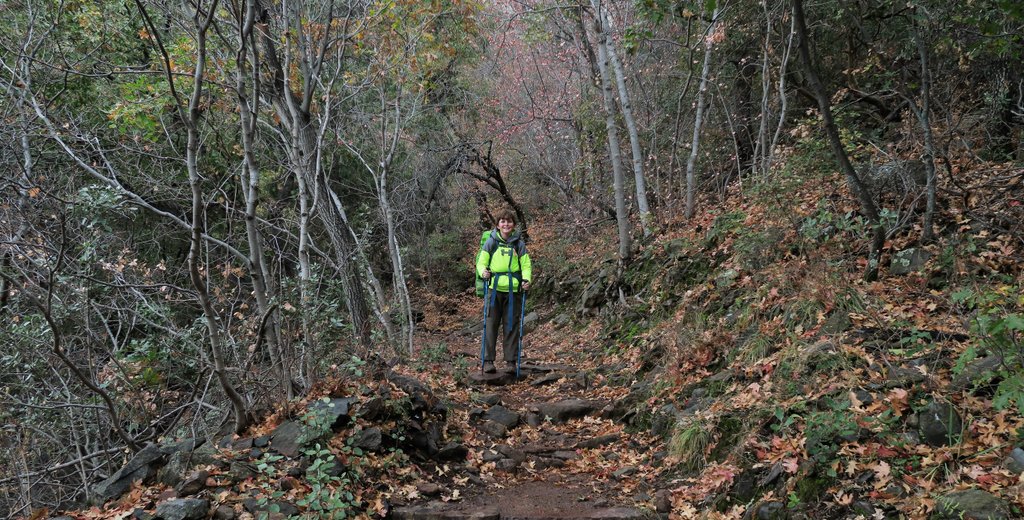
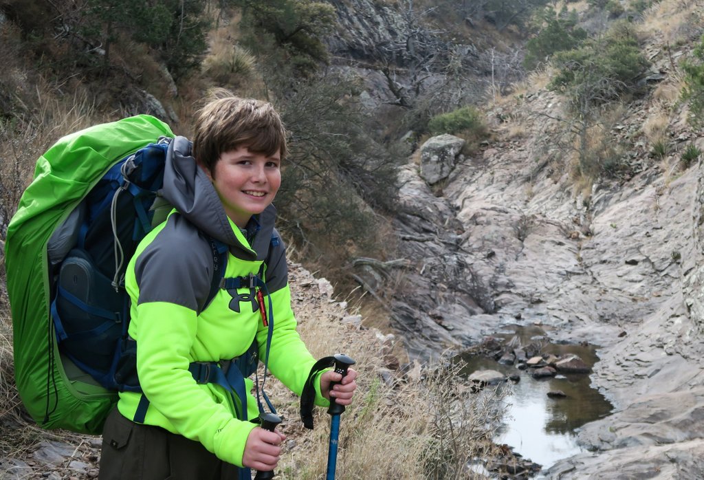
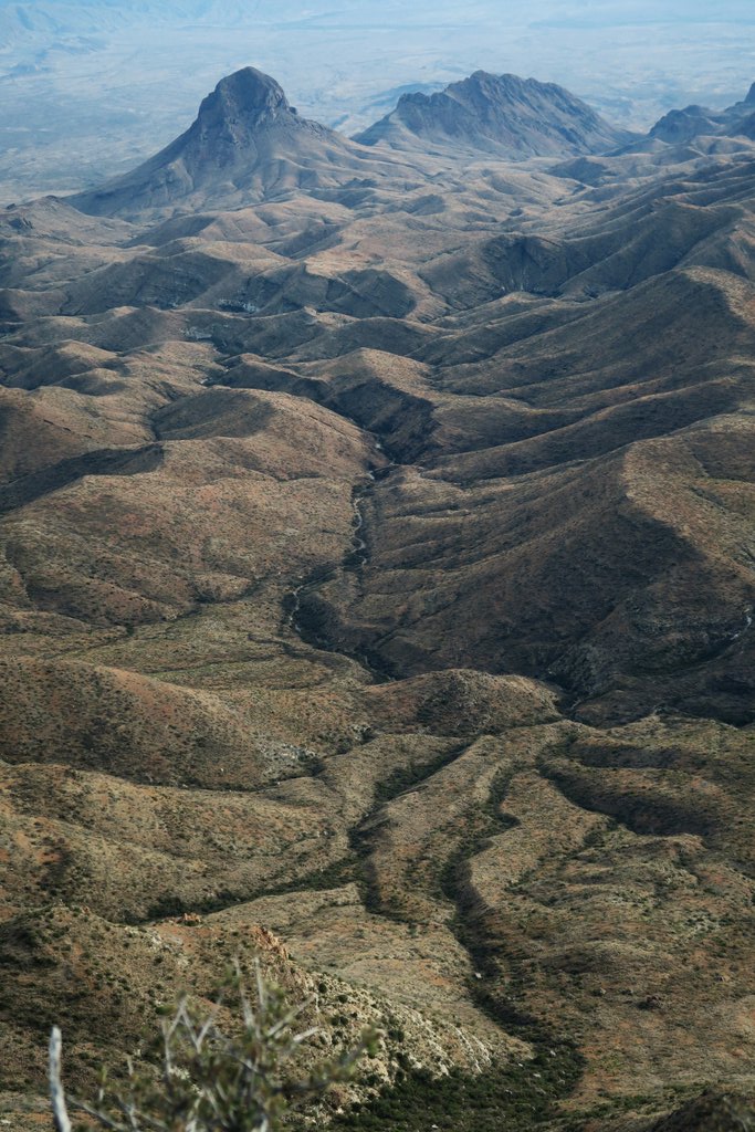
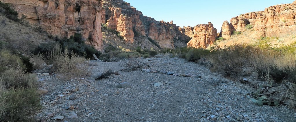
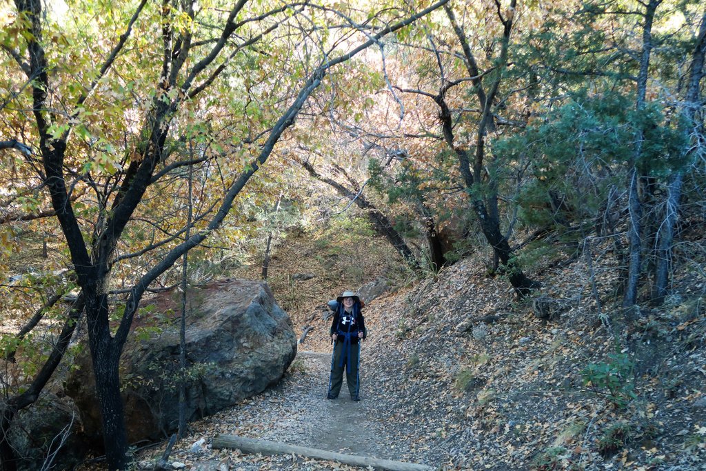
Monday Dec 18th. Filtered 8l of water at Boot Spring pipe – joined by a baby mule deer in the middle of it. Ready to head down Juniper – a bit surprised to climb quite a bit at first to get out of Boot Canyon and into Juniper – but it was through some beautiful forest. Not long until we were heading down, and down, and down. Met 3-4 groups of people which was more than expected, though the ranger had indicated there were a few groups – with a maximum of 40 allowed overnight in the Dodson zone. Stopped at Upper Juniper Spring which was a beautiful location, filtered 1l of water – which took a while as the water was difficult to collect. The long downhill section of Juniper was the toughest part of the hike for my son – mainly due to the forces on his feet. We made it to the Dodson junction, headed about 0.5 miles along Dodson for our 3rd night. Out of the mountains, it was warmer so we opted to not use the fly – but just when falling asleep, Samuel some flashes, and then we heard some rumbles. We got the fly on just before the rain started – and it led to a fantastic night’s sleep! Again, the GPS seemed to be measuring longer distances than the map. 10.8 miles, with an elevation loss of 3898 ft. 8 ¾ hrs hiking, 4.5 hrs moving.
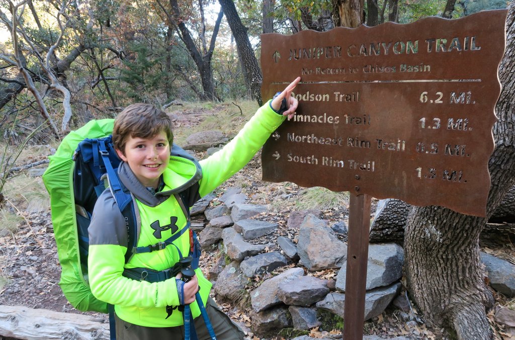
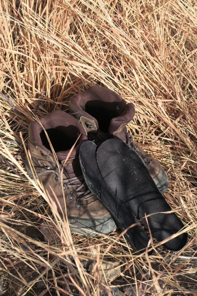
Up before dawn! Though this was just 7am. We were hesitant to do much hiking in the dark, but it would have been fine. Recent reports suggest the Juniper Canyon trail is more difficult to follow after the 2021 fires. Also, the Dodson is quite difficult to navigate even in daylight!Some clouds below the mountains in the distance, but there weren’t any close to us.Contemplating the descent into Juniper Canyon while enjoying the morning hot chocolate.I got a reflection of Samuel, and the sunrise catching Emory Peak!We started to head down Juniper Canyon, and I felt this was the start of the Outer Mountain Loop. “No return to Chisos Basin” sounds like there is no turning back now!I thought we would immediately start heading down Juniper Canyon. However, there is about a half-mile climb to Juniper Canyon campsite, and then it opens up.Snack time on the easy-to-follow trail, though recent reports suggest it is more difficult after the 2021 fire.Upper Juniper Spring is easy to find. While there is not a sign to it, there is a path off the main trail by this sign that heads into some trees.Upper Juniper Spring had just a trickle of water flowing, but that is all that you need. Also, it provided some beautiful shade and was a great place to hang out.Some remains of habitation by the spring remain.The path descends quickly, and soon the surrounding mountains tower above.The pack weight and steep downhill took their toll on Samuel’s feet. He made it to the bottom but then hit the panic button. It was time for a well-earned rest! This photo shows a merino wool thermal top. Merino wool thermals are an excellent base layer when the temperatures change so much.
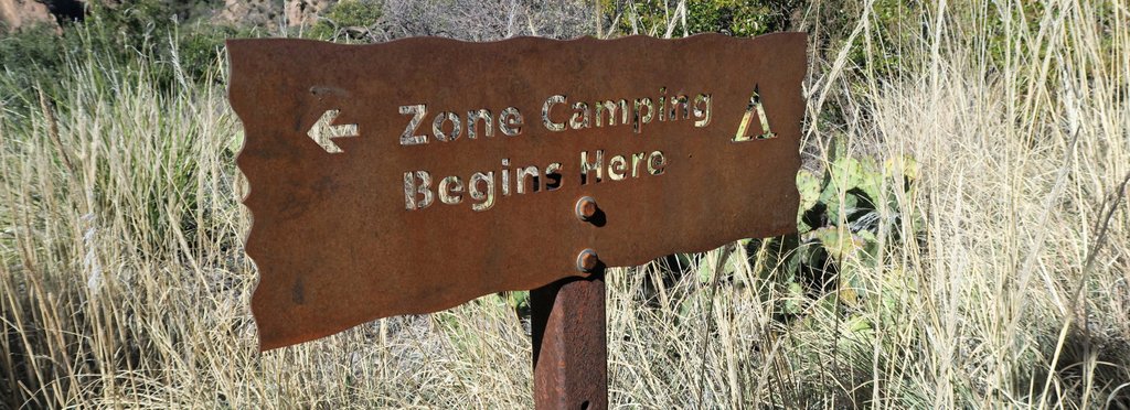
While resting, we made the most of drying out shoes that were wet with sweat.
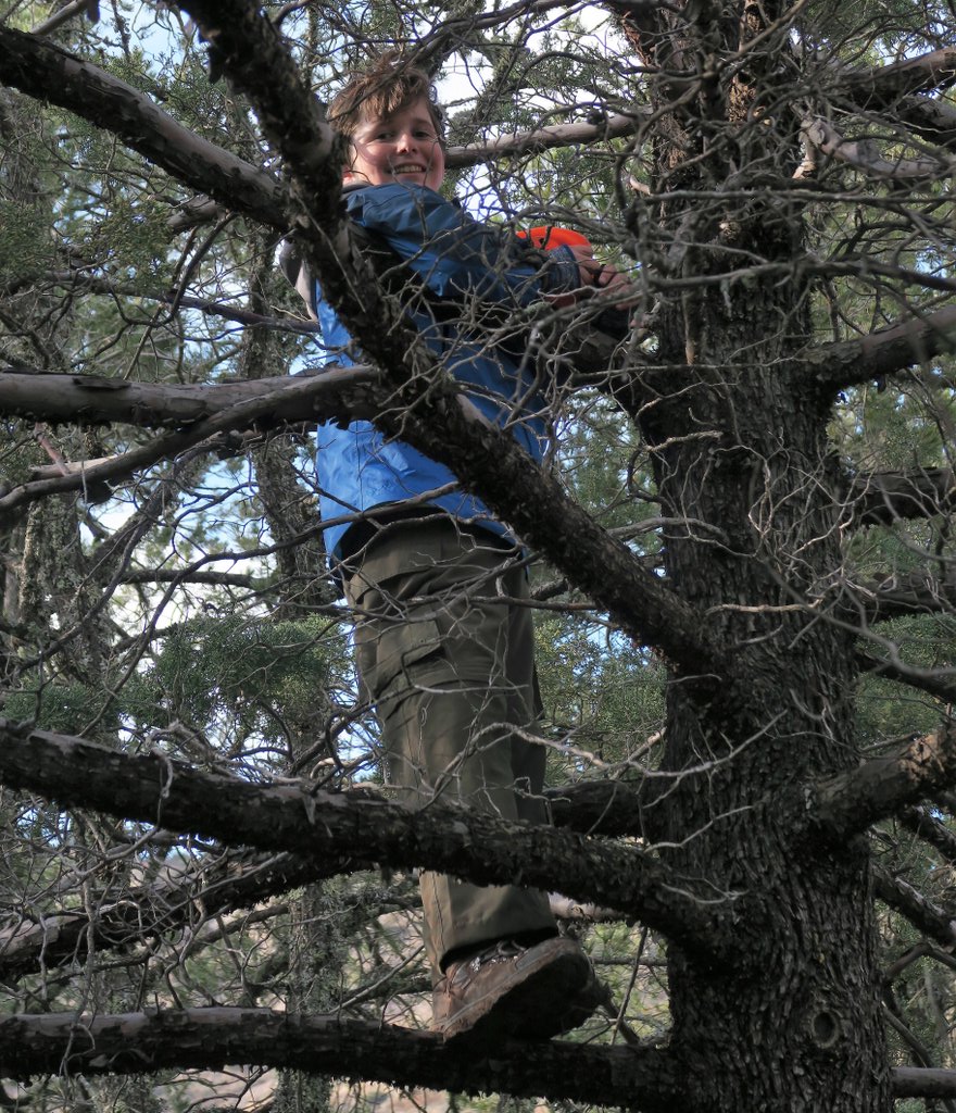
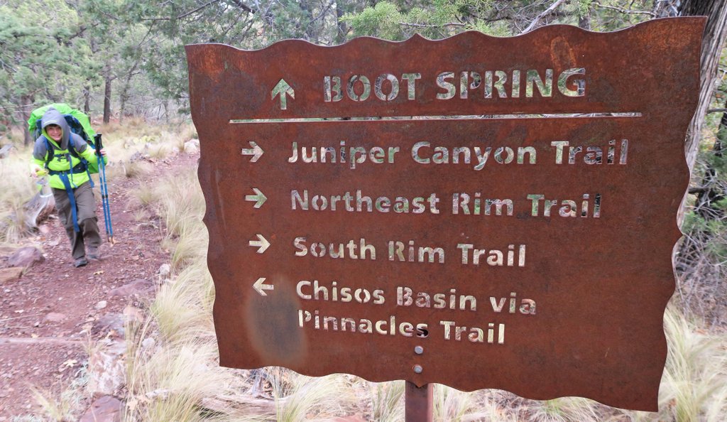
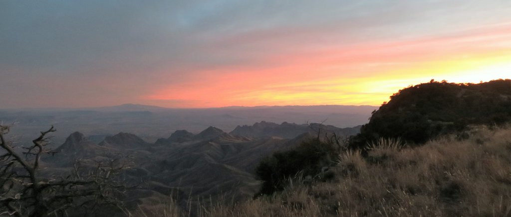
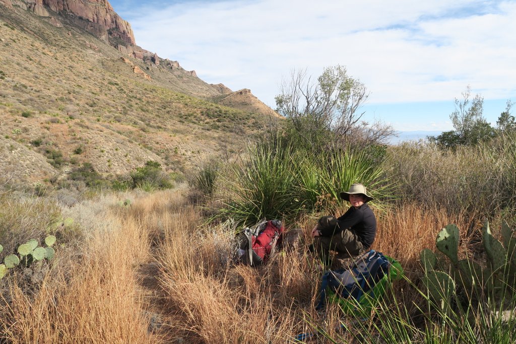
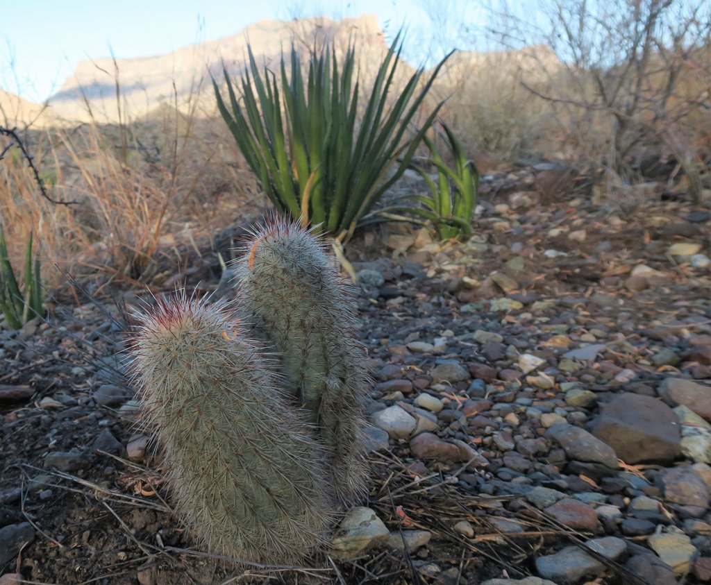
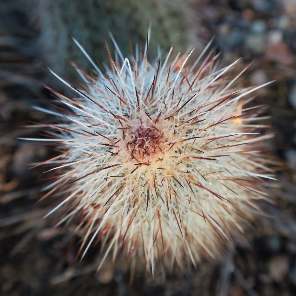
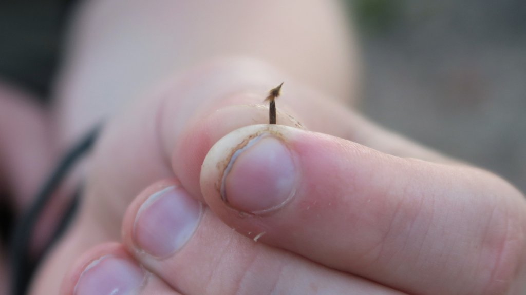
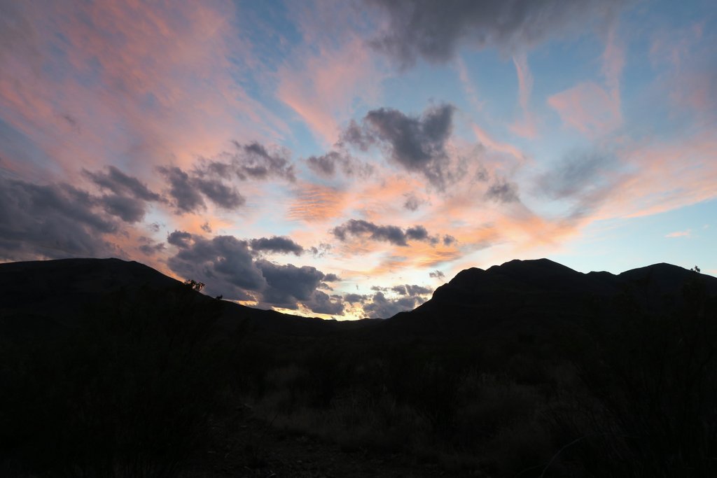
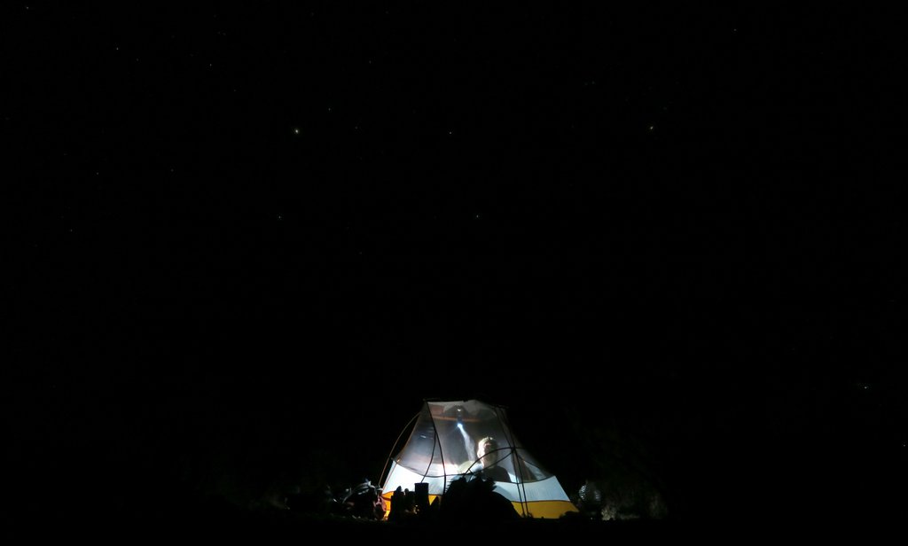
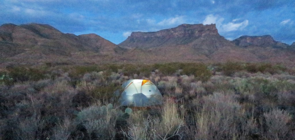
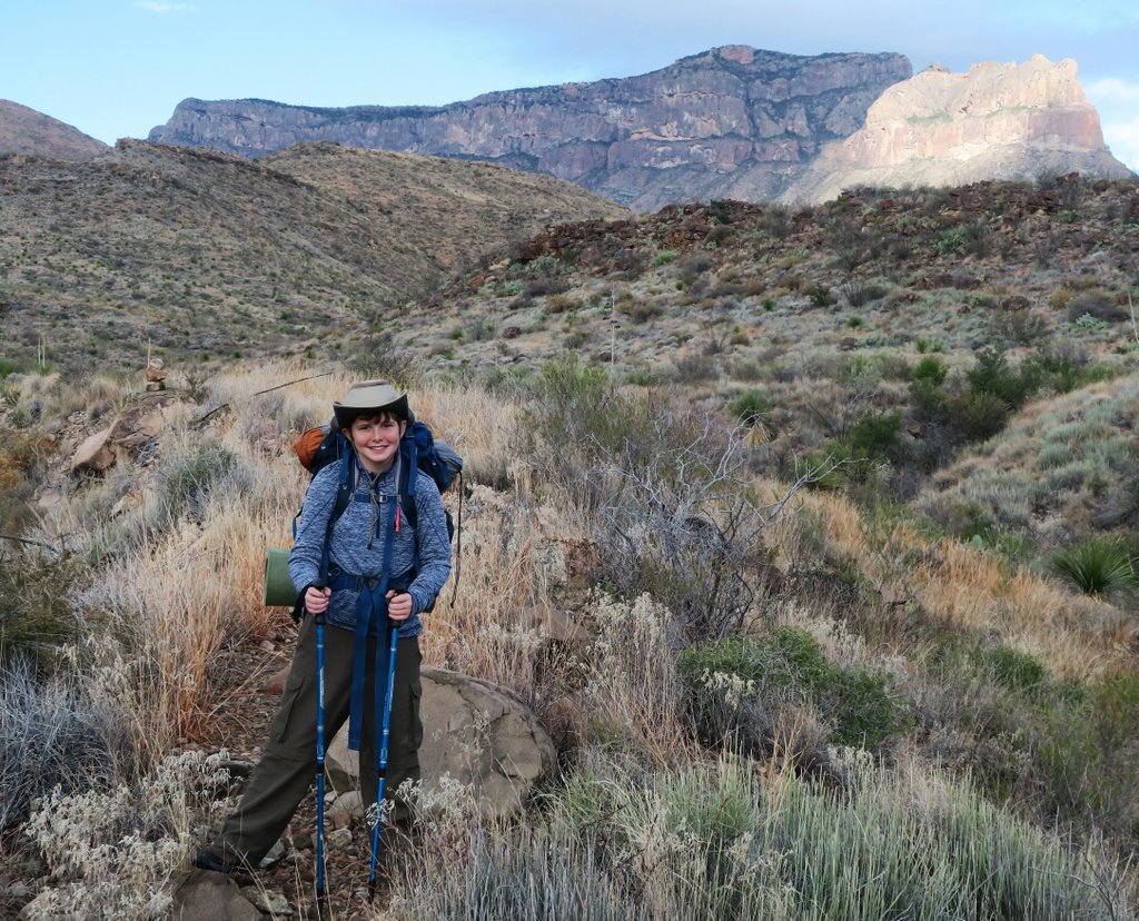
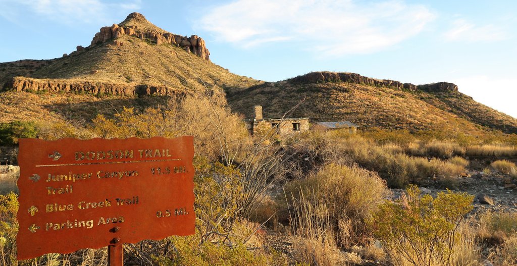
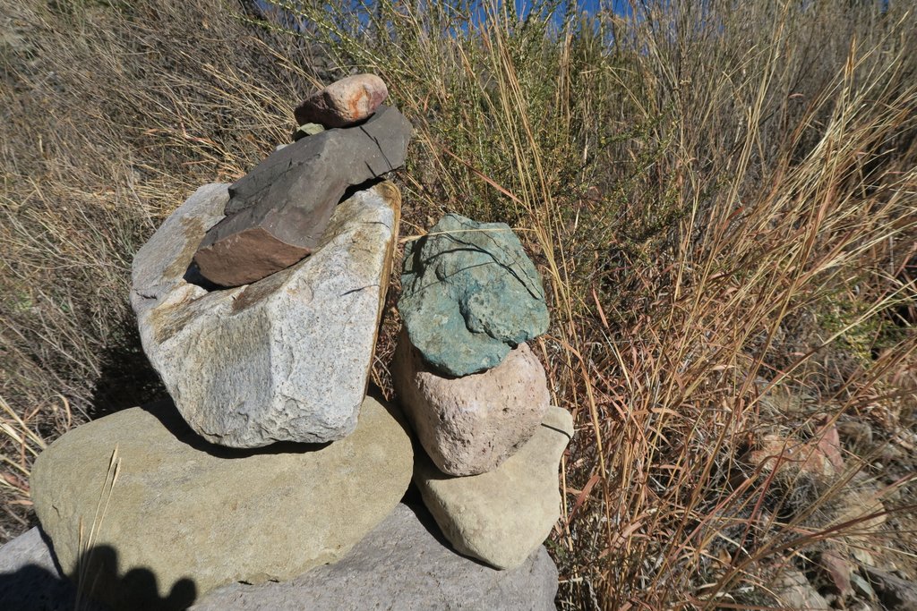
After a rest and a snack, Samuel was back to his old self and ready to go. Redistributing some pack weight also helped!Care is needed as you descend with spiky cactus growing across the path, and they are not very forgiving!Fascinating rock formations look down on you.When the path levels out, you can see the complete Northeast Rim.After twenty minutes more walking, the whole of the South Rim comes into view. Wow!!After a bit more walking, we arrived at the junction of Juniper Canyon Trail and the Dodson Trail. I felt this marked the completion of the first of the three “legs” of the OML. At the trail junction, there is a small parking lot at the end of an unpaved, high-clearance-vehicle road. There is this bear box where you can cache water ahead of time if you have the right vehicle and time. I decided that we did not need to cache water here, as the reports from Big Bend Chat gave me sufficient confidence that there would be water at the springs.It had been comforting to have the bear boxes for food when camping at the designated sites in the Chisos. However, the next two nights would be open camping without such luxuries. It seems bears don’t roam the desert unless they are changing location. We kept food in our packs and in our tent and did not leave them unattended. On other trips since this, I have carried food in special odor-proof bags, which I will use on any future OML trips.Fairly soon after the junction, we found a cleared pad for the tent. There were plenty along this part of the trail.We enjoyed a chill evening. We think we heard one other camper once, but otherwise we were all by ourselves.The trails in this part of the Dodson are easy to follow, but constant vigilance is required on the trails and campsite for cactus.I wasn’t vigilant enough….A pair of tweezers is wise equipment for desert hikes with prominent cactus!The Chisos looked down on us, all the more beautiful as its colors changed with the setting sun.The setting sun dramatically lights up the Sierra del Carmen Mountain range in Mexico. F.D.R. wanted a cross-border international park here.Even the clouds gave us a dramatic sunset.The thought of sleeping under the stars led to us leaving off the tent’s rainfly. The stars were amazing and my photo does not capture it. Just as we were going to sleep, Samuel said “was that lightning.” I dismissed it, and then I heard thunder. We felt the rainfly was a good idea, and ten minutes later, it was raining! It helped us sleep and we slept very well.
Day 4 – The Dodson via Fresno Creek to Homer Wilson
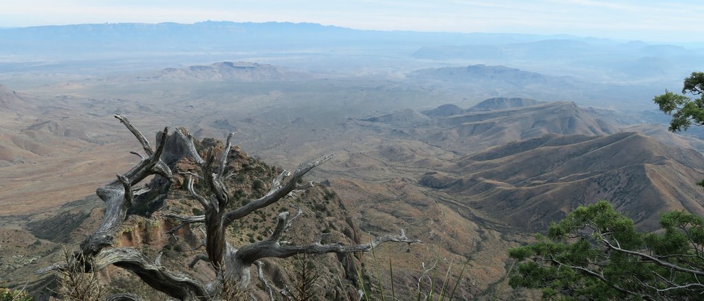
Tuesday Dec 19th. A good day to get going early and get some miles in – but we didn’t. A slower start and some piddling around early on. We checked out the Dodson spring (well, stagnant puddle), and the remains of the Dodson ranch (with a bed!!), and then filtered 2l of water at Fresno, and had a fantastic lunch looking up at the rim. Camping near Fresno would have been really good and I’d recommend it – but it would take either an extra day, or a much longer day. We enjoyed the Dodson trail as it was much more like the desert trails we were expecting – which Juniper was not. However, it seems a long long way from Fresno to Homer Wilson. You can see the mountain just behind the ranch from a long way away, and you ask yourself “it can’t be that far!”. Yes it can! Grabbed our 3 gallons of stashed water and headed 0.5 mile up Blue Canyon. Ate double dinner – as we’d brought an extra in case, we now had plenty of water, and we were still on our first small Jetboil fuel canister (it boiled 2-cups of water 19 times for us). 12.7 miles, 2530 ft elevation gain, 9.5 hours hiking, 6 hours moving time. Guide book says Dodson is 9.9 miles, the sign posts say 11.5 miles, Nat Geo map not say.
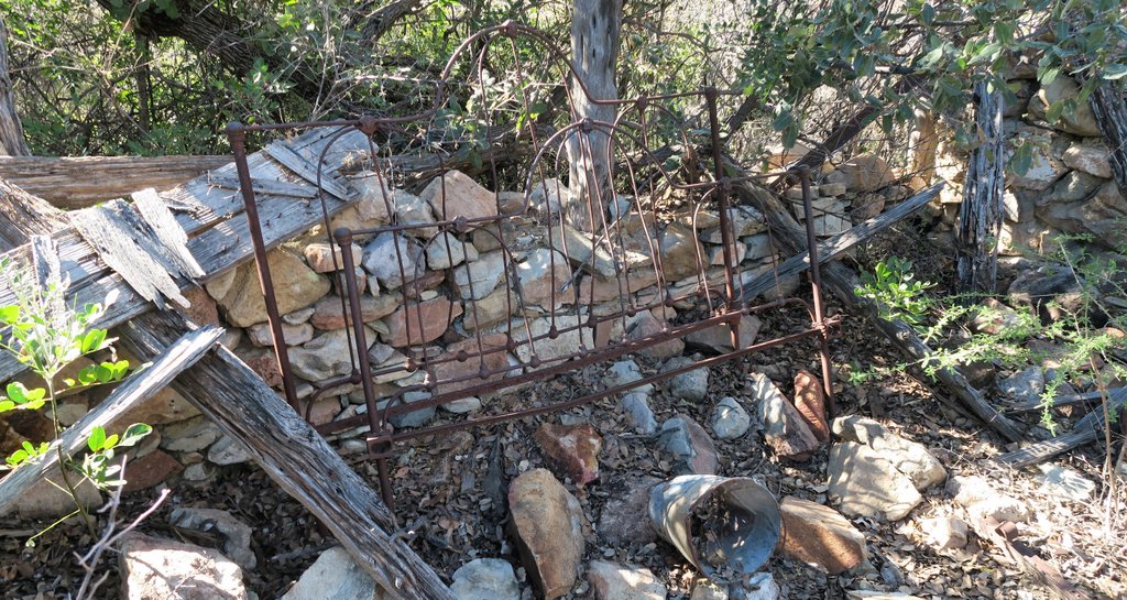
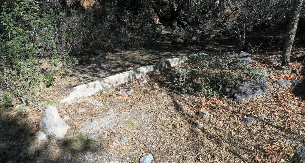
We start packing up a bit before dawn, still in awe at our views.Samuel is eating one of the egg-based dehydrated breakfasts which we soon got sick of and can no longer eat! My favorite breakfast now is an instant oatmeal, pouring hot water into the packet it comes in, minimizing cleanup.A beautiful sunrise to the East. One advantage of hiking the OML clockwise is that the morning sun is behind you. But its less great when you are hiking into the late afternoon!Trekking past the South Rim on the Dodson called us. At the beginning, you are about three miles from the South Rim.After good sleep, the boy was ready to go!The Dodson is difficult to navigate, with the trail going in and out of washes. While cairns mark the trail, they are sometimes difficult to notice. We drifted off trail at one point, but having preloaded an AllTrails route onto my phone, could easily find our way back, though the downloaded GPS routes are not always accurate.Dodson Spring is a little over a mile from the rim.The “Spring” was this puddle, and even this was after overnight rain. I’m glad we had no need to filter here.The remains of a house are just off the trail by the spring, including a bed frame. I don’t think it would have made the night any more comfortable though.
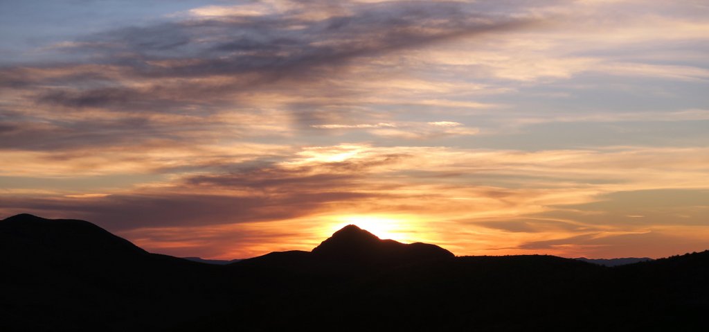
The sun was at the right angle for our signature silhouette photo.
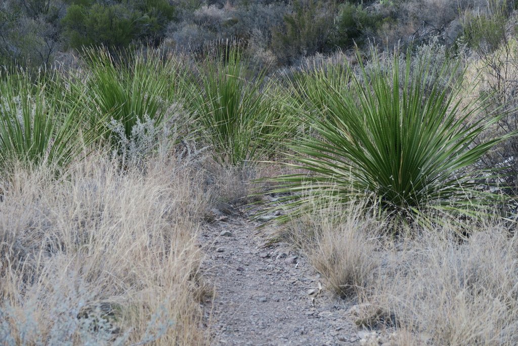
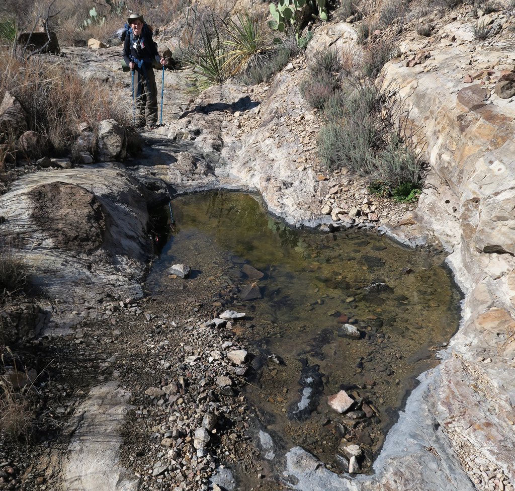
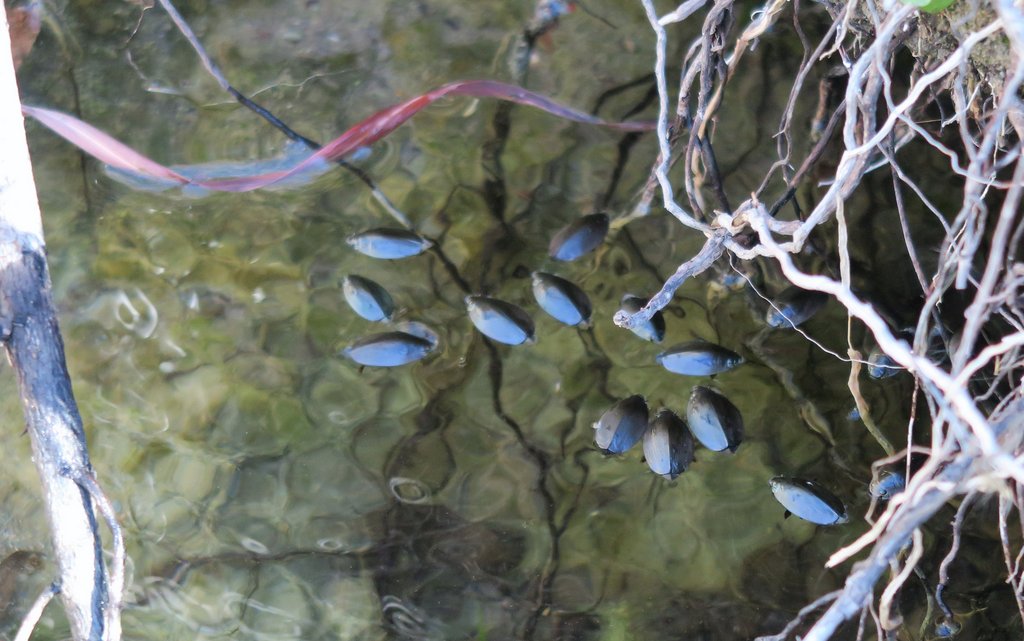
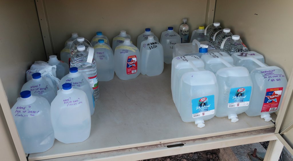
The overnight rain resulted in some rockpools on the trail which will dry up quickly.We were not moving quickly. The sun rose and the haze built up. The lack of shade on the Dodson and the roughness of the terrain led to pain. At “just” 10 miles, the Dodson had not really concerned us, but it was the most grueling part of the loop.We reached Fresno Creek, and it was difficult to miss as it was flowing across the path! At drier times, I understand you need to hike downstream a bit to find water. We took care not to contaminate it, and camping is not permitted close by for that reason.Some whirligig beetles enjoy Fresno Creek. Fresno Creek is about one and a half miles from the South Rim.Shortly after Fresno Creek is the junction with Elephant Tusk Trail. This trail crosses Fresno Creek after about half a mile which might be required if the Creek is dry at the Dodson Trail. Psychologically, it feels like Fresno Creek is half way along the Dodson. It is approximately in the middle, but the second half felt A LOT longer than the first.Sotol cacti appeared throughout the trail, sometimes in abundant clusters.Passing the Smoky Creek Trail junction confirms the progress made, and the location on the map. This picture shows Samuel’s Nalgene water bottle. We now use Smartwater bottles, as they are lighter, and the thread matches the input for the Sawyer Squeeze which is good for redundancy.About thirty minutes after the Smoky Creek junction, the view opens up to this. The distinctive hill on the right is Carousel Mountain, and Homer Wilson Ranch is just beyond that. Getting closer to Carousel Mountain – there are people on the trail in the foreground. By now, the sun is high and in front of us, it is hot, and the legs are weary.When we made it to this sign, which marked the end of the Dodson Trail, we felt we had cracked the most difficult part of the loop. We had met a few other hikers, but none had mentioned how young Samuel looked, which pleased him. One pair of guys overtook us, and Samuel was very proud of himself when he noticed them going the wrong way and called them back. He did most of our navigation and was better at spotting the trail than I was.Homer Wilson Ranch underneath Carousel Mountain. It’s about half a mile to the parking area, though its quite a climb.About half way up to the parking area are a couple of large bear boxes where you can stash water. Our three gallons are in the back right corner with the screw top lids, making them more robust for carrying. Several other groups have cached. There was some emergency water left by rangers, but it should not be relied upon as it is for emergencies!!Having retrieved our water, the exhaustion hit. However, you need to camp out of sight of the parking area and at least half a mile from Homer Wilson, so we headed about a mile up Blue Creek Trail.The beginning of our final leg, the third side of the triangle.We set up camp as the sun set. Such beautiful sunsets also signify the dropping temperatures.The clear night included a fairly new moon, with light reflecting off the earth illuminating the rest of it. We slept without the rainfly as there was no lightning. I fell asleep with my glasses on so that I could see the stars as I drifted off.
Day 5 – Blue Creek Trail to Chisos Basin
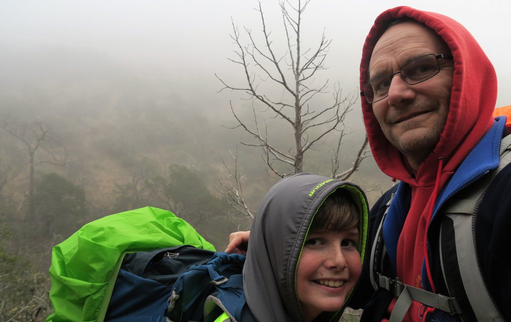
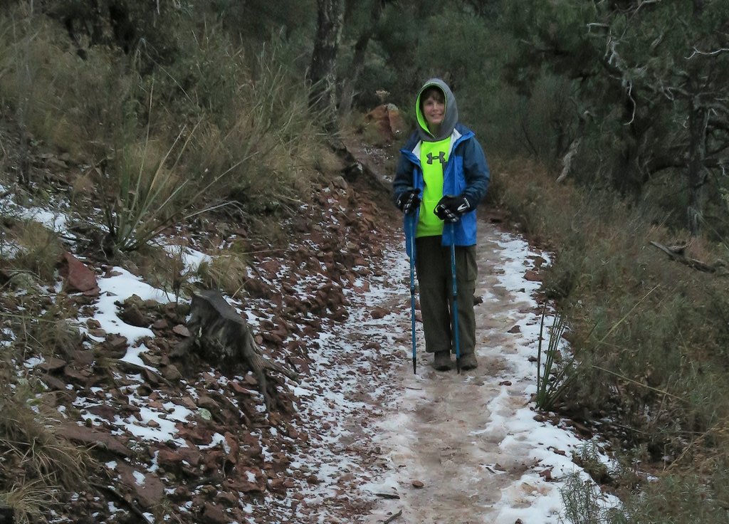
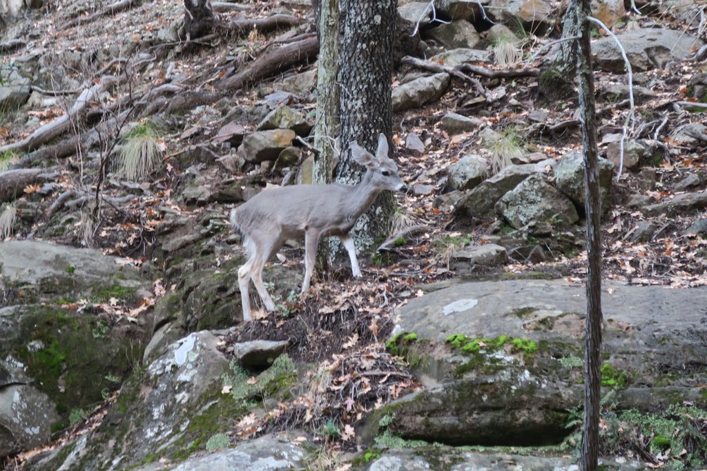
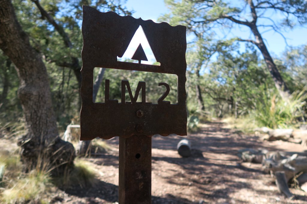
Wednesday Dec 20th. Another rough sleep – most probably due to allergies to the cedar pollen. But we got a double breakfast, and double coffee!! Not sure what to do with an extra gallon of water – so poured it out before heading up Blue Creek Canyon. Even saw a blue rock in one of the cairns! We really enjoyed this hike – with the views opening up both ahead and behind – and the exhilarating feeling of knowing “we’d nearly finished”. Even though a pipe shows itself in many places on the trail, there was no sign of water – though lots of shade trees. Great feeling of reaching the sign post for the South Rim at the top! We had lunch at LM2 campsite – fantastic views of Emory Peak, and looks like a great campsite for a group. For the hike into the basin, we were very tired, and I went over on my ankle several times – with my sturdy boots and hiking poles saving me from injury. About half way down, a young male mule deer was on the path and refused to leave it – enjoying drinking from puddles made by hiker footprints. Eventually he ran off and we could get down into the basin. And rushed to the store to buy some wetwipes for my best wetwipe bath ever!! Stayed again in campsite 34, with a 5am start to get back to Houston. 10 miles, 2733 ft gained, and only 1680 ft lost – the Laguna Meadows trail peaks a lot lower than Pinnacles.
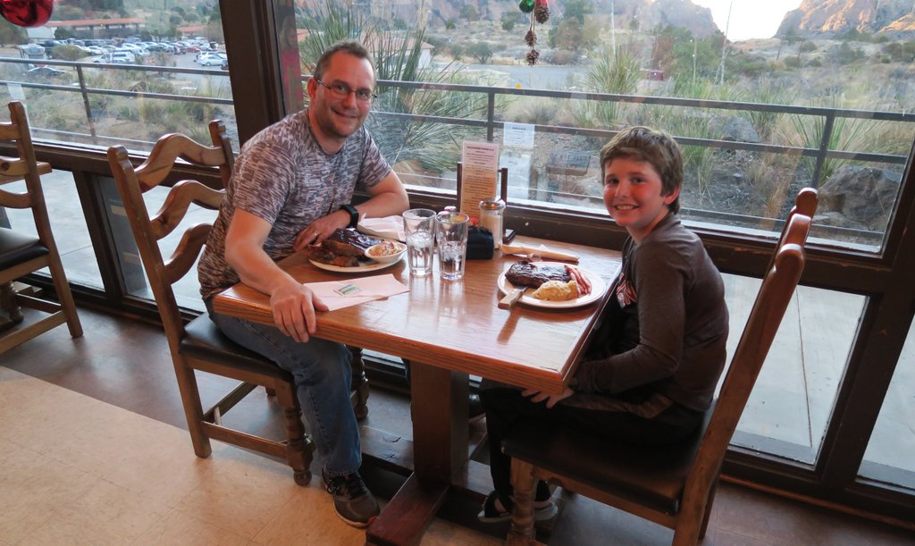
Our final morning. No rainfly helped air the socks!The shade from the canyon walls as you climb Blue Creek Trail are welcome. It is flatish for one or two miles.Look out for rows of rocks like this which are indicating when the trail exits the wash. Lots of these on the Dodson too.Cairns guide the way, and this has some blue rock for which the canyon is named.The trail goes up there! This day has a lot of climbing to get back onto the Chisos plateau. Some find this the toughest part. Our GPS indicated that we climbed almost as much on the Dodson Trail as we did climbing up this path. Along this trail, there is evidence of an old pipe and this habitation. No water anywhere though.The view behind opens up as you climb.Another sign that reminds you that you are making progress and can place you on the map.We could see the radio masts on the top of Emory Peak.Laguna Meadows 2 campground was a perfect lunch spot.We rationed the Nutella perfectly. Nutella has worked in different ways for us on subsequent trips. The challenge is selecting food that will work well with your palette, which changes in the backcountry! While it is simplest to identify a day’s food that works and repeat it each day, I’ve learned the hard way that variety is what makes the food interesting and is essential.On completing the Blue Creek trail, you have completed the third side of the OML triangle. Campsite LM2 is close to that point and has a great view of Emory Peak. It’s all downhill from here into Chisos Basin.We are going down there.We pass back through the deciduous zone of trees.The recent rains had left muddy puddles on the trail which this deer took a liking too but wouldn’t move!Back in the Chisos Basin, we feel the tremendous sense of accomplishment having completed a grueling but lifechanging OML. Our total journey was fifty miles over five days.When you start the hike, be aware of meal times at the lodge. We enjoyed a fine steak dinner.Farewell Big Bend, the Chisos, and the OML. Until next time!!
If you have any questions about the Outer Mountain Loop, don’t hesitate to leave a comment below, but remember to include your email address!
To read about our other adventures in West Texas, go to our West Texas page.
"Cajunlimeys" combines Lousiana (Janet) and England (Peter). For "limeys," check out scurvy in the English navy.
We love adventures and use blogging to write a photo diary to preserve our memories. Some crazy friends enjoy following us and my notes might help others plan.
View more posts
One thought on “The Outer Mountain Loop in 2017”
What a fantastic adventure! Great pictures! Thanks for sharing.


What a fantastic adventure! Great pictures! Thanks for sharing.
LikeLiked by 1 person