
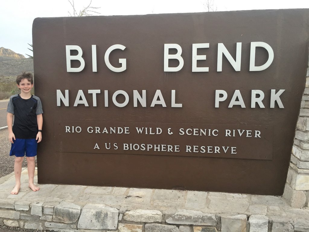
Now for my third visit to West Texas. After an awe-inspiring summitting of Guadalupe Peak, Samuel and I were ready for our next challenge. Spring Break 2016 gave us the opportunity to head back to the desert while the girls did a trip to New York. Each of us were very happy with our trips! Recognizing that Samuel was only eleven and my wilderness experience remained low, I didn’t want to be too ambitious. Also, as I still had not embraced filtering water and the National Park website stressed the uncertainty of the spring water in the Chisos Mountains (more on that in later blogs when we relied on it), our backcountry hiking was limited to how many days of water we could carry, which translated into how much I could carry as Samuel was still small. So, we planned for three nights in the Chisos (one in the basin and two in the mountains), one-night remote car-camping, an overnight hike to the river, and a two-day one-night canoeing trip with an outfitter.
This trip doubled the length of our previous backcountry adventure, with good exposure to day and night hiking in the desert. I learned that carrying water is definitely a limiting factor, was amazed at the energy of an eleven-year-old, but also that when that energy runs out, it is like hitting a wall! While this was a steppingstone to bigger trips like the Outer Mountain Loop, the trip itself was still an epic experience for a father and son, especially enabling Samuel’s joy.
Activity #1: Camping in the Chisos Mountains
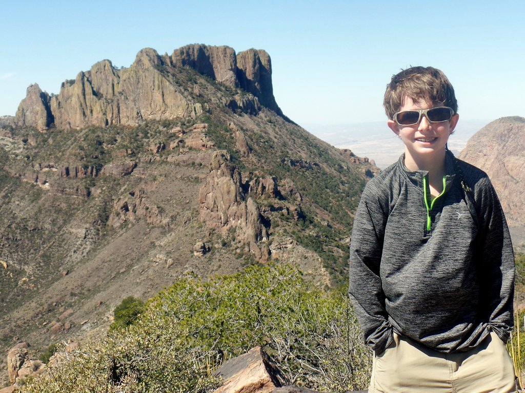
My research had shown that the South Rim of the Chisos Mountains was a highlight of the park. This is also close to the location of the park’s highest point, Emory Peak, which wasn’t identified as a highlight, but we still had to climb it! Our previous trip to Guadalupe Peak had taught us to expect hot days and cold nights so we tried to be prepared.
Our first night, after the long drive from Houston, was camping in the Chisos Basin. It is a functional car-camping campground that fills up and needs early reservations, especially during busy times like Spring Break. Most importantly, it is close to the mountains. Its other redeeming feature is its proximity to the Chisos Mountains Lodge, which has a restaurant, and the permit station at the Chisos Basin Visitor Center.

One of the advertised views and trails in the Chisos Basin is the Window View or the Window Trail. We did neither on this trip and haven’t on future trips. Much of our enjoyment comes from getting away from the crowds, which often means hiking to places that the vast majority of people are unable or unwilling to. We are happy to help anyone else get to such places!
The following morning, we could not need to start at the crack of dawn as we had to pick up our permit, but we were at the trailhead soon, ready to go.
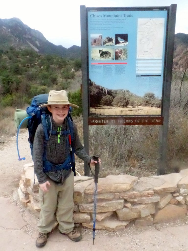
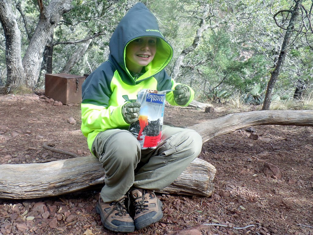
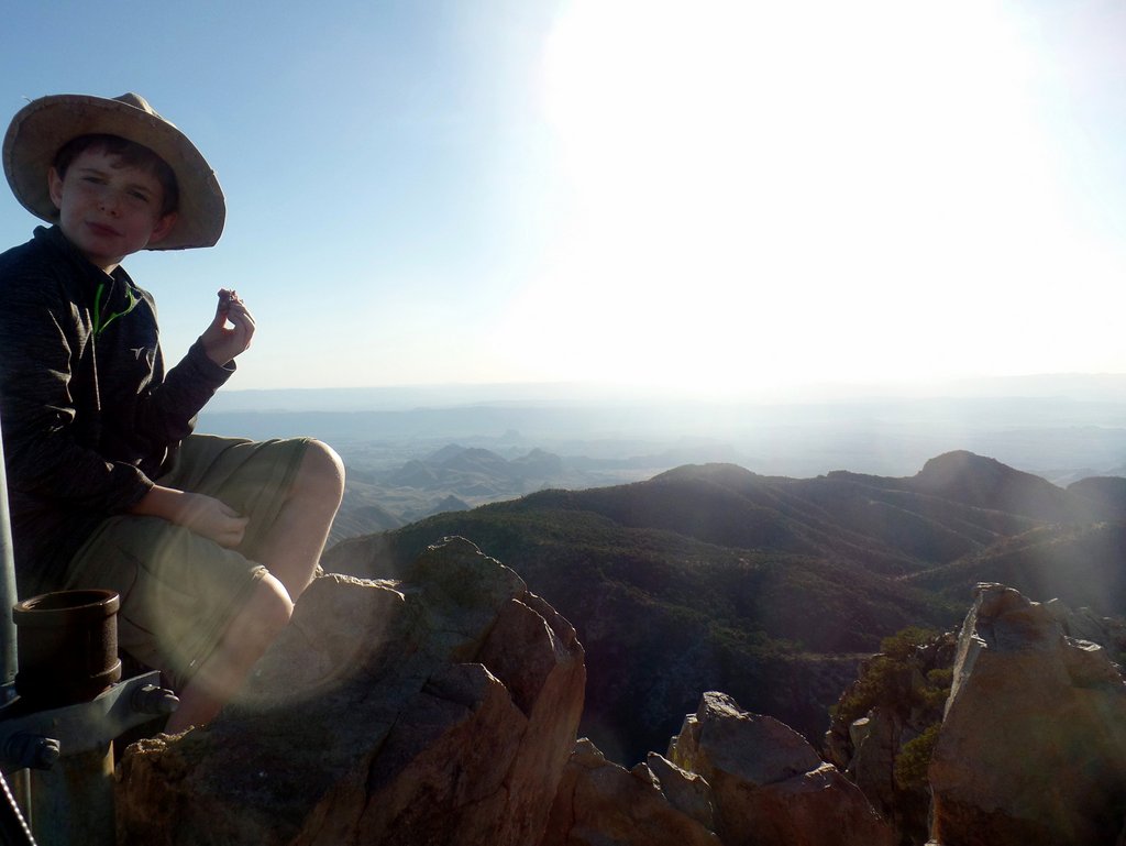
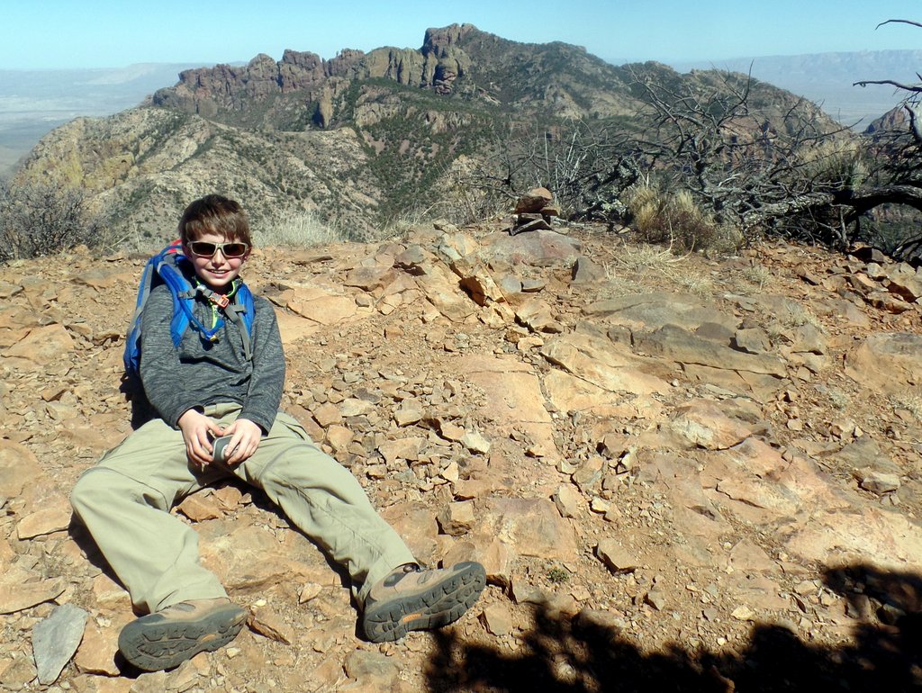
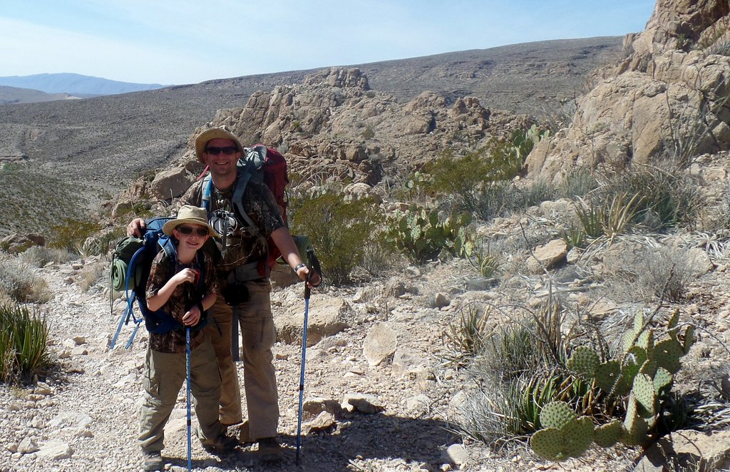
This photo shows Samuel’s gear nicely. His sleeping mat was a $10 special from Academy, which was fine for his size and weight. He used a junior backpack (Osprey Ace 50). At this point, we were still drinking from a bladder, but have moved to bottles which are easier to fill and show you how much you are drinking. Non-cotton long sleeves and pants are the best against sun, insects, and sharp plants, even in hot weather. Samuel loved this hat, but when it was lost, has generally not worn one (not recommended!). The red thing is an emergency whistle. We shared a pair of hiking poles, but now use a pair each as they reduce the force on the knees and feet during descents. We were also still hiking in heavy boots, eventually replaced with lightweight trail runners in future trips.

This also shows my gear. I’m using the Osprey Aether 60 backpack. We used the entry-level REI backpacking tent Camp Dome 2 which was a heavy five pounds, very strong, but without vestibules. I used a Samsung automatic camera, and my belly was too big! I was trying some US-made lightweight hiking pants which ripped and I have since reverted to my favorite Craghoppers pants from the UK which, even though they are a polyester/cotton blend, they are water-repellant and quick drying and stronger than the non-cotton pants I have seen. I’ve even been able to buy extra pairs while in the US. I’m still in heavy boots at this point too!
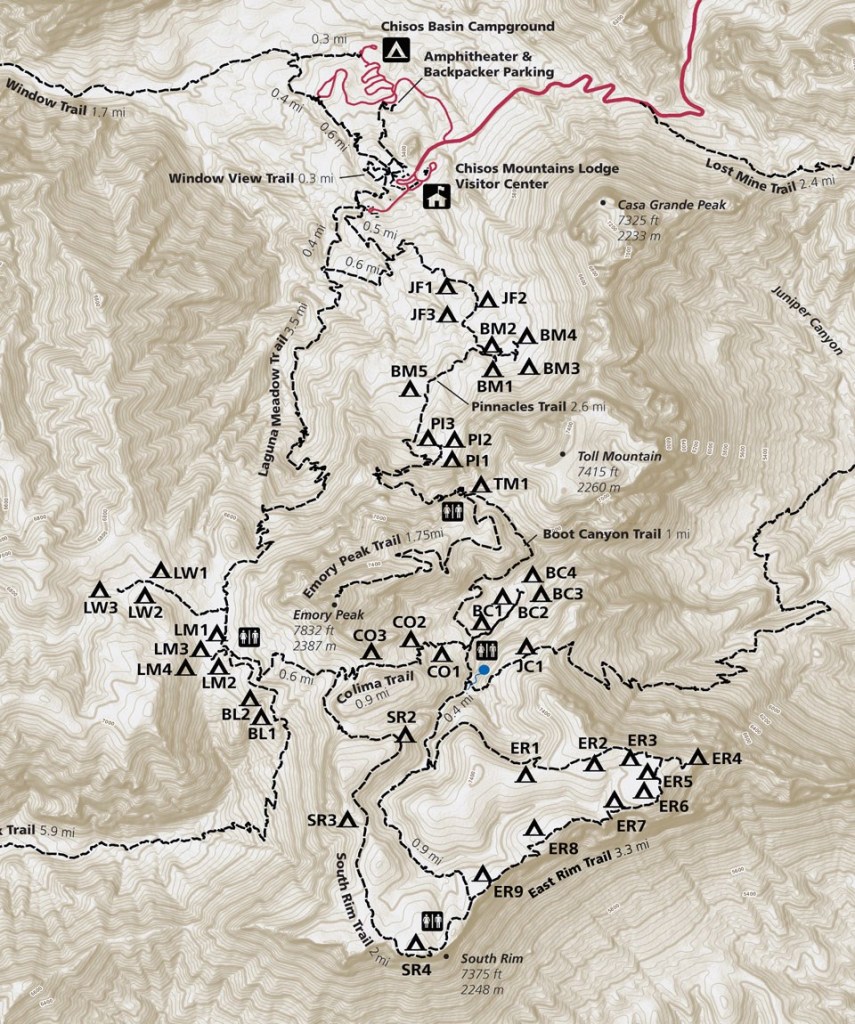
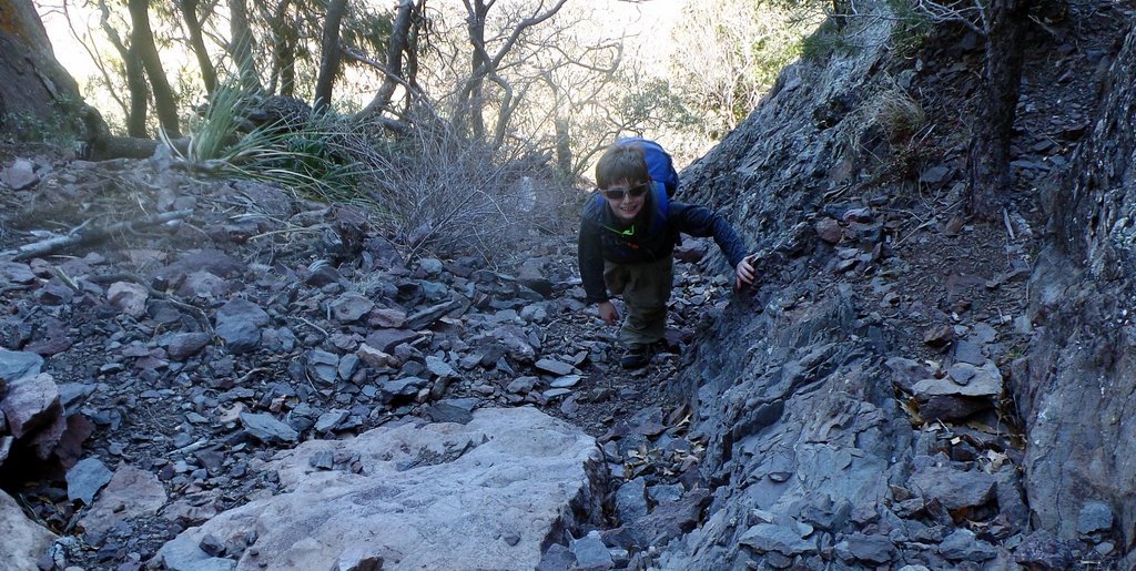
The hike into the mountains is a climb but is OK when it is not too hot, and you take it easy. We were taking it easy and made it to our campsite in Boot Canyon without incident.
Even after a tough hike to the campground, Samuel was eager to hike up to Emory Peak.
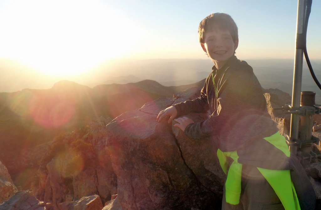
To get to the peak, there is a tough class-3 scramble over the final stretch after an otherwise easy trail.

After our incident getting lost coming down off Guadalupe Peak, I was a little concerned about staying up here after sunset, so we headed down before it was dark.
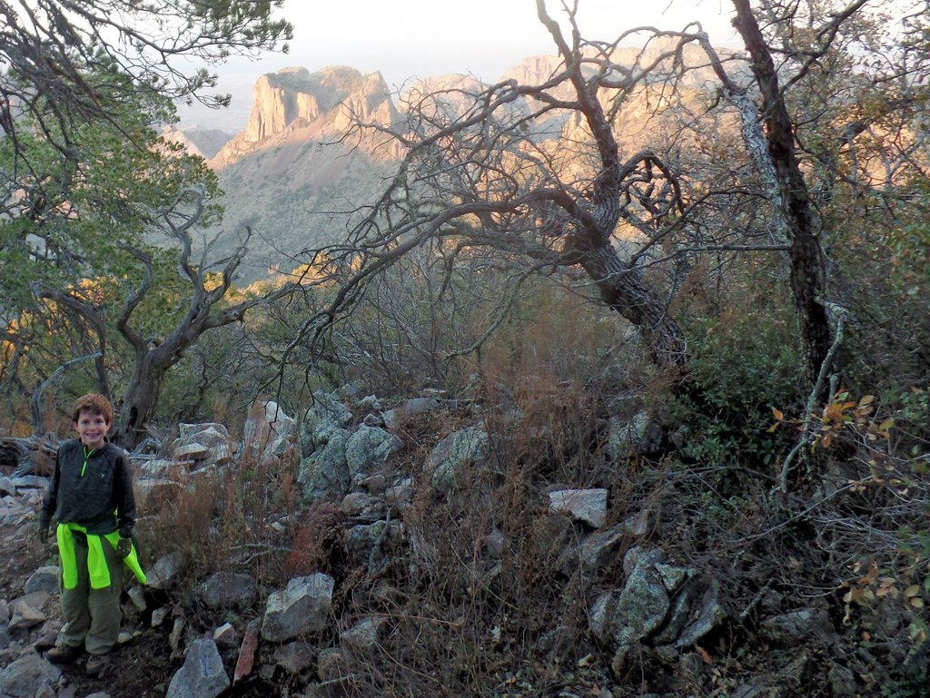


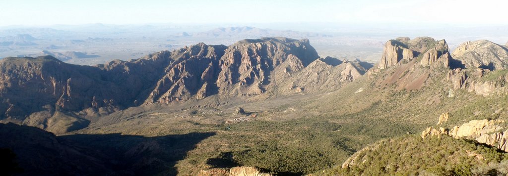
We have returned to this view several times, and it only changes in how the sun lights it. Such remote locations are special.

The next morning, after two nights camping in Boot Canyon, it was time to hike out. As I recall, I had carried in much too much water and dumped a gallon before hiking out. The temperatures had not been high so we hadn’t drunk as much as expected, but it’s better to be safe when there is uncertainty. I was learning that filtering rather than carrying will save a lot of effort! I have also learned that having an older teenager means that he can carry most of the weight!
Activity #2: Hiking Casa Grande and Geocaching
Once back at the car, we drove to the trailhead for the Lost Mine Trail. We got one of the last parking places and joined crowds walking this popular trail. However, having walked to the end, we eyed our target: Casa Grande (= big house in Spanish).
There isn’t an established trail to the peak. However, there is a virtual geocache on the summit which provided good background information and proved that there was a way up! We met one other group as we traversed the ridge, but it was otherwise deserted.


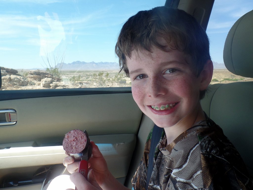
We headed to Rio Grande Village to get a few provisions, including summer sausage, but first we had to visit a ranger!
Activity #3: Junior Ranger

Bailey and Samuel had completed many Junior Ranger badges at National Parks in our family travels. Their achievement is still recognized on the Petrified Forest National Park’s website:

Activity #4: Remote Car Camping
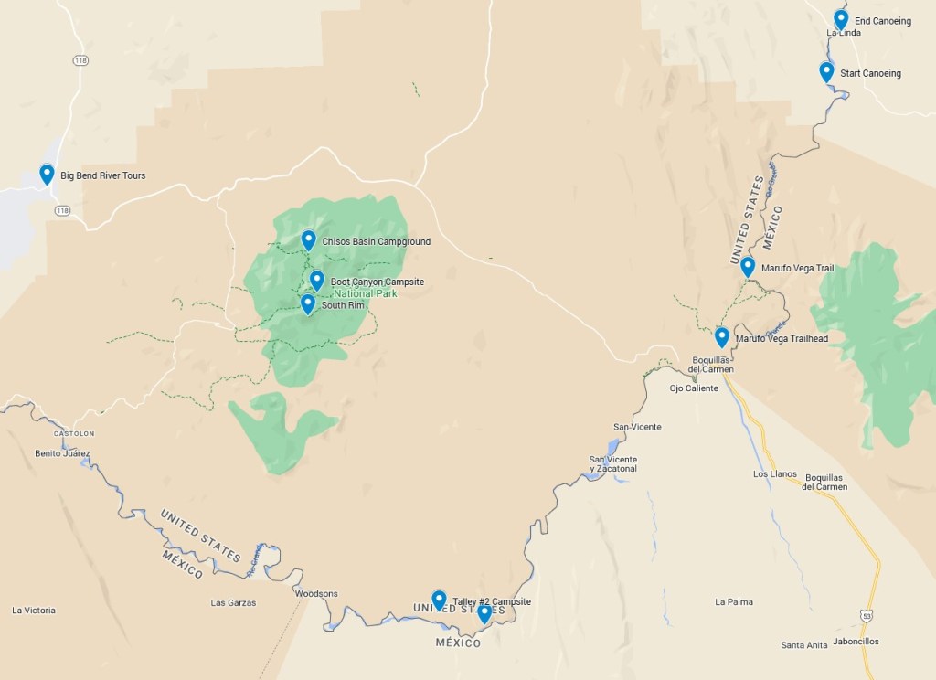
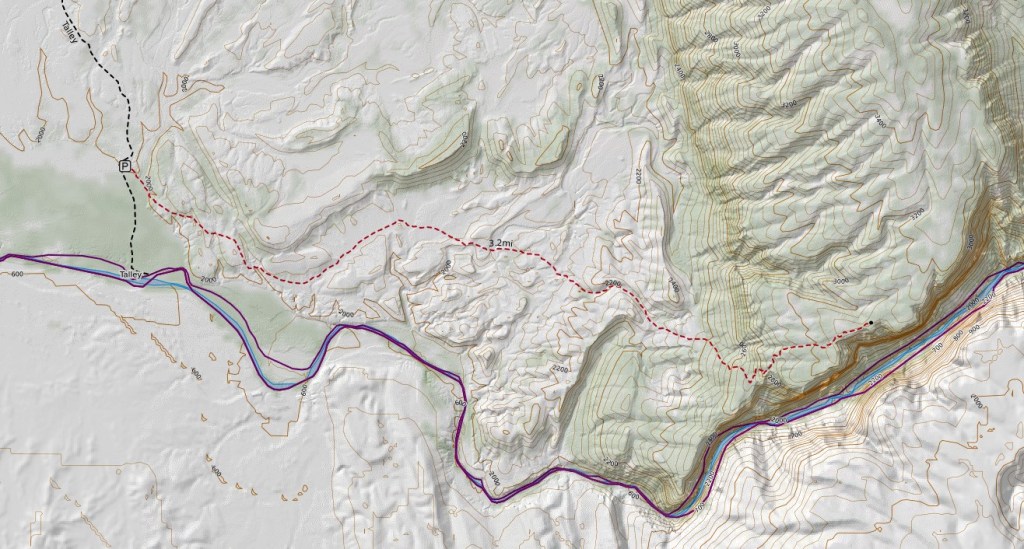
Next, we headed out onto the dirt roads to get to our roadside Talley #2 campsite for the night. The site was close to the river and truly felt like we were in the middle of nowhere.


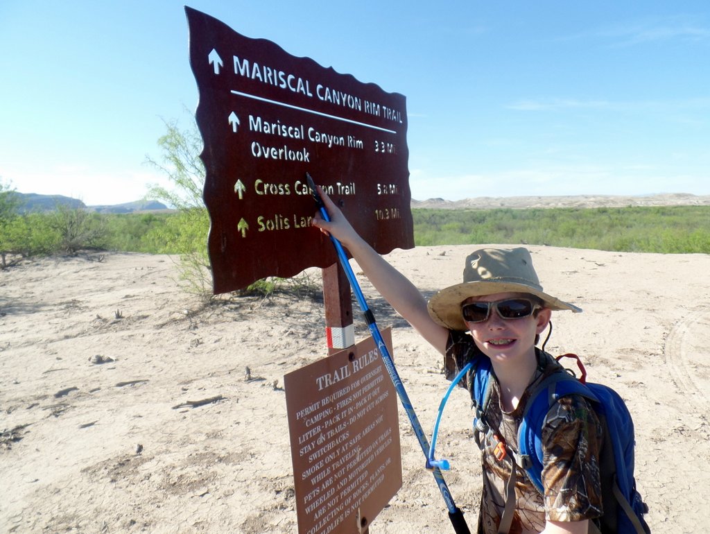
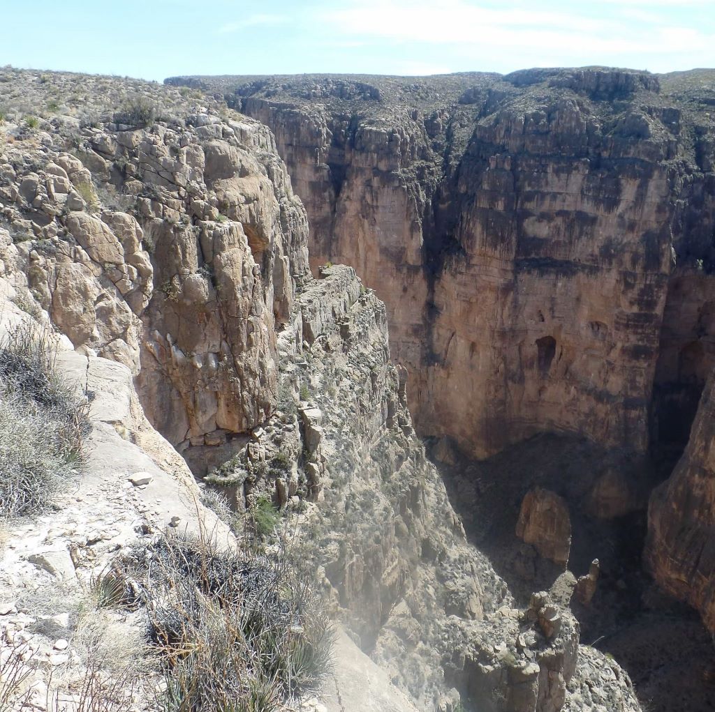
Activity #5: Hiking Marisco Canyon Rim Trail
Next up – another hike. As we had been in the mountains, we had got used to cooler temperatures, and were not ready for the increased temperatures on the plains.


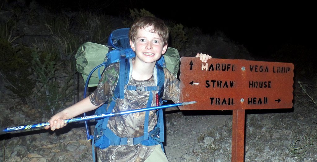
Activity #6: A Night Hike with Camping
We had booked a night at the Rio Grande Village campground, but we came up with the alternative of hiking the Marufo Vega Trail. It went down to the river in a different part of the park and would involve a single night of backcountry “open ” camping as there weren’t established campsites. After the heat, we decided it would be best to hike at night.

As the sun set and it darkened, the stars came out. As the path became less visible, we relied more on the stars to navigate, which was very cool. At one point, we heard some commotion off the path and wondered whether it was some animal. We realized it was a tent, and the occupant appeared quite angry, as he thought we were a bear!
It was on this hike that Samuel hit another wall. It had been quite amazing how he had kept going with all of the hiking and the heat. We were unsure where we would camp and had decided we would stop when we saw a good spot or felt like stopping. The lack of plan was unwise, and we walked on until Samuel suddenly realized he had had enough. There was a shallow ravine just off the path, and we managed to clear enough dead vegetation to make room for a tent. It was far from ideal but it worked.

The next morning, we were both surprisingly well rested!


Having walked out, we were very happy to be in the car’s air-conditioning and our drive to Terlingua on the other side of the park. The roadside had large patches of bluebonnets, and I remembered them from my visit with Janet, so I had to get them with Samuel!

The hotel room at the Big Bend Motor Lodge was basic, but to us it was luxury. We could bathe! We washed all of our clothes in the bath, and while they weren’t exactly clean, they smelt less for the next leg of our adventure.
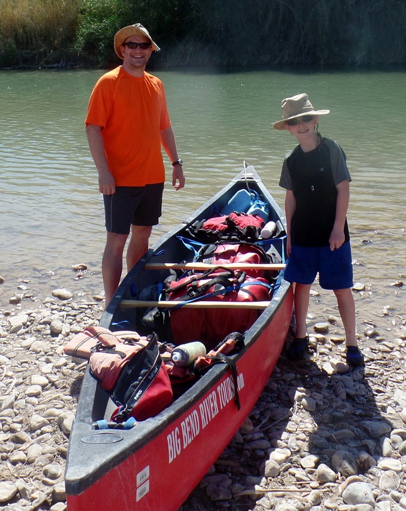
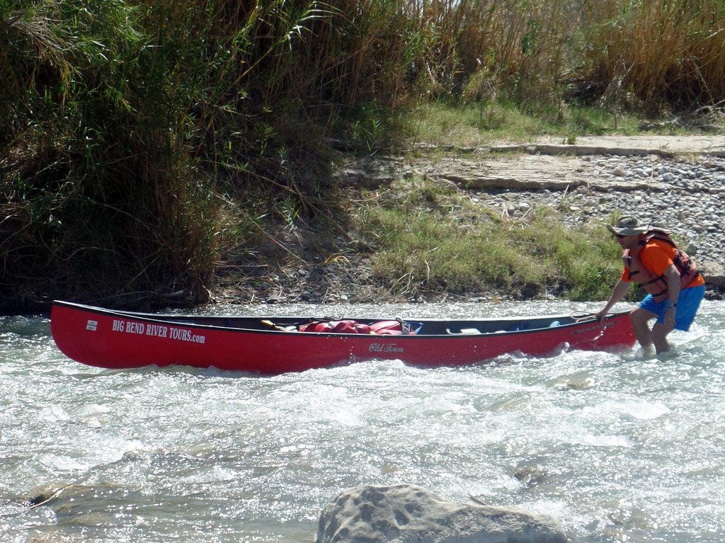
Activity #7: Canoeing the Rio Grande
The river levels were low, so the river guides took us to a stretch of river on the far side of the park, putting in at Heath Creek. While outside of Big Bend National Park, the Rio Grande is still protected as a National Wild and Scenic River.

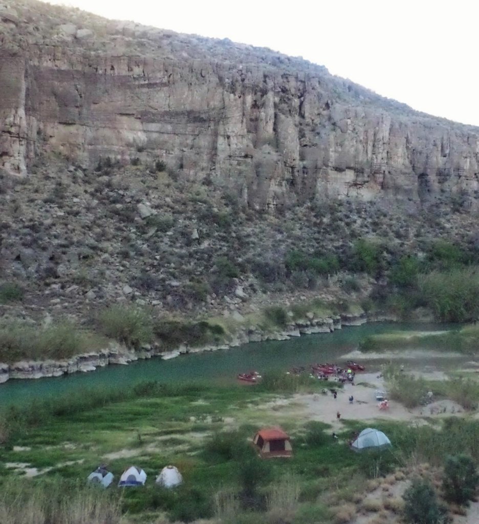

The following morning, we were off again for a short distance down the river so that we could take the canoes out at La Linda. It had been interesting paddling along the US/Mexico border, in such a way that we were going back and forth along the border.

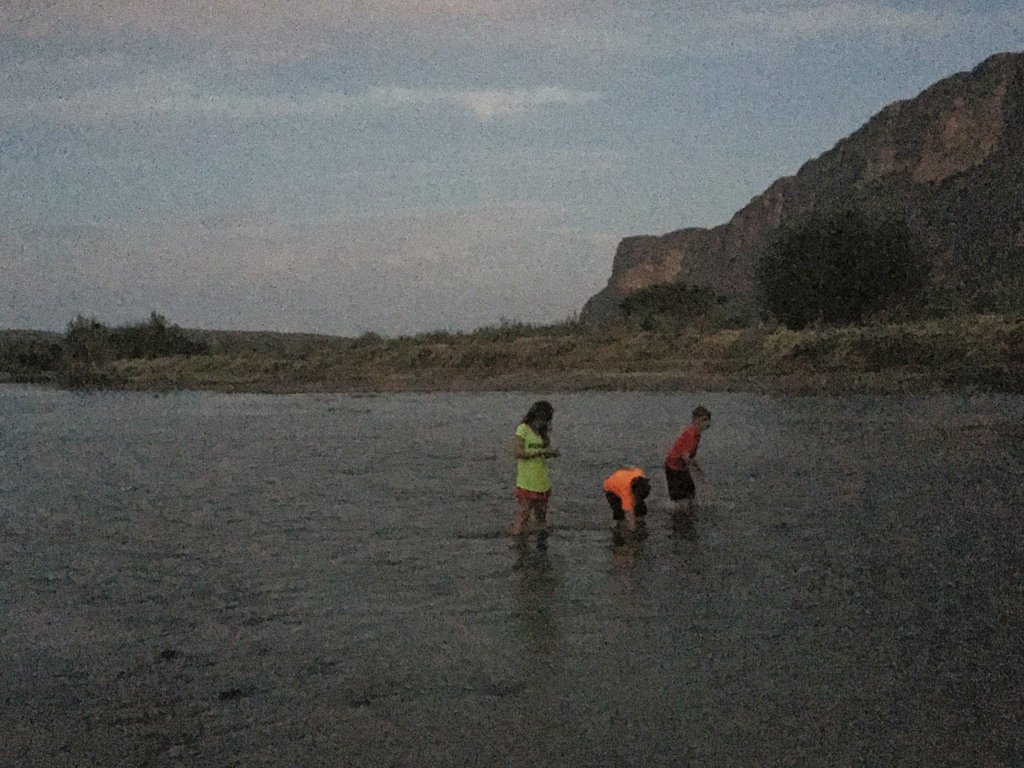
On arrival at the end point, we had a bit of time to kill as the transport had not arrived yet. The kids had some fun rocking the boat. However, it ended in tragedy!

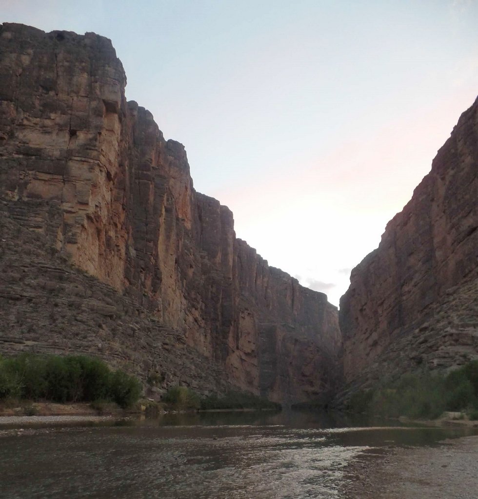
And that was the canoeing trip and the end of our planned activities. After heading back to Terlingua with the boats, we went to check back into our hotel. Without knowing they were in Big Bend, we bumped into the family who lived next door to us, who were hunting fossils! We quickly learned that there had been a mess up with their hotel reservation. As Samuel and I had both a room and a tent, and there was space in the campground attached to the hotel, they took our room. We also made the most of the time and headed back down to the Santa Elena Canyon. We quickly realized why we had not canoed here – the water was too shallow, but it was great for the kids to find skimming rocks. It also helped Samuel forget that he had lost his hat!
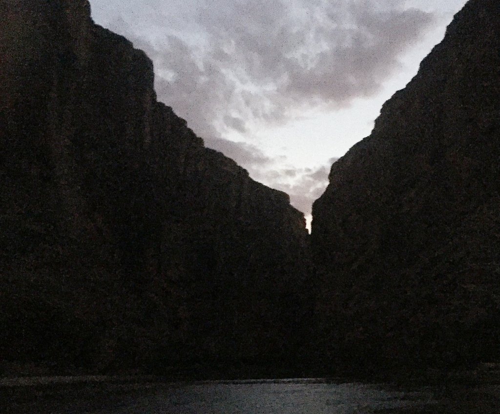
The Finale: Santa Elena Canyon
And that was the end of our Big Bend adventure. Well, nearly the end. There is just the minor details of a ten-hour drive home. First, as you leave Big Bend, you pass through a customs check. I have previous experience of increased attention and delays when a customs officer hears my foreign accent so I tried to keep my mouth shut. I am sure some odors left the car when I opened the window for the customs officer. We got through the first challenge without issue. The second challenge was a certain traffic cop, who was very nice. We just wanted to get home and I was making the most of the 85-mph speed limit on I-10. When we were stopped for going perhaps a little over this, the cop politely reminded me that 85 meant 85… Finally, the real challenge hit me – fatigue. I was falling asleep so we stopped at a rest stop so I could have a nap. I might even have done it a couple of times! But thankfully, we made it home without me driving off the road.
We got home and were so happy that Janet and Bailey had also had a fantastic time in New York watching shows and going backstage and other fun things. For Samuel and me, it had been an epic trip and cemented our desires to pursue adventure independently. I’m still amazed at how much we got done. Each part of this trip was so memorable. Also, I had seen the possibilities that filtering water would open up, and I had seen a few references to the “Outer Mountain Loop.” This sounded like a big challenge, but it might be possible. And then a colleague at work, Tim Long, told me about doing it with his son several years earlier, and I knew it had to be. So, twenty-one months later, we were back!
If you have any questions about our adventures in Big Bend, don’t hesitate to leave a comment below, but remember to include your email address!
To read about our other adventures in West Texas, go to our West Texas page.
