
I have migrated this information to a standalone website at https://trailbetweenthelakes.org/.
The new website is being updated whereas this one is not.
A Guide
This guide started with the information I identified when preparing for my January 2025 thru-hike, and I keep it updated as I learn more. Use the information below with caution as it may be inaccurate.
If you are aware of worthwhile information that is missing, please let me know and send it in!
Overview
Online Resources
Maps
Hike Reports
Planning
Sections
Feedback
Overview
The 28-mile-long Trail Between the Lakes (TBTL) is what it says it is. Weaving within the Sabine National Forest, it begins at Lakeview Campground in Toledo Bend Reservoir and extends westward to a trailhead right next to Sam Rayburn Reservoir. The trail was built in the late 1980’s as a joint effort between the Sierra Club and the US Forest Service. The Sierra Club continues to play an active role in keeping the trail maintained and protecting the forest.
The Sabine National Forest is a working forest, but along the trail corridor, you will find mature stands of pine, with a thick shady canopy. The trail is particularly well known for its variety of bird population, including the elusive Red Cockaded Woodpecker. You may spot an eagle nest near the water, and hear a symphony of bird calls all year long.
The trail is for foot traffic only. Horses, mountain bikes, or motorized vehicles are not permitted. The whole trail is within the National Forest, but passes close to private land which must be respected. The trail is in National Forest (USFS) rather than National Park (NPS) land. This makes it wilder than experiences on well-manicured trails in NPS or State Parks, which many people prefer. It is likely that you won’t meet other people on the trail. Also, no permits are required though there are camping restrictions during hunting season, restricting camping to designated campsites.
Online Resources
https://www.facebook.com/groups/TrailBetweenTheLakes. This public Facebook group is the best way to stay in touch with what is happening on the trail, to ask specific questions, and to seek assistance like a shuttle.
https://www.sierraclub.org/texas/golden-triangle/trail-between-lakes. This Golden Triangle Sierra Club site gives an overview of the trail and links to other sites which are covered below.
https://lonestartrail.org/content.aspx?page_id=22&club_id=738078&module_id=680289. The Lone Star Hiking Trail’s (LSHT) website includes this information page which provides much useful information about the trail. Many of the recommendations on the site’s LSHT FAQs are applicable on the TBTL.
https://www.ouachitamaps.com/Trail%20Between%20Lakes.html. Charlie Williams gives an overview of the trail. His excel spreadsheet of the trail is a useful resource to assist orientation on the trail, complementing the Avenza maps.
Maps
Digital and paper maps are valuable for both trip planning and trail navigation. For the TBTL, a digital map showing the trail on a GPS-enabled device (like a smartphone or watch) is very useful in confirming trail location. The nature of the trail is such that you might get turned around or wander off trail. You are never far from a road but the digital map will help you get back on trail quicker. A printed paper map is a good backup in case something happens to your smartphone (fall in a river or run out of battery), or if you didn’t download the offline maps correctly. It is important to stay on trail as the trail passes close to private land.
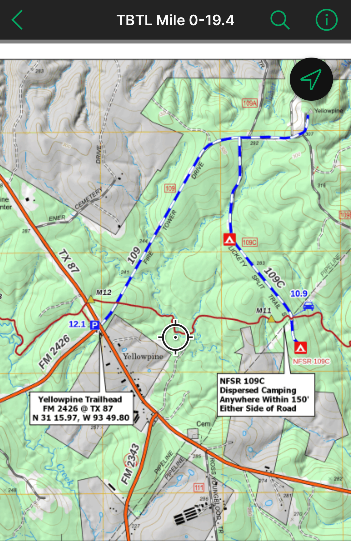
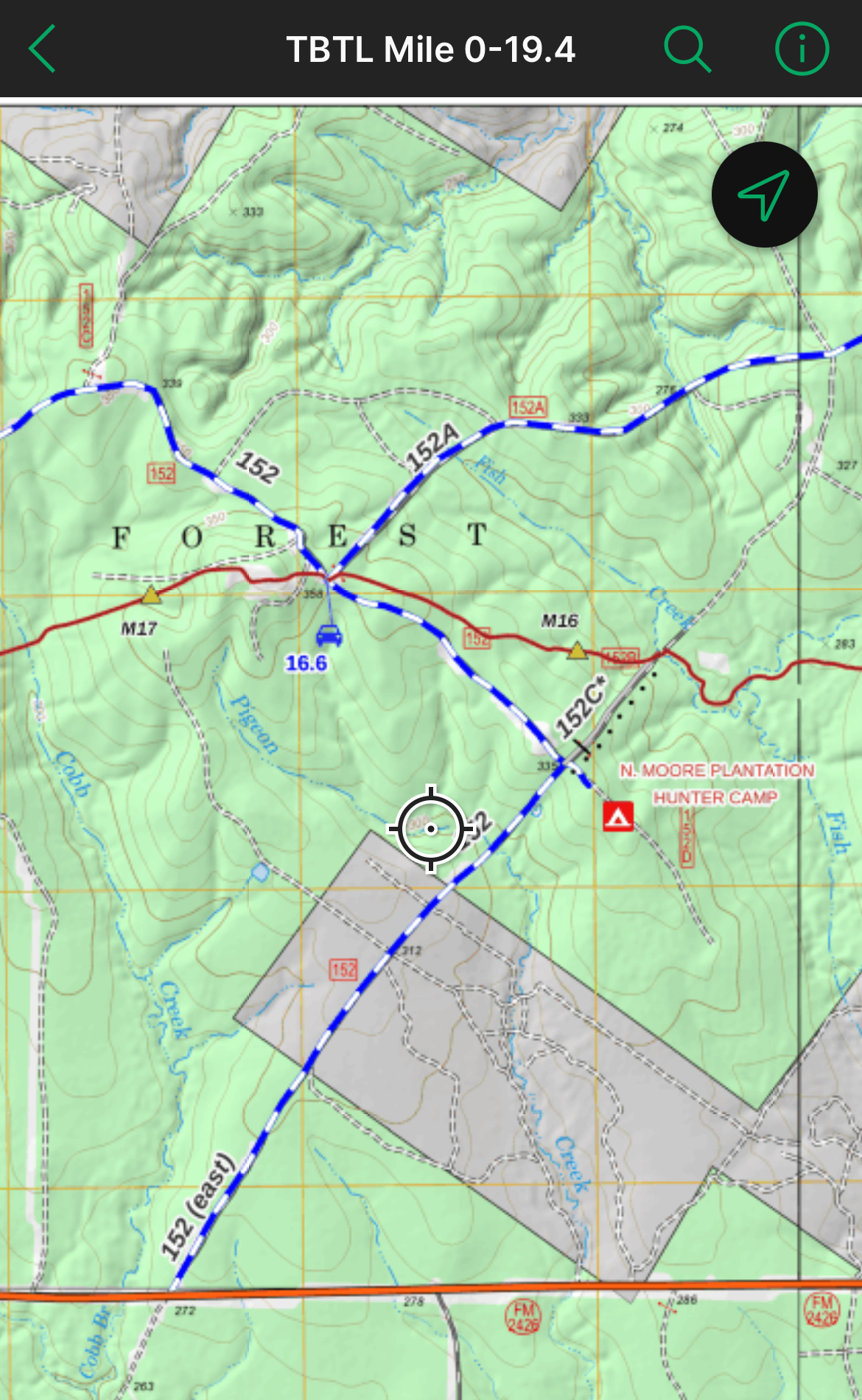
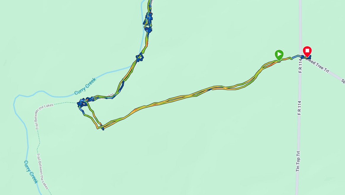
Digital Maps on Avenza. Avenza Maps is an app that supports navigation using custom-made georeferenced maps. Dave Wade from the Lone Star Hiking Trail Club updated the TBTL maps in 2023 and they are free of charge for personal use. You should download the app and these maps before you get on the trail.

Use Avenza & FREE Maps
- Find Avenza Maps in App Store
- Install the App & Touch ‘+’ to add a map
- Search ‘TBTL’ in Avenza Store
- Select a free single map or two-map bundle (18.9 MB)
- Show your location as you hike!
- Move from map to map automatically!
The great thing about these maps is that they contain pertinent information for the hiker. In addition to the trail, mileposts, roads, and the most river information I have found, it shows land ownership (including a warning about “Private!” land between miles 26 and 27), parking, and the designated campsites. It also provides the mileage where a road crosses the trail at a viable water-caching location. You will also notice red lines across road entrances that might be locked.
These maps align with the official trail length of 28 miles whereas AllTrails identifies the trail as 27 miles. The discrepancy appears to be evenly spaced throughout the trail.

Printable Maps on the LSHT website. Created by Dave Wade in 2015, this PDF file (downloaded from the LSHT page about the TBTL) covers the trail in four printable pages. It distinguishes private land (dark green) with National Forest land (light green) which is particularly useful at the western end of the trail.
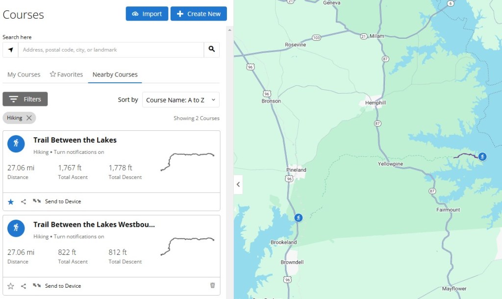
AllTrails. If you search for “Trail Between the Lakes:” you will find “Trail Between the Lakes: East to West” and “Trail Between the Lakes: West to East.” I followed the West to East version and it was accurate. It is best if you download these maps (requires subscription) onto your phone before heading to the trail to ensure they work without phone signal. I like to download the aerial imagery as well as the map.
GaiaGPS. This is a good alternative to AllTrails. I have created a custom map of the trail in GaiaGPS to identify obstructions that need maintenance but it might also be useful for hikers. If you use this, please provide feedback! You can help the trail by capturing your hike and any obstacles, on “ramblr” and sharing.

Garmin Watch. Several Garmin watches support navigating an uploaded GPX course. A few (Fenix, Epix and Forerunner 955) also support maps. This article explains how to create a GPX course and Garmin lists compatible devices here. AllTrails explains here how to send an AllTrail route to Garmin Connect. However, the TBTL is already available in Garmin Connect as a course that you can send to your watch – either eastbound or westbound.

Google Maps. While not the best map for hiking, it shows the trail, roads, and rivers well, and shows TH1 (east end), TH2 (Yellowpine), and TH3 (west end). You should download the map for offline use before leaving home (search “how to download a google map for offline use” to find instructions). Google Map’s “Streetview” is useful for checking what certain locations looks like, for instance the TH2 parking areas or sites for caching water. It does not cover TH1 or TH3.
I recommend being prepared with as many of the above as possible before heading to the trail.
Also of interest to those who are into maps are the free, downloadable, digital Forest Service maps. Interesting maps include their FS Topo maps and their Interactive Forest Visitor maps. You need to zoom in to select the area – look for the two lakes! Most, if not all of the information in these maps is included in the Digital Maps on Avenza maps mentioned above.
Caltopo.com is another useful map resource. This link is to CalTop’s TBTL map. It includes mileage markers that do NOT align with the mileposts on the trail, similar to the AllTrails 27-mile trail. Its free website also includes cellphone coverage maps from AT&T, T-Mobile, and Verizon. In summary, these maps suggest coverage is “spotty.” My experience was that cellphone signal would come and go, could not be relied upon, but you would find plenty of places on the trail where you had signal (Mint Mobile which uses T-Mobile). I used my Garmin InReach to check in each night because the campsites I chose lacked signal.
Trail Reports
One great planning tool is to read about or watch other people’s experiences. Here are some reports after thru-hikes or other trail experiences, with the most recent listed first. (please let me know of any others you might know of or find!). Note that the current state of the trail might be different (better!) than some of these hikers report soon after a hurricane or controlled burn.
- West to East solo thru-hike in January 2025. A blog with pictures by Peter Ireland (aka Cajunlimeys) of a 3-day eastbound thruhike .
- Trail Between the Lakes Part 1 (22 mins) and Part 2 (16 mins) in October 2024. Two Youtube videos by Cade The Catfish who hiked the trail westbound over 1.5 days. The most significant obstacle on the east end of the trail is shown at 21:36 in Part 1. Part 2 includes camping at the designated hunter camp at FR114/114D junction near mile 20 and comparisons with the Appalachian Trail.
- West to East thru-hike in March 2024. A 13-minute YouTube video by Eric and Vicki Newby (aka Oh LOOK! Outdoors). It demonstrates trail conditions after a bunch of rain with an example creek crossing as they check out some new gear at a typical primitive campsite while showcasing how great the weather can be in March!
- The Top Ten Backpacking Trails in Texas in April 2022. Ths list of Texas’s best backpacking trails by Taylor Bell from Texas Monthly includes the TBTL.
- West-to-East-to West “yo-yo” in March 2022. A 28-minute YouTube video by Jetgirl Hikes. She provides a great overview of the trail with lots of footage showing what the trail is like and shares many practical tips for the trail. She suggests that March and April are the best months to hike it.
- Fastest Known Time (FKT): Trail Between The Lakes in May 2020. Includes a report by James Hudgins of his trail completion in 6 hours 49 minutes! One month later, Patrick Welsh logged a faster time of 6 hours 20 minutes one-way and 15 hours 17 mins out-and-back.
- Trail Between the Lake Yoyo FKT Recap in June 2020. A YouTube video of Patrick Welsh’s record setting yoyo of the trail. Wow! Patrick recommends the TBTL though warns about the heat and humidity in the summer. Completing the trail in 6-hours (or even AllTrails’s “average of 9h 9 min to complete”) is for rare athletes, with most thru-hikers spending one or two nights on the trail.
- Trail Between the Lakes in April 2017. An informative summary of the trail by dprather of Big Bend Chat.
- Hiking The Trail Between the Lakes in 2017. A blog by Texas Master Naturalist Ron Bamberg.
- A West to East Hike in 2004. A blog by Charlie Williams, shortly after Columbia broke up over this part of Texas.
- An undated description of Trail Between the Lakes on Hiiker. Includes an interesting historical perspective on the activities in this area over the last two centuries.
One also finds shorter trip reports in the Facebook Group and reports in AllTrails.
Planning
Planning to hike the TBTL has many similarities to planning to hike other trails in East Texas. Below are some pointers, and many of the LSHT’s FAQs also apply on the TBTL. If you have specific questions, the TBTL Facebook Group is a good place to ask. The US Forest Service on (409) 625-1940 is also very helpful.
When
- East Texas has hot and humid summers and mild winters. It is known for storms which can bring high winds, heavy rains, and hard freezes. The fall/winter/spring is generally considered the best time for hiking. Spring brings beautiful wildflowers.
- One needs to consider hunting season and take note of camping restrictions.
- When conditions are favorable, the forest service might conduct controlled burns of the forest. Such burns do not always have a preplanned schedule and can disrupt hikes. See more information from the TBTL Facebook group. Or check the USFS National Forests and Grasslands in Texas FB page.
- Texas storms are life threatening. Strong winds blow down trees. Heavy rain causes localized flooding and creeks to top their banks. Fortunately, the creek levels decrease rapidly after heavy rains and are likely safe after 12 hours.
Parking
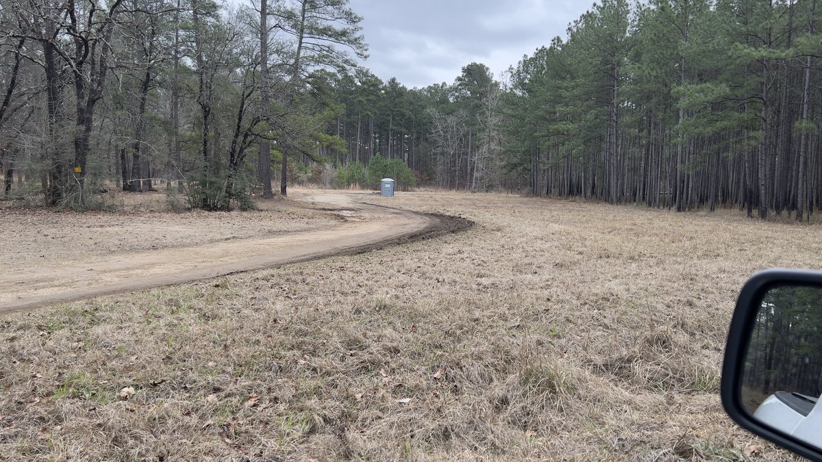
- Ample parking is available at the three trailheads: TH1 (east end), TH2 (Yellowpine), and TH3 (west end). Each site has space for a few cars. There is little traffic in these areas and they are generally considered safe but precautions remain wise. The parking at the east end is within the Lakeview Recreation area where a day use fee applies and there is a pit toilet and water faucet.
- Parking at other points where the trail crosses a road is possible. You have to make your own judgement. Streetview on Google Trails might help you plan this. The red line across the road on Avenza maps suggests the road has a locked gate while the blue-and-white roads indicate likely accessibility. I’m adding photos and info of viable parking sites on my custom Gaia GPS Map.
Camping
- Outside of hunting season, camping is permitted in USFS property along the trail (which is essentially the whole trail) except near trailheads. There is no shortage of trees so the trail is well-suited to hammock hangers. Most thru-hikers just find a convenient location anywhere in the woods. There are no “unofficial” sites, so any campsite should be left in the condition it was found. Campfires are discouraged due to the risk of forest fire. There aren’t any rocks to build a fire ring with. Follow all Leave No Trace principles, including packing out all of your food scraps and used toilet paper.
- During hunting season (Late September to early January), a USFS Designated Camping policy restricts camping to the Lakeview Campground or the four established Hunter Camps. These camps are also suitable for car camping which is a great way to experience overnighting in the forest without backpacking.
- The Sabine River Authority of Texas maintains and operates the Lakeview Campground on Toledo Bend Reservoir at the eastern end of the trail. Its ten sites with fire rings support tents and RVs. There are no hookups but there is a faucet, pit toilets, and a fee of $3 a night. It’s a beautiful site with a view of Louisiana and a breeze coming off the water.

- There is designated camping along Forest Road 109C which has easy access to the trail around mile 10.9. There is plenty of space at the end of the road (also known as Lickety Split Trail!) as well as cleared sites along the road. There are no facilities and some locations have improvised fire rings.


- The N. Moore Plantation Hunter Camp is on Forest Road 152, north of FM2426. There is easy access to the trail around mile 15.8, where you find the remains of an old bridge over Fish Creek.

- The Moore Plantation Hunter Camp is located just south of the junction between Forest Road 114 and 114D. This is a very large site. There is an old closed forest road with a locked gate that leads towards the trail at about mile 20.5. It is approximately 1/2 mile from trail to camp, with a short off-trail section to get from the road to the trail. Alternatively, you can leave the trail at MP21 and follow the road.

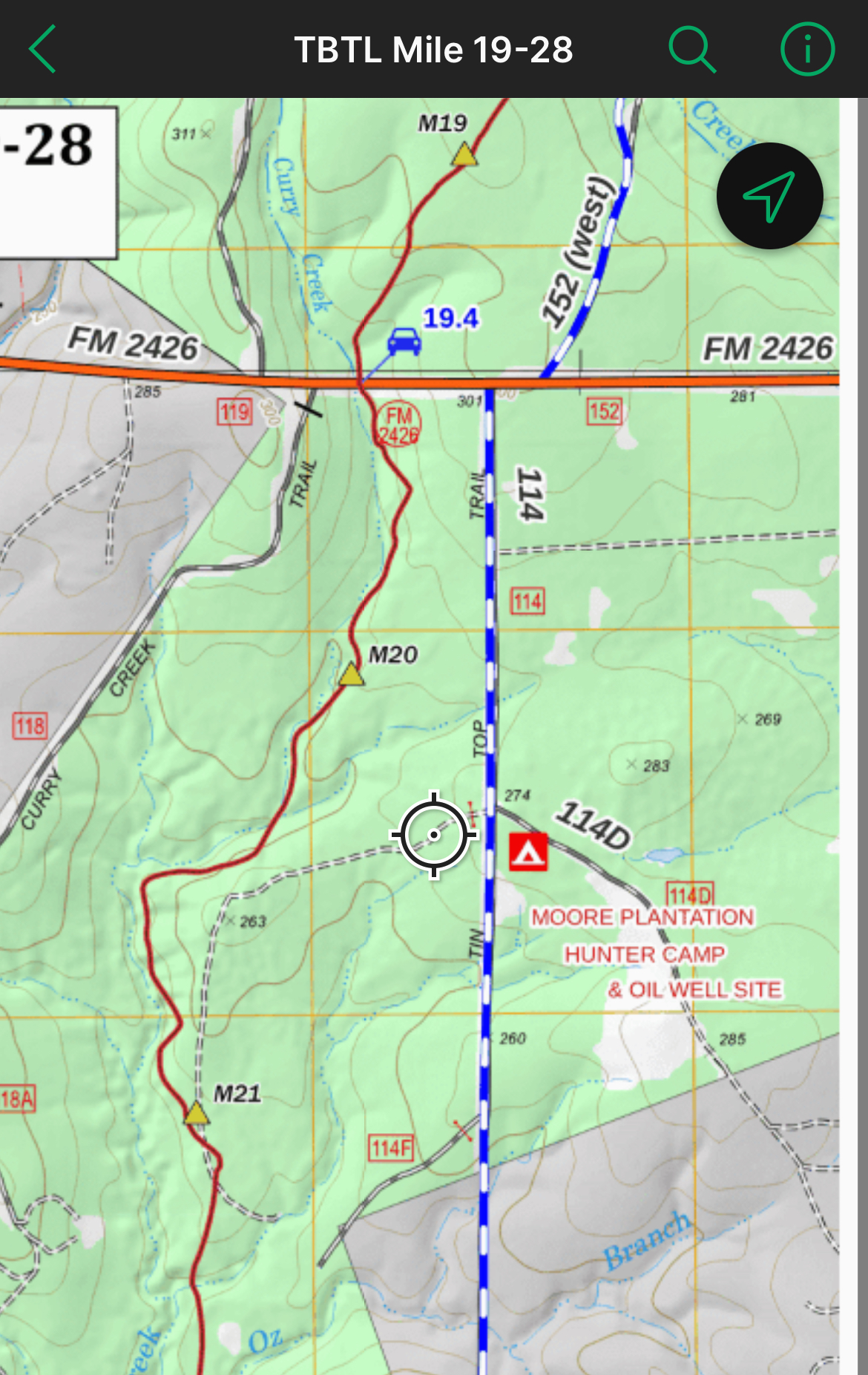
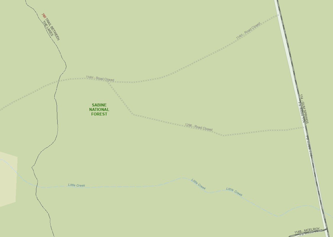
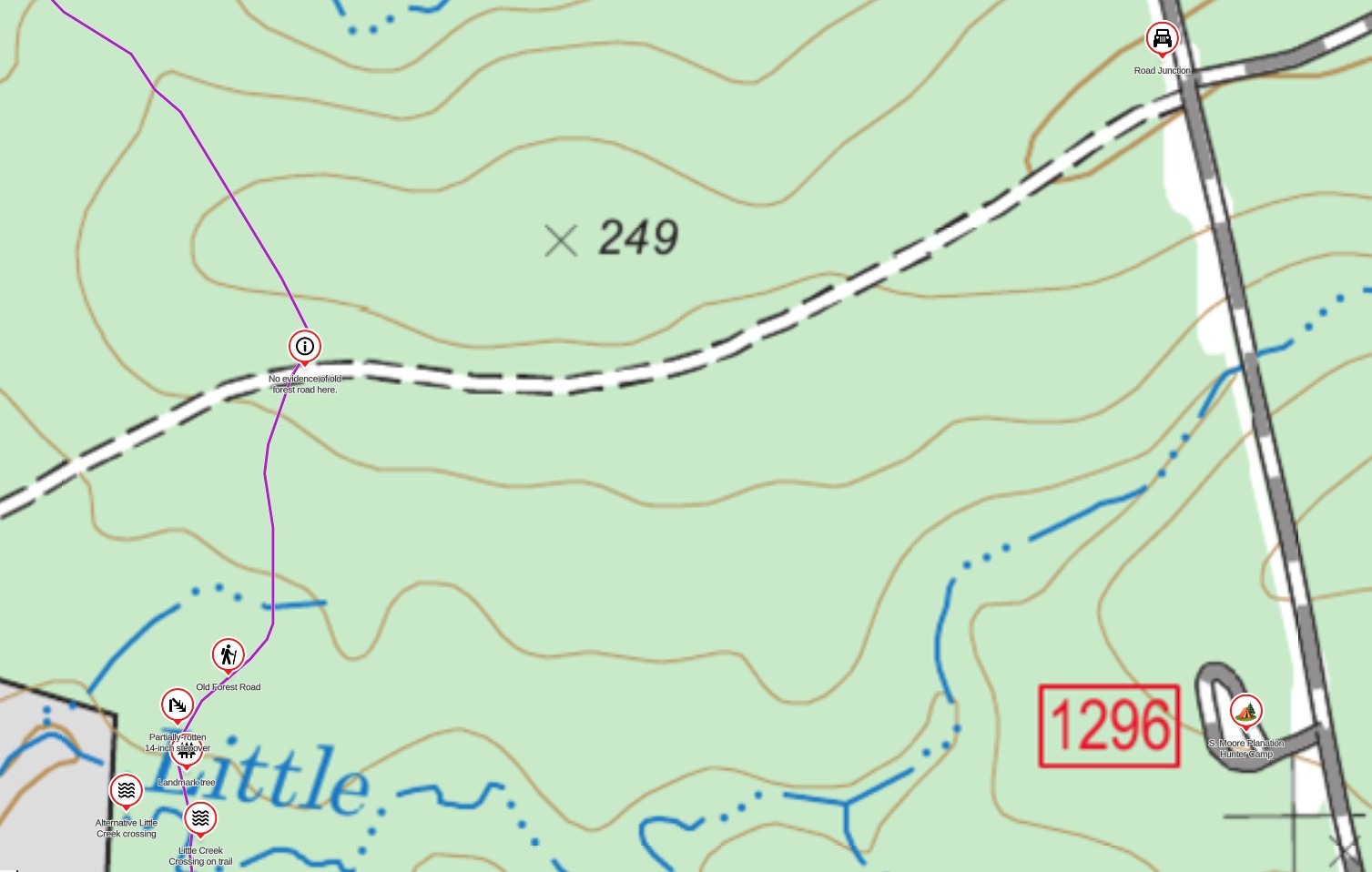
- The S. Moore Planation Hunter Camp is located off Forest Road 114 on the road labelled 1296 on the map (a little south of where the camp icon is on Avenza). This is another large site and the Forest Service Interactive Visitor Map shows that road 1296 leads to the trail. I found no evidence of a road crossing the trail as per the map but an old road crossed further south closer to Little Creek, but I did not follow it.


Insect and Animal Precautions.
- The trail is prone to mosquitoes, ticks, and chiggers, especially in warmer months. A winter hike might not see any of these. Pre-treating clothes with Permethrin is effective. Deet-based insect repellants and Picaridin, are effective. A headnet is a cheap, lightweight barrier against mosquitoes.
- During the warmer months, spiders weave webs across the trail. Read “The Spider Experience.” The spiders are generally considered harmless. However, walking into a web across the trail at head height can be distressing. A proven solution is following a taller hiking partner. Other solutions include waving your hiking pole in front of you, which gets old for 28 miles, or wearing a head net, which is also wonderful fashion accessory.
- These woods are home to the typical animals and snakes found in East Texas. Care should be taken to avoid snakes. Campers should store food appropriately to avoid animals finding it. Black bear sightings are extremely rare. Alligators might be found in any body of water, but are also extremely rare along the trail.
Water: Gauge, Potability, and Caching.
- The nearest water gauge is on Housen Bayou at SH87 near Hemphill. This is a good estimate for localized rainfall. However, TBTL creek levels rise and drop faster than Housen Bayou during and after rains. Just before this hike in January 2025, Little Creek (mile 23.5) rose ten feet and burst its banks after two-inches of overnight rain, but was just knee-deep twelve hours later. Little Creek and Walnut Creek (mile 13.4) are the largest creeks on the trail.
- Except during very heavy rains and within hours of it stopping, the TBTL does not have dangerous river crossings (compared to the LSHT’s San Jacinto East Fork at mile 71 or the Little Missouri in the Winding Stairs section of the Eagle Rock Loop.)
- Due to historical oil and gas drilling, the forest service recommend against drinking water from the trail, even filtered, due to dissolved heavy metals. It might be fine in an emergency and water caching is easy. This Texas Railroad Commission map shows the location of historical wells. I have not seen any evidence of these wells when hiking the trail.
- There is a water faucet in the Lakeview Campground. Day use fees help cover its cost.
- Caching water is recommended and is easy. The Avenza maps label where the trail crosses open roads with a car and the trail’s mile marker. It is recommended to use screw-top gallon water containers. Label them with your name and expected pickup date and hide them to prevent someone else grabbing them. Take the empty bottle with you on the hike – it is light and collapses small. If you are unable to complete your hike and miss a cache, please return to pick it up. If you have had to abandon the hike and a cache due to an emergency and were unable to pick it up, please post a note on the Facebook group so someone can pick it up for you. Unlike on some other trails, there are not water caches that anyone can use, so don’t leave your cache thinking that it will be useful for other hikers.
On Trail
- The trail’s elevation ranges from 181ft at Toledo Bend Reservoir and 387ft around mile 16.8. However, there are many creek crossings, some of which are several feet deep with steep sides. Hiking poles help climb the creek banks.
- Except during periods of drought, it is likely that your feet will get wet if thru-hiking the trail. There are dry sections for day hikes. Little Creek is the only crossing where you might be unable to find a crossing that is shallower than shin deep, except during or immediately after rain.
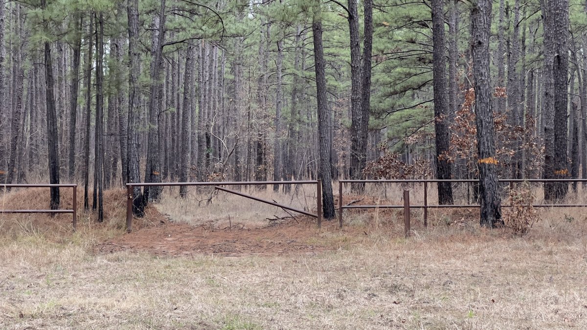
- Metal trail markers nailed onto trees identify the trail. There isn’t another hiking trail in the region so these metal markers indicate the TBTL. Paint and plastic might be hunter-related. There are seasons when undergrowth or blowdowns make navigation at some points on the trail less obvious. Certain lighting conditions can make them difficult to see. If you are unable to see the next trail marker, look for evidence of trail maintenance (sawn logs) or previous hikers walking the trail. Look backwards to see what direction the trail markers suggest hikers going in the other direction would be coming from. If all else fails, use your previously-downloaded digital map. It would be very difficult to navigate some sections of the trail in the dark so remember that flashlight!
- Wooden posts with a number on them mark each mile. Their locations are labelled on the Avenza maps.
- Any hiker can do their bit by picking up trash or moving limbs off the trail. Recording your hike with photos of obstacles on “ramblr” really helps update the survey for maintenance. Sharing a photo and location of obstacles helps the maintenance volunteers volunteers. For an insight into how regular hikers can help with maintenance, check out Jetgirl Hikes’s 3 minute YouTube video, “Trail Maintenance: Giving Back to the Trails We Love.“
- Cellphone coverage is spotty on the trail. While you are likely to get some signal at many parts of the trail, it is also likely that you will find dead spots. A satellite communicator, such as an InReach or newer phones, can be used, but should always be tested before taking on the trail. The dense canopy might be an issue for satellite devices.
- If you are interested in volunteering to help maintain the trail, please reach out to the TBTL Facebook Group.
- The Sportsman’s Cafe, about 1.5 miles by road from where the trail crosses roads at mile 6.8, is recommended by trail users.
Thru Hiking
- Thru-hiking the TBTL is a wild experience rarely found in this region. On trail, you will forget that you are so close to roads. It is likely that you will see no one else during a hike.
- As the trail is a point-to-point, you will require transport between one end of the trail to the other, unless you yoyo. Some members of the TBTL Facebook Group are informally available to help with this and it is best to reach out at least a week before your hike. These people have trail and local knowledge and can help identify suitable water caching locations. Shuttle such that your car is parked at the END of your hike, eliminating the variability of hiking time and availability of the shuttler.
- If planning a thru-hike, there is little to choose between which direction you take. People have personal preferences and a question to the Facebook Group will get responses.
- Consider doing a yo-yo hike, where you walk all the way along the trail and back again. The 56-miles is a rarely-found distance and negates the need for a shuttle. Parking your vehicle at the Yellowpine trailhead acts as a resupply point half way through your hike.
General LSHT guidance
The Lone Star Hiking Trail club website’s Frequently Asked Questions page covers questions on Planning your hike, On the Trail, Emergencies, and Off-trail Support. Some of this applies to the TBTL.
Sections
The trail does not have official sections. The following subsections help plan day hikes.
| Mile markers | Description |
|---|---|
| 0 to 6.7 | A 12.4 round trip (or less) from the east trailhead, a well-defined trail gently undulates as it leads the hiker along the peninsula. |
| 12.1 to 6.7 | A 10.8 round trip (or less) from the Yellowpine trailhead. |
| 12.1 to 13.4 | A 2.6 mile round trip to Walnut Creek from the Yellowpine trailhead, with about half of it following the creek. |
| 13.4 to 19.4 | This 6 mile section has various access points where parking is possible and itineraries of any length can be followed. There is a beautiful pond near milepost 14 with fantastic spring flowers in March and April. Jones Cemetery at 14.9 has some fascinating history. The stretch between Fish Creek (15.8) and the 152/152A junction (16.6) takes you through vibrant young forest. The trail’s high point is at 16.8. The historical logging operations around milepost 18 illustrate how the forest regenerates. |
| 19.4 to 23.5 | This 4.1 mile section is the trail’s wildest, and gets the least traffic. It is a beautiful walk along Curry Creek. There is direct access from FM2426, with parking on nearby forest trails. Alternatively, there is access from the forest roads off Tin Top Trail ( FR 114). Adventurers can continue past Little Creek (23.5) after a knee-deep wade. |
| 28.1 to 23.5 | A 9.2 mile round trip from the west trailhead to Little Creek on a well defined trail with brief periods on forest roads. |
There is not a designated trailhead between Walnut Creek (mile 13.4) and Little Creek (mile 23.5). This central ten-mile section of the trail is generally wilder than the end sections and includes some people’s favorite trail locations such as the pond (mile 14.1), Jones Cemetery (mile 14.9), or the trail’s high point (mile 16.8). Trail access is possible from road crossings but you need to consider the viability of parking.
If you read this far and you find this useful, please give me a like below :). Or even better, leave a comment!
Feedback
Please send in comments or feedback using the form below. THANKS!!


You must be logged in to post a comment.